
National Monument · Arizona
Trails in Wupatki National Monument
6 named trails · 1 miles · 1 trailhead · 4 with the Park Service's own write-up. The lines, trailheads and points are the Park Service's; the write-ups are the Service's own words; the climbing is read from USGS elevation along each line.
6 trails, A to Z.
Citadel Pueblo
Visit Citadel and Nalakihu Pueblos the Park Service's write-up
5-20 Minutes · no dogs · entrance fee applies
Start Citadel and Nalakihu Pueblo Trail
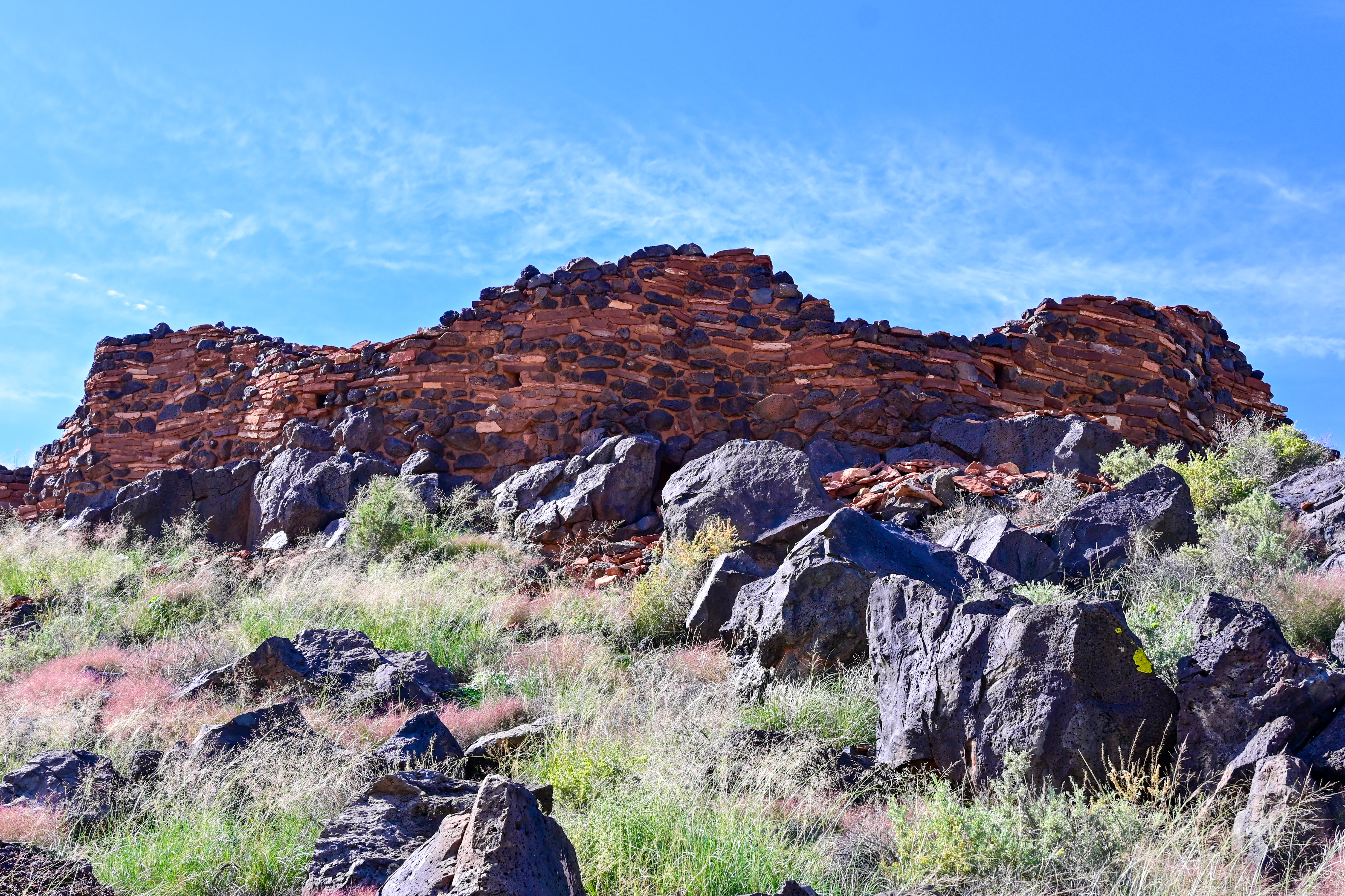
The Citadel and Nalakihu Pueblos were the central hub of a vibrant agricultural community between the early 1100s and mid 1200s CE. About half the size of Wupatki Pueblo, Citadel was around 50 rooms and is strategically located on the top of a small cinder hill overlooking a limestone sinkhole. The area provided good opportunities for farming and hunting game animals such as mule deer, elk, and pronghorn. Soil studies have revealed evidence that people here grew cotton which could have been an important trading commodity.
The Nalakihu Pueblo is a smaller structure built at the base of Citadel and was once used as the monument headquarters in the 1930s. The reconstructed portions of this pueblo have since been removed.
This trail is located a 4 mi. (6.4km) drive from the northern entrance off of HWY 89, or a 10 mi. (16km) drive from the Wupatki Visitor Center. It offers an intimate experience with an Ancestral Puebloan heritage site and grand views of the surrounding San Francisco peaks and volcanic field.
The first portion of the trail is accessible with a compacted decomposed granite surface. The parking lot is parallel to the road with an entrance/exit on both sides. There are 7 single car spaces, 2 accessible spaces, and 5 oversize vehicle spaces available. Pets are not allowed on this trail, leashed service animals are ok.
Although it is no longer physically occupied, descendent communities believe the people who lived and died here remain as spiritual guardians. These places are remembered and cared for, not abandoned. Thank you for visiting respectfully and leaving no trace. These sites and the lands they are on are culturally significant to the 13 Traditionally Associated Tribes of Wupatki National Monument, all of whom have ancestral ties to this area.
Pets Pets are allowed in the parking lot of this location but not on the trail. Leashed service animals are ok.
Accessibility accessible up to the base of the cinder hill with a compacted decomposed granite surface. The parking lot is parallel to the road with an entrance/exit on both sides. There are 7 single car spaces, 2 accessible spaces, and 5 oversize vehicle spaces available.
Lomaki Pueblo Trail
Trailhead Lomaki Pueblo Trailhead 5,339 ft Drive there
Visit Lomaki and Box Canyon Pueblos the Park Service's write-up
10-30 Minutes · no dogs · entrance fee applies
Start Lomaki and Box Canyon Pueblo Trail
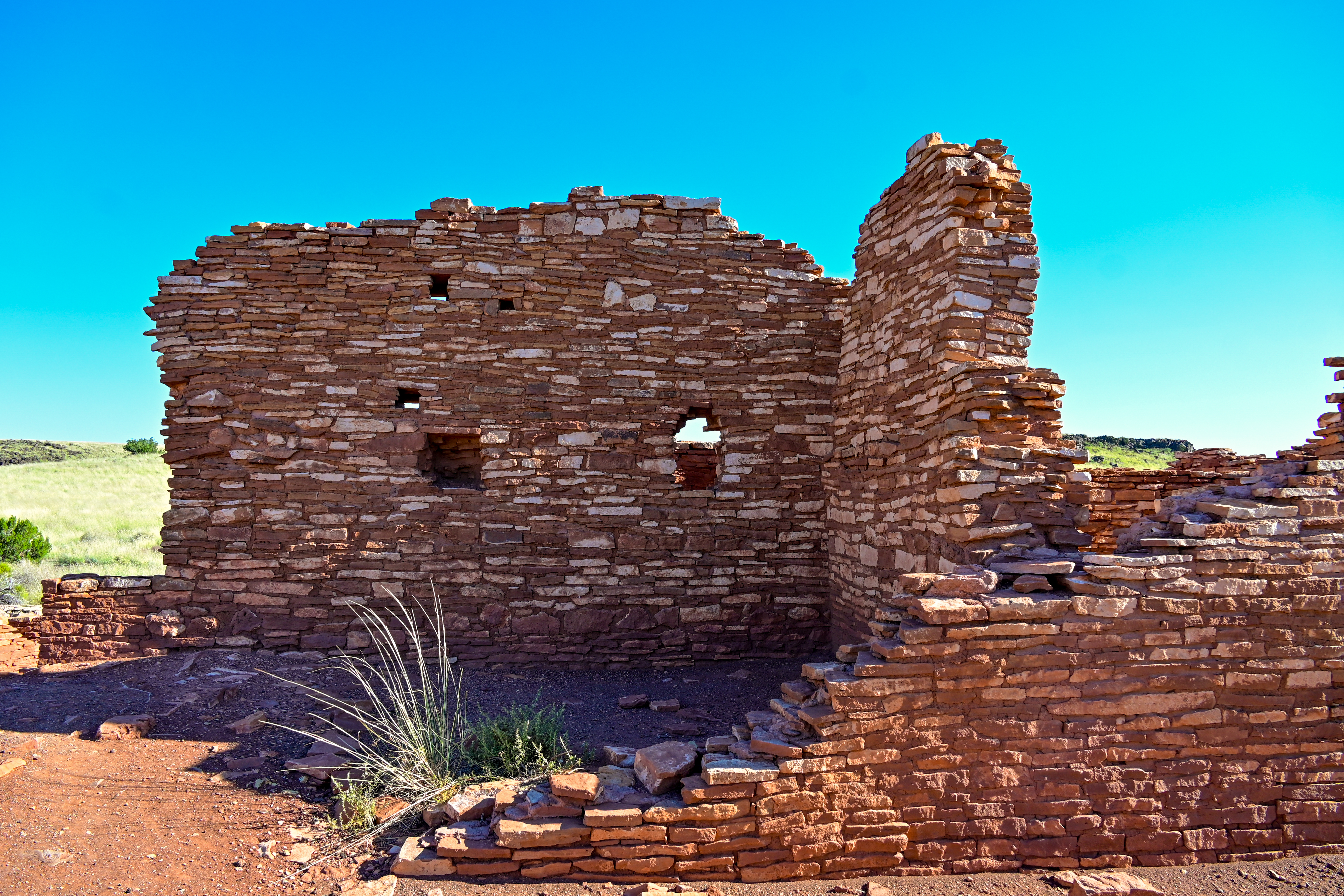
Lomaki means "Beautiful House" in the Hopi language. Located at the end of this trail it had nine rooms constructed from local limestone and sandstone in the last decade of the 1100s. Both the interior and exterior walls may have been coated with plaster, though none of the coating remains today.
The two smaller structures on either side of the earth crack may have housed extended family of the people living in Lomaki. These structures are only a few of dozens surrounding both Lomaki and Citadel. With a keen eye you can spot other walls on top of nearby mesas. At one time this was a thriving community that traded with other communities for hundreds of miles.
This trail is located a 4mi (6.4km) drive from the northern entrance off of Hwy 89, or a 10mi (16km) drive from the Wupatki Visitor Center and is open sunrise to sunset year-round. The trail is 0.5mi (0.8 km) round-trip in length and is a rough gravel surface. This trail is not currently accessible. Work is currently being done to create a new path which will be accessible to Lomaki and one of the Box Canyon Pueblos.
Pets are not allowed on this trail, leashed service animals are ok.
Although it is no longer physically occupied, descendent communities believe the people who lived and died here remain as spiritual guardians. These places are remembered and cared for, not abandoned. Thank you for visiting respectfully and leaving no trace. These sites and the lands they are on are culturally significant to the 13 Traditionally Associated Tribes of Wupatki National Monument, all of whom have ancestral ties to this area.
Pets Pets are allowed in the parking lot but not on the trail. Leashed service animals are ok on the trail.
Accessibility This trail is not currently accessible. It is a rough gravel surface with steep grades. Work is currently being done to create a new path which will be accessible to Lomaki and one of the Box Canyon Pueblos. There is a paved sidewalk to a vault toilet and wheelchair friendly picnic tables. The parking lot is a one way loop with 15 single car spaces, 2 accessible spaces (one van acessible) and two oversized vehicles spaces.
Nalakihu Pueblo Trail
Wukoki Pueblo
Visit Wukoki Pueblo the Park Service's write-up
5-15 Minutes · no dogs · entrance fee applies
Start Wukoki Pueblo Trail
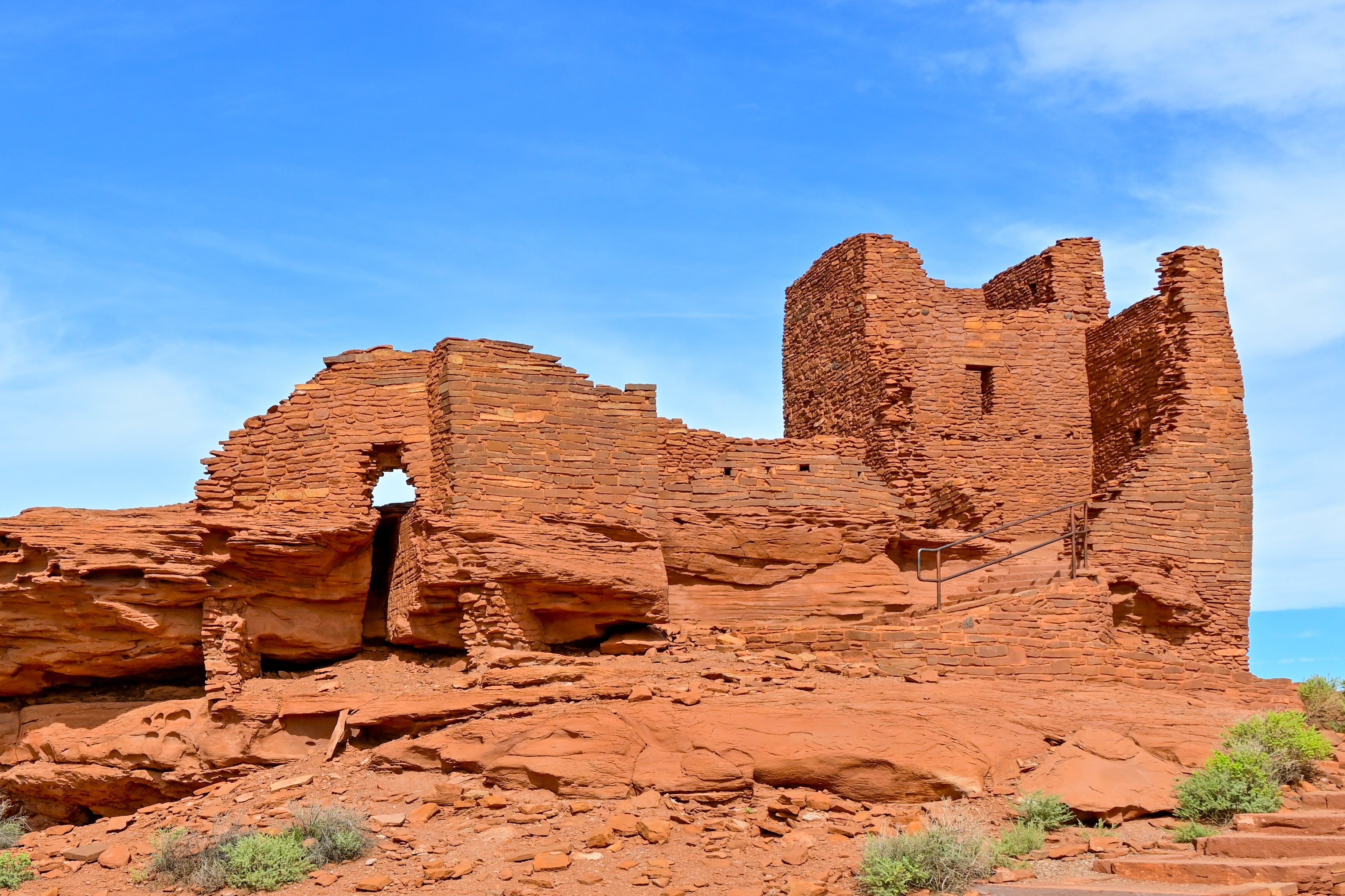
Wukoki Pueblo is an impressive eight room structure built on top of a large sandstone pedestal. It was occupied between the early 1100s and mid 1200s CE. The trail is 0.2 miles round trip, accessible up to the base of the pueblo, and offers grand views of the San Francisco Peaks in Flagstaff. The large tower was three stories tall and still contains original wood beams from the roof and ceiling structure.
This trail is located a short 2.5 mile drive from the Wupatki Visitor Center. The parking lot is a one way loop with accessible and oversized vehicles spaces. There is a pit toilet next to the parking area. Pets are not allowed on this trail. Leashed service animals are ok.
Although it is no longer physically occupied, descendent communities believe the people who lived and died here remain as spiritual guardians. These places are remembered and cared for, not abandoned. Thank you for visiting respectfully and leaving no trace. These sites and the lands they are on are culturally significant to the 13 Traditionally Associated Tribes of Wupatki National Monument, all of whom have ancestral ties to this area. Thank you for visiting respectfully and leaving no trace.
Pets Leashed pets can be exercised in the parking lot area. leashed service animals can be taken on the trail. Caution should be taken during the summer months when snakes may be present. (Emotional support animals are not considered service animals under current ADA regulations.)
Accessibility This trail is accessible up to the base of the structure with a compacted decomposed granite surface. The parking lot is a one way loop with 10 single vehicle spaces, 1 van accessible space, and 2 RV/Commercial bus spaces. There is a flight of steps with a handrail leading up to the pueblo structure. The loop trail around the base of the pueblo is a combination of loose cinders and steep slopes up rock faces.
Wupatki Pueblo
Picnic areasVisitor centers
Along the way Picnic Area Visitor Center Wupatki National Monument Visitor Center 4900ft 1493m
Antelope House Ranger-Led Hike the Park Service's write-up
no dogs · entrance fee applies · reservation required · Winter, Spring, Fall
Start Wupatki National Monument Visitor Center
No ranger-led hikes for 2026 are planned at this time.
Wupatki Ranger-Led Hikes take place on Saturdays between November and March. Learn about the archeological sites, petroglyphs, geology, flora, and fauna that make Wupatki National Monument a beautiful and special place. Hikes are 2-3 miles on moderate terrain. Wupatki is typically 10 degrees warmer than Flagstaff. Wear hiking boots and dress in layers. Bring a snack and at least 2 quarts of water.
All hikes meet at the Wupatki Visitor Center at 12:00pm on the day of the hike. Park entrance fees apply but there is no additional fee for the hike.
Please note that hikes have a limited number of spots available (12 for Kaibab House and East Mesa, 8 for Antelope House) and reservations are taken on a first come first served basis.
If participants cancel prior to the hike we will contact those who selected to be on the wait list in the order they signed up.
For questions about this hike please contact FLAG_Ranger_Hikes@nps.gov .
The Antelope House Hike is a unique opportunity for visitors to experience the backcountry of Wupatki with a ranger and see excellent examples of Ancestral Puebloan structures and scenic views within Wupatki National Monument's Eligible Wilderness. These sites and the lands they are on are culturally significant to the 13 Traditionally Associated Tribes of Wupatki National Monument, all of whom have ancestral ties to this area.
Accessibility The hike is moderately strenuous to include uneven terrain over loose cinders and limestone rocks. Hike length is a minimum of 2.5 mi (4km) in desert conditions and participants will be exposed to outdoor conditions for the entire hike.
Crack-In-Rock Ranger-Led Hike the Park Service's write-up
6-8 Hours · no dogs · entrance fee applies · reservation required · Spring
Start Wupatki National Monument Visitor Center
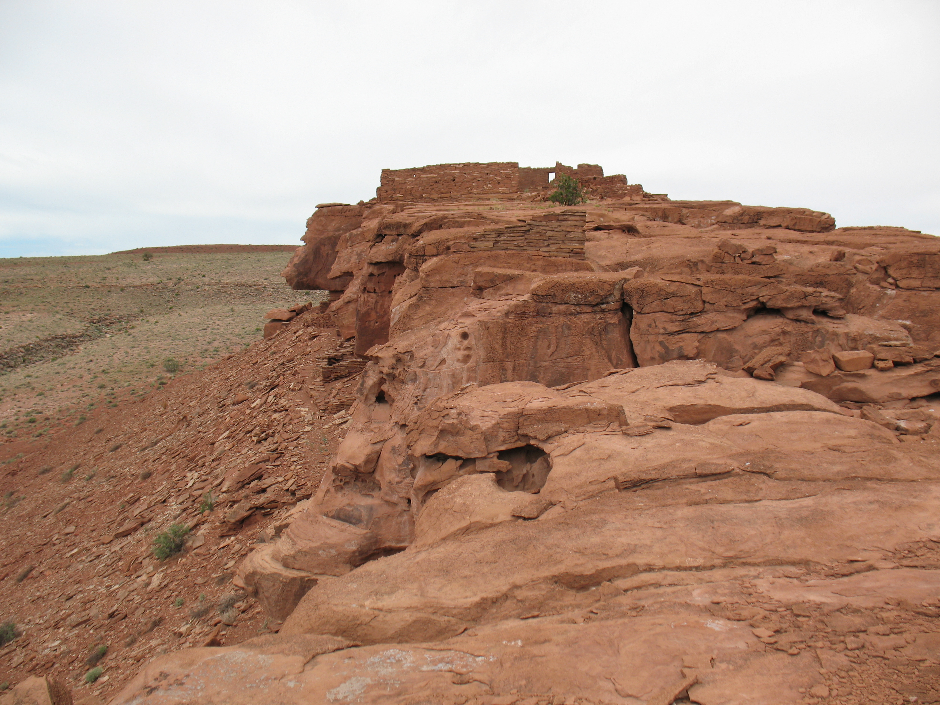
Crack-In-Rock Day Hikes
Day trips to Crack-In-Rock will be offered each year in April and October. The number of participants on each hike is limited to 12 to preserve these fragile resources. Hikes may be conducted with smaller groups depending on staff availability. Spots are filled on a first come first served basis with a waitlist of 5 people per hike. Two people maximum can be signed up at one time.
The 2026 October hikes are now FULL and registration is closed.
For questions about this hike please contact FLAG_Ranger_Hikes@nps.gov .
Participants will be driven by NPS staff in 4x4 vehicles and then led on a guided hike to the Crack-In-Rock Pueblo and other nearby archeological sites to experience protected petroglyph panels and Ancestral Puebloan structures.
This day hike will be approximately four miles total in desert conditions. The hike is strenuous to include uneven terrain and steep talus slopes, participants will be exposed to outdoor conditions all day.
These sites and the lands they are on are culturally significant to the 13 Traditionally Associated Tribes of Wupatki National Monument, all of whom have ancestral ties to this area.
Accessibility The hike is strenuous to include uneven terrain and steep talus slopes, will be approximately four miles total in desert conditions, and participants will be exposed to outdoor conditions all day.
East Mesa Ranger-Led Hike the Park Service's write-up
2-4 Hours · no dogs · entrance fee applies · reservation required · Winter, Spring, Fall
Start Wupatki National Monument Visitor Center
No ranger-led hikes for 2026 are planned at this time.
Wupatki Ranger-Led Hikes take place on Saturdays between November and March. Learn about the archeological sites, petroglyphs, geology, flora, and fauna that make Wupatki National Monument a beautiful and special place. Hikes are 2-3 miles on moderate terrain. Wupatki is typically 10 degrees warmer than Flagstaff. Wear hiking boots and dress in layers. Bring a snack and at least 2 quarts of water.
All hikes meet at the Wupatki Visitor Center at 12:00pm on the day of the hike. Park entrance fees apply but there is no additional fee for the hike.
Please note that hikes have a limited number of spots available (12 for Kaibab House and East Mesa, 8 for Antelope House) and reservations are taken on a first come first served basis.
If participants cancel prior to the hike we will contact those who selected to be on the wait list in the order they signed up.
For questions about this hike please contact FLAG_Ranger_Hikes@nps.gov .
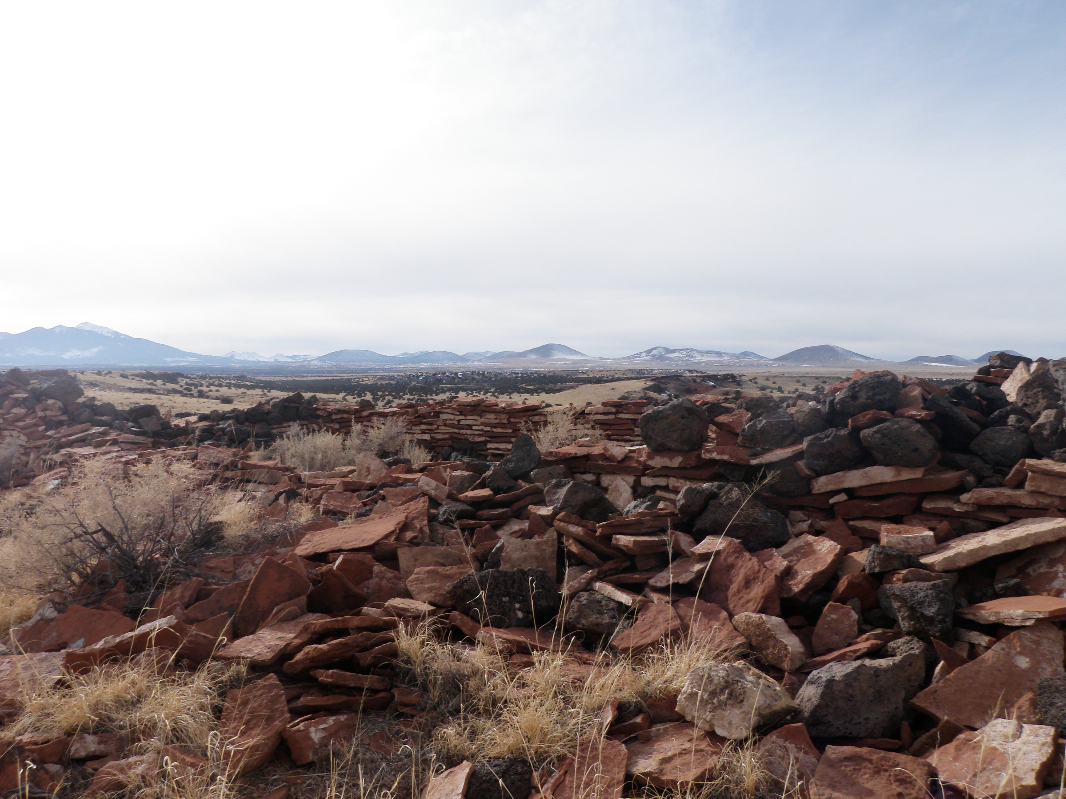
The East Mesa Hike is a unique opportunity for visitors to experience the backcountry of Wupatki with a ranger and see excellent examples of Ancestral Puebloan structures, petroglyphs, and artifacts. These sites and the lands they are on are culturally significant to the 13 Traditionally Associated Tribes of Wupatki National Monument, all of whom have ancestral ties to this area.
Accessibility The hike is moderately strenuous to include uneven terrain over loose cinders and limestone rocks. Hike length is a minimum of 1.5 mi (2.4km) in desert conditions and participants will be exposed to outdoor conditions for the entire hike.
Kaibab House Ranger-Led Hike the Park Service's write-up
3-5 Hours · no dogs · entrance fee applies · reservation required · Winter, Spring, Fall
Start Wupatki National Monument Visitor Center
No ranger-led hikes for 2026 are planned at this time.
Wupatki Ranger-Led Hikes take place on Saturdays between November and March. Learn about the archeological sites, petroglyphs, geology, flora, and fauna that make Wupatki National Monument a beautiful and special place. Hikes are 2-3 miles on moderate terrain. Wupatki is typically 10 degrees warmer than Flagstaff. Wear hiking boots and dress in layers. Bring a snack and at least 2 quarts of water.
All hikes meet at the Wupatki Visitor Center at 12:00pm on the day of the hike. Park entrance fees apply but there is no additional fee for the hike.
Please note that hikes have a limited number of spots available (12 for Kaibab House and East Mesa, 8 for Antelope House) and reservations are taken on a first come first served basis.
If participants cancel prior to the hike we will contact those who selected to be on the wait list in the order they signed up.
For questions about this hike please contact FLAG_Ranger_Hikes@nps.gov .
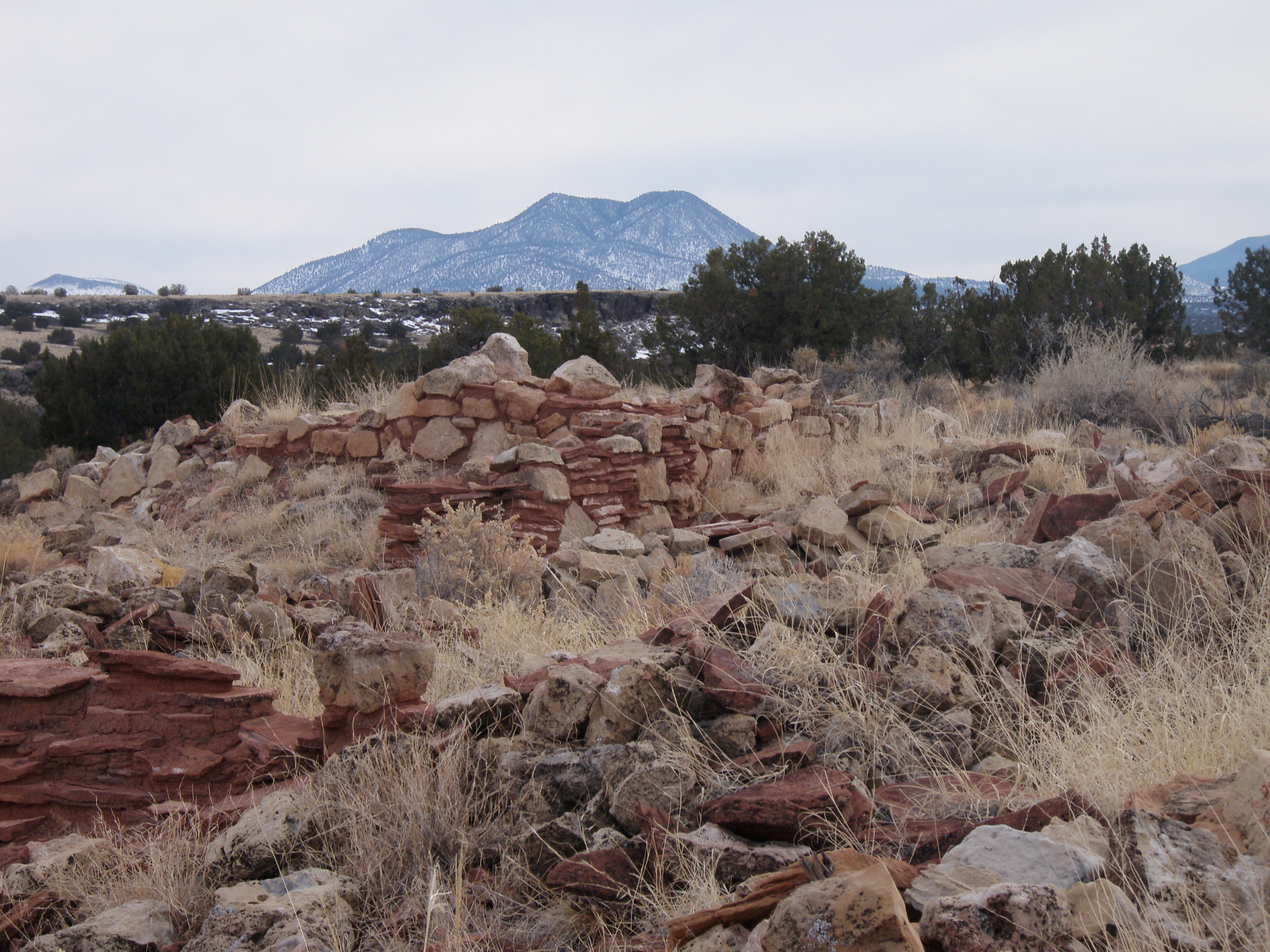
The Kaibab House Hike is a unique opportunity for visitors to experience the backcountry of Wupatki with a ranger and see excellent examples of Ancestral Puebloan structures, petroglyphs, and artifacts. These sites and the lands they are on are culturally significant to the 13 Traditionally Associated Tribes of Wupatki National Monument, all of whom have ancestral ties to this area.
Accessibility The hike is moderately strenuous to include uneven terrain over loose cinders and limestone rocks. Hike length is a minimum of 2.5 mi (4km) in desert conditions and participants will be exposed to outdoor conditions for the entire hike.
Visit Wupatki Pueblo the Park Service's write-up
5-30 Minutes · no dogs · entrance fee applies
Start Wupatki Pueblo
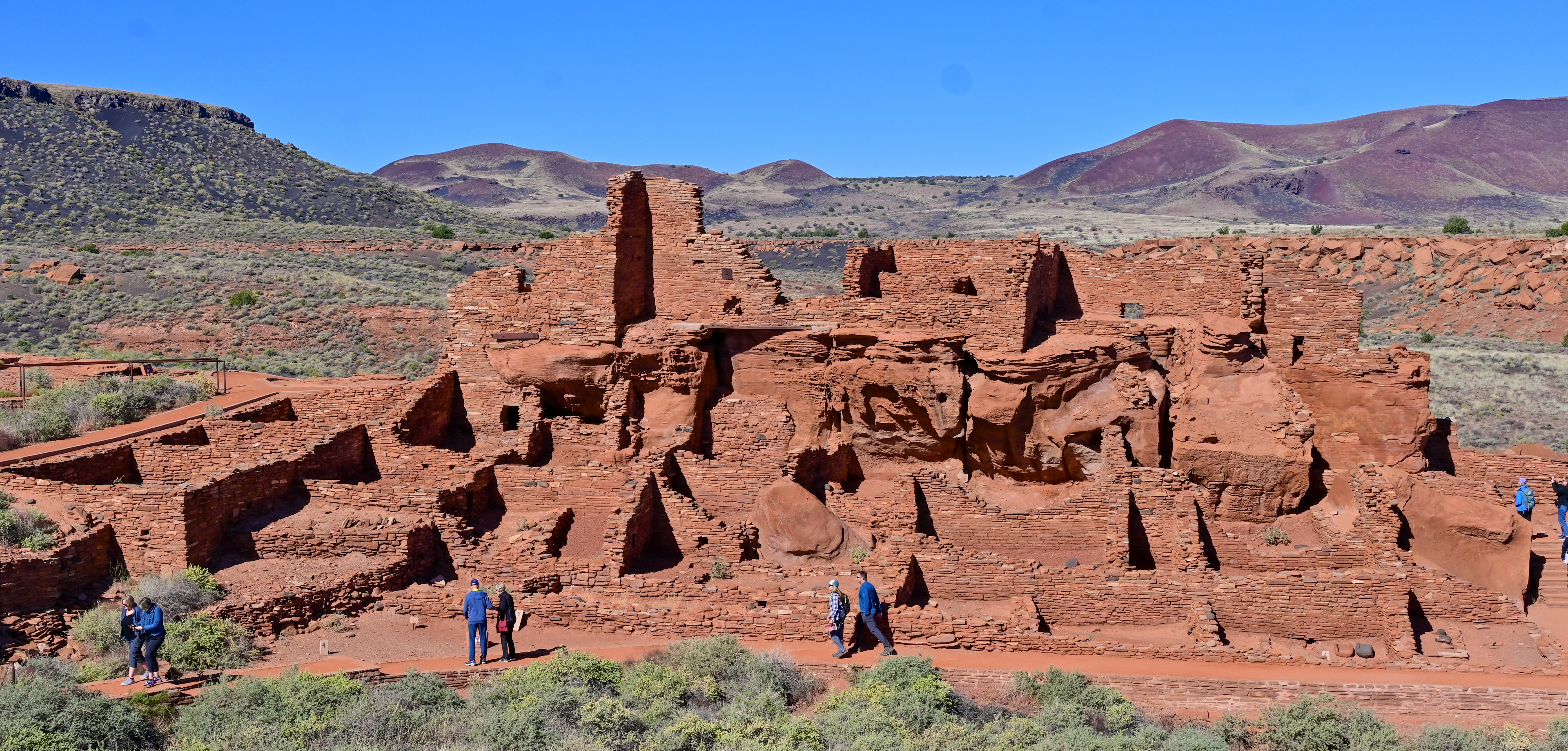
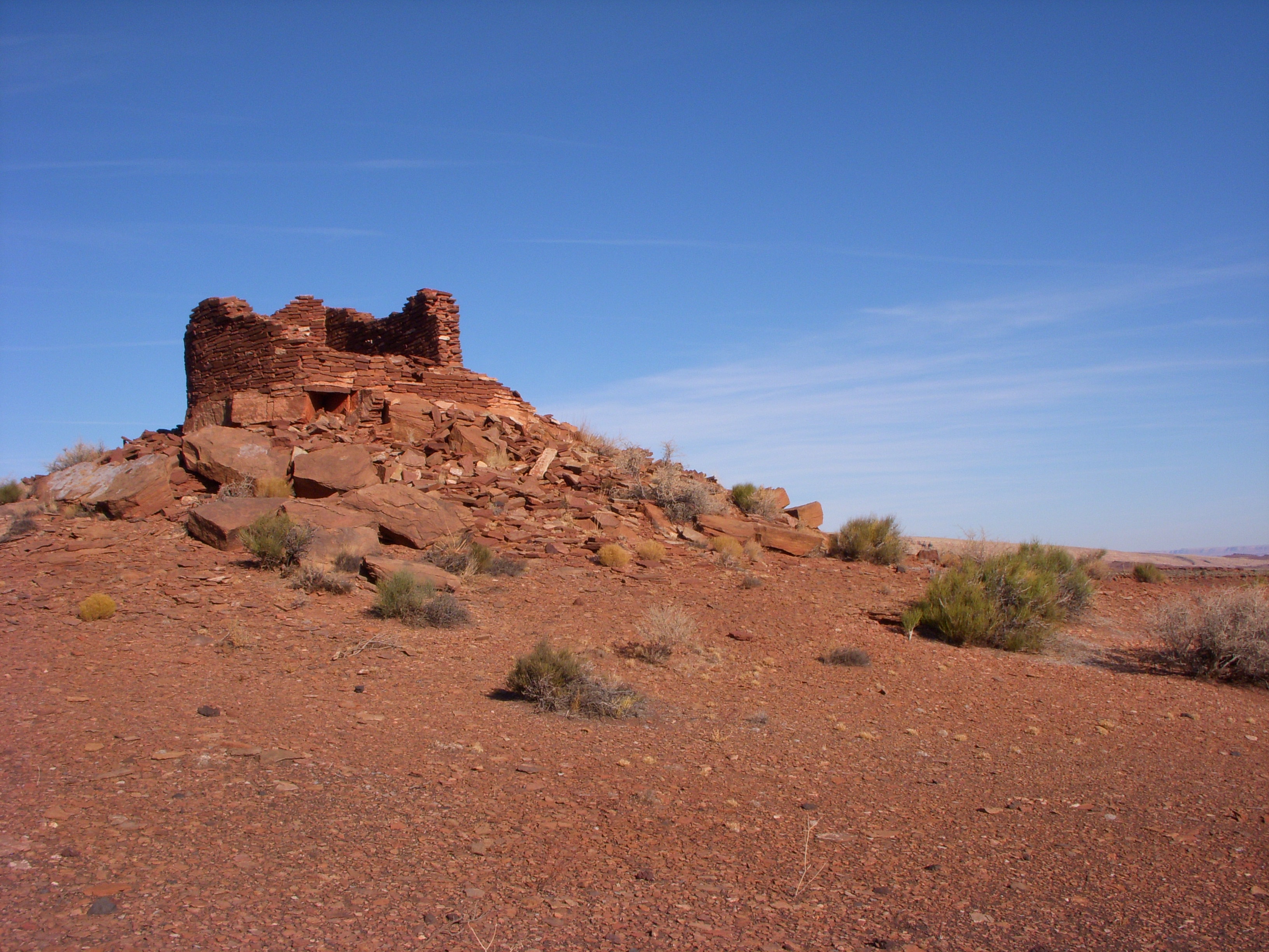
From the early 1100's to the mid 1200's CE this large Ancestral Puebloan structure was a bustling hub for trade and agriculture. Consisting of 104 rooms, a ceremonial ballcourt, and a large community room that likely held dances and ceremonies, the Wupatki Pueblo is the largest free standing pueblo in Northern, AZ. You can view the whole pueblo from an overlook point just a few hundred feet behind the visitor center along an accessible trail, or you can continue onto the 0.5 mi (.8 km) round-trip trail to get up close and personal with this important heritage site.
One of the most popular features at any pueblo in the Monument is the ball court and blow hole, both found at the farthest point on the trail.
This pueblo is located directly behind the Wupatki Visitor Center. It is a 13mi (20.9km) drive from the northern entrance of the monument off of Hwy 89, or 19.5mi (31.3km) from the Sunset Crater Volcano National Monument. For a more in depth experience pick up the Wupatki Pueblo Trail Guide in the park store for $2 which follows the numbered stops on the trail.
Although it is no longer physically occupied, descendent communities believe the people who lived and died here remain as spiritual guardians. These places are remembered and cared for, not abandoned. Thank you for visiting respectfully and leaving no trace. These sites and the lands they are on are culturally significant to the 13 Traditionally Associated Tribes of Wupatki National Monument, all of whom have ancestral ties to this area. Thank you for visiting respectfully and leaving no trace.
Pets Pets are not allowed on the Wupatki Pueblo trail. There is a shaded patio on the back side of the visitor center where pets can wait with a member of your group. Pets must be leashed at all times. Leashed service animals are ok.
Accessibility The parking area for Wupatki Pueblo has two accessible parking spaces (one van accessible). The path from the parking lot up to the Pueblo Overlook is paved concrete at a grade no more than 5% and a width of at least 4 ft. (48 in). Service animals are welcome on this trail. The trail beyond the overlook is a compacted decomposed granite surface with grades in excess of 5% and a width of at least 3 ft. (36 in). One side of the loop around the pueblo has a few sets of stairs with long platforms in between. The difficulty for the majority of the trail is easy. There is a moderate hill coming back from the ballcourt.
About these trails
The lines are the National Park Service's public trails layer, the trailheads and the waterfalls, views, peaks and historic places along them the Service's public points of interest, read 2026-10-14 and simplified for the map. The write-ups are the Service's own "things to do", unedited. Heights come from USGS 3DEP through Terrain Tiles on AWS (Mapzen/Tilezen), read along each line and rounded; a short trail on steep ground can be off by a few tens of feet. Closures change: check the park's own site before you go.