
National Park · South Dakota
Trails in Wind Cave National Park
11 named trails · 62 miles · 1 with the Park Service's own write-up. The lines, trailheads and points are the Park Service's; the write-ups are the Service's own words; the climbing is read from USGS elevation along each line.
11 trails, A to Z.
Centennial Trail
Centennial Trail #89
Cold Brook Canyon Trail
Views
Along the way Pullout
East Bison Flats Trail
Elk Mountain Nature Trail
Highland Creek Trail
Lookout Point Trail
Prairie Vista Trail
Visit Wind Cave's Natural Entrance the Park Service's write-up
10-20 Minutes · dogs allowed
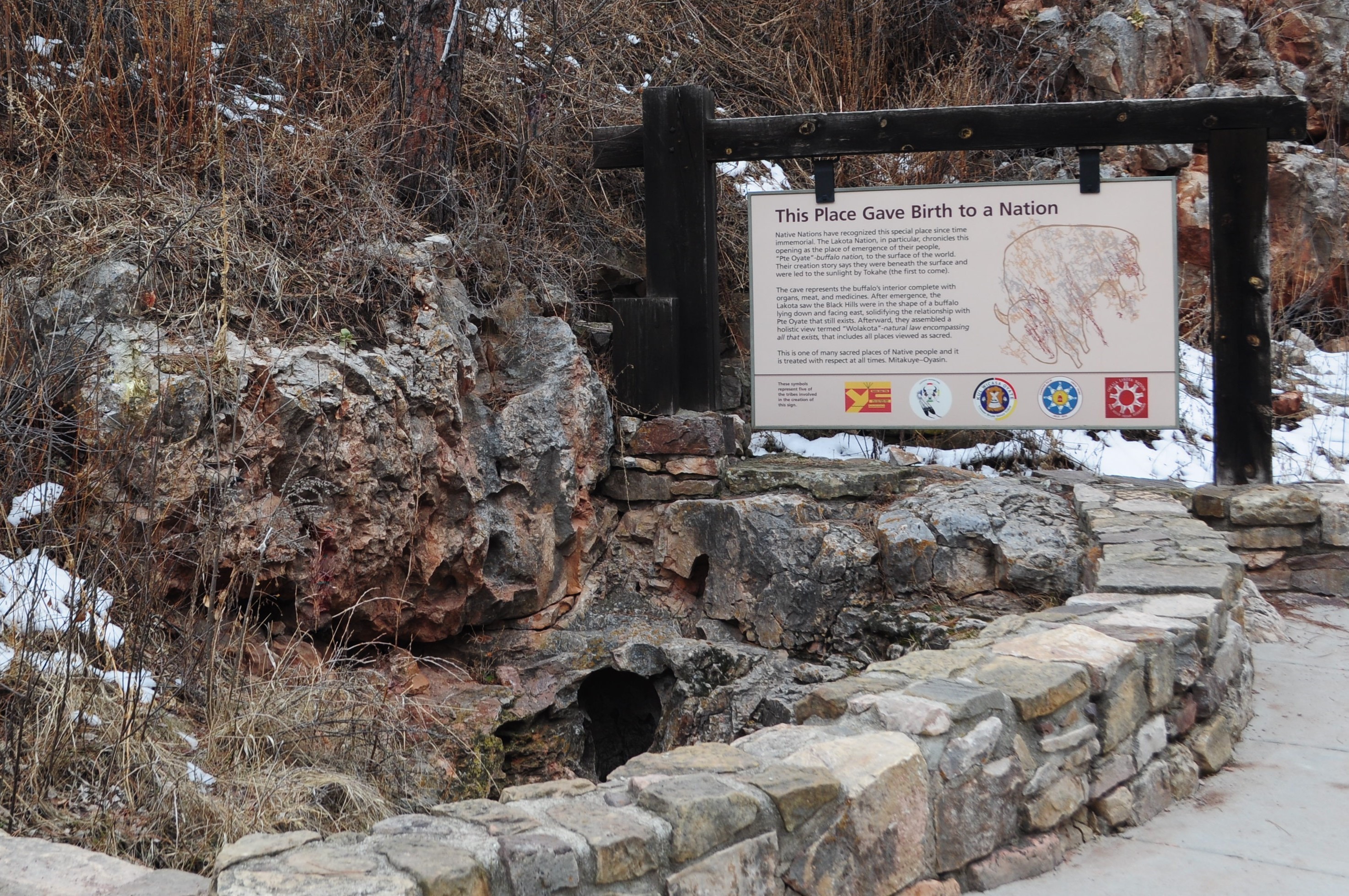
Despite its length and complexity, Wind Cave has very few natural entrances. The largest and most well-known naturally formed entrance is only about ten inches wide. Visitors can still view this entrance without going on a tour. This is a very spiritual place to many different native people and is considered the birthplace of the Lakota nation.
Accessibility Visitors using wheelchairs are able to view the natural entrance. During business hours, it can be accessed via a ramp and paved sidewalk leaving from the visitor center. The natural entrance is approximately 225 yards from the building. After hours, a wide gravel path with a fairly level grade at the picnic area leads to the natural entrance. The natural entrance is approximately 150 yards from the picnic area.
Sanctuary Trail
Wind Cave Canyon Trail
20 more mapped segments without a name are on the map, not in the list.
More hikes the Park Service describes
Write-ups that name no single mapped trail, in the Service's words.
- Hiking at Wind Cave · no dogs
View rolling prairie vistas, ponderosa forests, and see wildlife in its natural environment. Wind Cave National Park has over 30 miles of hiking trails on the surface and provides visitors the opportunity to view pristine Black Hills scenery. Find out which trail is the best for you. - Pet Friendly Hikes · 30-60 Minutes · dogs allowed
If you are traveling with a furry friend, Wind Cave has two pet friendly trails. Both are close to the visitor center and about one mile in length.
About these trails
The lines are the National Park Service's public trails layer, the trailheads and the waterfalls, views, peaks and historic places along them the Service's public points of interest, read 2026-10-14 and simplified for the map. The write-ups are the Service's own "things to do", unedited. Heights come from USGS 3DEP through Terrain Tiles on AWS (Mapzen/Tilezen), read along each line and rounded; a short trail on steep ground can be off by a few tens of feet. Closures change: check the park's own site before you go.