Scenic & Recreational River · New York, Pennsylvania

Trails in Upper Delaware Scenic & Recreational River

9 named trails · 12 miles · 7 trailheads · 8 with the Park Service's own write-up. The lines, trailheads and points are the Park Service's; the write-ups are the Service's own words; the climbing is read from USGS elevation along each line.

Open on the parks mapEvery park with trailsPark on nps.gov

9 trails, A to Z.

Bouchoux Trail

2.6 mi one way · about 1,600 ft of climbing · 874 ft–1,365 ft · earth surface · hiking

875 ft 1,364 ft · 0.8 mi high 1,364 ft

Trailhead Jensen's Ledges Trailhead 876 ft Drive there

Hike the Bouchoux Trail to Jensen's Ledges the Park Service's write-up

2-5 Hours · dogs allowed

Start Bouchouxville Road, Lordville, NY
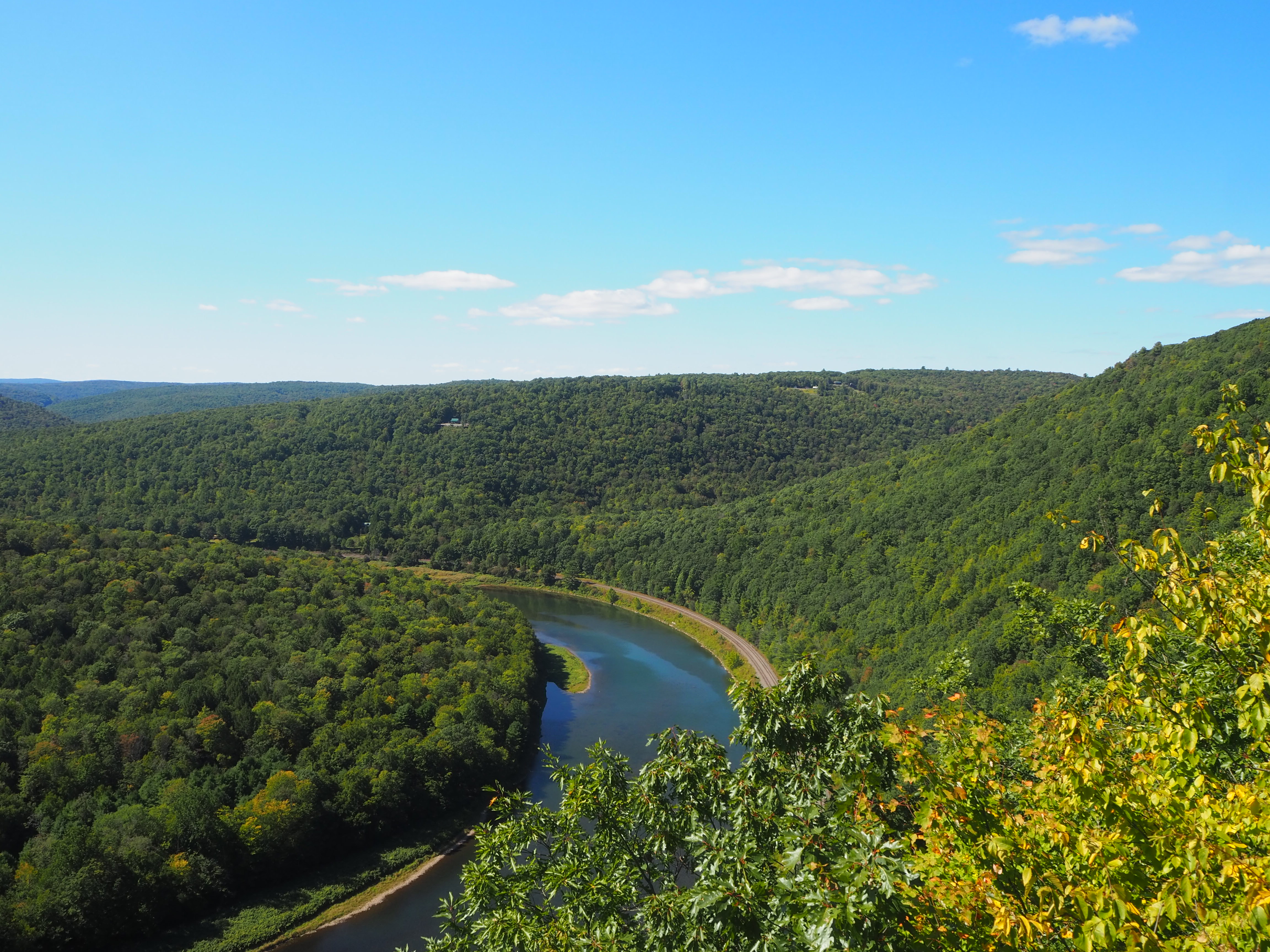
View of lush river valley with azure blue river snaking through trees
Hiking to Jensen's Ledges offer spectacular views of the river valley. Photo: NPS

After a difficult one-mile incline to the top, hikers can watch a waterfall cascade down a cliff and take in the incredible views of the larger river valley at Jensen’s Ledges. Rock cairns/rock sculptures sitting along the edge of the mountain near the ledges also provide a unique and majestic feature to the summit. Along the way, check out the bluestone rock, a nod to the history of bluestone quarrying in the area. For hikers who choose to continuing hiking past the ledges, the rest of the trail weaves through towering forest and alongside bubbling streams.

Please note that this trail is not regularly maintained and one may encounter downed trees, wet/muddy areas, and potentially parts of the trail flooded with several inch-deep water, especially after heavy rain. Trail conditions can differ depending on season and weather. Parts of the trail require hikers to cross small streams to continue. Although these streams are less than a foot deep, they can be too wide to jump across. Red, circular trail markers on trees indicate the trail path, which sometimes can be difficult to discern due to trail conditions and confusing signage.

We recommend all visitors sign in to the trail register at the start of the trail. Please note that there are no restrooms available.

This trail is managed by the New York State Department of Enviornmental Conservation Game Lands 209 and parts of the trail are on or surrounded by private property. Please stay on the trail and do not trespass onto private property.

Directions to Jensen's Ledges

Shortly after trail register, there is a fork in the trail. Take the left path, which also has a sign indicating that it leads to the ledges. Trail will be a regular incline. After the trail begins to flatten at the top, there is a fork in the path. The right leads down to cross a wider stream. To see the waterfall, look for a smaller path to the right of the trail leading down across the stream. This path leads to a ledge with the waterfall.

To reach Jensen’s Ledges, cross the stream and follow the trail. You will shortly see a path leading off the main trail to the right, marked with fall hazard signs. Take this path to the ledges.

The trail continues on past Jensen's Ledges, but the best scenic views are at the waterfall and Jensens' Ledges.

Parking

At the trailhead there is an unpaved, gravel lot that can accommodate 10-15 cars. After rain there may be mud and/or standing water.

Safety

This land is managed by New York State Department of Enviornmental Conservation Game Lands. For safety, please wear bright or fluorescent orange or pink to increase your visibility while hiking in these lawful hunting areas.

Please exercise caution and situational awareness with weather and river conditions while hiking.

During all seasons, there is always a risk of ticks. Please check for ticks on yourself and any pets after hiking.

Please note that there is very limited cell connectivity in the area and cell phones may not receive signal along the river or on the hike.

Respect private property and stay on the trail.

Leave No Trace and Pack It In, Pack It Out

Please practice "Leave No Trace" principles and do not litter or leave any waste, including animal waste, behind. Take waste with you and dispose of it properly. There are no trash receptacles available on the trails or at the trailheads, so you must take any trash with you when you leave.

Please leave nature as you found it. This includes not touching, moving, sitting on, or altering the rock cairns around Jensen's Ledges. Do not start or create fires or campfires.

Accessibility This is a moderately difficult trail with many inclines and a steep initial slope. The first mile is almost entirely uphill in order to reach the waterfall and ledges, to which the trail flattens. If hiking the larger Bouchoux Trail, the remainder of the trail has inclines, but none as steep as the initial mile incline to the ledges. The path is generally between 4-6 feet wide, unpaved and uneven, starting off as rock/gravel and transitioning to dirt. Obstacles such as tree roots, rocks, and downed trees are present on the trail. Parts of the trail can get wet and muddy and even contain standing water, especially after heavy rain. At several points along the trail, you may need to cross a small stream, all are less than 1 foot deep, but can be too wide to jump across. The water may be cold and swift. Please note that the waterfall ledge and Jensen’s Ledges are steep drop-offs and do not have handrails or guardrails. Please exercise caution at the ledges to avoid potential fall hazards and accidents. Elevation gain to Jensen’s Ledges is approximately 520 ft (150m), and elevation gain for total trail is approximately 1040 ft (317m). There are no designated accessible parking spots in the parking lot.
This hike on nps.gov

Cobey Pond Trail

2.0 mi one way · about 250 ft of climbing · 987 ft–1,177 ft · earth surface · hiking

987 ft 1,073 ft · 2.0 mi high 1,177 ft

Trailhead Cobey Pond Trail Trailhead 983 ft Drive there

Hike the Cobey Pond Trail the Park Service's write-up

1-2 Hours · dogs allowed

Start Masthope Plank Road, Masthope, PA

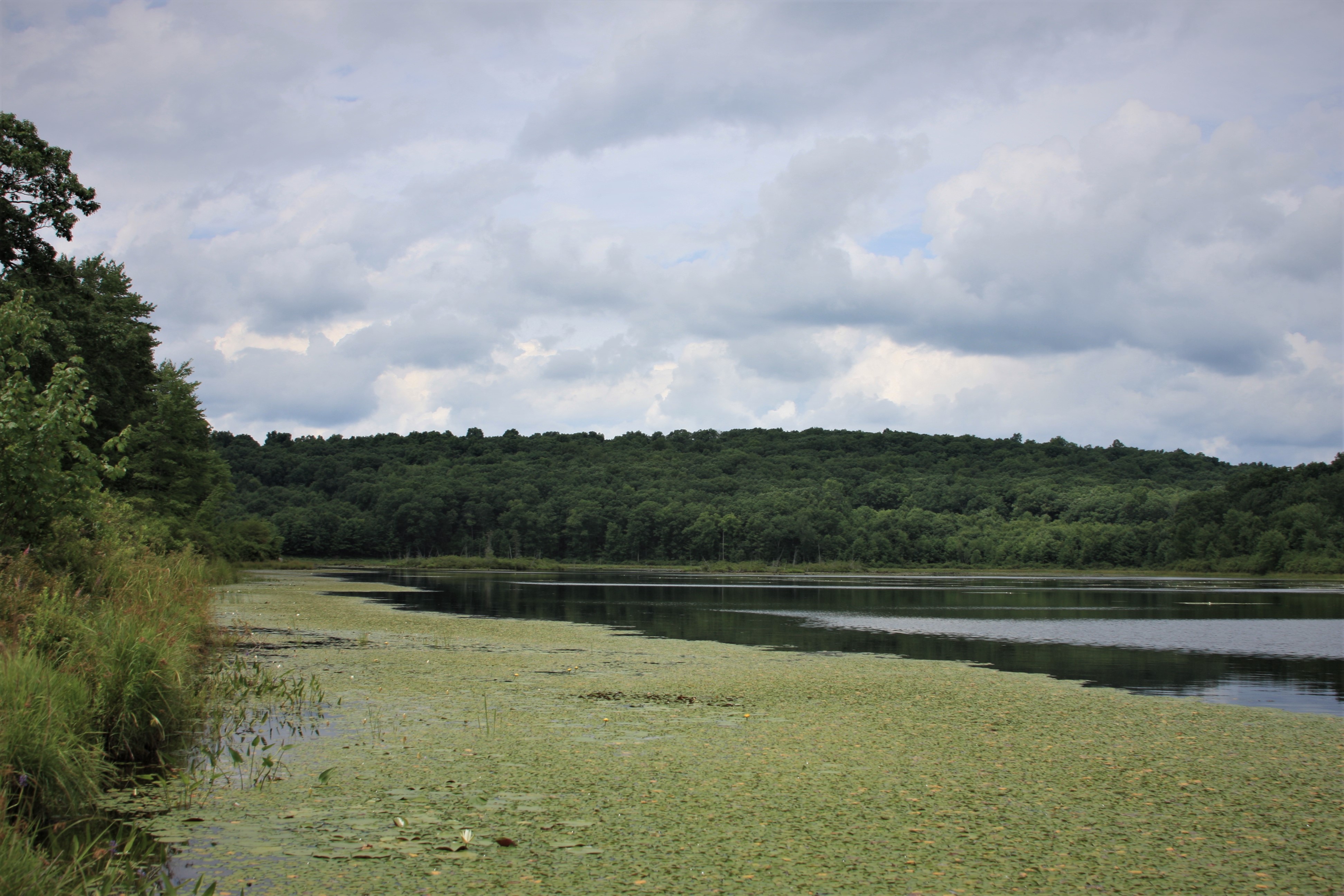
View of pond with lush green trees along shore, aquatic plants blanketing clear water near shore.
View along Cobey Pond. Photo: NPS

Spend an hour on this relatively easy hike around the picturesque Cobey Pond. The first quarter mile (400m) of the trail is on a moderate incline through the forest up to the pond. Keep right at the fork to go straight to the Cobey Pond. Pause on the dock or stand on the spillway to take in a beautiful view of the water, surrounded by peaceful forest. As you walk around the water, observe the bubbling brooks and quiet streams feeding into pond, and waterfowl and wildlife that call the place home.

Please note that there are no trail markers and the trail splits several times. Once reaching the pond, go right for the slightly longer route, then keep left to hike along the pond shore. The trail will split again, with the left following the shore and the right going through the woods back to the trailhead. Elevation gain is approximately 245 feet (75m). Be mindful of potentially wet, muddy conditions and ankle-tall grass.

This trail is located on Pennsylvania State Game Lands 316 and is owned and managed by the Pennsylvania Game Commission. There are no restrooms available. Fires, camping, and use of motor vehicles are prohibited. Please see the Pennsylvania State Game Lands page for more detail on land use regulations.

Parking

Parking is available at two spots. A very small gravel parking area with approximately 5 parking spots is located right off Masthope Plank Road. Parking in this lot is not recommended. Instead, keep left onto the gravel road and follow the road about half a mile (800m). A larger dirt parking lot able to accommodate 15 vehicles will be at the end of the road. The trail starts on the other side of the locked gate.

Safety

This land is owned by the Pennsylvania Game Commission. For safety, please wear bright or fluorescent orange or pink to increase your visibility while hiking in these lawful hunting areas.

This trail is not regularly maintained and parts of the trail may have ankle-high grass. Tall grass and leaf litter are prime habitats for ticks. Please check for ticks on yourself and any pets after hiking, no matter the season.

Pack It In, Pack It Out

Please practice "Leave No Trace" principles and do not litter or leave any waste, including animal waste, behind. Take waste with you and dispose of it properly. There are no trash receptacles available on the trails or at the trailheads, so you must take any trash with you when you leave.

Accessibility The trail starts off at a moderate incline for approximately a fourth of a mile (400m) up to Cobey Pond. The trail up to the pond is gravel and approximately 6-8 feet wide. At Cobey Pond, there is a wooden dock visitors can use. This dock does not have walls or railings. The trail around the pond and back to the trailhead varies from tall grass to dirt and leaf litter and on average is 4-5 feet (1.5m) wide. One may encounter rocks, mud, pools of water, and small gaps in the trail. Total elevation gain is approximately 245 feet (75m).

This hike on nps.gov

D & H Canal Trail

0.3 mi one way · 601 ft–605 ft · earth/grass surface · hiking

603 ft 604 ft · 0.3 mi high 605 ft

Hike the D&H Towpath Trail the Park Service's write-up

15-30 Minutes · dogs allowed

Start Roebling’s Delaware Aqueduct (New York Side)

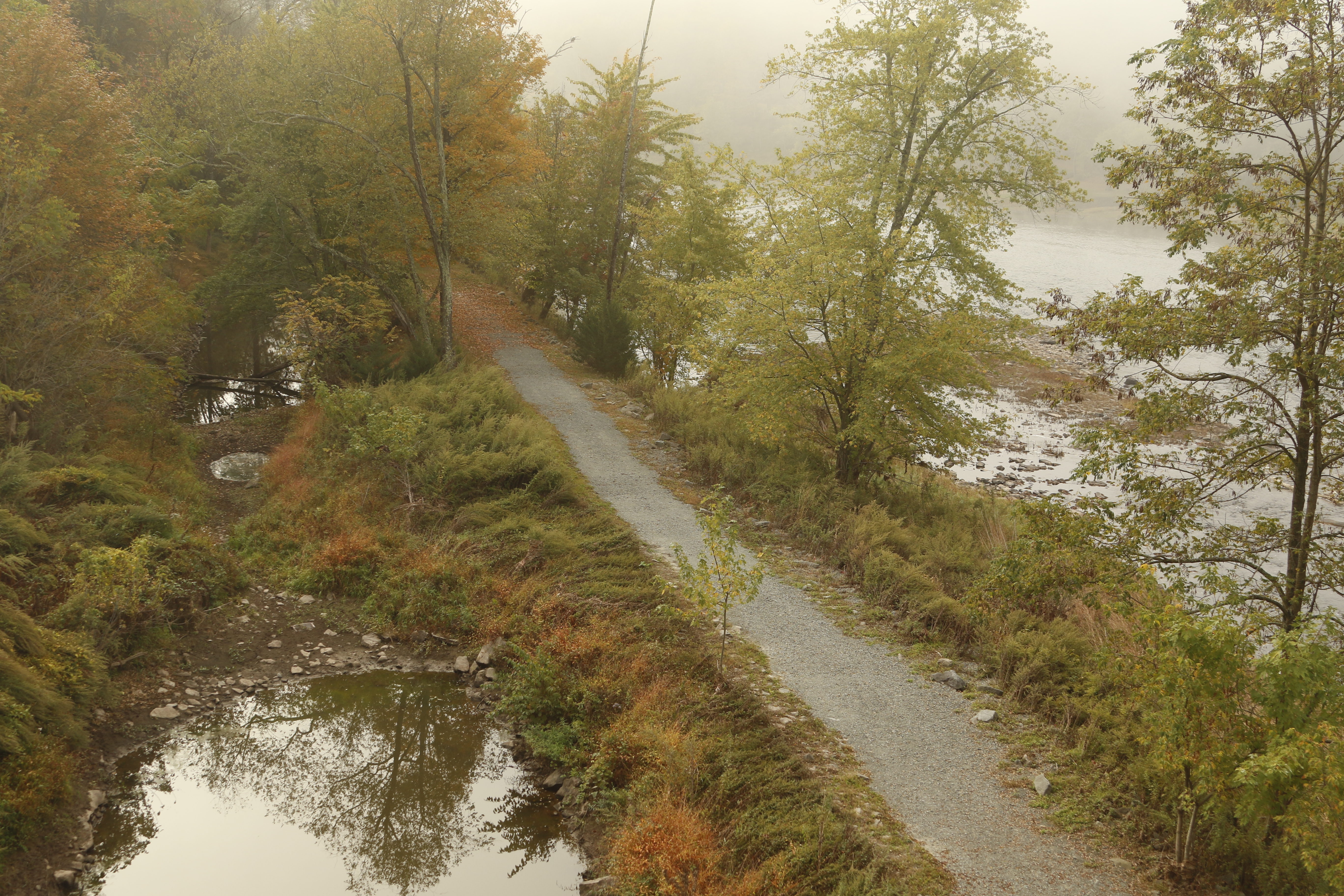
Gravel path flanked by grass, trees. River on 1 side, remains of partially-filled canal on other.
The D&H towpath trail takes visitors under the Roebling Bridge and along remains the old D&H canal. Photo: NPS

Enjoy this easy walking trail that takes you along the Delaware river and remains of the historic Delaware and Hudson (D&H) Canal . Experience beautiful views of the river, opportunities to spot a variety of flora and fauna, and the chance to peek into the past through Roebling’s Delaware Aqueduct and the remnants of the old canal still visible along the trail.

Due to its proximity to the river, this trail can be damaged after flooding and high-water events. Please check Upper Delaware Scenic and Recreational River’s Alerts & Current Conditions to check for trail closures, especially after severe weather events.

Parking and Restrooms

Parking is available at the trailhead on New York State Route 97. This is a paved, medium-sized parking lot able to accomodate approximately 10 vehicles. An additional parking lot, containing the only nearby public restroom, is located on the Pennsylvania-side of Roebling's Delaware Aqueduct.

Pack It In, Pack It Out

Please practice "Leave No Trace" principles and do not litter or leave any waste, including animal waste, behind. Take waste with you and dispose of it properly.

Connection to the Barbara Yeaman Observation Area/Minisink Ford Observation Area

The southern tip of the D&H Towpath Trail connects to another local walking trail that follows along Route 97 and the Delaware River. This additional riverside trail adds roughly an additional 0.4 miles one-way to the trail and ends at the Barbara Yeaman Observation Area near Minisink Ford. There are no structures or observation blinds in this wildlife observation area, but there are several designated parking spots.

Accessibility Although trail is relatively flat, it is not a paved trail. Trail is approximately 0.8 miles and made of dirt, grass, and/or gravel at different sections and is approximately 8 feet wide. Trail may get wet and muddy after rain, snow, and other inclement weather. This is a forested trails so tree roots and fallen branches may also be present of the trail. The parking lot next to trailhead does have an accessible parking space. The connecting trail to the wildlife observation area is made of packed gravel and is relatively flat.

This hike on nps.gov

Damascus Forest Trail

1.2 mi loop · about 100 ft of climbing · 1,070 ft–1,168 ft · earth surface · hiking

1,099 ft 1,095 ft · 1.1 mi high 1,168 ft

Trailhead Damascus Forest Trail Trailhead 1,074 ft Drive there

Hike the Damascus Forest Trail the Park Service's write-up

30-60 Minutes · dogs allowed

Start MacCubbins Road, Beach Lake, PA

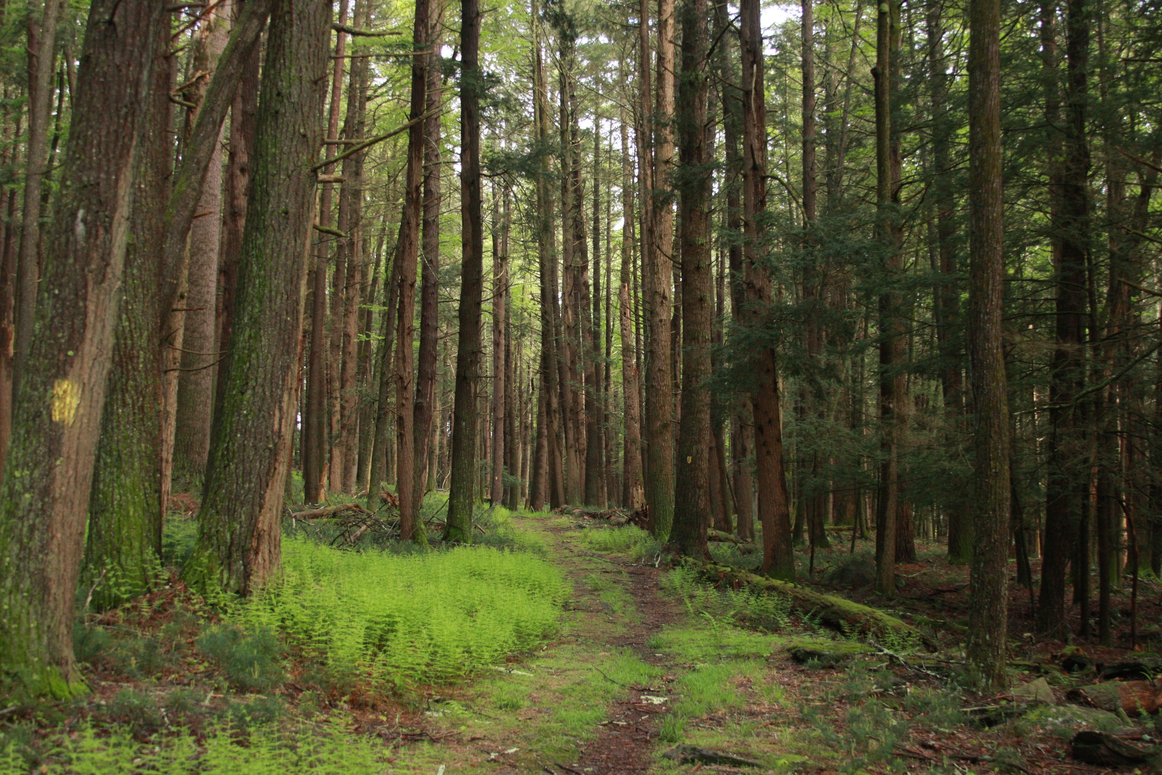
dirt/grass trail surrounding by towering hemlock trees
Enjoy both serene forest and lush wetlands along the Damascus Forest Trail. Photo: NPS

Take a hike on this moderately easy, short loop trail through the Damascus Forest. This trail offers a variety of things to see including lush wetlands teeming with life, forested uplands shadowed by trees, bright mossy paths under powerlines, crumbling rock walls, mushrooms, and towering old growth forests. Keep an eye out to see if you can spot the forest poem—an ode to the hemlocks—inscribed on a mossy rock along the trail.

Please note this trail is not regularly maintained and some parts of the trail path may be difficult to discern. Follow the yellow painted trail markers on the trees.

This trail is located on land owned and managed by Damascus Township. Pit toilets are available at the end of the trail loop, just down the road of the parking lot.

Parking

At the trailhead there is an unpaved, gravel lot that can accommodate approximately 20 cars.

Safety

Please exercise caution and situational awareness with weather conditions while hiking.

During all seasons, there is always a risk of ticks. Please check for ticks on yourself and any pets after hiking.

Please note that there is limited cell connectivity in the area and cell phones may not receive signal.

Pack It In, Pack It Out

Please practice "Leave No Trace" principles and do not litter or leave any waste, including animal waste, behind. Take waste with you and dispose of it properly. There are no trash receptacles available on the trails, parking lot, or at the trailheads, so you must take any trash with you when you leave.

Accessibility This is a moderately easy trail that has some inclines. Trail surface is unpaved and varies between grass and dirt as it winds through the forest. Trail width varies from approximately 3 to 5 feet (1-1.5m). Please watch out for obstacles such as tree roots and rocks. At some points on the path, you will have to walk in between openings in crumbling, rock walls. Pit toilet-style bathrooms are available at the southwestern end of the loop. These are not accessible restrooms.

This hike on nps.gov

Minisink Battleground Park Trail

0.9 mi loop · about 150 ft of climbing · 1,052 ft–1,179 ft · asphalt surface · hiking · seasonal: Winter Seasonal Closure

1,059 ft 1,054 ft · 0.9 mi high 1,179 ft

Trailhead Minisink Battleground Trail Trailhead 1,083 ft Drive there

Hike the Minisink Battleground Park Trail System the Park Service's write-up

30-120 Minutes · dogs allowed · Spring, Summer, Fall

Start Minisink Battleground Park

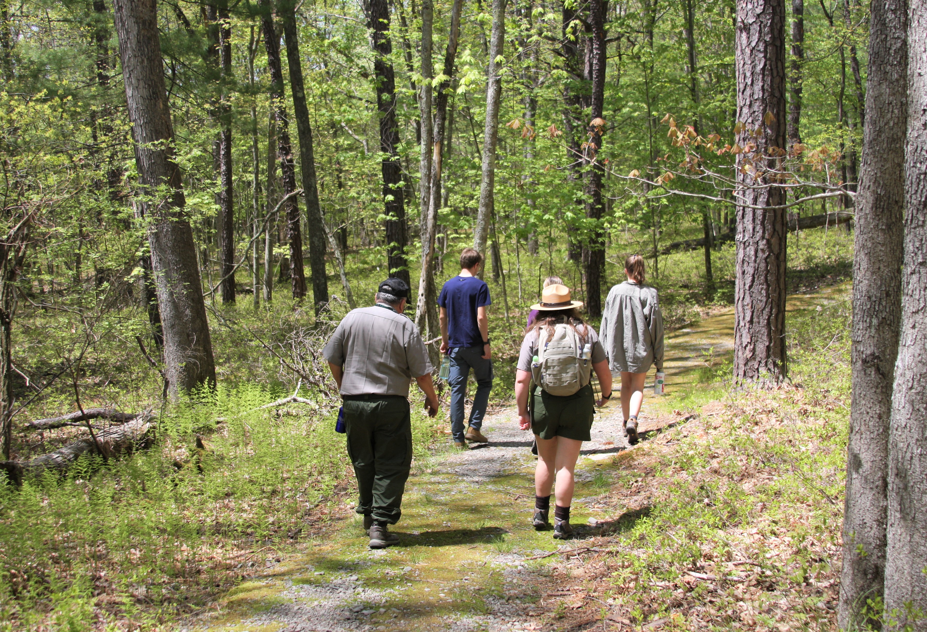
Park rangers and visitors walk on winding mossy trail through forest.
The Minisink Battleground Park offers a choose-your-own adventure with its network of trails. Photo: NPS

Spend an hour or less on a walk on bright mossy trails and through peaceful forest, with options for both shorter or longer hikes through the winding trails of this county park. Get not just your fill of nature—with towering trees, ponds and small streams, and impressive rock structures—but also a taste of history. The park is the only site in the Upper Delaware Valley region to have seen a major Revolutionary War battle. Interpretive information and monuments to those who lost their lives at the Battle of Minisink are available for visitors to learn from and pay their respects.

The Minisink Battleground Park Trail System includes three winding and intersecting trails: The Battleground Trail, the Old Quarry/Rockshelter Trail, and the Woodland Trail. Taking the outer loop of the trail system along the Old Quarry Tail and then onto the Woodland Trail is approximately 1 mile, although the total mileage of the combined trails is greater. The approximately elevation gain is 137 feet (42m). Please be mindful of potentially wet and muddy conditions, especially after heavy rainfall.

Restrooms are available and are located next to the main parking area, at the interpretive center. There is also a covered picnic shelter area available for the public to use.

This trail system is located within Minisink Battleground Park, which is owned and managed by Sullivan County Parks and Recreation.

Please note Minisink Battleground Park is closed December 1 - April 30.

Parking

There is a paved parking lot located within Minisink Battleground Park. This park is able to accommodate approximately 20 vehicles and there are designated accessible parking spots available.

Safety

Please exercise caution and situational awareness with weather conditions while hiking.

During all seasons, there is always a risk of ticks. Please check for ticks on yourself and any pets after hiking.

Please note that there is very limited cell connectivity in the area and cell phones may not receive signal along the river or on the hike.

Leave No Trace and Pack It In, Pack It Out

Please practice "Leave No Trace" principles and do not litter or leave any waste, including animal waste, behind. Take waste with you and dispose of it properly.

This trail is managed by Sullivan County of New York. Parts of the trail are close to or surrounded by private property. Please stay on the trail.

Accessibility This is a moderately easy trail which although mostly flat, does have a few moderate inclines depending on which trails you choose to take. Notable inclines include parts of the trail from the parking area to Minisink Monument, and on the Rockshelter Trail to the Minisink Spring. However, major inclines can be avoided by avoiding certain trail paths over others. Trail path is mossy, sometimes with rocks, mud, and tree roots, and is approximately 4 feet wide (1.2m) though it may narrow on some parts of the trails. Accessible parking spots are available at the main parking area.

This hike on nps.gov

Minisink Battleground Trail

1.8 mi one way · about 250 ft of climbing · 1,053 ft–1,179 ft · earth surface

1,059 ft 1,054 ft · 0.9 mi high 1,179 ft

Trailhead Minisink Battleground Trail Trailhead 1,083 ft Drive there

Hike the Minisink Battleground Park Trail System the Park Service's write-up

30-120 Minutes · dogs allowed · Spring, Summer, Fall

Start Minisink Battleground Park

Park rangers and visitors walk on winding mossy trail through forest.
The Minisink Battleground Park offers a choose-your-own adventure with its network of trails. Photo: NPS

Spend an hour or less on a walk on bright mossy trails and through peaceful forest, with options for both shorter or longer hikes through the winding trails of this county park. Get not just your fill of nature—with towering trees, ponds and small streams, and impressive rock structures—but also a taste of history. The park is the only site in the Upper Delaware Valley region to have seen a major Revolutionary War battle. Interpretive information and monuments to those who lost their lives at the Battle of Minisink are available for visitors to learn from and pay their respects.

The Minisink Battleground Park Trail System includes three winding and intersecting trails: The Battleground Trail, the Old Quarry/Rockshelter Trail, and the Woodland Trail. Taking the outer loop of the trail system along the Old Quarry Tail and then onto the Woodland Trail is approximately 1 mile, although the total mileage of the combined trails is greater. The approximately elevation gain is 137 feet (42m). Please be mindful of potentially wet and muddy conditions, especially after heavy rainfall.

Restrooms are available and are located next to the main parking area, at the interpretive center. There is also a covered picnic shelter area available for the public to use.

This trail system is located within Minisink Battleground Park, which is owned and managed by Sullivan County Parks and Recreation.

Please note Minisink Battleground Park is closed December 1 - April 30.

Parking

There is a paved parking lot located within Minisink Battleground Park. This park is able to accommodate approximately 20 vehicles and there are designated accessible parking spots available.

Safety

Please exercise caution and situational awareness with weather conditions while hiking.

During all seasons, there is always a risk of ticks. Please check for ticks on yourself and any pets after hiking.

Please note that there is very limited cell connectivity in the area and cell phones may not receive signal along the river or on the hike.

Leave No Trace and Pack It In, Pack It Out

Please practice "Leave No Trace" principles and do not litter or leave any waste, including animal waste, behind. Take waste with you and dispose of it properly.

This trail is managed by Sullivan County of New York. Parts of the trail are close to or surrounded by private property. Please stay on the trail.

Accessibility This is a moderately easy trail which although mostly flat, does have a few moderate inclines depending on which trails you choose to take. Notable inclines include parts of the trail from the parking area to Minisink Monument, and on the Rockshelter Trail to the Minisink Spring. However, major inclines can be avoided by avoiding certain trail paths over others. Trail path is mossy, sometimes with rocks, mud, and tree roots, and is approximately 4 feet wide (1.2m) though it may narrow on some parts of the trails. Accessible parking spots are available at the main parking area.

This hike on nps.gov

Mongaup River Trail

1.0 mi one way · about 70 ft of climbing · 498 ft–555 ft · earth, gravel surface · hiking

500 ft 533 ft · 0.7 mi high 549 ft

Trailhead Mongaup River Trail Trailhead 509 ft Drive there

Hike the Mongaup River Trail the Park Service's write-up

45-90 Minutes · dogs allowed · Spring, Summer, Fall

Start Near Mongaup River Access, on Route 97 near Sparrowbush, NY

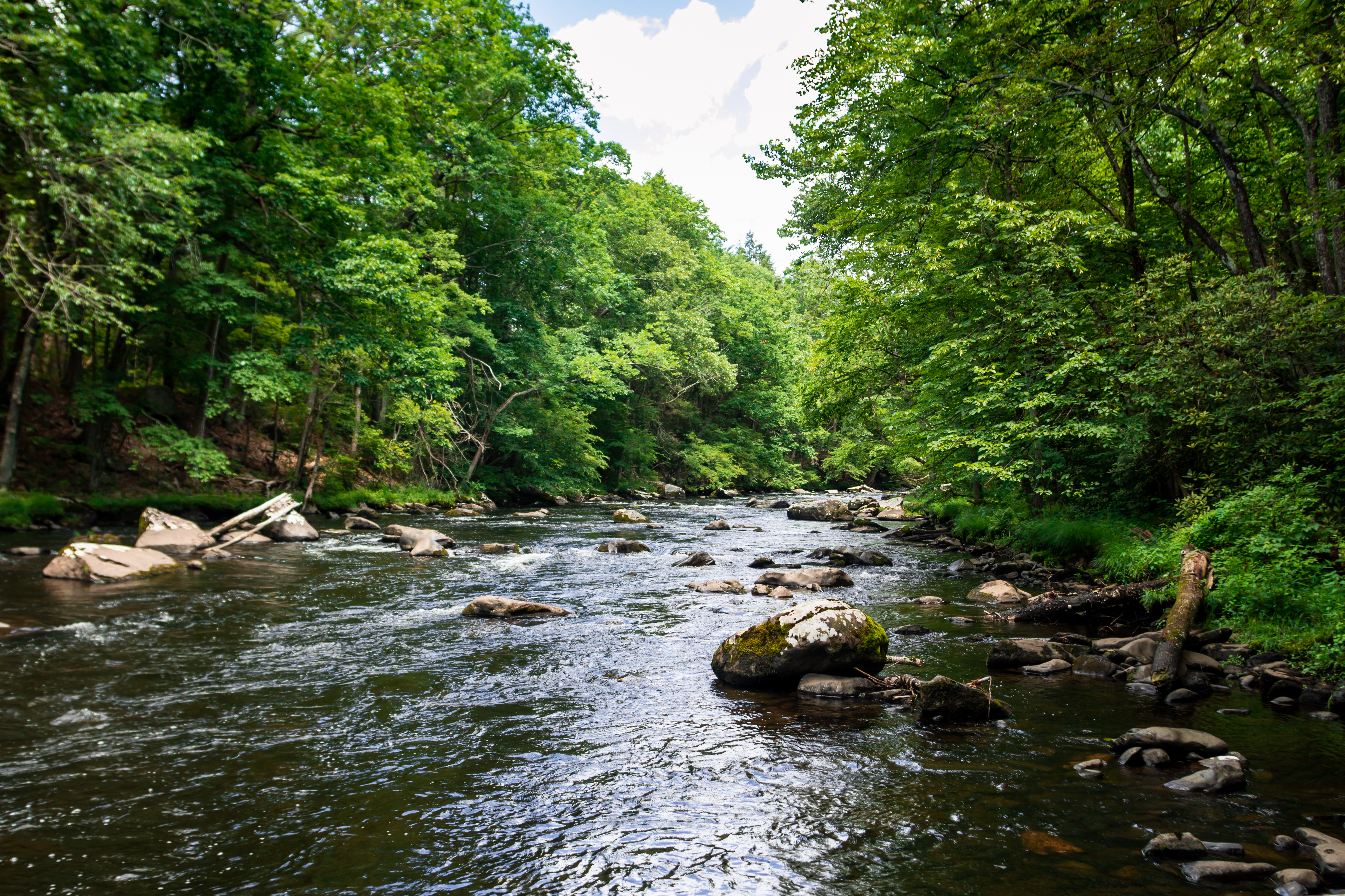
View of a lush, forested river. Water is clear and reflects blue sky. Rocks dot the riverbed.
Enjoy gorgeous riparian views along the Mongaup River Trail Photo: NPS / Joe Miles

Enjoy this relatively short but beautiful hike along the Mongaup River, located near the Mongaup River Access. This moderate hike has something for everyone, offering beautiful scenic views, peaceful bubbling streams, blooming wildflowers, and ample opportunities to view wildlife such as bald eagles, waterfowl, and more. Close your eyes and listen to the roar of the water or the rustle of the leaves. Overhead, regal Eastern Hemlock trees create a canopy, shading this steep ravine landscape. At the end of this there-and-back trail, visitors can admire the small but quaint Lower Mongaup Cemetery (also known as the Knight Cemetery), with graves dating back to the 19th century.

Although containing several inclines and small hills, the trail is relatively flat with only 72 feet (22m) in elevation gain. Please be aware that no restrooms are available at the trailhead.

This trail is located on lands owned and managed by New York State Department of Environmental Conservation (NY DEC).

Please note this trail is closed between December 1st – March 31st.

Parking

Parking is available at the trailhead. At the trailhead off of New York State Route 97 is a small gravel parking lot able to accommodate 5-10 vehicles.

Safety

Please exercise caution and situational awareness with weather and river conditions while hiking.

During all seasons, there is always a risk of ticks. Please check for ticks on yourself and any pets after hiking.

Please note that there is very limited cell connectivity in the area and cell phones may not receive signal along the river or on the hike.

Pack It In, Pack It Out

Please practice "Leave No Trace" principles and do not litter or leave any waste, including animal waste, behind. Take waste with you and dispose of it properly. There are no trash receptacles available on the trails or at the trailheads, so you must take any trash with you when you leave.

Accessibility The trail is relatively flat with inclines both up and down throughout, resulting in a total elevation gain of approximately 72 feet (22m). The trail varies from 3-6 feet (1-2m) wide and is made of dirt, with obstacles such as muddy areas, rocks, and tree roots. Please be mindful of drop offs, as the path follows the banks of the Mongaup River, whose current can be quite fast with white-water rapids.

This hike on nps.gov

Tusten Mountain Trail

2.2 mi one way · about 500 ft of climbing · 666 ft–1,134 ft · earth, gravel road surface · hiking

745 ft 743 ft · 1.5 mi high 1,134 ft

Trailhead Tusten Mountain Trail Trailhead 663 ft Drive there

Hike the Tusten Mountain Trail the Park Service's write-up

1-3 Hours · dogs allowed

Start Ten Mile River Access

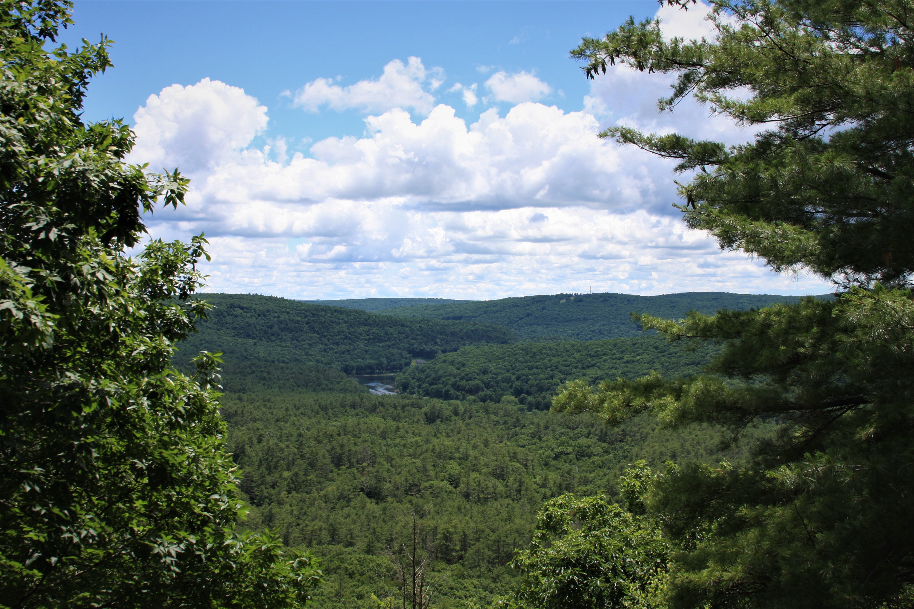
View overlooking lush river valley. Clear river cuts through rolling green tree-covered hills.
View from the summit overlook on the Tusten Mountain Trail Photo: NPS

Enjoy this moderately challenging 3-mile (5km) loop trail along the Delaware River and up Tusten Mountain through the remains of historic settlements tucked away in the forest. At the summit of the trail you will be rewarded with a magnificent view of the sparsely populated Upper Delaware River Valley. The trail has an elevation gain of approximately 500 feet (150m) and reaches elevation of over 1120 feet (340m) over sea level.

Starting from the Ten Mile River Access, walk along the Delaware River and glimpse the remains of the early settlements of Reeves Mill (dated 1757-1763) and Tusten (dated 1770s to early 1990s). Although all that remains today are foundations and stone, there was once an active sawmill, gristmill, and tannery in 1830s-1840s among a grove of hemlocks along the river. The stone bridge, constructed in 1875, is also a nod to different days, when Tusten’s industry included lumber and bluestone.

After reaching the trailhead and entering the forest, walk under towering white pines and a mixed eastern deciduous forest of oak, maple, and beech. Keep a lookout for ferns and fungi as red squirrels, grey squirrels, and eastern chipmunks squeak and scurry through the leaves. You may be startled by a deer or bear, serenaded by a melodious wood thrush or vireo, or chilled by screech of red-tailed hawk. Turn your face up and see if you can spot a turkey vulture or a bald eagle soaring overhead. There is also no shortage of unique rock and geologic formations, with the most prominent being bluestone, a durable blue-gray sandstone quarried along trail. Look for telltale signs of human handwork on some remaining rocks—scalloped edge on flat slabs of bluestone, often left in piles.

Trail Use

Trail markers on the trees indicate the trail path. There are two paths, one marked by yellow dot markers and one by red dot markers. These paths connect to form the trail loop. This trail is not regularly maintained and in some areas it may be difficult to distinguish the path on the forest floor. In such cases, always keep an eye out for the trail markers.

Please note that there are no restrooms available. Bikes and motor vehicles are not permitted on the trail. Fires and camping are also prohibited.

This trail is located on lands owned by the Conservation Fund.

Parking and Locating Trailhead

Parking is available at the Ten Mile River Access. This is an unpaved, medium-sized gravel lot able to accommodate approximately 15 cars, but cars are also able to park along Crawford Road next to the river access.

To reach the trailhead from the Ten Mile River Access, follow the gravel road north of the access. You will reach a stone arched bridge over the stream. Limited parking is available next to the stone bridge. Cross the small stone bridge and continue approximately half a mile (800m). A sign will indicate the trailhead and trail sign-in box is in the forested area on the right.

Please do not drive over the stone bridge to park on Tusten Road next to the trailhead. The designated parking area is at the Ten Mile River Access.

Safety

Please exercise caution and situational awareness with weather and river conditions while hiking. We strongly recommend wearing good hiking shoes or boots. Hikers should also use sunscreen, insect (and tick) repellant, wear a hat, and carry drinking water.

This area is open to hunting during hunting season. For safety, please wear bright or fluorescent orange or pink to increase your visibility while hiking in these lawful hunting areas.

During all seasons, there is always a risk of ticks. Please check for ticks on yourself and any pets after hiking. Always be alert for poison ivy, which can be identified by clusters/groups of three leaves together.

While not common, snakes have been seen in the area, including the only venomous snake in the area, the timber rattlesnake. Please exercise situational awareness and do not feed or disturb wildlife.

Please note that there is very limited cell connectivity in the area and cell phones may not receive signal along the river or on the hike.

Pack It In, Pack It Out

Please practice "Leave No Trace" principles and do not litter or leave any waste, including animal waste, behind. Take waste with you and dispose of it properly. There are no trash receptacles available on the trails or at the trailheads, so you must take any trash with you when you leave.

Accessibility This is a moderately difficult trail with many inclines and steep areas. It is uneven and not a paved trail, starting off as a wide, approximately 10 feet (3m) gravel road from the Ten Mile River Access to the Trailhead, and then switching over to a narrower dirt trail, on average 3-4 feet (1-1.5 m) wide. The trail can get wet and muddy in certain areas, but is also rocky as one progresses up the mountain. Close to the beginning of the trail (going counterclockwise), one will cross a series of simple bridges made of long wood planks placed across ditches, gaps, and/or small gorges. These bridges do not have railings or walls so please walk over them carefully. Other obstacles hikers may encounter include tree roots, downed trees, and drop offs. When snow and ice are present, parts of trail can be slippery. Elevation gain is approximately 500 vertical feet (150m). The trail reaches elevation of over 1120 feet (340m) over sea level.

This hike on nps.gov

About these trails

The lines are the National Park Service's public trails layer, the trailheads and the waterfalls, views, peaks and historic places along them the Service's public points of interest, read 2026-10-14 and simplified for the map. The write-ups are the Service's own "things to do", unedited. Heights come from USGS 3DEP through Terrain Tiles on AWS (Mapzen/Tilezen), read along each line and rounded; a short trail on steep ground can be off by a few tens of feet. Closures change: check the park's own site before you go.