National Historic Site · Colorado

Trails in Sand Creek Massacre National Historic Site

1 named trail · 1 miles · 1 trailhead · 1 with the Park Service's own write-up. The lines, trailheads and points are the Park Service's; the write-ups are the Service's own words; the climbing is read from USGS elevation along each line.

Open on the parks mapEvery park with trailsPark on nps.gov

1 trails, A to Z.

Bluff Trail

1.3 mi one way · about 50 ft of climbing · 3,992 ft–4,029 ft · native surface · hiking

Shelters

4,006 ft 4,029 ft · 1.2 mi high 4,029 ft

Along the way Shade Structure

The Bluff Trail the Park Service's write-up

dogs allowed
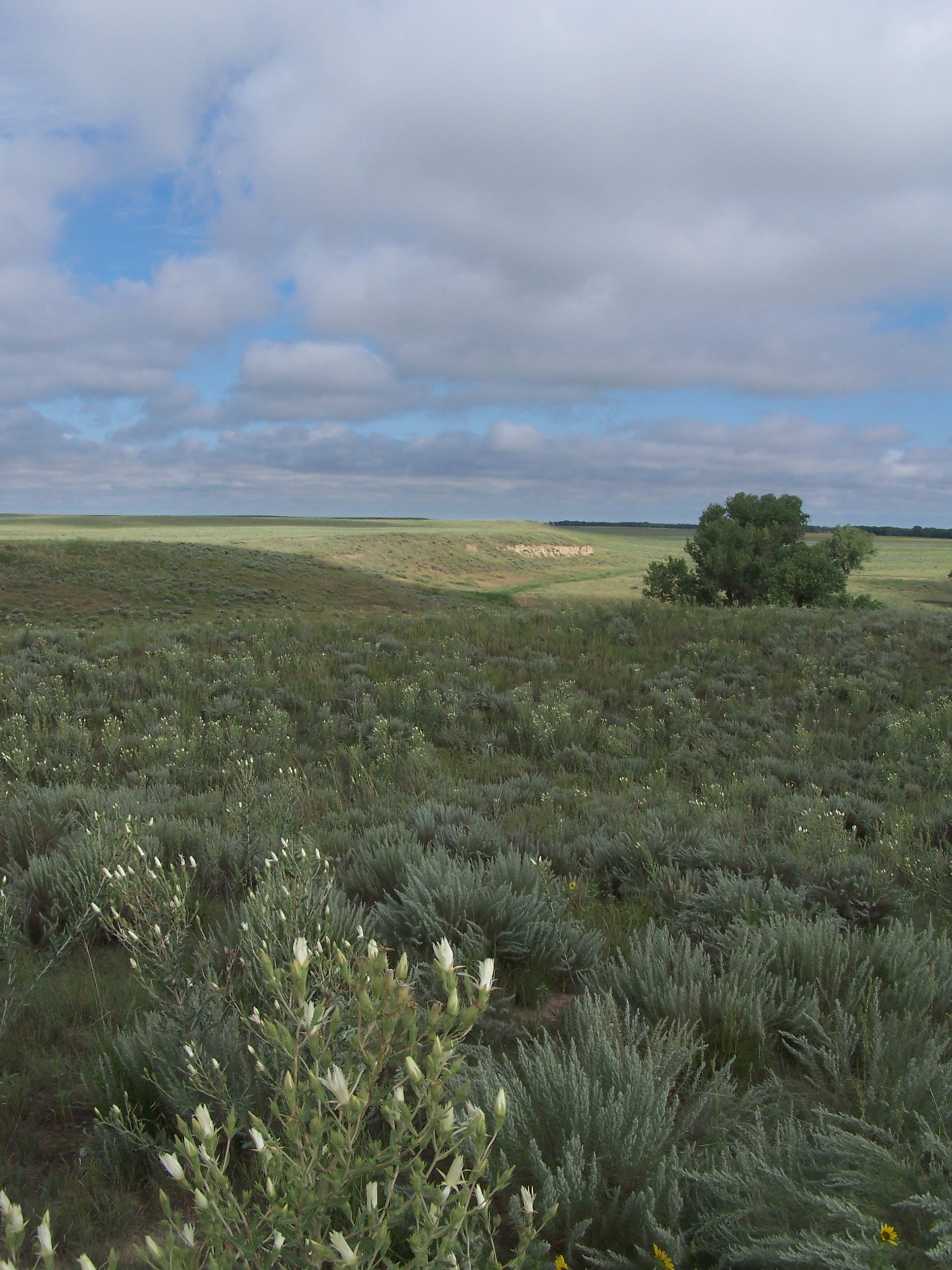
Prairie grasses stretch into the distance along a bluff line overlooking a creek.
Looking along the bluff above the Big Sandy Creek. Photo: NPS Photo

The Bluff Trail is approximately three-quarters of a mile long and runs northwest from the overlook along the bluff overlooking the Big Sandy Creek at roughly the 4,000-foot contour line. Round trip distance to the end of the Bluff Trail and back is one and a half miles. There is no shade on the trail.

The Bluff Trail overlooks the creek bed, allowing visitors to follow the course of the massacre as tribal members fled along the creek, with soldiers in pursuit. From vantage points along the trail, visitors are able to view the sandpits to which Cheyenne and Arapaho people had fled during the massacre. Benches and wayside exhibits along the trail allow for moments of peace, solitude, and reflection.

Enjoy a safe visit - please stay on designated trails at all times.

Accessibility All walking trails are sand-based with a fine walking surface.

This hike on nps.gov

More hikes the Park Service describes

Write-ups that name no single mapped trail, in the Service's words.

About these trails

The lines are the National Park Service's public trails layer, the trailheads and the waterfalls, views, peaks and historic places along them the Service's public points of interest, read 2026-10-14 and simplified for the map. The write-ups are the Service's own "things to do", unedited. Heights come from USGS 3DEP through Terrain Tiles on AWS (Mapzen/Tilezen), read along each line and rounded; a short trail on steep ground can be off by a few tens of feet. Closures change: check the park's own site before you go.