
National Historic Site · New York
Trails in Sagamore Hill National Historic Site
3 named trails · 1 miles · 1 trailhead · 1 with the Park Service's own write-up. The lines, trailheads and points are the Park Service's; the write-ups are the Service's own words; the climbing is read from USGS elevation along each line.
3 trails, A to Z.
Nature Trail
Visitor centersBridges
Along the way Eel Creek Bridge Roosevelt Museum at Old Orchard Sagamore Hill National Historic Site Visitor Center
Trailhead Nature Trail 119 ft Drive there
Hike Sagamore Hill's Nature Trail the Park Service's write-up
30-60 Minutes · dogs allowed
Start Sagamore Hill NHS
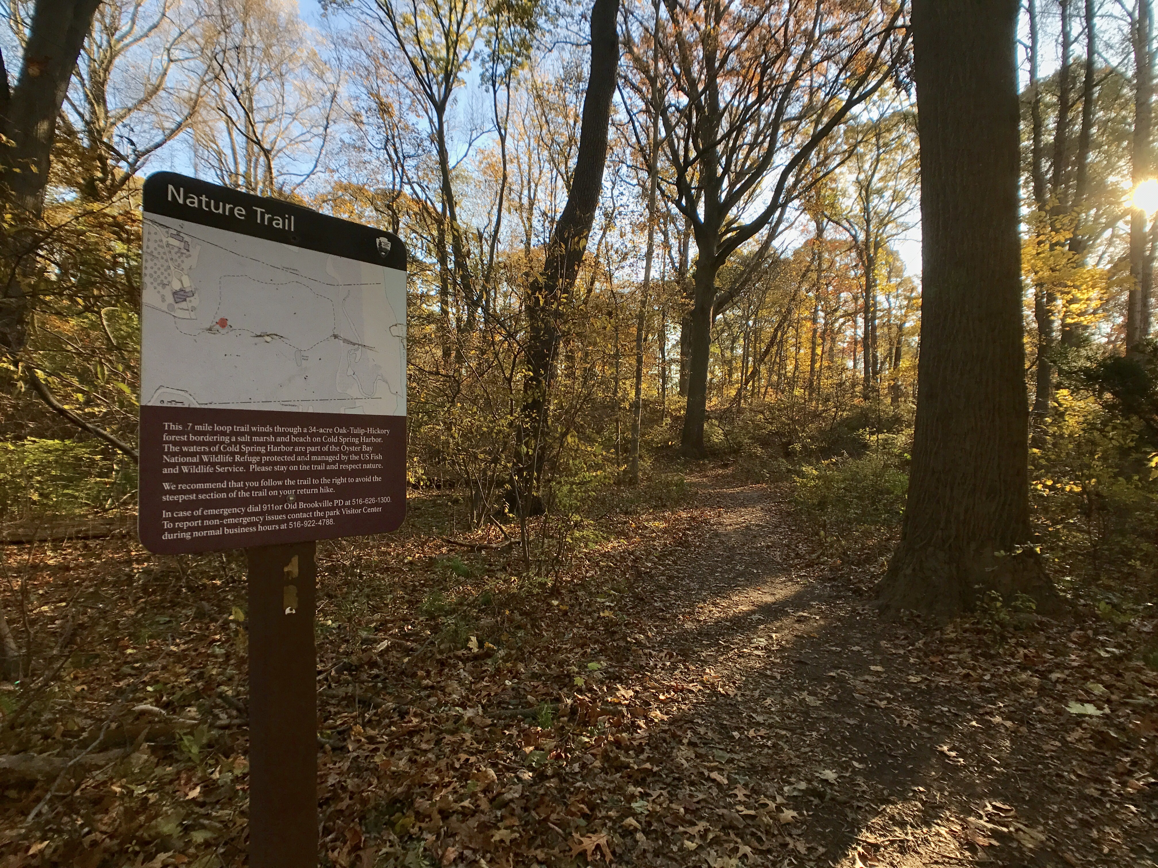
Take a walk in the footsteps of the Roosevelts and explore the woodlands and beach of Sagamore Hill on the nature trail. The trail is a 0.7 mile loop of easy to moderate difficulty that leads through an oak-tulip forest to a salt marsh and beach. Visitors can see a variety of wildlife such as songbirds, herons, egrets, osprey, bald eagles, fiddler crabs, white-tailed deer, and ducks depending on the season. This short trail includes some steep uphill and downhill sections.
Visitors should remain on trail to avoid poison ivy and ticks. Leashed dogs are allowed on-trail and at the beach. Please pack out all personal belongings, trash, and pet waste, as there are no trash receptacles on the trail. Note that the Cold Spring Harbor beach is for passive recreation only. Swimming, wading, or picnicking is not allowed. Coolers, umbrellas, shelters, children’s beach toys, sunbathing, and any other activity typical of a recreational beach is prohibited. See our page on Visiting Eel Creek and Cold Spring Harbor for more information.
Note on occasional trail flooding: During new and full moon high tides and storm events, the dune area and marsh will flood, limiting access to the beach. During these tides, sea water will wash over the creek’s bank and flood the sandy path that leads from the board walk. Flooding of this type can occur a few times per month. If going to the beach is an important part of your hike, it is suggested that you check a tides table against the moon phase. If high tide is predicted during your time of visit and you are visiting close to a new or full moon, you should plan on visiting another day, as the path may be flooded or closed. There is no alternative route to the beach.
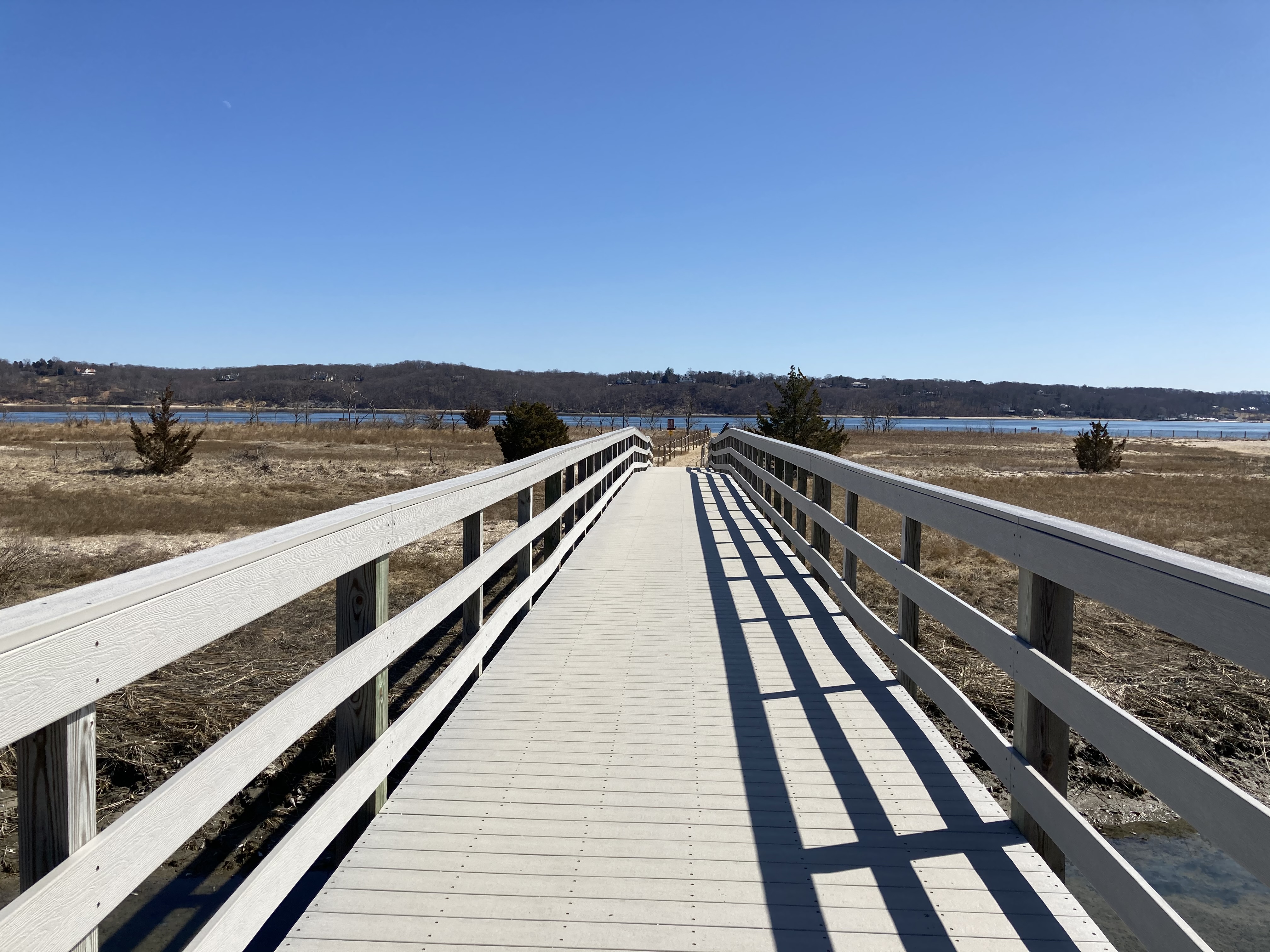
Accessibility The trail is 0.7 miles long, about eight feet wide with some steep grades. The trail surface is packed dirt in the woodland section, a boardwalk over the marsh, and loose sand and pebbles on the beach section.
Visit Eel Creek and Cold Spring Harbor the Park Service's write-up
60-120 Minutes · dogs allowed
Start Eel Creek and Cold Spring Harbor at Sagamore Hill National Historic Site
It's hard to imagine now, but when Theodore Roosevelt first built his home at Sagamore Hill, Cold Spring Harbor would have been visible from the top of the hill, as would Oyster Bay and Connecticut to the west and northwest! Now, some of these views require a little more walking on the Nature Trail (through our deciduous forest), but it's well worth the trip.
As you cross Eel Creek Bridge, the fantastic view of Cold Spring Harbor will stretch in front of you. When you reach the beach, turn and look towards the north for the view of Connecticut across Long Island Sound.
While in this area of the park, please remember how fragile this ecosystem is. As with most Long Island beaches, please stay off the dunes to ensure that beach grass remains intact to prevent erosion. We also ask you to please stay out of the precious, protected waters of the salt marsh and Cold Spring Harbor. To swim or play in the sand, please visit other beaches nearby.
Also, be careful if you notice flooding! Tidal flow can be unpredictable. If the path to the beach is flooded, please turn back and visit the beach at another time. Remember: Going off-trail is never permitted, even to avoid tidal floods!
Accessibility To visit Eel Creek and Cold Spring Harbor, you'll hike down the Nature Trail, which is not accessible. The trail is 0.7 miles long, about eight feet wide with some steep grades. The trail surface is packed dirt in the woodland section, a boardwalk over the marsh, and loose sand and pebbles on the beach section.
Old Carriage Road Trail
Exhibits
Along the way Tennis Court Wayside
12 more mapped segments without a name are on the map, not in the list.
More hikes the Park Service describes
Write-ups that name no single mapped trail, in the Service's words.
- Bring Your BARK Ranger for a Walk · 30-120 Minutes · dogs allowed
Your dog is welcome to visit Sagamore Hill with you, as long as you help them be good BARK Rangers by following four simple rules: 1) Bag your pet's waste. 2) Always keep your pet on a leash. 3) Respect Sagamore Hill's wildlife. 4) Know where you can go.
About these trails
The lines are the National Park Service's public trails layer, the trailheads and the waterfalls, views, peaks and historic places along them the Service's public points of interest, read 2026-10-14 and simplified for the map. The write-ups are the Service's own "things to do", unedited. Heights come from USGS 3DEP through Terrain Tiles on AWS (Mapzen/Tilezen), read along each line and rounded; a short trail on steep ground can be off by a few tens of feet. Closures change: check the park's own site before you go.