
National and State Parks · California
Trails in Redwood National and State Parks
170 named trails · 262 miles · 51 trailheads · 12 with the Park Service's own write-up. The lines, trailheads and points are the Park Service's; the write-ups are the Service's own words; the climbing is read from USGS elevation along each line.
170 trails, A to Z.
44 Camp Access Trail
44 Creek Loop closed
44 Creek Loop Spur
Adams Trail
Ah-Pah Trail
Trailhead Ah-Pah Trailhead 881 ft Drive there
Alder Basin Trail
Ancient Forest Loop (Wolf Creek)
Berry Glen Trail
Big Tree Access Trail
Trailhead Big Tree Wayside Trailhead 195 ft Drive there
Boat Creek Trail
Boat Ridge Trail
Boy Scout Tree Trail
Bridges
Along the way Boy Scout Tree Trail Bridge Boy Scout Tree Trail Bridge Boy Scout Tree Trail Bridge Boy Scout Tree Trail Bridge
Trailhead Boy Scout Tree Trailhead 207 ft Drive there
Hike the Boy Scout Tree Trail the Park Service's write-up
3-5 Hours · no dogs
Start Boy Scout Tree Trail
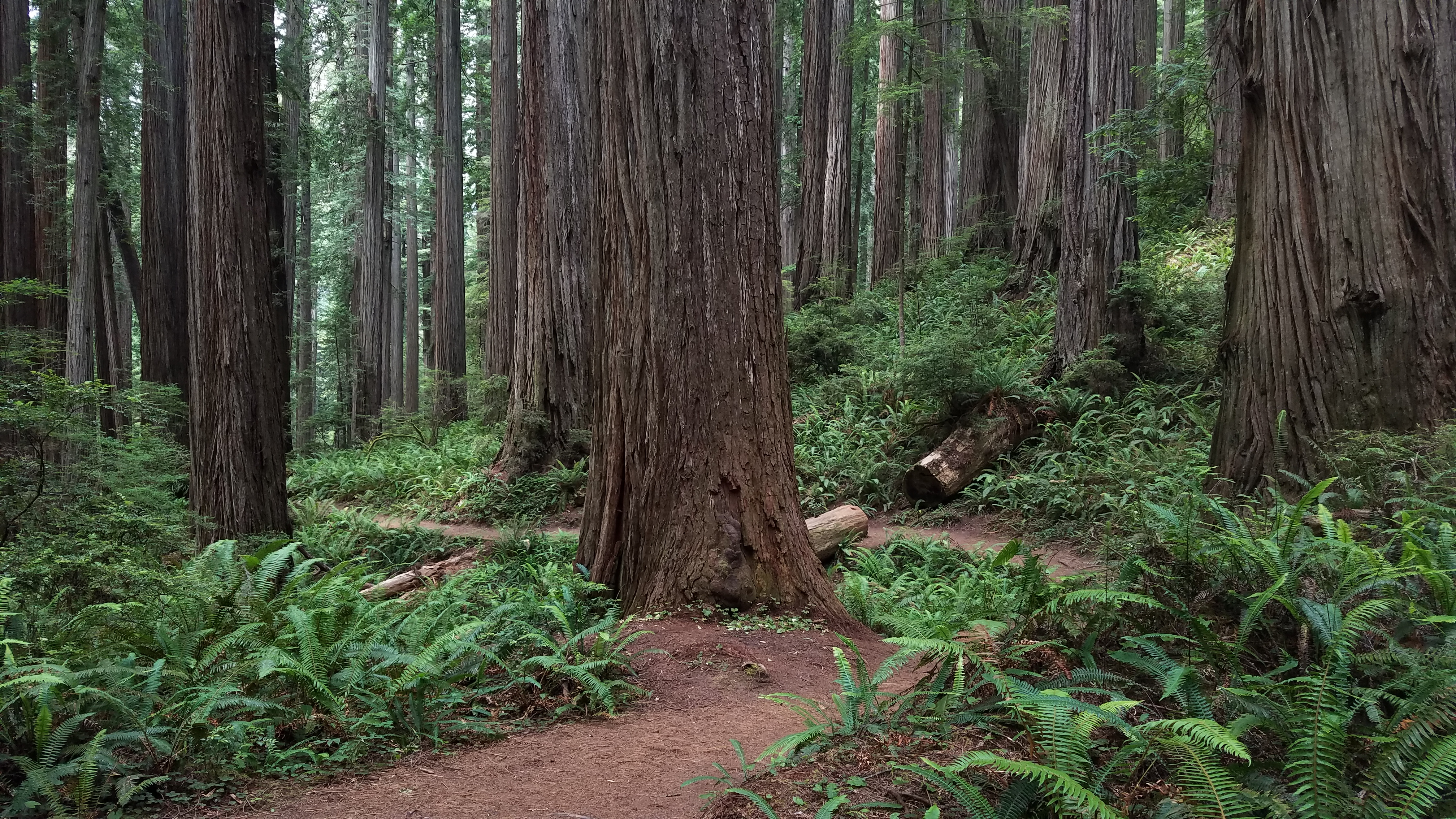
A Moderate Hike In The North
This rewarding hike though old-growth redwoods is popular for those in the north wanting a bit of a challenge. Located in Jedediah Smith Redwoods State Park, a twisting but scenic drive leads to this 5.5 mile round trip trail. During the walk, you will follow riperean areas, see "Fern Falls" and lots of big trees.
The shortest drive to the trailhead starts southeast of Crescent City at the Elk Valley Road. From this road you will need to take your vehicle east for 3.5 miles along the Howland Hill Road which is a dirt, windy road. Howland Hill Road is not suitable for trailers or motor homes . Trailhead parking is limited.
Pets Pets are not permitted on trails. Service animals are welcome.
Accessibility This is not an ADA accessible trail. It is composed of wood and aggregate and it ranges 4-6 feet wide. It climbs a couple of hundred feet with switchbacks. Service pets are welcome.
Braille Link Trail
Brown Creek Trail
Trailheads Prairie Creek Trailhead 254 ft Drive there · South Fork Trailhead 257 ft Drive there
Bummer Lake Road (Mill Creek)
Butler Creek Trail
Bridges
Along the way West Ridge Trail Bridge
C.R.E.A. Grove Trail
C.R.E.A. Trail
Bridges
Along the way CREA Trail Bridge
Campfire Center Access Trail
Campfire Center Loop Trail
Campfire Center Trail
Visitor centersBridges
Along the way Prairie Creek Trail Bridge Prairie Creek Visitor Center
Trailhead Prairie Creek/Foothills Trailhead 149 ft Drive there
Campground Trail JSSP
Carruthers Cove Trail
Trailhead Carruthers Cove Trailhead 575 ft Drive there
Cathedral Trees Bypass Trail
Bridges
Along the way Newton B. Drury Scenic Parkway Bridge
Cathedral Trees Trail
Visitor centersBridges
Along the way Cathedral Trees Trail Bridge Newton B. Drury Scenic Parkway Bridge Prairie Creek Trail Bridge Prairie Creek Visitor Center
Trailhead Prairie Creek/Foothills Trailhead 149 ft Drive there
Childs Hills Road Trail (Mill Creek)
Circle Trail
Clintonia Trail
Coastal Trail - DeMartin Section
Coastal Trail - DeMartin Section Spur
Bridges
Along the way Louis P DeMartin Memorial Bridge
Coastal Trail - Flint Ridge Section
Trailhead Flint Ridge Trailhead 110 ft Drive there
Coastal Trail - Flint Ridge Section Camp Trail
Coastal Trail - Flint Ridge Section Camp Trail Spur
Coastal Trail - Gold Bluffs Section
Coastal Trail - Klamath Section
Picnic areasBridges
Along the way Coastal Trail Bridge Louis P DeMartin Memorial Bridge Wilson Creek Day Use
Trailheads Coastal Trail Trailhead 602 ft Drive there · Coastal Trail/Lagoon Creek Trailhead 28 ft Drive there
Coastal Trail - Last Chance Section
ViewsBridges
Along the way Last Chance Trail Bridge Crescemt Beach Overlook Parking Lot
Trailhead Coastal Trailhead (Last Chance) 208 ft Drive there
Coastal Trail - Skunk Cabbage Section
Trailhead Skunk Cabbage Trailhead 77 ft Drive there
Coastal Trail - Skunk Cabbage Section Overlook Trail
Coastal Trail - Tey-wo-lew Section
Trailhead Coastal Trail/Tey-we-lew Trailhead 647 ft Drive there
Coastal Trail Access
Coastal Trail Access (Lagoon Creek)
Bridges
Along the way Coastal Trail Bridge
Coastal Trail Access Trail (Lagoon Creek)
Trailhead Coastal Trailhead (middle) 35 ft Drive there
Corkscrew Tree Trail
Trailhead Corkscrew Tree Trailhead 221 ft Drive there
Crescent Beach Trail
ViewsPicnic areas
Along the way Crescent Beach Crescent Beach Overlook
Trailheads Crescemt Beach Trailhead 176 ft Drive there · Crescent Beach Trailhead 114 ft Drive there · Crescent Beach Trailhead 23 ft Drive there
Crescent Beach Trail (Spur)
Picnic areas
Along the way Crescent Beach
Trailhead Crescent Beach Trailhead 114 ft Drive there
Crossover Road (Mill Creek)
Damnation Creek Trail
Bridges
Along the way Damnation Creek Trail Bridge
Davison Trail
Trailhead Davison Trailhead South 67 ft Drive there
Dolason Trail closed
Trailhead Dolason Prairie Trailhead 2,420 ft Drive there
Dry Lagoon Campground Trail
Dry Lagoon to Stone Lagoon Campground
Dry Lagoon to Stone Lagoon Campground Beach Trail
Elam Camp
Elam Creek Loop closed
Elk Meadow Footpath
Trailhead Davison Trailhead South 67 ft Drive there
Elk Prairie Day Use Trail
Trailhead Elk Prairie Trailhead 133 ft Drive there
Elk Prairie Trail
Bridges
Along the way Newton B. Drury Scenic Parkway Bridge
Trailheads Elk Prairie Trailhead 120 ft Drive there · Elk Prairie Trailhead 133 ft Drive there
Ellsworth Loop Trail
Emerald Ridge Trail closed
Trailhead Tall Trees Trailhead 812 ft Drive there
Environmental Camp Trail Spur
Fern Canyon Trail
Bridges
Along the way Foothill Trail Bridge
Hike the James Irvine Trail to Fern Canyon Loop the Park Service's write-up
4-8 Hours · no dogs
Start James Irvine Trailhead
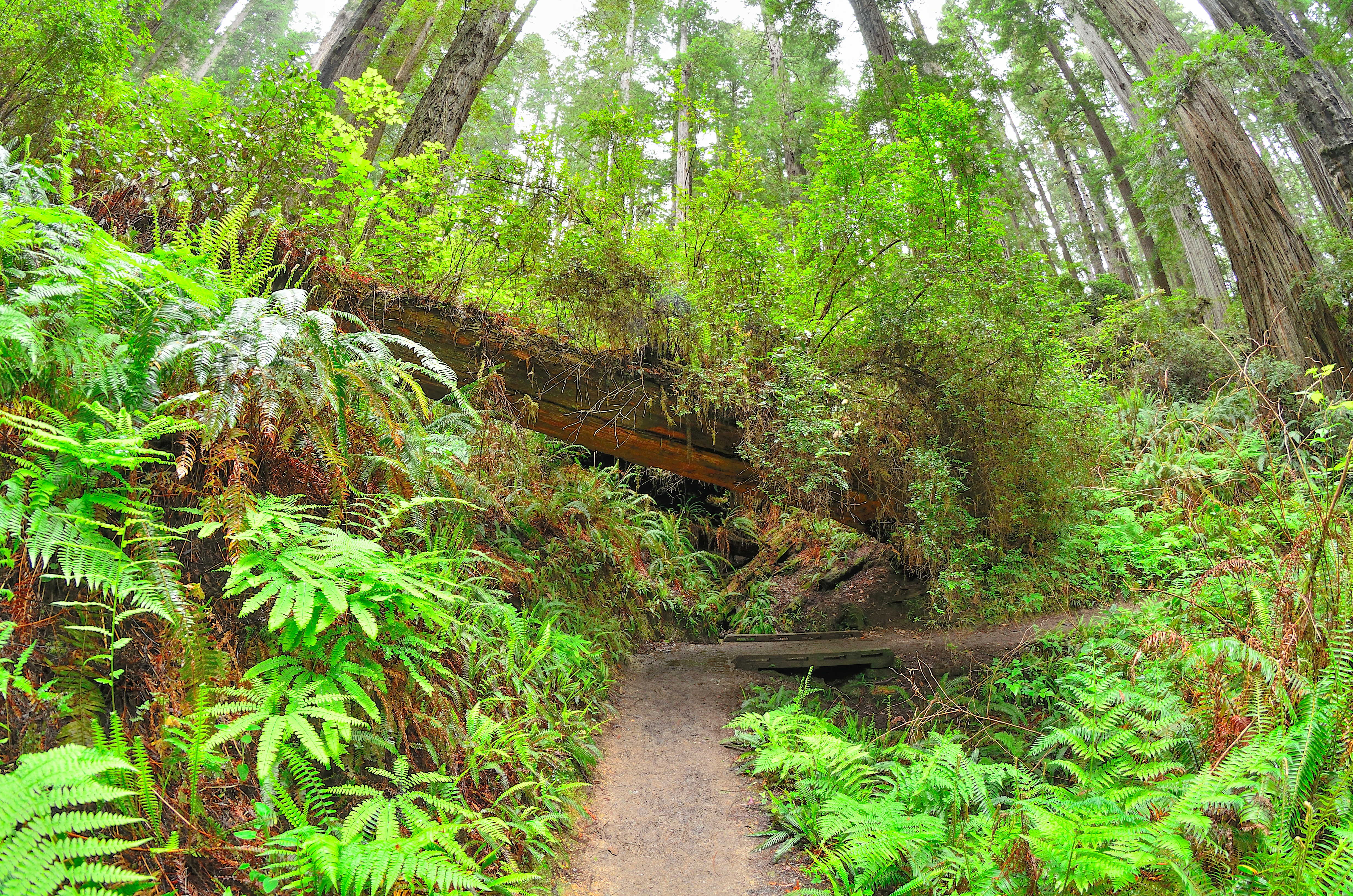
All Day Hike Through Redwoods to the Ocean and Back
A favorite and convenient series of trails for those ready and able to spend the whole day hiking. Hikers will follow creeks, see different kinds of forests and be rewarded by finding the Pacific Ocean. This 12-mile (19 km) loop starts and ends adjacent to the Prairie Creek Visitor Center - all hikers should pick up a hiking map for these trails from any park visitor center .
The first section of the 4.5 mile (7.2 km) James Irvine Trail will be in old-growth redwood forests before entering the spruce forests of the coast. On the western (coastal) end of the James Irvine trail it connects briefly with the Friendship Ridge Trail, and then onto the Fern Canyon Loop Trail. This will lead hikers through the dripping walls and stream cobbles of Fern Canyon and finally onto Gold Bluffs Beach - this is the ultimate turn around point. You can return back to the Prairie Creek Visitor Center on the same series of trails, or make a longer loop by heading 1.5 miles (2.4 km) south on Davison Road and taking the 4.1 mile (6.5 km) Miners Ridge trail back to the Praire Creek Visitor Center area.
There is limited full-day parking near the Prairie Creek Visitor Center, but there is parking for any sized vehicle along Newton B. Drury Scenic Parkway .
Accessibility This series of trails is not ADA accessible. Switchbacks with aggregate / wood surface. Elevation changes exceed 200 feet. Stream and steambed crossings with flowing water. Service animals are welcome.
Walk the Fern Canyon Loop Trail the Park Service's write-up
45-90 Minutes · no dogs · entrance fee applies · reservation required
Start Fern Canyon
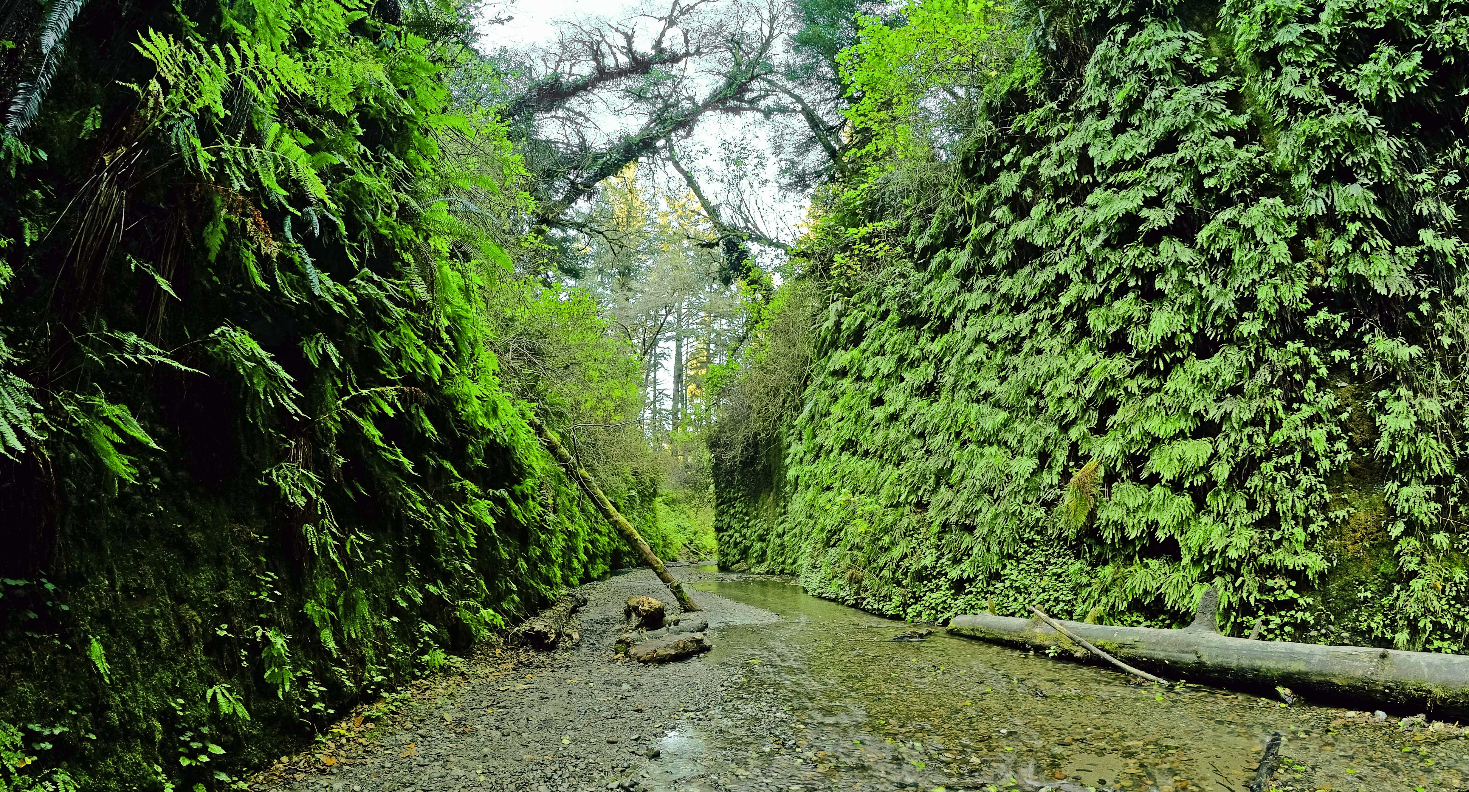
A Popular Destination That Comes With Challenges: Wild Elk and Stream Crossings
If you plan to drive to Fern Canyon from May 15th - Sept 15th, you will need a free Gold Bluffs Beach / Fern Canyon parking reservation (available online only).
Note : Hikers can still access Fern Canyon by doing the 10-mile round-trip hike on the James Irvine Trail from the Prairie Creek Visitor Center without a reservation.
Prepare to get your feet wet when exploring this short hike into a stunning mini-canyon covered with ferns. This very popular walk up a cobbled creek, Home Creek, takes you from Gold Bluffs Beach into the forest. Hikers must wade through the creek and climb over fallen trees, even when the boardwalk path is installed (summer only). Many travel writers and bloggers are correct when they talk about the natural beauty of this area while you won't find huge redwoods right here it is surrounded by sitka spruce and other conifers.
Hiking Fern Canyon:
Want to experience the entire canyon? Hike the 1-mile ‘lolly-pop’ loop to see in and above the canyon. The full loop takes about 45 minutes and has an elevation gain of 150 feet.
Interested in a shorter experience? Hike a quarter of a mile along Home Creek (the creek running through the canyon) to see the steep, leafy walls. This in-and-out option has a 30-foot elevation change.
Note : Both options require climbing through log jams and walking through an active creek.There is no defined trail along Home Creek, and you must cross the stream to experience the canyon.
From June to September, there are wooden footbridges installed in Fern Canyon to help walkers get partially up Home Creek without getting their feet too wet. Visitors should still plan to get wet!
Ranger tip: wear waterproof footwear with good traction and bring a pair of dry shoes to wear after the hike.
Be aware that the winding Davison Road (a gravel road) is not suitable for large recreational vehicles or anything towing a trailer . Also, people driving low-clearance vehicles often get stuck when trying to drive through the two streams on the way to the Fern Canyon parking area.
There is a California State Park entrance station on the way out Davison Road where you need to stop and pay the $12.00 entrance fee (per vehicle). Cash or check only for payment, credit cards are not accepted. California State Parks or the America the Beautiful (federal) passes are honored at this kiosk.
A herd of Roosevelt Elk are often spotted around the Fern Canyon area. It is important to keep your distance - don't approach them for any reason. Calving season is from late May to early June, which is when the female (cow) elk are very protective of their babies. Female elk might not have big antlers but they will kick and stomp anyone who gets too close. August through October is the rut season which means the male (bull) elk are especially irritable. Not only will the males use their antlers to protect their group of females, but they can also kick, stomp, and charge at anyone who gets too close (including vehicles). Year-round you should give the elk as much space as possible, at least a school bus length between you and the elk. Learn how to be safe around elk .
Before you set off to visit Fern Canyon, be sure to check current conditions and make sure that the roads are open - or to see if the seasonal footbridges have been installed.
Vault toilets and picnic tables are availble in the Fern Canyon parking area. There is also beach access from this parking area.
Accessibility Handicapped parking spaces. This is not an ADA trail. Much of the trail is through a cobbled stream bed. Seasonal footbridges are made of wood and about two feet wide. Service pets are welcome.
Fischer Grove Trail
Bridges
Along the way Miners Ridge Trail Bridge
Foothill Trail Access No. 1
Trailhead Foothill No.1 Trailhead 204 ft Drive there
Foothill Trail
Bridges
Along the way Cathedral Trees Trail Bridge Foothill Trail Bridge
Trailhead Big Tree Wayside Trailhead 195 ft Drive there
Walk the Karl Knapp (Prairie Creek) to Foothill Trail Loop the Park Service's write-up
1-2 Hours · no dogs
Start Karl Knapp (Prairie Creek) Trailhead
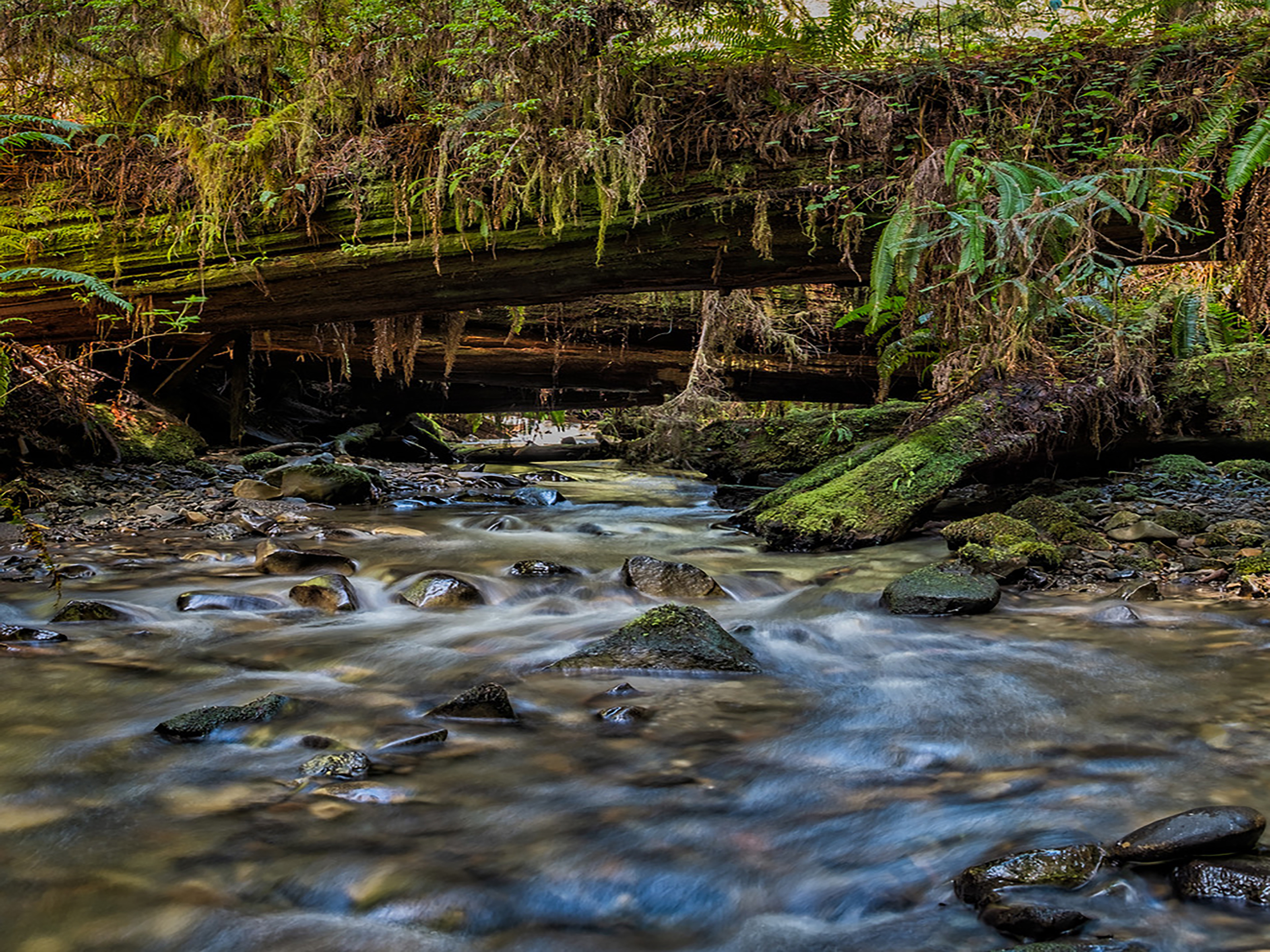
An Easy and Rewarding Loop Trail.
Note: In late 2021, the Prairie Creek Trail was renamed the Karl Knapp Trail. Future signs, publications, and maps will show that name change.
This flat 2.5 mile (4 km) trail meanders along a babbling creek and under some of the tallest redwood trees in the world. You can take a trip through history with information panels along this loop.
This loop is a combination of three, connected trails:
Karl Knapp Trail
Foothills Trail
Cathedral Trees Trail (only a few hundred feet of it)
We recommend that you grab a free Prairie Creek State Park brochure before beginning this walk. There are many other trails that lead off from this loop. Free maps are available at our visitor centers. Prairie Creek Visitor Center is the closest visitor center to this trail.
Want to learn more about this trailhead? Visit "Trailhead: Karl Knapp (Prairie Creek) to Foothills Trail Loop."
Navigating This Loop:
Karl Knapp Trail Section:
The Karl Knapp Trail begins next to the Prairie Creek Visitor Center. Head north on this trail. On the bridges, be sure to look down to see what might be swimming. In autumn, large Coho salmon can be seen spawning in Prairie Creek.After a mile, the Karl Knapp Trail forks east. You should follow any signs for the "Big Tree." You need to cross the Newton B. Drury Scenic Parkway to continue walking towards the Big Tree Wayside. Please watch for cars or bikes before crossing.
Foothills Trail Section:
After crossing the parkway, you will now be on the Foothills Trail. Turn right (heading south) to the "Big Tree". Once you pass the Big Tree Wayside, keep heading south on the Foothill Trail following signs for the visitor center. This part of the Foothills Trail is parallel to the Newton B. Drury Scenic Parkway.
Catherdral Trees Trail Section:
At the southern end of the Foothills Trail, you will continue your walk on the Cathedral Trees Trail. Head west on the Cathedral Trees Trail for a few hundred yards crossing the parkway back to the Prairie Creek Visitor Center.You should be heading right back to where you started. One final crossing over the scenic parkway is needed to finish up the loop. Please watch for cars or bikes before crossing.You can do this loop in either direction! For this recommendation, we are walking the loop clockwise starting from the trailhead at Prairie Creek Visitor Center.
Trail Elevation and Grades:
The 1.2 miles (1.9 km) of the Karl Knapp (Prairie Creek) Trail has a 99-foot elevation change. Typical grade is 3%, typical width is 5-feet wide and the trail surface is compact gravel.
The 1.2 miles (1.9 km) of the Foothill Trail has a 77-foot elevation gain and a typical grade of 3%. The trail is made of soil/aggregate and typically is 5-feet wide.
Accessibility The 1.2 miles (1.9 km) of the Prairie Creek Trail is ADA accessible with a 99-foot elevation change. Typical grade is 3%, typical width is 5-feet wide and the trail surface is compact gravel. The 1.2 miles (1.9 km) of the Foothill Trail is ADA accessible with a 77-foot elevation gain and a typical grade of 3%. The trail is made of soil/aggegate and typically is 5-feet wide. Service pets are welcome.
Foothill Trail Access No. 2
Trailhead Foothill No 2 Trailhead 208 ft Drive there
Friendship Ridge Trail
Bridges
Along the way James Irvine Trail Bridge James Irvine Trail Bridge
Geneva Road
Picnic areasBridges
Along the way Lost Man Creek Bridge Lost Man Creek
Trailhead Lost Man Creek Trailhad 97 ft Drive there
Gold Bluffs Environmental Camp Trail closed
Gold Bluffs Trail
Goosepen Trail
Visitor centers
Along the way Prairie Creek Visitor Center
Trailhead Prairie Creek/Foothills Trailhead 149 ft Drive there
Grove of Titans Trail
Bridges
Along the way Mill Creek Trail Bridge
Trailhead Grove of Titans Trailhead 179 ft Drive there
Hike to the Grove Of Titans the Park Service's write-up
1-2 Hours · no dogs
Start Grove of Titans Trail
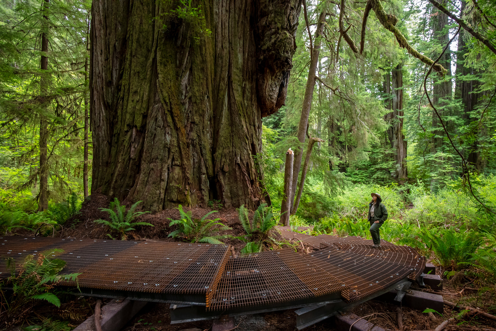
An Old Favorite With A New Elevated Boardwalk
Located in the northern part of Redwood National and State Parks, this trail was completed in summer 2022 to allow sustainable access to a group of ancient redwood trees named for their remarkable shape and size. The grove contains many tall and wide redwoods with complex features and fascinating adaptations.
The main trailhead is located on the eastern side of Howland Hill Road in Jedediah Smith Redwood State Park. Best access is from HWY 199 near Hiouchi, California. This 1.5 mile ( 2km) loop trail also connects to the Mill Creek Trail.
Known by indigenous people for thousands of years, the group of trees was "re-discovered" and named by researchers in the late 1990's. Then, with the arrival of GPS and online search engines, these trees became a destination for many visitors seeking "The Titans". Much damage was then done to the forest floor by well-meaning visitors seeking adventure.
1,500 feet of elevated boardwalk has been built to protect the forest floor and to allow for safe and easier viewing of the redwoods at the site. There are steps on the boardwalk and the trail is not ADA accessible. Funding for the expensive boardwalk and interpretive exhibits was led by Redwood Parks Conservancy and Save The Redwoods League .
Parking on Howland Hill Road is very limited in summer. No recreational vehicles or vehicles towing trailers are allowed on Howland Hill Road.
Accessibility This 1.5 mile (2km) loop trail is not ADA accessible. It has manay metal steps and includes a 1,500 foot elevated board walk. The trail is generally four feet wide and is made of compacted gravel, dirt, and duff. There are tree roots on - and along - sections of the trail.
Hamilton Road
Bridges
Along the way Hamilton Road Bridge
Hatton Loop Trail
Trailhead Hatton Trailhead 158 ft Drive there
Hatton Trail
Trailhead Hatton Trailhead 158 ft Drive there
Stroll the Simpson-Reed Trail the Park Service's write-up
30-60 Minutes · no dogs
Start Simpson-Reed Trail
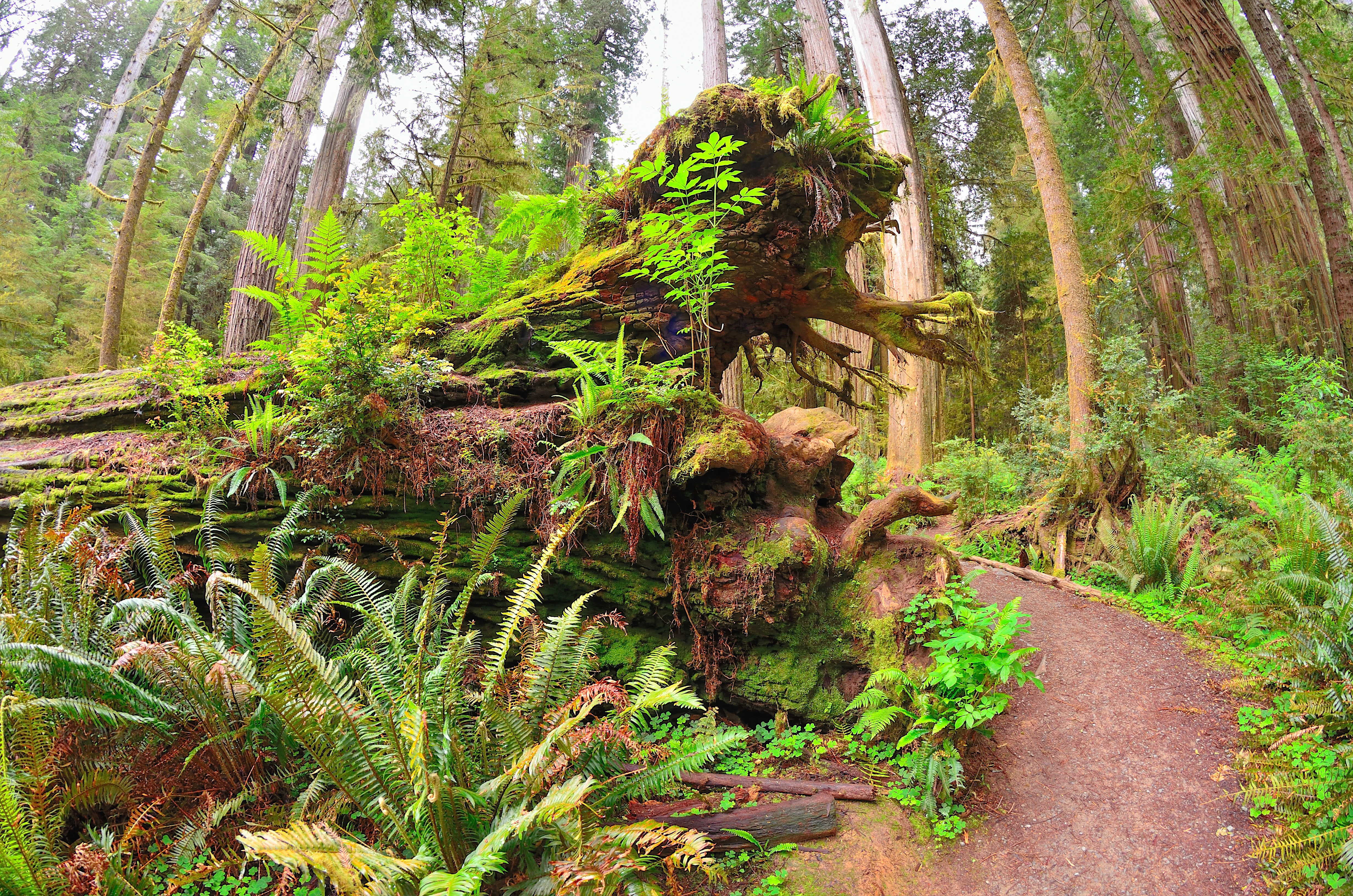
An Easy, Short Trail In The Northern Part of the Parks
If you are driving on HWY 199 between Crescent City and Hiouchi, this level walk is a good option for those short on time or energy - and if you have a smaller vehicle. There is no parking for RV's or vehicles with trailers .
Located in Jedediah Smith Redwoods State Park, this 0.8 mile (1.3 km) trail is beautiful. It takes you around redwood groves, creeks, nurse logs, ferns, hemlocks, huckleberries and a wide variety of other forest features and creatures. Interpretive wayside panels on the trail provide information on the natural and cultural history of the area.
You can access the trailhead by taking the Walker Road exit off HWY 199 - this is a turn to the north. For many people it is a sharp and hidden turn-off. After the turn-off it is about 0.1 mile up Walker Road before you get to the trailhead on the right.
Vault toilets and limited parking is available.
Accessibility Handicapped parking spaces. ADA accessible trail made of aggregate gravel that is four to five feet wide. Service pets are welcome.
High Bluff Beach Trail
High Bluff Trail
Picnic areas
Along the way High Bluff Overlook
Trailhead High Bluff Trailhead 509 ft Drive there
Hiouchi Trail
Hobbs Wall Trail
Holter Ridge Bicycle Trail
Hope Creek Trail
Trailheads Hope Creek Trailhead 631 ft Drive there · Ossagon Trailhead 626 ft Drive there
Howland Hill Nature Trail
James Irvine Trail
Bridges
Along the way Foothill Trail Bridge James Irvine Trail Bridge James Irvine Trail Bridge James Irvine Trail Bridge James Irvine Trail Bridge James Irvine Trail Bridge James Irvine Trail Bridge James Irvine Trail Bridge James Irvine Trail Bridge James Irvine Trail Bridge James Irvine Trail Bridge James Irvine Trail Bridge
Hike the James Irvine Trail to Fern Canyon Loop the Park Service's write-up
4-8 Hours · no dogs
Start James Irvine Trailhead
All Day Hike Through Redwoods to the Ocean and Back
A favorite and convenient series of trails for those ready and able to spend the whole day hiking. Hikers will follow creeks, see different kinds of forests and be rewarded by finding the Pacific Ocean. This 12-mile (19 km) loop starts and ends adjacent to the Prairie Creek Visitor Center - all hikers should pick up a hiking map for these trails from any park visitor center .
The first section of the 4.5 mile (7.2 km) James Irvine Trail will be in old-growth redwood forests before entering the spruce forests of the coast. On the western (coastal) end of the James Irvine trail it connects briefly with the Friendship Ridge Trail, and then onto the Fern Canyon Loop Trail. This will lead hikers through the dripping walls and stream cobbles of Fern Canyon and finally onto Gold Bluffs Beach - this is the ultimate turn around point. You can return back to the Prairie Creek Visitor Center on the same series of trails, or make a longer loop by heading 1.5 miles (2.4 km) south on Davison Road and taking the 4.1 mile (6.5 km) Miners Ridge trail back to the Praire Creek Visitor Center area.
There is limited full-day parking near the Prairie Creek Visitor Center, but there is parking for any sized vehicle along Newton B. Drury Scenic Parkway .
Accessibility This series of trails is not ADA accessible. Switchbacks with aggregate / wood surface. Elevation changes exceed 200 feet. Stream and steambed crossings with flowing water. Service animals are welcome.
Jensen Trail closed
Karl Knapp Trail
Visitor centersBridges
Along the way Prairie Creek Trail Bridge Prairie Creek Trail Bridge Prairie Creek Trail Bridge Prairie creek Trail Bridge Prairie Creek Trail Bridge Prairie Creek Trail Bridge Prairie Creek Trail Bridge Prairie Creek Trail Bridge Prairie Creek Trail Bridge Prairie Creek Trail Bridge Prairie Creek Trail Bridge Prairie Creek Trail Bridge and 3 more
Trailhead Prairie Creek/Foothills Trailhead 149 ft Drive there
Stroll to the Big Tree Wayside the Park Service's write-up
10-30 Minutes · no dogs
Start Big Tree Wayside Trailhead
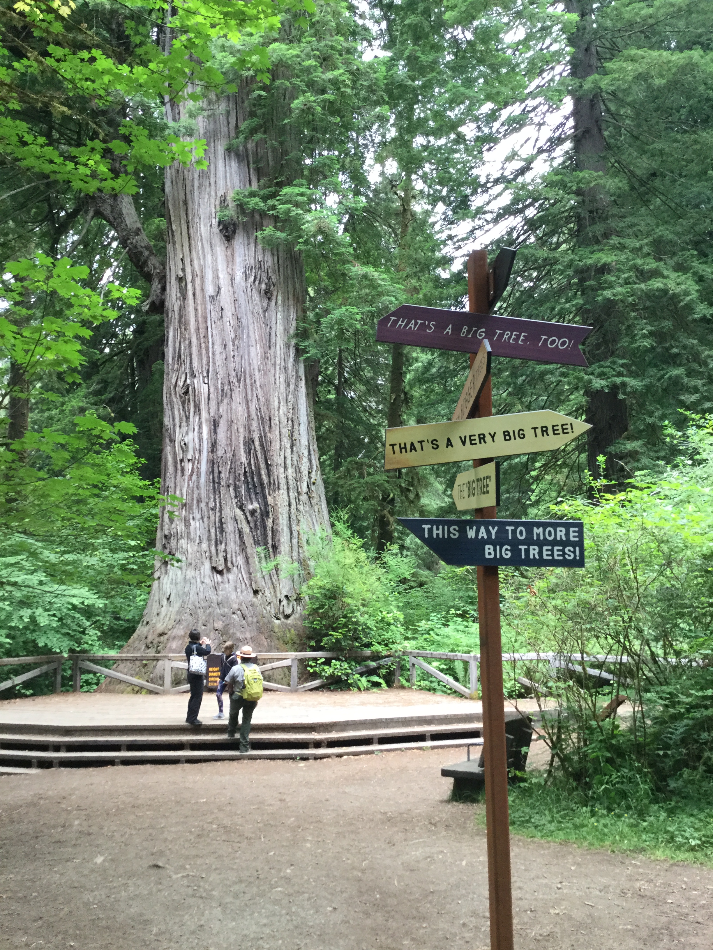
Quickest Way To See Some Really Big Trees
Located in Prairie Creek State Park and just off the Newton B. Drury Scenic Parkway, this is an easy walk to stunning old-growth redwood trees. A viewing platfrom and interpretive signage is located around the "Big Tree".
The walk to the Big Tree is less than 200 yards (100 meters) from the parking area.
This location is popular with visitors, tour groups or charter busses that have less than half an hour to experience any redwoods. Limited RV and trailer parking is available . Detailed trail information and audio boxes are located at the trailhead so people can hear from Yurok elders about redwood trees. Vault toilets are located at the parking area.
Other short walks like the 15-minute "Circle Trail" are found next to the Big Tree.
Pets Only service animals are allowed.
Accessibility The paved trail to the "Big Tree" is four to five feet wide and is level. Service animals are welcome.
Walk the Karl Knapp (Prairie Creek) to Foothill Trail Loop the Park Service's write-up
1-2 Hours · no dogs
Start Karl Knapp (Prairie Creek) Trailhead
An Easy and Rewarding Loop Trail.
Note: In late 2021, the Prairie Creek Trail was renamed the Karl Knapp Trail. Future signs, publications, and maps will show that name change.
This flat 2.5 mile (4 km) trail meanders along a babbling creek and under some of the tallest redwood trees in the world. You can take a trip through history with information panels along this loop.
This loop is a combination of three, connected trails:
Karl Knapp Trail
Foothills Trail
Cathedral Trees Trail (only a few hundred feet of it)
We recommend that you grab a free Prairie Creek State Park brochure before beginning this walk. There are many other trails that lead off from this loop. Free maps are available at our visitor centers. Prairie Creek Visitor Center is the closest visitor center to this trail.
Want to learn more about this trailhead? Visit "Trailhead: Karl Knapp (Prairie Creek) to Foothills Trail Loop."
Navigating This Loop:
Karl Knapp Trail Section:
The Karl Knapp Trail begins next to the Prairie Creek Visitor Center. Head north on this trail. On the bridges, be sure to look down to see what might be swimming. In autumn, large Coho salmon can be seen spawning in Prairie Creek.After a mile, the Karl Knapp Trail forks east. You should follow any signs for the "Big Tree." You need to cross the Newton B. Drury Scenic Parkway to continue walking towards the Big Tree Wayside. Please watch for cars or bikes before crossing.
Foothills Trail Section:
After crossing the parkway, you will now be on the Foothills Trail. Turn right (heading south) to the "Big Tree". Once you pass the Big Tree Wayside, keep heading south on the Foothill Trail following signs for the visitor center. This part of the Foothills Trail is parallel to the Newton B. Drury Scenic Parkway.
Catherdral Trees Trail Section:
At the southern end of the Foothills Trail, you will continue your walk on the Cathedral Trees Trail. Head west on the Cathedral Trees Trail for a few hundred yards crossing the parkway back to the Prairie Creek Visitor Center.You should be heading right back to where you started. One final crossing over the scenic parkway is needed to finish up the loop. Please watch for cars or bikes before crossing.You can do this loop in either direction! For this recommendation, we are walking the loop clockwise starting from the trailhead at Prairie Creek Visitor Center.
Trail Elevation and Grades:
The 1.2 miles (1.9 km) of the Karl Knapp (Prairie Creek) Trail has a 99-foot elevation change. Typical grade is 3%, typical width is 5-feet wide and the trail surface is compact gravel.
The 1.2 miles (1.9 km) of the Foothill Trail has a 77-foot elevation gain and a typical grade of 3%. The trail is made of soil/aggregate and typically is 5-feet wide.
Accessibility The 1.2 miles (1.9 km) of the Prairie Creek Trail is ADA accessible with a 99-foot elevation change. Typical grade is 3%, typical width is 5-feet wide and the trail surface is compact gravel. The 1.2 miles (1.9 km) of the Foothill Trail is ADA accessible with a 77-foot elevation gain and a typical grade of 3%. The trail is made of soil/aggegate and typically is 5-feet wide. Service pets are welcome.
Karl Knapp Trail Access No. 1
Bridges
Along the way Prairie Creek Trail Bridge
Trailhead Foothill No.1 Trailhead 204 ft Drive there
Karl Knapp Trail Access No. 2
Bridges
Along the way Prairie creek Trail Bridge
Trailheads Prairie Creek Trailhead 254 ft Drive there · South Fork Trailhead 257 ft Drive there
Lady Bird Johnson Nature Loop
Picnic areas
Along the way Lady Bird Johnson Grove
Trailhead Lady Bird Johnson Grove Trailhead 1,307 ft Drive there
Walk the Lady Bird Johnson Grove the Park Service's write-up
45-60 Minutes · no dogs
Start Lady Bird Johnson Grove Trailhead
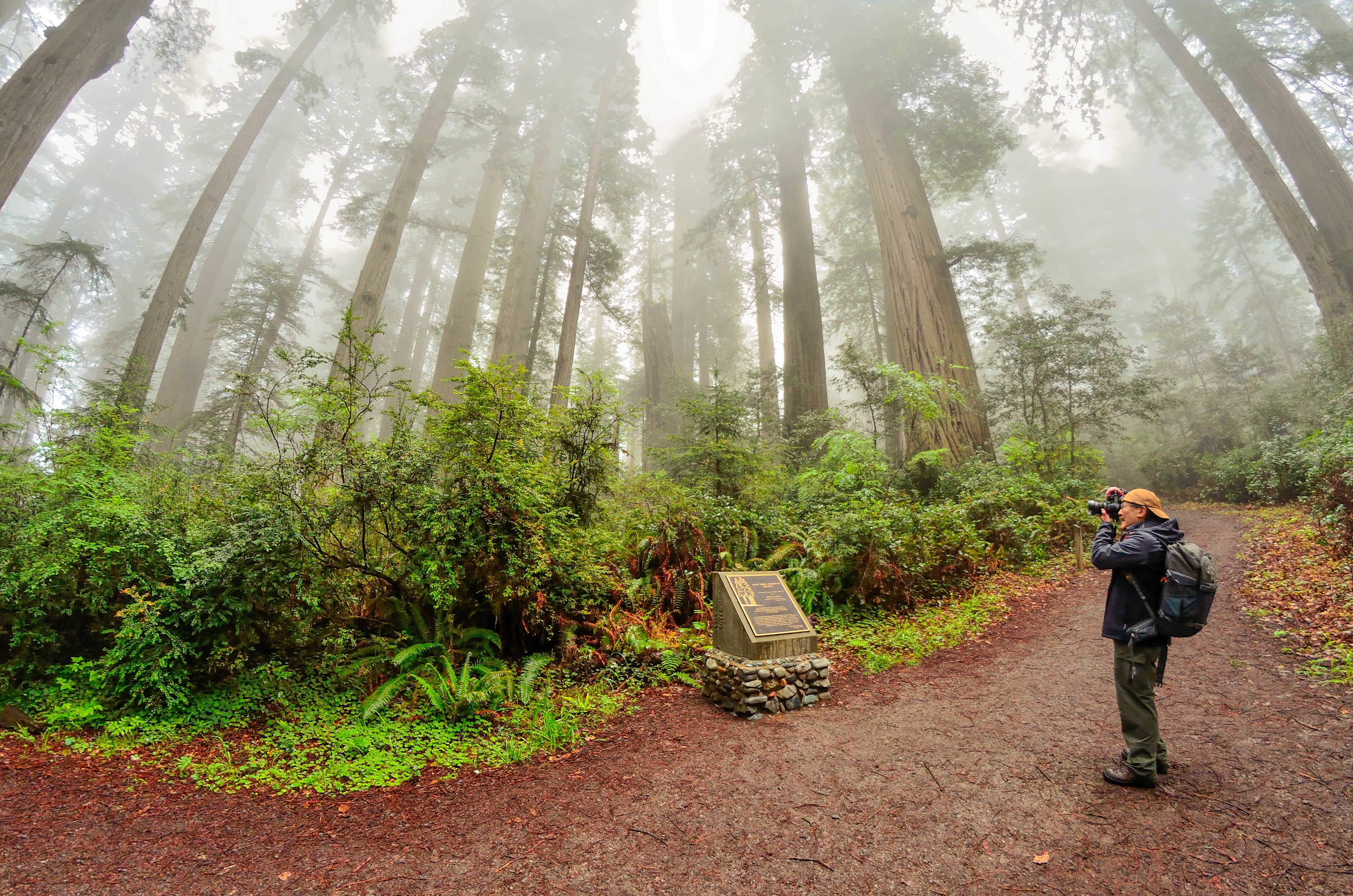
An Easy Walk Through A Famous Grove
This 1.5 mile (2km) loop is located ten minutes drive north of Orick on the Bald Hills Road. It is a popular first (or last) walk in the redwoods for visitors because it is on the southern end of the park.
Many people complete the whole loop and enjoy visiting the plaque dedicated to Lady Bird Johnson - who in her role as First Lady - actively promoted the protection and creation of natural habitats. An descriptive interpretive tour is availableon the park app.
The 2.5 mile drive up Bald Hills Roads to the parking area is windy, bumpy, and narrow - care must be taken because heavy trucks use that road. Because of the road's conditions RVs and trailers are not advised . The parking area has limited space and it often is full from summer mornings to late afternoon. Parking on the side of Bald Hills Road is not safe and not allowed.
Vault toilets are provided at the parking lot.
Accessibility This is not ADA accessible. The hikers bridge to cross the Bald Hills Road exceeds the slope for wheelchairs. The trail itself is composed of aggregate / wood and ranges from four to ten feet wide. Service animals are welcome.
Leiffer Loop
Leiffer North Trail
Trailhead Leiffer Loop North Trailhead 92 ft Drive there
Leiffer South Trail
Trailhead Leiffer Loop South Trailhead 150 ft Drive there
Little Bald Hills Campground Trail
Little Bald Hills Trail
Little Creek Trail
Trailhead Little Creek Trailhead 518 ft Drive there
Lohse Grove Trail
Lost Man Creek Trail
Bridges
Along the way Lost Man Creek Bridge Lost Man Creek Trail Bridge Lost Man Creek Trail Bridge Lost Man Creek Trail Bridge
Trailhead Lost Man Creek Trailhad 97 ft Drive there
Lyons Ranch Trail
Trailhead Lyons Ranch Trailhead 2,582 ft Drive there
McArthur Creek Loop
McArthur Creek Loop Spur
Memorial Grove Trail
Walk the Stout Memorial Grove Trail the Park Service's write-up
1-2 Hours · no dogs
Start Stout Memorial Grove Trailhead
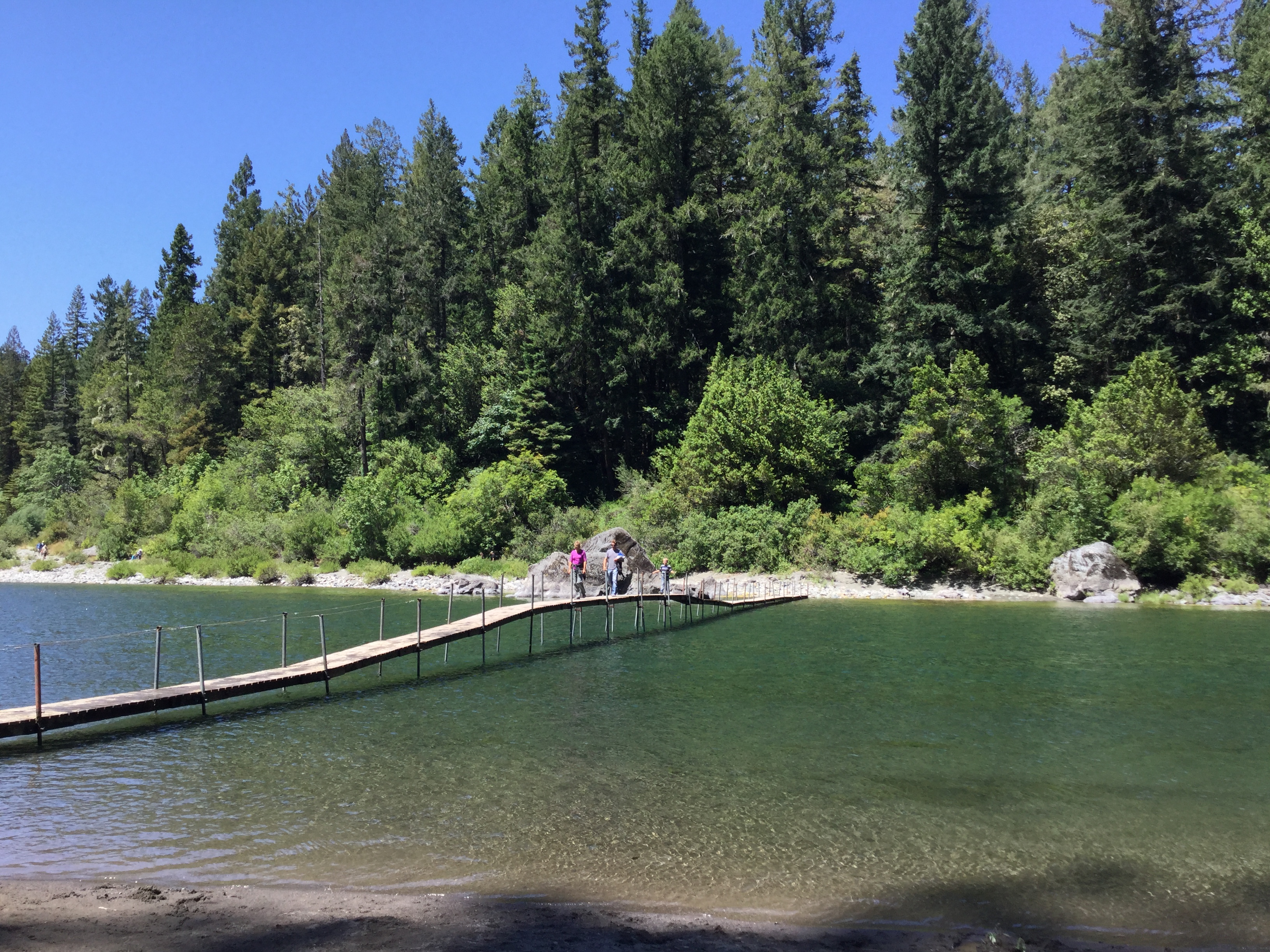
A Short Walk With An Adventure To Get There
These 300-foot trees are considerd by many as the heart of Jedediah Smith Redwoods State Park. This majestic 44-acre grove of old-growth redwoods is a popular summer destination for those willing to take on the challenge of getting there.
The trail is a short 0.5 mile (0.8 km) in length and the grove is on the edge of the beautiful Smith River. A short spur trail decends down twenty feet to the Smith River. In summer many people picnic, paddle, and swim at this cobbled beach. In summer this is where the hikers' bridge crosses the Smith River.
Getting to and from this grove takes some time and effort and that is why we recommend this for two-hours.
Option 1. Year round. Smaller vehicles like cars and vans can access the trailhead and parking lot by driving the eastern section of Howland Hill Road. Howland Hill Road is windy, narrow, mostly unpaved, and is not suitable for large vehicles. There is no parking for RVs and trailers at the trailhead.
Option 2. In summer, you can park any vehicle at the Jedediah Smith Redwoods State Park Campground Day Use Area ($8 fee required). From the campground walk towards the Smith River and along the riverbank you will find a walking trial heading upstream. This trail is about half a mile and then crosses the summer hikers' bridge to Stout Memorial Grove.
Accessibility This is not an ADA accessible trail. It is composed of wood and aggregate material and it ranges from 4-6 feet wide. Trail has switchbacks to access the river. Service pets are welcome.
Merrill Grove Trail
Mill Creek Horse Trail
Mill Creek Horse Trail (Alt Loop)
Mill Creek Horse Trail (East Loop)
Mill Creek Horse Trail (North)
Mill Creek Horse Trail (West Loop)
Mill Creek Trail
Bridges
Along the way Mill Creek Trail Bridge Mill Creek Trail Bridge Mill Creek Trail Bridge Mill Creek Trail Bridge
Trailhead Grove of Titans Trailhead 179 ft Drive there
Miners Ridge Camp Trail
Bridges
Along the way Squashan Creek Bridge (Miner's Ridge Trail)
Miners Ridge Trail
Bridges
Along the way Miner's Ridge Trail Bridge Miners Ridge Trail Bridge Miners Ridge Trail Bridge Miners Ridge Trail Bridge Miners Ridge Trail Bridge Miners Ridge Trail Bridge Miners Ridge Trail Bridge Miners Ridge Trail Bridge Squashan Creek Bridge (Miner's Ridge Trail)
Moorman Pond Trail
Trailheads Moorman Pond Trailhead 400 ft Drive there · Zig Zag No. 2 Trailhead 425 ft Drive there
Nature Loop Trail
Nature Trail
Picnic areasBridges
Along the way James Irvine Trail Bridge Jedediah Smith
Nature Trail 2 PCSP
Trailhead Elk Prairie Trailhead 120 ft Drive there
Nickel Creek Trail
Nickerson Ranch Trail
Trailhead Nickerson Ranch Trailhead 208 ft Drive there
North Spit
Off Highway Trail
Orick Horse Trail
Trailhead Orick School Trailhead 28 ft Drive there
Ossagon Trail
Trailheads Hope Creek Trailhead 631 ft Drive there · Ossagon Trailhead 626 ft Drive there
Ossagon Trail Link
P-J Spur Road (Mill Creek)
Peterson Memorial Trail
Rangers Grove Trail
Redwood Access Trail
Visitor centersBridges
Along the way Prairie Creek Trail Bridge Prairie Creek Visitor Center
Trailhead Prairie Creek/Foothills Trailhead 149 ft Drive there
Redwood Creek Estuary Trail
Picnic areas
Along the way Kuchel Visitor Center Picnic Area
Redwood Creek Trail closed
Redwood Creek Trail (Lower)
Rellim Ridge Trail
Reservoir Road (Mill Creek)
Bridges
Along the way Hamilton Road Bridge
Restroom Link Trail No. 1
Visitor centers
Along the way Prairie Creek Visitor Center
Restroom Link Trail No. 2
Visitor centers
Along the way Prairie Creek Visitor Center
Revelation Trail
Revelation Trail Tree Loop
Rhododendron Trail
Bridges
Along the way Newton B. Drury Scenic Drive Bridge
Trailheads Moorman Pond Trailhead 400 ft Drive there · Rhododendron Trailhead 402 ft Drive there
Hike Zig Zag Loop the Park Service's write-up
no dogs
Start Moorman Pond Trailhead
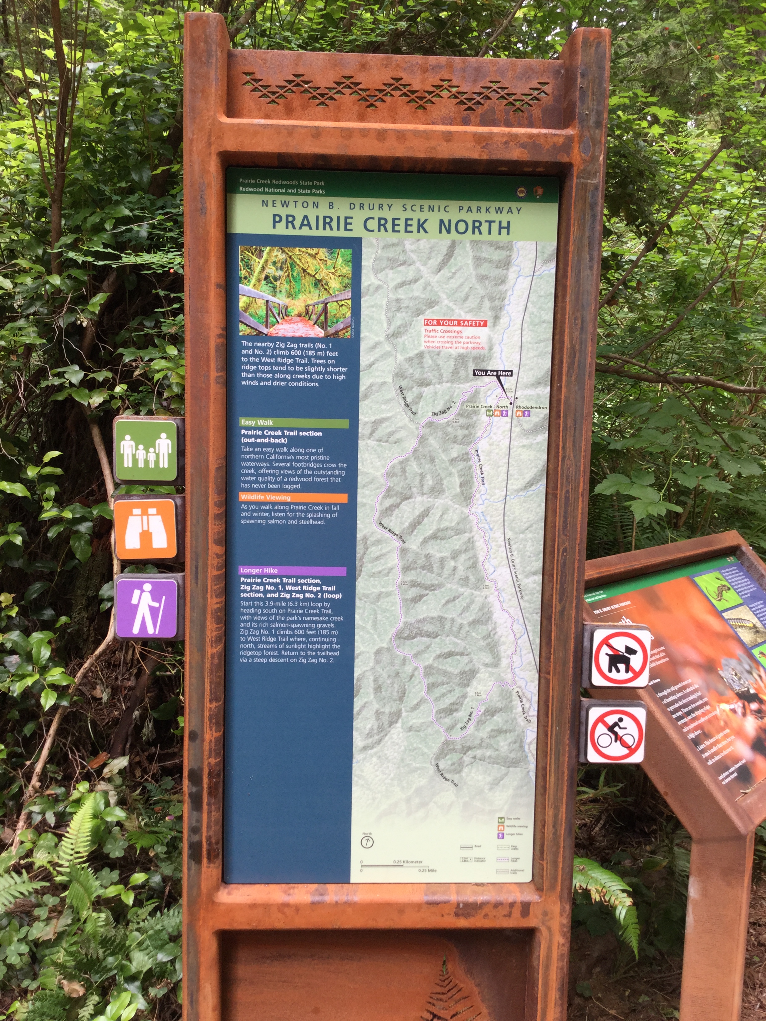
Walk along flowing Prairie Creek before ascending to ridgetop views.
Start this 3.9-mile (6.3 km) loop by heading south on Prairie Creek Trail, with views of the park's namesake creek and its rich salmon-spawning gravels. Zig Zag No. 1 climbs 600 feet (185 m) to West Ridge Trail where, continuing north, streams of sunlight highlight the ridgetop forest. Return to the trailhead via a steep descent on Zig Zag No. 2.
Parking: Limited dirt parking at Moorman Pond Trailhead 3 1/2 miles north of the Prairie Creek Visitor Center on Newton B. Drury Parkway. May not be suitable for larger RVs and trailers.
Difficulty: This loop includes two very steep sections, each progressing 600 feet over 1/2 mile. The terrain is compact dirt and may be wet and muddy. You may need to go over large roots and possible debris.
Safety Tips
Use a good map and trail guide for your adventures in Redwood National and State Parks. Don’t rely on online maps.
To protect the habitats, leave no trace also means staying on the developed trail. Please don’t go off trail or make any new trails. These forests grow by the inch, and will die by your foot.
To protect the wildlife (and you and other visitors), pets are not allowed on park trails.
Cell coverage is very limited and cannot be relied on in an emergency. Have a plan for checking in and checking out with a friend when you are here.
Accessibility This narrow trail is not wheelchair-accessible. The terrain (compact dirt) is rough and uneven, and often has protruding roots. The first section is fairly level, but the trail is very steep past the intersection with Zig Zag No. 1.
RIC Beach Access
River Trail
BridgesBoat launches
Along the way Jedediah Smith River Trail Bridge
Rock Creek Road (Mill Creek)
Saddler Skyline Trail
Schenck Grove East Loop Trail
Schenck Grove Trail
Simpson Reed Trail
Trailhead Simpton-Reed Grove Trailhead 137 ft Drive there
Skid Road Trail closed
South Fork Trail
Trailhead South Fork Trailhead 257 ft Drive there
Stagecoach Hill Azalea Nature Trail
Stone Lagoon Campground
Stout Grove Trail
Exhibits
Along the way Stout Grove
Trailhead Stout Grove Trailhead 122 ft Drive there
Streelow Creek Trail
Bridges
Along the way Bridge @ Mouth of North Fork Streelow
Tall Trees Trail
Bridges
Along the way Tall Trees Trail Bridge 1
Trailhead Tall Trees Trailhead 812 ft Drive there
Hike to the Tall Trees Grove the Park Service's write-up
3-6 Hours · no dogs · reservation required
Start Tall Trees Trailhead
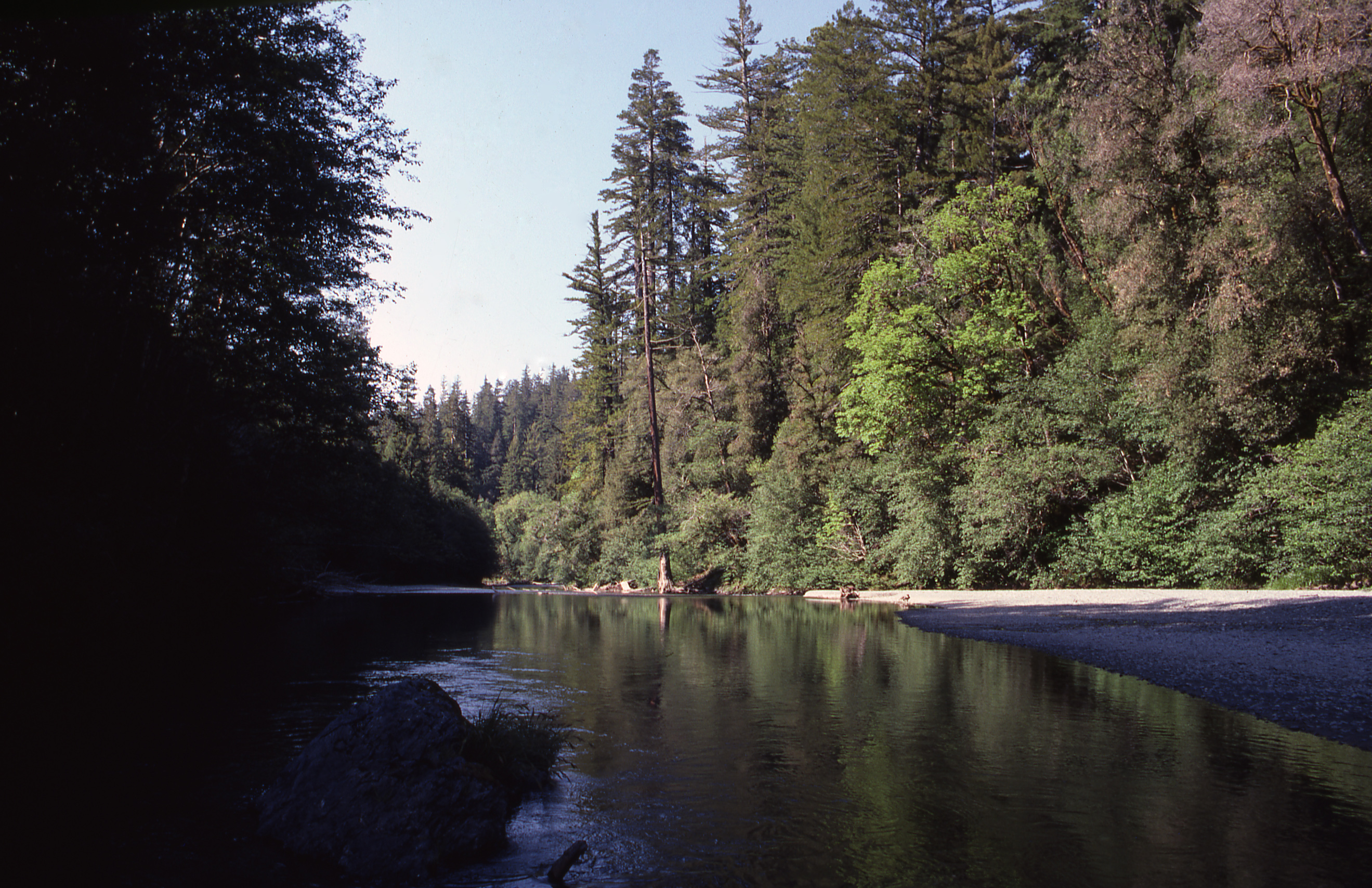
Half Day Adventure To A Celebrated Grove
Visitors wishing to go to the Tall Trees Grove must apply online for a free reservation These are limited to 50 parties for each day, and permits are issued up to 24-hours ahead of time. Tall Trees permits are no longer issued in person at our visitor centers.
This 4.5-mile (6.5km) round trip backcountry hike with a total 1,600 feet (487 m) elevation change is frequently written about in blogs, international publications, and by travel writers. As a result, this trail gets a lot of attention - but this hike is not for the faint of heart - or for people short on time. The Tall Trees Trail is a moderately strenuous hike that descends 800-feet down to the alluvial floodplain of Redwood Creek. The grove has plenty of water, good soil, and protection from winter winds and as a result has many redwood trees that exceed 350 feet (106 meters) in height.
Remember to stay on trail.
Luckily, there are many other trails in the redwood parks that are easier to access and physically easier to hike. These other trails will also will lead you to equally beautiful old-growth redwood groves. If you want our best suggestion for an alternative to the Tall Trees Trail, we suggest the Karl Knapp (Prairie Creek) to Foothill Trail Loop . It is very easy to get to, it has redwoods just as tall, and that loop is much easier on the knees and heart.
The grove was featured in a famous 1963 National Geographic Magazine article that helped propel a public push for the creation of Redwood National Park. The tallest tree in the world is not located in the Tall Trees Grove. After the discovery by the National Geographic survey team, the tree known as the Libby Tree, or "Tall Tree", held the title until 1994 when the top died back, dropping it down to the 34th tallest tree on the planet.
Be Prepared: Make sure you have food, water, sturdy shoes, raingear, and a flashlight.
Access: Allow a 1-hour drive (including 7-miles on a dirt road) from the nearest visitor center to the trailhead. The road to the Tall Trees trailhead is a narrow and windy. The small parking lot does not accommodate RVs over 21 feet or vehicles towing trailers. There is a locked gate at the top of the road to manage the traffic and to avoid overcrowding.
We recommend that visitors do not rely on digital maps to find your way to the gate - digital map accuracy and data coveage in our area is poor. Park rangers will provide good directions when you get your free online permit.
Two vault toilets, a shelter, and information and interpretive panels are located at the trailhead.
Accessibility This is not an ADA trail and has switchbacks and a grade exceeding 10%. Trail is four to six feet wide. Aggreate and wood material with occasional tree roots. Service animals are welcome.
Tall Trees Trail Spur
Trailhead Tall Trees Trailhead 812 ft Drive there
Ten Taypo Trail
Teran Road (Mill Creek)
To Gold Bluffs/Fern Canyon Trails
Trail off Mill Creek Road
Trestle Loop Trail
Trailhead Trestle Loop Trailhead 394 ft Drive there
Trillium Falls Trail
WaterfallsBridges
Along the way Trillium Falls Trail Bridge Trillium Falls Trail Bridge Trillium Falls Trail Bridge Trillium Falls Trail Bridge Trillium Falls Trail Bridge Trillium Falls
Hike to Trillium Falls the Park Service's write-up
30-90 Minutes · no dogs
Start Trillium Falls Trail: Elk Meadow day-use area
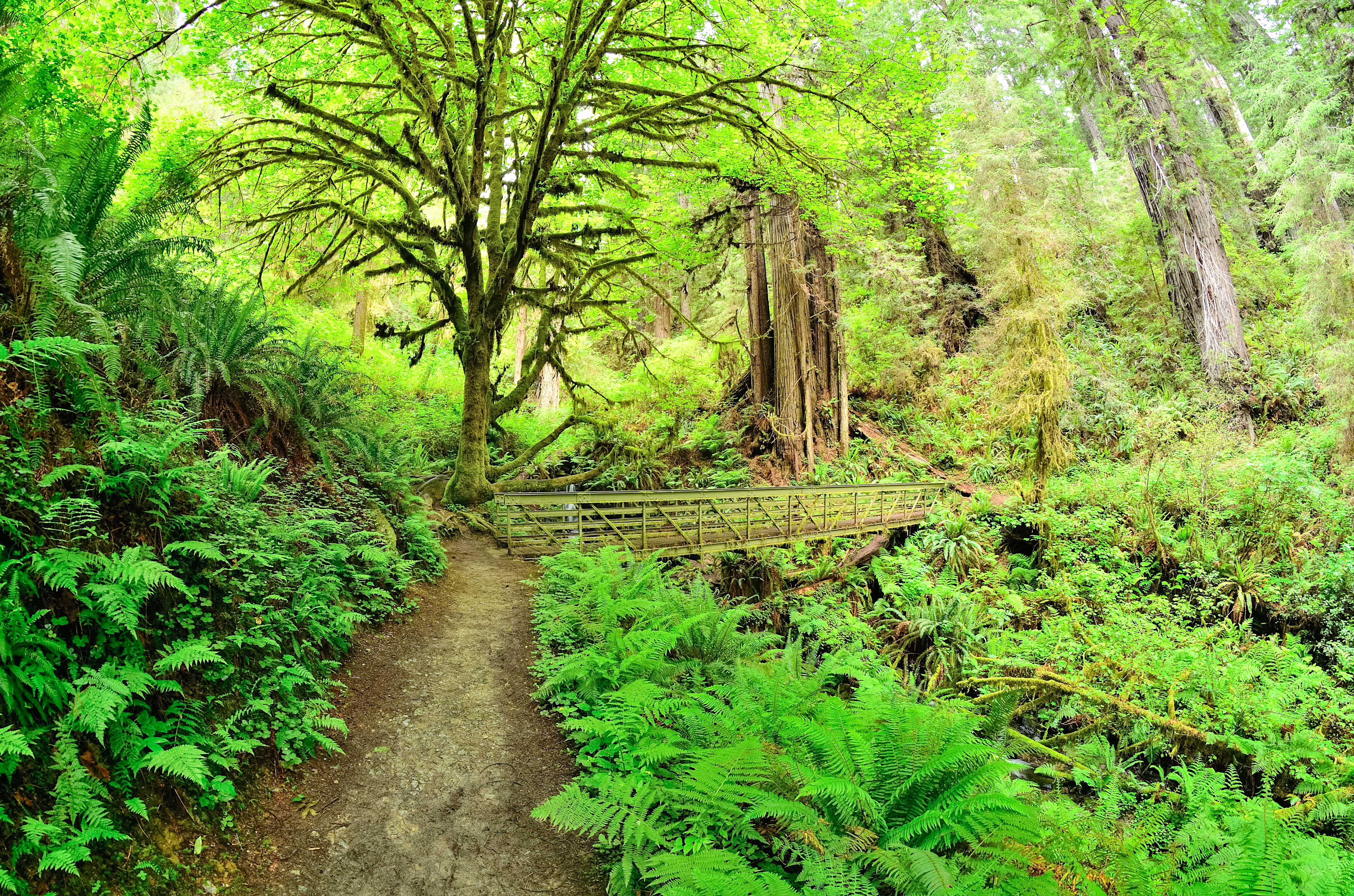
A Highly Recommended Walk For the Whole Family
Located in the south of the parks, this is a family-friendly hike through old-growth redwoods, maples, past trillium flowers, ferns, and fir trees... with a small waterfall too! There are some switchbacks and an elevation gain of 200-feet to reach the falls.
The trailhead is located at Elk Meadow - just off Davison Road, three miles north of Orick. There are flush toilets, picnic tables and it has parking for vehicles of any size (busses, RV's, and trailers included). Because of the scenic beauty of the trail, and facilities at the trailhead, many rangers recommend this as one the best walks in Redwood National and State Parks. At the parking area, there is a good chance of seeing one of the Roosevelt elk herds that live in the park.
Trillium Falls is 1/2 mile from the trailhead and is a great photo stop and turn-around point. To protect the vegetation at the waterfall please stay on the hikers' bridge.
If you wish to spend more time under these giant trees, then you can do the full loop (back to the parking area) in less than 3-miles (5km). This extra section climbs and decends several hundred feet more.
Accessibility Trail is made of compact gravel, aggregate and wood. It averages about four feet wide. There is a moderate climb of 5-10% and switchbacks for 1/4 mile. Tree roots occasionally cross the trail.
Upper First Gulch Road (Mill Creek)
Upper Visser Road (Mill Creek)
Upper Visser-1 Road (Mill Creek)
Visitor Center Link
Visitor centersBridges
Along the way Prairie Creek Trail Bridge Prairie Creek Visitor Center
Trailhead Prairie Creek/Foothills Trailhead 149 ft Drive there
Wellman Trail
West Branch Road (Mill Creek)
West Prairie Trail
Visitor centers
Along the way Prairie Creek Visitor Center
Trailhead Elk Prairie Trailhead 133 ft Drive there
West Ridge Trail
Bridges
Along the way James Irvine Trail Bridge West Ridge Trail Bridge West Ridge Trail Bridge West Ridge Trail Bridge
Wilson Creek Beach Access Trail ?
World War II Trail
History
Along the way WWII Radar Farmhouse
Trailhead WWII Radar Farmhouse Trailhead 331 ft Drive there
Xaa-yuu-chit Tes-dvm (High-Status-Stream/River Trail)
Yurok Loop Trail
Trailhead Yurok Loop Trailhead 88 ft Drive there
Zig Zag No. 1
Bridges
Along the way Prairie Creek Trail Bridge
Zig Zag No. 2
Bridges
Along the way Newton B. Drury Scenic Drive Bridge Prairie Creek Trail Bridge Zig Zag No. 2 Bridge Zig Zag No. 2 Bridge Zig Zag No. 2 Bridge
Trailheads Moorman Pond Trailhead 400 ft Drive there · Rhododendron Trailhead 402 ft Drive there · Zig Zag No. 2 Trailhead 425 ft Drive there
About these trails
The lines are the National Park Service's public trails layer, the trailheads and the waterfalls, views, peaks and historic places along them the Service's public points of interest, read 2026-10-14 and simplified for the map. The write-ups are the Service's own "things to do", unedited. Heights come from USGS 3DEP through Terrain Tiles on AWS (Mapzen/Tilezen), read along each line and rounded; a short trail on steep ground can be off by a few tens of feet. Closures change: check the park's own site before you go.