
National Park · Arizona
Trails in Petrified Forest National Park
8 named trails · 5 miles · 9 trailheads · 6 with the Park Service's own write-up. The lines, trailheads and points are the Park Service's; the write-ups are the Service's own words; the climbing is read from USGS elevation along each line.
8 trails, A to Z.
Blue Mesa
Shelters
Along the way Shade Shelter
Trailhead Blue Mesa Trail 5,625 ft Drive there
Walk Blue Mesa Trail the Park Service's write-up
30-120 Minutes · dogs allowed
Start Blue Mesa Trail, Petrified Forest National Park
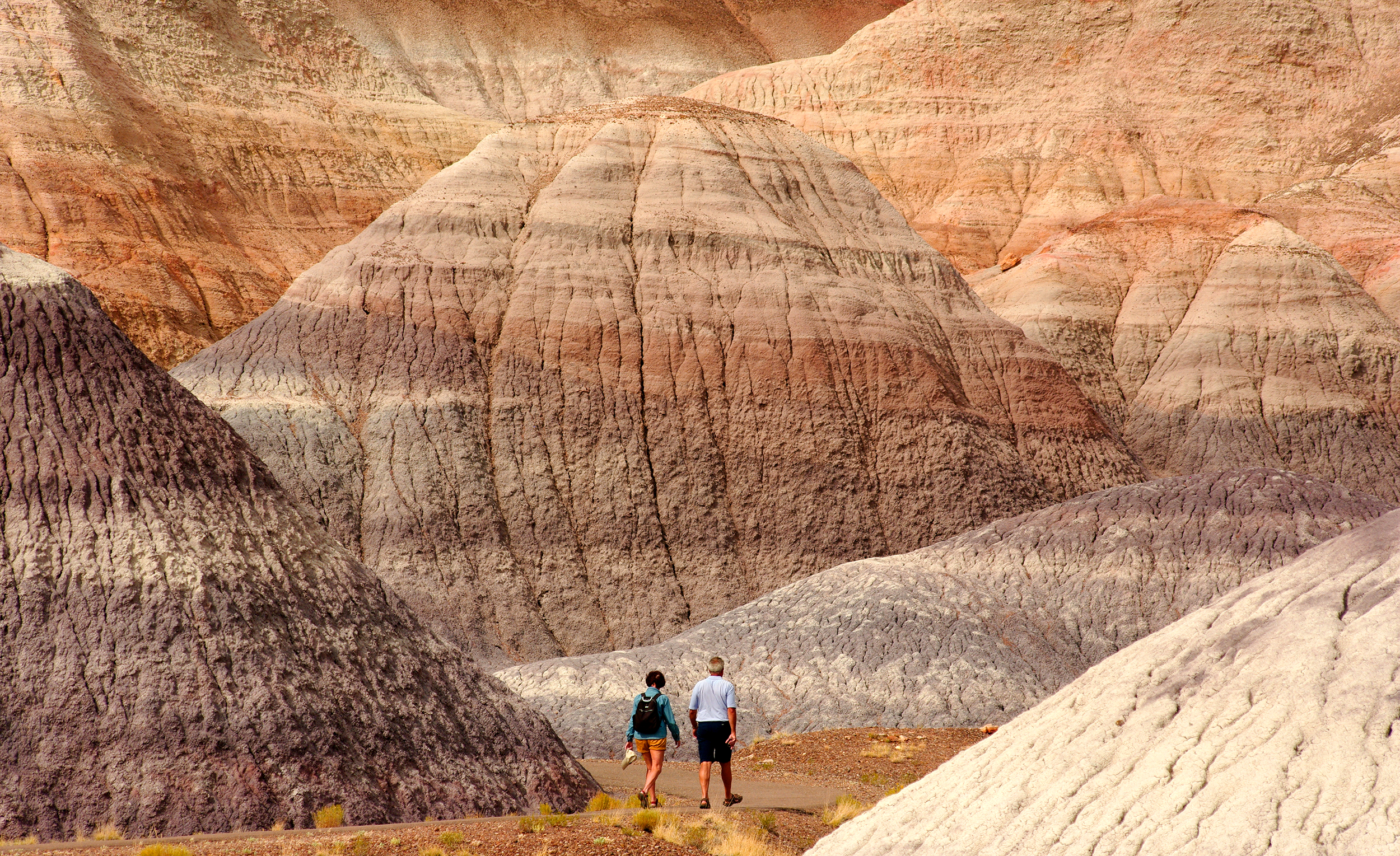
Steeply descending from the mesa top, this 1-mile alternately paved and gravel trail loop offers the unique experience of hiking among blue, purple, peach, and gray banded badland hills of bentonite clay as well as petrified wood. Numerous plant and animal fossils have been found by paleontologists in the sedimentary layers of Blue Mesa.
Accessibility Most of this trail is not accessible for mobility devices. Steep grade near beginning of trail. The surface is hard, paved or graveled. Exhibits have proper contrast for visibility challenges.
Crystal Forest Trail
Shelters
Along the way Crystal Forest
Trailhead Crystal Forest 5,534 ft Drive there
Walk Crystal Forest Trail the Park Service's write-up
20-120 Minutes · dogs allowed
Start Crystal Forest Trail, Petrified Forest National Park
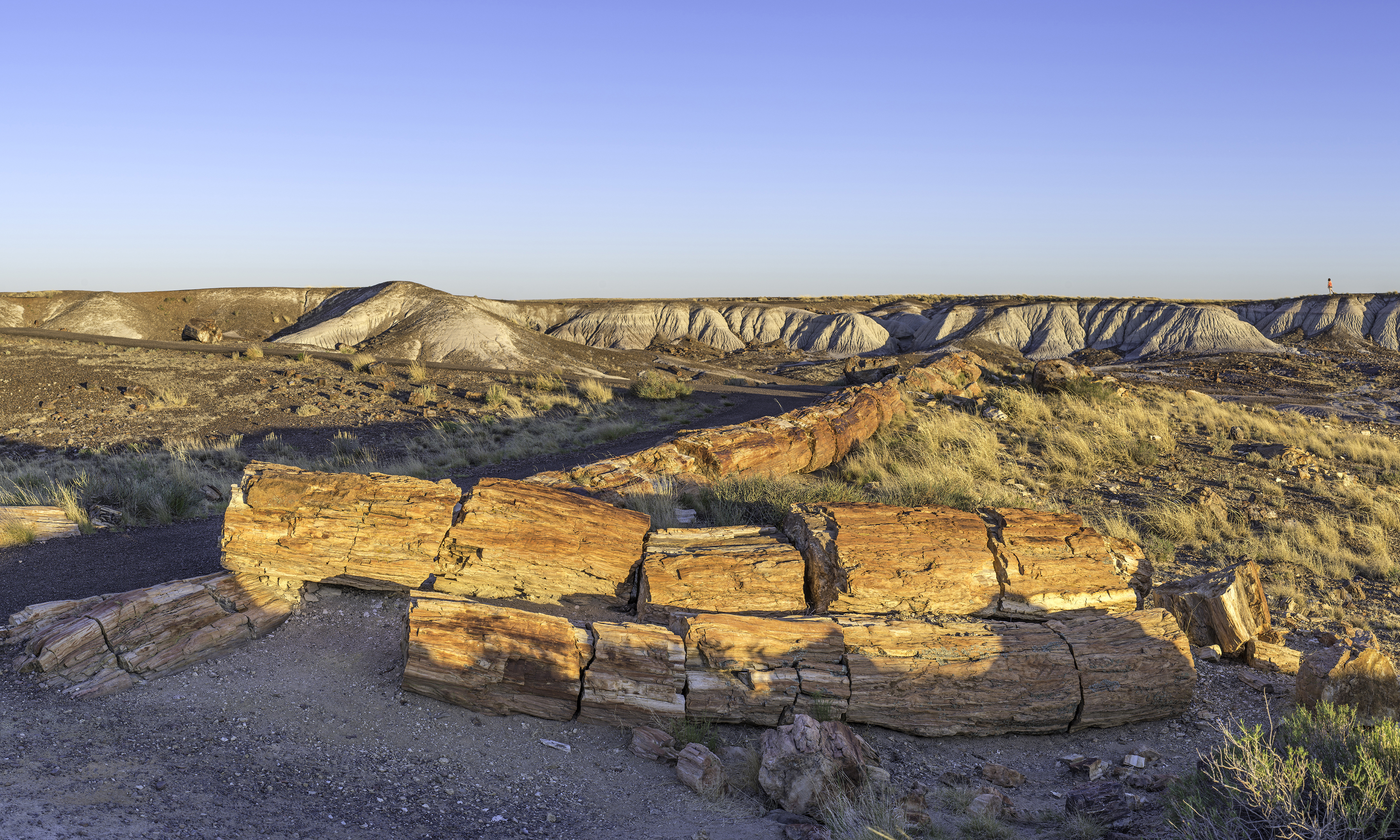
Named for the presence of beautiful crystals that can be found in the petrified logs, this trail offers one of the best opportunities to experience the petrified wood deposits as it loops through rolling gray and purple badlands. Please leave the petrified wood for others to enjoy. Report any removal of petrified wood or other materials to park staff.
Accessibility Tread width: 71 in (179.8 cm), min 65 in (165.1 cm) Grade: 5.2%, max 22.5% Cross Slope: 2.2%, max 11.3% Depending on the individual, most of this trail is accessible for mobility devices. The surface is hard, paved or graveled. Exhibits have proper contrast for visibility challenges.
Kachina Point
Trailheads PD Rim Trail 5,825 ft Drive there · PD Wilderness Trailhead 5,831 ft Drive there
Long Logs Trail
Trailhead Long Logs 5,464 ft Drive there
Walk Long Logs Trail the Park Service's write-up
60-120 Minutes · dogs allowed
Start Long Logs Trail, Petrified Forest National Park
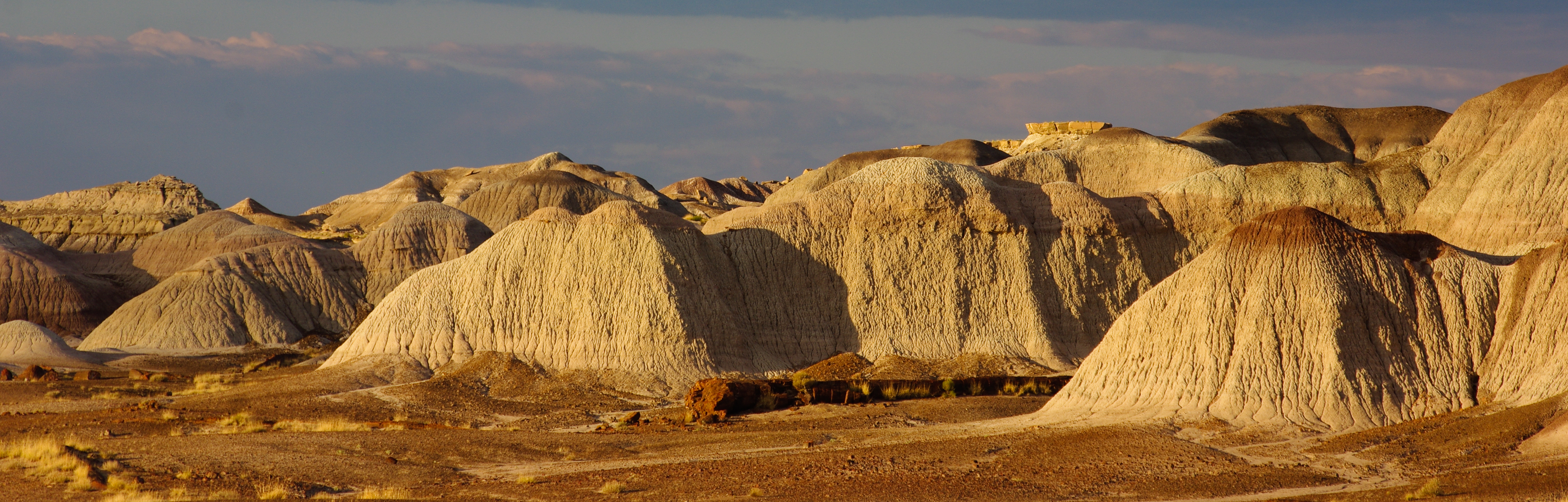
Long Logs is one of the largest concentrations of colorful petrified wood in the park, including some of the longest logs. Explore this ancient log jam at the base of purple and gray badlands along a paved half-mile loop (access trail is 0.5-mile one way—you can add this with Agate House Trail). Please leave petrified wood for others to enjoy. Report any removal of petrified wood or other materials to park staff.
Accessibility The first half-mile of this trail is paved and suitable for mobility equipment and strollers. Strollers may be negotiated on the loop, but it is not recommended for most wheelchairs and other mobility equipment due to its narrow turns, grade, and rough surface. Tread width: 85 in (216 cm), min 50 in Grade: 3.5%, max 20.5% Cross Slope: 2.9%, max 17.4%
Puerco Loop
Walk Puerco Pueblo Trail the Park Service's write-up
10-60 Minutes · dogs allowed
Start Puerco Pueblo Trail, Petrified Forest National Park
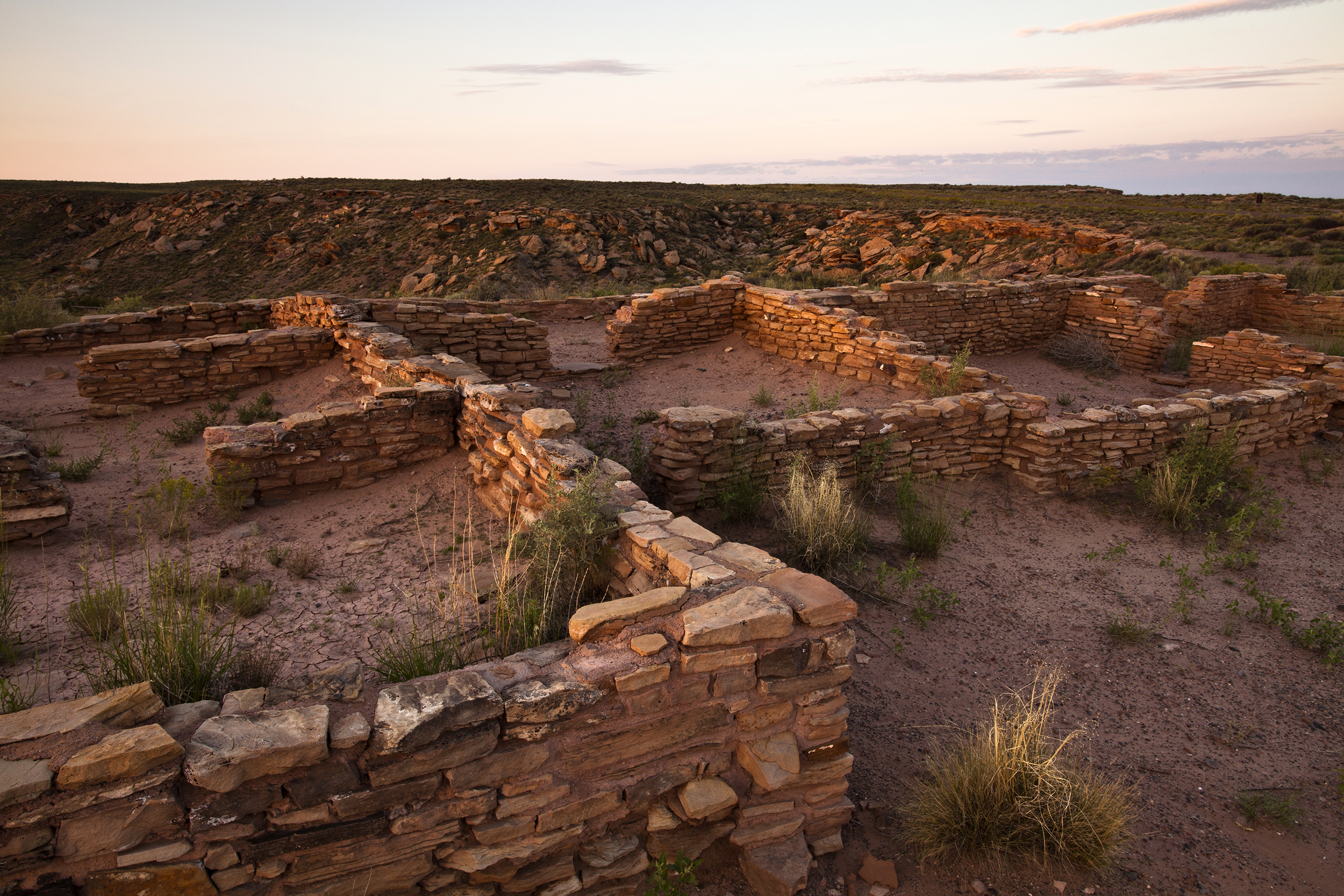
The 3/4 -mile paved Puerco Pueblo Trail features the remnants of a hundred room masonry pueblo, occupied by the ancestral Puebloan people over 600 years ago. Petroglyphs can be viewed along the south end of the trail, including one that interacts with the rising sun on the summer solstice. Please do not climb on the boulders or walls and do not touch the petroglyphs. There is a mini museum halfway along the trail with cultural, archeological, and historical exhibits inside a CCC-built structure.
Accessibility Suitable for strollers and various mobility equipment (power and manual), except on short trail spurDepending on the individual, most of this trail is accessible for mobility devices. The surface is hard, paved or graveled. Exhibits have proper contrast for visibility challenges.
Rim Trail
Trailheads PD Rim Trail 5,825 ft Drive there · PD Rim Trail 5,853 ft Drive there
Walk the Painted Desert Rim Trail the Park Service's write-up
20-120 Minutes · dogs allowed
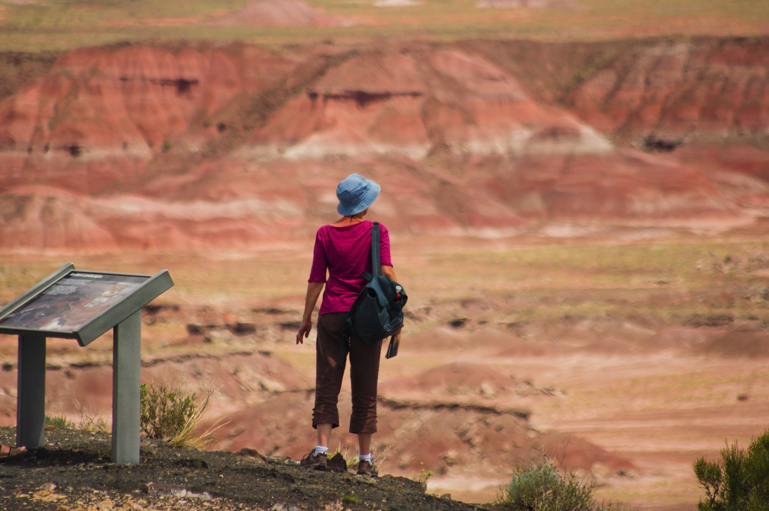
This unpaved trail winds 1-mile round trip through the rim woodland, a place for chance encounters of many species of plants and animals and spectacular views of the Painted Desert. In spring, cliffroses and other native wildflowers grow along the pathway. Birds find food and shelter in this area making it a good spot for birdwatching. Below, the view features red badlands and crenulated white tuff.
Accessibility Tread width: 62 in (158.6 cm), min 60 in (152.4 cm) Grade: 6.3%, max 25.6% Cross Slope: 3.8%, max 16.2%T his trail does not have stairs, but the waterbars and dirt-gravel surface may make this trail unsuitable for strollers or mobility devices.
Tewa Trail
Trailheads PD Rim Trail 5,853 ft Drive there · Tawa Trail 5,769 ft Drive there
Walk the Tawa Trail the Park Service's write-up
30 Minutes · dogs allowed
Start Tawa Trail Trailhead, Petrified Forest National Park

Enjoy the tranquility of the grassland as the paved trail leads you to scenic Tawa Point. The 1.2-mile one way Tawa Trail is a perfect place to stretch your legs after a long road trip. You will have views of the shortgrass prairie (particularly nice during wildflower season) and the red part of the Painted Desert. In Hopi ideology, Tawa refers to the Sun Spirit, the creator of the World. The Hopi are one of several modern Native American groups who are connected to the rich, varied history of Petrified Forest.
Accessibility Hard-surface, wide trail, plenty of places to turn around as needed. Meets standards for outdoor developed areas. Typical grade 2.3% with grades up to 8.3% Typical Cross Slope: 2% Max Cross Slope: 5% Typical Tread Width: 60 in (152.4 cm) No obstacles
More hikes the Park Service describes
Write-ups that name no single mapped trail, in the Service's words.
- Become a BARK Ranger! · dogs allowed
As long as you both follow the BARK Ranger rules, you can take your leashed dog, cat, or other pet almost everywhere you can go in the park. - Take a Self-Guided Tour of Giant Logs · 30-60 Minutes · dogs allowed
Take a self-guided tour of Giant Logs, one of the highest concentration of large, colorful petrified logs.
About these trails
The lines are the National Park Service's public trails layer, the trailheads and the waterfalls, views, peaks and historic places along them the Service's public points of interest, read 2026-10-14 and simplified for the map. The write-ups are the Service's own "things to do", unedited. Heights come from USGS 3DEP through Terrain Tiles on AWS (Mapzen/Tilezen), read along each line and rounded; a short trail on steep ground can be off by a few tens of feet. Closures change: check the park's own site before you go.