
National Scenic Riverways · Missouri
Trails in Ozark National Scenic Riverways
16 named trails · 51 miles · 8 with the Park Service's own write-up. The lines, trailheads and points are the Park Service's; the write-ups are the Service's own words; the climbing is read from USGS elevation along each line.
16 trails, A to Z.
Blue Spring Trail
Blue Spring Trail the Park Service's write-up
dogs allowed
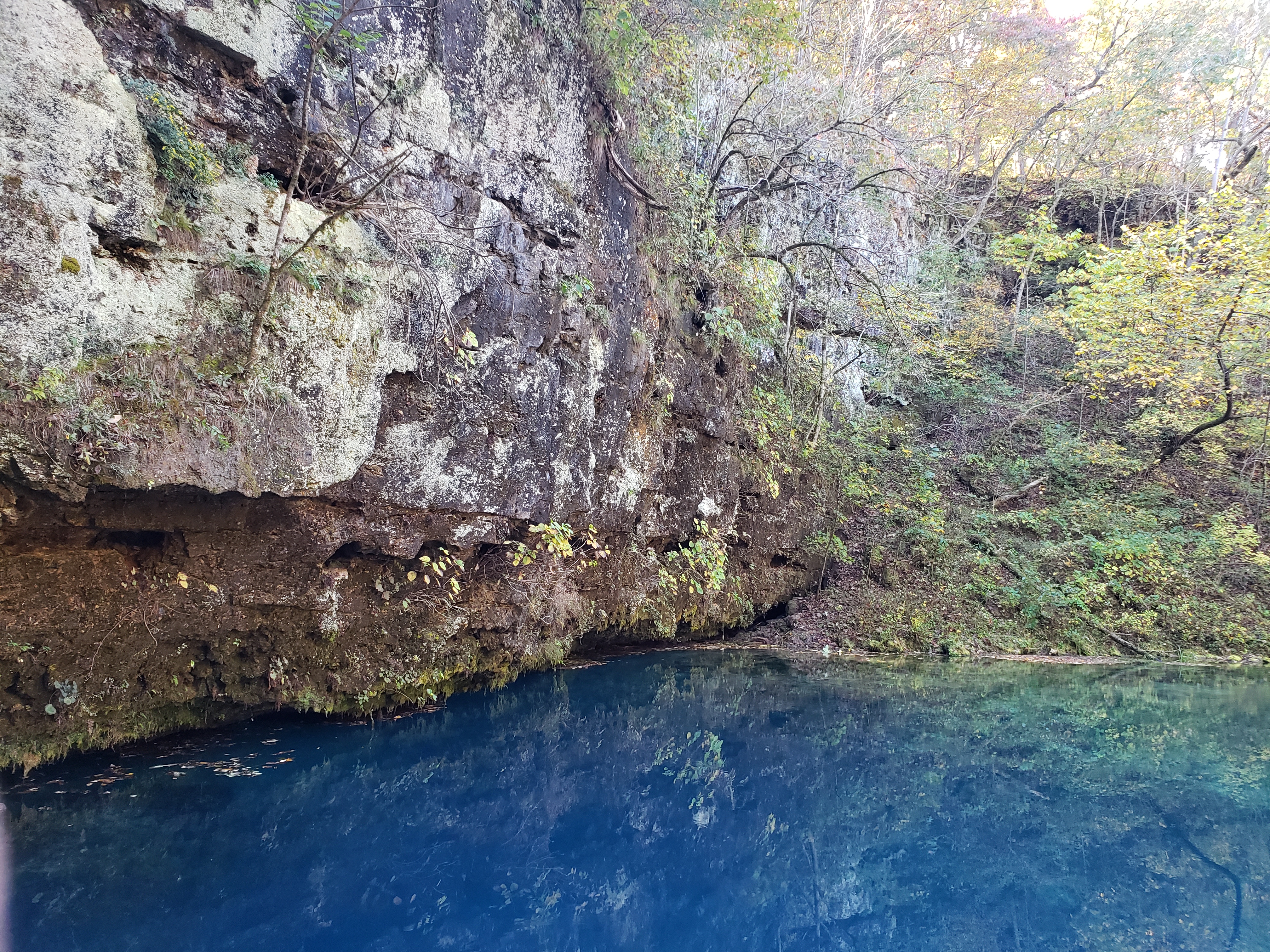
1 mile round trip. This easy to moderate hike may be accessed at Powder Mill or from the picnic area at the Blue Spring Trailhead & Picnic Area. The trail skirts the bottomland riparian forest along the Current River between Powder Mill and the Blue Spring State Natural Area--- where the trail parallels the spring branch out to Blue Spring . As the name of this spring indicates---Blue Spring is deemed the "bluest" spring in Missouri and at a depth of around 300 feet---it is Missouri's deepest.
Accessibility Uneven trail surfaces and steep inclines make this trail inaccessible to wheelchairs.
Centennial Bluff Trail
Current River Trail
About Current River Challenge the Park Service's write-up
dogs allowed
Note: The Current River Challenge is currently suspended due to major renovations at Current River State Park. Find more details about the closure here .
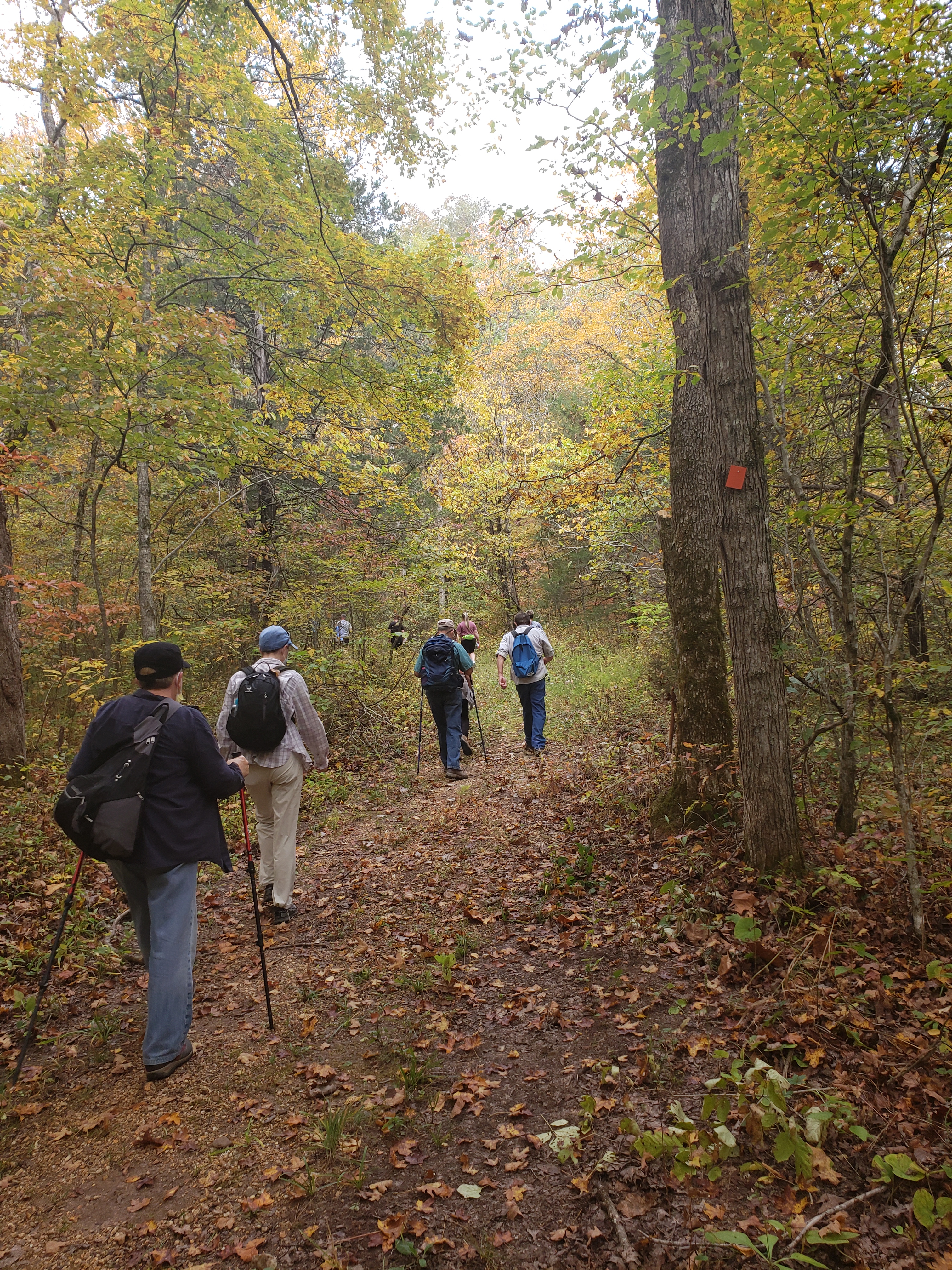
The Current River Challenge is a unique hike-float opportunity that visitors can enjoy at any time. Ozark National Scenic Riverways and Missouri State Parks partnered to promote hiking and floating between Round Spring, Echo Bluff State Park and Current River State Park in celebration of the recently completed trails in the area. The challenge consists of a "4 mile" hike from Round Spring to Echo Bluff State Park, another "4 mile" hike from Echo Bluff State Park to Current River State Park, and a "4 mile" float from Current River State Park to Round Spring. The float is solely the responsibility of the participant to arrange a shuttle and/or vessel rental. The challenge can be done in any order and at anytime of the year. The challenge can be done at any time and we encourage participants to not try to complete the challenge all in one outing. Participants can pick up their challenge cards at Round Spring Ranger Station or Echo Bluff State Park and collect stamps at each location at the end of that leg.
Accessibility The trails are rugged, uneven terrain and loose gravel surfaces makes them inaccessible to wheelchairs.
Devils Well- Cave Spring Trail
Cave Spring Trail the Park Service's write-up
dogs allowed
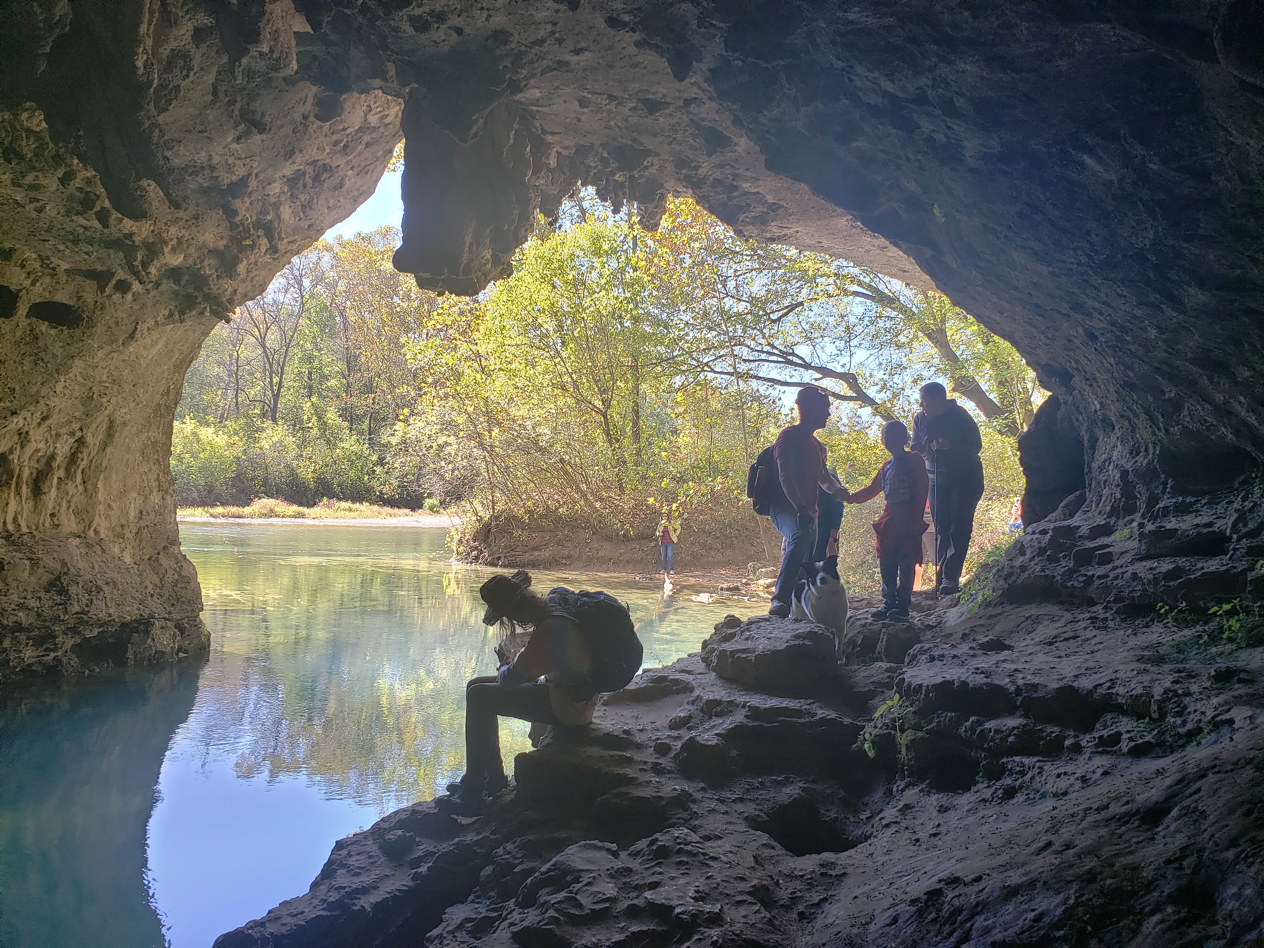
4.6 mile loop trail. This trail is moderate but long with short stretches classed as difficult as the trail climbs over the cliff presenting a challenging 'scramble'. Follow signs on KK east of Akers where a gravel access road leads to Devils Well (an ancient sinkhole at the bottom of which lies an underground lake the size of a football field).The loop trail, beginning at the Devils Well traverses oak-pine forest ridges, a limestone glade, winds through hollows and crosses intermittent streams as it brings hikers down to the mouth of Cave Spring on the Current River. The 'Cliff' segment of this loop trail traverses the side of a high limestone bluff overlooking the Current River with spectacular views, then returns to Devils Well via Parker Hollow alongside an intermittent stream bed.
Accessibility Rugged trail, steep inclines, uneven surfaces make this trail inaccessible to wheelchairs.
Jones Hollow Trail
Ninebark Trail
Ozark Trail - Between the Rivers Section
Ozark Trail - Blair Creek Section
Hike the Ozark Trail the Park Service's write-up
dogs allowed

The Ozark Trail runs through the heart of the riverways along the Upper Current River, Current River and Blair Creek sections. Hikers may chose to do an overnight, multiday or just hike a few miles along these sections. For more on the Ozark Trail, including trail maps and regulations, please visit them here .
Accessibility Trail sections of the Ozark Trail are not accessible to wheelchairs.
Ozark Trail - Current River Section
Ozark Trail - Current River Spur
Prarie Hollow Trail
Round Spring spur
Scenic Overlook Trail
Visitor centers
Along the way Alley Mill
Alley Overlook Trail the Park Service's write-up
dogs allowed
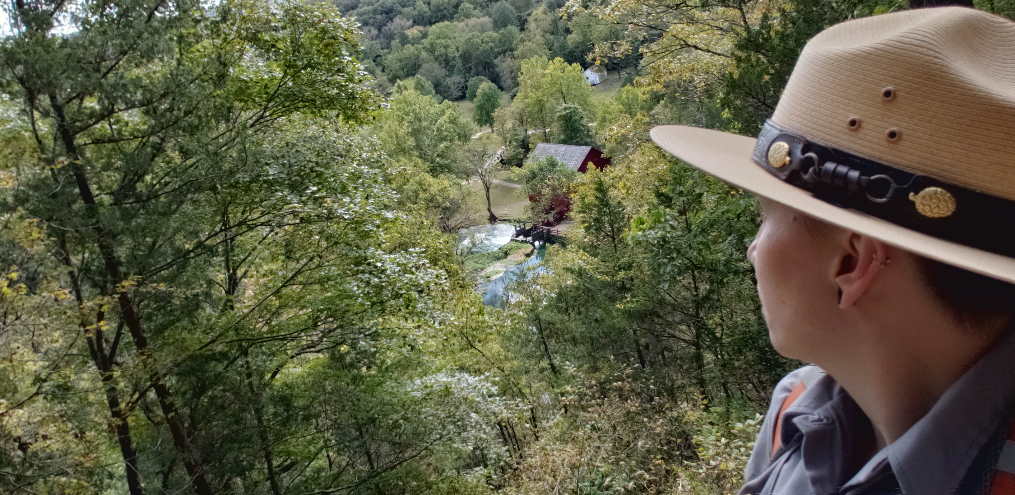
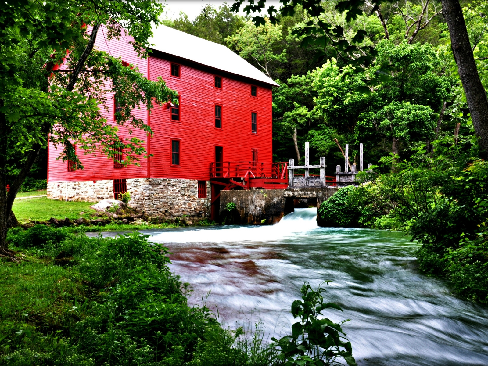
1.3 mile loop trail. This hike begins at Alley Mill. There is a steep rocky ascent that climbs the dolomite bluff from which Alley Spring emerges.The short climb leads to a scenic overlook where one has a birds-eye view of the red Alley Mill below and the crystalline blue waters of Alley Spring. An interpretive wayside at the overlook reveals the extent of this once thriving 19 th century community with a general store, a blacksmith shop, and a farmstead with corn fields and fence rows on the rolling slopes beyond Alley Mill. The trail continues along the ridge top through an upland pine-oak forest and this long segment of trail is level and easy walking. Following the ridge southward the trail dips down a series of switchbacks into the floodplain where Alley Spring Branch flows towards the Jacks Fork River. Hikers may return to the parking area or complete the "loop" back to Alley Mill along the spring branch.
Accessibility The overlook trail is steep with switchbacks and a gravel base making it inaccessible for wheelchairs.
Serenity at Alley Spring the Park Service's write-up
dogs allowed
Mental Wellness at Ozark National Scenic Riverways
Sometimes you just need a moment to pause, reflect, and unplug. The mental challenges invite you to explore the park to improve your mental health. Whether it’s nature journaling near Alley Spring , stretching on one of the many greenspaces, or capturing beautiful photos of the landscapes around you, the mental challenges give you a chance to connect with yourself and your surroundings.
Challenge 1: Serenity at Alley Spring
Be present and practice deep breathing while observing the scenery at Alley Spring . You can also reach out with your senses to explore your surroundings. Climb the Alley Overlook Trail and think of all the memories the historic Alley Mill holds within its doors. Or, just relax and calm your mind as you listen to nature moving around you.
How would you describe this place?
What captures your attention?
What sparks your curiosity?
Accessibility Accessibility Information General Information: The Headquarters Visitor Information Center has accessible parking, restrooms, and water fountains. The park brochure is available in text and audio formats and is audio described on the park website and on the UniD App. Please give us 14 days notice if you need an ASL Interpreter A park staff member can provide live audio description if you provide us 7 days notice Contact information: Phone: 573-323-4814 Email: dena_matteson@nps.gov Serenity at Alley Spring The Alley Spring area has an accessible parking space and bathroom with paved sidewalks. Alley Spring Trail is 0.3 miles of uneven surface and a slope of less than 5%. There are stairs. Alley Overlook Trail is 1.3-miles with a steep rocky ascent to the overlook. There is a concrete pathway, uneven wood slat bridge, and 50 yards of cobblestone pathway to Alley Mill. Learn more about accessibility at Ozark National Scenic Riverways.
Slough Trail
Campgrounds
Along the way Big Spring
Alley Slough Trail the Park Service's write-up
dogs allowed
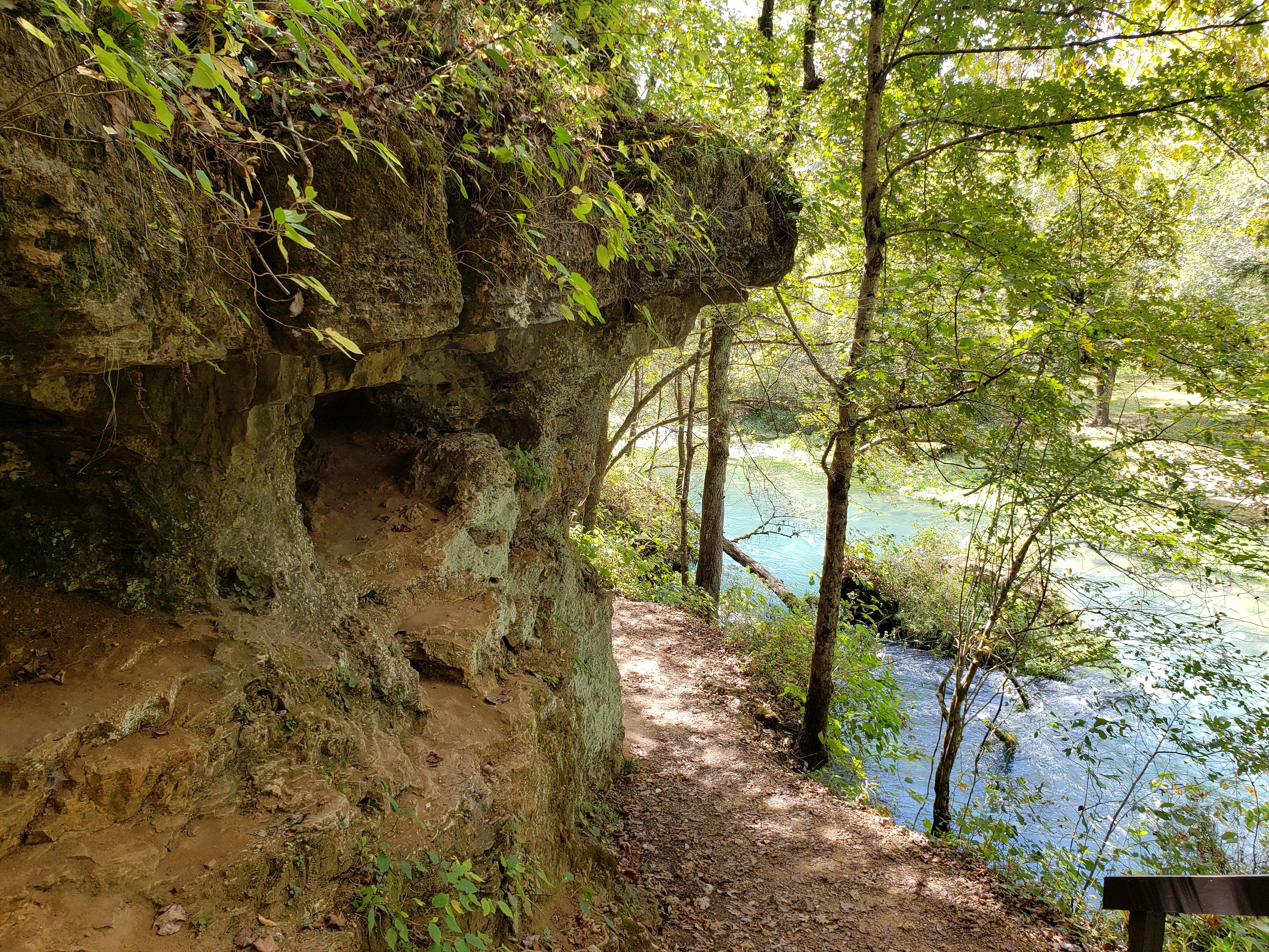
0.3 mile loop. This easy hike begins at the historic Alley Mill located on the banks of Alley Spring. Following a tour of the old turbine powered grist mill, visitors can walk the perimeter of the deep blue spring along a trail that hugs the base of a massive dolomite cliff. The remnants of the old stone impoundment and mill sluice send the 81 million gallons of water per day that flow from Alley Spring cascading into the spring branch. The trail continues for a short distance along the spring branch past a series of small caves and moss-covered rock outcroppings and continues down the branch to the visitor parking area.
Accessibility The slough trail starting at the mill is inaccessible to wheelchairs.
Big Spring Slough Trail the Park Service's write-up
dogs allowed
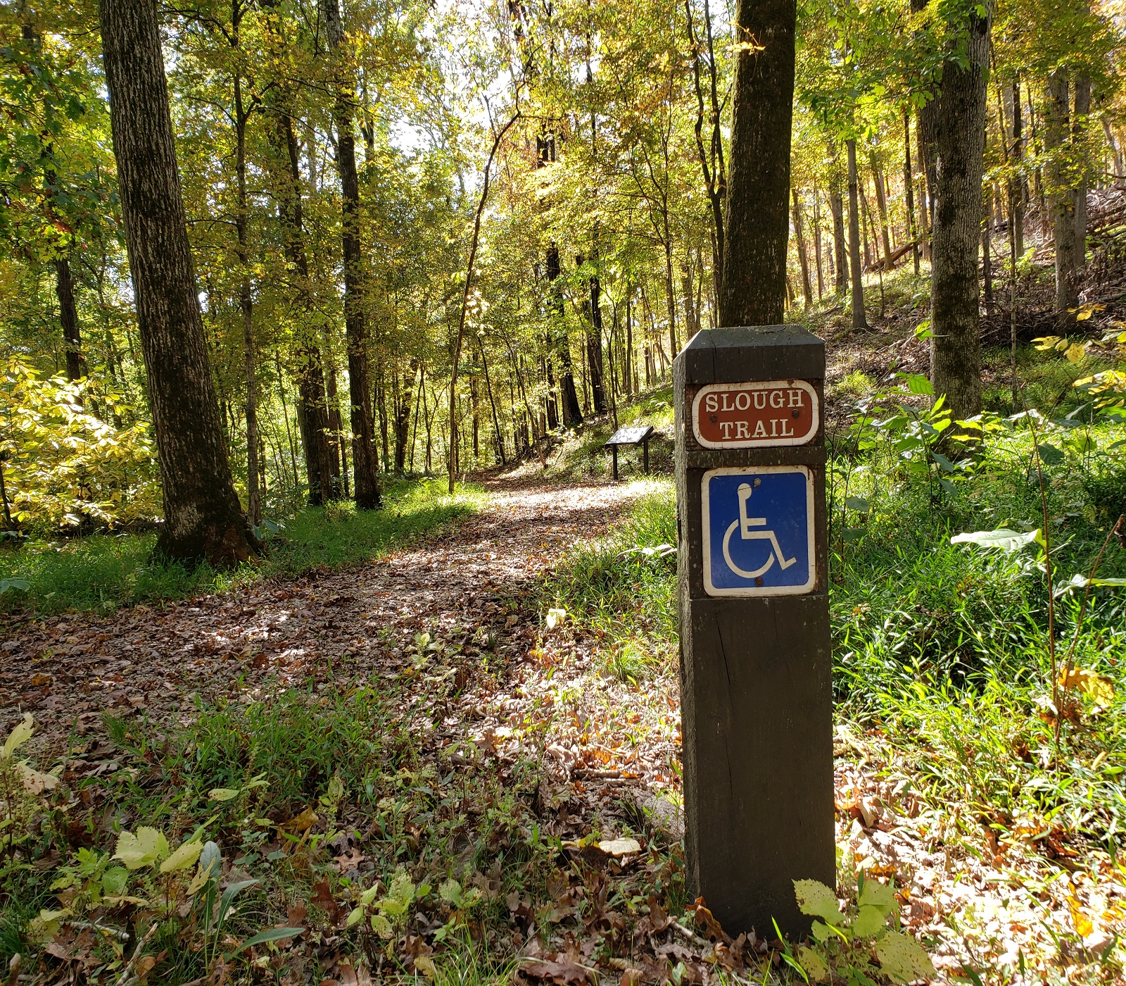
1.2 miles round trip. An easy path that begins just north of the 'Big Spring'. The route traverses a stand of cane and riparian forest along the slough with impoundments constructed by the CCC. Interpretive exhibits explain history, pre-history, and natural habitat of the immediate area. Hikers can cross Peavine Road and continue north along the Current River by taking the River's Edge Trail which leads to the Big Spring Campground.
Accessibility Big Spring Slough trail is accessible to wheelchairs with a small rock surface material or leaves in the fall and winter. Low grades exist.
Big Spring Stone Ridge Trail the Park Service's write-up
dogs allowed
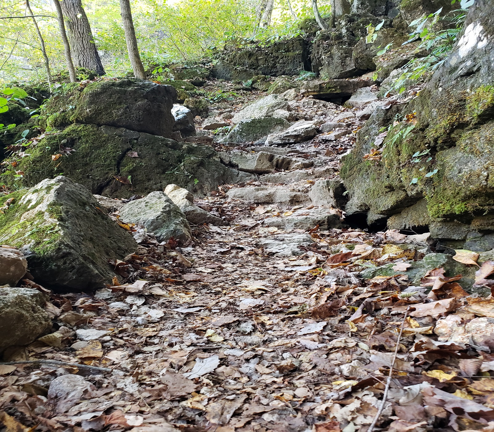
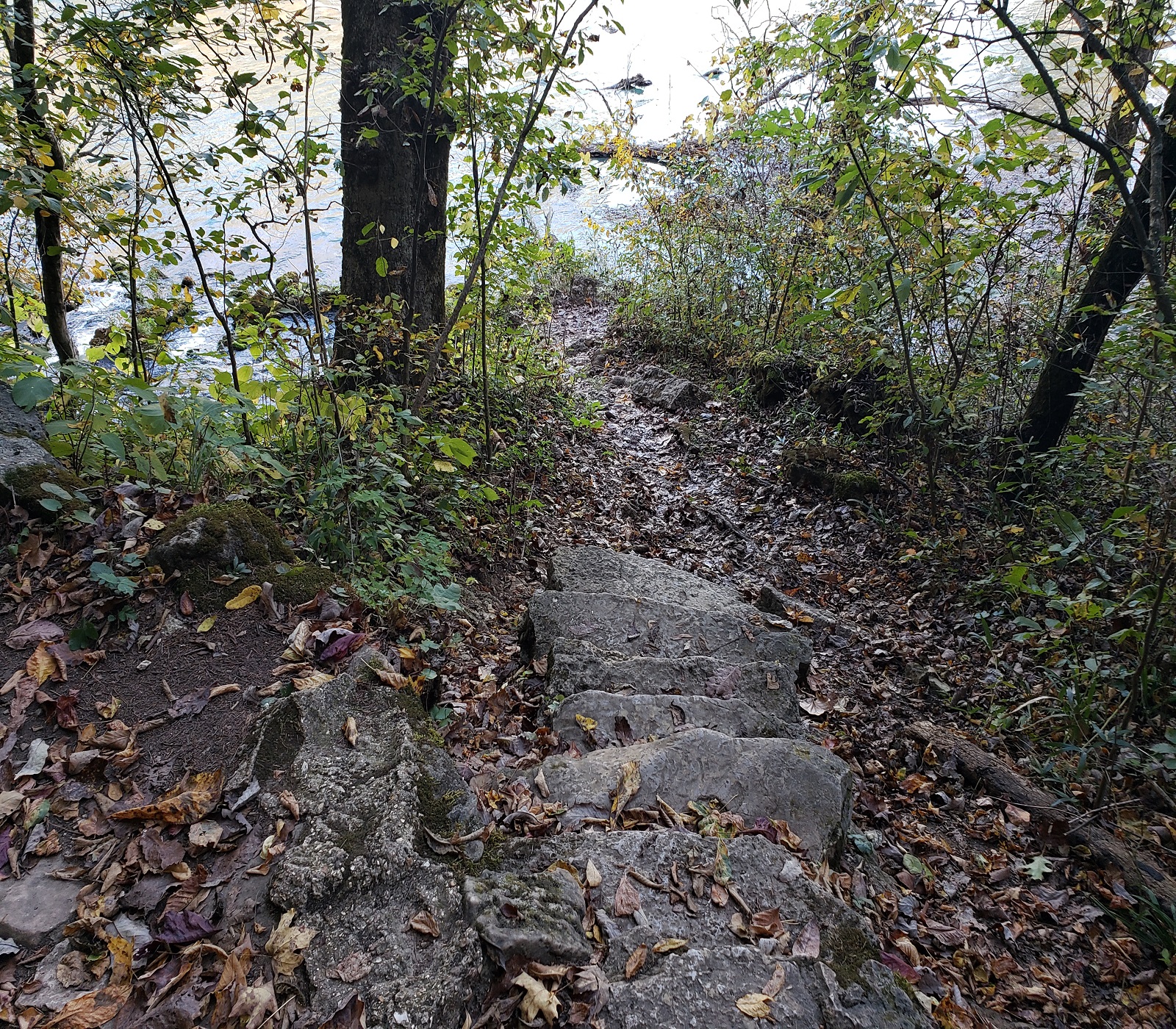
1.2 miles long.This moderate to mildly strenuous hike ascends the dolomite bluff to the ridgeline above the Big Spring, then descends through swales and hollows down to link up with the Slough Trail . Segments of this trail consist of stone steps constructed by the "CCC boys" during the Depression era when Big Spring was an early State Park. The trail travels through dry upland oak woods with numerous dolomite outcroppings and several opportunities for scenic views.
Accessibility Big Spring Stone Ridge Trail is not accessible to wheelchairs.
Refresh at Big Spring the Park Service's write-up
dogs allowed
Mental Wellness at Ozark National Scenic Riverways
Sometimes you just need a moment to pause, reflect, and unplug. The mental challenges invite you to explore the park to improve your mental health. Whether it’s nature journaling near Alley Spring , stretching on one of the many greenspaces, or capturing beautiful photos of the landscapes around you, the mental challenges give you a chance to connect with yourself and your surroundings.
Challenge 2: Refresh at Big Spring
Rejuvenate your mind and spirit at Big Spring while embracing the soothing water sounds. Reflect on nature's gifts or just let your mind wander as the water flows by. You can even settle at a picnic table to observe the details around you or walk or roll on Slough Trail to view the spring up close.
How would you describe this place?
What captures your attention?
What sparks your curiosity?
Accessibility Accessibility Information General Information: The Headquarters Visitor Information Center has accessible parking, restrooms, and water fountains. The park brochure is available in text and audio formats and is audio described on the park website and on the UniD App. Please give us 14 days notice if you need an ASL Interpreter A park staff member can provide live audio description if you provide us 7 days notice Contact information: Phone: 573-323-4814 Email: dena_matteson@nps.gov Refresh at Big Spring Big Spring area has an accessible parking space and bathroom. Along the level paved gravel pathway there are two benches. The Slough Trail is 1.2 miles long with a paved, level gravel surface. Learn more about accessibility at Ozark National Scenic Riverways.
Spring Branch Trail
Campgrounds
Along the way Big Spring
Big Spring Branch Trail the Park Service's write-up
dogs allowed
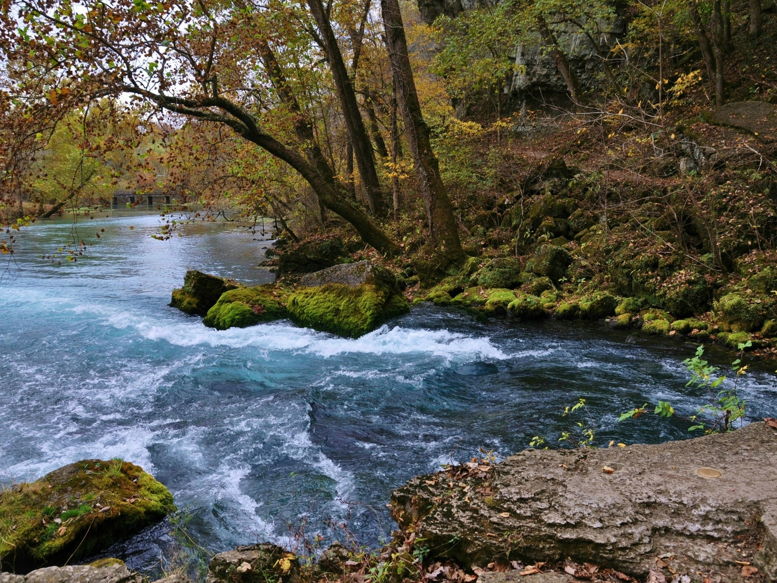
1 mile round trip. This short rocky (in some sections) trail connects Big Spring to the Historic Dining Lodge built by the "CCC boys." The trail lies at the base of the dolomite cliff from which Big Spring emerges, loops around the spring, then follows the spring branch as it delivers 280 million gallons of crystal clear water into the Current River. Spring wildflowers, lichens, mosses, and ferns cling to the cliff-side. It intersects the Stone Ridge Trail before crossing the paved road then proceeds south to the Dining Lodge.
Accessibility Big Spring Branch Trail is not accessible to wheelchairs.
17 more mapped segments without a name are on the map, not in the list.
More hikes the Park Service describes
Write-ups that name no single mapped trail, in the Service's words.
- A Detective in Nature · dogs allowed
Unearth the secrets of nature with your own journey through Ozark National Scenic Riverways. - About Hiking Safety · dogs allowed
Hiking Safety - Big Spring River's Edge Trail · dogs allowed
Big Spring River's Edge Trail - Discover Geologic Wonders · dogs allowed
There is so much to discover within the park’s 134-miles of river and 80,000 acres of land. - Paws in the Park · dogs allowed
Follow along as your dog takes the lead through the trails to new spaces. - Picture This · dogs allowed
Experience the wonder of nature’s scale from the smallest details to the openness of the sky and waters. - Pulltite Nature Trail · dogs allowed
Pulltite Nature Trail - Reach New Elevations · dogs allowed
Reach new elevations in the Ozark Mountains and enjoy the view. - Round Spring Loop Trail · dogs allowed
Round Spring Loop Trail. - Round Spring Trail · dogs allowed
Round Spring Trail - Susie Nichols Cabin Trail · dogs allowed
Susie Nichols Trail
About these trails
The lines are the National Park Service's public trails layer, the trailheads and the waterfalls, views, peaks and historic places along them the Service's public points of interest, read 2026-10-14 and simplified for the map. The write-ups are the Service's own "things to do", unedited. Heights come from USGS 3DEP through Terrain Tiles on AWS (Mapzen/Tilezen), read along each line and rounded; a short trail on steep ground can be off by a few tens of feet. Closures change: check the park's own site before you go.