
National Park & Preserve · West Virginia
Trails in New River Gorge National Park & Preserve
50 named trails · 87 miles · 33 trailheads · 4 with the Park Service's own write-up. The lines, trailheads and points are the Park Service's; the write-ups are the Service's own words; the climbing is read from USGS elevation along each line.
50 trails, A to Z.
Arbuckle Connector
Big Branch Trail
Trailhead Big Branch Trailhead 1,356 ft Drive there
Big Buck Trail
Picnic areas
Along the way Grandview Picnic Shelter 2
Trailhead Big Buck Trailhead 2,433 ft Drive there
Bridge Buttress Extention Trail
Bridge Buttress Trail
Trailhead Bridge Butress Trailhead 1,496 ft Drive there
Bridge Trail
Trailhead Bridge Trailhead 1,565 ft Drive there
Brooklyn Mine Trail
Trailhead Upper Coal Run Trailhead 1,581 ft Drive there
Burnwood Trail
Trailhead Burnwood Trailhead 1,725 ft Drive there
Butchers Branch Trail
Trailhead Kaymoor Top Trailhead 1,965 ft Drive there
Canyon Rim Boardwalk
Views
Along the way Canyon Rim Lower Bridge Overlook Canyon Rim Middle Bridge Overlook Canyon Rim Upper Bridge Overlook
Castle Rock Trail
Views
Along the way Grandview Main Overlook Grandview North Overlook
Castle Rock Hike the Park Service's write-up
30-120 Minutes · dogs allowed
Start Castle Rock
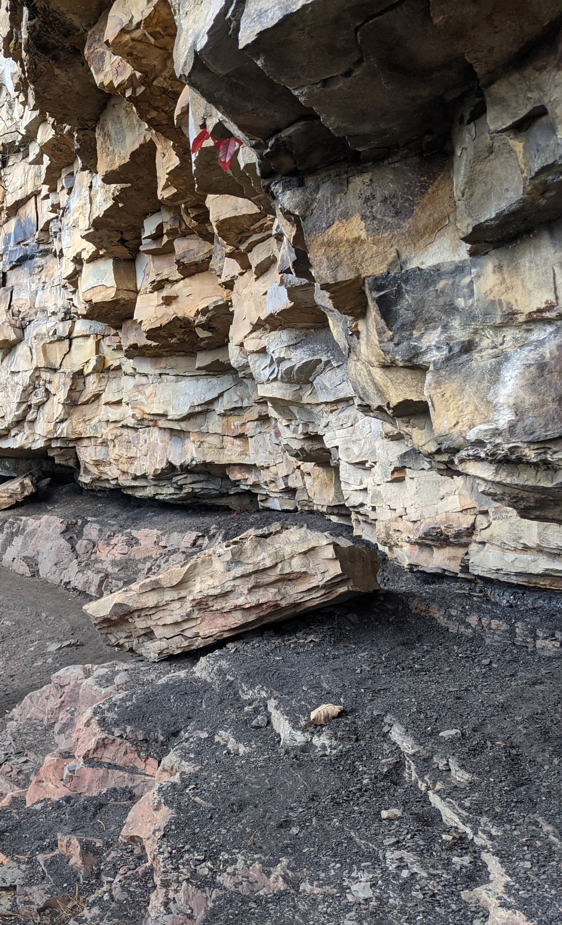
This is the most unique and fun trail. However, this trail is not for the faint hearted. The Castle Rock Trail is listed as strenuous and is .6 mile in length. After the .6 mile mark, the trail merges into the Grandview Rim Trail. From this intersection, if you turn right you will be going out to Turkey Spur for another scenic view and then retrace your steps and follow the upper trail called the Grandview Rim Trail back to the parking area (this is approximately 3.2 miles all together). The other option is to turn left and this will bring you back to the main parking area (this is approximately 1.1 miles in total).
This trail is listed as strenuous. The steps that are made out of rocks are uneven. The trail is about 3 feet in width and the gorge is just off to one side as you are walking along.
This trail is not recommended in rainy weather or when there is ice or snow on the ground because the rock surface can make this very slippery.
If you are interested in geology, this trail is for you. You will be within and arms length of the rock striations that make-up the gorge. Along this .6 mile trail you will see a coal seam at approximately the .4 mile mark and also a variety of conglomerate, shale, sandstone and limestone along this trail. If you are afraid of heights, this trail might give you the butterflies.
Accessibility The Castle Rock Trail has many uneven terrain feautures and once you are on the trail, the only way to get off is to either continue to the end or to retrace your steps and go back to where you started. The Castle Rock Trail may require some scrambling over large rocks. The Castle Rock Trail is very slippery when wet. There is a restroom located in the Main Parking area.
Church Loop Trail
Climbers Access
Clovis
Trailhead Arrowhead Trailhead 1,999 ft Drive there
Connector
Conveyor Trail
Craig Branch Trail
Trailhead Arrowhead Trailhead 1,999 ft Drive there
Dalton
Endless Wall Trail
Trailheads Fern Creek Trailhead 1,773 ft Drive there · Nuttall Trailhead 1,882 ft Drive there
Trail run at Endless Wall the Park Service's write-up
60-120 Minutes · dogs allowed
Start Endless Wall, Nuttall Trailhead
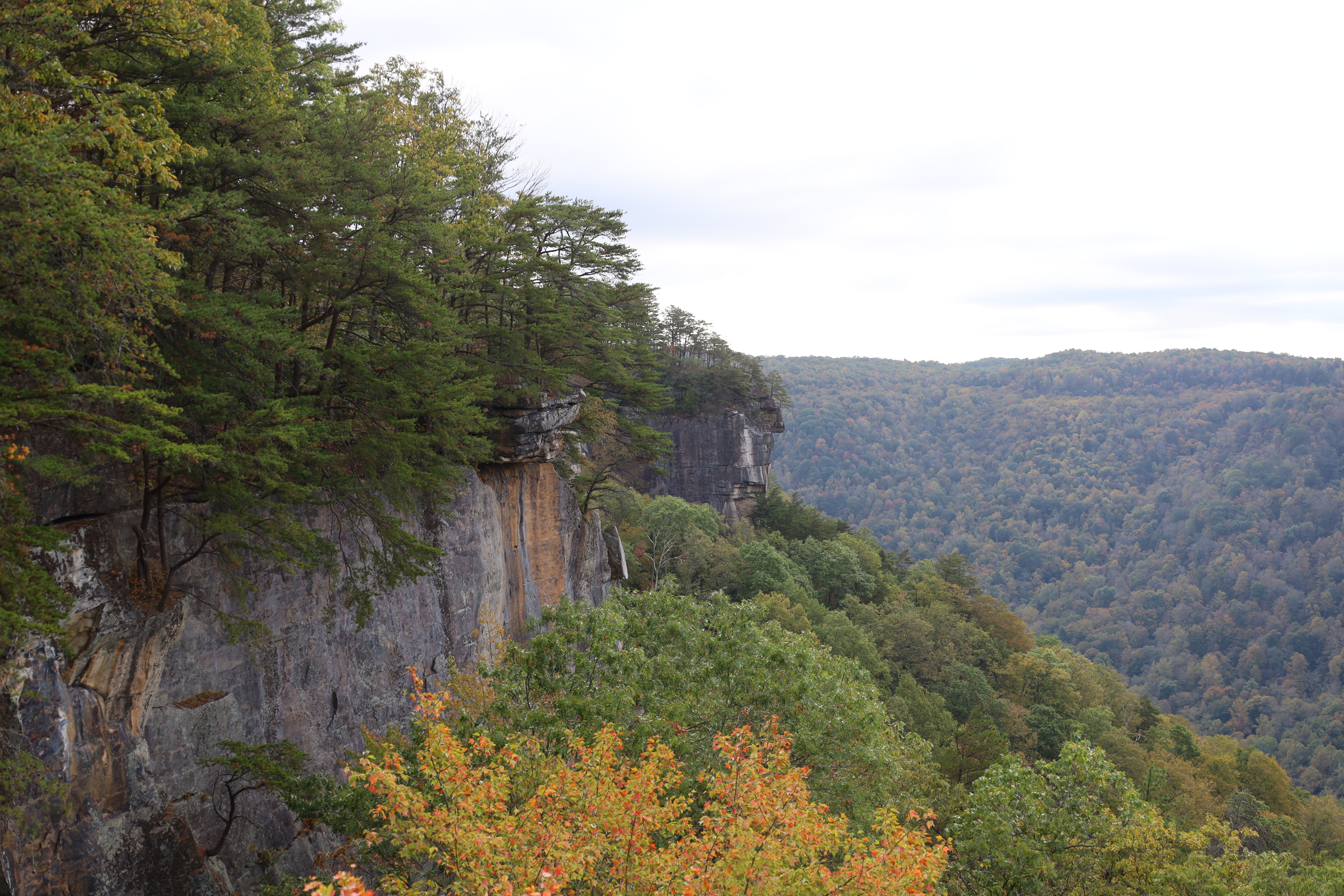
Endless Wall is a delightful trail. Hikers are drawn to this amazing location for the views that look down in the gorge from the cliff edge and for the rich forest. The trail is listed as easy to moderate due to the elevation change. The trail is listed as 2.4 miles but in order to make it back to your vehicle, you would have to either cautiously walk along the road or choose the safer option of hiking out to the Diamond Point Overlook and then return to your parking location by retracing the same path.
Trail Running
This a much loved trail at New River Gorge National Park and Preserve so it may not be the best fit for a trail run due to the volume of others on the trail and the narrow trail width to get around other hikers. If you go early in the morning, you may be able to avoid the crowds.
The Endless Wall Trail is an uneven terrain with only a slight change in elevation. There are many tree roots and rocks scattered along the trail, so stay alert if out for a run. The views into the gorge are spectacular and will inspire all outdoor enthusiasts.
Accessibility The terrain is rugged and has a few uneven steps. There can be obstacles in the trail such as tree roots and or rocks. The elevation change on this trail is noted as easy to moderate. The Endless Wall Trail is heavily trafficked and there are several narrow widths along the trail so this would not be recommended on a busy visitation day for a trail run. There are compost toilets at both trailheads.
Fayetteville Trail
Trailheads Fayetteville Trailhead 1,820 ft Drive there · Kaymoor Top Trailhead 1,965 ft Drive there · Kaymoor Trail (Wolf Creek) Trailhead 1,158 ft Drive there
Glade Creek Trail
Trailheads Lower Glade Creek Trailhead 1,247 ft Drive there · Upper Glade Creek Trailhead 1,943 ft Drive there
Grandview Rim Trail
ViewsPicnic areas
Along the way Grandview Picnic Shelter 1 Grandview North Overlook
Trailheads Grandview Shelter 1 Trailhead 2,458 ft Drive there · Main Overlook Trailhead 2,504 ft Drive there · Turkey Spur Trailhead 2,337 ft Drive there
Hike the Grandview Rim Trail the Park Service's write-up
0-2 Hours · dogs allowed
Start Grandview Rim Trail
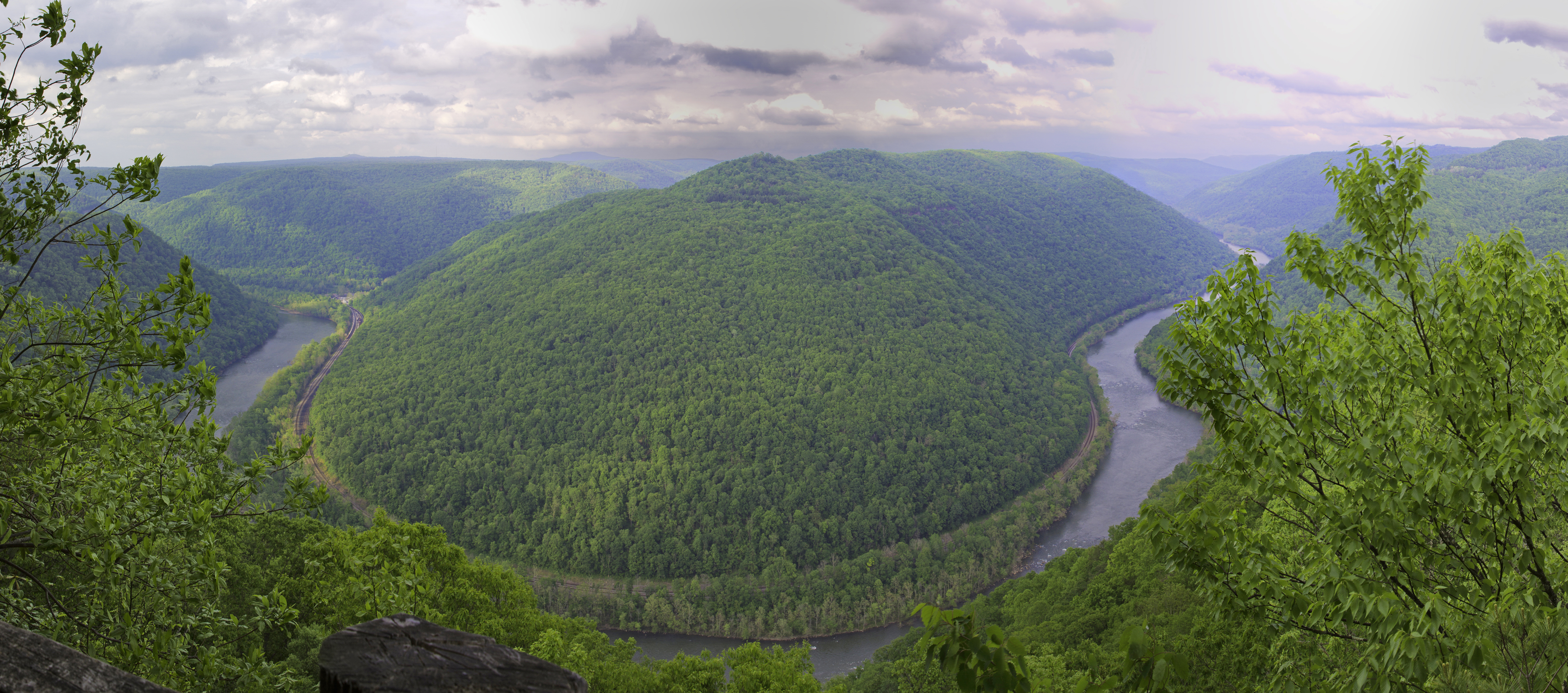
Visit the highest point in New River Gorge National Park and Preserve!
The main overlook at Grandview give spectacular views of a horseshoe bend of the New River.
The Grandview Rim Trail connects the Main Overlook to two other overlooks, North Overlook and Turkey Spur Overlook. This moderate 1.6 mile (one-way) trail takes you along the ridge at Grandview, through the forest overlooking the gorge. Look for wildlife along the trail and enjoy the blooming rhododendren in the spring time (typically around May).
Accessibility The Grandview Rim Trail is a moderate trail along the ridge at Grandview. The Turkey Spur and Main Overlooks are accessible by car. To reach the Turkey Spur Overlook, you must climb a series of wooden steps. The steps can become slippery in wet or snowy weather, please take caution. The Main Overlook has a paved sidewalk and is generally accessible from the parking lot. The main overlook viewing area is a large, mostly flat rock overlooking the gorge. It can be slippery in wet or snowy conditions.
Trail Run Grandview Rim Trail the Park Service's write-up
dogs allowed
Start Grandview Rim Trail Starting Point
Trail Run: Grandview Rim Trail: 3.1 miles out and back.
Are you looking for a great place to run and have great views down into the Gorge of the New River? The Grandview Rim Trail at the Grandview location is super easy to find and to follow. Park in the area near the Grandview Visitor Center and start your warm-up by walking the short distance to the Main Overlook. This is about a football field distance from the car parking area. As you walk to the Main Overlook from the parking area, notice the benches to your left that are bordering a wide trail. This is your starting point. The Grandview Rim Trail follows along the perimeter of the Gorge so keep the Gorge to your right shoulder and you will come to a sign for the North Overlook. This is where you will split away from the Gorge and start in a more forested area. When you reach the road , stay on the trail to the right and it is a windy trail that will have a change in elevation of about 460 feet. The trail will end in a parking lot for Turkey Spur. If you want to stop running for a few minutes and go up the 150 steps in this rock outcropping next to the parking lot you can. There are three additional vantage points to see down into the Gorge from the top of Turkey Spur. Most runners simply turn around in the parking lot and retrace their steps back to the main parking area next to the Main Overlook.
Accessibility This trail is a mixture of hard packed soil, rocks, and smaller dirt compositions. It is not entirely accessible. There are segments that are accessible at the start of the trail, but there are divots and dips within .2 of a mile from the starting point. .
Grandview Walkways
ViewsVisitor centers
Along the way Grandview Main Overlook Grandview Visitor Center
Trailheads Grandview Shelter 1 Trailhead 2,458 ft Drive there · Main Overlook Trailhead 2,504 ft Drive there
Gwinn Ridge Trail
Trailhead Gwinn Ridge Trailhead 2,446 ft Drive there
Hawks Nest Connector Trail
Headhouse Trail
Trailhead Short Creek Trailhead 1,992 ft Drive there
Island Loop Trail
Trailhead Sandstone Falls Trailhead 1,298 ft Drive there
Kates Falls Trail
Kaymoor Miners Trail
Trailhead Kaymoor Miners Trailhead 1,979 ft Drive there
Kaymoor Trail closed
Trailheads Kaymoor Trail (Cunard) Trailhead 1,574 ft Drive there · Kaymoor Trail (Wolf Creek) Trailhead 1,158 ft Drive there
Keeneys Creek Rail Trail
Trailhead Nuttallburg Keeneys Creek Trailhead 1,049 ft Drive there
LeCroy
Little Laurel Trail
Picnic areas
Along the way Grandview Picnic Shelter 4
Trailhead Little Laurel Trailhead 2,428 ft Drive there
Trail Run or hike the Little Laurel Trail the Park Service's write-up
30-120 Minutes · dogs allowed
Start Little Laurel Trailhead
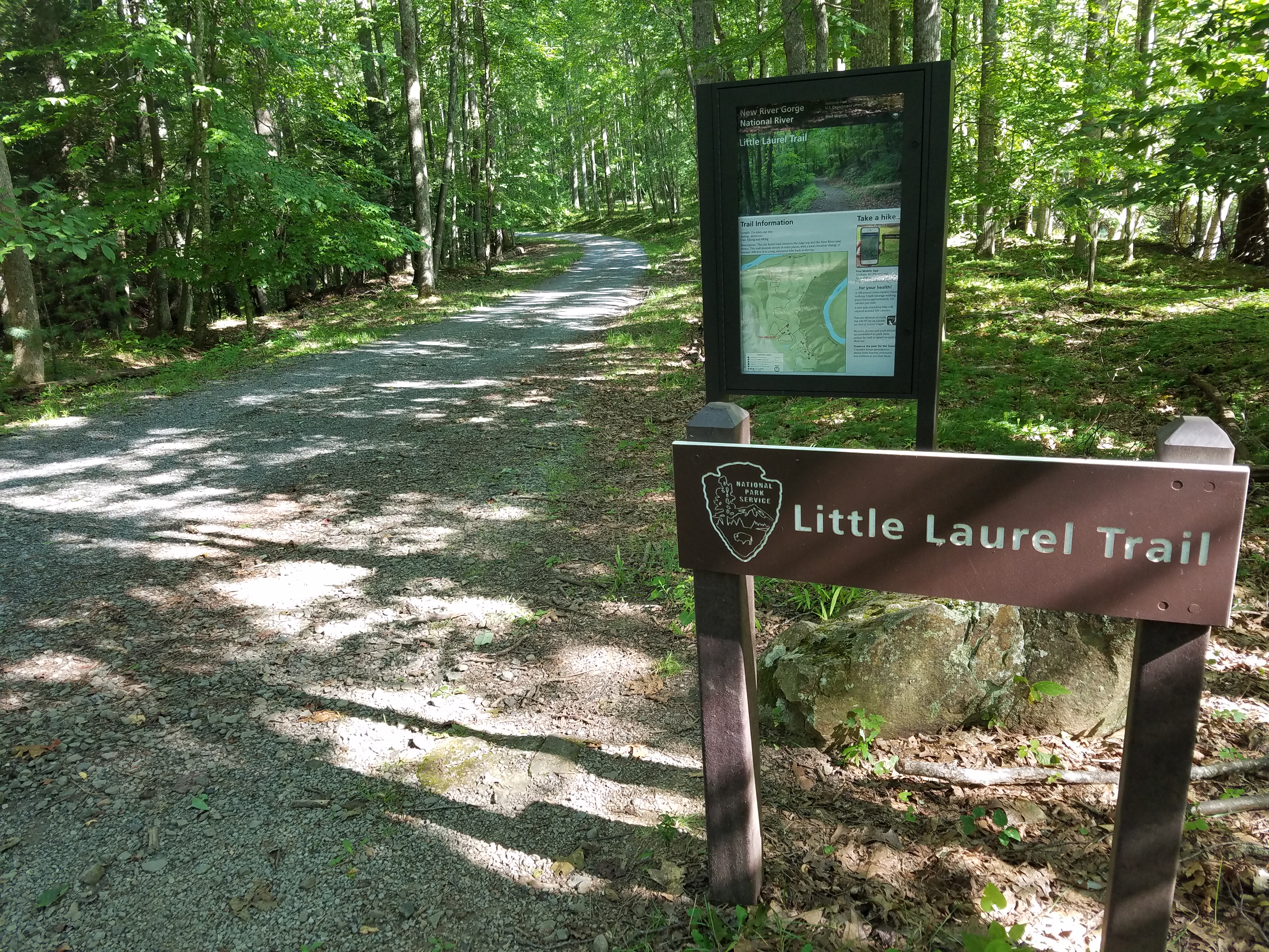
Have you ever wanted to go on a trail run or a hike on a trail where you won't run into a lot of people?
If you are seeking an outdoor hike or trail run away from the crowds, the Little Laurel Trail may be just the place for you!
The trail can be accessed from the top at Grandview Area or from the bottom at Glade Creek. The Little Laurel Trail is 2.0 miles in each direction and one of those directions will be uphill. If you begin at the trailhead located at Grandview, you will begin your journey downhill on a crushed rock path. This was an old maintenance road and the rocks are still maintained. Once you get to the bottom, you will come to a gate which is just steps away from the Glade Creek Rd. Diagonally across from this intersection is the location of the abandoned coal town called Royal. If you turn around and retrace your steps, you will have a 2.0 mile hike (or run) back up to the plateau at the Grandview location.
Accessibility The Little Laurel Trail has steep inclines on a rocky path that descends approximately 1000 feet down into the gorge. The trail starts at the top of the plateau at the Grandview location (near picnic shelter 4) and will stop at the Glade Creek Rd. The outdoor enthusiast will have to return back up the trail to get back to where the journey started.
Long Point Trail
Trailheads Long Point Trailhead 1,961 ft Drive there · Timber Ridge Trailhead 1,962 ft Drive there
Park Loop
Trailhead Fayetteville Trailhead 1,820 ft Drive there
Polls Plateau Trail
Rend Trail
Trailheads Rend Trail - Minden Trailhead 1,559 ft Drive there · Rend Trail - Thurmond Trailhead 1,161 ft Drive there
Route 20 Overlook Sandstone Falls
Views
Along the way Sandstone Falls Overlook
Sandstone Falls Boardwalk
Views
Along the way Sandstone Falls Boardwalk Overlook
Trailhead Sandstone Falls Trailhead 1,298 ft Drive there
Seldom Seen Trail
Southside Trail
Boat launches
Along the way Brooklyn River Access
Trailhead Brooklyn Trailhead 1,017 ft Drive there
Stone Cliff Trail
Trailhead Stone Cliff Trailhead 1,076 ft Drive there
Terry Top Trail
Timber Ridge
Trailheads Long Point Trailhead 1,961 ft Drive there · Timber Ridge Trailhead 1,962 ft Drive there
Tipple Trail
Trailhead Nuttallburg Trailhead 968 ft Drive there
Town Loop Connector Trail
Trailhead Nuttallburg Trailhead 968 ft Drive there
Town Loop Trail
Tunnel Trail
Views
Along the way Grandview Main Overlook
Woodland Loop Trail
Picnic areas
Along the way Grandview Picnic Shelter 2
Trailheads Big Buck Trailhead 2,433 ft Drive there · Woodland Loop Trailhead 2,443 ft Drive there
About these trails
The lines are the National Park Service's public trails layer, the trailheads and the waterfalls, views, peaks and historic places along them the Service's public points of interest, read 2026-10-14 and simplified for the map. The write-ups are the Service's own "things to do", unedited. Heights come from USGS 3DEP through Terrain Tiles on AWS (Mapzen/Tilezen), read along each line and rounded; a short trail on steep ground can be off by a few tens of feet. Closures change: check the park's own site before you go.