Administration Office Sidewalk
Picnic areasVisitor centers
Along the way Visitor Center Picnic Area Tupelo Visitor Center

Parkway · Alabama, Mississippi, Tennessee
78 named trails · 109 miles · 78 trailheads · 5 with the Park Service's own write-up. The lines, trailheads and points are the Park Service's; the write-ups are the Service's own words; the climbing is read from USGS elevation along each line.
78 trails, A to Z.
Picnic areasVisitor centers
Along the way Visitor Center Picnic Area Tupelo Visitor Center
Views
Along the way Birdsong Hollow Overlook
Trailhead Bear Creek Mound Trail 455 ft Drive there
Springs
Along the way Buzzard Roost Spring
Trailhead Buzzard Roost Spring 453 ft Drive there
CavesSprings
Along the way Cave Spring Cave Spring
Trailhead Cave Spring Trail 451 ft Drive there
History
Along the way Colbert Stand
Trailhead Colbert Stand Trail 500 ft Drive there
Views
Along the way Freedom Hills Overlook
Trailhead Freedom Hills Overlook Trail 744 ft Drive there
Picnic areas
Along the way Holly Picnic Area
Springs
Along the way Rock Spring Rock Spring
Trailhead Rock Spring Self Guiding Trail 458 ft Drive there
Trailhead Sunken Trace Trail 1,009 ft Drive there
History
Along the way Chickasaw Village
Trailhead Chickasaw Village Self Guiding Trail / NST Blackland Prairie Section Trail 308 ft Drive there
History
Along the way Chickasaw Village
Trailhead Chickasaw Village Self Guiding Trail / NST Blackland Prairie Section Trail 308 ft Drive there
Trailhead NST - Blackland Prairie Section Trail 317 ft Drive there
Campgrounds
Along the way Witch Dance Bike Only Camping
Trailhead Witch Dance Horse Trail 401 ft Drive there
Campgrounds
Along the way Jeff Busby Campground
Trailheads Little Mountain Trail 543 ft Drive there · Little Mountain Trail 424 ft Drive there · Little Mountain Trail 597 ft Drive there
Trailhead Old Trace 343 ft Drive there
History
Along the way Bynum Mounds
Trailhead Bynum Mounds Trail 341 ft Drive there
Visitor centers
Along the way Meriwether Lewis Historic Information Cabin
Trailheads Footpaths Through History Self Guiding Trail 922 ft Drive there · Footpaths Through History Self Guiding Trail 921 ft Drive there
Trailhead Cole Creek Self Guiding Trail 448 ft Drive there
History
Along the way French Camp North
Trailhead Drane House Trailhead 397 ft Drive there
Trailhead Hurricane Creek Trail 422 ft Drive there
Trailhead Myrick Creek Self Guiding Trail 360 ft Drive there
ViewsPicnic areas
Along the way Jackson Falls Picnic Area Baker Bluff Overlook Duck River Overlook
Trailheads Baker Blulff Trail 754 ft Drive there · Jackson Falls Trail 655 ft Drive there
History
Along the way Gordon House
HistoryPicnic areas
Along the way Gordon House Gordon House Historic Site Gordon House Picnic Area
Trailhead Gordon Ferry Trail 539 ft Drive there
WaterfallsViewsPicnic areas
Along the way Jackson Falls Picnic Area Duck River Overlook Jackson Falls
Trailhead Jackson Falls Trail 655 ft Drive there
WaterfallsViews
Along the way Fall Hollow Waterfall Overlook Fall Hollow Waterfall
Trailhead Fall Hollow Trail 698 ft Drive there
Picnic areas
Along the way Glenrock Branch Picnic Area
Trailheads Glenwood Branch Trail 768 ft Drive there · Glenwood Branch Trail 819 ft Drive there
ViewsPicnic areas
Along the way Little Swan Picnic Area Picnic Area Little Swan Ovelook
Trailheads Little Swan Overlook Trailhead 908 ft Drive there · Meriwether Lewis Picnic Spur Trail 798 ft Drive there · Meriwether Lewis Trail 704 ft Drive there
Trailhead Metal Ford Trail 726 ft Drive there
Trailhead Old Trace Walk 849 ft Drive there
Trailhead Phosphate Mine Trail 671 ft Drive there
Trailhead Sweetwater Branch Self Guiding Trail 791 ft Drive there
ViewsHistoryPicnic areas
Along the way Brashears Stand Site Choctaw Agency Ridgeland Information Cabin Picnic Area Reservoir Overlook
Trailheads Chisha Foka Multi-Use Trail 369 ft Drive there · Chisha Foka Multi-Use Trail 294 ft Drive there · Chisha Foka Multi-Use Trail 342 ft Drive there · Chisha Foka Multi-Use Trail 361 ft Drive there
Trailhead Bullen Creek Self Guiding Trail 157 ft Drive there
History
Along the way Elizabeth Female Academy Site
Trailhead Elizabeth Female Academy Trail 280 ft Drive there
Trailhead Emerald Mound Trail 361 ft Drive there
HistoryVisitor centers
Along the way Chamberlain-Ferguson Family Cemetary Mount Locust Inn Mount Locust Visitor Center
Trailhead Mt Locust Trail 161 ft Drive there
Trailheads NST - Potkopinu Section Trail 124 ft Drive there · NST - Potkopinu Section Tral 241 ft Drive there
1-6 Hours · dogs allowed
Start Natchez Trace Parkway near Fayette, Mississippi
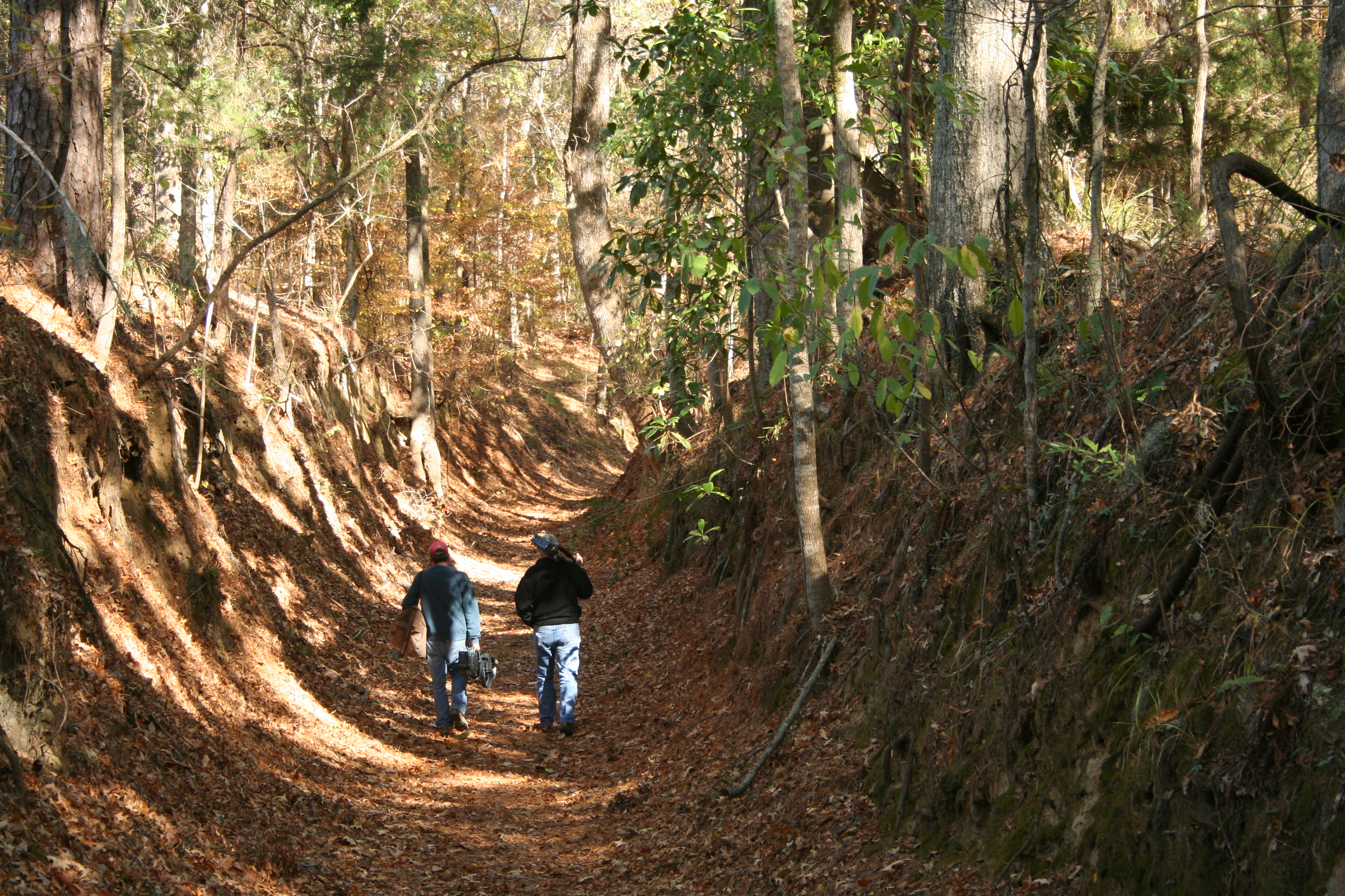
Potkopinu (Pot-cop-i-new), the southernmost section of the Natchez Trace National Scenic Trail, is only three miles long, but it is the longest stretch of "sunken" historic Trace remaining. Named for the Natchez word meaning "little valley." Thus trail cuts deep into the rich, fine-grained soil. It doesn't take much to erode this type of soil, and centuries of human and animal traffic have done an impressive job. This trail has some embankments over twenty feet high!
The land surrounding the trail is private property. Please stay on the trail at all times.
Safety Alert: Prepare to walk through water at stream crossings. Crossing conditions vary from muddy areas to knee-deep water, depending on rainfall.
Horses are not permitted on the Potkopinu section.
Contour map of the Potkopinu Section of the Natchez Trace National Scenic Trail
Camping is not permitted along this section of trail. All camping must take place in designated campgrounds unless you received a special use permit in advance. See Camping along the Natchez Trace Parkway for additional information.
See Maps for basic maps of all five developed sections of the Natchez Trace National Scenic Trail.
See Alerts & Conditions for additional information.
Trailheads on the Potkopinu Section of the Natchez Trace National Scenic Trail
Northern Terminus Trailhead at Road 553(near Milepost 20): This trailhead is the larger of the two for Potkopinu. Vehicles may be parked parallel to the road. If you have an oversized vehicle this is the only place to park to access this trail. To reach this trailhead exit the Parkway at Milepost 20. Turn left (east) on Road #553 known as River Road. Turn right onto a dirt road and travel a short distance and parking is on the right.
Southern Terminus Trailhead at Milepost 17: This trailhead has room for a few cars. There is no overflow parking at this location. This locations is not recommended for oversized or recreational vehicles. Follow the signs on the Parkway to reach this trailhead. You will travel on dirt roads to reach the trailhead.
Accessibility This trail stretches for 3 miles in total. The trail is about 3 to 4 feet wide and goes over uneven terrain. The trail can get muddy due to use as well as after rainfall. There are several stream crossings along the trail as well that vary from muddy to knee-deep depending on rainfall.
Trailhead NST - Blackland Prairie Section Trail 317 ft Drive there
ViewsHistoryPicnic areas
Along the way War of 1812 Burns Branch Picnic Area Carter Lane Picnic Area Garrison Creek Picnic Area Highway 7 Picnic Area War of 1812 Picnic Area Garrison Creek Overlook
Trailheads NST - Garrison Creek Section Trail 690 ft Drive there · NST - Highland Rim Section Trail 888 ft Drive there · NST - Highland Rim Section Trail 985 ft Drive there · NST - Highland Rim Section Trail 555 ft Drive there · NST - Highland Rim Section Trail 722 ft Drive there · NST - Highland Rim Section Trail 760 ft Drive there · NST - Highland Rim Section Trail 824 ft Drive there
1-10 Hours · dogs allowed
Start Natchez Trace Parkway in Tennessee
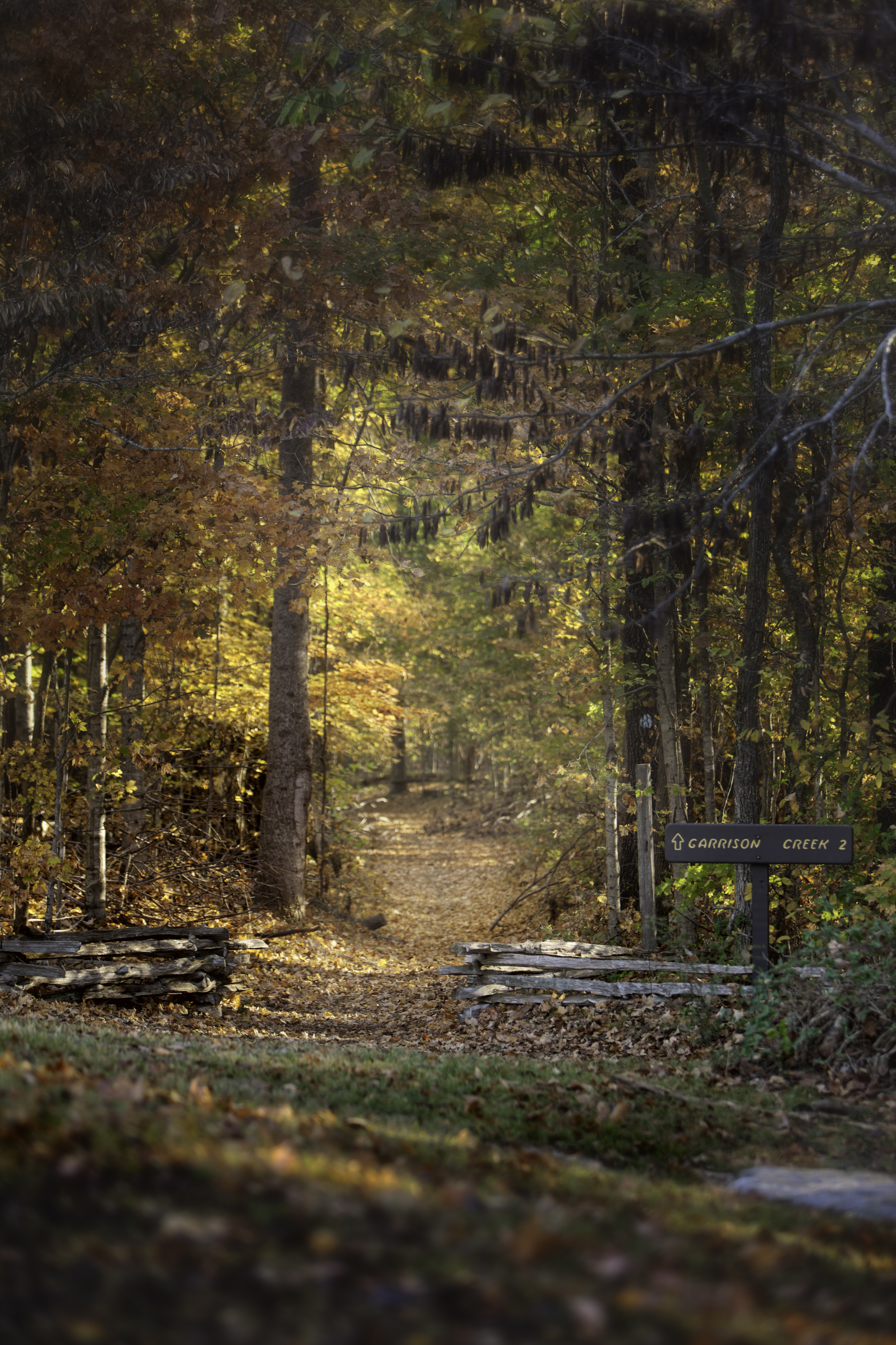
This twenty mile section is a popular hiking and equestrian corridor for visitors south of Nashville in Tennessee. Bicycles are prohibited on this trail. You can view a basic map of the Highland Rim section of the Natchez Trace National Scenic Trail here.
Camping is not permitted along this section of trail. All camping must take place in designated campgrounds. For more information about camping check Camping Along the Natchez Trace Parkway.
See Alerts & Conditions and Road and Site Status for additional information.
Areas on the Highland Rim Section of the Natchez Trace National Scenic Trail
Northern Terminus Trailhead at Garrison Creek (Milepost 427.6) : The Garrison Creek Trailhead is popular for both horseback riders and hikers alike. There is a designated parking area for horse trailers on the North end of the parking lot. Picnic tables and hitching posts are found near the Creek. Visitors will find drinking water near the restrooms. Hikers can start their walk from the trailhead near the restrooms, or at the trailhead near the picnic tables. As the northern terminus for the Natchez Trace National Scenic Trail, it is a great location to start a hike or trail ride.
War of 1812 Memorial (Milepost 426.3) : The War of 1812 Memorial, Milepost 426.3, honors the service and sacrifice of all brave volunteers who marched on the Natchez Trace during the War of 1812 especially those that are buried in unmarked graves up and down the Old Natchez Trace.
You can hike a roughly 1.3 mile section of the Old Natchez Trace here. This section is relatively flat through the shaded forest until you start to descend to the Garrison Creek trailhead.
Burns Branch (Milepost 425.4): This trailhead has parking for vehicles but not trailer parking and is not a staging area for horses. The site offers a hitching post and a picnic table to take a break if you would like.
Tennessee Valley Divide (Milepost 423.9): This trailhead parking is open to hikers only. As the scenic trail passes the parking lot, riders and hikers are rewarded with views of the Parkway, including vibrant blooms in the spring, and spectacular colors in the fall.
Carter Lane Picnic Area (Milepost 422.9): This picnic area is not accessible from the Natchez Trace Parkway. A hitching post and picnic table is available at this area. The large grassy area can become very muddy after rainfall.
Fly Trailhead on Highway 7 (Near Milepost 416): The Highway 7 Trailhead provides a small parking area for one or two horse trailers. If space is available, this will be a great starting point for just a few people. If there are numerous people riding together, the Highway 50 trailhead may be a better option. There is no water available at this trailhead. One hitching post is available here.
To reach the trailhead north of TN Hwy. 7, exit the Parkway at Milepost 416, turn left on Hwy. 7, then turn left on Old Natchez Trace Road. The trailhead is at the top of the hill on the left.
Shady Grove Trailhead on Hwy. 50, Southern Terminus (Near Milepost 408): This trailhead is a great place for hikers and horseback riders alike to start their journey on the Highland Rim Section of the Natchez Trace National Scenic Trail. There is ample parking for horse trailers, two hitching posts, and water available for horses. Visitors will need to get drinking water at the Gordon House, milepost 407.7.
This trailhead is located west of the Parkway on Totty Lane. Totty Lane is a gravel lane and ample parking is on your right once you pull onto Totty Lane.
Accessibility This trail stretches for 20 miles in total. The trail is about 3 to 4 feet wide and goes over uneven terrain. The trail can get muddy due to use as well as after rainfall. Please watch your step on steep sections of the trail at the Garrison Creek Trailhead
Trailhead West Florida Boundary Trail & NST - Yockanookany Section Trail 343 ft Drive there
HistoryPicnic areas
Along the way Dean Stand Dean Stand Picnic Area
Trailhead Dean Stand Trail 182 ft Drive there
Trailhead Grindstone Ford Trail 120 ft Drive there
Trailhead Sunken Trace Trail 185 ft Drive there
Trailhead NST - Rocky Springs Section Trail 187 ft Drive there
Picnic areas
Along the way Rocky Springs Picnic Area
Trailhead NST - Rocky Springs Section Picnic Area Spur Trail 241 ft Drive there
Waterfalls
Along the way Owens Creek Waterfall
Trailheads NST - Rocky Springs Section Campground Spur Trail 183 ft Drive there · NST - Rocky Springs Section Historic Trace Spur Trail 241 ft Drive there · NST - Rocky Springs Section Trail 229 ft Drive there
History
Along the way Boyd Site
Trailhead Boyd Mounds Trail 341 ft Drive there
Trailhead Southern Pines Self Guiding Trail 320 ft Drive there
Trailhead Cowles Mead Cemetery Trail 380 ft Drive there
Trailhead Cypress Swamp Self Guiding Trail 305 ft Drive there
History
Along the way Choctaw Agency
Trailhead Chisha Foka Multi-Use Trail 361 ft Drive there
Trailheads NST - Yockanookany Section Trail 319 ft Drive there · NST - Yockanookany Section Trail 343 ft Drive there · Southern Pines Self Guiding Trail 320 ft Drive there
1-15 Hours · dogs allowed
Start North of Jackson, MS on the Natchez Trace
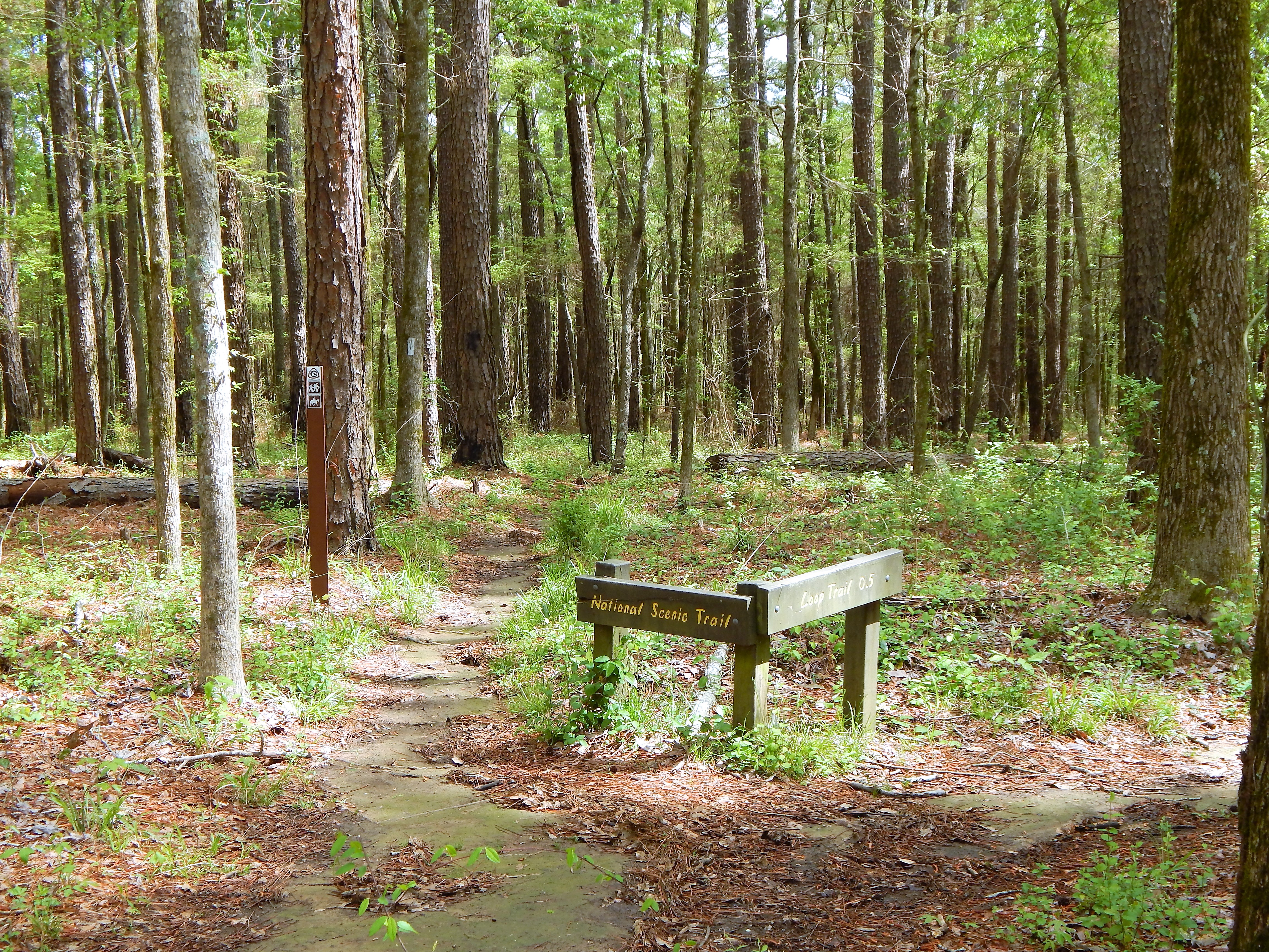
North of Jackson, Mississippi the Yockanookany section of the Natchez Trace National Scenic Trail is the longest of the five developed trail sections at 26 miles. Eight miles run alongside the Ross R. Barnett Reservoir, and the other sixteen miles go through dense forests, seasonal streams and open pastureland.
There is a lot to see on this stretch of trail; many sites are accessible via short side trails (you may have to cross the parkway). The trail parallels the parkway roadbed; use caution at all times, especially at bridge crossings, where you must walk along the Parkway road.
Camping is not permitted along this section of trail. All camping must take place in designated campgrounds unless you received a special use permit in advance. See Camping on the Natchez Trace Parkway for additional information.
See Maps for additional information.
See Alerts & Conditions and Road and Site Status for additional information.
Areas on the Yockanookany Section of the Natchez Trace National Scenic Trail
Northern Terminus Trailhead at Yockanookany (Milepost 130.9): The Yockanookany trailhead is the northern terminus of the Yockanookany Section of the Natchez Trace National Scenic Trail. This trailhead is open to hikers only. From this trailhead, the southern terminus at West Florida Boundary is about 26 miles away. To access the trailhead from the parking area walk south from the parking area several hundred feet until you see the Natchez Trace National Scenic Trail sign on your right.
Upper Choctaw Boundary (Milepost 128.4): Hikers can access the Yockanookany section of the Natchez Trace National Scenic Trail from the short self-guided interpretive walk at the location.
Cypress Swamp (Milepost 122): The Cypress Swamp Trailhead is located directly across the paved Parkway from the Cypress Swamp site. Hikers may hike south 14.1 miles to the West Florida Boundary, north 8.9 miles to the Yockanookany Trailhead, or any distance they chose on this out and back trail.
Highway 43 Trailhead (near Milepost 114.9): This is a the only staging area for horses on this section of the Natchez Trace National Scenic Trail. There is ample room for parking trailers, and water is available for horses to drink at this trailhead. Riders can travel north 16 miles to the northern terminus at Yockanookany, or south seven miles to the southern terminus at the West Florida Boundary.
To reach the Mississippi Hwy. 43 trailhead, exit the Parkway at Milepost 115; go west on MS Hwy 43 a short distance to Yandell Road; turn left (south) for 100 feet; turn left into the parking area.
Southern Terminus Trailhead at the West Florida Boundary (milepost 107.9): The West Florida Boundary Trailhead is the southern terminus of the Yockanookany Section of the Natchez Trace National Scenic Trail. This parking area and trailhead is for hikers only. Hikers may chose to walk a short loop on the nature trail or continue for 26 miles to the northern terminus of this section at the Yockanookany Trailhead.
Accessibility This trail stretches for 26 miles in total. The trail is about 3 to 4 feet wide and goes over uneven terrain. The trail can get muddy due to use as well as after rainfall.
ViewsHistoryPicnic areas
Along the way Brashears Stand Site Brashears Stand Picnic Area Old Trace Overlook
Trailhead Brashears Stand Trail 297 ft Drive there
History
Along the way Rocky Springs Church and Cemetery
Trailhead Rocky Springs Town Site Self Guiding Trail 279 ft Drive there
Trailhead Rocky Springs Trail 273 ft Drive there
1-12 Hours · dogs allowed
Start Natchez Trace Parkway, north of Port Gibson, Mississippi
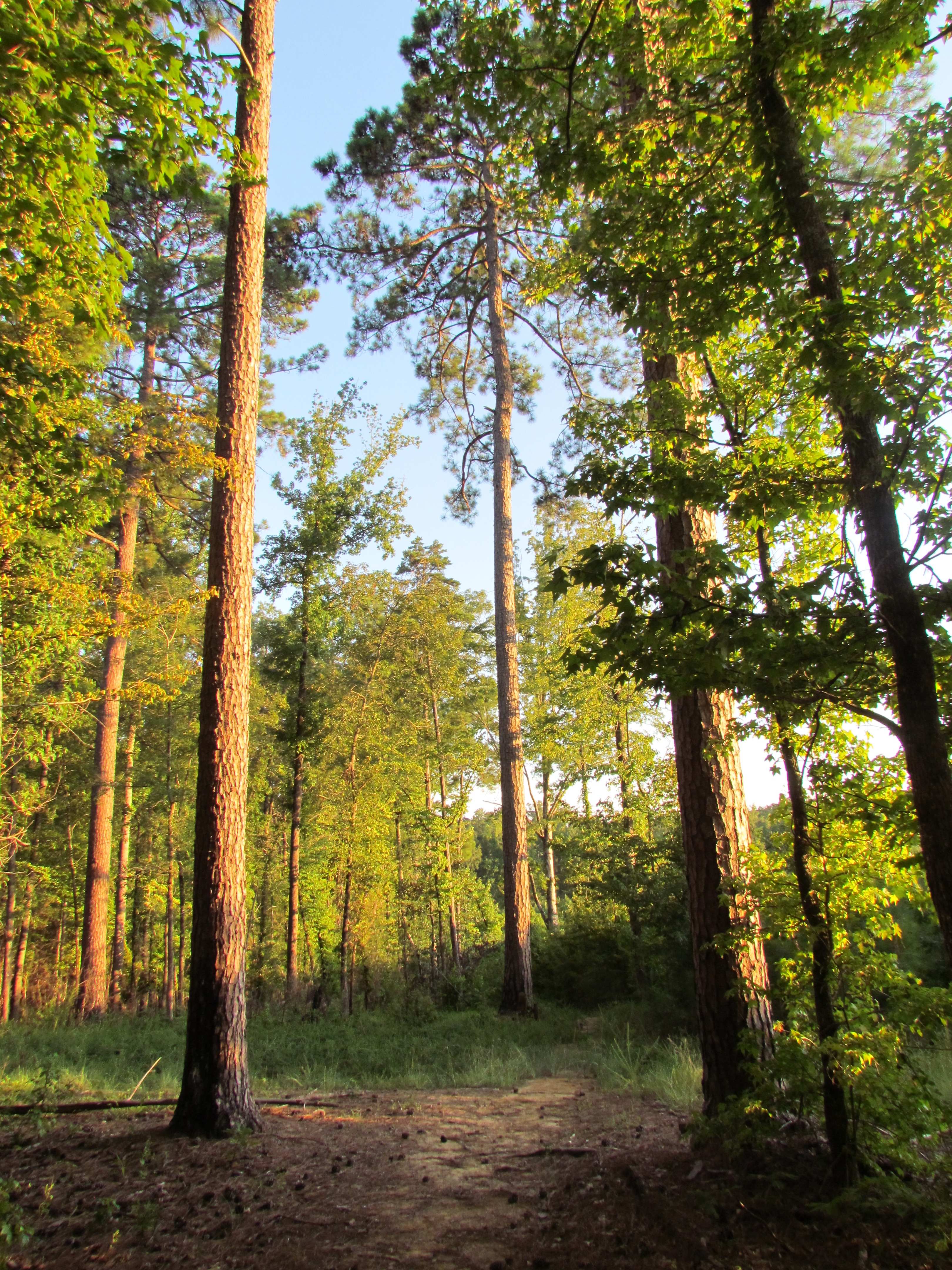
The Rocky Springs Section of the Natchez Trace National Scenic Trail is a little over 6 mile section located near Port Gibson, Mississippi. You can pick up a Natchez Trace National Scenic Trail brochure by visiting the Natchez Trace Parkway Visitor Center at Mount Locust, Milepost 15.5. Check Mount Locust visitor hours here.
This trail crosses gently rolling forested land. At Rocky Springs, a side trail leads to the remains of the old town , including a church and cemetery. The church and cemetery are off Parkway property.
South of Rocky Springs the trail is moderately strenuous in places--up and down through deep ravines. Near the south terminus at Owens Creek is a good spot to sit quietly and listen to the forest.
Camping is not permitted along this section of trail. All camping must take place in designated campgrounds. Rocky Springs Campground is located very close to the trail. See Camping along the Natchez Trace Parkway for additional information.
See Maps for additional information.
See Alerts & Conditions for additional information.
Areas on the Rocky Springs Section of the Natchez Trace National Scenic Trail
Northern Terminus Trailhead at Hwy27/Fisher Ferry Road (near Milepost 59): This trailhead is an excellent staging area for horseback riders. There is ample parking for trailers. This is the only area for horses to stage on this section of trail. There is no water available at this location. Horseback riders will be riding on the road shoulder for part of this trail.
To get to this trailhead exit the Parkway at Milepost 59 and follow the signs to the Natchez Trace National Scenic Trail Parking.
Rocky Springs Picnic Area (Milepost 54.8): This trailhead is accessible to hikers only. Hikers can take the trail from the picnic area, and continue north eight miles to the northern terminus or continue south two and one half miles to the southern terminus at Owens Creek. The southern portion of trail takes you over rocky outcroppings and on steep ridges. This trailhead has the most amenities and parking available on this section of Natchez Trace National Scenic Trail.
Southern Terminus at Owens Creek (Milepost 52.4): Owens Creek is the southern terminus of the Rocky Springs Section of the Natchez Trace National Scenic Trail. This trailhead is available to hikers. You can start here and hike 6 miles north to the northern terminus of the Rocky Springs Section of the Natchez Trace National Scenic Trail. This area can be unstable due to erosion. Please see Alerts & Conditions before hiking and respect all trail closures.
Accessibility This trail has an average width of 3 feet. The composite of the trail varies from grass, gravel, wooden boardwalks. The trail is 6 miles in total length. South of Rocky Springs the trail is moderately strenuous in places--up and down in terrain through deep ravines.
Trailhead Sinkhole Trail 557 ft Drive there
Trailhead Beech Springs Self Guiding Trail 317 ft Drive there
Trailhead Dogwood Valley Self Guiding Trail 419 ft Drive there
Trailhead Donivan Slough Trail 319 ft Drive there
Picnic areas
Along the way Jourdan Creek Picnic Area
Trailhead Jourdan Creek Trail 367 ft Drive there
ViewsHistoryLakes
Along the way Chickasaw Village Old Town Lake Old Town Overlook
Trailheads Chickasaw Village Self Guiding Trail / NST Blackland Prairie Section Trail 308 ft Drive there · NST - Blackland Prairie Section Trail 317 ft Drive there · NST - Blackland Prairie Section Trail 319 ft Drive there
1-6 Hours · dogs allowed
Start Tupelo, Mississippi
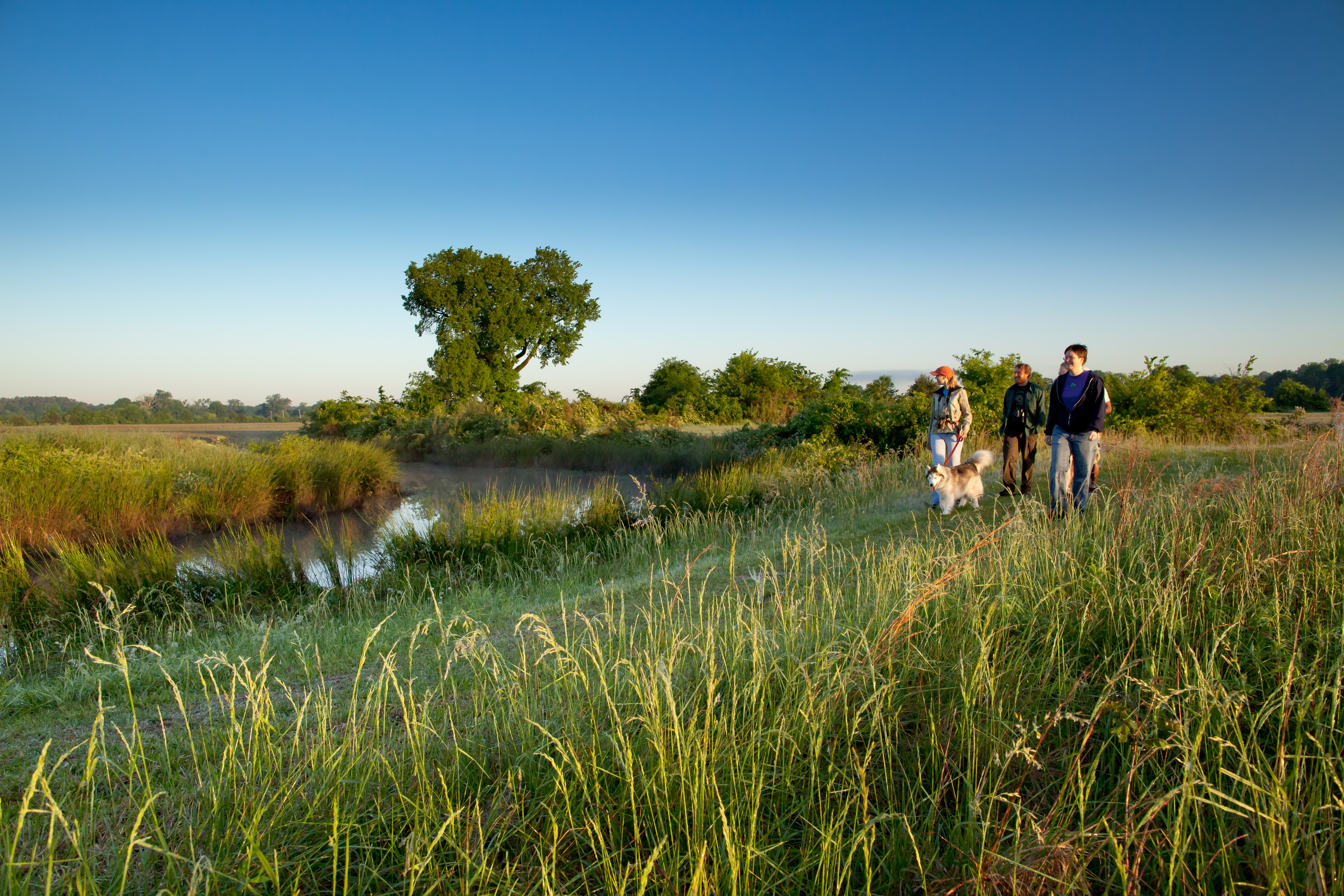
In and around Tupelo, Mississippi, this six mile section is a popular hiking and equestrian corridor for visitors. Bicycles are prohibited on this trail. You can pick up a Natchez Trace National Scenic Trail brochure by visiting the Natchez Trace Parkway Visitor Center near the northern terminus trail head at Milepost 266 on the Natchez Trace Parkway. Check Parkway Visitor Center hours here
This trailhead is open to both hikers and horseback riders. This is the only staging area for horseback riders on the Tupelo section of Scenic Trail. A 3.5-mile loop trail is available for horseback riders.
Safety Information
At the following road crossing; creek crossing at milepost 264.5 and US 178 (McCullough Blvd.) crossing at Milepost 262.5, you must walk up to the Parkway and follow the road’s shoulder. Also be extremely careful at the railroad track crossing north of Chickasaw Village. See Alerts & Conditions and Road Site and Status for additional information.
Areas on the Trail
Northern Terminus Trailhead (Milepost 266): This trailhead is located just across the Parkway from the Natchez Trace Parkway Visitor Center. Hikers can travel six miles along the outskirts of Tupelo (12 miles roundtrip). You can make the walk as long or as short as you would like on this out and back trail. This section of Scenic Trail is open to hikers only and requires walking on the Parkway for road and creek crossings.
Old Town Overlook (Milepost 263.9): Hikers can continue north for 2 miles to reach the Parkway Visitor Center or continue south for 2 miles to reach the Chickasaw Village Site. This section of Scenic Trail is open to hikers only and requires walking on the Parkway for road and creek crossings.
Chickasaw Village (Milepost 261.8): The Chickasaw Village Site provides hikers access to the Natchez Trace National Scenic Trail, as well as a one-half mile interpretive trail. The half mile trail identifies plants and their uses by American Indians, especially the Chickasaw. Visitors can continue north to the Old Town Overlook and Visitor Center or can make a loop by using the horse trail and hiking trail. This section of Scenic Trail requires walking on the Parkway for road and creek crossings. The trail on the south side of the prairie is closed due to storm damage.
Directions
From the Natchez Trace Parkway, exit onto Highway 6 at Milepost 260. Travel west on MS Highway 6 for approximately ½ mile to Air Park Road. Turn right and travel north to the end of the road at Jackson Street. Turn right on Jackson Street. A paved parking/staging area is on the left.
Accessibility This trail has an average width of 3 feet. The composite of the trail varies from grass, gravel, wooden boardwalks and pavement. The trail is 6 miles in total length.
Campgrounds
Along the way Tupelo Bicycle Only Campground
History
Along the way Confederate Gravesites and Old Trace
Trailhead Confederate Gravesites Trail 328 ft Drive there
Picnic areas
Along the way Tenn-Tom Picnic Area
Trailhead Tenn-Tom Waterway Trail 340 ft Drive there
Picnic areasVisitor centers
Along the way Visitor Center Picnic Area Parkway Visitor Center Tupelo Visitor Center
Trailhead Beech Springs Self Guiding Trail 317 ft Drive there
HistoryPicnic areas
Along the way War of 1812 War of 1812 Picnic Area
Trailhead West Florida Boundary Trail & NST - Yockanookany Section Trail 343 ft Drive there
1 more mapped segment without a name is on the map, not in the list.
Write-ups that name no single mapped trail, in the Service's words.
The lines are the National Park Service's public trails layer, the trailheads and the waterfalls, views, peaks and historic places along them the Service's public points of interest, read 2026-10-14 and simplified for the map. The write-ups are the Service's own "things to do", unedited. Heights come from USGS 3DEP through Terrain Tiles on AWS (Mapzen/Tilezen), read along each line and rounded; a short trail on steep ground can be off by a few tens of feet. Closures change: check the park's own site before you go.