
National Park · Kentucky
Trails in Mammoth Cave National Park
53 named trails · 80 miles · 1 trailhead · 3 with the Park Service's own write-up. The lines, trailheads and points are the Park Service's; the write-ups are the Service's own words; the climbing is read from USGS elevation along each line.
53 trails, A to Z.
Bluffs Campsite Trail
Backcountry camps
Along the way Back Country Site Bluffs Backcountry Campsite
Bluffs Trail
ViewsPicnic areas
Along the way Picnic Area Overlook
BTRL-First Creek Backcountry Surface Trail
Backcountry camps
Along the way Back Country Site First Creek 1 Backcountry Campsite
BTRL-White Oak Backcountry Surface Trail
Backcountry camps
Along the way White Oak Backcountry Campsite
Buffalo Trail
History
Along the way Miles-Davis Cemetery
Collie Ridge Campsite Trail
Backcountry camps
Along the way Back Country Site Collie Ridge Backcountry Campsite
Collie Ridge Trail
History
Along the way Cemetery / Graveyard
CTRL Cave Trails
ViewsVisitor centers
Along the way Overlook Visitor Center
Echo River Spring Trail
Ferguson Campsite Trail
Backcountry camps
Along the way Back Country Site Ferguson Backcountry Campsite
First Creek 1 Trail
Backcountry camps
Along the way Back Country Site First Creek 1 Backcountry Campsite
First Creek 2 Trail
Backcountry camps
Along the way Back Country Site First Creek 2 Backcountry Campsite
First Springs Campsite 1 Trail
Backcountry camps
Along the way Back Country Site First Creek 2 Backcountry Campsite
FTRL-Cedar Sink Front Country Trail
Explore Wildflowers at Cedar Sink the Park Service's write-up
45-60 Minutes · dogs allowed · Spring, Summer, Fall
Start Cedar Sink Trailhead
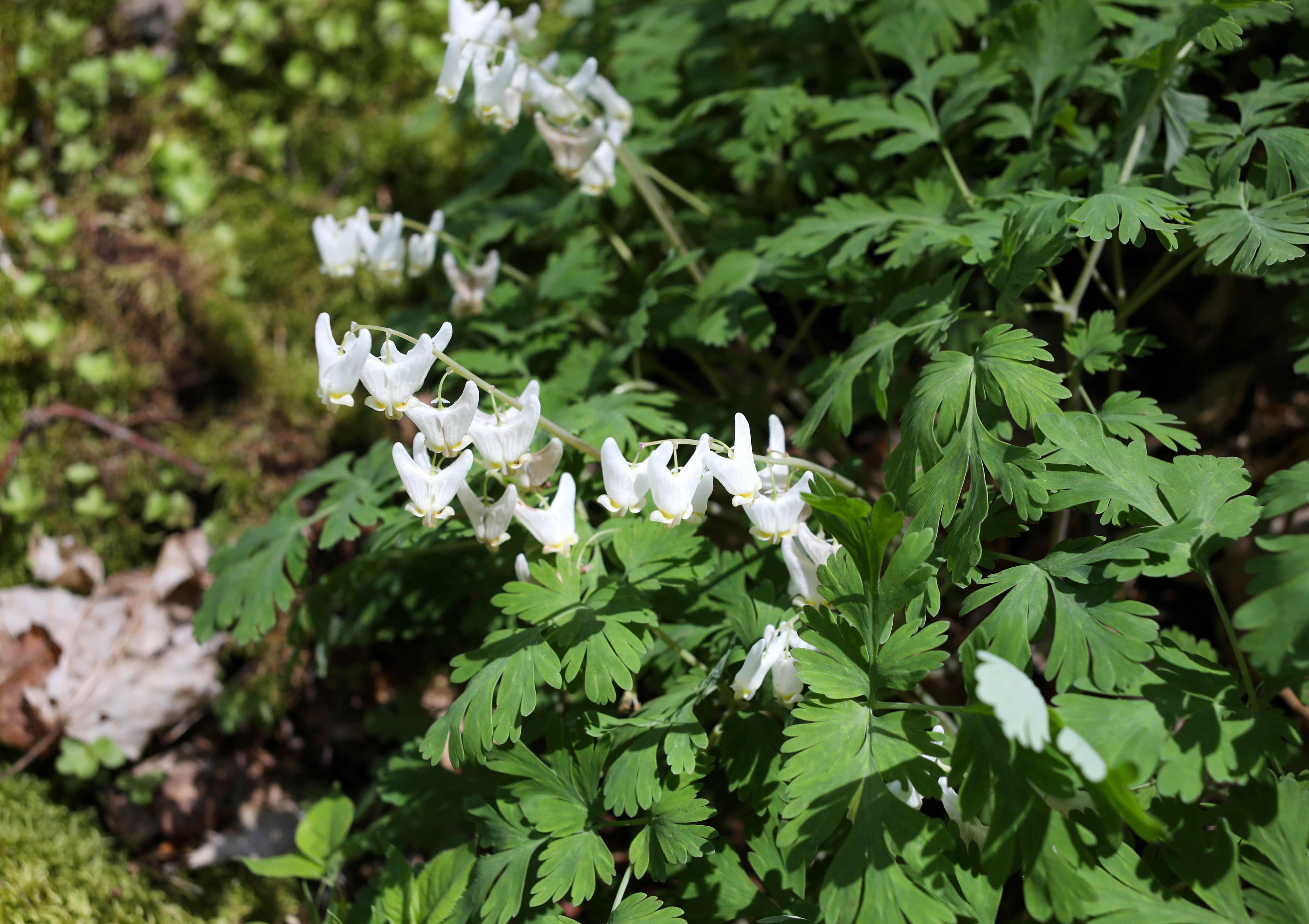
Mammoth Cave National Park is home to an incredible variety of seasonal wildflowers due to the abundance of forest habitats. One such place an enormous sinkhole called Cedar Sink. It hosts a stunning variety of spring and summer wildflowers, making it a favorite spot for hikers and floral enthusiasts.
The hike is 1-mile roundtrip, with several sets of stairs that will lead you down into the sink hole and back out. A total of 295 stairs will be traveled during the hike.
Accessibility Cedar Sink trail is not accessible for all visitors. The trail to Cedar Sink is a rolling dirt path, roughly 6 feet wide. This section extends for approximately 0.75 miles before arriving at the sink. To enter the Cedar, visitors must descend 150 feet of stairs and return up another 150 feet of stairs at the other end of the sinkhole. Once inside the sinkhole, footing is fairly flat and stable. Parking is at located at the trailhead, and may fill up quickly depending on visitation. Service animals are welcome on this trail.
FTRL-Turnhole Bend Front Country Trail
Backcountry camps
Along the way Back Country Site Turnhole Bend Backcountry Campsite
Good Springs Loop Trail
Good Springs Trail
Green River Ferry
CampgroundsBoat launches
Along the way Boat Launch Miss Green River Green River River Floodplain Campsites
Green River Trail
Take a Ridge-top Walk to Sunset Point the Park Service's write-up
30-60 Minutes · dogs allowed
Start Heritage Trail Trailhead
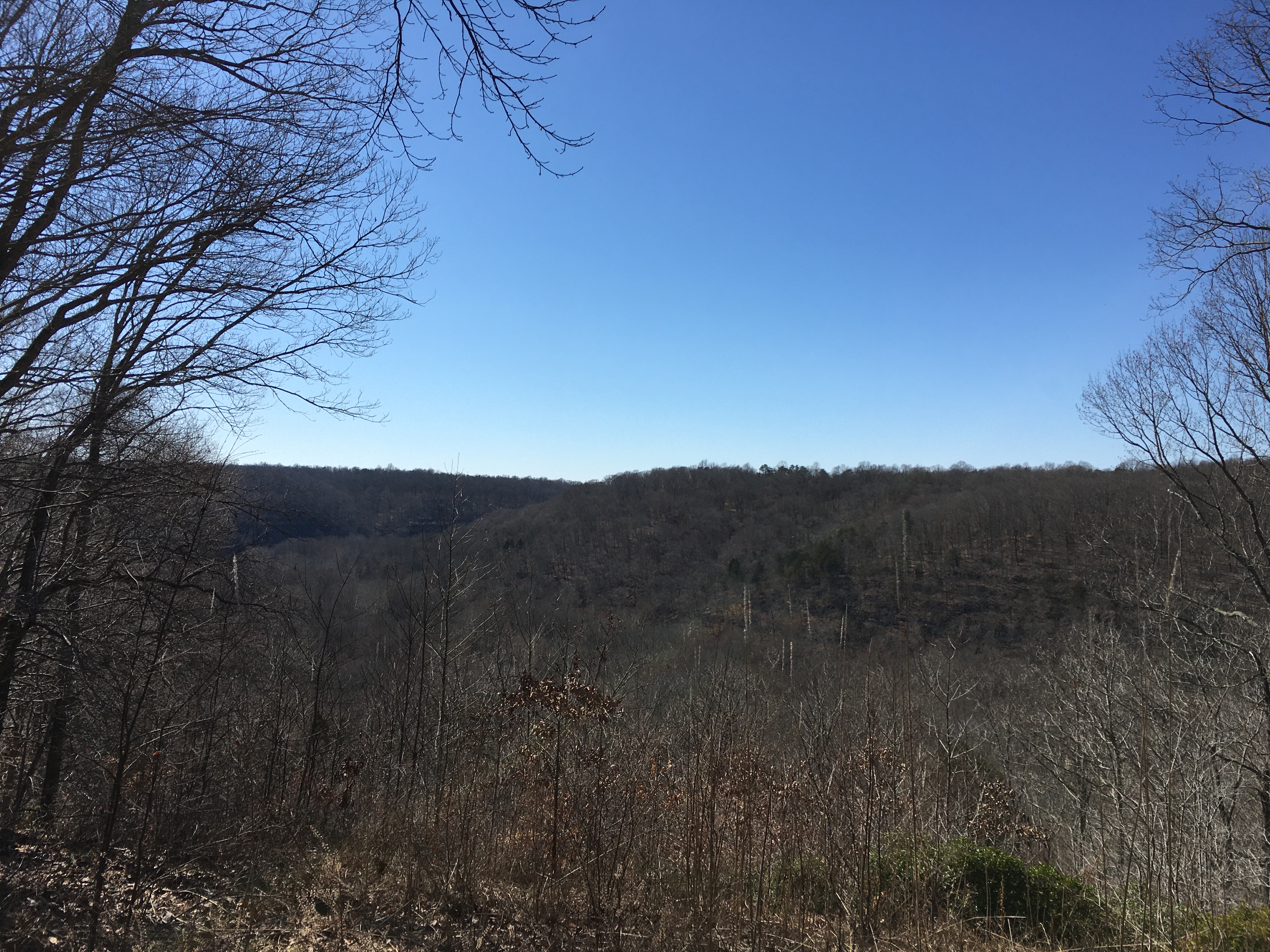
Above the winding underground passages of Mammoth Cave, you can gaze over the hills and valleys that make up our Kentucky karst landscape.
Take an easy stroll to Sunset Point to enjoy a park-favorite panorama of the Green River Valley where you can catch the best views of fresh spring foliage and vivid autumn colors.
Accessibility The Heritage Trail is appropriate for all visitors and all ranges of mobility. The first .5 miles of the trail is a raised, wooden walkway, accessible by low grade ramps at the beginning for the trail. The remaining .1 mile of the trail is a flat, stable cement loop, also appropriate for all visitors. The trail is approximately 6 feet wide with, railings available and benches readily available. There are waysides along the trail, though they do not offer braille and audio options. Accessible parking is available alongside the Lodge at Mammoth Cave, within 100 yards from the trail. Service animals are welcome along this trail.
Hercules/Amphitheater
Heritage Trail
ViewsHistory
Along the way Old Guides Cemetery Sunset Point
Homestead Campsite Trail
Backcountry camps
Along the way Back Country Site Homestead Backcountry Campsite
J And J Connector Trail
Mammoth Cave Railroad Bike and Hike Trail
HistoryBackcountry campsPicnic areas
Along the way Mammoth Cave Campground Mammoth Cave Campground Mammoth Cave Campground Mammoth Cave Campground Mammoth Cave Campground Mammoth Cave Campground Mammoth Cave Campground Mammoth Cave Campground Mammoth Cave Campground Mammoth Cave Campground Mammoth Cave Campground Furlong Cemetery and 1 more
Trailhead Sloans Crossing 830 ft Drive there
Mammoth Dome Sink Trail
Mccoy Hollow Campsite Trail
Backcountry camps
Along the way Back Country Site Mccoy Hollow Backcountry Campsite
McCoy Hollow Trail
Backcountry camps
Along the way Back Country Site Mammoth Cave Campground Three Springs Backcountry Campsite
Old Guides Cemetery
History
Along the way Old Guides Cemetery
Old Guides Trail
Pathway
Backcountry campsVisitor centers
Along the way Mammoth Cave Campground Mammoth Cave Campground Mammoth Cave Campground Mammoth Cave Campground Mammoth Cave Campground Mammoth Cave Campground Mammoth Cave Campground Mammoth Cave Campground Mammoth Cave Campground Mammoth Cave Campground Mammoth Cave Campground Mammoth Cave Campground and 2 more
Raymer Hallow Trail
Raymer Hollow Campsitetrail
Backcountry camps
Along the way Back Country Site Raymer Hollow Backcountry Campsite
Raymer Hollow Trail
Raymer Hollow-Good Springs Connector
Sal Hallow Trail
Backcountry camps
Along the way Back Country Site Sal Hollow Backcountry Campsite
Sal Hollow Campsite Trail
Backcountry camps
Along the way Back Country Site Sal Hollow Backcountry Campsite
Sand Cave Trail
Second Creek Campground Trail
Backcountry camps
Along the way Back Country Site Second Creek Backcountry Campsite
Second Creek Trail
Backcountry camps
Along the way Back Country Site Second Creek Backcountry Campsite
Sidewalk
Backcountry camps
Along the way Mammoth Cave Campground
Sloans Crossing Pond Walk
Picnic areas
Along the way Picnic Area
Trailhead Sloans Crossing 830 ft Drive there
Sunset Point Trail
Views
Along the way Sunset Point
Take a Ridge-top Walk to Sunset Point the Park Service's write-up
30-60 Minutes · dogs allowed
Start Heritage Trail Trailhead
Above the winding underground passages of Mammoth Cave, you can gaze over the hills and valleys that make up our Kentucky karst landscape.
Take an easy stroll to Sunset Point to enjoy a park-favorite panorama of the Green River Valley where you can catch the best views of fresh spring foliage and vivid autumn colors.
Accessibility The Heritage Trail is appropriate for all visitors and all ranges of mobility. The first .5 miles of the trail is a raised, wooden walkway, accessible by low grade ramps at the beginning for the trail. The remaining .1 mile of the trail is a flat, stable cement loop, also appropriate for all visitors. The trail is approximately 6 feet wide with, railings available and benches readily available. There are waysides along the trail, though they do not offer braille and audio options. Accessible parking is available alongside the Lodge at Mammoth Cave, within 100 yards from the trail. Service animals are welcome along this trail.
Three Springs Campsite Trail
Backcountry camps
Along the way Back Country Site Three Springs Backcountry Campsite
Turnhole Bend Hiking Trail
Wet Prong Connector
Wet Prong Loop
Wet Prong Of Buffalo Loop Trail
Wet Prong of Buffalo Trail
Wet Prong Trail
Wet Prong-Mccoy Hollow Spur
White Cave Trail
Backcountry camps
Along the way Mammoth Cave Campground
Whites Cave Trail
6 more mapped segments without a name are on the map, not in the list.
About these trails
The lines are the National Park Service's public trails layer, the trailheads and the waterfalls, views, peaks and historic places along them the Service's public points of interest, read 2026-10-14 and simplified for the map. The write-ups are the Service's own "things to do", unedited. Heights come from USGS 3DEP through Terrain Tiles on AWS (Mapzen/Tilezen), read along each line and rounded; a short trail on steep ground can be off by a few tens of feet. Closures change: check the park's own site before you go.