
National Memorial · Indiana
Trails in Lincoln Boyhood National Memorial
2 named trails · 2 miles · 1 with the Park Service's own write-up. The lines, trailheads and points are the Park Service's; the write-ups are the Service's own words; the climbing is read from USGS elevation along each line.
2 trails, A to Z.
Trail of the Twelve Stones
Hike the Boyhood Trail the Park Service's write-up
10-15 Minutes · dogs allowed
Start Boyhood Nature Trail

Begin your walk at the Pioneer Cemetery where Abraham Lincoln's mother, Nancy Hanks Lincoln , is buried. The existing headstone, erected in 1879, marks the burial spot of Abraham Lincoln’s mother, who died of milk sickness in 1818. Others who died of the disease are buried on the wooded knoll as well. In the late 19th century, the hilltop served as the Lincoln City cemetery and most of the marked graves date from that period.
The trail winds slowly down a hill through a secondary growth forest before entering the southwestern edge of the property once owned by Thomas Lincoln. As you enter the Thomas Lincoln farm, crop fields line the trail. Crops such as wheat, oats, tobacco, and cotton are often planted and can be seen growing in the fields. Rangers and volunteers in period dress might be seen working in the fields during the spring and summer months. The trail ends at the Lincoln Living Historical Farm .
Accessibility The trail has a steep incline from the North Parking lot to the Pioneer Cemetery. Trail surface is compacted creek rock. Average width is 8 feet with a typical grade of 10% (maximum grade is 13%). Cross slope is minimal.
Hike the Trail of Twelve Stones the Park Service's write-up
10-20 Minutes · dogs allowed
Start Trail of Twelve Stones
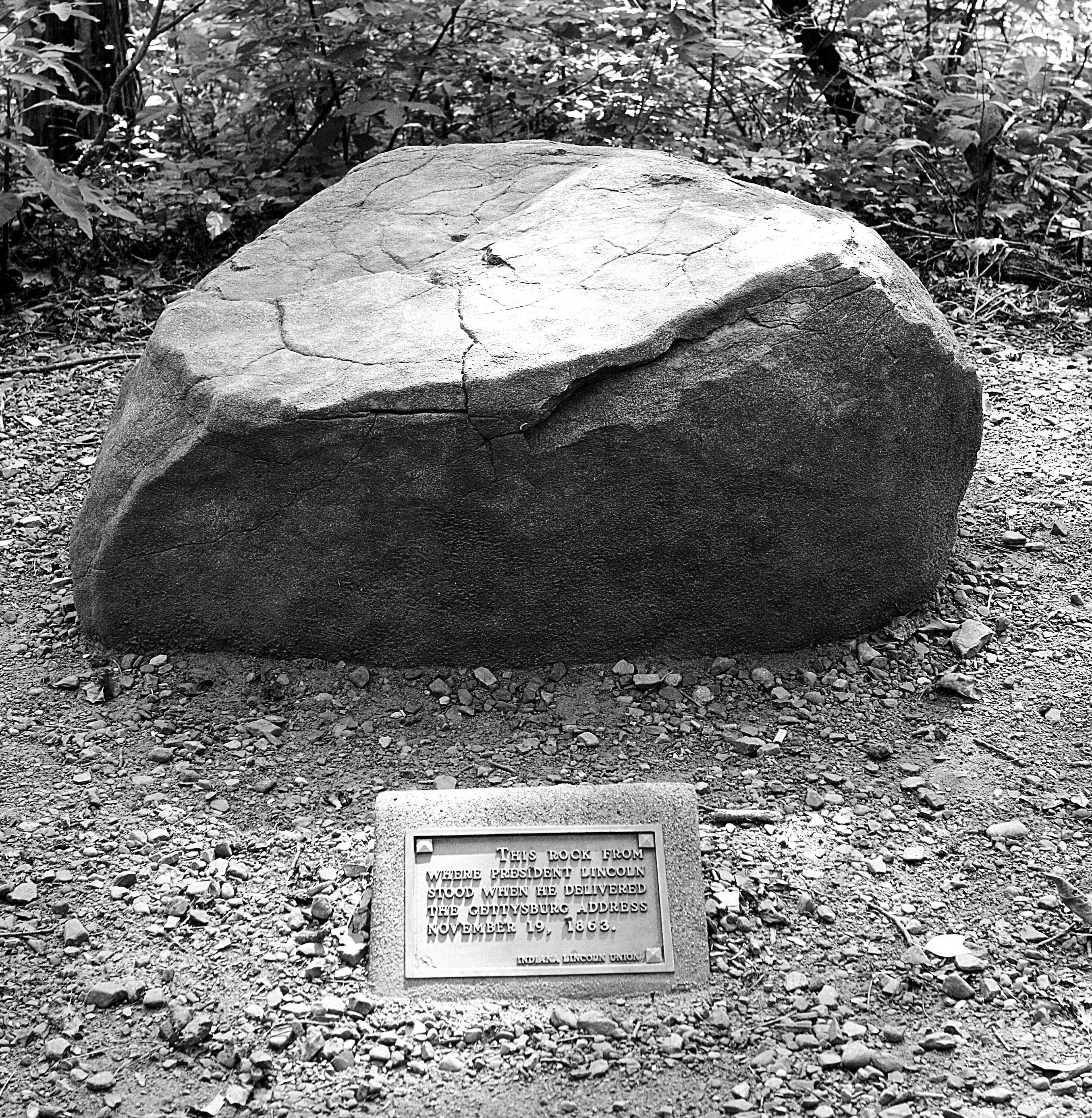
The Trail of Twelve Stones is a unique way to review some of the major events in Abraham Lincoln's life. Beginning just east of the Cabin Site Memorial, twelve historic stones are arranged in chronological order at irregular intervals. Small bronze tablets located near each stone, briefly explain the events in Lincoln's life associated with each of the memorial stones. There are stones from twelve locations beginning with his birthplace in Kentucky and ending with a stone left over from the Lincoln Tomb in Illinois.
The trail is 1/2 mile in length and was designed to start at the Living Historical Farm and end near the Pioneer Cemetery.
Accessibility Trail surface is compacted creek rock. Average width is 8 feet with a typical grade of 4% (maximum grade is 15%). Cross slope is minimal.
2 more mapped segments without a name are on the map, not in the list.
About these trails
The lines are the National Park Service's public trails layer, the trailheads and the waterfalls, views, peaks and historic places along them the Service's public points of interest, read 2026-10-14 and simplified for the map. The write-ups are the Service's own "things to do", unedited. Heights come from USGS 3DEP through Terrain Tiles on AWS (Mapzen/Tilezen), read along each line and rounded; a short trail on steep ground can be off by a few tens of feet. Closures change: check the park's own site before you go.