94 named trails · 259 miles · 23 with the Park Service's own write-up. The lines, trailheads and points are the Park Service's; the write-ups are the Service's own words; the climbing is read from USGS elevation along each line.
1.6 mi one way · about 350 ft of climbing · 2,731 ft–3,069 ft · earth surface · hiking
Hike Fortynine Palms Oasis the Park Service's write-up
2-3 Hours · no dogs · Winter, Spring, Fall
Start Fortynine Palms Oasis
Hiking Fortynine Palms Oasis Trail Photo: NPS / Preston Jordan
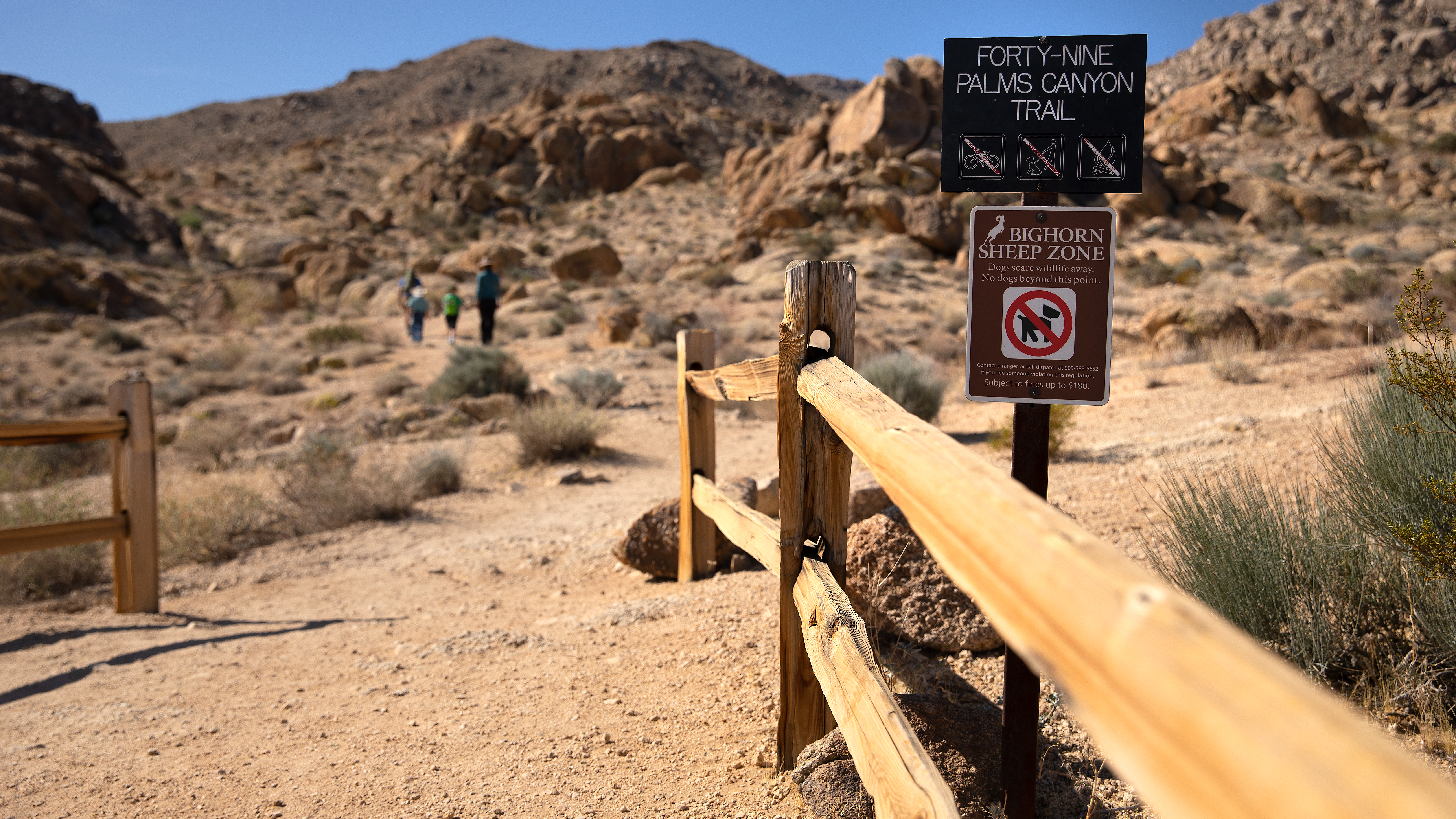
The Fortynine Palms Oasis Trail is a difficult three mile out and back hike with 300 feet of elevation gain in each direction. Located on the northern edge of the park off Highway 62 on Canyon Road, this trail climbs over a ridge and into a desert canyon and oasis. Hikers are rewarded with scenic views, abundant plant life, and the potential to see wildlife.
This oasis is a sensitive biological area, please follow posted signs and do not enter the oasis as this is a crucial water supply for plant and wildlife.
This trail has no shade and no cell service. Always check the weather forecast before heading into the park and consider changing plans if the weather conditions are too extreme. Before hiking, tell a safety buddy where you are going and when you plan on leaving the park.
Pets Pets are not allowed on this trail. Pets can be walked around the Oasis of Mara path in the town of Twentynine Palms.
Accessibility This trail is a mix of dirt, sand, and rock. This trail climbs over steep ridges with steps in both directions Pets are not allowed on this trail, but service animals are welcome. Service animals must remain on a 6-foot (1.8 meter) leash at all times.
0.5 mi one way · 80 ft of descent · 3,828 ft–3,909 ft · earth surface · hiking
Hike Arch Rock the Park Service's write-up
45-90 Minutes · no dogs · Winter, Spring, Fall
Start Arch Rock Trailhead
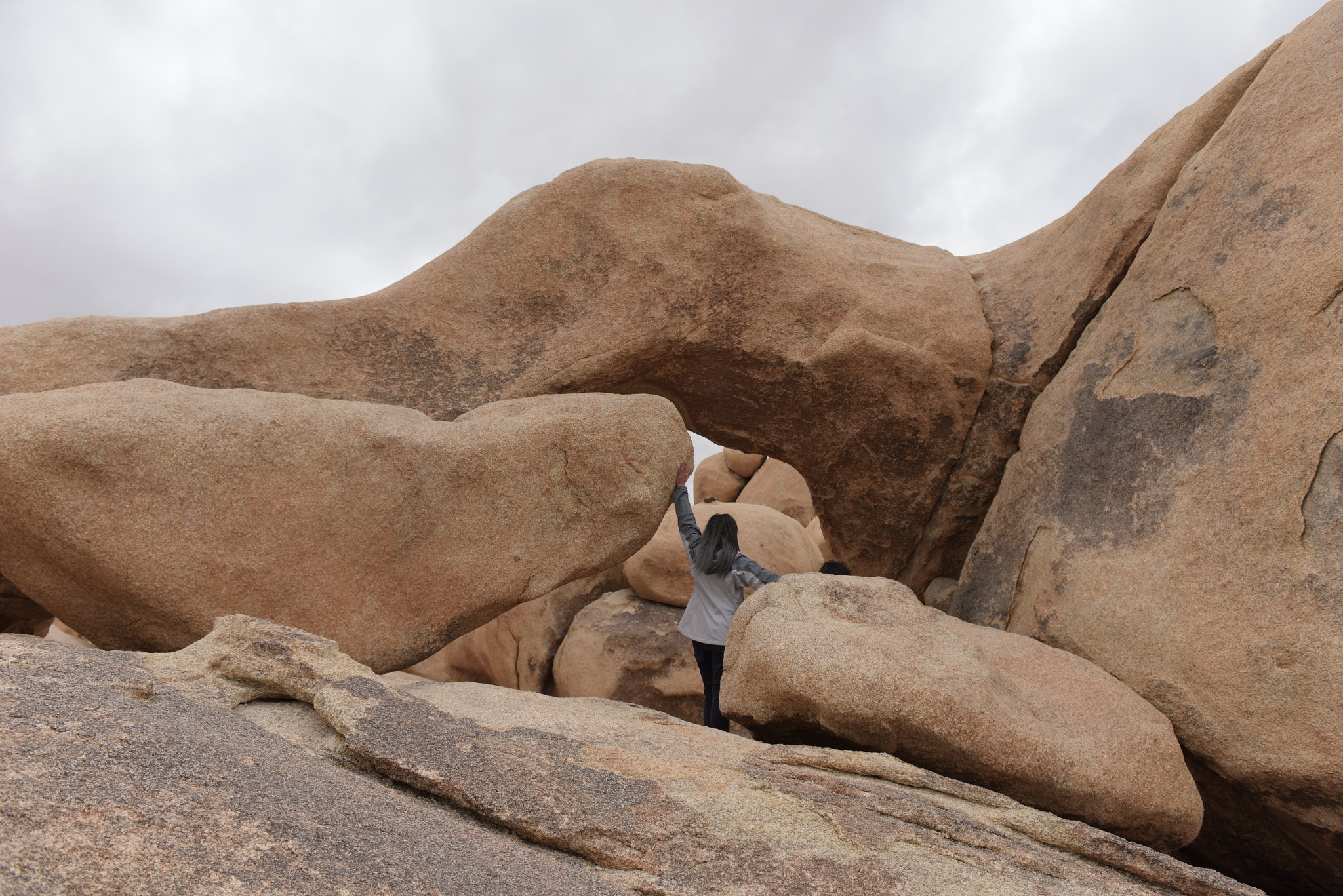
Hiker on the Arch Rock Trail Photo: NPS / Hannah Schwalbe
The Arch Rock Trailhead is in the Twin Tanks Parking Lot. The trail looks like a lollipop; the route heads in a straight line for .6-miles from the parking lot to the east, where it becomes a short loop. Hikers can take the loop in either direction, but hiking it counterclockwise is recommended because it is easier to spot the namesake arch from that direct. The loop is a short .2-miles and leads hikers back to the straightaway trail to the parking lot.
The arch is roughly .1-mile into the loop section and is a popular photography spot. The loop also has educational wayside signs along the trail describing the unique geology and characteristics in the area. The first part of the trail is mostly sandy, whereas the loop section is mostly rocky.
This trail has no shade and no cell service. Summer hikers should start this trail before 10 am and bring plenty of water. Always check the weather forecast before heading into the park and consider changing plans if the weather conditions are too extreme. Hikers should always tell a safety buddy where they are going and when they plan on leaving the park.
Pets Pets are not allowed on trails or in the backcountry. Please help us protect our wildlife by walking pets on-leash in campgrounds or on dirt roads.
Accessibility The Arch Rock Trail contains various terrain types, including deep sand, hard pack dirt, and uneven rocky surfaces. The trail is relatively flat and has a 100 feet total elevation change. The trail widens to a 4 feet across in some areas but is as narrow as 1-2 feet in certain areas. A section of the trail on the loop that is very rocky. The trail is not accessible for people using wheelchairs. Pets and emotional support animals are not allowed on trails, but service animals are welcome. Service animals must remain on a 6-foot (1.8 meter) leash at all times.
0.3 mi one way · 1,906 ft–1,917 ft · earth surface · hiking
Hike Bajada Trail the Park Service's write-up
15-30 Minutes · no dogs · Winter, Spring, Fall
Start Bajada Nature Trail
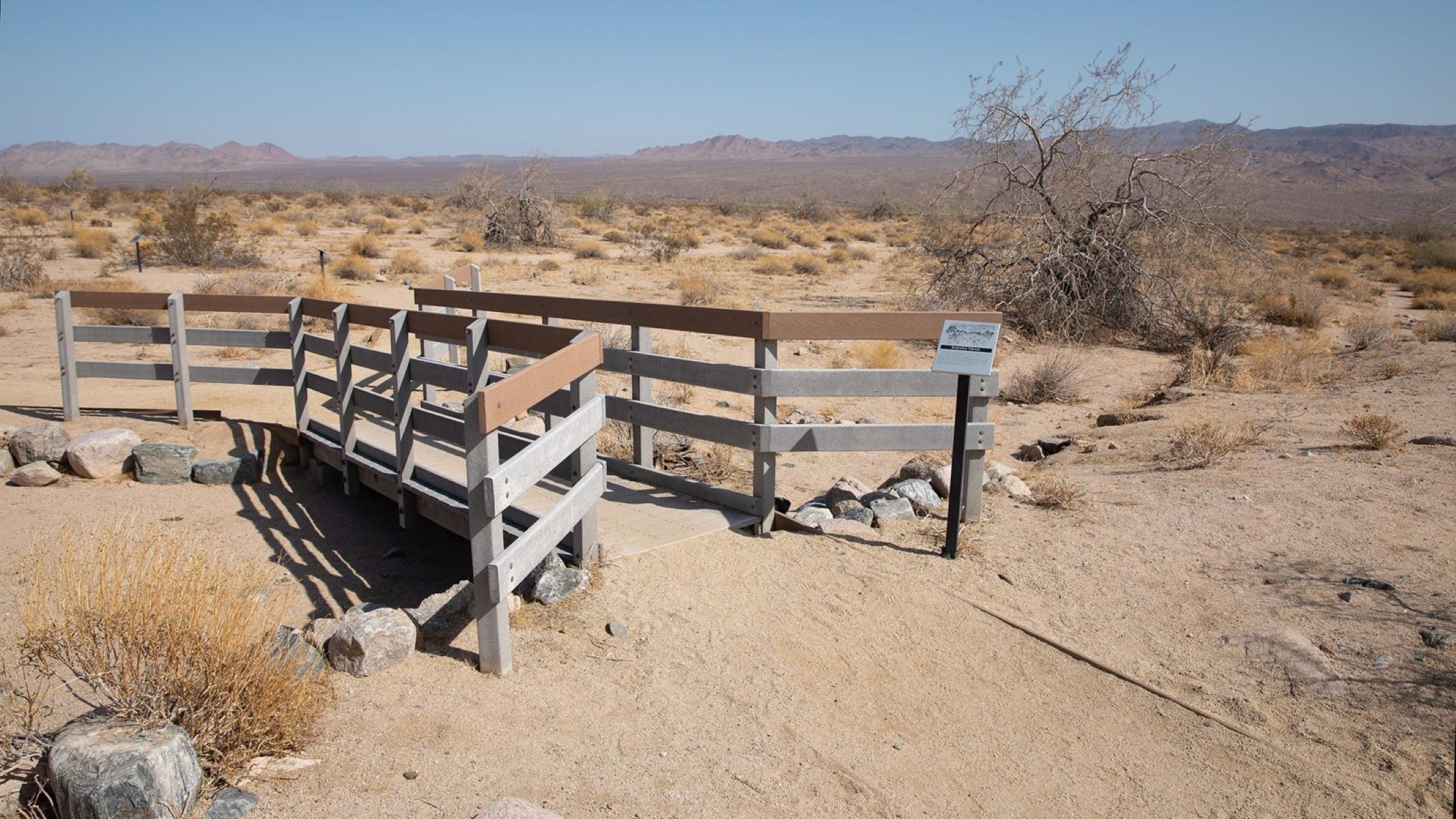
This short, easy trail highlights vegetation found in the Colorado desert. Photo: NPS / Preston Jordan Jr.
This short and flat, quarter-mile nature trail meanders through common vegetation found in the Colorado Desert. Along the trail are interpretive signs highlighting different plants and their adaptations and uses. The trail is located near the southern boundary of the park, south of the Cottonwood Visitor Center. It is much lower in elevation than most of the park and offers a unique showcase of plants highly adapted to extreme heat and little rain. Occasionally, after wet winters, this trail will offer vibrant displays of wildflowers in February and March.
Pets Pets and emotional support animals are not allowed on trails, but service animals are welcome. Service animals must remain on a 6-foot (1.8 meter) leash at all times.
Accessibility This trail has areas of deep sand and may not be suitable for all wheelchairs. Pets and emotional support animals are not allowed on trails, but service animals are welcome. Service animals must remain on a 6-foot (1.8 meter) leash at all times.
1.1 mi one way · about 70 ft of climbing · 4,253 ft–4,292 ft · earth surface · hiking
Hike Barker Dam Trail the Park Service's write-up
30-60 Minutes · no dogs
Hikers exploring the Barker Dam Nature Trail Photo: NPS / Kelsey Graczyk
The Barker Dam Trail is a relatively flat, 1.1-mile loop through the Mojave Desert. This trail will take you by monzogranite rock formations and boulders, Joshua trees, a wide range of plant life, the Barker Dam, and a rock art site. After periods of heavy rainfall, the Barker Dam reservoir will occasionally fill with water. Otherwise, the reservoir is typically dry most of the year.
Interpretive signs along the trail provide information about Barker Dam and the plants, animals, and people that call the desert home. The rock art site, a highlight of the trail, tells a story of the desert's human history. Do not climb on or otherwise disturb the rock art and the boulder the rock art lives on. Much of the rock art is not immediately visible and may exist on any portion of the rock, so please refrain from stepping on, climbing on, or touching any part of the rock formation. View the rock art from a respectable distance at the signage for the site.
Accessibility Barker Dam Trail begins on flat, compact dirt, but slowly begins to incline and transitions into granite boulders to step on or over. Some boulders have steps, other small boulders do not. The trail continues to a viewpoint of Barker Dam on top of a flat, granite boulder. From there, it transitions into a tight squeeze between or around boulders, down more granite steps, and into a sandy wash. The trail's average wide is three feet with an average grade of 1% and a max grade of 3%. This trail is not accessible for people using wheelchairs. The park prohibits strollers on this trail to protect the fragile desert ecosystem and prevent trail degradation. Pets are not allowed on this trail, but service animals are welcome. Service animals must remain on a 6-foot (1.8 meter) leash at all times.
8.0 mi one way · about 1,400 ft of climbing · 2,854 ft–4,184 ft · earth surface · hiking, horse
Hike Boy Scout Trail the Park Service's write-up
1-10 Hours · no dogs
Hikers on the Boy Scout Trail Photo: NPS / Hannah Schwalbe
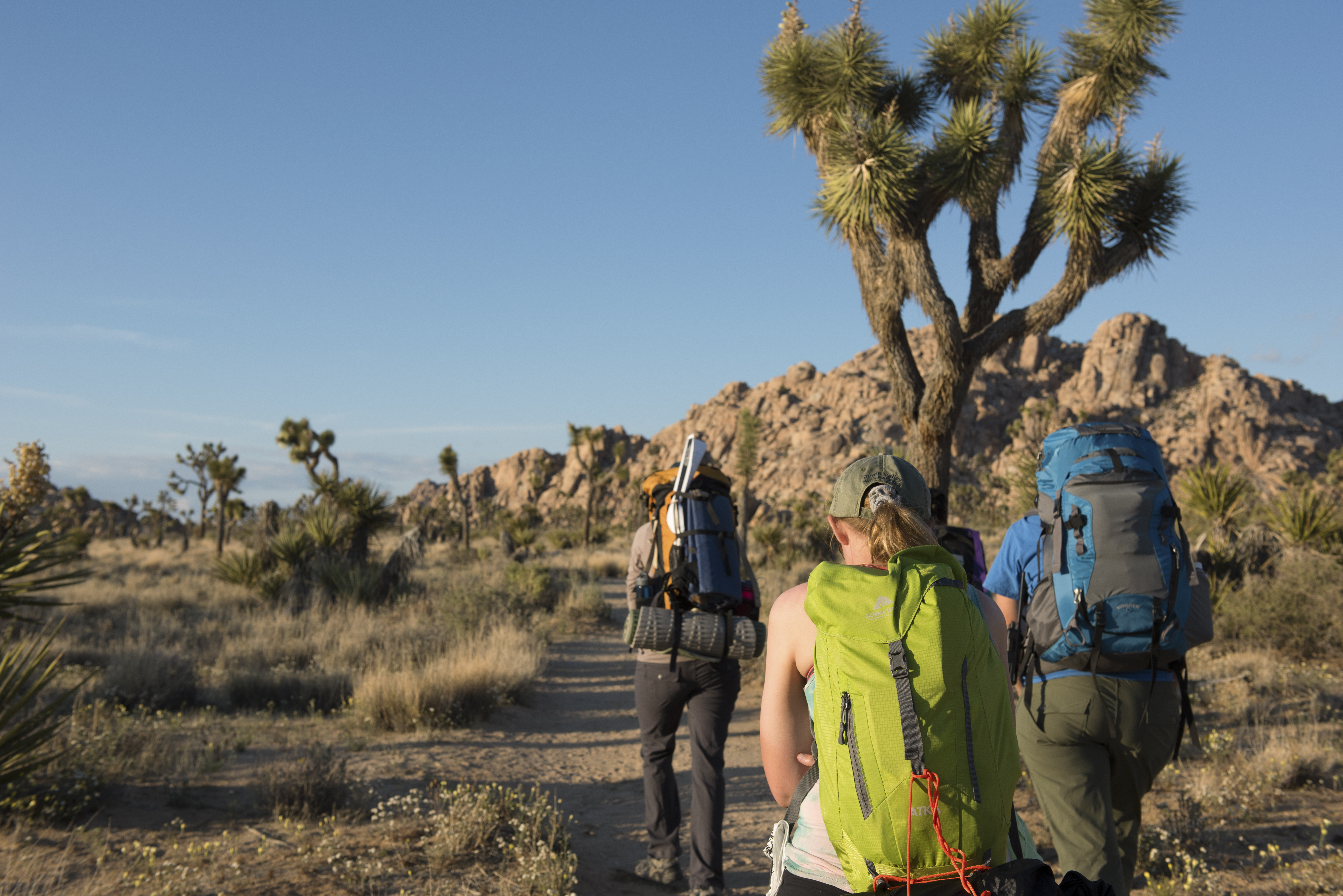
Explore the Wonderland of Rocks on the Boy Scout Trail. The Boy Scout Trail is 8 miles, but many hikers complete shorter sections of the trail and turn around early. Hikes of any length can be a great way to experience the Wonderland of Rocks along the Boy Scout Trail. Start from the Keys West Wilderness Backpacking Board along Park Boulevard and enjoy a hike for as long as you would like.
This trail has little shade and unreliable cell service. Always check the weather forecast before heading into the park and consider changing plans if the weather conditions are too extreme. Before hiking, tell a safety buddy where you are going and when you plan on leaving the park.
Accessibility The Boy Scout Trail is a dirt trail with both hard packed and sandy sections, as well as rocks, vegetations, and other obstacles. Manual wheel chairs are allowed on the trail but it is recommended to check on trail conditions a visitor center first. More information on accessibility is available here . Pets are not allowed on this trail, but service animals are welcome. Service animals must remain on a 6-foot (1.8 meter) leash at all times.
0.4 mi one way · about 20 ft of climbing · 4,269 ft–4,294 ft · earth surface · hiking
Hike Cap Rock the Park Service's write-up
15-45 Minutes · no dogs
Start Cap Rock Trailhead
Cap Rock gets its name from the boulder resting atop the rock formation. Photo: NPS / Preston Jordan Jr.
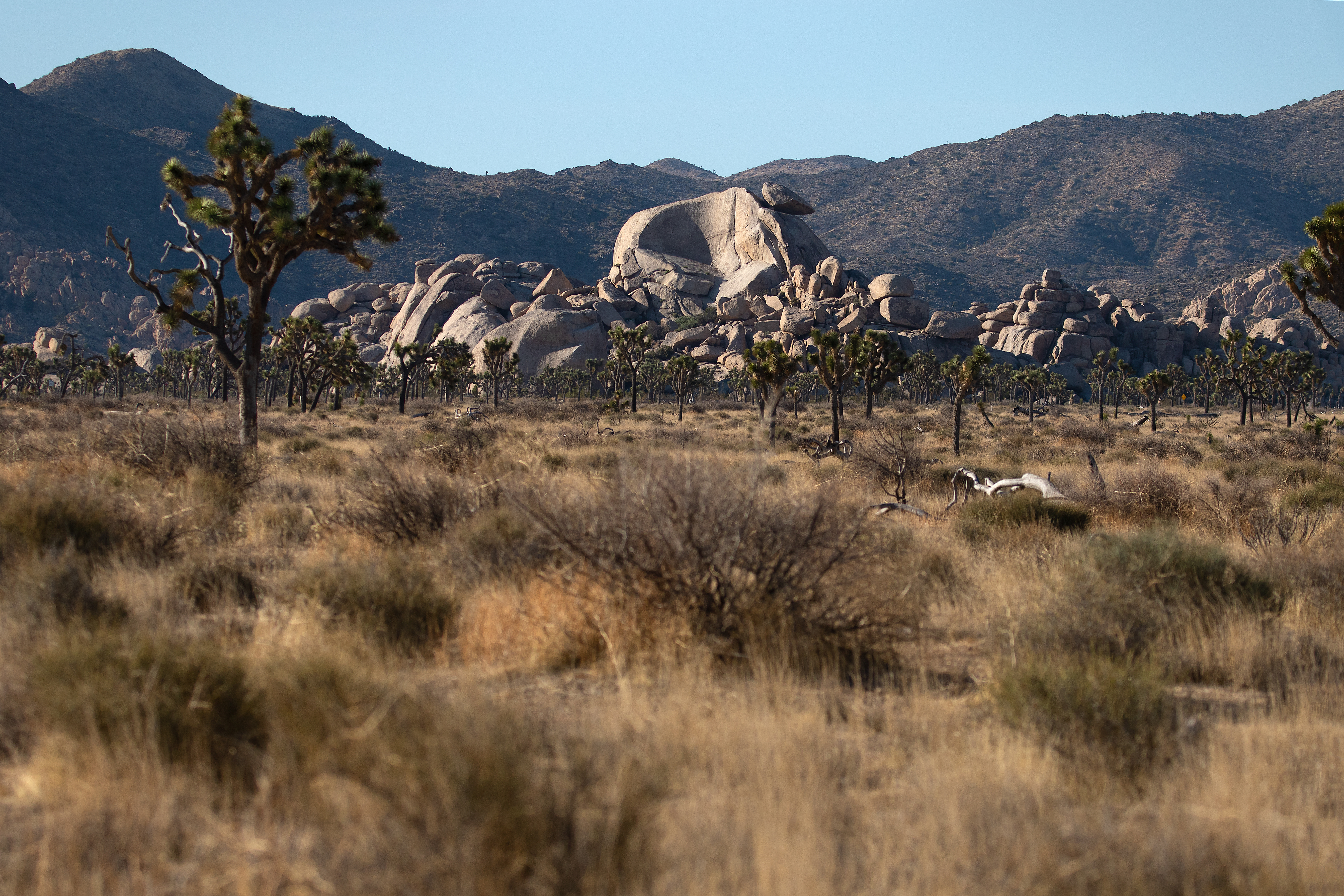
This trail is an easy 0.4-mile (0.6-km) loop with minimal elevation change. It winds through Joshua trees, Mojave yuccas, and spectacular granite rock formations. Along the trail, there are benches to rest on and interpretive signs showing information about plants and wildlife.
There are picnic tables and a bathroom near the trailhead.
This trail has minimal shade and no cell service. Summer hikers should start this trail before 10 am and bring water. Always check the weather forecast before heading into the park and consider changing plans if the weather conditions are too extreme. Before hiking, tell a safety buddy where you are going and when you plan on leaving the park.
Pets Pets and emotional support animals are not allowed on trails, but service animals are welcome. Service animals must remain on a 6-foot (1.8 meter) leash at all times.
Accessibility This is a dirt trail that is mostly flat with occasional mild inclines. Pets are not allowed on this trail, but service animals are welcome. Service animals must remain on a 6-foot (1.8 meter) leash at all times.
0.2 mi one way · 2,185 ft–2,195 ft · earth surface · hiking
Hike Cholla Cactus Garden the Park Service's write-up
15-30 Minutes · no dogs
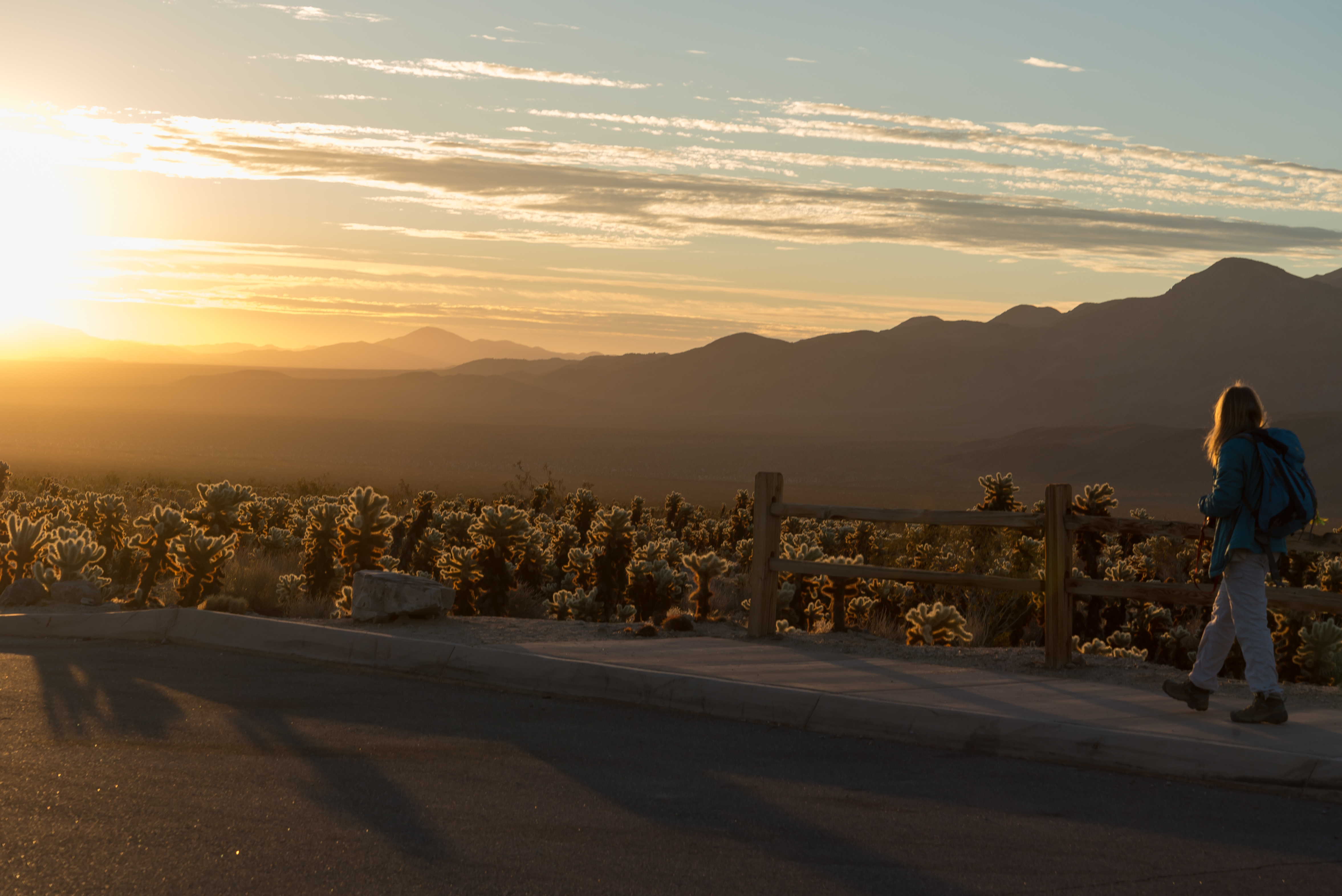
Cholla Cactus Garden at Sunset Photo: NPS / Alison Taggart-Barone
Cholla Cactus Garden is an easy quarter mile walk with minimal elevation gain along Pinto Basin Road. This walk meanders through a dense patch of teddy bear cholla on the edge of the Pinto Basin and provides views of the basin and surrounding mountains. Even though this is a short and easy hike, it is strongly recommended to wear closed shoes for protection from the cholla.
This trail has no shade and no cell service. Summer hikers should start this trail before 10 am and bring plenty of water. Always check the weather forecast before heading into the park and consider changing plans if the weather conditions are too extreme. Before hiking, tell a safety buddy where you are going and when you plan on leaving the park.
Accessibility This is a dirt trail that is mostly flat with occasional mild inclines. Pets are not allowed on this trail, but service animals are welcome. Service animals must remain on a 6-foot (1.8 meter) leash at all times.
1.9 mi one way · 650 ft of descent · 2,923 ft–3,600 ft · earth surface · hiking, horse
Hike Contact Mine the Park Service's write-up
2-3 Hours · no dogs · Winter, Spring, Fall
Start Contact Mine Trailhead
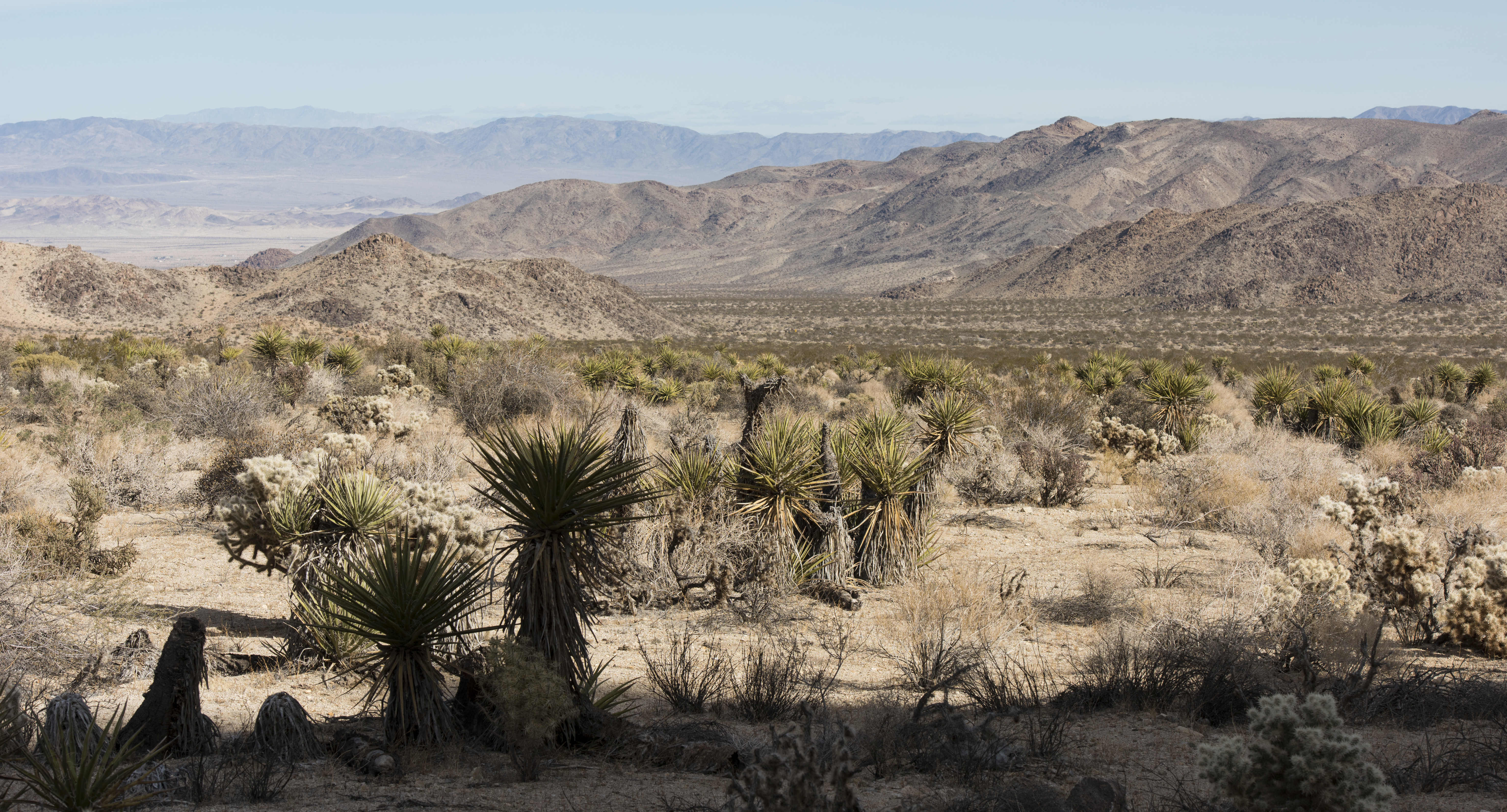
The contact mine trail offers great views of distant mountains and the valley below. Photo: NPS / Brad Sutton
The Contact Mine Trail is an out-and-back hike to a historic mining site. It is 4-miles round trip with 700 feet of elevation gain. The trail begins in a sandy wash then ascends a rocky mountainside to the mine. The hike features expansive views of the surrounding mountains and a chance to view mining artifacts used a century ago. Do not handle or remove any historic artifacts from the site.
This trail is a great option if you are looking to get away from the crowds and enjoy more solitude. After abundant winter rains, this trail offers a vibrant springtime display of wildflowers.
Pets Pets and emotional support animals are not allowed on this trail, but service animals are welcome. Service animals must remain on a 6-foot (1.8 meter) leash at all times.
Accessibility This trail begins in a sandy wash then ascends a rocky mountainside on a hard-packed dirt trail with occasional built-in rock steps. Pets and emotional support animals are not allowed on this trail, but service animals are welcome. Service animals must remain on a 6-foot (1.8 meter) leash at all times.
0.2 mi one way · 20 ft of descent · 3,117 ft–3,134 ft · earth surface · hiking
Picnic areas
Along the wayCottonwood
Hike Cottonwood Spring the Park Service's write-up
5-20 Minutes · no dogs
Start Cottonwood Springs
Oases are important water sources for wildlife in the desert. Photo: NPS/Robb Hannawacker
Enjoy a short 0.1-mile stroll to a spring-fed oasis filled with cottonwood trees and California fan palms, the only native palm tree in the Western US. Joshua Tree is home to five fan palm oases. This is a great place to observe multiple species of birds and enjoy the shade of the palm trees.
Cottonwood Spring was an important water source for Native Americans, prospectors, and miners in the area. Just past the oasis is a bedrock mortar, a Native American milling site used to grind seeds, nuts and acorns. Look for the interpretive sign along the trail just past the wash. Cottonwood Spring was first mentioned in a gold mining claim filed in 1875. The remains of an arrastra, a primitive type of gold mill, can also be found near the spring. It is illegal to take any cultural artifacts from the national park.
Much of the oasis is closed off to visitors to help protect the fragile ecosystem and allow wildlife to have undisturbed access to this rare and vital water source. Please do not go beyond the established boundaries.
The trail can be continued past cottonwood spring to mastodon peak (3 miles roundtrip) and lost palms oasis (7.5 miles roundtrip).
Pets Pets and emotional support animals are not allowed on trails, but service animals are welcome. Service animals must remain on a 6-foot (1.8 meter) leash at all times.
Accessibility The trail descends from the parking lot on hard-packed dirt and sand. Cottonwood spring can be viewed from the paved parking lot above. Pets and emotional support animals are not allowed on trails, but service animals are welcome. Service animals must remain on a 6-foot (1.8 meter) leash at all times.
0.6 mi one way · about 60 ft of climbing · 3,286 ft–3,348 ft · earth surface · hiking
Hike Indian Cove Trail the Park Service's write-up
30-45 Minutes · no dogs
The start to the Indian Cove Trail. Photo: NPS
The Indian Cove Trail is an easy .6 mile loop with 50 feet of elevation gain. The trailhead located at the west end of the Indian Cove Campground. Interpretive panels are located along the path with information on local plants and their traditional uses by Native Americans.
This trail has no shade and unreliable cell service. Always check the weather forecast before heading into the park and consider changing plans if the weather conditions are too extreme. Before hiking, tell a safety buddy where you are going and when you plan on leaving the park.
Pets Pets are not allowed on this trail but can be hiked around the roads in Indian Cove Campground.
Accessibility Pets are not allowed on this trail, but service animals are welcome. Service animals must remain on a 6-foot (1.8 meter) leash at all times. There is a variety of terrain on this trail including soft sand. The trail is roughly 1.5–3 ft wide, and is mostly flat with an approximate 100 foot elevation gain, including some stairs.
6.8 mi one way · about 900 ft of climbing · 4,574 ft–5,119 ft · earth surface · hiking, horse
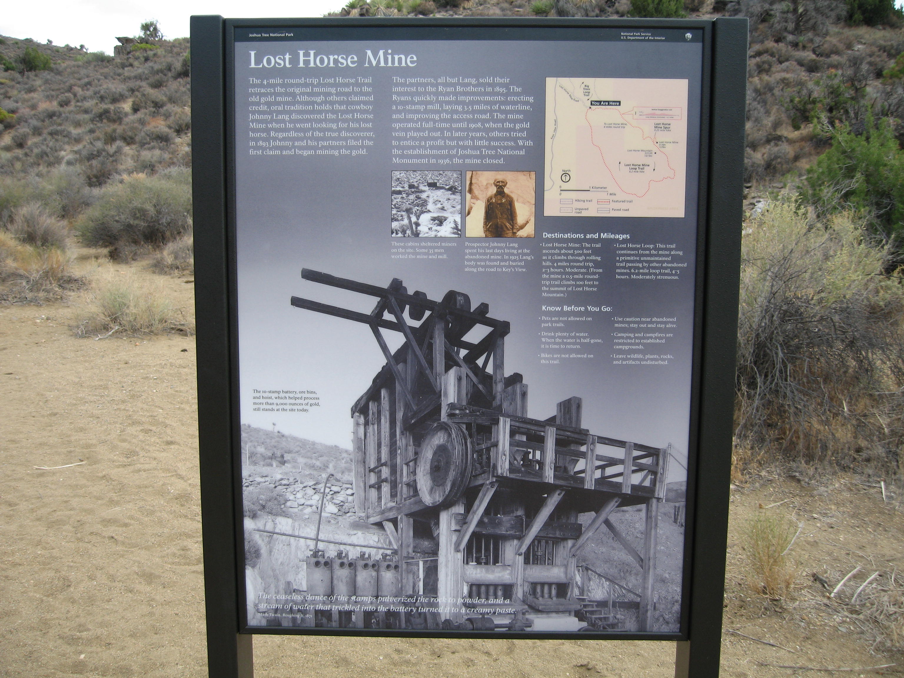
Hike Lost Horse Mine the Park Service's write-up
2-4 Hours · no dogs · Winter, Spring, Fall
Start Lost Horse Mine Trailhead
From 1894-1931, Lost Horse Mine produced over 10,000 ounces of gold and 16,000 ounces of silver. Photo: NPS / Robb Hannawacker
The Lost Horse Mine Trail is a 6.8-mile loop with 900 feet of total elevation gain. The trail showcases the rich mining history of Joshua Tree. Along the trail, you will see a stamp mill, mining equipment and artifacts, and the remnants of an old cabin. Please stay out of the fenced-off milling site and any closed-off mines. It is illegal to remove any historic artifacts from the area.
The hike can be shortened by walking to the stamp mill site then back down to the parking lot instead of completing the loop. This variation is 4 miles roundtrip with 550 feet of elevation gain.
The parking lot at the trailhead is small and fills quickly during busy weekends, holiday times, and spring break. Start early and have a backup hike ready. Do not park alongside the 1-mile dirt road leading to the trailhead.
This trail has limited shade and unreliable cell service. Summer hikers should start this trail before 8 am and bring plenty of water. Always check the weather forecast before heading into the park and consider changing plans if the weather conditions are too extreme. Hikers should always tell a safety buddy where they are going and when they plan on leaving the park.
Pets Pets and emotional support animals are not allowed on trails, but service animals are welcome. Service animals must remain on a 6-foot (1.8 meter) leash at all times.
Accessibility This trail contains various terrain types, including deep sand, hard pack dirt, uneven rocky surfaces, steep inclines and installed rock steps. It is not accessible for people using wheelchairs. Pets and emotional support animals are not allowed on trails, but service animals are welcome. Service animals must remain on a 6-foot (1.8 meter) leash at all times.
3.6 mi one way · about 550 ft of climbing · 2,994 ft–3,450 ft · earth surface · hiking
Hike Lost Palms Oasis the Park Service's write-up
4-6 Hours · no dogs · Winter, Spring, Fall
Hikers heading to Lost Palms Oasis Photo: NPS / Hannah Schwalbe
The Lost Palms Oasis Trail is a difficult 7.5 mile out and back hike with 500 feet of elevation. Starting from Cottonwood Spring, most of this hike is on rolling hills through the desert before climbing down into the Lost Palms Canyon to reach the oasis. This last section of the trail to reach the oasis gets rocky and is a strenuous climb to get back out. Hikers that make it to the oasis are rewarded with a unique desert oasis full of fan palms and a high number of desert plants that can attract an array of wildlife.
This hike can be combined with Mastodon Peak for a longer hike.
Accessibility This trail is a mix of dirt, sand, and rock. Most of the trail is rolling hills, but at the end to enter the canyon it becomes steep with rocky steps and can require some scrambling over rock to reach the oasis. Pets are not allowed on this trail, but service animals are welcome. Service animals must remain on a 6-foot (1.8 meter) leash at all times.
Mastodon Peak is a moderate three mile loop with 375 feet of elevation gain. This hike starts from the Cottonwood Spring Oasis parking lot and starts on the Lost Palms Oasis Trail by Cottonwood Spring before splitting off to the left on the Mastodon Peak Loop. This hike provides great views of the southern portion of the park and includes an option scramble up to the top of the craggy granite peak.
This hike can be combined with the Lost Palms Oasis Trail for a longer hike.
This trail has no shade and no cell service. Always check the weather forecast before heading into the park and consider changing plans if the weather conditions are too extreme. Before hiking, tell a safety buddy where you are going and when you plan on leaving the park. Summer hikers should start this trail before 9 am and bring plenty of water.
Pets Pets are not allowed on this trail. Pets can be walked nearby at Cottonwood Campground or along one of the park's many dirt roads.
Accessibility This trail is a mix of dirt, sand, and rock and includes steep sections with rock. There is an option scramble up rocks and boulders if you would like to reach the highest point. Pets are not allowed on this trail, but service animals are welcome. Service animals must remain on a 6-foot (1.8 meter) leash at all times.
1.6 mi one way · about 90 ft of climbing · 4,134 ft–4,225 ft · earth surface · hiking
Hike Hidden Valley Trail the Park Service's write-up
30-60 Minutes · no dogs
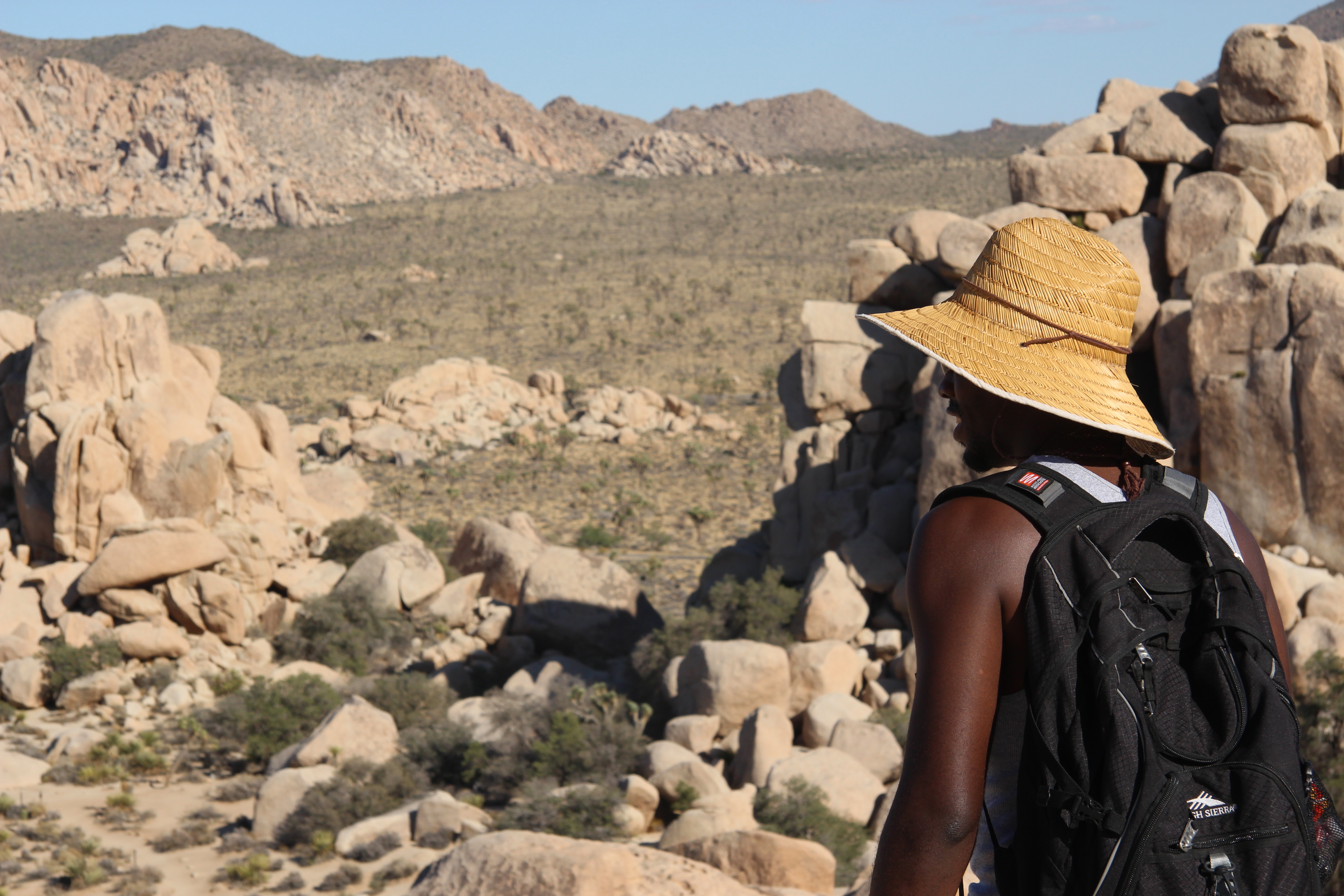
A hiker enjoying the view in Hidden Valley. Photo: NPS / Hannah Schwalbe
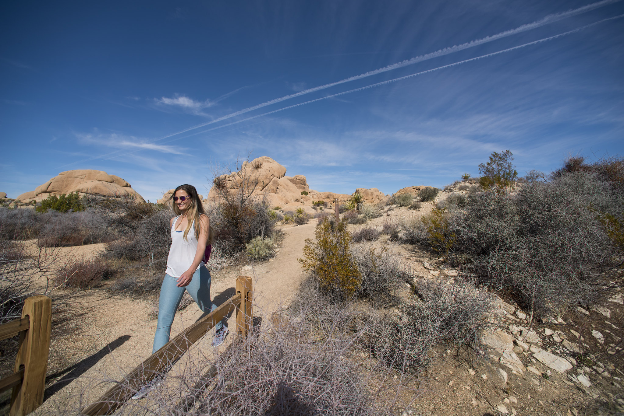
Hidden Valley Trail is an easy one mile hike. The trail starts near the Hidden Valley Picnic Area and gains 100 feet of elevation as it makes a loop around Hidden Valley, which was rumored to have once been used by cattle rustlers. There are interpretive signs along the way providing information on the area and its plants and wildlife.
This trail has little shade and no cell service. Always check the weather forecast before heading into the park and consider changing plans if the weather conditions are too extreme. Before hiking, tell a safety buddy where you are going and when you plan on leaving the park.
Accessibility Pets are not allowed on this trail, but service animals are welcome. Service animals must remain on a 6-foot (1.8 meter) leash at all times. This trail meanders through a variety of terrain including hard pack dirt, soft sand, gravel, rocks, boulders, and other obstacles. Some boulders have steps, other small boulders do not. The trail is roughly 1.5–3 ft wide, with a few steep sections and an approximate 100 feet of elevation gain. The trail has an average grade of 4% and a max grade of 19%.
Hike Minerva Hoyt Trail the Park Service's write-up
1-2 Hours · no dogs · Winter, Spring, Fall
Start Minerva Hoyt Trailhead
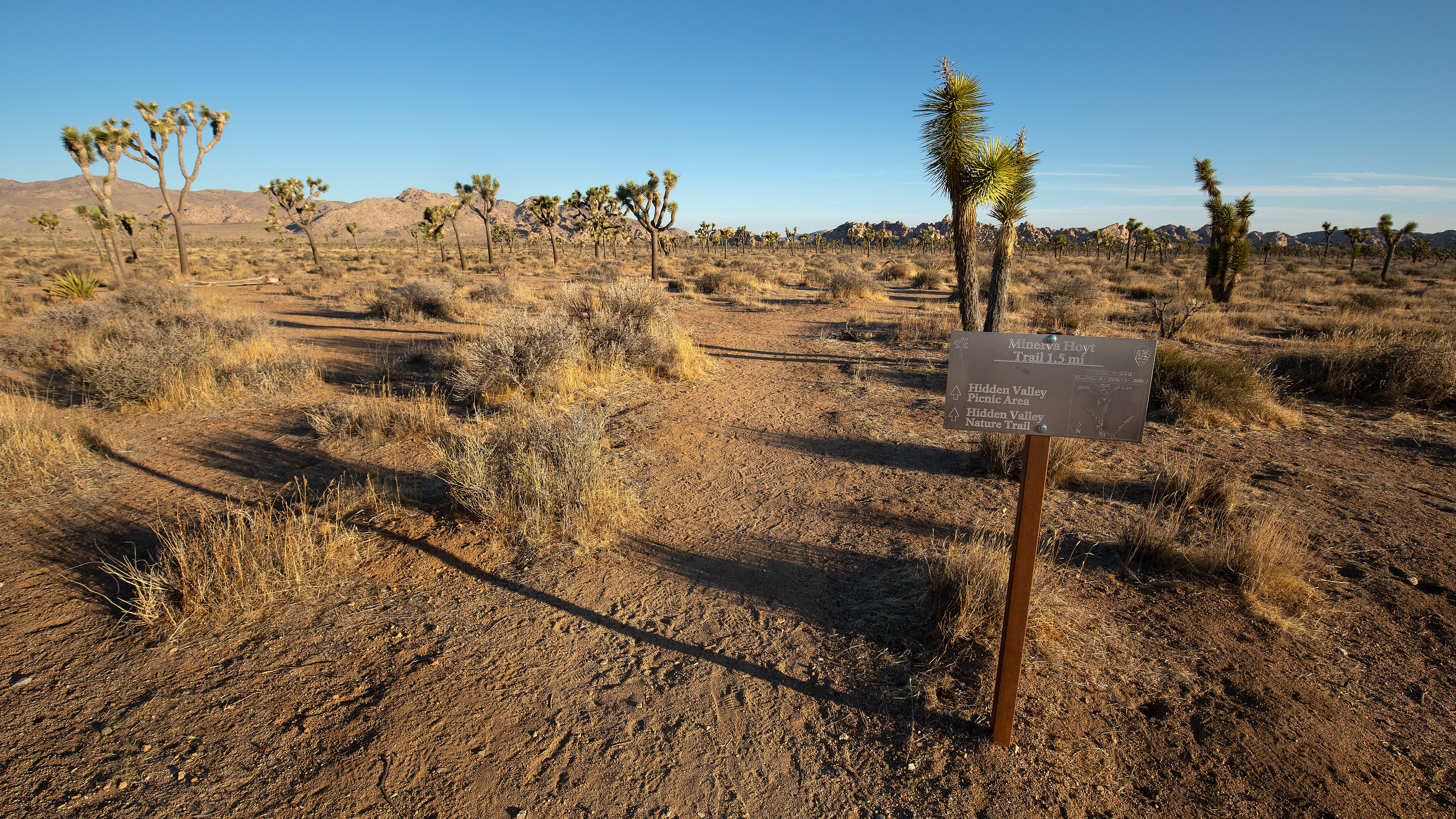
Minerva Hoyt loved the cacti and native vegetation and saw the desert as a place of solace. Photo: NPS / Preston Jordan Jr.
The Minerva Hoyt Trail is an out-and-back hike to the Hidden Valley picnic area. It is 3 miles roundtrip with 100 feet of elevation gain. From the parking lot, the trail follows an old road before it takes a sharp right towards Hidden Valley. The hike goes through a valley of Joshua trees with excellent views of unique rock formations and mountains in the distance. It can be combined with the 1-mile Hidden Valley Nature Trail to create a 4-mile “lollipop” loop.
The trail is named after Minerva Hoyt, the founding force behind Joshua Tree National Park. She lobbied congress and President FDR to preserve the area. Her efforts helped the park become designated as a National Monument in 1936. It later became a National Park in 1994.
Pets Pets and emotional support animals are not allowed on this trail, but service animals are welcome. Service animals must remain on a 6-foot (1.8 meter) leash at all times.
Accessibility This is a dirt trail with both hard packed and sandy sections. Pets and emotional support animals are not allowed on this trail, but service animals are welcome. Service animals must remain on a 6-foot (1.8 meter) leash at all times.
0.5 mi one way · about 10 ft of climbing · 1,964 ft–1,978 ft · concrete surface · hiking
Visitor centersRanger stations
Along the wayOasisOasis Visitor Center
Hike Oasis of Mara the Park Service's write-up
30-45 Minutes · dogs allowed
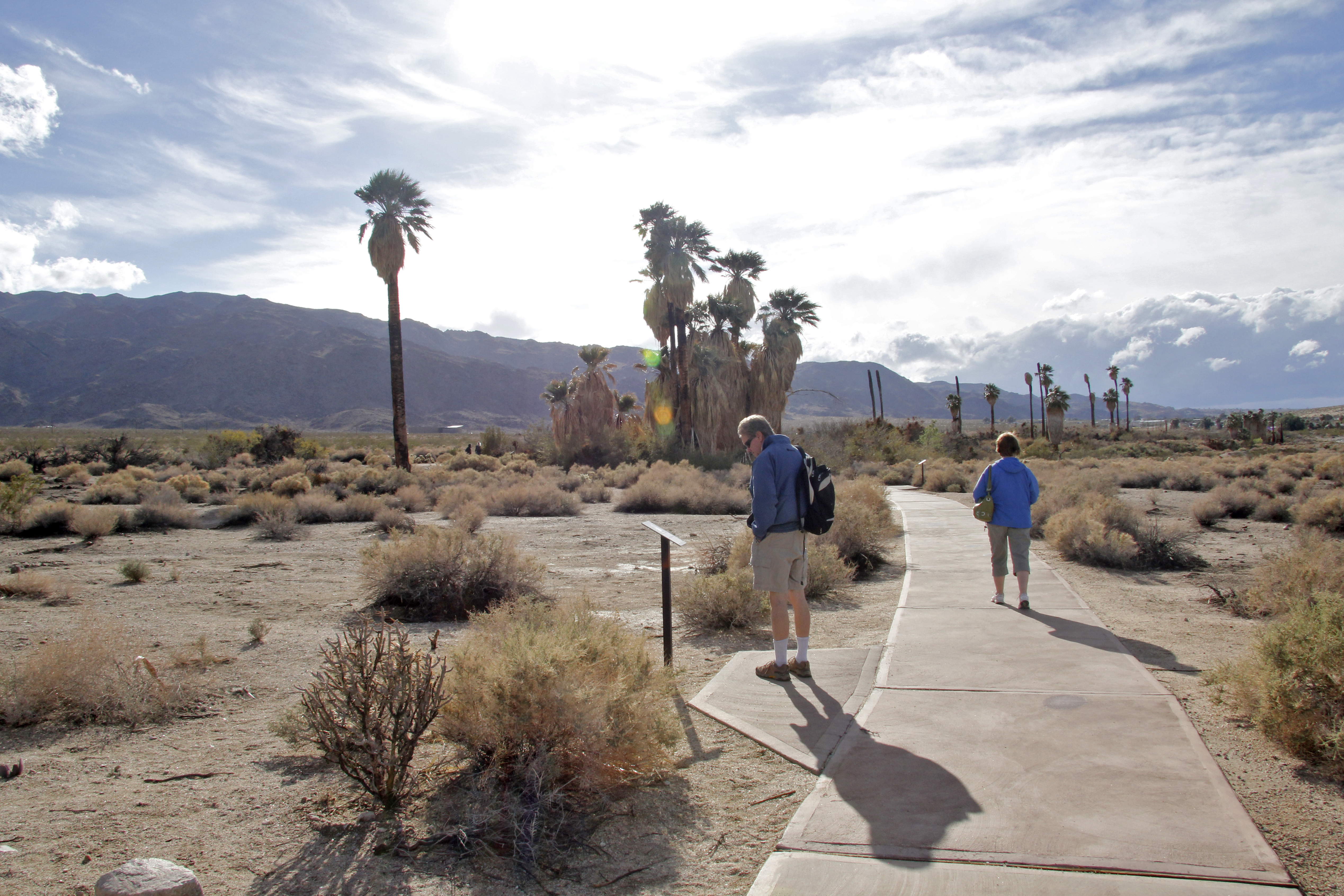
Hiking the Oasis of Mara Photo: NPS / Brad Sutton
The Oasis of Mara is an easy half mile loop on a paved trail with minimal elevation gain. This trail begins at the Joshua Tree National Park Headquarters in Twentynine Palms and provides an easy opportunity to visit a desert oasis and the increased chance to see desert wildlife with the rare water source that the oasis provides. There are interpretive panels along the way to learn about the oasis.
Accessibility This trail is a paved trail with minimal elevation suitable for all wheelchairs. Service animals are welcome on a 6-foot (1.8 meter) leash.
3.2 mi one way · about 250 ft of climbing · 900 ft of descent · 3,380 ft–4,266 ft · earth surface · hiking, horse
Hike Panorama Loop Trail the Park Service's write-up
3-5 Hours · no dogs · Winter, Spring, Fall
A section of the Panorama Loop Trail Photo: NPS / Renata Harrison
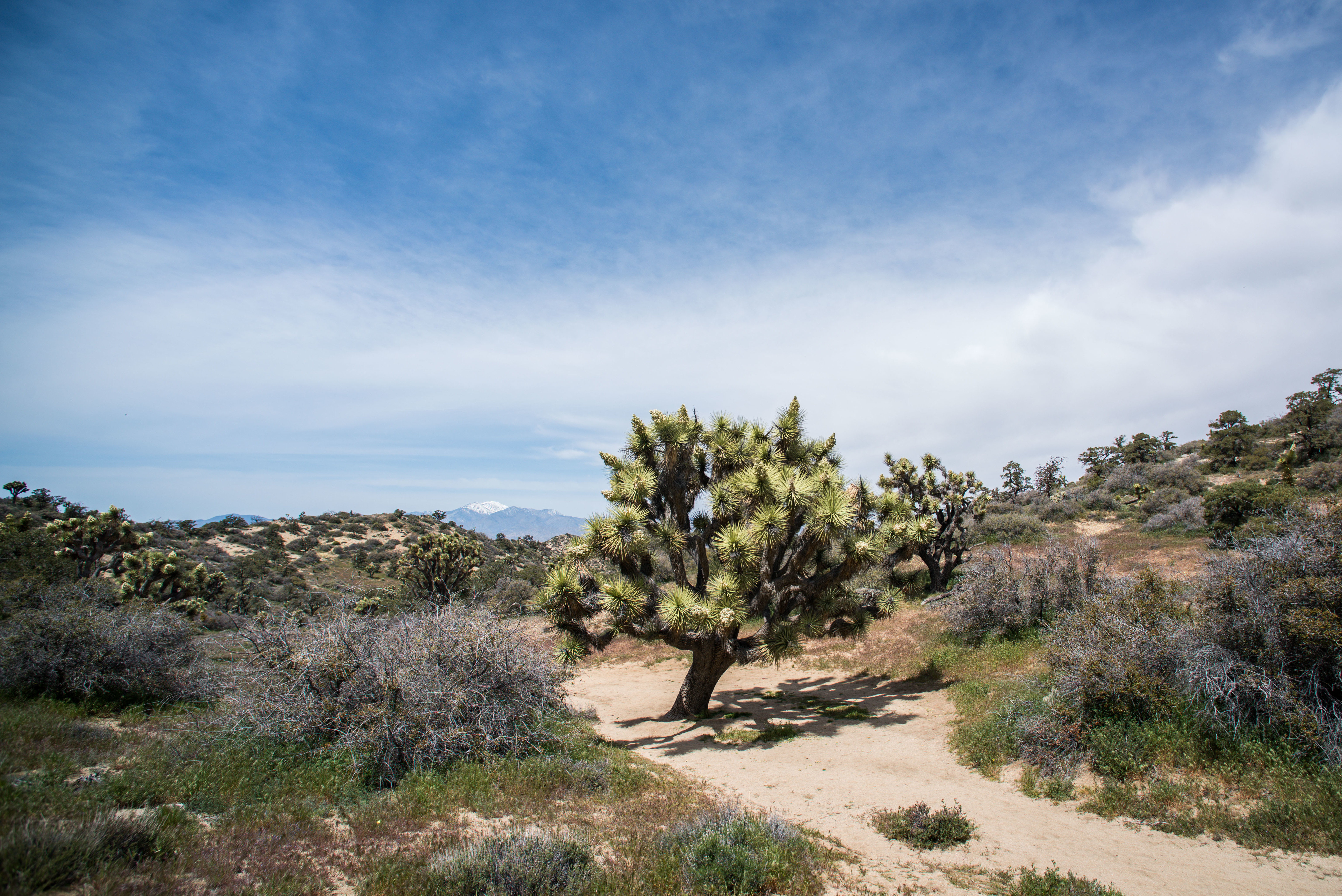
Hike up a sandy wash, then follow the ridgeline of the Little San Bernardino Mountains. Enjoy scenic views, dense Joshua tree forest, and pinyon-juniper woodland. This trail is 6.6 miles and has over a 1,000 feet of elevation gain. Warren Peak can be reached from a spur-trail off of the Panorama Loop. Bring a good map when hiking in the Black Rock area because there are many trails that crisscross and intersect.
There are a few parking areas around the Black Rock Campground and Nature Center for hikers. Parking in the campground area can fill up on busy days. Hikers cannot park in a campsite unless they have reserved that campsite. To find the trailhead, hike south from the Black Rock Nature Center, in the uphill direction. At the end of the campground, find the trail sign for panorama loop and start up the washy trail.
This trail has limited shade and unreliable cell service. Always check the weather forecast before heading into the park and consider changing plans if the weather conditions are too extreme. Hikers should always tell a safety buddy where they are going and when they plan on leaving the park.
Pets Pets and emotional support animals are not allowed on this trail but they can be walked around the Black Rock Campground.
Accessibility This trail contains various terrain types, including deep sand, hard pack dirt, and uneven rocky surfaces. The trail has steep sections and over 1,000 feet of total elevation change. The trail widens to a 4 feet across in some areas but is as narrow as 2 feet in certain areas. The trail is not accessible for people using wheelchairs. Pets and emotional support animals are not allowed on trails, but service animals are welcome. Service animals must remain on a 6-foot (1.8 meter) leash at all times.
2.6 mi one way · about 600 ft of climbing · 4,441 ft–5,158 ft · earth surface · hiking, horse
Hike Panorama Loop Trail the Park Service's write-up
3-5 Hours · no dogs · Winter, Spring, Fall
A section of the Panorama Loop Trail Photo: NPS / Renata Harrison
Hike up a sandy wash, then follow the ridgeline of the Little San Bernardino Mountains. Enjoy scenic views, dense Joshua tree forest, and pinyon-juniper woodland. This trail is 6.6 miles and has over a 1,000 feet of elevation gain. Warren Peak can be reached from a spur-trail off of the Panorama Loop. Bring a good map when hiking in the Black Rock area because there are many trails that crisscross and intersect.
There are a few parking areas around the Black Rock Campground and Nature Center for hikers. Parking in the campground area can fill up on busy days. Hikers cannot park in a campsite unless they have reserved that campsite. To find the trailhead, hike south from the Black Rock Nature Center, in the uphill direction. At the end of the campground, find the trail sign for panorama loop and start up the washy trail.
This trail has limited shade and unreliable cell service. Always check the weather forecast before heading into the park and consider changing plans if the weather conditions are too extreme. Hikers should always tell a safety buddy where they are going and when they plan on leaving the park.
Pets Pets and emotional support animals are not allowed on this trail but they can be walked around the Black Rock Campground.
Accessibility This trail contains various terrain types, including deep sand, hard pack dirt, and uneven rocky surfaces. The trail has steep sections and over 1,000 feet of total elevation change. The trail widens to a 4 feet across in some areas but is as narrow as 2 feet in certain areas. The trail is not accessible for people using wheelchairs. Pets and emotional support animals are not allowed on trails, but service animals are welcome. Service animals must remain on a 6-foot (1.8 meter) leash at all times.
2.0 mi one way · about 150 ft of climbing · 4,439 ft–4,605 ft · earth surface · hiking, horse
Hike Pine City Trail the Park Service's write-up
2-3 Hours · no dogs · Winter, Spring, Fall
Start Pine City Trailhead
The start to the Pine City Trail Photo: NPS
The Pine City Trail is a moderate four mile out and back trail. This is a fairly flat trail that goes through a dense stand of pinyon pines and juniper trees before arriving at an old mining site. For safety do not try to enter the mining site. The trailhead is located at the end of the Desert Queen Mine Road.
Though named after the large populations of pinyon pines that grow in the area, the trail is an excellent place to view many desert plants. Classic Mojave Desert flora speckle the landscape including creosote, Mojave yucca, and a wide variety of cactus. The trail also passes by some small rock formations that can be fun to scramble over and explore for all ages.
This trail has no shade and no cell service. Always check the weather forecast before heading into the park and consider changing plans if the weather conditions are too extreme. Before hiking, tell a safety buddy where you are going and when you plan on leaving the park.
Pets Pets are not allowed on this trail but can be walked on the nearby dirt roads like Bighorn Pass Road.
Accessibility Pets are not allowed on this trail, but service animals are welcome. Service animals must remain on a 6-foot (1.8 meter) leash at all times. This trail meanders through a variety of terrain including hard pack dirt, soft sand, rocks, and other obstacles. The trail is roughly 1.5–4 ft wide, and has a gentle grade with an approximate 500 feet elevation gain.
1.4 mi one way · 1,000 ft of descent · 4,403 ft–5,464 ft · earth surface · hiking
Hike Ryan Mountain the Park Service's write-up
2-3 Hours · no dogs · Winter, Spring, Fall
Hiker at the summit of Ryan Mountain Photo: NPS / Alison Taggart-Barone
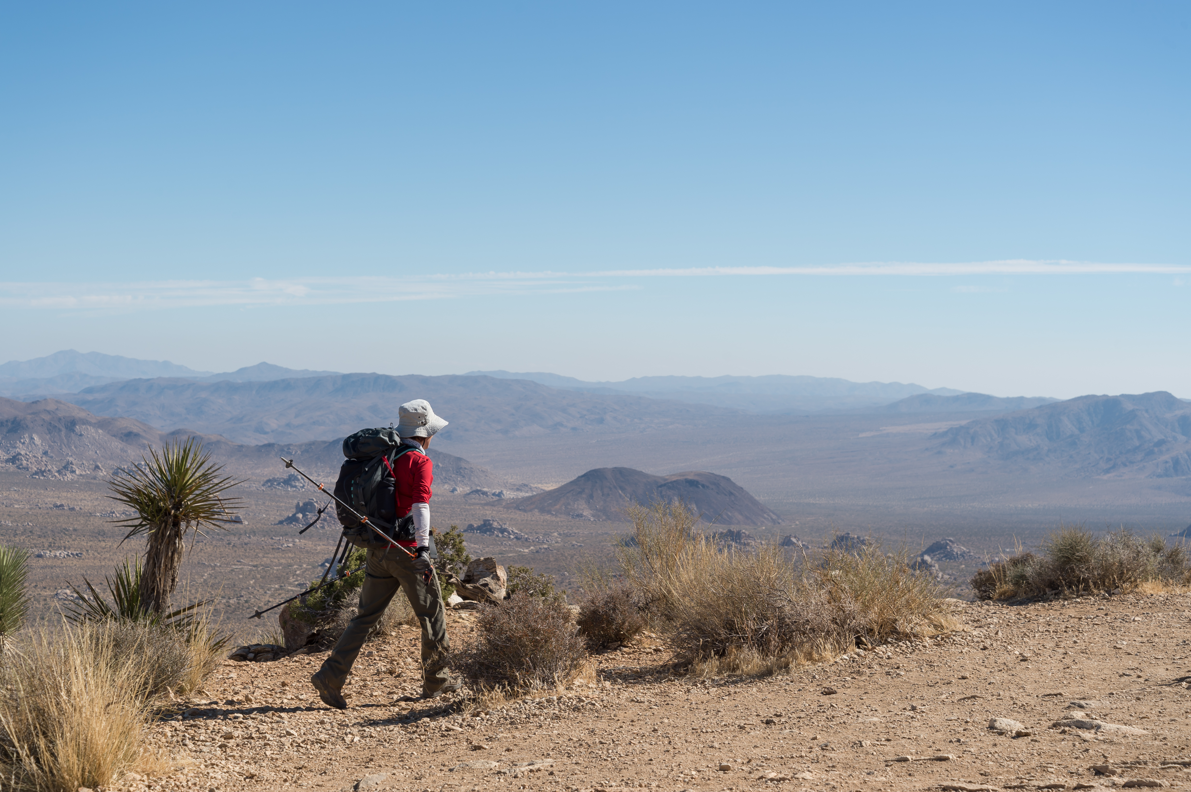
Ryan Mountain is a difficult three mile out and back hike with 1,050 feet of elevation in the central part of Joshua Tree National Park. The first section of the trail is relatively flat, but quickly gains in elevation up the mountain. This is one of the most popular hikes as it provides sweeping panoramic views of the park.
The trailhead for Ryan Mountain is located along Park Boulevard between Ryan Campground and Sheep Pass Campground. There is a secondary trailhead for campers at Sheep Pass Campground, but there is no parking available at Sheep Pass for non-campers.
Accessibility This hike is on a rough dirt and rock trail with many steps and steep sections. Pets are not allowed on this trail, but service animals are welcome. Service animals must remain on a 6-foot (1.8 meter) leash at all times.
1.3 mi one way · about 200 ft of climbing · 4,334 ft–4,442 ft · earth surface · hiking
Hike Skull Rock the Park Service's write-up
1-2 Hours · no dogs · Winter, Spring, Fall
Start Skull Rock Trailhead
The Skull Rock Trail Photo: NPS / Hannah Schwalbe
Hike through the large, granite boulder fields around the Jumbo Rocks area, including the namesake rock near Park Boulevard that closely resembles a skull. The trail meanders through boulders, washes, and the Jumbo Rocks Campground. This is an excellent trail for anyone who wants to get up close to the rough granitic rock formations that Jumbo Rocks Campground was named after.
Hikers can pick up the trail in a few areas, but the most common trailhead is the one at the Skull Rock Parking Area. The loop can be hiked in either direction, but we'll describe the trail in the clockwise direction starting from the Skull Rock Parking Area. The first highlight, only about 70 feet from the road, is the namesake Skull Rock. This large boulder has a few cavities that resemble the eye and nose sockets of a skull and is hard to miss. Next, the trail moves past the southwest (right) side of Skull Rock and turns towards the right, eventually meeting up with a road in Jumbo Rocks Campground. Hikers should turn right onto this campground road and head toward the campground entrance, where the trail intersects with Park Boulevard. The trail crosses Park Boulevard, meandering back into the desert landscape, and eventually turns back towards the east (left), heading back to the parking area. The trail is mostly sandy and occasionally crosses a hard rock surface.
The Discovery Trail connects The Skull Rock Trail with the Split Rock Loop for approximately 5-6 miles of hiking for those who enjoy longer hikes.
This trail has no cell service and almost no shade. Summer hikers should start this trail before 10 am and bring plenty of water. Always check the weather forecast before heading into the park and consider changing plans if the weather conditions are too extreme. Hikers should always tell a safety buddy where they are going and when they plan on leaving the park.
Pets Pets and emotional support animals are allowed in Jumbo Rocks Campground and must be on-lesh. Pets are not allowed on trails or in the backcountry. Please help us protect our wildlife by walking pets on-leash in campgrounds or on dirt roads.
Accessibility The Skull Rock Trail contains various terrain types, including deep sand, hard pack dirt, and uneven rocky surfaces. The trail is relatively flat and has a 150 feet total elevation change. The trail widens to a 6+ feet across in some areas but is as narrow as 2 feet in certain areas. A section of the trail near the Jumbo Rocks Campground has rocky steps that ascend about 20-40 feet of elevation. The trail is not accessible for people using wheelchairs. Some wheelchair users are comfortable on the section of the trail that merges with the Jumbo Rock campground road. However, this road is uneven and often covered in rocks and sand and is not accessible for every type of wheelchair. Pets and emotional support animals are not allowed on trails, but service animals are welcome. Service animals must remain on a 6-foot (1.8 meter) leash at all times.
2.0 mi loop · about 250 ft of climbing · 4,218 ft–4,375 ft · earth surface · hiking, horse
Hike Split Rock the Park Service's write-up
90-150 Minutes · no dogs · Winter, Spring, Fall
Start Split Rock Trailhead
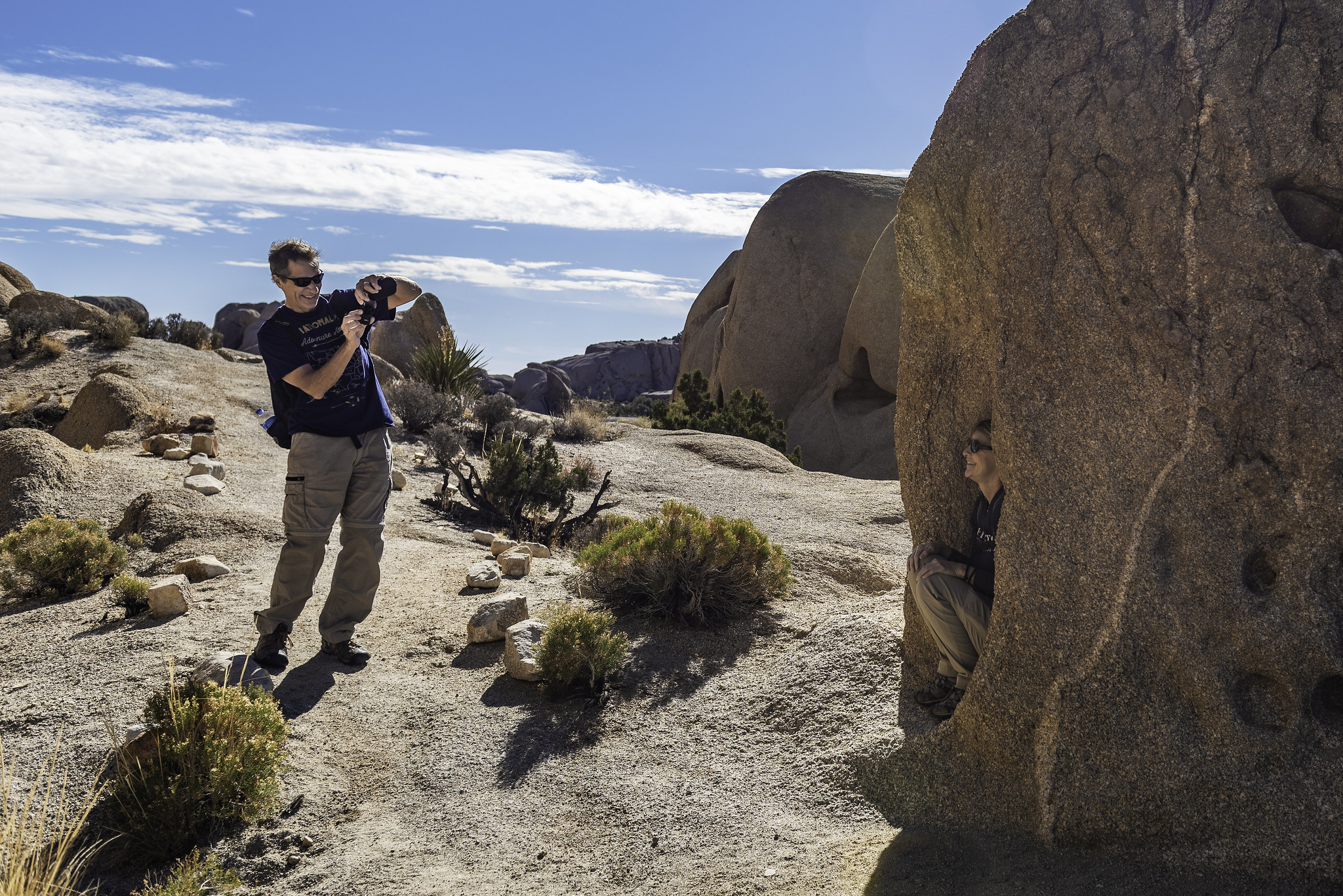
Hiker taking a photo on the Split Rock Trail Photo: NPS / Emily Hassell
Split Rock is a 2.5 mile loop trail with 150 feet of elevation gain. The trail moves through washes, over rocks, and past large boulders. The rock formations highlight the park's geologic forces and can be fun for hikers of all ages.
Hikers looking for a longer trail experience can take the Face Rock Spur Trail to the Discovery Trail and all the way to the Skull Rock Trail. Linking up the Split Rock, Discovery, and Skull Rock Trails creates an approximately 5-6 mile hike. Hikers should only link trails if they have a map and good navigation skills.
This trail has no shade and no cell service. Summer hikers should start this trail before 9 am and bring plenty of water. Always check the weather forecast before heading into the park and consider changing plans if the weather conditions are too extreme. Hikers should always tell a safety buddy where they are going and when they plan on leaving the park.
Pets Pets and emotion support animals are not allowed on trails in Joshua Tree National Park but service animals are welcome. The closest campgrounds are Jumbo Rocks and Belle and both are great places to walk a pet.
Accessibility Service animals are allowed on this trail but must remain on a 6-foot (1.8 meter) leash at all times. The terrain is varied and includes deep sandy and rocky sections. This trail is not wheelchair accessible.
1.1 mi one way · 90 ft of descent · 4,256 ft–4,345 ft · earth surface · hiking, horse
Hike Wall Street Mill the Park Service's write-up
45-120 Minutes · no dogs · Winter, Spring, Fall
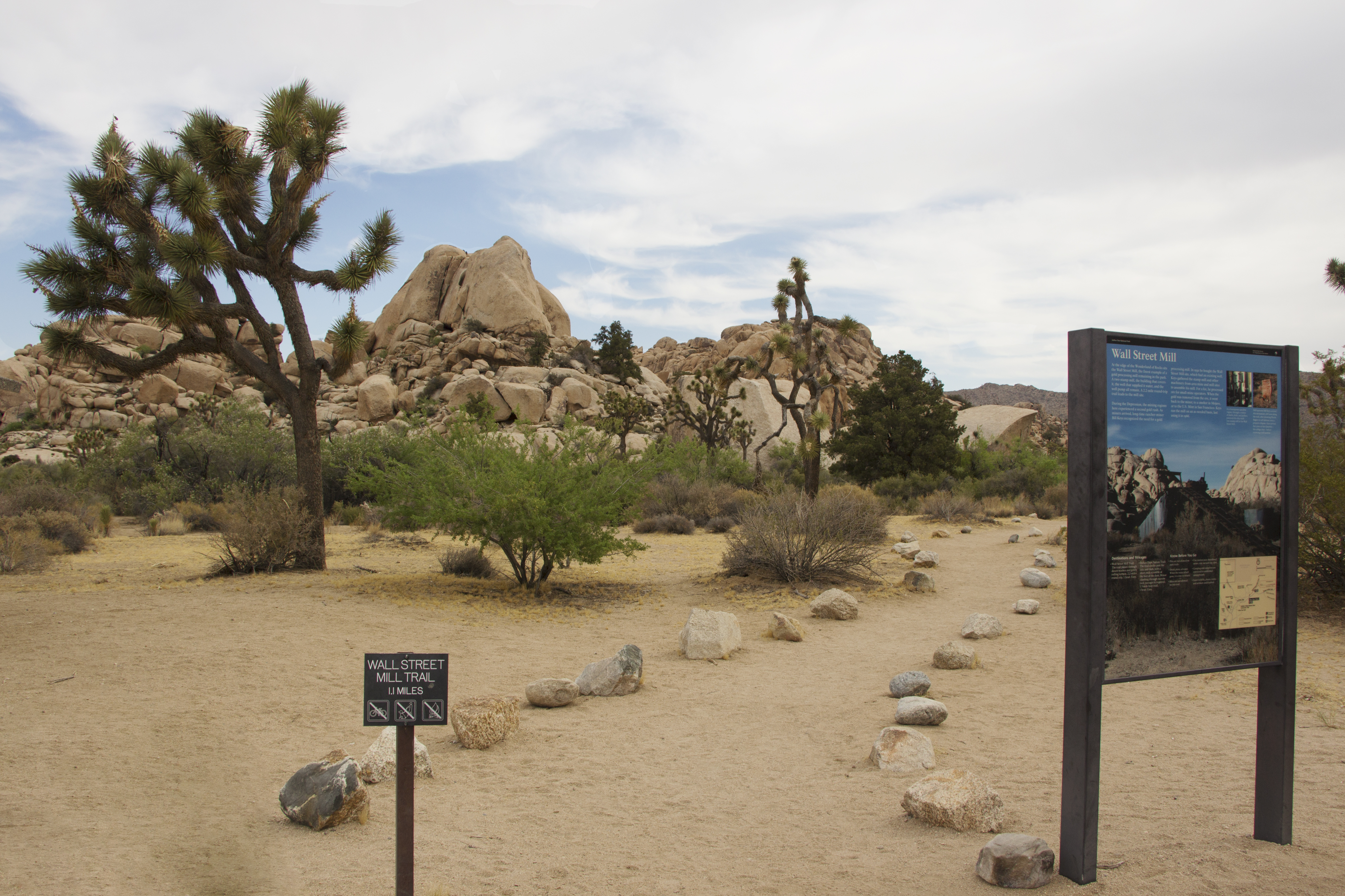
Wall Street Mill Trailhead Photo: NPS / Hannah Schwalbe
Wall Street Mill is a moderate two mile out and back hike to an old mill site. This mill was used to process gold from local mining operations. At the end of the trail the homestead and mill still stands and there are several old rusted cars around the area. Please leave all artifacts for future visitors to enjoy as well.
The trailhead starts just east of the Barker Dam area from a dirt parking lot off of Queen Valley Road.
This trail has little shade and no cell service. Always check the weather forecast before heading into the park and consider changing plans if the weather conditions are too extreme. Before hiking, tell a safety buddy where you are going and when you plan on leaving the park.
Pets Pets are not allowed on this trail but can be walked on nearby dirt roads including Bighorn Pass Road. Pets can also be walked in campgrounds including Hidden Valley Campground.
Accessibility Pets are not allowed on this trail, but service animals are welcome. Service animals must remain on a 6-foot (1.8 meter) leash at all times. This trail is sandy without obstacles to climb with just 80 feet of elevation gain.
4.8 mi one way · about 900 ft of climbing · 3,993 ft–4,539 ft · earth surface · hiking, horse
CampgroundsRanger stations
Along the wayBlack Rock CanyonBlack Rock Canyon
Hike Hi-View Trail the Park Service's write-up
1-2 Hours · no dogs · Winter, Spring, Fall
Start The trailhead for the Hi-View Nature Trail
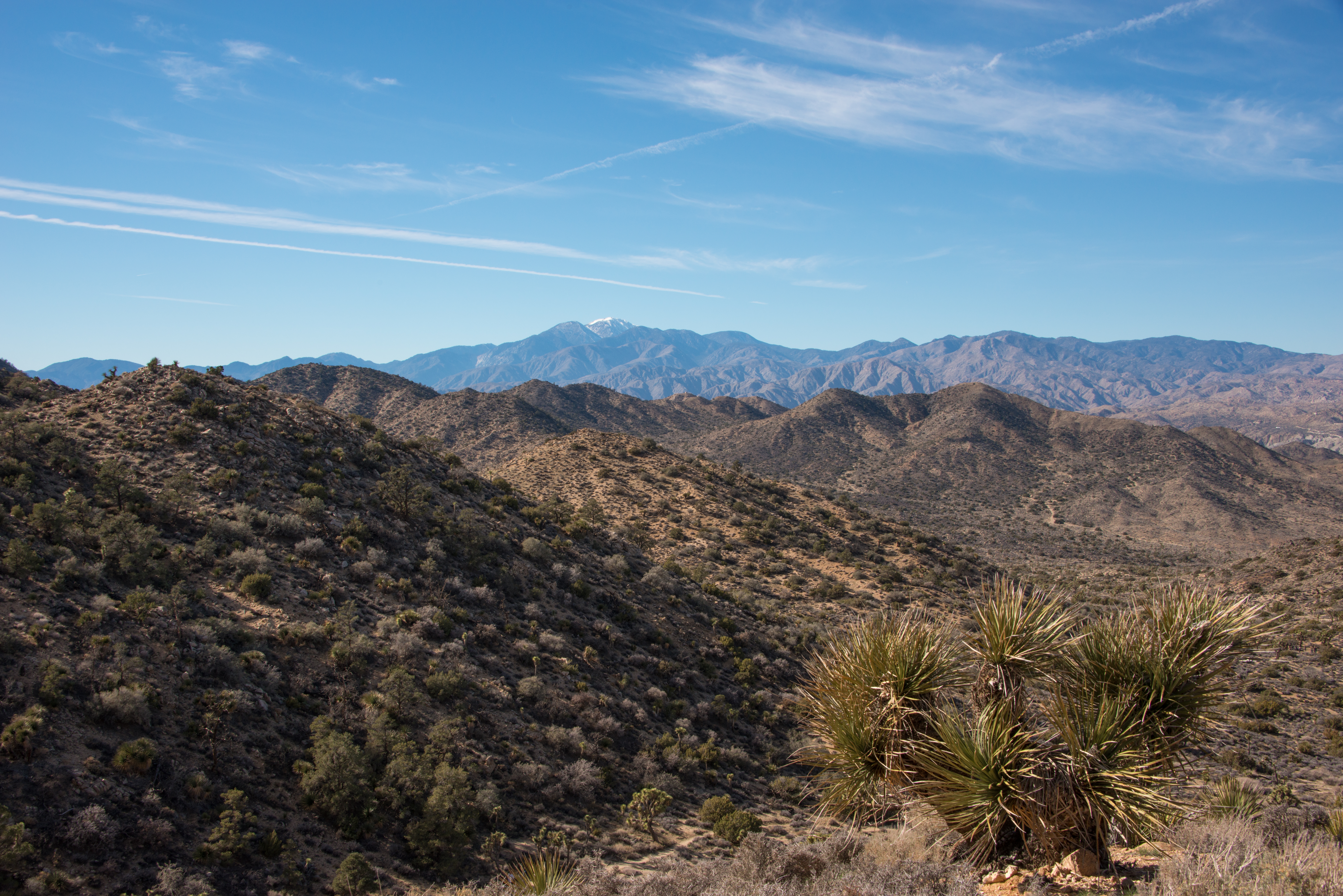
The view from the trail looking towards San Gorgonio, the tallest peak in Southern California. Photo: NPS / Lian Law
The Hi-View Trail is a 1.3-mile loop hike in the Black Rock area. The hike ascends 400 feet of elevation gain and reaches a high point with sweeping views of the surrounding mountains. Along the trail, you will see large Joshua trees, pinyon pine, and juniper trees. This area of the park tends to be slightly cooler and less busy than other areas of the park.
To access the trailhead, take the road west from the campground entrance (past the horse camp and water tank) to the parking area/trailhead at the end of the road. On busy days when parking is limited, visitors may use the horse camp area as overflow parking. Hikers cannot park in a campsite unless they have reserved that campsite.
Alternatively, hikers can add more mileage to their trek by starting from the parking lot between Black Rock campground sites 20 and 21. This would turn the hike into a “lollipop” loop and be a total of 3 miles.
Bring a good map when hiking in the Black Rock area because many trails crisscross and intersect.
This trail has limited shade and unreliable cell service. Summer hikers should start this trail before 8 am and bring plenty of water. Always check the weather forecast before heading into the park and consider changing plans if the weather conditions are too extreme. Hikers should always tell a safety buddy where they are going and when they plan on leaving the park.
Accessibility The Hi-View Trail contains various terrain types, including deep sand, hard pack dirt, and uneven rocky surfaces. This trail begins on a flat sandy trail and gradually gets steeper. On the steeper sections, there are installed rock steps to ascend/descend. The trail widens to a 6+ feet across in some areas but is as narrow as 2 feet in certain areas. The trail is not accessible for people using wheelchairs. Pets and emotional support animals are not allowed on trails, but service animals are welcome. Service animals must remain on a 6-foot (1.8 meter) leash at all times.
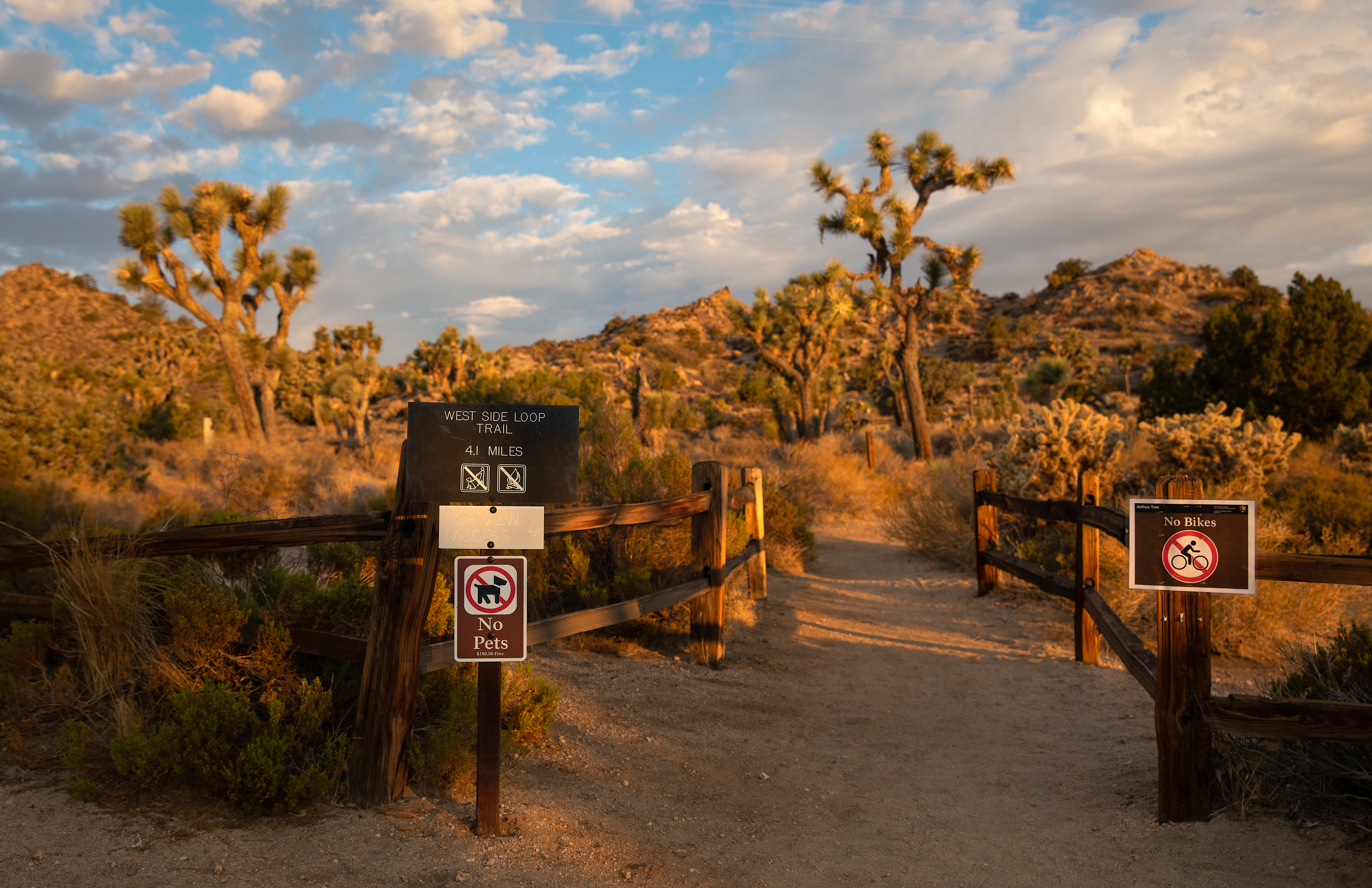
The view from the trailhead west of the Black Rock Nature Center. Photo: *Please note the sign in this image incorrectly labels the total distance* NPS / Preston Jordan Jr.
The West Side Loop Trail is a moderate, 4.7-mile loop hike in the Black Rock area of Joshua Tree. The trail meanders through stands of large Joshua trees and pinyon-juniper woodland and ascends 785 feet of vertical gain. The hike offers stunning views of San Gorgonio, the tallest peak in Southern California. This area of the park tends to be slightly cooler and less busy than other areas of the park.
There are multiple places to park and start/finish this trail. The most common are the Black Rock Nature Center and the trailhead for the Hi-View Nature Trail. The Black Rock Nature Center is located in the center of the Black Rock Campground. Park at the nature center and walk west to where the trail begins from the parking area between campsites 20 and 21. To access the Hi-View Nature Trailhead, take the road west from the campground entrance (past the horse camp and water tank) to the parking area/trailhead at the end of the road. On busy days when parking is limited, visitors may use the horse camp area as overflow parking. Hikers cannot park in a campsite unless they have reserved that campsite.
Bring a good map when hiking in the Black Rock area because many trails crisscross and intersect. This trail has limited shade and unreliable cell service. Summer hikers should start this trail before 8 am and bring plenty of water. Always check the weather forecast before heading into the park and consider changing plans if the weather conditions are too extreme. Hikers should always tell a safety buddy where they are going and when they plan on leaving the park.
Pets Pets and emotional support animals are not allowed on this trail but they can be walked around the Black Rock Campground.
Accessibility This trail contains various terrain types, including deep sand, hard pack dirt, and uneven rocky surfaces. The trail has steep sections and 785 feet of total elevation change. The trail is not accessible for people using wheelchairs. Pets and emotional support animals are not allowed on trails, but service animals are welcome. Service animals must remain on a 6-foot (1.8 meter) leash at all times.
2.2 mi one way · about 20 ft of climbing · 100 ft of descent · 4,039 ft–4,161 ft · earth surface · hiking
Hike Willow Hole the Park Service's write-up
3-5 Hours · no dogs · Winter, Spring, Fall
Start Boyscout Trailhead
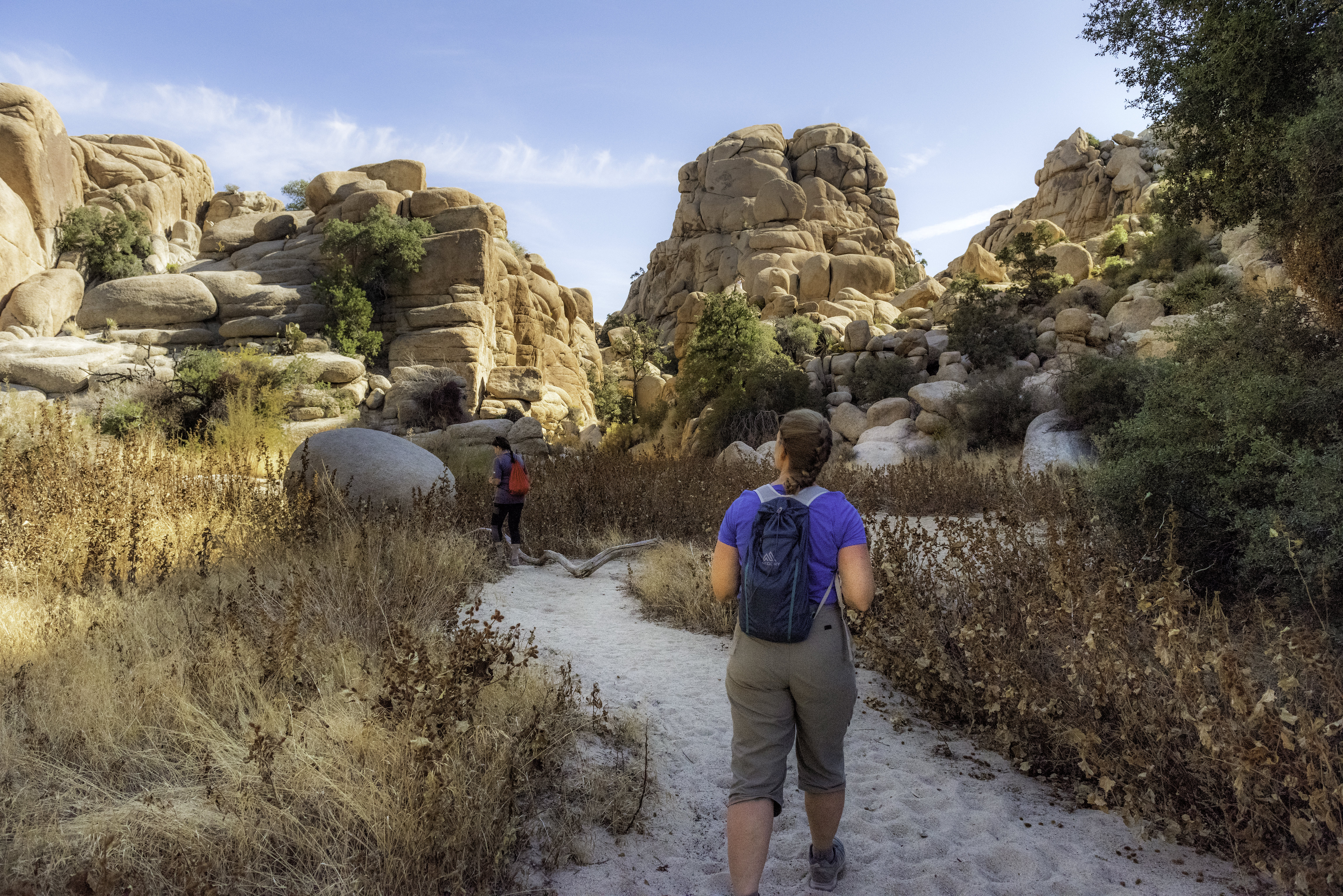
Hikers exploring the wonderland of rocks, an area filled with unique granite rock formations. Photo: NPS / Emily Hassell
The Willow Hole Trail is an out-and-back hike that ventures into the Wonderland of Rocks. It is 7 miles roundtrip and has 246 feet of elevation gain. The hike begins at the Boy Scout Trailhead and initially follows the same path as the Boy Scout Trail. After 1.2 miles, the trail splits off to the right (northeast) and heads 2.3 miles to Willow Hole. Look for cottonwood and willow trees in this area. Occasionally, Willow Hole will have a small pool of water during and after periods of rainfall. If you spot wildlife at the water souce please observe from a distance and do not approach.
The first part of the trail to Willow Hole features expansive views of the desert and distant mountains. The second part of the trail follows washes into the Wonderland of Rocks, a labyrinth of cliffs, canyons, domes, and unique rock formations. During this section, pay close attention to following the trail signs and correct wash.
Overnight camping is not allowed at Willow Hole or in the Wonderland of Rocks area as they are an important and sensitive wildlife and vegetation area. Backpacking is permitted on the west side of the Boy Scout Trail.
Pets Pets and emotional support animals are not allowed on this trail, but service animals are welcome. Service animals must remain on a 6-foot (1.8 meter) leash at all times.
Accessibility This is a dirt trail with both hard packed and sandy sections. Pets and emotional support animals are not allowed on this trail, but service animals are welcome. Service animals must remain on a 6-foot (1.8 meter) leash at all times.
The lines are the National Park Service's public trails layer, the trailheads and the waterfalls, views, peaks and historic places along them the Service's public points of interest, read 2026-10-14 and simplified for the map. The write-ups are the Service's own "things to do", unedited. Heights come from USGS 3DEP through Terrain Tiles on AWS (Mapzen/Tilezen), read along each line and rounded; a short trail on steep ground can be off by a few tens of feet. Closures change: check the park's own site before you go.