79 named trails · 40 miles · 3 trailheads · 1 with the Park Service's own write-up. The lines, trailheads and points are the Park Service's; the write-ups are the Service's own words; the climbing is read from USGS elevation along each line.
79 trails, A to Z.
30 ft–36 ft · concrete surface · bike, hiking
36 ft
35 ft · 0.0 mi
high 36 ft
On the parks map · Drive to the trail's end
23 ft–26 ft · concrete surface · bike, hiking
On the parks map · Drive to the trail's end
0.1 mi one way · 20 ft of descent · 165 ft–183 ft · native surface · hiking
Picnic areas
183 ft
165 ft · 0.1 mi
high 183 ft
Along the way Area A
On the parks map · Drive to the trail's end
0.3 mi one way · about 10 ft of climbing · 23 ft–38 ft · asphalt surface · bike, hiking
38 ft
36 ft · 0.3 mi
high 38 ft
On the parks map · Drive to the trail's end
0.1 mi one way · 5 ft–6 ft · asphalt, gravel surface · hiking
5 ft
5 ft · 0.1 mi
high 6 ft
On the parks map · Drive to the trail's end
0.3 mi one way · 3 ft–7 ft · concrete surface · hiking
6 ft
6 ft · 0.1 mi
high 7 ft
On the parks map · Drive to the trail's end
0.1 mi one way · about 30 ft of climbing · 34 ft–64 ft · native surface · hiking
34 ft
62 ft · 0.1 mi
high 64 ft
On the parks map · Drive to the trail's end
0.1 mi one way · 1 ft–2 ft · wood surface · hiking
Views
2 ft
2 ft · 0.1 mi
high 2 ft
Along the way Dyke Marsh Viewpoint
On the parks map · Drive to the trail's end
0.7 mi one way · 1 ft–5 ft · native surface · hiking
5 ft
1 ft · 0.7 mi
high 5 ft
On the parks map · Drive to the trail's end
0.2 mi one way · about 20 ft of climbing · 8 ft–43 ft · native surface · hiking
21 ft
12 ft · 0.1 mi
high 21 ft
On the parks map · Drive to the trail's end
0.6 mi one way · 34 ft–48 ft · asphalt, gravel, native surface · hiking
Picnic areas
48 ft
45 ft · 0.4 mi
high 48 ft
Along the way Fort Hunt Area A Pavilion
On the parks map · Drive to the trail's end
1.0 mi one way · about 20 ft of climbing · 31 ft–49 ft · asphalt surface · bike, hiking
Picnic areas
49 ft
49 ft · 1.0 mi
high 49 ft
Along the way Fort Hunt Area A Pavilion
On the parks map · Drive to the trail's end
0.9 mi one way · about 30 ft of climbing · 60 ft of descent · 11 ft–45 ft · native surface · hiking
36 ft
24 ft · 0.4 mi
high 37 ft
On the parks map · Drive to the trail's end
0.1 mi one way · 5 ft–14 ft · asphalt surface · bike, hiking
5 ft
12 ft · 0.1 mi
high 12 ft
On the parks map · Drive to the trail's end
0.1 mi one way · 10 ft of descent · 73 ft–87 ft · native surface · hiking
87 ft
75 ft · 0.1 mi
high 87 ft
On the parks map · Drive to the trail's end
0.1 mi one way · 6 ft–6 ft · native surface · hiking
6 ft
6 ft · 0.1 mi
high 6 ft
On the parks map · Drive to the trail's end
1 ft–5 ft · native surface · hiking
On the parks map · Drive to the trail's end
0.1 mi one way · 4 ft–7 ft · asphalt surface · bike, hiking
6 ft
7 ft · 0.0 mi
high 7 ft
On the parks map · Drive to the trail's end
0.1 mi one way · 5 ft–7 ft · concrete surface · hiking
5 ft
7 ft · 0.0 mi
high 7 ft
On the parks map · Drive to the trail's end
0.1 mi one way · 5 ft–6 ft · asphalt, concrete surface · hiking
5 ft
6 ft · 0.0 mi
high 6 ft
On the parks map · Drive to the trail's end
0.8 mi one way · 3 ft–7 ft · asphalt, concrete, native surface · hiking
7 ft
5 ft · 0.2 mi
high 7 ft
On the parks map · Drive to the trail's end
0.5 mi one way · 4 ft–11 ft · asphalt, concrete surface · bike, hiking
5 ft
11 ft · 0.4 mi
high 11 ft
On the parks map · Drive to the trail's end
0.7 mi one way · about 40 ft of climbing · 10 ft–34 ft · concrete surface · bike, hiking
26 ft
17 ft · 0.2 mi
high 34 ft
On the parks map · Drive to the trail's end
0.8 mi one way · about 40 ft of climbing · -1 ft–21 ft · concrete surface · bike, hiking
18 ft
21 ft · 0.4 mi
high 21 ft
On the parks map · Drive to the trail's end
0.3 mi one way · 40 ft of descent · 80 ft–123 ft · gravel surface · bike, hiking
123 ft
80 ft · 0.3 mi
high 123 ft
On the parks map · Drive to the trail's end
15 mi one way · about 250 ft of climbing · 2 ft–101 ft · asphalt, concrete surface · bike, hiking
Picnic areas
16 ft
7 ft · 2.9 mi
high 18 ft
Along the way Belle Haven Picnic Area
On the parks map · Drive to the trail's end
74 ft–81 ft · asphalt surface · bike, hiking
81 ft
79 ft · 0.0 mi
high 81 ft
On the parks map · Drive to the trail's end
0.2 mi one way · 20 ft of descent · 57 ft–78 ft · asphalt surface · bike, hiking
78 ft
61 ft · 0.2 mi
high 78 ft
On the parks map · Drive to the trail's end
0.6 mi one way · about 30 ft of climbing · 15 ft–48 ft · asphalt surface · bike, hiking
41 ft
28 ft · 0.4 mi
high 43 ft
On the parks map · Drive to the trail's end
0.2 mi one way · 9 ft–15 ft · asphalt surface · bike, hiking
10 ft
15 ft · 0.2 mi
high 15 ft
On the parks map · Drive to the trail's end
3 ft–6 ft · wood surface · bike, hiking
6 ft
5 ft · 0.0 mi
high 6 ft
On the parks map · Drive to the trail's end
14 ft–14 ft · asphalt surface · bike, hiking
On the parks map · Drive to the trail's end
10 ft of descent · 3 ft–16 ft · asphalt surface · bike, hiking
16 ft
11 ft · 0.0 mi
high 16 ft
On the parks map · Drive to the trail's end
20 ft–25 ft · asphalt surface · bike, hiking
23 ft
25 ft · 0.0 mi
high 25 ft
On the parks map · Drive to the trail's end
10 ft–12 ft · asphalt surface · bike, hiking
On the parks map · Drive to the trail's end
7 ft–8 ft · asphalt surface · bike, hiking
7 ft
8 ft · 0.0 mi
high 8 ft
On the parks map · Drive to the trail's end
4 ft–4 ft · asphalt surface · bike, hiking
On the parks map · Drive to the trail's end
6 ft–6 ft · asphalt surface · bike, hiking
On the parks map · Drive to the trail's end
4 ft–5 ft · asphalt surface · bike, hiking
5 ft
5 ft · 0.1 mi
high 5 ft
On the parks map · Drive to the trail's end
23 ft–25 ft · wood surface · bike, hiking
25 ft
23 ft · 0.0 mi
high 25 ft
On the parks map · Drive to the trail's end
11 ft–20 ft · wood surface · bike, hiking
20 ft
13 ft · 0.0 mi
high 20 ft
On the parks map · Drive to the trail's end
2 ft–11 ft · wood surface · bike, hiking
9 ft
11 ft · 0.0 mi
high 11 ft
On the parks map · Drive to the trail's end
26 ft–29 ft · asphalt surface · bike, hiking
29 ft
28 ft · 0.0 mi
high 29 ft
On the parks map · Drive to the trail's end
19 ft–26 ft · asphalt surface · bike, hiking
19 ft
26 ft · 0.0 mi
high 26 ft
On the parks map · Drive to the trail's end
0.1 mi one way · 12 ft–14 ft · asphalt surface · bike, hiking
12 ft
14 ft · 0.1 mi
high 14 ft
On the parks map · Drive to the trail's end
44 ft–48 ft · asphalt surface · bike, hiking
48 ft
48 ft · 0.1 mi
high 48 ft
On the parks map · Drive to the trail's end
42 ft–43 ft · asphalt surface · bike, hiking
On the parks map · Drive to the trail's end
10 ft–10 ft · asphalt surface · bike, hiking
On the parks map · Drive to the trail's end
5 ft–5 ft · asphalt surface · bike, hiking
On the parks map · Drive to the trail's end
7 ft–8 ft · asphalt surface · bike, hiking
On the parks map · Drive to the trail's end
6 ft–7 ft · asphalt surface · bike, hiking
On the parks map · Drive to the trail's end
8 ft–8 ft · asphalt surface · bike, hiking
On the parks map · Drive to the trail's end
0.2 mi one way · 1 ft–3 ft · asphalt surface · bike, hiking
2 ft
3 ft · 0.2 mi
high 3 ft
On the parks map · Drive to the trail's end
4 ft–4 ft · asphalt surface · bike, hiking
On the parks map · Drive to the trail's end
3 ft–4 ft · asphalt surface · bike, hiking
On the parks map · Drive to the trail's end
6 ft–9 ft · asphalt surface · bike, hiking
On the parks map · Drive to the trail's end
0.1 mi one way · 7 ft–8 ft · asphalt surface · bike, hiking
7 ft
8 ft · 0.1 mi
high 8 ft
On the parks map · Drive to the trail's end
0.1 mi one way · 3 ft–4 ft · asphalt surface · bike, hiking
4 ft
4 ft · 0.1 mi
high 4 ft
On the parks map · Drive to the trail's end
4 ft–4 ft · concrete surface · bike, hiking
On the parks map · Drive to the trail's end
0.1 mi one way · 4 ft–6 ft · concrete surface · bike, hiking
6 ft
5 ft · 0.1 mi
high 6 ft
On the parks map · Drive to the trail's end
3 ft–8 ft · asphalt surface · bike, hiking
5 ft
8 ft · 0.0 mi
high 8 ft
On the parks map · Drive to the trail's end
0.1 mi one way · about 10 ft of climbing · 10 ft–23 ft · concrete surface · bike, hiking
10 ft
23 ft · 0.1 mi
high 23 ft
On the parks map · Drive to the trail's end
0 ft–7 ft · asphalt surface · bike, hiking
4 ft
7 ft · 0.0 mi
high 7 ft
On the parks map · Drive to the trail's end
0.1 mi one way · 16 ft–20 ft · asphalt, stone surface · hiking
16 ft
19 ft · 0.1 mi
high 19 ft
On the parks map · Drive to the trail's end
0.2 mi one way · 26 ft–30 ft · concrete surface · bike, hiking
28 ft
26 ft · 0.1 mi
high 29 ft
On the parks map · Drive to the trail's end
0.5 mi one way · 36 ft–43 ft · asphalt surface · bike, hiking
40 ft
43 ft · 0.5 mi
high 43 ft
On the parks map · Drive to the trail's end
0.8 mi one way · about 30 ft of climbing · 87 ft–118 ft · native surface · hiking
87 ft
118 ft · 0.8 mi
high 118 ft
On the parks map · Drive to the trail's end
9.7 mi one way · about 850 ft of climbing · 4 ft–253 ft · native surface · hiking
Views
9 ft
60 ft · 7.9 mi
high 239 ft
Along the way North Donaldson Run Overlook
Hike between Scott's Run Nature Preserve and Theodore Roosevelt Island the Park Service's write-up
4-7 Hours · dogs allowed
Start trailheads for Scott's Run Nature Preserve and for Potomac Heritage Trail/Theodore Roosevelt Island/Mount Vernon Trail
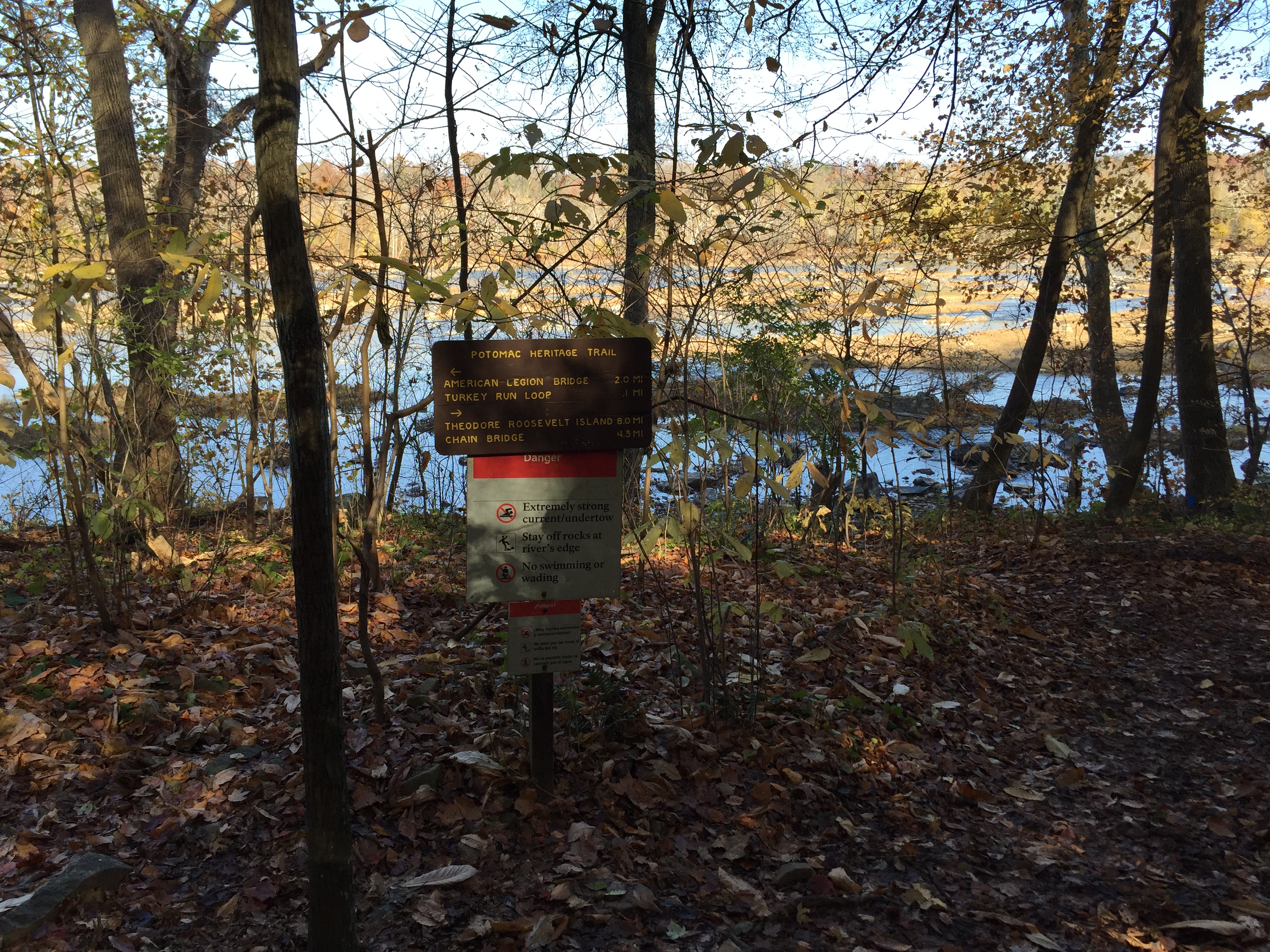
This 10-mile PHT within George Washington Memorial Park and a 2-mile loop within Scott's Run Nature Preserve--connected by a 1-mile path along Live Oak Lane--are unusual for the relatively wild character of these places in such close proximity to urban environments. While one can, of course, travel in an upstream direction, we are considering this hike as one in a series of hikes travelling in a downstream direction from points north. The trailhead for Theodore Roosevelt Island /Potomac Heritage Trail/Mount Vernon Trail can be accessed from the Roslyn Metro and a pedestrian-bicycle facility, but you will need to set up a vehicle shuttle for travelling in one direction only. See a map of the corridor on the "Maps" page and review the hike as described in Potomac Heritage Trail: A Hiker's Guide .
A map of the Potomac Heritage National Scenic Trail from Theodore Roosevelt Island to Scott's Run
Accessibility The trail surface varies from flat paved asphalt to native material with tree roots and moderate inclines.
This hike on nps.gov
On the parks map · Drive to the trail's end
37 ft–40 ft · native surface · hiking
On the parks map · Drive to the trail's end
0.1 mi one way · 18 ft–30 ft · concrete surface · bike, hiking
26 ft
27 ft · 0.1 mi
high 30 ft
On the parks map · Drive to the trail's end
0.1 mi one way · 14 ft–18 ft · asphalt surface · bike, hiking
17 ft
16 ft · 0.1 mi
high 18 ft
On the parks map · Drive to the trail's end
0.3 mi one way · 16 ft–30 ft · asphalt surface · bike, hiking
20 ft
17 ft · 0.3 mi
high 30 ft
On the parks map · Drive to the trail's end
0.1 mi one way · 18 ft–20 ft · asphalt surface · bike, hiking
18 ft
18 ft · 0.1 mi
high 20 ft
On the parks map · Drive to the trail's end
0.3 mi one way · about 40 ft of climbing · 169 ft–221 ft · native surface · hiking
Picnic areas
212 ft
215 ft · 0.1 mi
high 220 ft
Along the way Area B
Trailhead Trailhead 221 ft Drive there
On the parks map
0.2 mi one way · 10 ft of descent · 216 ft–229 ft · native surface · hiking
Picnic areas
229 ft
226 ft · 0.1 mi
high 229 ft
Along the way Area C-1 Area C-2
Trailhead Trailhead 230 ft Drive there
On the parks map
0.6 mi one way · about 150 ft of climbing · 48 ft–212 ft · native surface · hiking
Picnic areas
66 ft
198 ft · 0.3 mi
high 198 ft
Along the way Area C-1
Trailhead Trailhead 217 ft Drive there
On the parks map
1.0 mi one way · about 20 ft of climbing · 200 ft of descent · 55 ft–231 ft · native surface · hiking
Picnic areas
229 ft
55 ft · 0.9 mi
high 229 ft
Along the way Area A Area C-1 Area C-2
Trailheads Trailhead 217 ft Drive there · Trailhead 230 ft Drive there
On the parks map
0.7 mi one way · 94 ft–103 ft · asphalt surface · hiking
97 ft
97 ft · 0.1 mi
high 98 ft
On the parks map · Drive to the trail's end
0.1 mi one way · 60 ft of descent · 28 ft–88 ft · native surface · hiking
88 ft
28 ft · 0.1 mi
high 88 ft
On the parks map · Drive to the trail's end
16 more mapped segments without a name are on the map, not in the list.
Write-ups that name no single mapped trail, in the Service's words.
The lines are the National Park Service's public trails layer, the trailheads and the waterfalls, views, peaks and historic places along them the Service's public points of interest, read 2026-10-14 and simplified for the map. The write-ups are the Service's own "things to do", unedited. Heights come from USGS 3DEP through Terrain Tiles on AWS (Mapzen/Tilezen), read along each line and rounded; a short trail on steep ground can be off by a few tens of feet. Closures change: check the park's own site before you go.