#67 Goldmine Branch Access
Backcountry camps
Along the way #67 Goldmine Branch

National Park · North Carolina, Tennessee
244 named trails · 843 miles · 130 trailheads · 41 with the Park Service's own write-up. The lines, trailheads and points are the Park Service's; the write-ups are the Service's own words; the climbing is read from USGS elevation along each line.
244 trails, A to Z.
Backcountry camps
Along the way #67 Goldmine Branch
Waterfalls
Along the way Abrams Falls
Trailhead Abrams Falls Trail Trailhead 1,708 ft Drive there
no dogs · entrance fee applies
Start Trailhead located on 11-mile, one-way Cades Cove Loop Road
Overview
Abrams Falls trail will be closed Mondays through Thursdays from August 24 to September 30 so that the park can replace aging footlog bridges and improve visitor safety. During construction the trail will remain open to hikers Fridays through Sundays , and on Labor Day.
Swimming is strongly discouraged due to slippery rocks and a deadly undertow
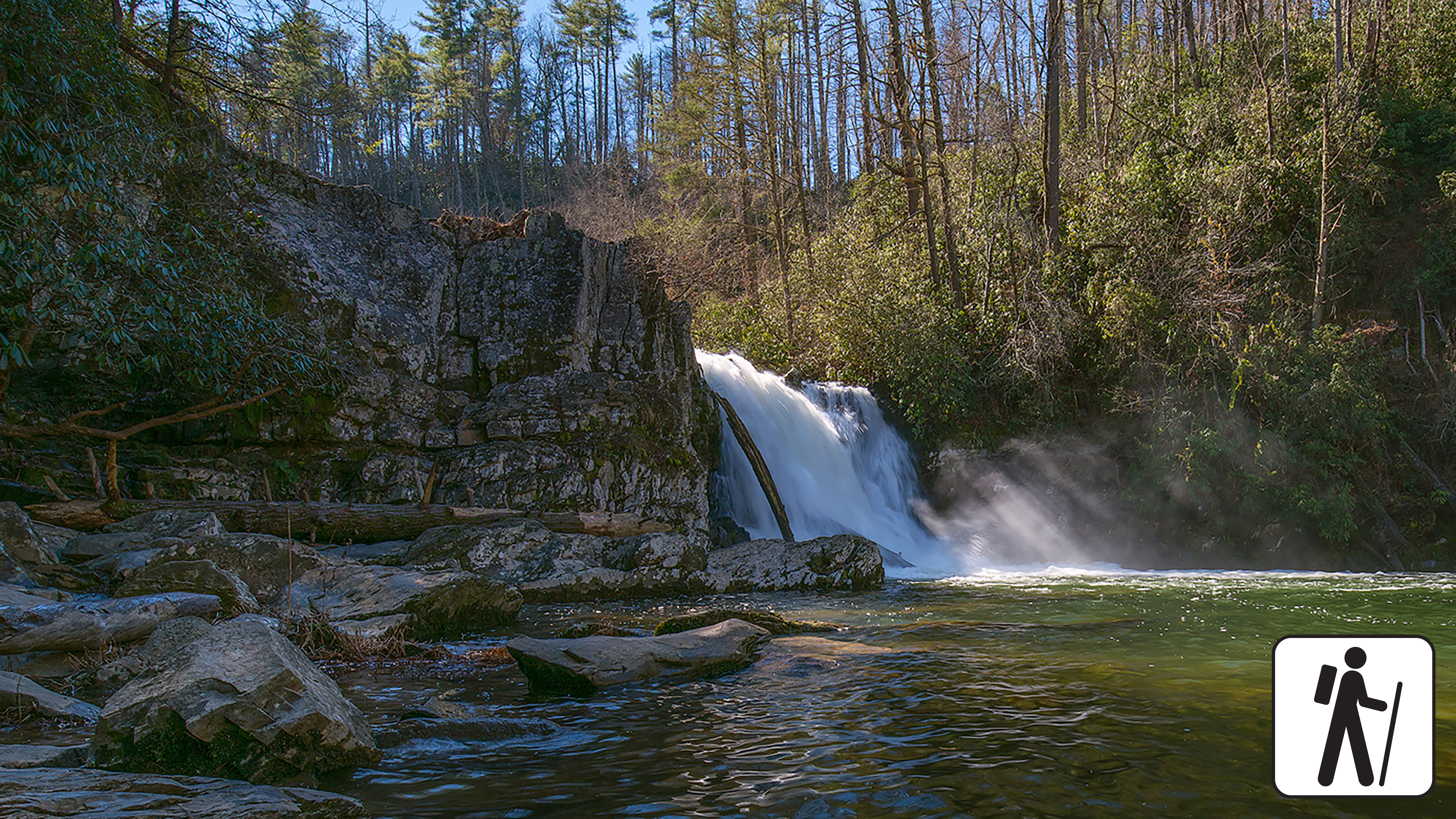
Walk 5 miles (8 km) roundtrip through rhododendron, hemlock, and pine-oak forest in Great Smoky Mountains National Park to a 25-foot (7.6-m) waterfall that flows over a ledge of sandstone into a deep, picturesque pool. This trail is also known for its spring wildflowers.
Length
5 miles (8 km) roundtrip
Parking & Trailhead
After driving roughly halfway around the one-way Cades Cove Loop Road , park at the Abrams Falls Trailhead at the end of Abrams Falls Road (between loop road sign posts 10 and 11). Don't forget your parking tag .
Nearest Restroom
Pit toilet at the trailhead (available year-round)
Alternate Hikes
Deep Creek Waterfall Loop : 2.4 miles (3.9 km) roundtrip
Lynn Camp Prong Cascades : 1.4 miles (2.3 km) roundtrip
West Prong: 5.4 miles (8.7 km) roundtrip
Pets The Gatlinburg Trail and Oconaluftee River Trail are the two park trails where pets are permitted. Pets are also allowed in picnic areas, in campgrounds, and on roads.
Accessibility Trail has occasional obstacles of roots and rocks.
Gaps
Along the way Rich Mountain Gap
Trailhead Ace Gap Trail Trailhead 1,950 ft Drive there
Groves
Along the way Albright Grove
ViewsPeaksRock formations
Along the way Peregrine Peak Alum Cave Bluffs Clifftop Overlook
Trailheads Alum Cave Trail Trailhead 3,879 ft Drive there · Alum Cave trailhead Trailhead 3,851 ft Drive there
no dogs · entrance fee applies
Start Expect crowds and full parking at Alum Cave Trailhead—consider a shuttle
Overview
Expect extreme crowding and limited parking—consider a shuttle or alternate hikes listed below
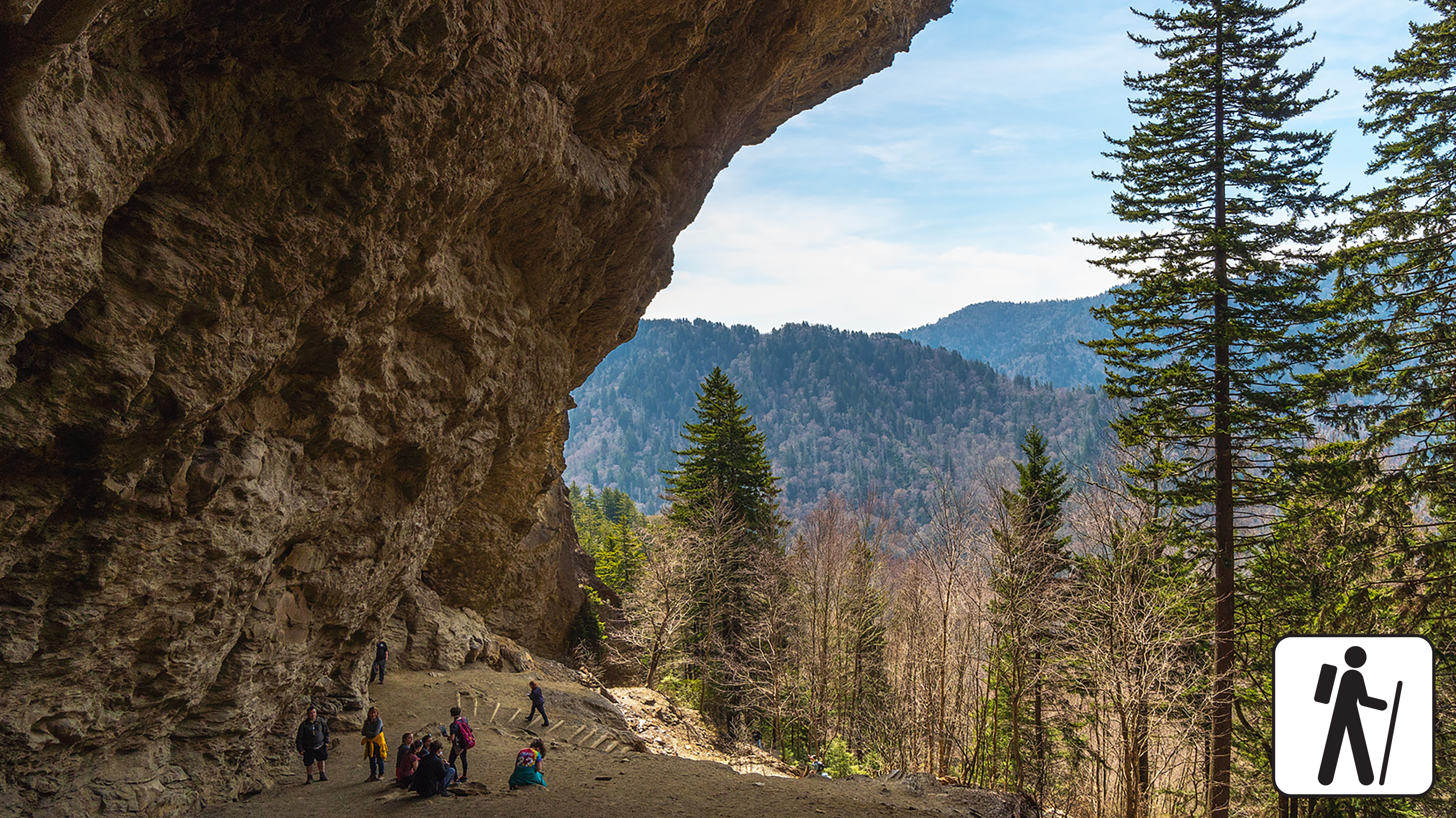
Hike 4.6 miles (7.4 km) roundtrip along Alum Cave Trail in Great Smoky Mountains National Park to see Alum Cave Bluffs and walk through Arch Rock while enjoying old-growth forest and the sounds of mountain streams along the way.
Past Arch Rock, the trail gets considerably steeper. For a more moderate hike, consider turning around at Arch Rock (2.8 miles roundtrip).
Hikers also have the more strenuous option to continue to Mount Le Conte —10 miles (16 km) roundtrip. Find the trailhead and a large parking area 6.8 miles (10.9 km) south of Sugarlands Visitor Center on Newfound Gap Road (US 441).
In cold weather, prepare for ice on the trail and potential falling icicles. Microspikes (chains or small spikes to slip on shoes for better traction) recommended in winter.
Length
4.6 miles (7.4 km) roundtrip
Parking & Trailhead
Please consider a shuttle or park at Alum Cave Bluffs Trailhead located on Newfound Gap Road (US 441) between mile marker 10 and 11. Don't forget your parking tag .
Nearest Restroom
Pit toilet available seasonally at the trailhead
Alternate Hikes
Charlies Bunion : 8 miles (13 km) roundtrip
Andrews Bald : 3.6 miles (5.8 km) roundtrip
West Prong : 5.4 miles (8.7 km) roundtrip
Cove Hardwood Nature Trail : 0.75 miles (1.2 km) roundtrip
Pets The Gatlinburg Trail and Oconaluftee River Trail are the only two park trails where pets are permitted. Pets are also allowed in picnic areas, in campgrounds, and on roads.
Accessibility Trail includes multiple sets of stairs, steep sections, and obstacles like rocks and roots.
no dogs · entrance fee applies
Start Expect crowds and full parking at Alum Cave Trailhead—consider a shuttle
Overview
Expect extreme crowding and limited parking—consider a shuttle and alternate hikes listed below
At 10 miles (16.1 km) roundtrip, this is the shortest of the five routes to Mount LeConte, a challenging and rewarding experience in Great Smoky Mountains National Park . Park at Alum Cave Trailhead along Newfound Gap Road (US 441), but plan to arrive early for this popular hike.
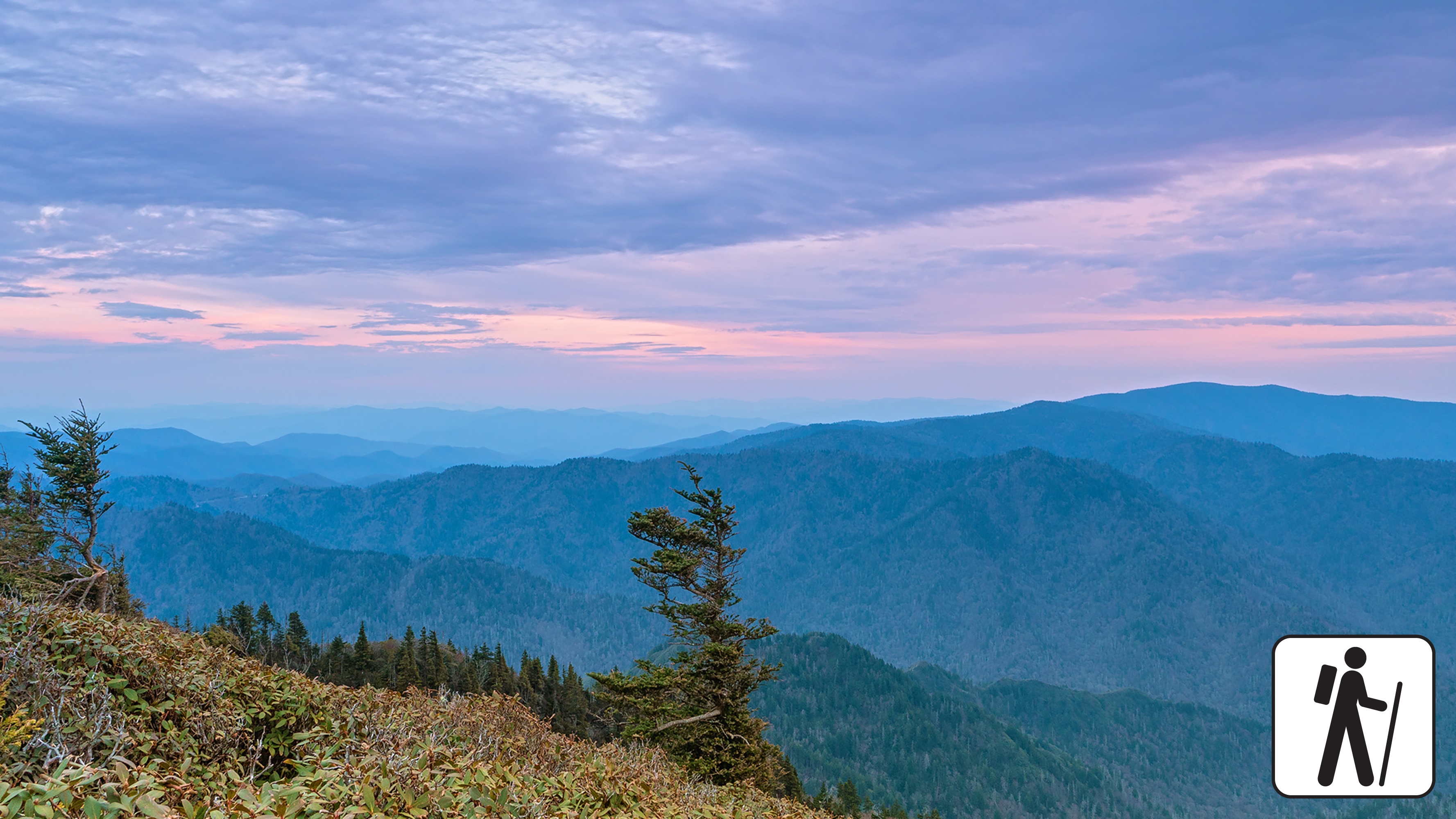
Enjoy dense forest along Alum Cave Creek on the way to Arch Rock and admire Alum Cave Bluffs at 2.3 miles (3.7 km). This is not a cave but an 80-foot (24-m) tall cliff that is curled inward. Spruce-fir forest lines the trail past the bluffs and hikers are rewarded with one of the steepest and highest mountains in the Smokies. Near the summit, the best views are at Cliff Top and Myrtle Point, both marked with signs.
In cold weather, prepare for ice on the trail and potential falling icicles. Microspikes (chains or small spikes to slip on shoes for better traction) recommended in winter.
Length
10 miles (16.1 km) roundtrip
Parking & Trailhead
Please consider a shuttle or park at Alum Cave Trailhead on Newfound Gap Road (US 441). Don't forget your parking tag .
Nearest Restroom
Pit toilets at Alum Cave Trailhead parking area
Alternate Hikes
Alum Cave Bluffs : 4.6 miles (7.4 km) roundtrip
Appalachian Trail & Boulevard Trail to Mount LeConte : 16.2 miles (26.1 km) roundtrip
Bullhead Trail to Mount LeConte : 13.6 miles (21.9 km) roundtrip
Trillium Gap Trail to Mount LeConte : 13 miles (20.9 km) roundtrip
Rainbow Falls Trail to Mount LeConte : 13 miles (20.9 km) roundtrip
Pets The Gatlinburg Trail and Oconaluftee River Trail are the only two park trails where pets are permitted. Pets are also allowed in picnic areas, in campgrounds, and on roads.
Accessibility This trail is steep and rocky, and includes stairs and bridges.
Trailhead Alum Cave trailhead Trailhead 3,851 ft Drive there
Backcountry camps
Along the way #09 Anthony Creek
Trailhead Anthony Creek Trail Trailhead 2,027 ft Drive there
ViewsPeaksHistoryBackcountry campsSheltersGapsTowers
Along the way #113 Birch Spring Gap Beechnut Gap Big Abrams Gap Birch Spring Gap Buck Gap Buckeye Gap Camel Gap Collins Gap Coppers Gap Double Spring Gap Dry Sluice Gap Ekaneetlee Gap and 47 more
Trailheads Appalachian Trail Trailhead 5,272 ft Drive there · Appalachian Trail Trailhead 1,745 ft Drive there · Appalachian Trail Trailhead 5,043 ft Drive there · Appalachian Trail Trailhead 1,881 ft Drive there · Fork Ridge Trail Trailhead 5,884 ft Drive there · Fork Ridge Trail Trailhead 5,881 ft Drive there
no dogs · entrance fee applies
Start Expect full parking at Newfound Gap Overlook—consider a shuttle
Overview
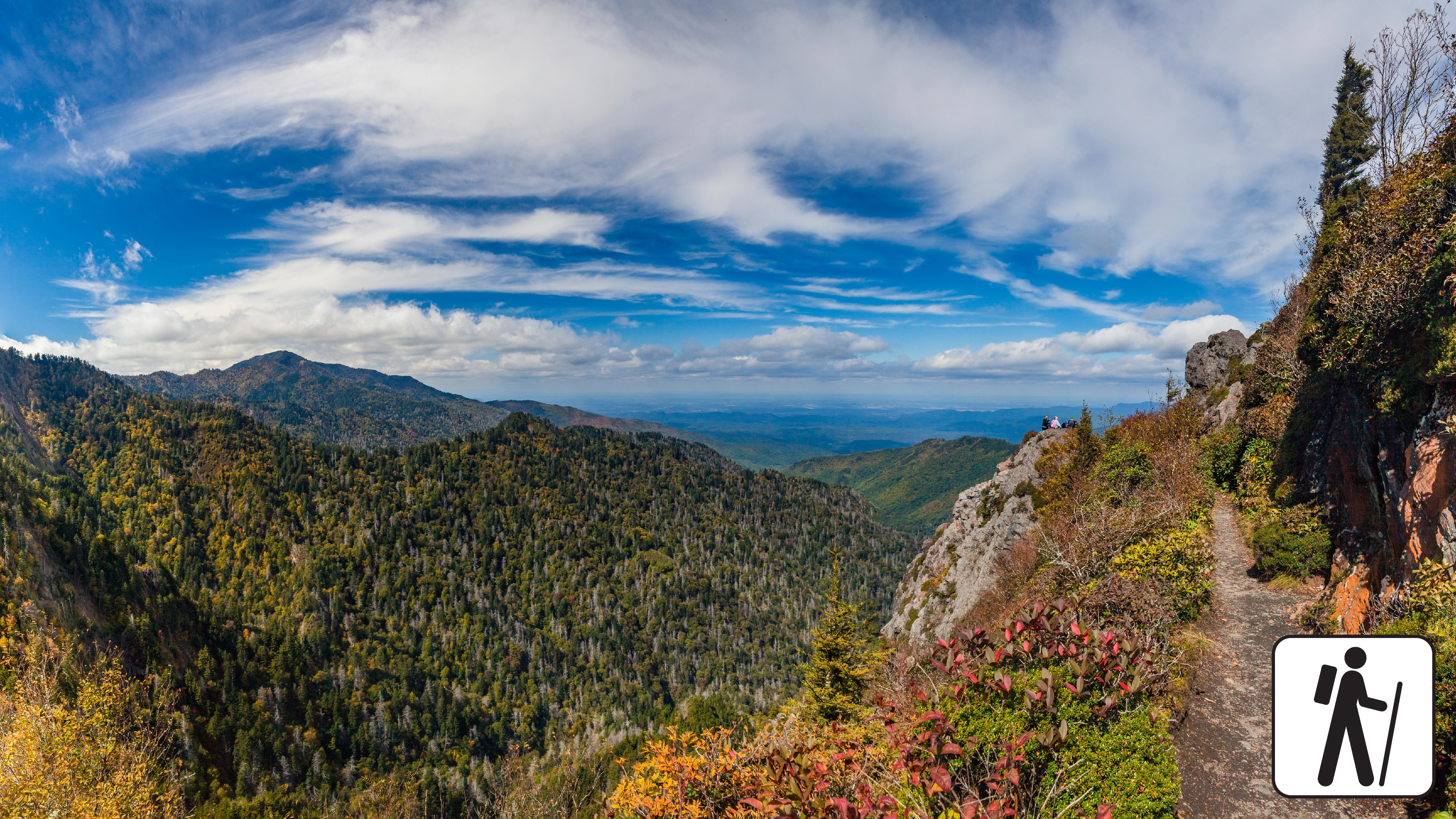
Hike a popular section of the Appalachian Trail in Great Smoky Mountains National Park for 8 miles (12.9 km) roundtrip through hardwood and high-elevation, spruce-fir forest to enjoy panoramic mountain views and a unique rocky outcrop surrounded by steep cliffs.
This wide, firmly packed trail narrows as it ascends to Mount Ambler before descending to Masa Knob and Charlies Bunion.
Always exercise caution near exposed cliffs. In cold weather, prepare for ice on the trail. Microspikes (chains or small spikes to slip on shoes for better traction) recommended in winter.
Length
8 miles (12.9 km) roundtrip
Parking & Trailhead
Please consider a shuttle or park at Newfound Gap Overlook on US 441/Newfound Gap Road. The hike begins on the Appalachian Trailhead at the end of the parking area to the left of the overlook. Don't forget your parking tag .
Nearest Restroom
Near trailhead at Newfound Gap Overlook
Alternate Hikes
Andrews Bald : 3.6 miles (5.8 km) roundtrip
Alum Cave Bluffs : 4.6 miles (7.4 km) roundtrip
Chimney Tops Overlook : 3.5 miles (5.6 km) roundtrip
Pets The Gatlinburg Trail and Oconaluftee River Trail are the only two park trails where pets are permitted. Pets are also allowed in picnic areas, in campgrounds, and on roads.
Accessibility Hike has many steep sections plus roots and rocks on the trail.
no dogs · entrance fee applies
Start Expect crowds and full parking at Newfound Gap Overlook—consider a shuttle
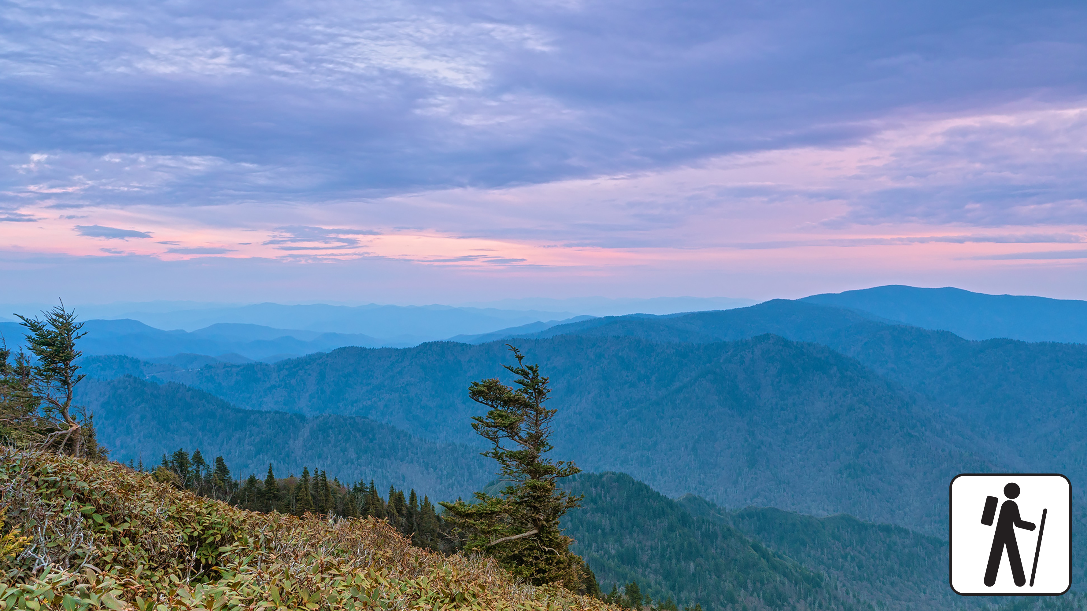
Overview
Expect extreme crowding and limited parking—consider a shuttle and alternate hikes listed below
The longest of the five routes to Mount Le Conte, this strenuous hike—16.2 miles (26.1 km) roundtrip—offers a variety of views in Great Smoky Mountains National Park and includes part of the Appalachian Trail. Charlies Bunion , a rocky outcrop, is a short but rewarding detour. High-elevation forest lines the trail and visitors might spot red squirrels or other wildlife.
In cold weather, prepare for ice on the trail and potential falling icicles. Microspikes (chains or small spikes to slip on shoes for better traction) recommended in winter.
Length
16.2 miles (26.1 km) roundtrip
Parking & Trailhead
Please consider a shuttle or park at Newfound Gap Overlook on US 441/Newfound Gap Road. From the Appalachian Trailhead (left of the overlook), hike for 2.7 miles (4.3 km) to intersect the Boulevard Trail which then leads to the summit. Don't forget your parking tag .
Nearest Restroom
Pit toilets at Newfound Gap Overlook
Alternate Hikes
Charlies Bunion : 8 miles (12.9 km) roundtrip
Bullhead Trail to Mount Le Conte : 13.6 miles (21.9 km) roundtrip
Trillium Gap Trail to Mount Le Conte : 13 miles (20.9 km) roundtrip
Rainbow Falls Trail to Mount Le Conte : 13 miles (20.9 km) roundtrip
Alum Cave Trail to Mount Le Conte : 10 miles (16.1 km) roundtrip
Pets The Gatlinburg Trail and Oconaluftee River Trail are the only two park trails where pets are permitted. Pets are also allowed in picnic areas, in campgrounds, and on roads.
Accessibility Trail is steep with occasional obstacles like roots and rocks.
no dogs · entrance fee applies
Start Expect crowds at Cades Cove Visitor Center
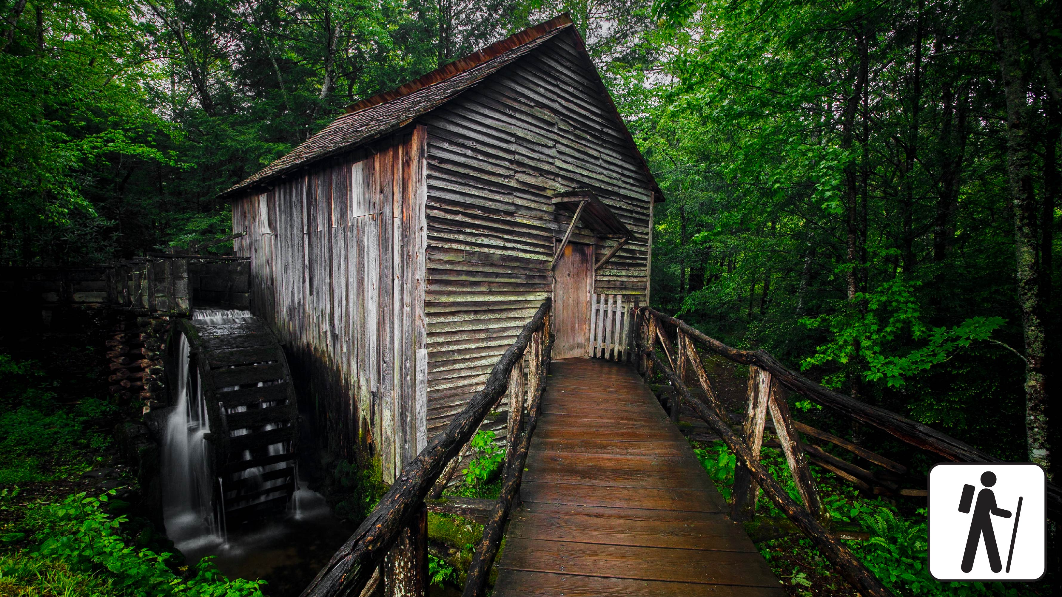
Overview
Cades Cove Visitor Center is approximately 5.5 miles (8.5 km) around the Cades Cove Loop Road. The paths and trails near the visitor center that access the gift shop, restrooms, and the Cable Mill Historic Area , which includes the Becky Cable House, Cable Mill , blacksmith shop, and barns, are primarily paved or hard-packed gravel and relatively flat. The path beyond the Becky Cable House has a step that transitions to a dirt path. There are restrooms, a bookstore and gift shop, and multiple historic buildings including a gristmill that operates spring through fall.
Length
0.3 miles (1.6 km) roundtrip
Parking & Trailhead
Park at the Cades Cove Visitor Center. Don't forget your parking tag .
Nearest Restroom
Restrooms available at Cades Cove Visitor Center.
Pets The Gatlinburg Trail and Oconaluftee River Trail are the only two park trails where pets are permitted. Pets are also allowed in picnic areas, in campgrounds, and on roads.
Accessibility Paths are primarily paved or hard-packed gravel and relatively flat.
History
Along the way Mayna Treanor Avent Cabin/Studio
Backcountry camps
Along the way #32 Injun Creek
PeaksSheltersGaps
Along the way Beech Gap Laurel Gap Pin Oak Gap Ledge Bald Laurel Gap Shelter
Trailhead Balsam Mountain Trail Trailhead 4,427 ft Drive there
History
Along the way Baskins Creek Cemetery
WaterfallsHistoryBridges
Along the way Roaring Fork Motor Nature Trail Bridge #2 Spruce Flats Cemetery Baskins Creek Falls
Trailheads Baskins Creek Trail Trailhead 2,738 ft Drive there · Baskins Creek Trail Trailhead 2,437 ft Drive there
PeaksBackcountry campsPicnic areasTowers
Along the way #38 Mount Sterling Mount Sterling Big Creek Picnic Area Mt. Sterling Lookout Tower
Trailhead Baxter Creek Trail Trailhead 1,712 ft Drive there
Backcountry camps
Along the way #75 Poplar Flats
Backcountry camps
Along the way #03 Hesse Creek #11 Beard Cane
Views
Along the way Beech Flats Overlook
GapsBridges
Along the way Straight Fork Bridge Beech Gap
Trailheads Beech Gap Trail Trailhead 3,148 ft Drive there · Beech Gap Trail Trailhead 3,104 ft Drive there
Campgrounds
Along the way Big Creek Group Camp
Trailheads Big Creek Horse Trailhead 1,682 ft Drive there · Big Creek Horse Trailhead 1,673 ft Drive there · Big Creek Trail Trailhead 1,732 ft Drive there
WaterfallsBackcountry camps
Along the way #36 Upper Walnut Bottom #37 Lower Walnut Bottom Midnight Hole Falls
Trailhead Big Creek Trail Trailhead 1,732 ft Drive there
Trailhead Little Dudley Concession Horse Trail Trailhead 1,550 ft Drive there
Trailhead Big Fork Ridge Trail Trailhead 2,817 ft Drive there
HistoryBackcountry camps
Along the way #83 Bone Valley J. H. Kress Cabin
History
Along the way Robert Palmer Cemetery
Gaps
Along the way Hickory Tree Gap Sandy Gap
Trailhead Bote Mountain Trail Trailhead 1,592 ft Drive there
no dogs · entrance fee applies
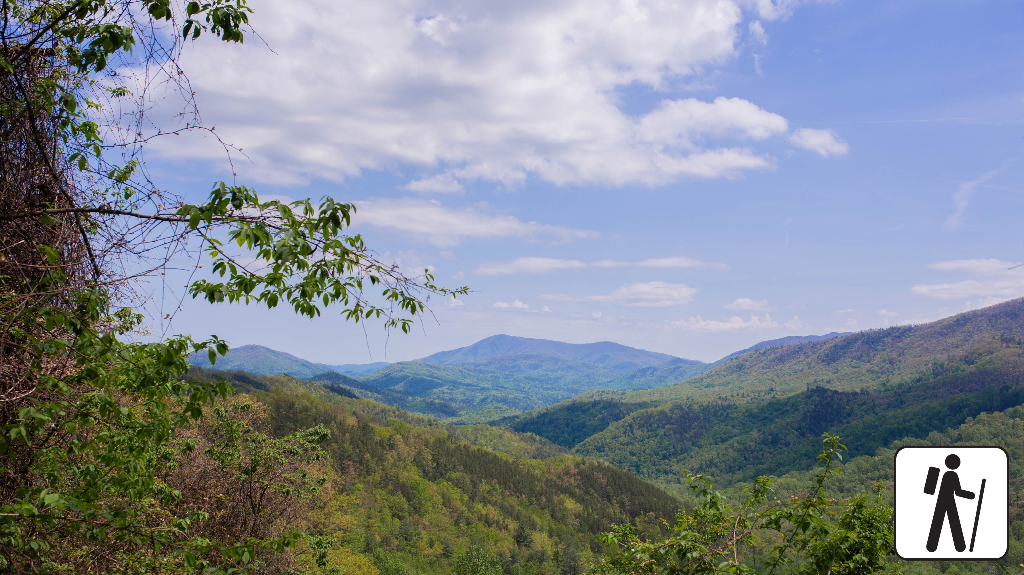
Overview
This loop hike links three shorter trails sections, offering hikers a chance to experience the biodiversity of Bote Mountain at various elevations and temperatures. Climbing over 1,200 feet across 6.9 miles (11.10 km), hikers will experience the rhododendron-lined thickets on Finley Cane Trail, the ridgeline views atop Bote Mountain, and a cool descent beneath the mixed hardwoods and tulip poplar trees on Lead Cove trail. This all-season loop provides wildflowers in the spring, shade in the summer, leaf-lined vistas in the fall, and unobstructed views to the east and west of the Bote Mountain ridgeline in the winter. Located only minutes away from Cades Cove, this loop trail is perfect for hikers looking to step away from the crowds and onto a trail steeped in both history and elevation.
Length
6.9 miles (11.1 km) loop
2.5 miles from Finley Cove Trailhead to Bote Mountain Trail Junction
2.4 miles from Bote Mountain Trail Junction to Lead Cove Trail Junction
1.95 miles from Lead Cove Trail Junction to Finley Cane Trailhead
Elevation Gain
1,215 feet
Parking & Trailhead
Head West on Laurel Creek Road, towards Cades Cove, and parallel park on the left (south side) at one of the two paved pull-offs available near the Finley Cane Trailhead. These pull-offs service three trails: Turkeypen Ridge Trail, Finley Cane Trail and Lead Cove Trail. If you park on the opposite side of the road, be cautious as traffic can be heavy. Don't forget your parking tag .
Nearest Restroom
Cades Cove Picnic Area
Alternate Hikes
West Prong Trail: 5.4 miles (8.7 km) roundtrip
Pets The Gatlinburg Trail and Oconaluftee River Trail are the only two park trails where pets are permitted. Pets are also allowed in picnic areas, in campgrounds, and on roads.
Accessibility This trail includes dirt and loose gravel with rocky sections, protruding roots, water crossings, and steep grades.
PeaksSheltersGaps
Along the way Alum Gap High Top MtLeConte Shelter
no dogs · entrance fee applies
Start Expect crowds and full parking at Newfound Gap Overlook—consider a shuttle
Overview
Expect extreme crowding and limited parking—consider a shuttle and alternate hikes listed below
The longest of the five routes to Mount Le Conte, this strenuous hike—16.2 miles (26.1 km) roundtrip—offers a variety of views in Great Smoky Mountains National Park and includes part of the Appalachian Trail. Charlies Bunion , a rocky outcrop, is a short but rewarding detour. High-elevation forest lines the trail and visitors might spot red squirrels or other wildlife.
In cold weather, prepare for ice on the trail and potential falling icicles. Microspikes (chains or small spikes to slip on shoes for better traction) recommended in winter.
Length
16.2 miles (26.1 km) roundtrip
Parking & Trailhead
Please consider a shuttle or park at Newfound Gap Overlook on US 441/Newfound Gap Road. From the Appalachian Trailhead (left of the overlook), hike for 2.7 miles (4.3 km) to intersect the Boulevard Trail which then leads to the summit. Don't forget your parking tag .
Nearest Restroom
Pit toilets at Newfound Gap Overlook
Alternate Hikes
Charlies Bunion : 8 miles (12.9 km) roundtrip
Bullhead Trail to Mount Le Conte : 13.6 miles (21.9 km) roundtrip
Trillium Gap Trail to Mount Le Conte : 13 miles (20.9 km) roundtrip
Rainbow Falls Trail to Mount Le Conte : 13 miles (20.9 km) roundtrip
Alum Cave Trail to Mount Le Conte : 10 miles (16.1 km) roundtrip
Pets The Gatlinburg Trail and Oconaluftee River Trail are the only two park trails where pets are permitted. Pets are also allowed in picnic areas, in campgrounds, and on roads.
Accessibility Trail is steep with occasional obstacles like roots and rocks.
WaterfallsHistory
Along the way Tom Huskey's Child Cemetery Hitchin Post Falls Taywa Creek Cascade
Trailhead Bradley Fork Trail Trailhead 2,247 ft Drive there
no dogs · entrance fee applies
Start Trailhead located in the Smokemont Campground.
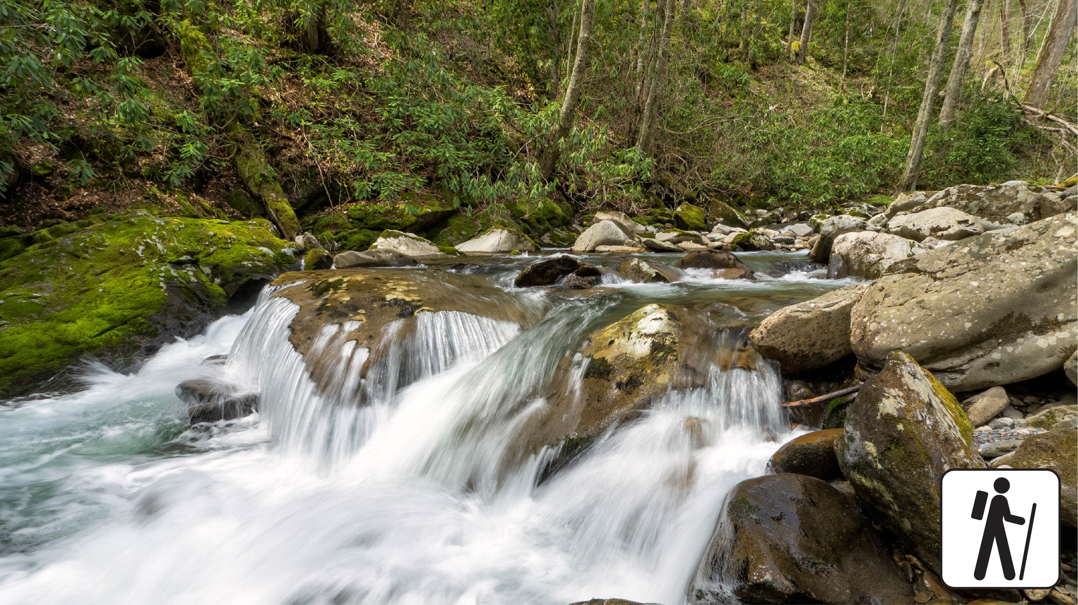
a { text-decoration: none; color: #464feb; } tr th, tr td { border: 1px solid #e6e6e6; } tr th { background-color: #f5f5f5; } Overview
The Bradley Fork Trail offers a scenic and diverse outdoor experience, featuring picturesque creeks surrounded by dog hobble and rhododendron, seasonal wildflowers, fishing access, horseback riding opportunities, and backcountry camping .
The trail begins as a flat, wide old roadbed and gently ascends for the first 4 miles toward the Hughes Ridge Trail, with all creek crossings bridged. At 1.2 miles, hikers reach the Chasteen Creek Trail junction, which leads 0.1 miles to backcountry campsite #50. At mile 4, the trail intersects with the Cabin Flats Trail, where it becomes steep and narrow, transitioning into rocky terrain that requires extra caution. This rugged section continues until the trail ends at the Hughes Ridge Trail, offering a more challenging hike through the backcountry. A backcountry permit is required to camp at the site.
Parking & Trailhead
Hikers should access this trail from the back of Smokemont Campground , at the far end of the D loop, where a small parking area is avalible. Don't forget your parking tag !
Nearest Restroom
Smokemont Campground
Alternate Hikes
Deep Creek Waterfall Loop : 2.4 miles (3.9 km) roundtrip
Little River, Cucumber Gap, Jakes Creek Loop : 5.4 miles (8.7 km) roundtrip
Oconaluftee River Trail : 3 miles (4.8 km) roundtrip
Kephart Prong Trail : 4 miles (6.4 km) roundtrip
Accessibility a { text-decoration: none; color: #464feb; } tr th, tr td { border: 1px solid #e6e6e6; } tr th { background-color: #f5f5f5; } This trail is not ADA accessible. GRIT Freedom Chairs are available free of charge on a first-come, first-served basis for use on a portion of this trail. These all-terrain mobility devices can be used for the first 1.3 miles , starting from the back of Smokemont Campground and leading to Campsite #50 . Please note: The trail surface includes uneven dirt, rocks, and gravel , with sections of exposed roots and large rocks that may affect travel for wheelchair or mobility device users. There are a few steep sections along the route. Use descriptions, maps, and photos to determine which hikes are suitable for you. For information about the reservation process and other trail segments where GRIT Freedom Chairs can be used, visit the trail accessibility page.
PeaksGaps
Along the way Trillium Gap Brushy Mountain
History
Along the way Lail Cemetery
no dogs · entrance fee applies
Start Expect crowds and full parking at Rainbow Falls/Bullhead Trailhead—consider a shuttle
Bullhead trail is closed Monday - Thursday for trail rehabilitation. Learn more about this closure.
Overview
Expect extreme crowding and limited parking—consider a shuttle and alternate hikes listed below
One of five routes to Mount Le Conte in Great Smoky Mountains National Park , the Bullhead Trail offers consistent views along the way. This strenuous hike is 13.6 miles (21.9 km) roundtrip. See rocky cliffs near the beginning and climb the Bullhead, a heath-covered bald that may resemble a bull's head from a distance.
Near the top, proceed straight at both the Rainbow Falls Trail and Alum Cave Trail junctions to arrive at Mount Le Conte. Partially due to the burn remnants of the 2016 Chimney Tops fire, the trail does not offer much shade during hot summer months.
From the parking area on Cherokee Orchard Road, follow the nearby gravel road (technically the Old Sugarlands Trail) for four-tenths of a mile (0.6 km) to the Bullhead Trail junction on your left. Consult a map to pair this with Rainbow Falls Trail or Trillium Gap Trail to create a loop hike to Mount LeConte (total mileages will vary).
In cold weather, prepare for ice on the trail and potential falling icicles. Microspikes (chains or small spikes to slip on shoes for better traction) recommended in winter.
Length
13.6 miles (21.9 km) roundtrip
Parking & Trailhead
Please consider a shuttle or park at Rainbow Falls/Bullhead Trailhead on Cherokee Orchard Road (follow Old Sugarlands Trail from the parking area to arrive at Bullhead Trail). Don't forget your parking tag .
Nearest Restroom
Pit toilets at Rainbow Falls Trailhead
Alternate Hikes
Appalachian Trail & Boulevard Trail to Mount Le Conte : 16.2 miles (26.1 km) roundtrip
Trillium Gap Trail to Mount Le Conte : 13 miles (20.9 km) roundtrip
Rainbow Falls Trail to Mount Le Conte : 13 miles (20.9 km) roundtrip
Alum Cave Trail to Mount Le Conte : 10 miles (16.1 km) roundtrip
Pets The Gatlinburg Trail and Oconaluftee River Trail are the only two park trails where pets are permitted. Pets are also allowed in picnic areas, in campgrounds, and on roads.
Accessibility Trail is very steep and rocky.
Backcountry camps
Along the way #49 Cabin Flats
Trailhead Cades Cove Horse Trail Trailhead 1,885 ft Drive there
HistoryBackcountry camps
Along the way #41 Caldwell Fork Shelton-Caldwell Cemetery
Backcountry campsGaps
Along the way #16 Scott Gap Scott Gap
Backcountry camps
Along the way #65 Bear Pen Branch
Backcountry camps
Along the way #98 Chambers Creek
HistoryBackcountry campsGaps
Along the way #02 Cane Creek Cane Gap Buchanan Family Cemetery
History
Along the way Carson-Messer Cemetery
History
Along the way Carver Cemetery
Gaps
Along the way Panther Spring Gap
Trailhead Cataloochee Divide Trail Trailhead 4,064 ft Drive there
HistoryCampgroundsBridges
Along the way Palmer Creek Bridge Cataloochee Horse Camp Indian Creek (Beech Grove) School Palmer Chapel Methodist Church
Trailheads Cataloochee Horse Trail Trailhead 2,637 ft Drive there · Cataloochee Horse Trail Trailhead 2,745 ft Drive there · Cataloochee Horse Trail Trailhead 2,779 ft Drive there
History
Along the way Chambers Cemetery
WaterfallsBackcountry camps
Along the way #48 Upper Chasteen #50 Lower Chasteen Creek Chasteen Creek Cascade
no dogs · entrance fee applies
Overview
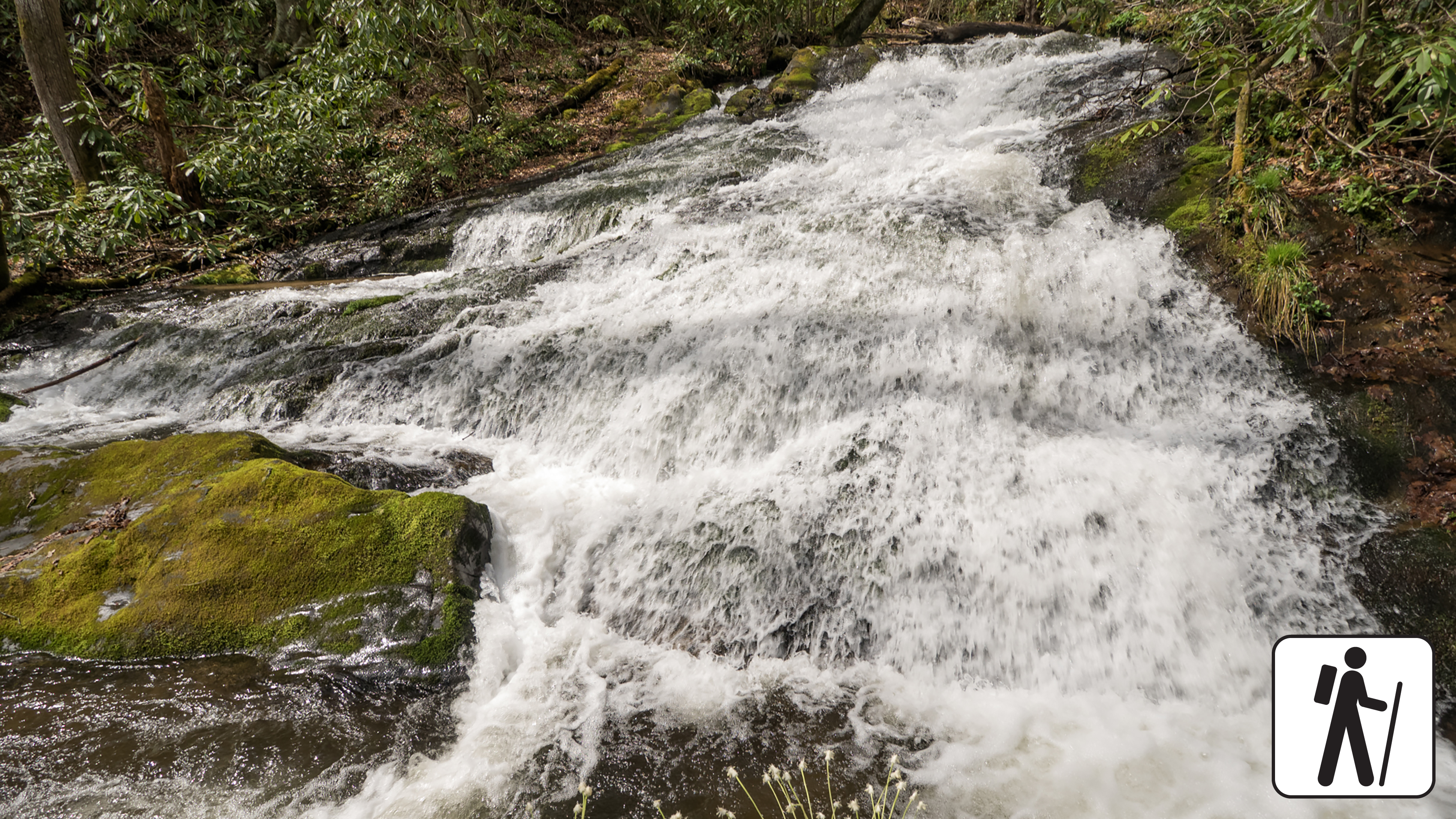
Hike 3.6 miles (5.8 km) roundtrip through hardwood forest in Great Smoky Mountains National Park following the path of the Bradley Fork of the Oconaluftee River to a peaceful cascade that slides 15 feet (4.6 m) down smoothly worn standstone.
This section of the Bradley Fork Trail is a popular wooded adventure for hikers and horse-riders who are departing from the Smokemont Campground area. Wooded views are interspersed with open areas and thin forests of flowering dogwood, yellow birch, sycamore, and tuliptree.
Length
3.6 miles (5.8 km) roundtrip
Parking & Trailhead
The Bradley Fork Trailhead is on the far north end of Smokemont Campground Road. Don't forget your parking tag .
Nearest Restroom
Smokemont Campground (available year-round)
Alternate Hikes
Smokemont Loop Trail: 6.1 miles (9.8 km) roundtrip
Towstring Trail: 4 miles (6.4 km) roundtrip
Newton Bald Trail: 9.4 miles (15.1 km) roundtrip
Pets The Gatlinburg Trail and Oconaluftee River Trail are the only two park trails where pets are permitted. Pets are also allowed in picnic areas, in campgrounds, and on roads.
Accessibility Trail has occasional obstacles of roots and rocks.
Bridges
Along the way Chestnut Branch Bridge
Trailhead Chestnut Branch Trail Trailhead 1,626 ft Drive there
PeaksGaps
Along the way Bryant Gap Chestnut Top Lead
Trailhead Chestnut Top Trail Trailhead 1,137 ft Drive there
no dogs · entrance fee applies
Overview
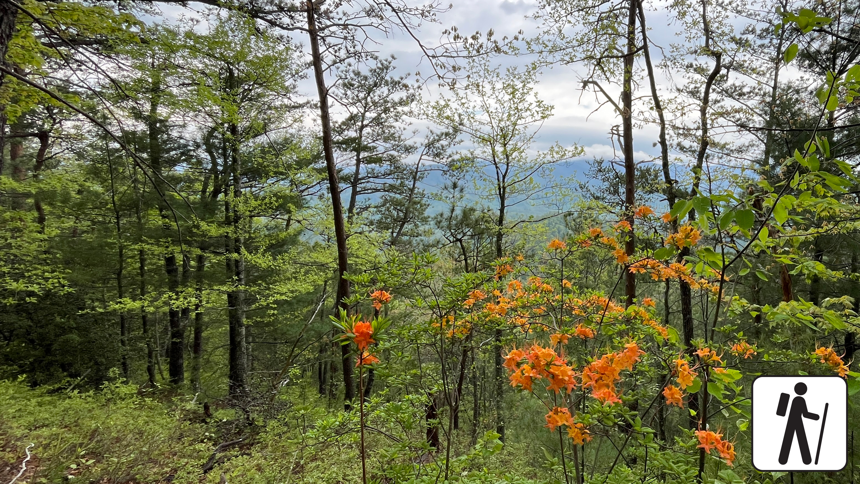
Hike 5.6 miles (9 km) roundtrip on a trail in Great Smoky Mountains National Park that climbs steadily through mixed hardwood forest to a ridgetop where American chestnut trees were once abundant.
The vast majority of American chestnut trees succumbed to an imported fungus by the 1950s, but fall leaf color and plentiful spring wildflowers remain a draw on this serene trail.
Length
5.6 miles (9 km) roundtrip
Turnaround location is not designated but noticeable by views to the left and a slight clearing. Trail continues roughly 1.5 additional miles (2.4 km) to the intersection with Schoolhouse Gap Trail. Plan ahead and bring a map.
Parking & Trailhead
Park at the Townsend Wye intersection of Little River Road and Townsend Entrance Road. Chestnut Top Trailhead is on the opposite side of the road from the parking lot. Don't forget your parking tag .
Nearest Restroom
Townsend Visitor Center
Alternate Hikes
Lynn Camp Prong Cascades : 1.4 miles (2.3 km) roundtrip
Rich Mountain Loop Trail: 8.5 miles (13.7 km) roundtrip
Pets The Gatlinburg Trail and Oconaluftee River Trail are the only two park trails where pets are permitted. Pets are also allowed in picnic areas, in campgrounds, and on roads.
Accessibility Trail steadily climbs on a sometimes-narrow path with some tree roots and fallen logs.
Trailhead Chimney Tops Trail Trailhead 3,438 ft Drive there
no dogs · entrance fee applies
Start Expect crowds and full parking at Chimney Tops Trailhead—consider a shuttle
Overview
Expect extreme crowding and limited parking—consider a shuttle
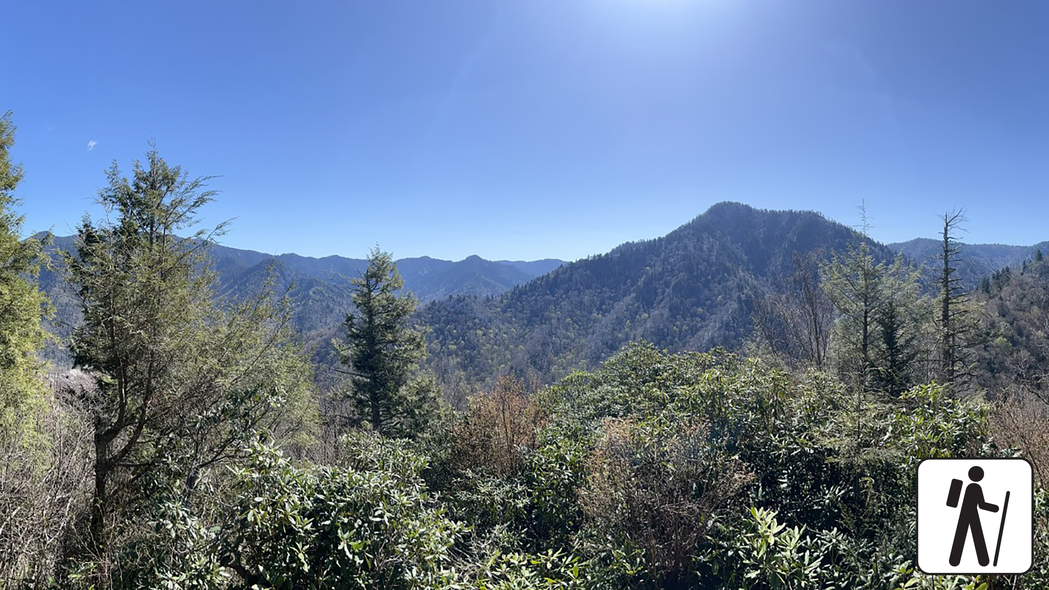
Hike 3.5 miles (5.6 km) roundtrip with steep inclines, a few early bridge crossings, and stone stairs that deliver hikers to a picturesque view in Great Smoky Mountains National Park .
In November 2016, this area experienced an unprecedented wildfire which changed the landscape, making it vulnerable to erosion and other hazards. Do not enter the closed area and do not put yourself at risk. Please read the closed sign and do not go past the gate.
To preserve habitat and for the safety of all visitors, please adhere to all trail closures.
Length
3.5 miles (5.6 km) roundtrip
Parking & Trailhead
Please consider a shuttle or park at the Chimney Tops Trailhead on Newfound Gap Road (US 441), roughly 7 miles (11.3 km) from Sugarlands Visitor Center and 22 miles (35.4 km) from Oconaluftee Visitor Center. Don't forget your parking tag .
Alternative Hikes
West Prong: 5.4 miles (8.7 km) roundtrip
Cove Hardwood Nature Trail : 0.75 miles (1.2 km) roundtrip
Nearest Restroom
Sugarlands Visitor Center
Pets The Gatlinburg Trail and Oconaluftee River Trail are the two park trails where pets are permitted. Pets are also allowed in picnic areas, in campgrounds, and on roads.
Accessibility Trail is steep with stairs and other trail obstacles like roots and rocks.
ViewsPeaks
Along the way Cliff Top Clifftop Overlook
Gaps
Along the way Cold Spring Gap
History
Along the way Connor - Hickory Flats Cemetery Stiles Cemetery
History
Along the way Conner - Oconaluftee Cemetery
Trailhead Conner Cemetery Access Trailhead 2,111 ft Drive there
Backcountry campsCampgrounds
Along the way #01 Cooper Road Abrams Creek Campground
Trailhead Cooper Road Trail Trailhead 1,821 ft Drive there
no dogs · entrance fee applies
Overview
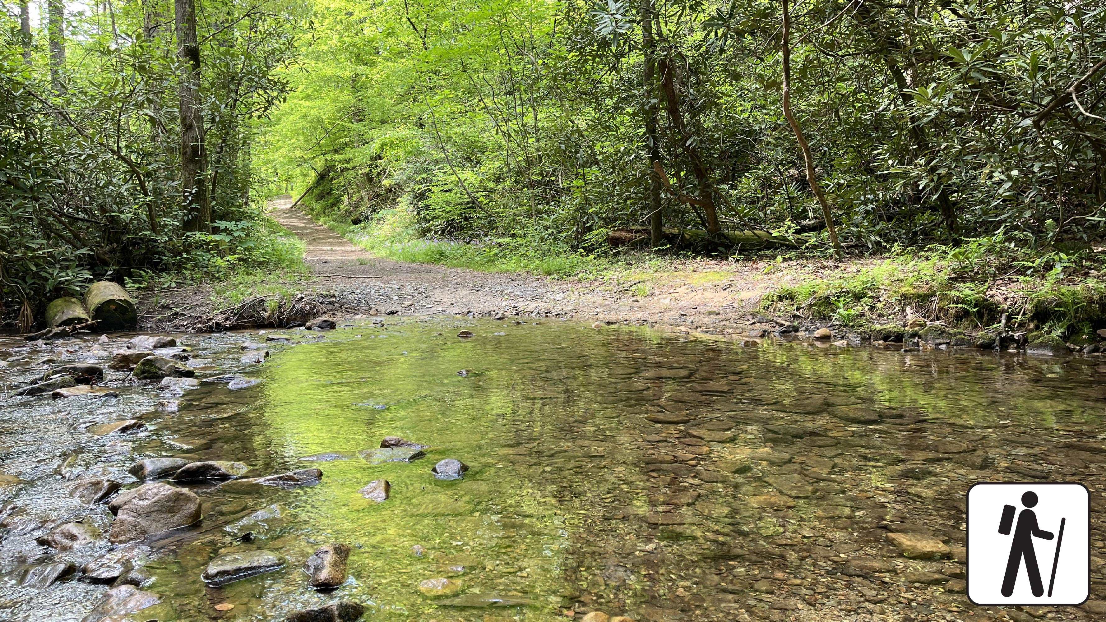
This trail was historically used to travel in and out of Cades Cove by Native Americans, early settlers, and the logging industry. These days, the Cooper Road Trail is the road less traveled. The wide trail is a former road that begins as gravel and transitions to dirt with roots, rocks, depressions and numerous stream crossings.
Length
10.9 miles (17.5 km) from Abrams Creek Campground to Cades Cove Loop Road.
Parking & Trailhead
Cooper Road Trail has two trailheads:
Abrams Creek: Park at Abrams Creek Ranger Station located on Abrams Creeks Campground Road. The Cooper Road trailhead is located at the end of the campground loop.
Cades Cove Loop Road: Drive 4.3 miles on Cades Cove Loop Road from the beginning of the loop. Look for trail signs on the right and park on the left.
No matter which trailhead you use, don't forget your parking tag .
Nearest Restroom
Nearest restroom to Abrams Creek trailhead: Available seasonally in Abrams Creek Campground .
Nearest restoom to Cades Cove trailhead: Restrooms, including accessible restrooms, are available at the Cades Cove Visitor Center .
Pets The Gatlinburg Trail and Oconaluftee River Trail are the only two park trails where pets are permitted. Pets are also allowed in picnic areas, in campgrounds, and on roads.
Accessibility The first mile of this trail from the Abrams Creek trailhead has been assessed using the High-Efficiency Trail Assessment Process (HETAP) to provide objective information such as grade and slope. GRIT Freedom Chairs are available for free checkout on a first-come, first-served basis for this section, which runs from Abrams Creek Campground to backcountry campsite #1. The trail begins with gravel and transitions to dirt with roots, rocks, and depressions. Note: Cooper Road Trail has two trailheads: Abrams Creek and Cades Cove Loop Road. Use descriptions, maps, and photos to determine which hikes are suitable for you. For information about the reservation process and other trail segments where GRIT Freedom Chairs can be used, visit the trail accessibility page.
Picnic areas
Along the way Chimneys Picnic Area
Trailhead Cove Hardwood Nature Trail Trailhead 2,739 ft Drive there
no dogs · entrance fee applies
Overview
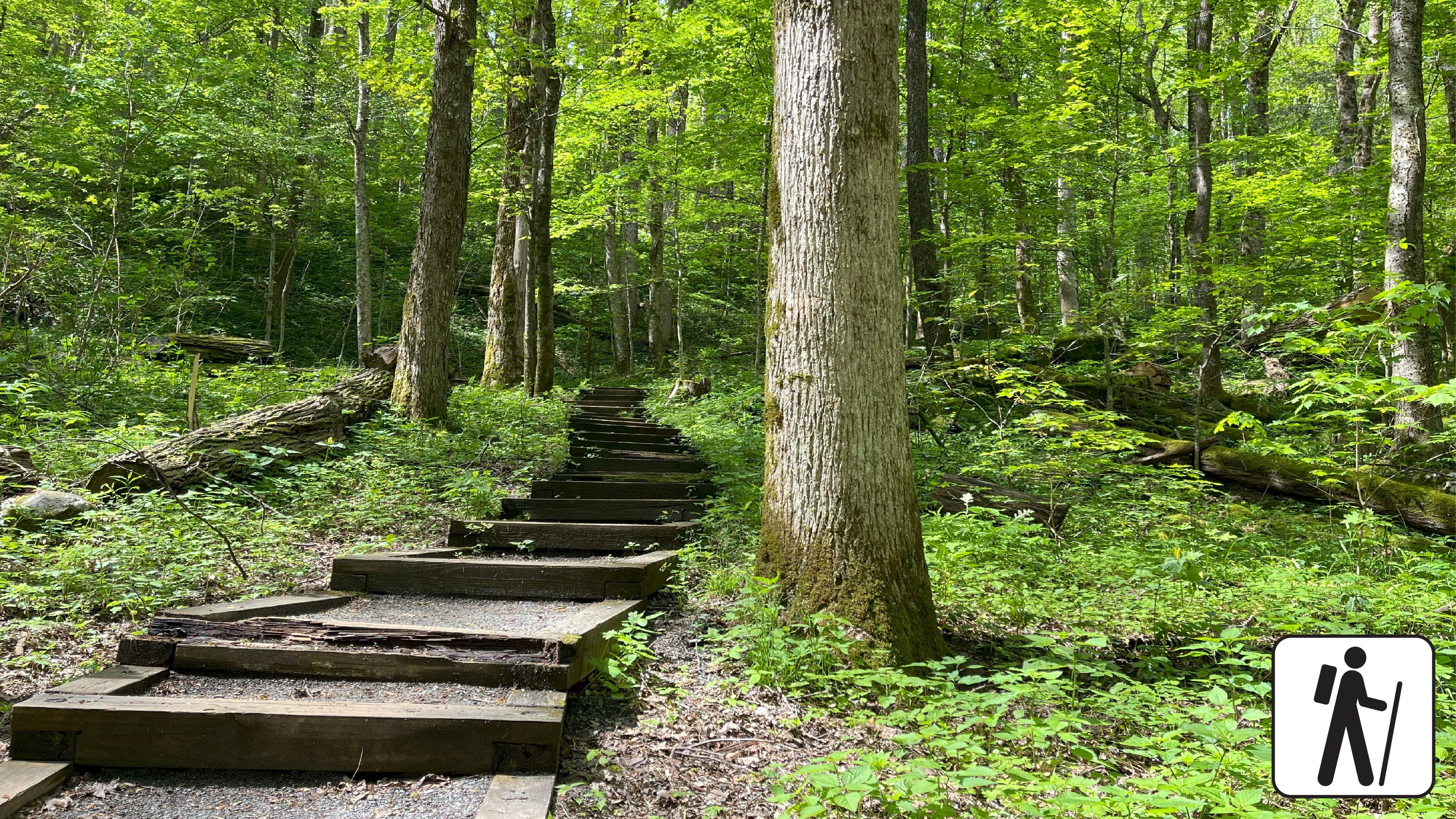
Explore a forest of giants and wind through a lush mountainside on this iconic 0.75-mile loop hike. Cove hardwood forests are amongst the most biodiverse ecosystems on the planet, home to a multitude of trees, plants, and animals. This forest also tells a story of human settlement, logging, and regrowth, representing the resilience of the forests that make up the present-day park.
Expect to climb several sets of stairs and step over roots and rocks at the beginning of this loop trail, but once you reach the trail junction the terrain climbs more gently and ends with a gradual descent. Find solitude among the songbirds and streams. The vibrant flowers of spring, the lush green of summer, the parade of color in fall, and the peaceful hush of winter create a sense of an enchanted forest here in every season.
The trail begins in the Chimneys Picnic Area with stairs that wind up past the group picnic site and then transition to soil, roots, and rocks. The first section of the trail has two sets of steps (40 in total), but the trail becomes less steep for the rest of the hike. After the steps, approximately 700 feet from the trailhead, there is a junction with an arrow pointing to take the loop to the right. Follow the loop around until it begins to descend back to the junction. Turn right to return to the trailhead and parking area.
Length
0.75 miles (1.2 km) roundtrip
Parking & Trailhead
Seven parking spots next to the trailhead and additional parking available throughout the Chimneys Picnic Area . Don't forget your parking tag .
Nearest Restroom
Restrooms available seasonally at Chimneys Picnic Area .
Alternate Hikes
Smokemont Nature Trail
Cooper Road Trail
Pets The Gatlinburg Trail and Oconaluftee River Trail are the only two park trails where pets are permitted. Pets are also allowed in picnic areas, in campgrounds, and on roads.
Accessibility Trail includes some steep sections, stairs, and occasional roots/rocks.
WaterfallsPeaksHistoryRanger stationsBridges
Along the way Headquarters Residence Bridge Park Headquarters Road Lower Fighting Creek Cemetery Mount Harrison Phils View Little River Ranger Station Cataract Falls
Trailhead Cove Mountain Trail Trailhead 1,450 ft Drive there
Gaps
Along the way Incline Gap
Trailheads Crib Gap Trail Trailhead 2,055 ft Drive there · Crib Gap Trail Trailhead 1,754 ft Drive there · Crib Gap Trail Trailhead 2,023 ft Drive there
Waterfalls
Along the way Crooked Arm Cascades
no dogs · entrance fee applies
Overview
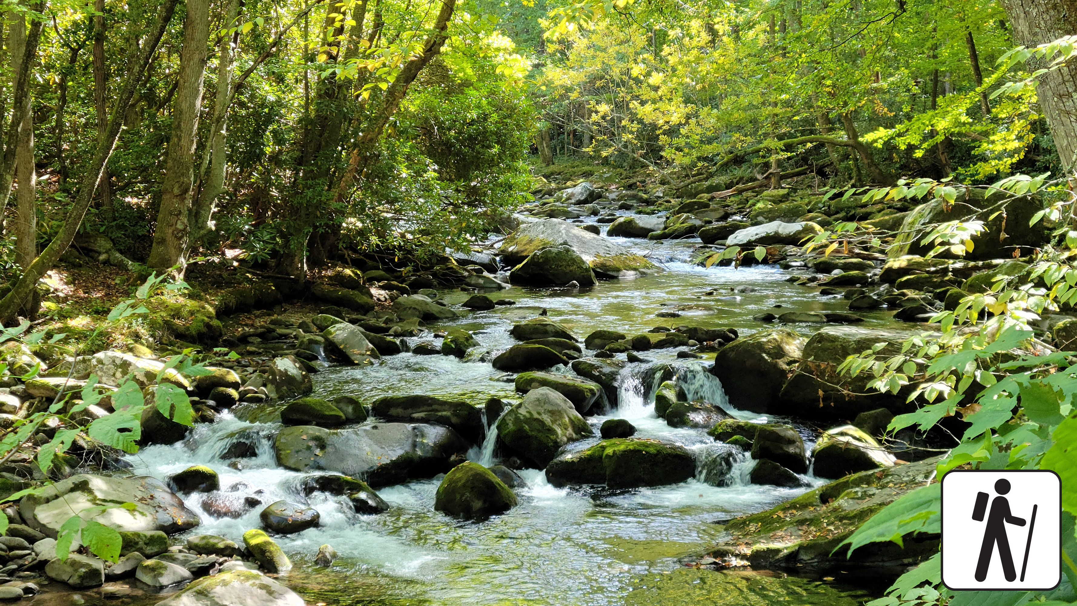
Hike 5.4 miles (8.7 km) on a pleasant and shady loop in the Elkmont area of Great Smoky Mountains National Park . The route connects three trails with streamside views, historic structures, and prolific spring wildflower displays.
Trail conditions vary from paved road and graveled path to narrower and rockier sections with minor stream crossings. The Little River section is wide and flat. Jakes Creek is wide and slightly steeper/rockier, but still has a mild-to-moderate grade. Cucumber Gap is narrow with ups and downs.
The Little River and Jakes Creek trailheads and parking areas are separated by a short section of one-way road in the leafy historic district of Elkmont.
Water crossing at Husky Branch on the Cucumber Gap Trail may not be passable during high water.
Length
5.4 miles (8.7 km) roundtrip
Parking & Trailhead
Park at either the Jakes Creek or Little River Trailhead in Elkmont Historic District. Both hikes begin on wide, gravel trails. Don't forget your parking tag .
Nearest Restroom
Elkmont Campground (available seasonally)
Alternate Hikes
Lynn Camp Prong Cascades : 1.4 miles (2.3 km) roundtrip
Chasteen Creek Cascades : 3.6 miles (5.8 km) roundtrip
Twentymile Cascades: 1.2 miles (1.9 km) roundtrip
Finley Cane Trail to Bote Mtn Trail to Lead Cove Trail Loop : 6.9 mile (11.1 km) loop
Pets The Gatlinburg Trail and Oconaluftee River Trail are the only two park trails where pets are permitted. Pets are also allowed in picnic areas, in campgrounds, and on roads.
Accessibility Little River and Jakes Creek trails are mostly wide and relatively flat with some rocks and roots on the trail. Cucumber Gap Trail is more narrow.
Gaps
Along the way Curry Gap
Trailhead Curry Mountain Trail Trailhead 1,692 ft Drive there
Shelters
Along the way Davenport Gap Shelter
WaterfallsPicnic areas
Along the way Deep Creek Picnic Pavilion Juney Whank Falls
WaterfallsViewsBackcountry camps
Along the way #53 Poke Patch #54 Nettle Creek #55 Pole Road #56 Burnt Spruce #57 Bryson Place #58 Nicks Nest Branch #59 Mc Cracken Branch #60 Bumgardener Branch Deep Creek Valley Overlook Tom Branch Falls
Trailheads Deep Creek Trail Trailhead 1,829 ft Drive there · Deep Creek Trail Trailhead 4,762 ft Drive there · Juney Whank Falls Trail Trailhead 1,821 ft Drive there
no dogs · entrance fee applies
Overview
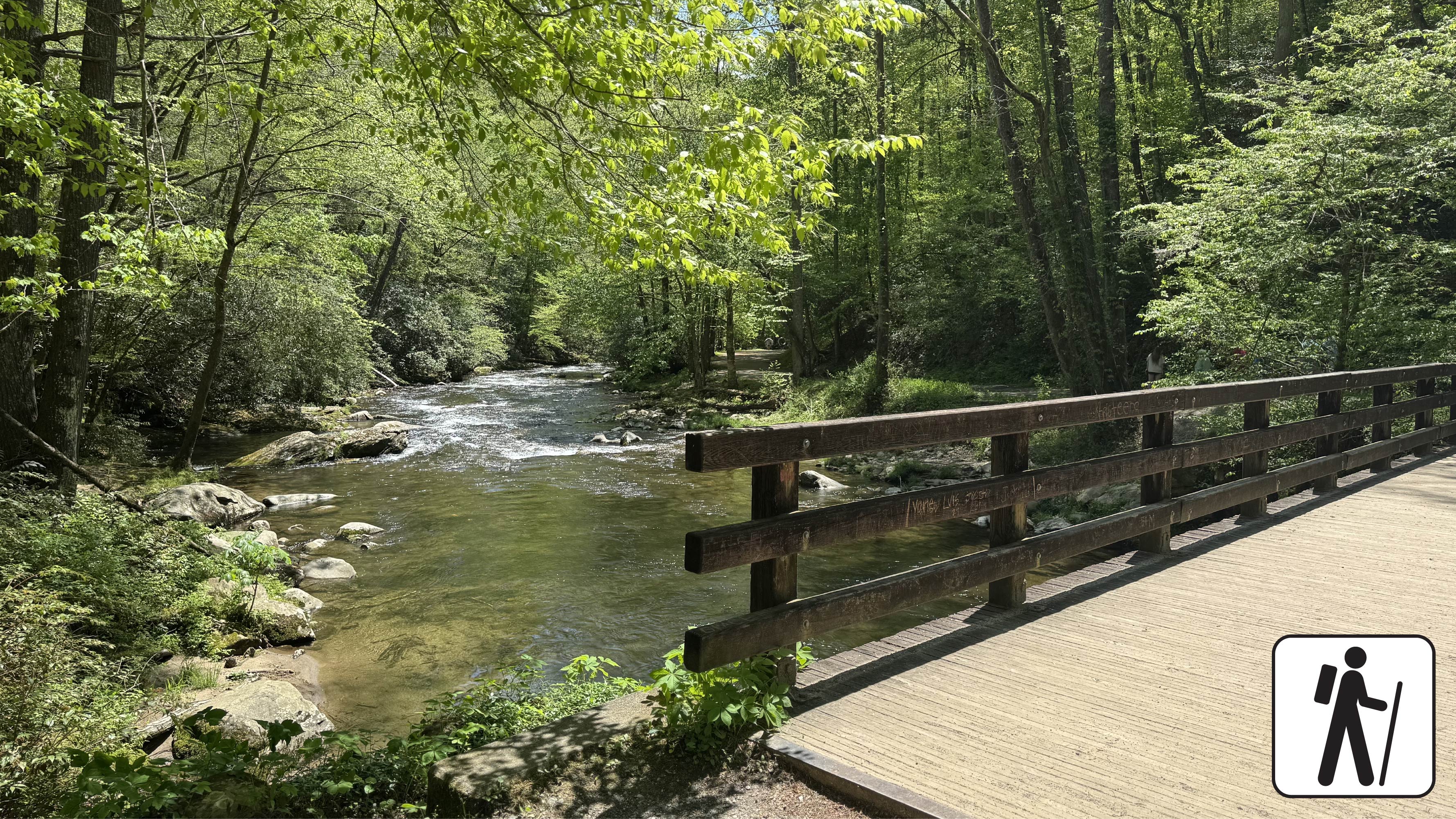
Hike 1.6 miles (2.6 km) roundtrip along Deep Creek, which features views of two waterfalls, Tom Branch Falls and Indian Creek Falls. The trail is a wide, gravel path with occasional roots and rocks. At approximately 0.3 miles (0.5 km), the trail flattens out near Tom Branch Falls. Take in the view on one of five benches before proceeding an additional 0.4 miles (0.6 km) to the Indian Creek Trail junction. After crossing the footbridge , there are three creek-side benches and one bench further up the trail with an elevated overlook of Deep Creek. Turn right at the junction with Indian Creek Trail and proceed 520 feet (161 m) to Indian Creek Falls on the left side of the trail. Proceed up-trail to see the waterfall below. Use caution when close to the edge of the trail.
Length
1.6 miles (2.6 km) roundtrip
Elevation Gain
160 ft (48.8 m)
Parking & Trailhead
Park at the end of Deep Creek Road to access the Deep Creek Trailhead past the Deep Creek Campground. Don't forget your parking tag .
Nearest Restroom
Deep Creek Campground (available seasonally)
Alternate Hikes
Take a longer route with the Deep Creek Waterfalls Loop 2.4 miles (3.9 km) roundtrip
Lynn Camp Prong Cascades : 1.4 miles (2.3 km) roundtrip
Little River, Cucumber Gap, Jakes Creek Loop : 5.4 miles (8.7 km) roundtrip
Pets The Gatlinburg Trail and Oconaluftee River Trail are the only two park trails where pets are permitted. Pets are also allowed in picnic areas, in campgrounds, and on roads.
Accessibility This section of trail has been assessed using the High-Efficiency Trail Assessment Process (HETAP) to provide objective information such as grade and slope. GRIT Freedom Chairs are available for free checkout on a first-come, first-served basis for this section of trail. The trail is a wide, gravel path with occasional roots and rocks. Use descriptions, maps, and photos to determine which hikes are suitable for you. For information about the reservation process and other trail segments where GRIT Freedom Chairs can be used, visit the trail accessibility page.
no dogs · entrance fee applies
Overview
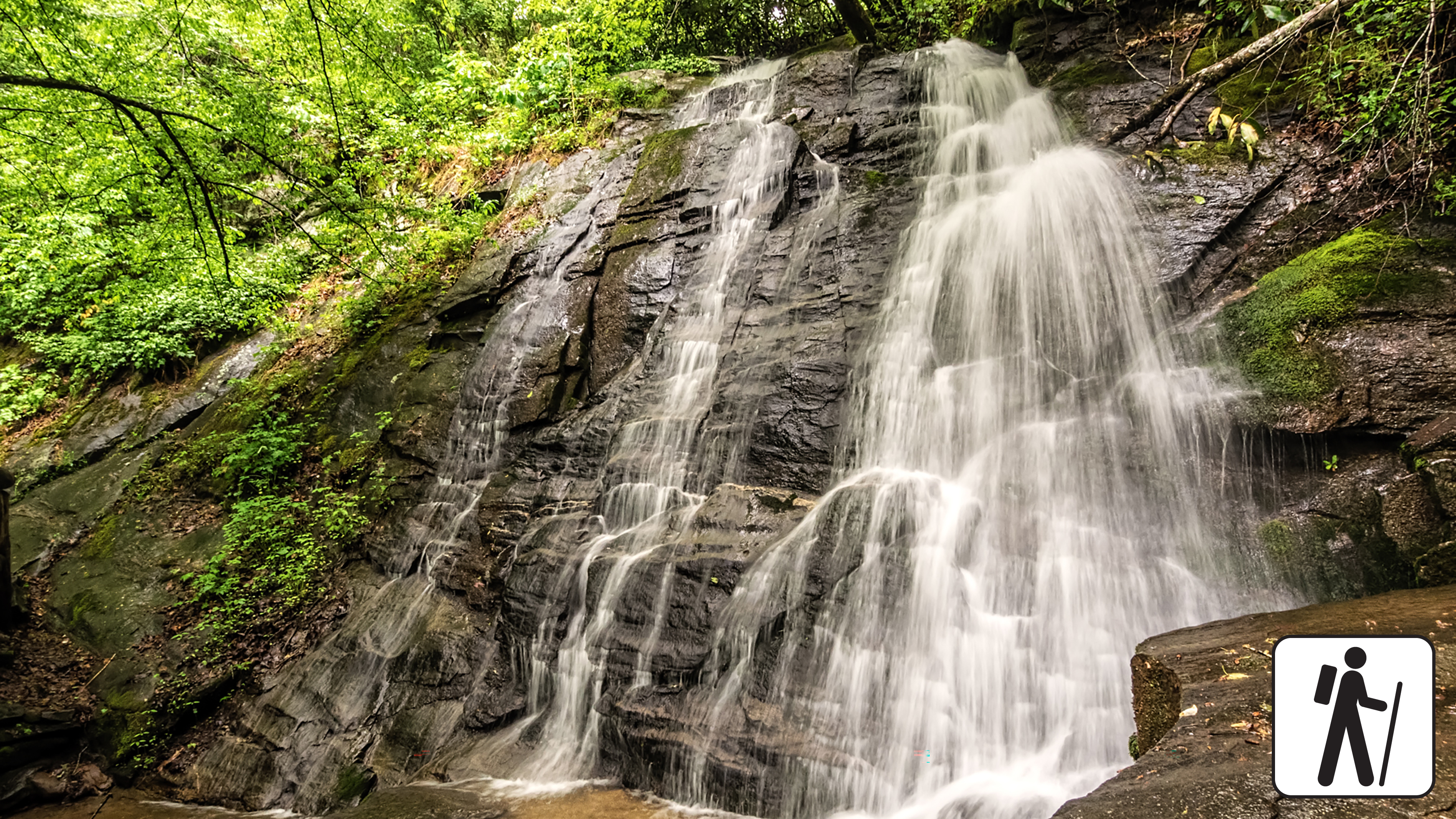
Hike a loop of 2.4 miles (3.9 km) around the Deep Creek area in Great Smoky Mountains National Park to reach three waterfalls: Juney Whank Falls (pictured above), Indian Creek Falls, and Tom Branch Falls.
Detailed directions: From the parking area at the end of Deep Creek Road past the Deep Creek Campground, take the steep but short trail to Juney Whank Falls. Cross the falls on a footbridge and continue 300 feet (91 m) to the trail junction. Turn right, then left, and follow Deep Creek Horse Trail toward Deep Creek Trail.
At the junction with Deep Creek Trail, turn right and proceed 0.1 mile (0.2 km) to Indian Creek Trail. Follow Indian Creek Trail 200 feet (61 m) to Indian Creek Falls, then backtrack to Deep Creek Trail, turn left, and follow it back to the trailhead where you started. You will pass Tom Branch Falls 0.5 miles (0.8 km) from Indian Creek Falls. Bring a map for reference.
Length
2.4 miles (3.9 km) roundtrip
Parking & Trailhead
Park at the end of Deep Creek Road to access the Deep Creek Trailhead past the Deep Creek Campground. Don't forget your parking tag .
Nearest Restroom
Deep Creek Campground (available seasonally)
Alternate Hikes
Lynn Camp Prong Cascades : 1.4 miles (2.3 km) roundtrip
Little River, Cucumber Gap, Jakes Creek Loop : 5.4 miles (8.7 km) roundtrip
Oconaluftee River Trail : 3 miles (4.8 km) roundtrip
Pets The Gatlinburg Trail and Oconaluftee River Trail are the only two park trails where pets are permitted. Pets are also allowed in picnic areas, in campgrounds, and on roads.
Accessibility Hike has some steep sections, stairs, and occasional roots/rocks on the trail.
WaterfallsBackcountry campsGaps
Along the way #51 George's Branch Deeplow Gap Little Creek Falls
History
Along the way Hiram Caldwell Cemetery
Backcountry campsShelters
Along the way #89 Lower Ekaneetlee #96 Eagle Creek Island #97 Big Walnut Spence Field Shelter
ViewsHistory
Along the way Elijah (Leige) Oliver Cabin Elijah Oliver Barn Elijah Oliver Overlook
Trailhead Elijah Oliver Cabin Access Trail Trailhead 1,753 ft Drive there
Backcountry camps
Along the way #47 Enloe Creek
History
Along the way Enloe Cemetery
Trailhead Enloe-Mingus Cemetery Access Trailhead 2,044 ft Drive there
History
Along the way Payne Cemetery
Trailhead Fairfax/Old Payne (Palmer) Access Trailhead 1,826 ft Drive there
History
Along the way Ferguson Cabin
HistoryVisitor centersBridges
Along the way Fighting Creek Bridge John Ownby Cabin N.S. McCarter Cemetery Sugarlands Visitor Center
Trailheads Finley Cane Trail Trailhead 1,829 ft Drive there · Turkeypen Ridge Trail Trailhead 1,827 ft Drive there
no dogs · entrance fee applies
Overview
This loop hike links three shorter trails sections, offering hikers a chance to experience the biodiversity of Bote Mountain at various elevations and temperatures. Climbing over 1,200 feet across 6.9 miles (11.10 km), hikers will experience the rhododendron-lined thickets on Finley Cane Trail, the ridgeline views atop Bote Mountain, and a cool descent beneath the mixed hardwoods and tulip poplar trees on Lead Cove trail. This all-season loop provides wildflowers in the spring, shade in the summer, leaf-lined vistas in the fall, and unobstructed views to the east and west of the Bote Mountain ridgeline in the winter. Located only minutes away from Cades Cove, this loop trail is perfect for hikers looking to step away from the crowds and onto a trail steeped in both history and elevation.
Length
6.9 miles (11.1 km) loop
2.5 miles from Finley Cove Trailhead to Bote Mountain Trail Junction
2.4 miles from Bote Mountain Trail Junction to Lead Cove Trail Junction
1.95 miles from Lead Cove Trail Junction to Finley Cane Trailhead
Elevation Gain
1,215 feet
Parking & Trailhead
Head West on Laurel Creek Road, towards Cades Cove, and parallel park on the left (south side) at one of the two paved pull-offs available near the Finley Cane Trailhead. These pull-offs service three trails: Turkeypen Ridge Trail, Finley Cane Trail and Lead Cove Trail. If you park on the opposite side of the road, be cautious as traffic can be heavy. Don't forget your parking tag .
Nearest Restroom
Cades Cove Picnic Area
Alternate Hikes
West Prong Trail: 5.4 miles (8.7 km) roundtrip
Pets The Gatlinburg Trail and Oconaluftee River Trail are the only two park trails where pets are permitted. Pets are also allowed in picnic areas, in campgrounds, and on roads.
Accessibility This trail includes dirt and loose gravel with rocky sections, protruding roots, water crossings, and steep grades.
ViewsPeaksPicnic areas
Along the way Flat Creek Bald Heintooga Picnic Area Heintooga Overlook
Trailheads Flat Creek Trail Trailhead 4,896 ft Drive there · Flat Creek Trail Trailhead 5,328 ft Drive there
History
Along the way Floyd Cemetery
History
Along the way Evans Chapel Cemetery
Trailhead Floyd Cemetery Access Trail Trailhead 2,081 ft Drive there
Bridges
Along the way Huskey Grove Branch Bridge
Backcountry campsGaps
Along the way #53 Poke Patch Deep Creek Gap
Trailheads Fork Ridge Trail Trailhead 5,884 ft Drive there · Fork Ridge Trail Trailhead 5,881 ft Drive there
WaterfallsBackcountry camps
Along the way #68 Steel Trap #69 Huggins #70 Jonas Creek #71 C.C.C. #74 Lower Forney Rock Slab Falls
PeaksGaps
Along the way Board Camp Gap Andrews Bald
no dogs · entrance fee applies
Start Expect crowds and full parking at Kuwohi to access Forney Ridge Trailhead—consider a shuttle
Overview
Expect extreme crowding and limited parking—consider a shuttle or alternate hikes listed below
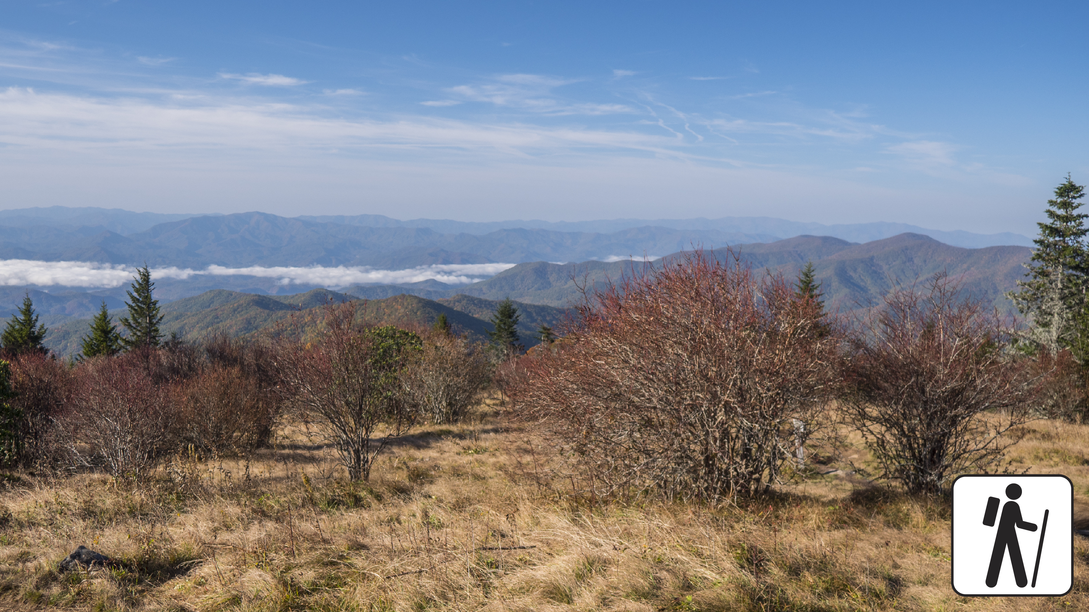
Hike 3.6 miles (5.8 km) roundtrip in Great Smoky Mountains National Park descending through high-elevation, spruce-fir forest to a popular grassy bald known for its flowering azaleas in summer and views of the surrounding mountains.
The trail is wide and graveled and descends many stairs before the first junction. It narrows to a well-trodden dirt path. The return hike to the trailhead involves a relatively strenuous climb, but hikers will enjoy the company of dark-eyed juncos and other high-elevation birds along the way.
Length
3.6 miles (5.8 km) roundtrip
Parking & Trailhead
Please consider a shuttle or park at the Kuwohi (formerly Clingmans Dome) parking area (closed in winter). Forney Ridge Trailhead is on the left just before the visitor information center. Don't forget your parking tag .
Nearest Restroom
Pit toilets available seasonally at Kuwohi (formerly Clingmans Dome) parking area.
Alternate Hikes
Gregory Bald: 11.4 miles (18.3 km) roundtrip
Pets The Gatlinburg Trail and Oconaluftee River Trail are the only two park trails where pets are permitted. Pets are also allowed in picnic areas, in campgrounds, and on roads.
Accessibility Trail has steep sections, stairs, and narrow parts.
History
Along the way Friendship Baptist Church Cemetery
Trailhead Grapeyard Ridge Trail Trailhead 1,673 ft Drive there
WaterfallsHistoryBackcountry campsGaps
Along the way #34 Sugar Cove Bearneck Gap Jennifer Cemetery Sallie Sutton Cemetery Hen Wallow Falls
Trailheads Gabes Mountain Trail Trailhead 2,165 ft Drive there · Gabes Mountain Trail Trailhead 2,299 ft Drive there
no dogs · entrance fee applies
Overview
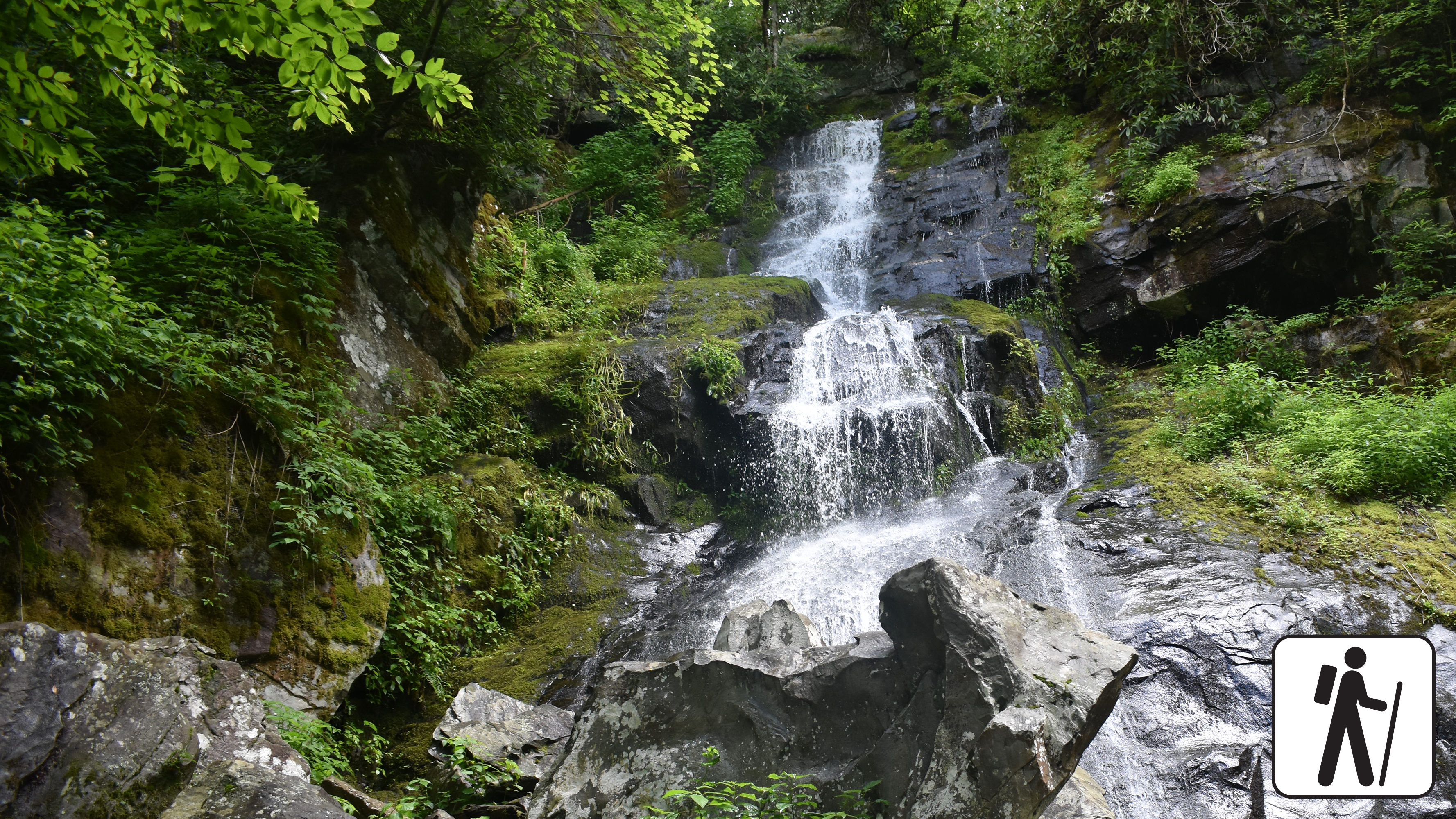
Hike 4.3 miles (6.9 km) roundtrip through a hardwood forest with hemlock and rhododendron to a popular 90-foot (27-m) waterfall in Great Smoky Mountains National Park .
This trail includes some steep sections and switchbacks. Hen Wallow Creek, only two feet wide at the top of the falls, separates into two streams and fans out to 30 feet at it tumbles to the base of the falls. If you look carefully, you can often see salamanders in the pool at the bottom. Hikers continuing on the Gabes Mountain Trail beyond the falls can enjoy an impressive old-growth forest.
Length
4.3 miles (6.9 km) roundtrip
Parking & Trailhead
Park in the designated hiker parking area at Cosby Picnic Area near the entrance to Cosby Campground and backtrack on foot approximately 100 yards along the entrance road to the signed start of Gabes Mountain Trail. Don't forget your parking tag .
Nearest Restroom
Cosby Picnic Area
Alternate Hikes
Lynn Camp Prong Cascades : 1.4 miles (2.3 km) roundtrip
Mouse Creek Falls : 4 miles (6.4 km) roundtrip
Pets The Gatlinburg Trail and Oconaluftee River Trail are the two park trails where pets are permitted. Pets are also allowed in picnic areas, in campgrounds, and on roads.
Accessibility Hike has steep sections and tree roots across multiple sections of trail.
Trailheads Gatlinburg Trail Trailhead 1,333 ft Drive there · Gatlinburg Trail Trailhead 1,419 ft Drive there · Gatlinburg Trail Trailhead 1,338 ft Drive there
dogs allowed · entrance fee applies
Overview
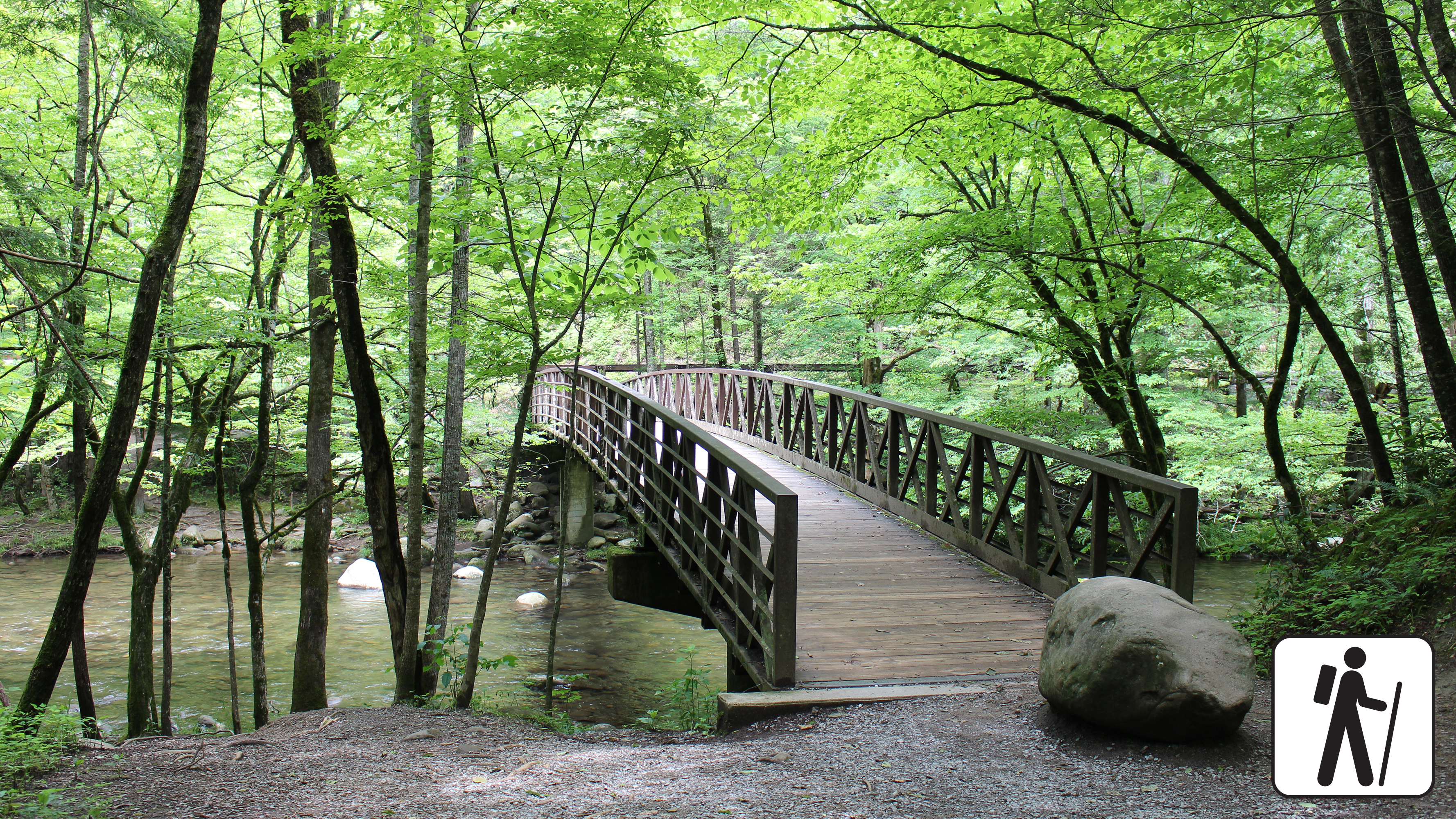
Enjoy a pleasant riverside stroll approximately 4 miles (6.4 km) roundtrip through a cove hardwood forest along one of the only dog- and bike-friendly trails in Great Smoky Mountains National Park .
This trail connects the Sugarlands Visitor Center with River Road in Gatlinburg. Near the visitor center, the trail includes sections of sidewalk and roadside, but after reaching the North District Maintenance Center, it turns into a wide, well-graded dirt path through the woods with a couple notable steeper sections. Historic stone chimneys are visible along this trail.
Length
Approximately 4 miles (6.4 km) roundtrip
Parking & Trailhead
Park at the Sugarlands Visitor Center and walk behind the building, past the restrooms, and past the brick headquarters building to the Gatlinburg Trailhead. Trail follows the road before continuing through the forest past the park maintenance area. Don't forget your parking tag .
Nearest Restroom
Sugarlands Visitor Center
Alternate Hikes
Oconaluftee River Trail : 3 miles (4.8 km) roundtrip
Little River, Cucumber Gap, Jakes Creek Loop : 5.4 miles (8.7 km) roundtrip
Big Creek Trail: varying lengths
Accessibility This trail is not ADA accessible. This trail has been assessed using the High-Efficiency Trail Assessment Process (HETAP) to provide objective information such as grade and slope. GRIT Freedom Chairs are available for free checkout on a first-come, first-served basis for this trail. The trail is relatively wide and flat, with sections of paved road, crushed stone, roots, and uneven dirt. A few steep sections plus occasional roots and rocks on the trail, but considered a leisurely path that is mostly flat and wide. Use descriptions, maps, and photos to determine which hikes are suitable for you. For information about the reservation process and other trail segments where GRIT Freedom Chairs can be used, visit the trail accessibility page.
no dogs · entrance fee applies
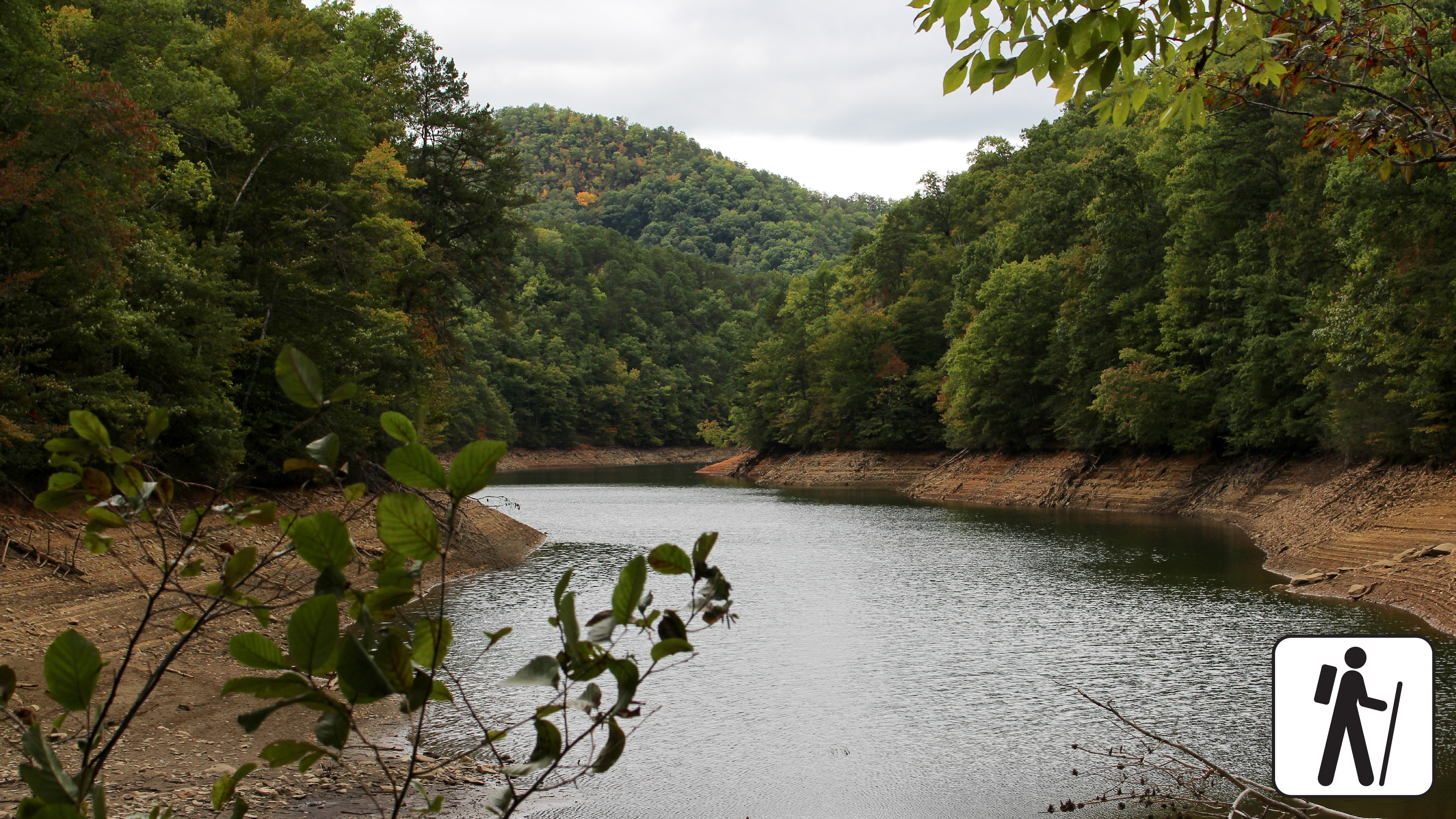
Overview
Hike 4 miles (6.4 km) on Lakeshore and Goldmine Loop trails through a hardwood forest filled with signs of old homesites and farms in Great Smoky Mountains National Park .
Exploring this area is pure gold, or at least that's what early European settlers originally thought. Although no significant amount of gold was ever found here, there are still plenty of signs that people used to live here. This trail is moderate but includes some rocky areas and some shallow stream crossings.
Length
4 miles (6.4 km) roundtrip
Parking & Trailhead
To reach the trailhead, park at the end of Lakeview Drive and hike 1 mile (1.6 km) down Lakeshore Trail. Goldmine Loop Trail will be on your left. Don't forget your parking tag .
Nearest Restroom
Facilities near Deep Creek or outside the park before arriving
Pets The Gatlinburg Trail and Oconaluftee River Trail are the only two park trails where pets are permitted. Pets are also allowed in picnic areas, in campgrounds, and on roads.
Accessibility Some rocky areas and shallow stream crossings.
WaterfallsBackcountry camps
Along the way #23 Camp Rock Fish Camp Cascades War Branch Cascade
HistoryGapsBridges
Along the way Ramsey Cascades Road Bridge #1 Roaring Fork Motor Nature Trail Bridge #2 James Gap Alex Cole Cabin Friendship Baptist Church Cemetery Homer / Jim Bales Barn
Trailheads Grapeyard Ridge Trail Trailhead 1,673 ft Drive there · Grapeyard Ridge Trail Trailhead 2,415 ft Drive there
Shelters
Along the way Kephart Shelter
Trailhead Grassy Branch Trail Trailhead 1,657 ft Drive there
Gaps
Along the way Sams Gap
PeaksBackcountry campsGaps
Along the way #13 Sheep Pen Gap Briar Lick Gap Buck Gap Cold Spring Gap Panther Gap Rich Gap Gregory Bald
Trailheads Gregory Bald Trail Trailhead 2,780 ft Drive there · Hannah Mountain Trail Trailhead 2,780 ft Drive there
Backcountry campsGaps
Along the way #12 Forge Creek Rich Gap
Trailhead Gregory Ridge Trail Trailhead 1,944 ft Drive there
Waterfalls
Along the way Gunter Fork Cascade Gunter Fork Falls
Backcountry campsGaps
Along the way #14 Flint Gap Flint Gap Scott Gap
Trailheads Gregory Bald Trail Trailhead 2,780 ft Drive there · Hannah Mountain Trail Trailhead 2,780 ft Drive there
WaterfallsBackcountry camps
Along the way #82 Calhoun #83 Bone Valley #84 Sugar Fork #85 Sawdust Pile #86 Proctor Hazel Creek Cascades
PeaksGaps
Along the way Garretts Gap Maggot Spring Gap Polls Gap Sugartree Licks Sheepback Knob
Trailheads Hemphill Bald Trail Trailhead 5,127 ft Drive there · Rough Fork Trail Trailhead 5,128 ft Drive there
History
Along the way Fighting Creek Cemetery
Peaks
Along the way High Rocks
Shelters
Along the way Pecks Corner Shelter
Trailhead Huskey Gap Trail Trailhead 1,881 ft Drive there
PeaksBackcountry campsBridges
Along the way #44 Mc Gee Spring Straight Fork Road Bridge Hyatt Bald
Trailhead Hyatt Ridge Trail Trailhead 2,940 ft Drive there
Waterfalls
Along the way Indian Creek Falls
no dogs · entrance fee applies
Overview
Hike 1.6 miles (2.6 km) roundtrip along Deep Creek, which features views of two waterfalls, Tom Branch Falls and Indian Creek Falls. The trail is a wide, gravel path with occasional roots and rocks. At approximately 0.3 miles (0.5 km), the trail flattens out near Tom Branch Falls. Take in the view on one of five benches before proceeding an additional 0.4 miles (0.6 km) to the Indian Creek Trail junction. After crossing the footbridge , there are three creek-side benches and one bench further up the trail with an elevated overlook of Deep Creek. Turn right at the junction with Indian Creek Trail and proceed 520 feet (161 m) to Indian Creek Falls on the left side of the trail. Proceed up-trail to see the waterfall below. Use caution when close to the edge of the trail.
Length
1.6 miles (2.6 km) roundtrip
Elevation Gain
160 ft (48.8 m)
Parking & Trailhead
Park at the end of Deep Creek Road to access the Deep Creek Trailhead past the Deep Creek Campground. Don't forget your parking tag .
Nearest Restroom
Deep Creek Campground (available seasonally)
Alternate Hikes
Take a longer route with the Deep Creek Waterfalls Loop 2.4 miles (3.9 km) roundtrip
Lynn Camp Prong Cascades : 1.4 miles (2.3 km) roundtrip
Little River, Cucumber Gap, Jakes Creek Loop : 5.4 miles (8.7 km) roundtrip
Pets The Gatlinburg Trail and Oconaluftee River Trail are the only two park trails where pets are permitted. Pets are also allowed in picnic areas, in campgrounds, and on roads.
Accessibility This section of trail has been assessed using the High-Efficiency Trail Assessment Process (HETAP) to provide objective information such as grade and slope. GRIT Freedom Chairs are available for free checkout on a first-come, first-served basis for this section of trail. The trail is a wide, gravel path with occasional roots and rocks. Use descriptions, maps, and photos to determine which hikes are suitable for you. For information about the reservation process and other trail segments where GRIT Freedom Chairs can be used, visit the trail accessibility page.
PeaksGaps
Along the way Indian Grave Gap Cerulean Knob
Trailhead Indian Grave Gap Trail Trailhead 2,526 ft Drive there
HistoryBackcountry campsGaps
Along the way #27 Lower Jakes Gap Jakes Gap Elkmont Club Cabin # 15, Hale
Trailhead Jakes Creek Trail Trailhead 2,210 ft Drive there
no dogs · entrance fee applies
Overview
Hike 5.4 miles (8.7 km) on a pleasant and shady loop in the Elkmont area of Great Smoky Mountains National Park . The route connects three trails with streamside views, historic structures, and prolific spring wildflower displays.
Trail conditions vary from paved road and graveled path to narrower and rockier sections with minor stream crossings. The Little River section is wide and flat. Jakes Creek is wide and slightly steeper/rockier, but still has a mild-to-moderate grade. Cucumber Gap is narrow with ups and downs.
The Little River and Jakes Creek trailheads and parking areas are separated by a short section of one-way road in the leafy historic district of Elkmont.
Water crossing at Husky Branch on the Cucumber Gap Trail may not be passable during high water.
Length
5.4 miles (8.7 km) roundtrip
Parking & Trailhead
Park at either the Jakes Creek or Little River Trailhead in Elkmont Historic District. Both hikes begin on wide, gravel trails. Don't forget your parking tag .
Nearest Restroom
Elkmont Campground (available seasonally)
Alternate Hikes
Lynn Camp Prong Cascades : 1.4 miles (2.3 km) roundtrip
Chasteen Creek Cascades : 3.6 miles (5.8 km) roundtrip
Twentymile Cascades: 1.2 miles (1.9 km) roundtrip
Finley Cane Trail to Bote Mtn Trail to Lead Cove Trail Loop : 6.9 mile (11.1 km) loop
Pets The Gatlinburg Trail and Oconaluftee River Trail are the only two park trails where pets are permitted. Pets are also allowed in picnic areas, in campgrounds, and on roads.
Accessibility Little River and Jakes Creek trails are mostly wide and relatively flat with some rocks and roots on the trail. Cucumber Gap Trail is more narrow.
PeaksHistoryGaps
Along the way Haw Gap Higdon Cemetery Cherry Knob Woodward Knob
History
Along the way John Oliver Cabin
Trailhead John Oliver Cabin access Trailhead 1,818 ft Drive there
WaterfallsBackcountry camps
Along the way #70 Jonas Creek Jonas Creek Falls Yanu Branch Cascade
WaterfallsBridges
Along the way Tom Branch Road Bridge Juney Whank Falls
Trailheads Deep Creek Trail Trailhead 1,829 ft Drive there · Juney Whank Falls Trail Trailhead 1,821 ft Drive there
Trailhead Kanati Fork Trail Trailhead 2,851 ft Drive there
Trailhead Kanati Fork Trail Trailhead 2,851 ft Drive there
Shelters
Along the way Kephart Shelter
Trailhead Kephart Prong Trail Trailhead 2,732 ft Drive there
no dogs · entrance fee applies
Start Limited parking available at Kephart Prong Trailhead—consider a shuttle
Overview
Limited parking available at trailhead—consider a shuttle or see below for alternate hikes
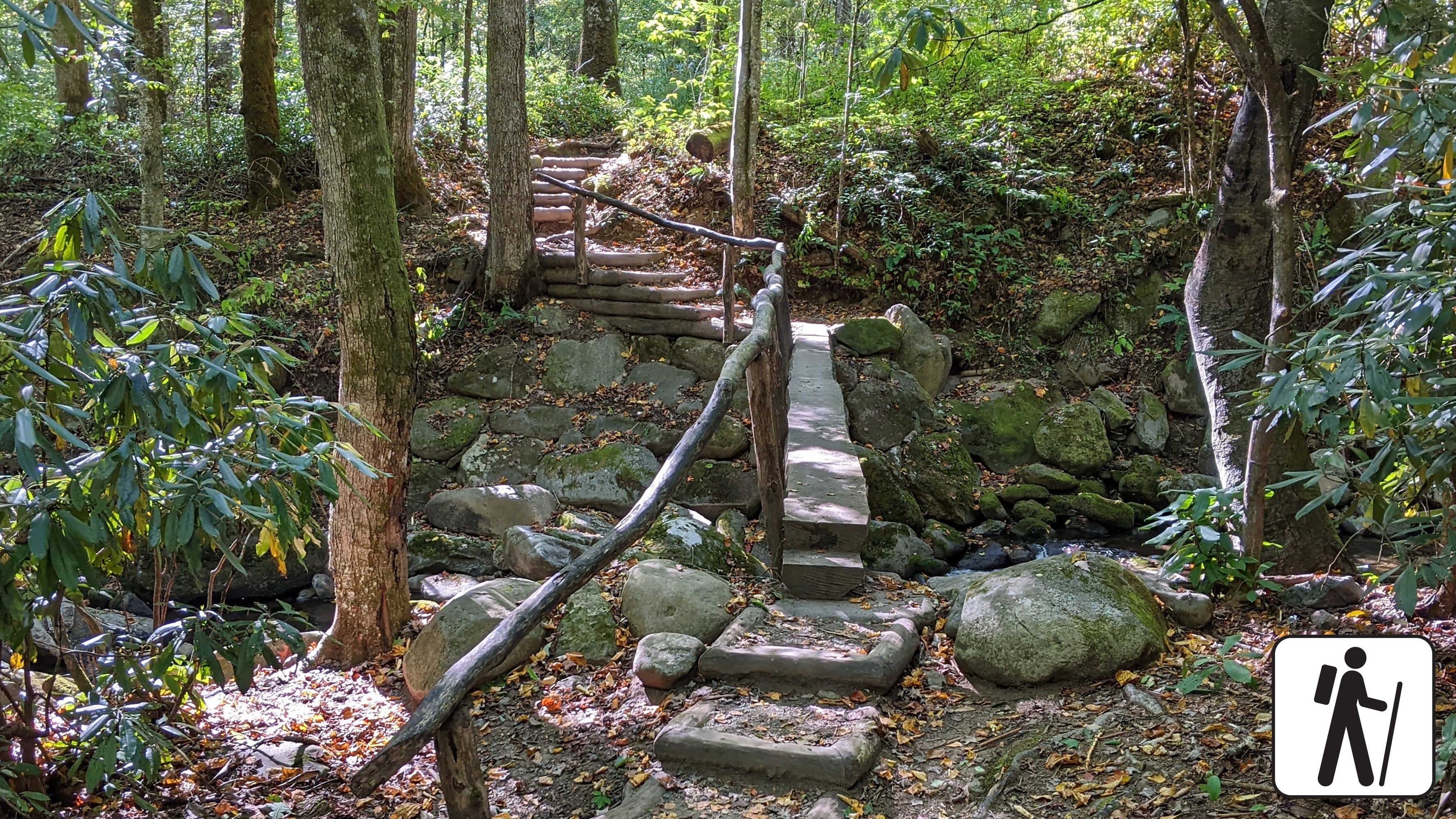
Follow the flow of mountain streams 4 miles (6.4 km) roundtrip through hardwood forest and across several log footbridges to the remains of a CCC camp and the Kephart Shelter in Great Smoky Mountains National Park .
This trail follows the route of a formerly-paved jeep road and includes five railed footbridges that cross various streams. With a total elevation gain of 830 feet (253 m), many find this a leisurely trail.
Reservation and backcountry permit required to stay overnight at Kephart Shelter.
Length
4 miles (6.4 km) roundtrip
Parking & Trailhead
Please consider a shuttle or park at Kephart Prong Trailhead at a small, paved pull-off 5 miles (8 km) north of Smokemont Campground on Newfound Gap Road (US 441). Don't forget your parking tag .
Nearest Restroom
Collins Creek Picnic Area (open seasonally) south of the Kephart Prong Trailhead (restrooms also available at Oconaluftee Visitor Center )
Alternate Hikes
Lynn Camp Prong Cascades : 1.4 miles (2.3 km) roundtrip
Little River, Cucumber Gap, Jakes Creek Loop : 5.4 miles (8.7 km) roundtrip
Pets The Gatlinburg Trail and Oconaluftee River Trail are the only two park trails where pets are permitted. Pets are also allowed in picnic areas, in campgrounds, and on roads.
Accessibility Trail includes stairs and five railed footbridges that cross various streams.
ViewsPeaksVisitor centersTowers
Along the way Kuwohi Kuwohi Tower Forney Ridge Overlook Kuwohi Overlook Kuwohi Visitor Center
Trailhead Kuwohi Trail Trailhead 6,310 ft Drive there
no dogs · entrance fee applies
Start Expect crowds and full parking at Kuwohi—consider a shuttle
Overview
Expect extreme crowding and limited parking—consider a shuttle or alternate hikes listed below
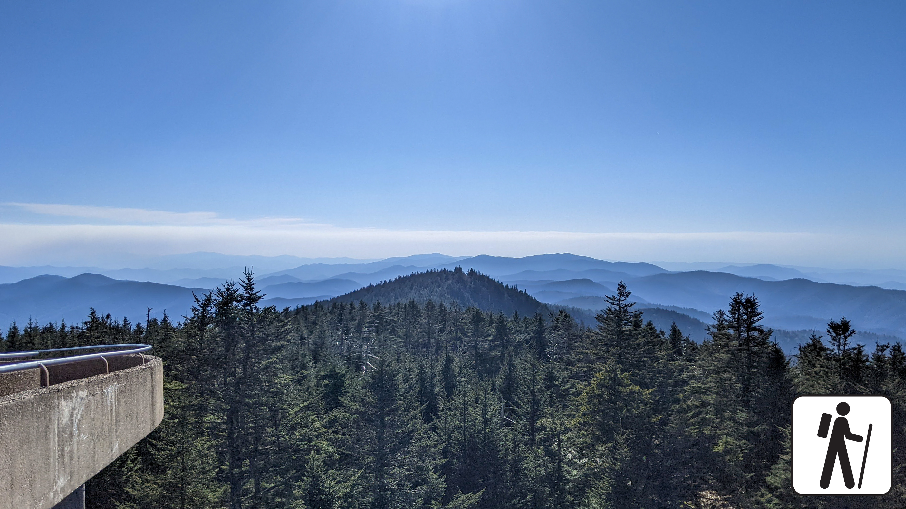
Walk one mile (1.6 km) roundtrip from the parking area along a steep, paved path to an iconic and popular observation tower with panoramic views from the highest peak in Great Smoky Mountains National Park .
Reach the observation tower from either the paved hike leading from the parking lot or the bypass trail, which begins at the Forney Ridge Trailhead and ascends towards the Appalachian Trail. The bypass trail offers visitors high-elevation solitude in what is often a congested area of the park. Along this short route, visitors can enjoy vistas of Sugarland Mountain and the Elkmont area of the Smokies.
Kuwohi Road (formerly known as Clingmans Dome Road) is closed in winter.
Length
1 mile (1.6 km) roundtrip
Parking & Trailhead
Consider a shuttle or park at the end of Kuwohi Road (formerly known as Clingmans Dome Road). The trail leaves from near the visitor information center. Don't forget your parking tag .
Nearest Restroom
Pit toilets near parking lot (closed in winter)
Alternate Hikes
Look Rock Tower : 0.8 miles (1.3 km) roundtrip
Andrews Bald : 3.6 miles (5.8 km) roundtrip
Pets The Gatlinburg Trail and Oconaluftee River Trail are the only two park trails where pets are permitted. Pets are also allowed in picnic areas, in campgrounds, and on roads.
Accessibility Trail is paved but very steep.
HistoryBackcountry campsGapsTunnels
Along the way #74 Lower Forney #76 Kirkland Creek #77 Pilkey Creek #81 North Shore #90 Lost Cove Flint Gap Calhoun House Lakeview Drive Tunnel
Trailheads Lakeshore Trail Trailhead 2,096 ft Drive there · Lakeshore Trail Trailhead 1,902 ft Drive there
no dogs · entrance fee applies
Overview
Hike 4 miles (6.4 km) on Lakeshore and Goldmine Loop trails through a hardwood forest filled with signs of old homesites and farms in Great Smoky Mountains National Park .
Exploring this area is pure gold, or at least that's what early European settlers originally thought. Although no significant amount of gold was ever found here, there are still plenty of signs that people used to live here. This trail is moderate but includes some rocky areas and some shallow stream crossings.
Length
4 miles (6.4 km) roundtrip
Parking & Trailhead
To reach the trailhead, park at the end of Lakeview Drive and hike 1 mile (1.6 km) down Lakeshore Trail. Goldmine Loop Trail will be on your left. Don't forget your parking tag .
Nearest Restroom
Facilities near Deep Creek or outside the park before arriving
Pets The Gatlinburg Trail and Oconaluftee River Trail are the only two park trails where pets are permitted. Pets are also allowed in picnic areas, in campgrounds, and on roads.
Accessibility Some rocky areas and shallow stream crossings.
History
Along the way Laney Cemetery
WaterfallsGaps
Along the way Fighting Creek Gap Laurel Falls
no dogs · entrance fee applies
Start Expect crowds and full parking at Laurel Falls Trailhead—consider a shuttle
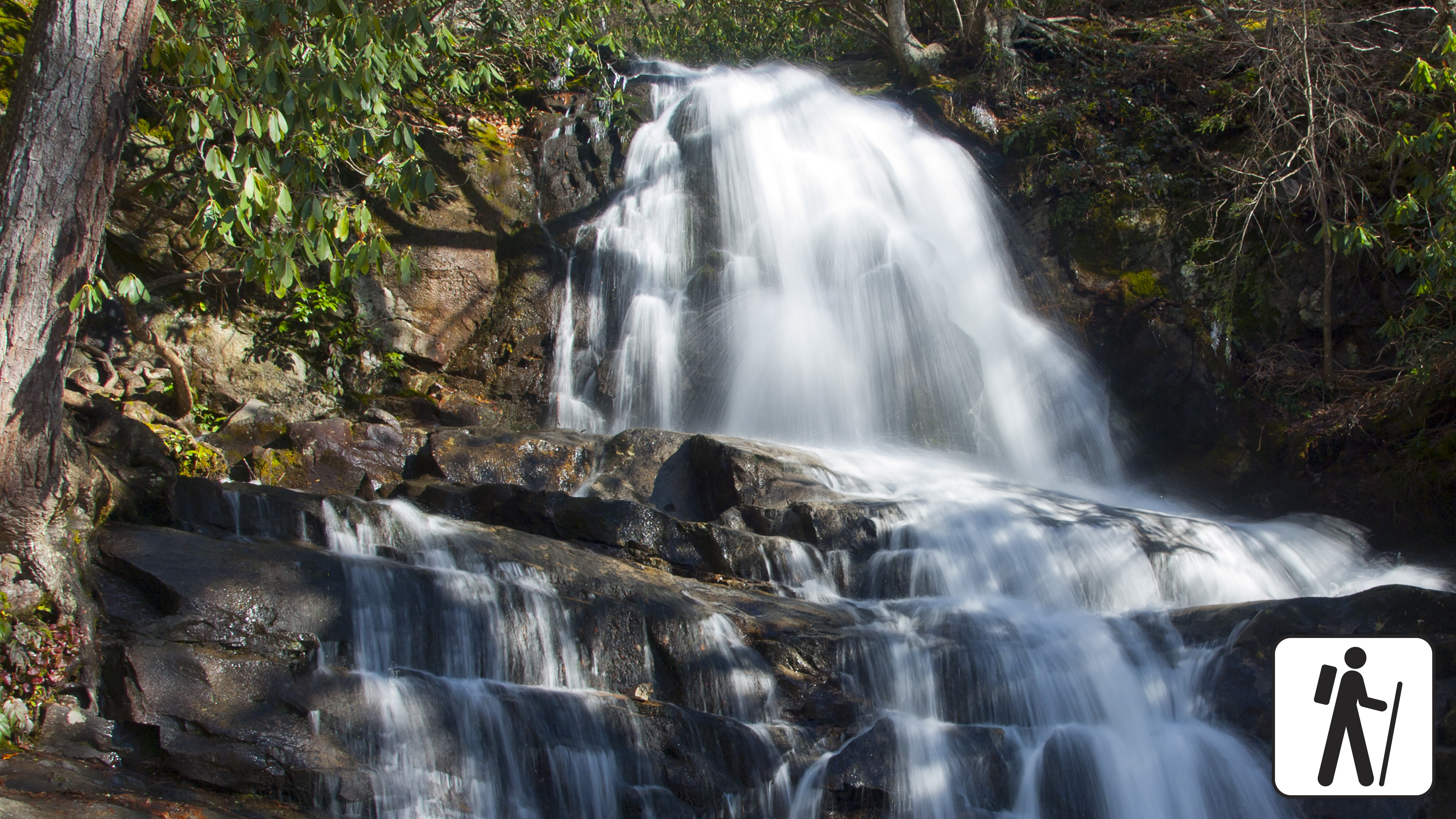
Overview
Laurel Falls Trail is closed as of Jan. 6, 2025 for rehabilitation work—alternate hikes listed below.
Learn more about the trail rehabilitation project in the news release .
Hike 2.6 miles (4.2 km) roundtrip through a mixed hardwood forest to an 80-foot (24-m) waterfall in Great Smoky Mountains National Park . On the way, enjoy dense mountain laurel and rhododendron plus views of the mountain landscape before arriving at the waterfall.
Length
2.6 miles (4.2 km) roundtrip
Parking & Trailhead
Please consider a shuttle or park at Laurel Falls Trailhead on Little River Road 3 miles (4.8 km) west of Sugarlands Visitor Center, though these parking lots are often full due to this trail's popularity. Don't forget your parking tag .
Nearest Restroom
Sugarlands Visitor Center
Alternate Hikes
Little River, Cucumber Gap, Jakes Creek Loop : 5.4 miles (8.7 km) roundtrip
Grotto Falls : 4 miles (6.4 km) roundtrip
Lynn Camp Prong Cascades : 1.4 miles (2.3 km) roundtrip
Gatlinburg Trail : 4 miles (6.4 km) roundtrip
Pets The Gatlinburg Trail and Oconaluftee River Trail are the only two park trails where pets are permitted. Pets are also allowed in picnic areas, in campgrounds, and on roads.
Accessibility Some sections of the trail have cracked, uneven pavement.
History
Along the way Lawson Cemetery
HistoryBridges
Along the way Old Cataloochee Entrance Road Bridge #3 Lawson Jenkins-Kerr Cemetery
Trailhead Lawson Jenkins-Kerr Cemetery Access Trailhead 2,467 ft Drive there
Gaps
Along the way Sandy Gap
Trailheads Finley Cane Trail Trailhead 1,829 ft Drive there · Turkeypen Ridge Trail Trailhead 1,827 ft Drive there
no dogs · entrance fee applies
Overview
This loop hike links three shorter trails sections, offering hikers a chance to experience the biodiversity of Bote Mountain at various elevations and temperatures. Climbing over 1,200 feet across 6.9 miles (11.10 km), hikers will experience the rhododendron-lined thickets on Finley Cane Trail, the ridgeline views atop Bote Mountain, and a cool descent beneath the mixed hardwoods and tulip poplar trees on Lead Cove trail. This all-season loop provides wildflowers in the spring, shade in the summer, leaf-lined vistas in the fall, and unobstructed views to the east and west of the Bote Mountain ridgeline in the winter. Located only minutes away from Cades Cove, this loop trail is perfect for hikers looking to step away from the crowds and onto a trail steeped in both history and elevation.
Length
6.9 miles (11.1 km) loop
2.5 miles from Finley Cove Trailhead to Bote Mountain Trail Junction
2.4 miles from Bote Mountain Trail Junction to Lead Cove Trail Junction
1.95 miles from Lead Cove Trail Junction to Finley Cane Trailhead
Elevation Gain
1,215 feet
Parking & Trailhead
Head West on Laurel Creek Road, towards Cades Cove, and parallel park on the left (south side) at one of the two paved pull-offs available near the Finley Cane Trailhead. These pull-offs service three trails: Turkeypen Ridge Trail, Finley Cane Trail and Lead Cove Trail. If you park on the opposite side of the road, be cautious as traffic can be heavy. Don't forget your parking tag .
Nearest Restroom
Cades Cove Picnic Area
Alternate Hikes
West Prong Trail: 5.4 miles (8.7 km) roundtrip
Pets The Gatlinburg Trail and Oconaluftee River Trail are the only two park trails where pets are permitted. Pets are also allowed in picnic areas, in campgrounds, and on roads.
Accessibility This trail includes dirt and loose gravel with rocky sections, protruding roots, water crossings, and steep grades.
Backcountry camps
Along the way #01 Cooper Road #17 Little Bottoms
HistoryGaps
Along the way Little Brier Gap Little Brier Cemetery Little Greenbrier School
Trailhead Little Brier Gap Trail Trailhead 1,801 ft Drive there
HistoryGaps
Along the way Davidson Gap Daniel Cook Cabin (Cataloochee) Little Cataloochee Baptist Church Little Cataloochee Baptist Church Cemetery
Trailhead Little Cataloochee Trail Trailhead 3,012 ft Drive there
History
Along the way Ogle Cemetery
Trailhead Little Dudley Concession Horse Trail Trailhead 1,550 ft Drive there
PeaksGaps
Along the way Little Brier Gap Wear Cove Gap Little Mountain
Trailhead Little Greenbrier Trail Trailhead 1,834 ft Drive there
no dogs · entrance fee applies
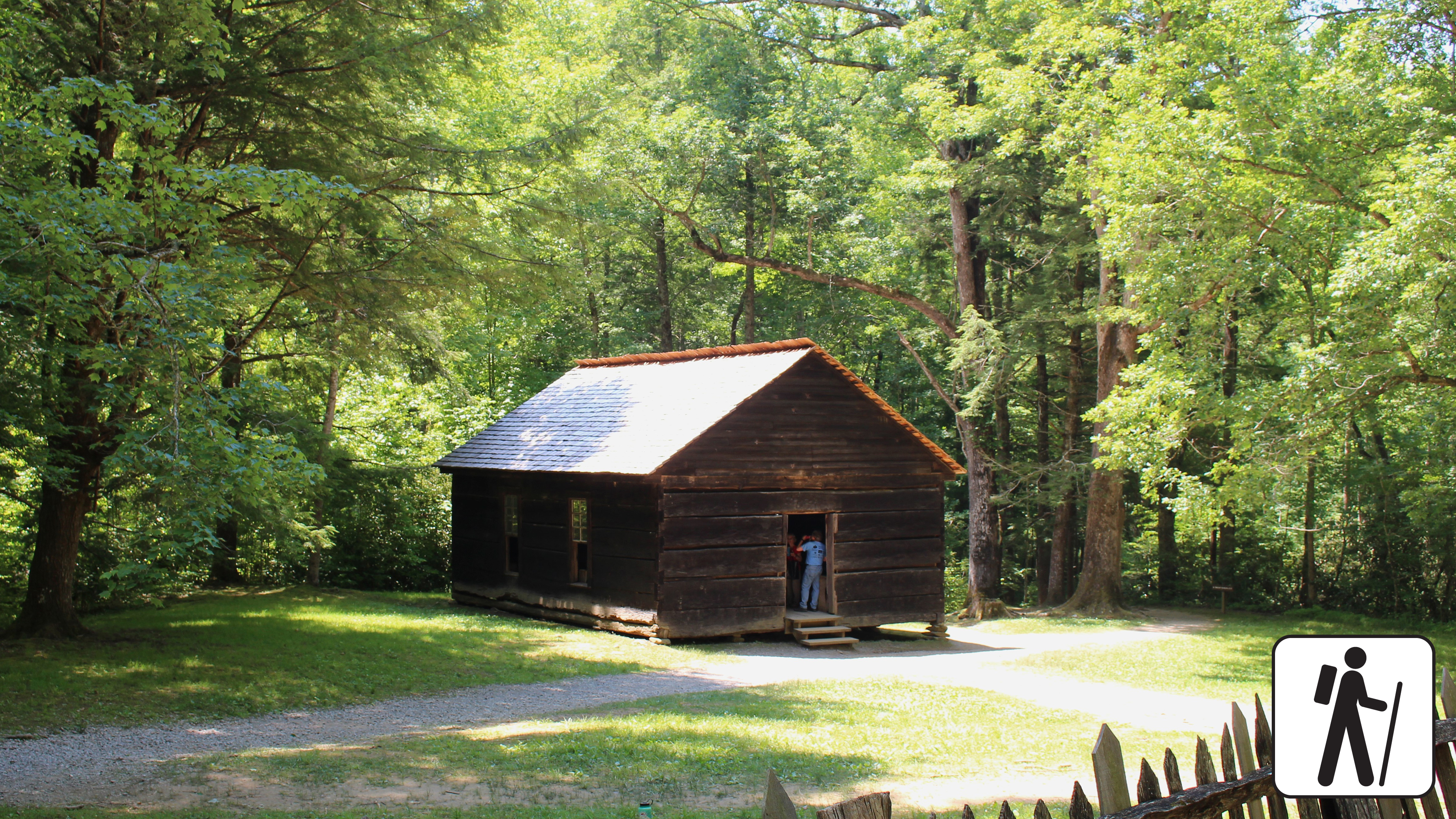
Overview
Hike 3.4 miles (5.5 km) roundtrip from the Metcalf Bottoms Picnic Area in Great Smoky Mountains National Park through hardwood forest to see remnants of past Smokies residents including stonework; the historic, one-room Little Greenbrier School; and the preserved homesite of the Walker family.
This hike begins on the Metcalf Bottoms Trail, located just beyond the bridge that connects Wears Cove Gap Road to the picnic area. leading to the historic Little Greenbrier Schoolhouse. The path is a well-packed dirt trail that gently climbs through the forest. Alternatively, the schoolhouse can also be accessed via a seasonally open gravel road off Wears Cove Gap Road. From the schoolhouse, the route continues uphill along a wide gravel roadbed, which is part of the Little Brier Gap Trail. This section leads to the preserved 19th-century homestead of the Walker family. Originally built in the 1840s, the cabin features two spacious rooms with fireplaces and a charming front porch. The site also includes a spring house and a corn crib, offering a glimpse into Appalachian mountain life of the past.
Length
3.4 miles (5.5 km) roundtrip
Parking & Trailhead
After parking at the Metcalf Bottoms Picnic Area, walk across the small bridge north of the picnic area to find the Metcalf Bottoms Trailhead. Don't forget your parking tag .
Nearest Restroom
Metcalf Bottoms Picnic Area
Alternate Hikes
John Oliver Cabin : 0.3 miles (0.5 km) roundtrip
Little River, Cucumber Gap, Jakes Creek Loop : 5.4 miles (8.7 km) roundtrip
Noah Bud Ogle Homesite: ~0.7 miles (1.1 km) roundtrip loop
Pets The Gatlinburg Trail and Oconaluftee River Trail are the only two park trails where pets are permitted. Pets are also allowed in picnic areas, in campgrounds, and on roads.
Accessibility Some steep sections plus occasional roots and rocks.
WaterfallsBackcountry camps
Along the way #24 Rough Creek #30 Three Forks Husky Branch Falls
Trailhead Little River Trail Trailhead 2,169 ft Drive there
no dogs · entrance fee applies
Start Little River Trail
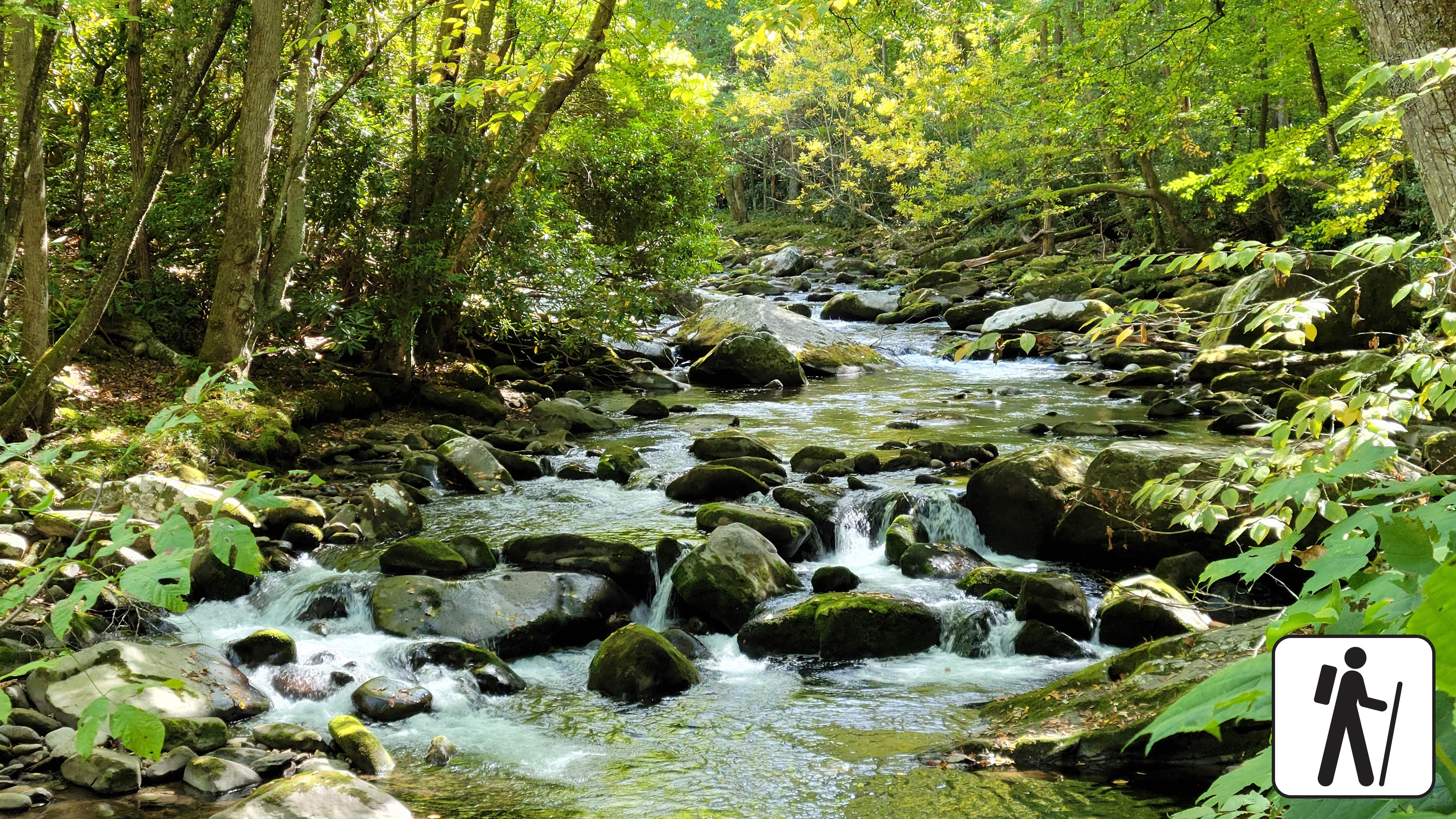
Overview
a { text-decoration: none; color: #464feb; } tr th, tr td { border: 1px solid #e6e6e6; } tr th { background-color: #f5f5f5; }
Once a railroad bed, the Little River Trail now offers a peaceful hike through the Elkmont area of the Smokies. As you follow the river’s gentle flow, you’ll pass remnants of the historic Daisytown community—stone chimneys and foundations quietly tucked into the forest.
The start of this trail is wide and scenic with minimal elevation gain, making it ideal for a relaxed hike to the Husky Gap Trail junction. For a longer, more challenging adventure, continue along the trail. The trail dead ends after passing a few trail junctions and backcountry campsites at backcountry campsite #30.
Due to its location, this route is perfect for hikers seeking both tranquility and a touch of history.
a { text-decoration: none; color: #464feb; } tr th, tr td { border: 1px solid #e6e6e6; } tr th { background-color: #f5f5f5; }
a { text-decoration: none; color: #464feb; } tr th, tr td { border: 1px solid #e6e6e6; } tr th { background-color: #f5f5f5; }
Length
12.4-miles (20 km) roundtrip
Parking & Trailhead
Park at the Little River Trailhead in Elkmont Historic District. Don't forget your parking tag .
Nearest Restroom
Daisy Town or Elkmont Campground (available seasonally)
Alternate Hikes
Lynn Camp Prong Cascades : 1.4 miles (2.3 km) roundtrip
Chasteen Creek Cascades : 3.6 miles (5.8 km) roundtrip
Twentymile Cascades : 1.2 miles (1.9 km) roundtrip
Finley Cane Trail to Bote Mtn Trail to Lead Cove Trail Loop : 6.9 mile (11.1 km) loop
Accessibility This trail is not ADA accessible. For the first 2.7 miles, the trail is relatively wide and flat, featuring a mix of crushed stone and occasional roots and rocks. While a few sections are slightly steeper, the overall path is considered leisurely, making it ideal for a relaxed hike. Around mile marker 2.5, the trail begins to narrow and transitions from a roadbed to a more natural path. After passing the junction with Rough Creek Trail at approximately 4.5 miles, the terrain becomes rockier and more challenging. The final stretch includes three water crossings, which require careful footing. A section of this trail has been assessed using the High-Efficiency Trail Assessment Process (HETAP) to provide objective information such as grade and slope. HETAP data collected on the first 0.9 miles of this trail: The typical slope is 3.2%. The typical cross slope/grade in the trail side-to-side , is 2.0%, with a maximum of 19.1%. The typical width is 10.6 feet (3.22 meters) with a minimum of 3.3 feet (1.02 meters). The trail surface is composed of aggregate material and gravel. GRIT Freedom Chairs are available for free checkout on a first-come, first-serve basis for the first 2.7 miles (one-way) of this trail to the junction with Huskey Gap Trail. Use descriptions, maps, and photos to determine which hikes are suitable for you. For information about the reservation process and other trail segments where GRIT Freedom Chairs can be used, visit the trail accessibility page.
no dogs · entrance fee applies
Overview
Hike 5.4 miles (8.7 km) on a pleasant and shady loop in the Elkmont area of Great Smoky Mountains National Park . The route connects three trails with streamside views, historic structures, and prolific spring wildflower displays.
Trail conditions vary from paved road and graveled path to narrower and rockier sections with minor stream crossings. The Little River section is wide and flat. Jakes Creek is wide and slightly steeper/rockier, but still has a mild-to-moderate grade. Cucumber Gap is narrow with ups and downs.
The Little River and Jakes Creek trailheads and parking areas are separated by a short section of one-way road in the leafy historic district of Elkmont.
Water crossing at Husky Branch on the Cucumber Gap Trail may not be passable during high water.
Length
5.4 miles (8.7 km) roundtrip
Parking & Trailhead
Park at either the Jakes Creek or Little River Trailhead in Elkmont Historic District. Both hikes begin on wide, gravel trails. Don't forget your parking tag .
Nearest Restroom
Elkmont Campground (available seasonally)
Alternate Hikes
Lynn Camp Prong Cascades : 1.4 miles (2.3 km) roundtrip
Chasteen Creek Cascades : 3.6 miles (5.8 km) roundtrip
Twentymile Cascades: 1.2 miles (1.9 km) roundtrip
Finley Cane Trail to Bote Mtn Trail to Lead Cove Trail Loop : 6.9 mile (11.1 km) loop
Pets The Gatlinburg Trail and Oconaluftee River Trail are the only two park trails where pets are permitted. Pets are also allowed in picnic areas, in campgrounds, and on roads.
Accessibility Little River and Jakes Creek trails are mostly wide and relatively flat with some rocks and roots on the trail. Cucumber Gap Trail is more narrow.
History
Along the way Hannah Cemetery
PeaksBackcountry campsGaps
Along the way #92 Upper Flats Proctor Field Gap Rye Patch
ViewsPeaksTowers
Along the way Look Rock Look Rock Tower Look Rock Overlook Murray Gap Overlook
Trailhead Look Rock Developed Trail Trailhead 2,473 ft Drive there
no dogs · entrance fee applies
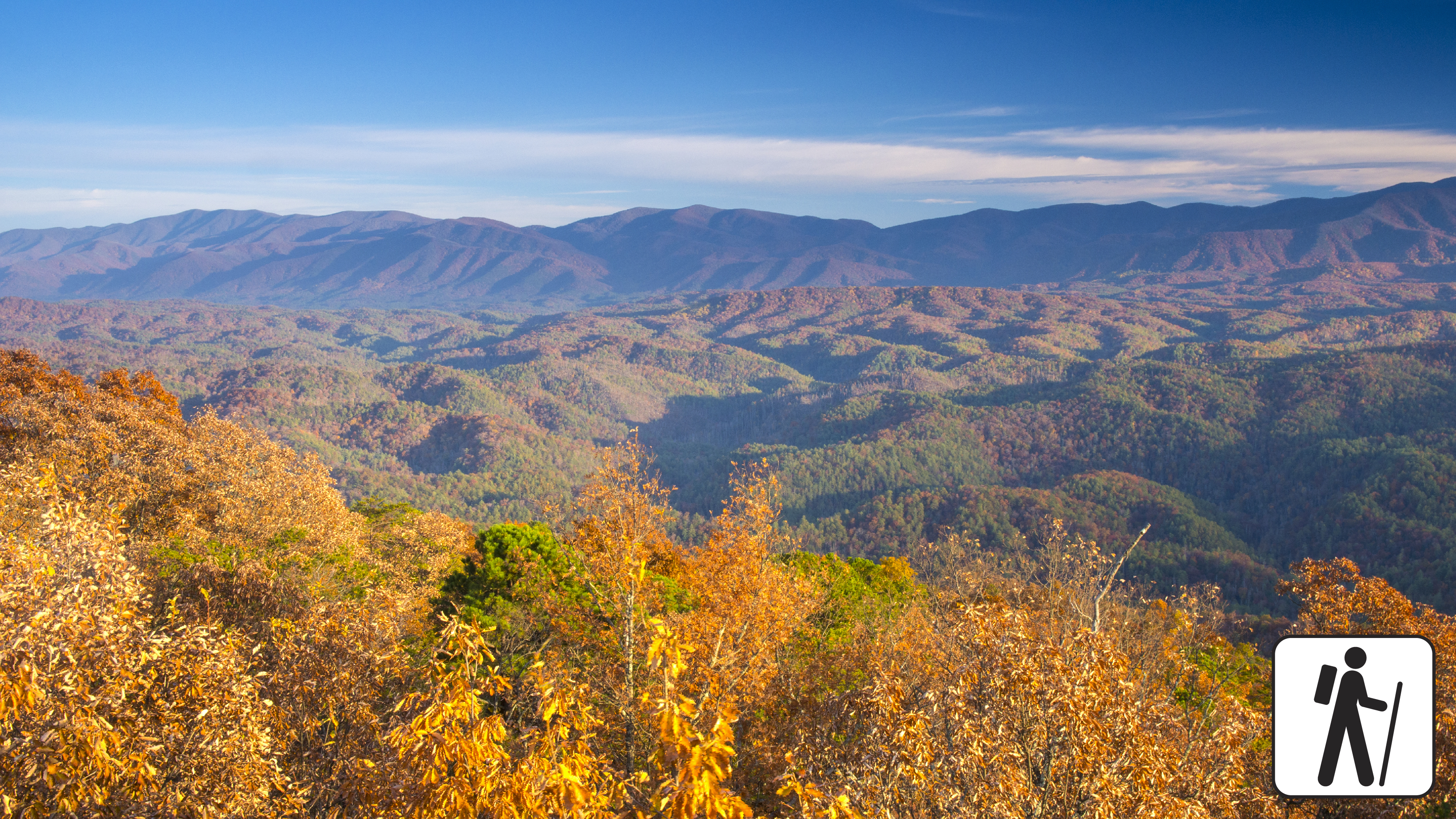
Overview
Walk 0.8 miles (1.3 km) on a short, paved trail through the forest to an observation tower in Great Smoky Mountains National Park with panoramic views of the surrounding mountains and Blount County, Tennessee. This trail includes some mild to moderate inclines.
Length
0.8 miles (1.3 km) roundtrip
Parking & Trailhead
Look Rock Tower Trailhead is on the south side of the road across from a pull-out on Foothills Parkway West between mile markers 14 and 15 (other access points from Look Rock Campground and the nearby Look Rock Picnic Area ). Don't forget your parking tag .
Nearest Restroom
Look Rock Picnic Area (no restrooms at parking lot or trailhead)
Alternate Hikes
Sugarlands Valley Nature Trail : 0.5 miles (0.8 km) roundtrip
John Oliver Cabin : 0.3 miles (0.5 km) roundtrip
Kuwohi : 1 mile (1.6 km) roundtrip
Pets The Gatlinburg Trail and Oconaluftee River Trail are the only two park trails where pets are permitted. Pets are also allowed in picnic areas, in campgrounds, and on roads.
Accessibility Trail is paved but steep.
Backcountry campsGaps
Along the way #91 Upper Lost Cove Sassafras Gap
Backcountry campsGaps
Along the way #37 Lower Walnut Bottom Low Gap
Trailhead Low Gap Trail Trailhead 2,214 ft Drive there
Trailhead Low Gap Trail Access Trailhead 2,356 ft Drive there
History
Along the way Queen-Lower Indian Creek Cemetery
HistoryBackcountry camps
Along the way #35 Gilliland Creek Phillips Cemetery
Trailhead Lower Mount Cammerer Trail Trailhead 2,336 ft Drive there
History
Along the way Lower Noland-Monteith Cemetery
Gaps
Along the way Buckhorn Gap
Trailhead Lumber Ridge Trail Trailhead 1,355 ft Drive there
Backcountry camps
Along the way #28 Marks Cove
no dogs · entrance fee applies
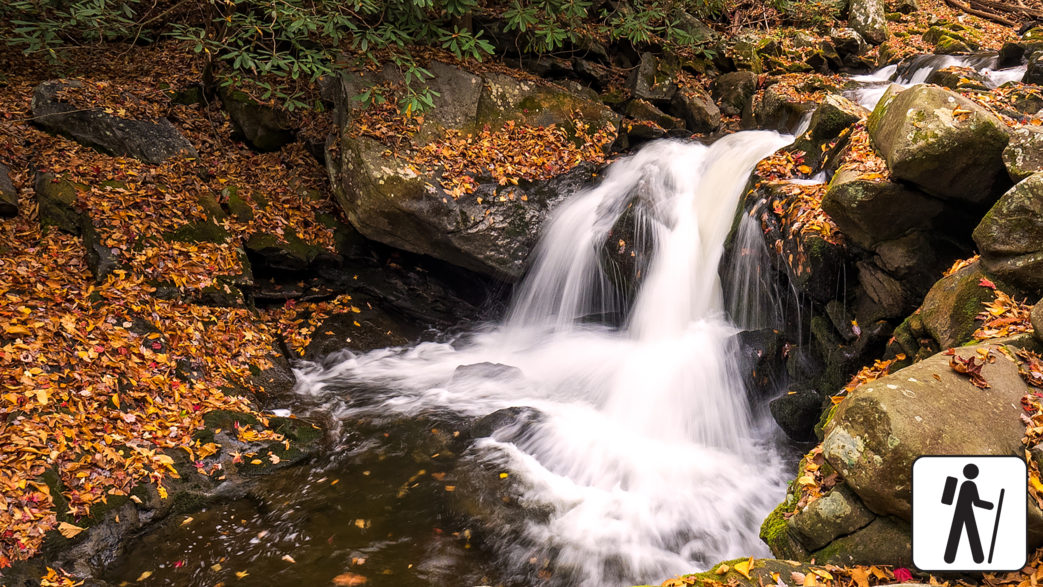
Overview
Hike 1.4 miles (2.3 km) roundtrip for a woodland stroll following an old railroad bed along the Middle Prong of Little River to a dramatic cascade in Great Smoky Mountains National Park .
The trail is mostly wide and flat and gently ascends through rhododendron and some cliff-like rock outcroppings, though it narrows in some sections where washouts have occurred.
Length
1.4 miles (2.3 km) roundtrip
Parking & Trailhead
Park at Middle Prong Trailhead at the end of Upper Tremont Road (unpaved but well-maintained). Don't forget your parking tag .
Nearest Restroom
Great Smokies Welcome Center in Townsend (7929 E. Lamar Alexander Pkwy, Townsend, TN 37882)
Alternate Hikes
Kephart Prong Trail : 4 miles (6.4 km) roundtrip
Little River, Cucumber Gap, Jakes Creek Loop : 5.4 miles (8.7 km) roundtrip
Twentymile Cascades: 1.2 miles (1.9 km) roundtrip
Anthony Creek Trail: varying lengths
Pets The Gatlinburg Trail and Oconaluftee River Trail are the only two park trails where pets are permitted. Pets are also allowed in picnic areas, in campgrounds, and on roads.
Accessibility The first 1.3 miles of Middle Prong Trail has been assessed using the High-Efficiency Trail Assessment Process (HETAP) to provide objective information such as grade and slope. GRIT Freedom Chairs are available for free checkout on a first-come, first-served basis for this section of trail. Trail is mostly wide and flat with a gentle ascent. Use descriptions, maps, and photos to determine which hikes are suitable for you. For information about the reservation process and other trail segments where GRIT Freedom Chairs can be used, visit the trail accessibility page.
HistoryBackcountry campsGroves
Along the way #29 Ottercreek Albright Grove Willis Baxter Cabin
Backcountry campsGaps
Along the way #57 Bryson Place Martins Gap
History
Along the way McClure Cemetery
WaterfallsBridges
Along the way Sinks Bridge Meigs Creek Cascade The Sinks
Trailhead Meigs Creek Trail Trailhead 1,559 ft Drive there
HistoryBackcountry campsGaps
Along the way #19 Upper Henderson #20 King Branch Upper Buckhorn Gap Meigs Mountain Cemetery
HistoryBridges
Along the way Metcalf Bottoms Bridge Little Brier Cemetery Little Greenbrier School
Trailheads Little Brier Gap Trail Trailhead 1,801 ft Drive there · Metcalf Bottoms Trail Trailhead 1,678 ft Drive there
no dogs · entrance fee applies
Overview
Hike 3.4 miles (5.5 km) roundtrip from the Metcalf Bottoms Picnic Area in Great Smoky Mountains National Park through hardwood forest to see remnants of past Smokies residents including stonework; the historic, one-room Little Greenbrier School; and the preserved homesite of the Walker family.
This hike begins on the Metcalf Bottoms Trail, located just beyond the bridge that connects Wears Cove Gap Road to the picnic area. leading to the historic Little Greenbrier Schoolhouse. The path is a well-packed dirt trail that gently climbs through the forest. Alternatively, the schoolhouse can also be accessed via a seasonally open gravel road off Wears Cove Gap Road. From the schoolhouse, the route continues uphill along a wide gravel roadbed, which is part of the Little Brier Gap Trail. This section leads to the preserved 19th-century homestead of the Walker family. Originally built in the 1840s, the cabin features two spacious rooms with fireplaces and a charming front porch. The site also includes a spring house and a corn crib, offering a glimpse into Appalachian mountain life of the past.
Length
3.4 miles (5.5 km) roundtrip
Parking & Trailhead
After parking at the Metcalf Bottoms Picnic Area, walk across the small bridge north of the picnic area to find the Metcalf Bottoms Trailhead. Don't forget your parking tag .
Nearest Restroom
Metcalf Bottoms Picnic Area
Alternate Hikes
John Oliver Cabin : 0.3 miles (0.5 km) roundtrip
Little River, Cucumber Gap, Jakes Creek Loop : 5.4 miles (8.7 km) roundtrip
Noah Bud Ogle Homesite: ~0.7 miles (1.1 km) roundtrip loop
Pets The Gatlinburg Trail and Oconaluftee River Trail are the only two park trails where pets are permitted. Pets are also allowed in picnic areas, in campgrounds, and on roads.
Accessibility Some steep sections plus occasional roots and rocks.
Waterfalls
Along the way Lynn Camp Prong Cascades
Trailhead Middle Prong Trail Trailhead 1,908 ft Drive there
History
Along the way Mingus Creek Cemetery
History
Along the way Evans Chapel Cemetery Mingus Mill
Trailhead Floyd Cemetery Access Trail Trailhead 2,081 ft Drive there
PeaksBackcountry campsGaps
Along the way #26 Dripping Spring Jakes Gap Ben Parton Lookout
ViewsPeaksGapsTowers
Along the way Sharpton Gap Mount Cammerer Mt. Cammerer Lookout Tower Mt. Cammerer Overlook
Gaps
Along the way Pretty Hollow Gap
Gaps
Along the way Mount Sterling Gap
Trailhead Mount Sterling Trail Trailhead 3,887 ft Drive there
Peaks
Along the way Myrtle Point
History
Along the way Hughes Cemetery Nations Cemetery
Trailhead Nations Cemetery Access Trailhead 2,041 ft Drive there
History
Along the way New Beck Cemetery
Bridges
Along the way Bridge
Trailhead Newton Bald Concession Horse Trail Loop Trailhead 2,170 ft Drive there
Backcountry campsBridges
Along the way #52 Newton Bald Smokemont Campground Entrance Bridge
Trailheads Newton Bald Trail Trailhead 2,185 ft Drive there · Newton Bald Trail Trailhead 2,195 ft Drive there
History
Along the way Noah Ogle Barn Noah Ogle Barn Noah Ogle House
HistoryBackcountry campsGapsBridges
Along the way #61 Bald Creek #62 Upper Ripshin #63 Jerry Flats #64 Mill Creek #66 Lower Noland Creek Noland Creek Bridge Upper Sassafras Gap Jerry Flats Cemetery Upper Noland-Branton Cemetery
Trailheads Noland Creek Trail Trailhead 1,836 ft Drive there · Noland Creek Trail Trailhead 1,914 ft Drive there · Noland Creek Trail Trailhead 1,946 ft Drive there
GapsPicnic areas
Along the way Lower Sassafras Gpa Upper Sassafras Gap Deep Creek Picnic Pavilion
Trailheads Noland Divide Trail Trailhead 1,813 ft Drive there · Noland Divide Trail Trailhead 5,931 ft Drive there
HistoryVisitor centers
Along the way Bee Gum Stand (Oconaluftee Mountain Farm Museum) Conard Meat House (Oconaluftee Mountain Farm Museum) Floyd/Enloe Barn (Oconaluftee Mountain Farm Museum) J. Caldwell Springhouse (Oconaluftee Mountain Farm Museum) Jenkins Chicken House (Oconaluftee Mountain Farm Museum) Jim Beard Corn Crib & Gear Shed (Oconaluftee Mountain Farm Museum) Joe Queen Corn Crib (Oconaluftee Mountain Farm Museum) Joe Queen House (Oconaluftee Mountain Farm Museum) Joe Queen Woodshed (Oconaluftee Mountain Farm Museum) Messer Apple House (Oconaluftee Mountain Farm Museum) Outhouse (Oconaluftee Mountain Farm Museum) Sorghum Shed (Oconaluftee Mountain Farm Museum) and 1 more
Trailheads Oconaluftee River Trail Trailhead 1,986 ft Drive there · Oconaluftee River Trail Trailhead 2,030 ft Drive there
dogs allowed · entrance fee applies
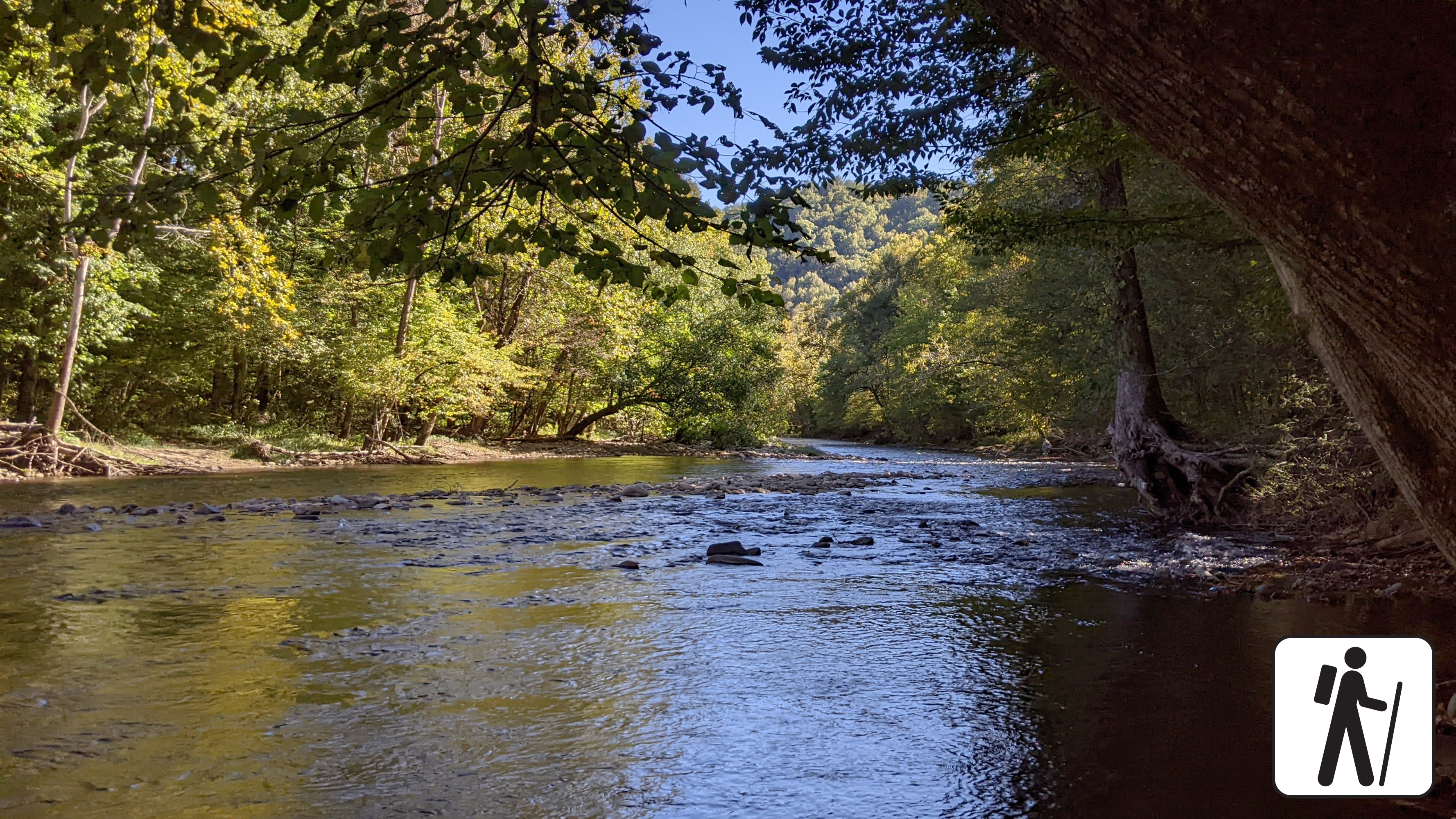
Overview
Elk frequent this area—please stay 50 yards from elk and all wildlife
Enjoy a riverside stroll approximately 3 miles (4.8 km) roundtrip on one of the only pet- and bike-friendly trails in Great Smoky Mountains National Park .
This popular trail is relatively flat, wide, and graveled, and follows the Oconaluftee River through elk habitat and low-elevation hardwood forest from the Oconaluftee Visitor Center to the park boundary at the edge of Cherokee, North Carolina. The grade and width make this trail wheelchair, stroller, and bicycle friendly. Pets are allowed on this trail but must be on a leash.
Length
3 miles (4.8 km) roundtrip
Parking & Trailhead
Park at the Oconaluftee Visitor Center and walk from the visitor center parking to the Mountain Farm Museum to find the Oconaluftee River Trailhead. Don't forget your parking tag .
Nearest Restroom
Oconaluftee Visitor Center
Alternate Hikes
Gatlinburg Trail : approximately 4 miles (6.4 km) roundtrip
Kephart Prong Trail : 4 miles (6.4 km) roundtrip
Little River, Cucumber Gap, Jakes Creek Loop : 5.4 miles (8.7 km) roundtrip
Big Creek Trail: varying lengths
Accessibility Trail has occasional obstacles of roots and rocks, but is considered a leisurely trail that is mostly flat and wide. There are some sections with large gravel tread.
History
Along the way Old Beck Cemetery
HistoryBackcountry campsBridges
Along the way #33 Settlers Camp Ramsey Cascades Road Bridge #2 Maddron Cemetery
Trailhead Old Settlers Trail Trailhead 1,694 ft Drive there
Bridges
Along the way West Prong Bridge at Headquarters
Trailheads Old Sugarlands Trail Trailhead 2,569 ft Drive there · Old Sugarlands Trail Trailhead 1,461 ft Drive there
no dogs · entrance fee applies
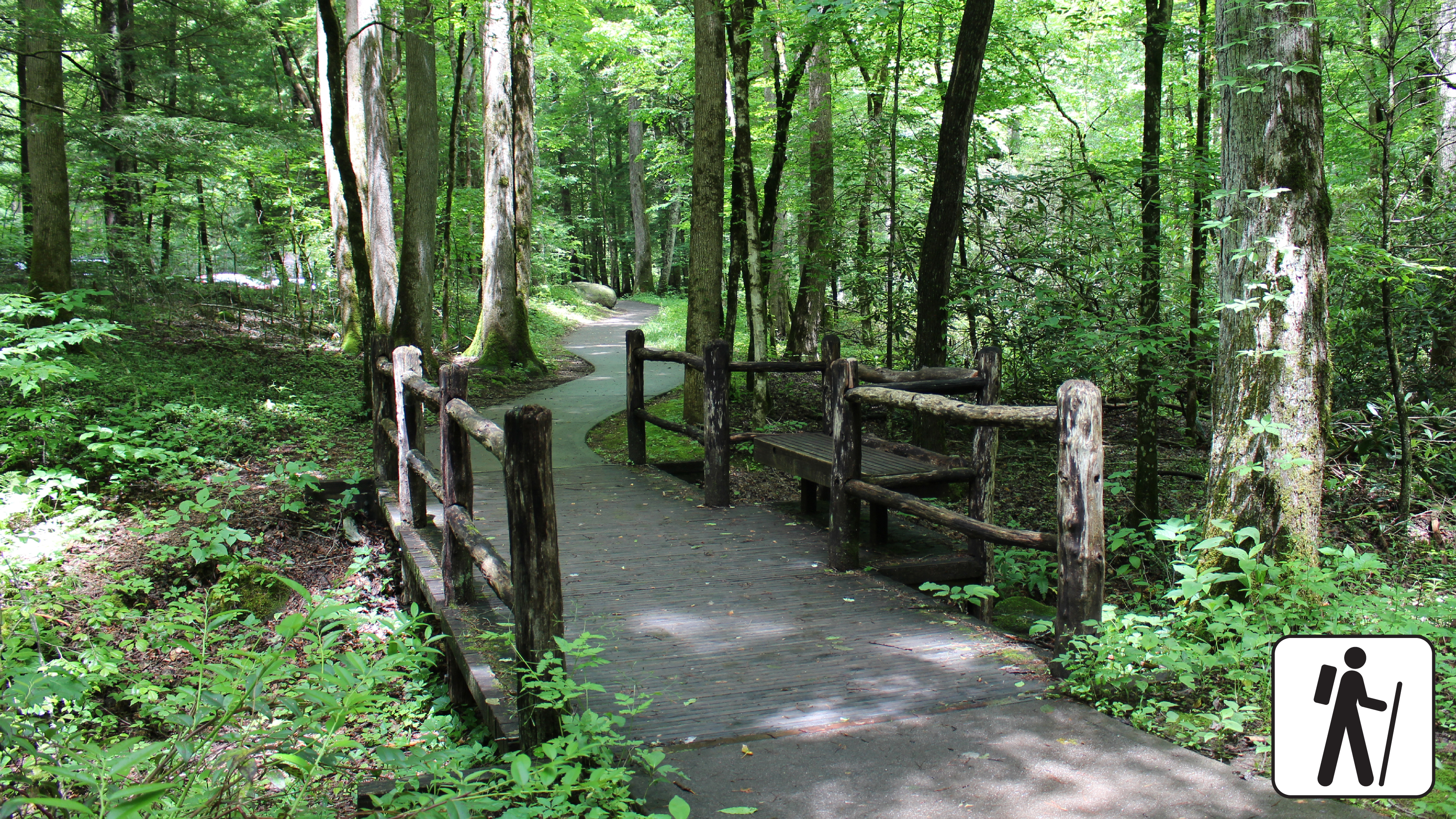
Overview
Wander through a cove hardwood forest with streamside views, rock walls, and historic stone chimneys on this half-mile (0.8 km) loop along a paved, flat trail in Great Smoky Mountains National Park .
Length
0.5 miles (0.8 km) roundtrip
Parking & Trailhead
Sugarlands Valley Nature Trailhead is adjacent to a small parking area with several accessible spaces along Newfound Gap Rd (US 411) near Sugarlands Visitor Center. Don't forget your parking tag .
Nearest Restroom
Sugarlands Visitor Center
Alternate Hikes
John Oliver Trail : 0.3 miles (0.5 km) roundtrip
Gatlinburg Trail : ~4 miles (6.4 km) roundtrip
Cataract Falls Trail
Pets The Gatlinburg Trail and Oconaluftee River Trail are the two park trails where pets are permitted. Pets are also allowed in picnic areas, in campgrounds, and on roads.
Accessibility This trail has been assessed using the High-Efficiency Trail Assessment Process (HETAP) to provide objective information such as grade and slope. GRIT Freedom Chairs are available for free checkout on a first-come, first-served basis for trail. This trail is fully paved and flat. Use descriptions, maps, and photos to determine which hikes are suitable for you. For information about the reservation process and other trail segments where GRIT Freedom Chairs can be used, visit the trail accessibility page.
Trailhead Palmer Creek Trail Trailhead 4,506 ft Drive there
Gaps
Along the way Jakes Gap
History
Along the way Posey Cemetery
Gaps
Along the way Upper Sassafras Gap
HistoryBackcountry camps
Along the way #31 Porters Flalt Ownby-Longbranch Cemetery
Trailhead Porters Creek Trail Trailhead 1,886 ft Drive there
1-3 Hours · no dogs · entrance fee applies
Start Greenbrier
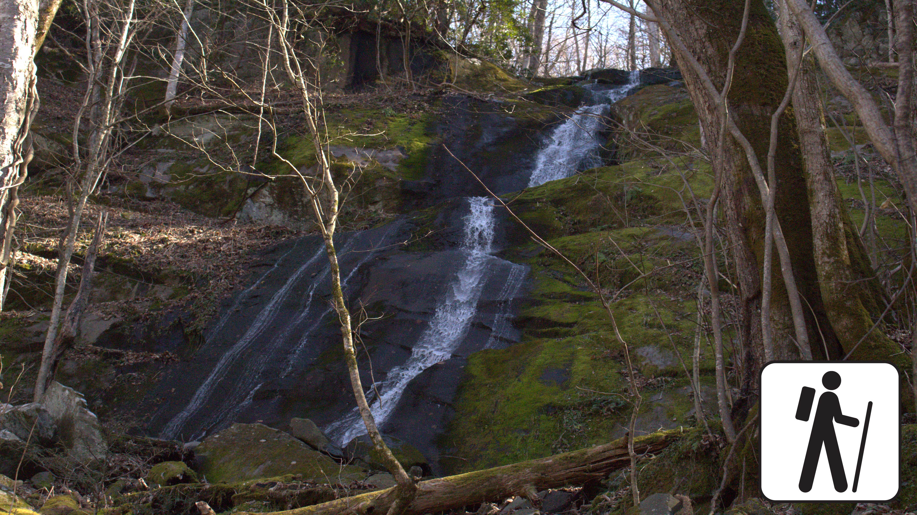
Porters Creek is a peaceful trail that is filled with history and loads of natural wonders.
Overview
If you're seeking a moderate hike that's typically less crowded than other park trails, Porters Creek Trail is a great option. The trail features historical and natural wonders, including the Great Smoky Mountain Hiking Club Cabin and the tranquil 40-foot Fern Branch Falls.
The trail ends at backcountry campsite #31, but many hikers turn back after reaching Fern Branch Falls, about 2 miles in. If you decide to continue, be aware that the trail becomes steeper just before the waterfall and remains mostly uphill to the campsite. A backcountry permit is required to camp at the site.
Parking & Trailhead
The trailhead is located at the dead-end of Greenbrier Road. Once you enter Greenbrier, continue to the end of the road in which you will see the trailhead and a gravel parking area with room for approximately 20 vehicles to park. Don’t forget your parking tag!
Nearest Restroom
Greenbrier Picnic Pavillion
Alternate Hikes
Hen Wallow Falls via Gabes Mountain Trail 4.3 miles (6.9 km) roundtrip.
Lynn Camp Prong Cascades via Middle Prong Trail 1.4 miles (2.3 km) roundtrip.
Gatlinburg Trail 3.8 miles (6.1 km) roundtrip.
Husky Branch Falls via Little River-Cucumber Gap-Jakes Creek Loop 5.4 miles (8.7 km) roundtrip.
Pets Pets are not permitted on this trail.
Accessibility Roots, rocks, high footlog bridges, stream crossings, and some elevation gain may make this trail challenging for some individuals.
History
Along the way Pikey Cemetery
History
Along the way Posey Cemetery
Backcountry campsGaps
Along the way #39 Pretty Hollow Pretty Hollow Gap
History
Along the way Queen Cemetery
Trailhead Queen Cemetery Access Trailhead 2,075 ft Drive there
PeaksBackcountry campsGapsRanger stations
Along the way #15 Rabbit Creek Scott Gap Coon Butt Pine Mountain Abrams Creek Ranger Station
Trailhead Abrams Falls Trail Trailhead 1,708 ft Drive there
Waterfalls
Along the way Rainbow Falls
Trailhead Rainbow Falls Trail Trailhead 2,582 ft Drive there
no dogs · entrance fee applies
Start Expect crowds and full parking at Rainbow Falls Trailhead—consider a shuttle
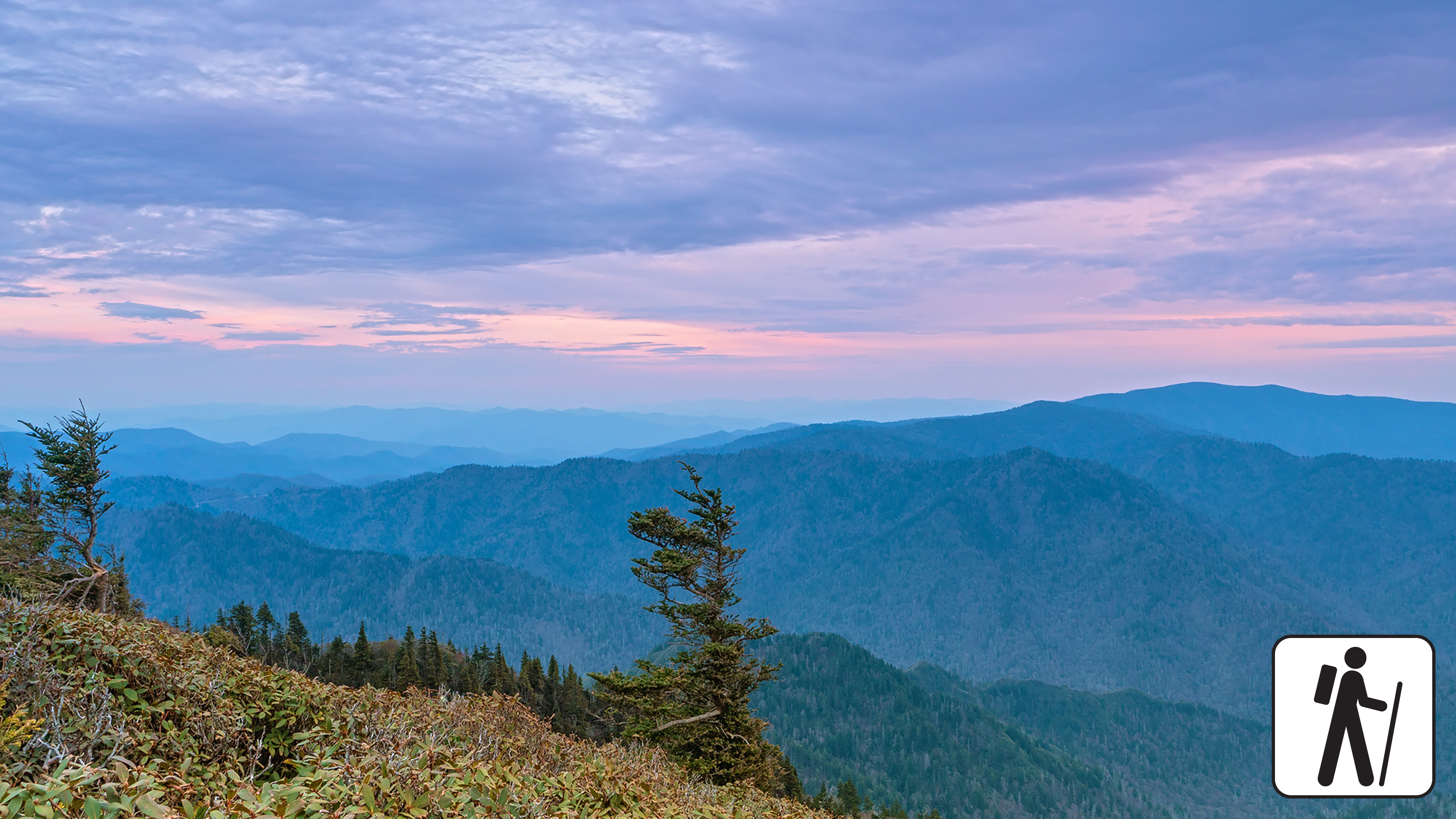
Overview
Expect extreme crowding and limited parking—consider a shuttle or alternate hikes listed below
One of five routes to Mount Le Conte in Great Smoky Mountains National Park , the Rainbow Falls Trail includes a waterfall, rocky ascents, and forest views. The strenuous hike is 13 miles (20.9 km) roundtrip. Hike along a creek and across three bridges before arriving at Rainbow Falls approximately 2.2 miles (3.5 km) from the trailhead before continuing to Mount Le Conte.
Past the falls, lush forests line the trail and hikers will intersect the Bullhead Trail, Alum Cave Trail, and Trillium Gap Trail before reaching the summit (check a map for full details). Hikers are rewarded with expansive views atop Mount Le Conte—6,593 feet (2,010 m) tall. Near the summit, the best views are at Cliff Top and Myrtle Point, both marked with signs.
In cold weather, prepare for ice on the trail and potential falling icicles. Microspikes (chains or small spikes to slip on shoes for better traction) recommended in winter.
In high water conditions, consider using Bullhead Trail to Mount Le Conte .
Length
13 miles (20.9 km) roundtrip
Parking & Trailhead
Please consider a shuttle or park at Rainbow Falls Trailhead on Cherokee Orchard Road. Don't forget your parking tag .
Nearest Restroom
Rainbow Falls Trailhead
Alternate Hikes
Appalachian Trail & Boulevard Trail to Mount Le Conte : 16.2 miles (26.1 km) roundtrip
Bullhead Trail to Mount Le Conte : 13.6 miles (21.9 km) roundtrip
Trillium Gap Trail to Mount Le Conte : 13 miles (20.9 km) roundtrip
Alum Cave Trail to Mount Le Conte : 10 miles (16.1 km) roundtrip
Pets The Gatlinburg Trail and Oconaluftee River Trail are the two park trails where pets are permitted. Pets are also allowed in picnic areas, in campgrounds, and on roads.
Accessibility Trail is steep, rocky, and includes stairs.
no dogs · entrance fee applies
Start Expect crowds and full parking at Rainbow Falls Trailhead—consider a shuttle
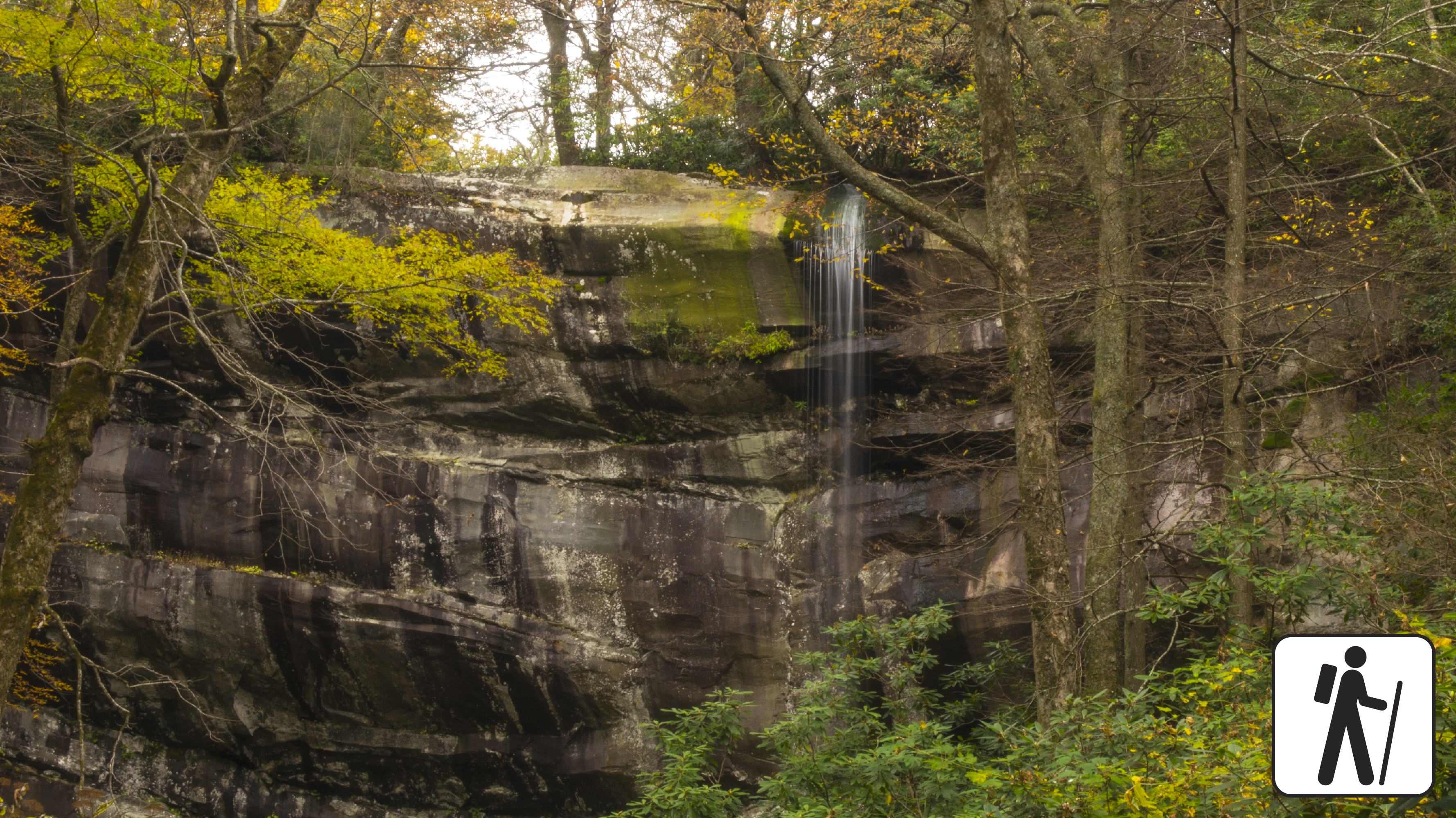
Overview
Expect extreme crowding and limited parking—consider a shuttle or alternate hikes listed below
Hike 5.6 miles (9 km) roundtrip through varied forest to a popular waterfall in Great Smoky Mountains National Park named for the misty rainbow that often appears at its base on sunny afternoons.
This trail is well-traveled and maintained, but the climb to the falls is relatively steep with approximately 1,500 feet (457 m) in elevation gain from the trailhead to the falls. See some old growth trees along the trail, along with burn scars from a fire in 2016. This trail is also used to reach Mount LeConte, which is 6.7 miles (10.8 km) from the trailhead.
If taking this trail to Mount Le Conte , consider using Bullhead Trail in high water conditions; trail is often icy in winter
Length
5.6 miles (9 km) roundtrip
Parking & Trailhead
Please consider a shuttle or park at Rainbow Falls Trailhead on Cherokee Orchard Road (trailhead can be accessed from either the upper or lower lot). Don't forget your parking tag .
Nearest Restroom
Pit toilets at trailhead
Alternate Hikes
Hen Wallow Falls : 4.3 miles (6.9 km) roundtrip
Lynn Camp Prong Cascades : 1.4 miles (2.3 km) roundtrip
Finley Cane Trail to Bote Mtn Trail to Lead Cove Trail Loop : 6.9 mile (11.1 km) loop
Pets The Gatlinburg Trail and Oconaluftee River Trail are the only two park trails where pets are permitted. Pets are also allowed in picnic areas, in campgrounds, and on roads.
Accessibility Trail is very steep and rocky.
Waterfalls
Along the way Ramsey Cascades
no dogs · entrance fee applies
Start Expect crowds and full parking at Ramsey Cascades Trailhead—consider a shuttle
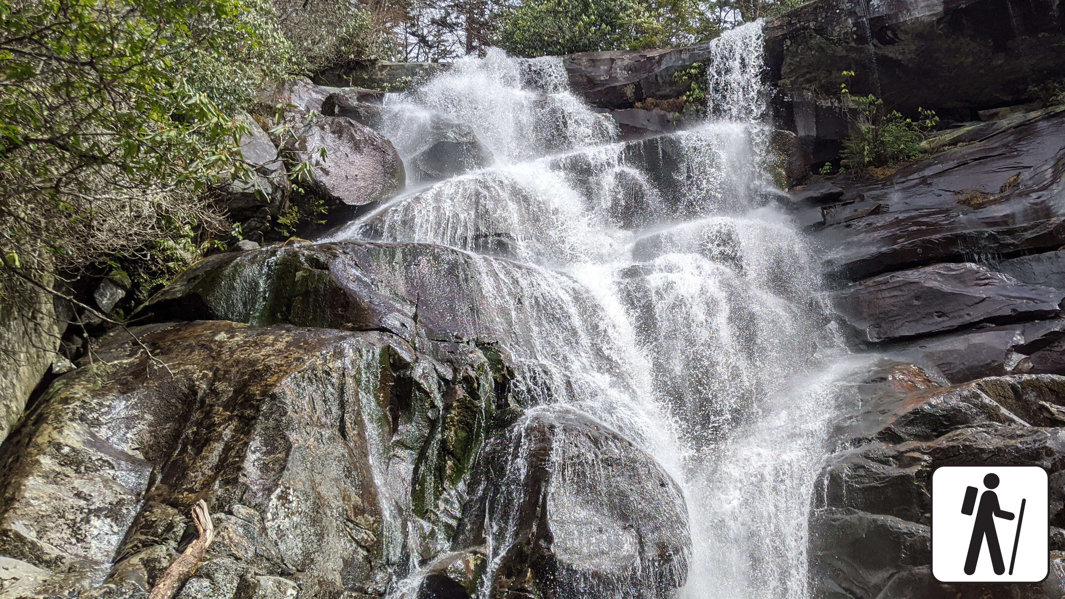
Overview
Expect extreme crowding and limited parking—consider a shuttle or alternate hikes listed below
Hike 8 miles (12.9 km) roundtrip on this popular but relatively challenging trail through cove hardwood forest to see the tallest waterfall in Great Smoky Mountains National Park at 105 feet (32 m).
The trail begins on an old roadbed and passes through a cove hardwood forest but becomes narrower and rockier as it ascends more than 2,000 feet (610 m) in elevation and crosses multiple footlog bridges and streams along the way.
Do not attempt to climb to the top of the falls—it is muddy and slippery.
This trail was rehabiliated by the 'Trails Forever program' learn more here .
Length
8 miles (12.9 km) roundtrip
Parking & Trailhead
Please consider a shuttle or park at Ramsey Cascades Trailhead on Ramsey Prong Road in Greenbrier. Don't forget your parking tag .
Nearest Restroom
Greenbrier Picnic Area
Alternate Hikes
Hen Wallow Falls : 4.3 miles (6.9 km) roundtrip
Lynn Camp Prong Cascades : 1.4 miles (2.3 km) roundtrip
Pets The Gatlinburg Trail and Oconaluftee River Trail are the only two park trails where pets are permitted. Pets are also allowed in picnic areas, in campgrounds, and on roads.
Accessibility Trail has many steep sections plus roots and rocks on the trail.
History
Along the way John Oliver Cabin
Trailhead Rich Mountain Loop Trail Trailhead 1,920 ft Drive there
Backcountry camps
Along the way #05 Rich Mountain
Trailhead Rich Mountain Trail Trailhead 1,970 ft Drive there
History
Along the way Vance Newman Cemetery
Trailhead Huskey Gap Trail Trailhead 1,881 ft Drive there
WaterfallsGaps
Along the way Indian Gap Talking Falls Trickling Falls
Trailhead Appalachian Trail Trailhead 5,272 ft Drive there
HistoryBackcountry campsGaps
Along the way #40 Big Hemlock Polls Gap Steve Woody House
Trailheads Hemphill Bald Trail Trailhead 5,127 ft Drive there · Rough Fork Trail Trailhead 5,128 ft Drive there · Rough Fork Trail Trailhead 2,827 ft Drive there
no dogs · entrance fee applies
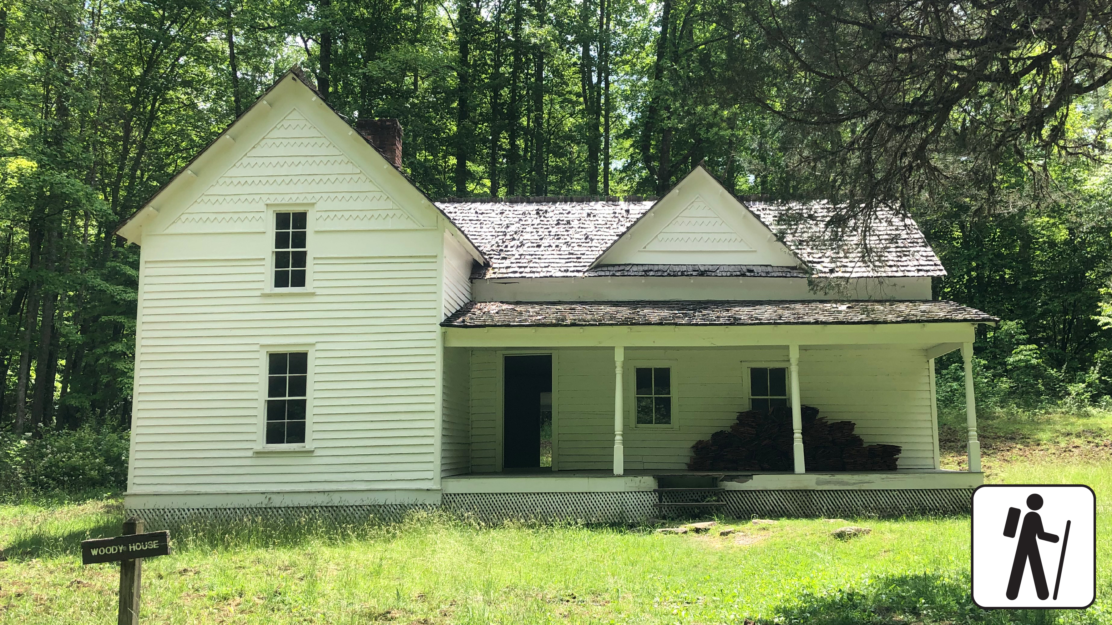
Overview
Walk 2 miles (3.2 km) roundtrip through a hardwood forest on a wide, well-graded path following a mountain stream to reach the historic Steve Woody Place in Great Smoky Mountains National Park , which was once the center of a sprawling homestead with several outbuildings.
Today, visitors can see the house surrounded by the open fields of the Cataloochee Valley, but the homesite once included a house, barn, chicken house, tool house, canning house, spring house, and wood shed.
Length
2 miles (3.2 km) roundtrip
Parking & Trailhead
Park at Rough Fork Trailhead (follow Cataloochee Road to the dead end past the campground, ranger station, Messer Barn, and Palmer Chapel to the parking area). Don't forget your parking tag .
Nearest Restroom
Cataloochee Campground (closed seasonally)
Alternate Hikes
Kephart Prong Trail : 4 miles (6.4 km) roundtrip
Little River, Cucumber Gap, Jakes Creek Loop : 5.4 miles (8.7 km) roundtrip
Pets The Gatlinburg Trail and Oconaluftee River Trail are the only two park trails where pets are permitted. Pets are also allowed in picnic areas, in campgrounds, and on roads.
Accessibility Trail is mostly flat and wide with a couple of stream crossings on narrow log bridges.
Trailheads Roundtop Trail Trailhead 1,769 ft Drive there · Roundtop Trail Trailhead 1,143 ft Drive there
Backcountry campsShelters
Along the way #10 Ledbetter Ridge Russell Field Shelter
GapsBridges
Along the way Laurel Creek Bridge #4 Dosey Gap
Trailhead Schoolhouse Gap Trail Trailhead 1,594 ft Drive there
Backcountry campsGaps
Along the way #06 Turkeypen Ridge Schoolhouse Gap Scott Gap
HistoryRanger stations
Along the way Bradley Cemetery Oconaluftee Ranger Station
Trailhead Smokemont Loop Trail Trailhead 2,203 ft Drive there
Trailhead Smokemont Nature Trail Trailhead 2,212 ft Drive there
no dogs · entrance fee applies
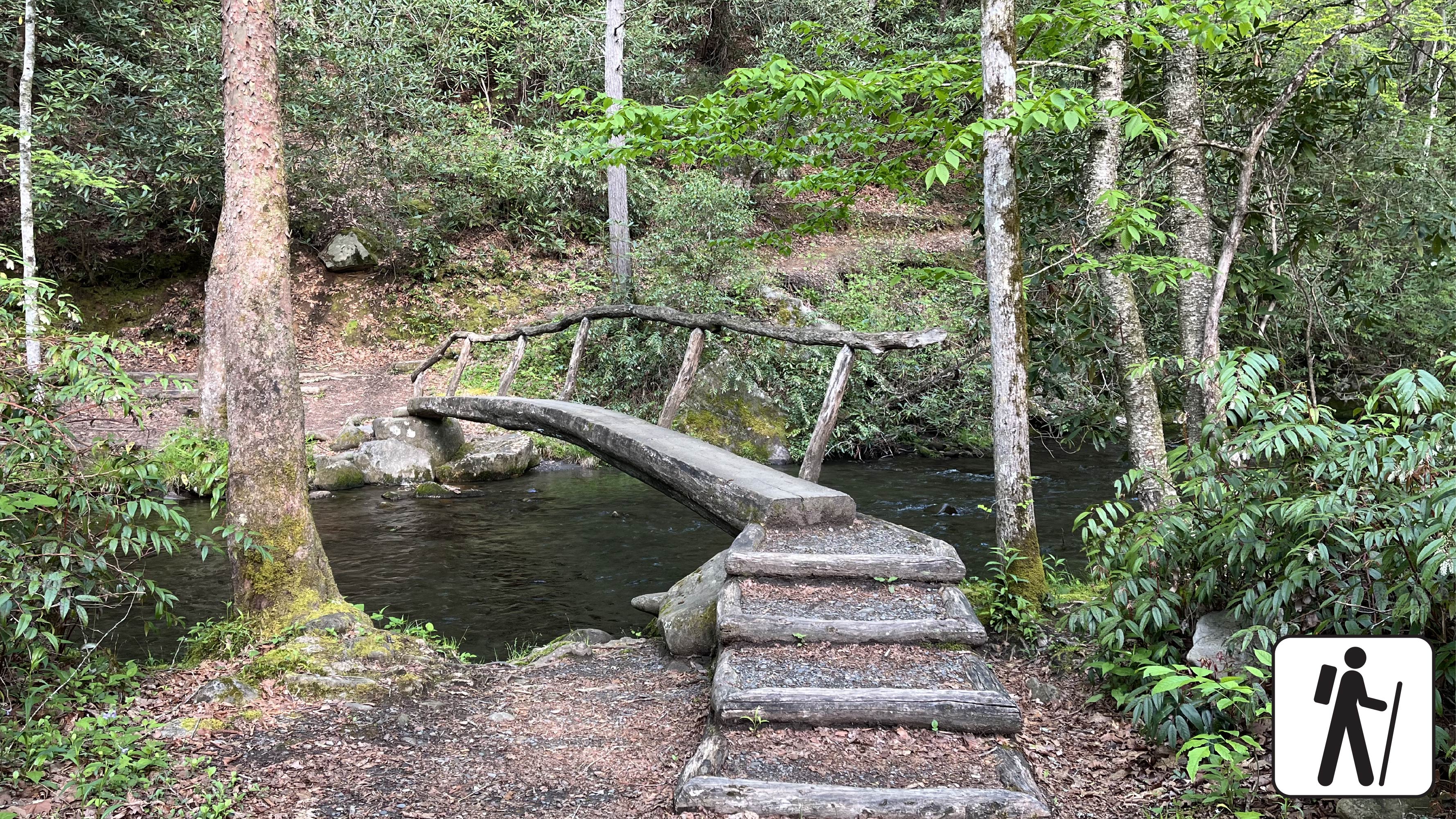
Overview
This scenic loop hike near Smokemont Campground provides a peaceful escape and views of the surrounding peaks. Hike across narrow foot log bridges over pristine Bradley Fork and enjoy wildflowers, lush trees, and bird song. Once known as Bradleytown, the Smokemont region’s history is tied to early 1900s logging and Champion Fibre Company before the establishment of the park and included barracks, stores, churches, and sawmills.
This hike is suitable for hikers of many skill levels, especially for families or hikers camping in the area looking for a short hike away from the bustle of Cherokee or Gatlinburg. This trail also has designated picnic areas near the trailhead, which are perfect for a post-hike snack or lunch.
Begin at the trailhead, located across from campsite B31 in the Smokemont Campground. The trail is marked by a sign reading “Smokemont Self-Guided Nature Trail.” Cross two small foot log bridges, then look for a sign with an arrow pointing to the right: this is the start of the loop trail.
At the start, the trail follows the Bradley Fork upstream before turning right and climbing gently to the top of the loop where one can enjoy scenic views to the east and northeast from the ridge. The trail then curves to the west side of the mountain and begins a gentle descent back to the Bradley Fork and the log bridges.
Length
0.62-mile (1 km) roundtrip
Elevation Gain
168 feet (51 meters)
Parking & Trailhead
18 parking spots for day use at the Smokemont Campground. The trailhead is located directly across from the campground at site B31. Hikers should not park in campsites. Don't forget your parking tag .
Nearest Restroom
Smokemont Campground
Alternate Hikes
Smokemont Loop Trail with Bradley Cemetery: 6 miles (9.66 km) roundtrip
Pets The Gatlinburg Trail and Oconaluftee River Trail are the only two park trails where pets are permitted. Pets are also allowed in picnic areas, in campgrounds, and on roads.
Accessibility No designated accessible parking spaces. The trail has two narrow foot log bridges with handrails. The trail has some steep sections and occasional roots/rocks.
History
Along the way Smokemont Baptist Church
PeaksHistory
Along the way Williamson Cemetery Snake Den Mountain
Trailhead Snake Den Ridge Trail Trailhead 2,360 ft Drive there
Backcountry campsGaps
Along the way #64 Mill Creek #71 C.C.C. Board Camp Gap
Backcountry camps
Along the way #42 Spruce Mountain
Trailhead Spruce Mountain Trail Trailhead 4,812 ft Drive there
History
Along the way Stiles Cemetery
Trailhead Stiles Cemetery Access Trailhead 2,167 ft Drive there
PeaksSheltersGaps
Along the way Fighting Creek Gap Husky Gap Mids Gap Sugarland Mountain Mount Collins Shelter
Trailhead Sugarland Valley Accessible Trail Trailhead 1,531 ft Drive there
Gaps
Along the way Martins Gap
History
Along the way Sutton-McGhee Cemetery
Gaps
Along the way Pretty Hollow Gap
Shelters
Along the way Kephart Shelter
Views
Along the way Short Beech Ridge Overlook
PeaksHistoryBackcountry campsGaps
Along the way #52 Newton Bald Deeplow Gap Tuskee Gap Wiggins-Watson Cemetery Nettle Creek Bald
Trailheads Thomas Divide Trail Trailhead 2,183 ft Drive there · Thomas Divide Trail Trailhead 4,642 ft Drive there
History
Along the way Old Beck Cemetery
Trailhead Tow String Horse Trail Trailhead 2,134 ft Drive there
Shelters
Along the way Tricorner Shelter
WaterfallsViewsGapsLodgesBridges
Along the way Roaring Fork Motor Nature Trail Bridge #1 Trillium Gap LeConte Lodge Baskins Creek Overlook Falls Branch Overlook LeConte Lodge Overlook Grotto Falls
Trailheads Baskins Creek Trail Trailhead 2,738 ft Drive there · Old Sugarlands Trail Trailhead 2,569 ft Drive there · Trillium Gap Trail Trailhead 3,162 ft Drive there
no dogs · entrance fee applies
Start Expect crowds and full parking at Trillium Gap Trailhead for Grotto Falls—consider a shuttle
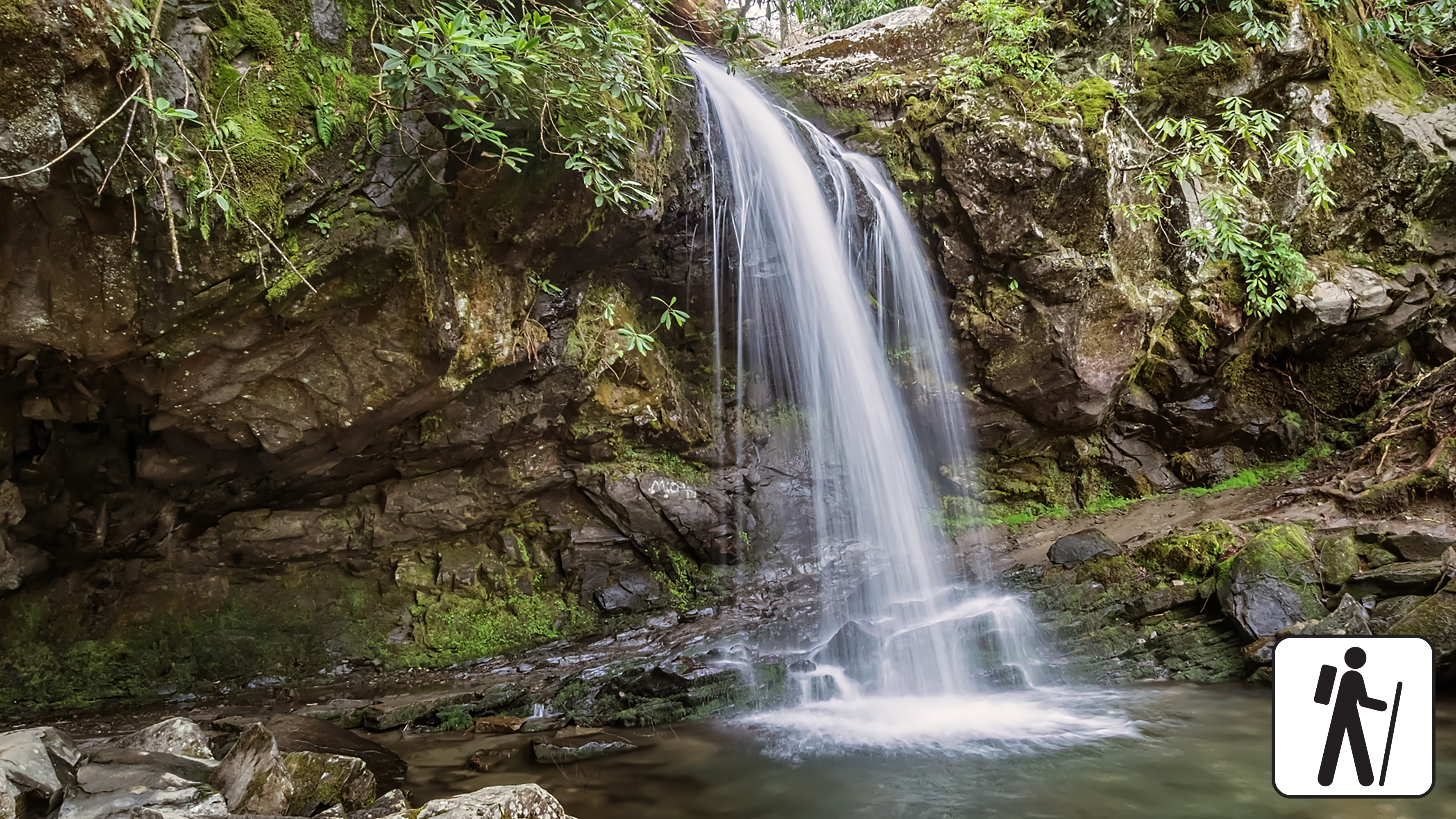
Overview
Expect extreme crowding and limited parking—consider a shuttle or alternate hikes listed below
Hike 2.6 miles (4.2 km) roundtrip on Trillium Gap Trail as it crosses multiple streams in Great Smoky Mountains National Park and meanders through sections of old-growth forest and rhododendron to reach a cool mountain cove with mossy boulders and a unique waterfall you can walk behind.
The trail to Grotto Falls is well-traveled, especially in summer, but rainfall and high water can make for muddy and slippery conditions.
Length
4 miles (6.4 km) roundtrip
Parking & Trailhead
Please consider a shuttle or park at Trillium Gap Trailhead on the one-way Roaring Fork Motor Nature Trail (road closed in winter). Don't forget your parking tag .
Nearest Restroom
Pit toilets at Rainbow Falls Trailhead (plan to stop for restrooms before entering the one-way loop to the trailhead)
Alternate Hikes
Baskins Creek Falls: roughly 3 miles (4.8 km) roundtrip
Extension on Trillium Gap via Rainbow Falls parking area: see a map for varying lengths
Pets The Gatlinburg Trail and Oconaluftee River Trail are the only two park trails where pets are permitted. Pets are also allowed in picnic areas, in campgrounds, and on roads.
Accessibility Trail has occasional roots, rocks, and inclines.
no dogs · entrance fee applies
Start Expect crowds and full parking at Trillium Gap Trailhead—consider a shuttle
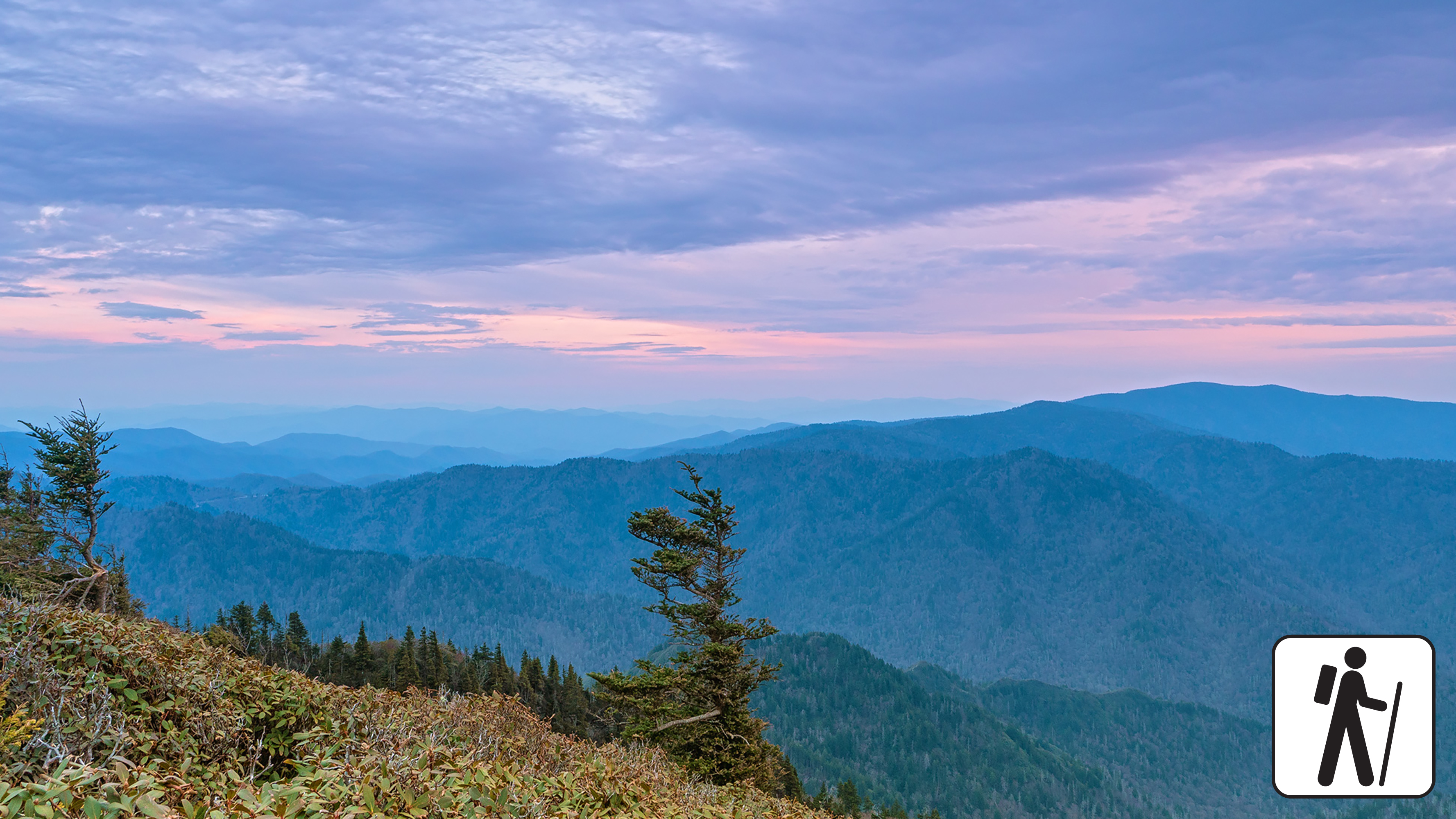
Overview
Expect extreme crowding and limited parking—consider a shuttle and alternate hikes listed below
One of five routes to Mount Le Conte in Great Smoky Mountains National Park , Trillium Gap Trail rewards hikers with mountain views, diverse forest, and a waterfall. The 25-foot (7.6-m) tall Grotto Falls greets visitors approximately 1.5 miles (2.4 m) into the journey before the trail steadily ascends. Spring wildflowers also draw many visitors to this trail. The roundtrip distance is 13 miles (20.9 km) if hikers go out and back on Trillium Gap Trail. Consult a map to combine with other trails and create a loop (mileages will vary).
At nearly 3 miles (4.8 km), turn right at the junction with Brushy Mountain Trail to continue to Mount LeConte. Near the summit, the best views are at Cliff Top and Myrtle Point, both marked with signs.
In cold weather, prepare for ice on the trail and potential falling icicles. Microspikes (chains or small spikes to slip on shoes for better traction) recommended in winter.
Length
13 miles (20.9 km) roundtrip
Parking & Trailhead
Please consider a shuttle or park at Trillium Gap Trailhead on one-way Roaring Fork Motor Nature Trail. Don't forget your parking tag .
Nearest Restroom
Rainbow Falls Trailhead before entering one-way Roaring Fork Motor Nature Trail
Alternate Hikes
Grotto Falls : 2.6 miles (4.2 km) roundtrip
Appalachian Trail & Boulevard Trail to Mount Le Conte : 16.2 miles (26.1 km) roundtrip
Bullhead Trail to Mount Le Conte : 13.6 miles (21.9 km) roundtrip
Rainbow Falls Trail to Mount Le Conte : 13 miles (20.9 km) roundtrip
Alum Cave Trail to Mount Le Conte : 10 miles (16.1 km) roundtrip
Pets The Gatlinburg Trail and Oconaluftee River Trail are the only two park trails where pets are permitted. Pets are also allowed in picnic areas, in campgrounds, and on roads.
Accessibility Trail is steep, rocky, and includes stairs and bridges.
History
Along the way Tritt Cemetery
Trailhead Tritt Cemetery Access Trail Trailhead 1,674 ft Drive there
Trailheads Lakeshore Trail Trailhead 2,096 ft Drive there · Tunnel Bypass Trail NC Trailhead 2,080 ft Drive there
Gaps
Along the way Dosey Gap
Trailheads Finley Cane Trail Trailhead 1,829 ft Drive there · Turkeypen Ridge Trail Trailhead 1,827 ft Drive there
Gaps
Along the way Proctor Field Gap
WaterfallsBackcountry campsGapsRanger stations
Along the way #93 Twentymile Creek Proctor Field Gap Sassafras Gap 20 Mile Ranger Station Twentymile Creek Cascade
Trailhead Twentymile Trail Trailhead 1,318 ft Drive there
no dogs · entrance fee applies
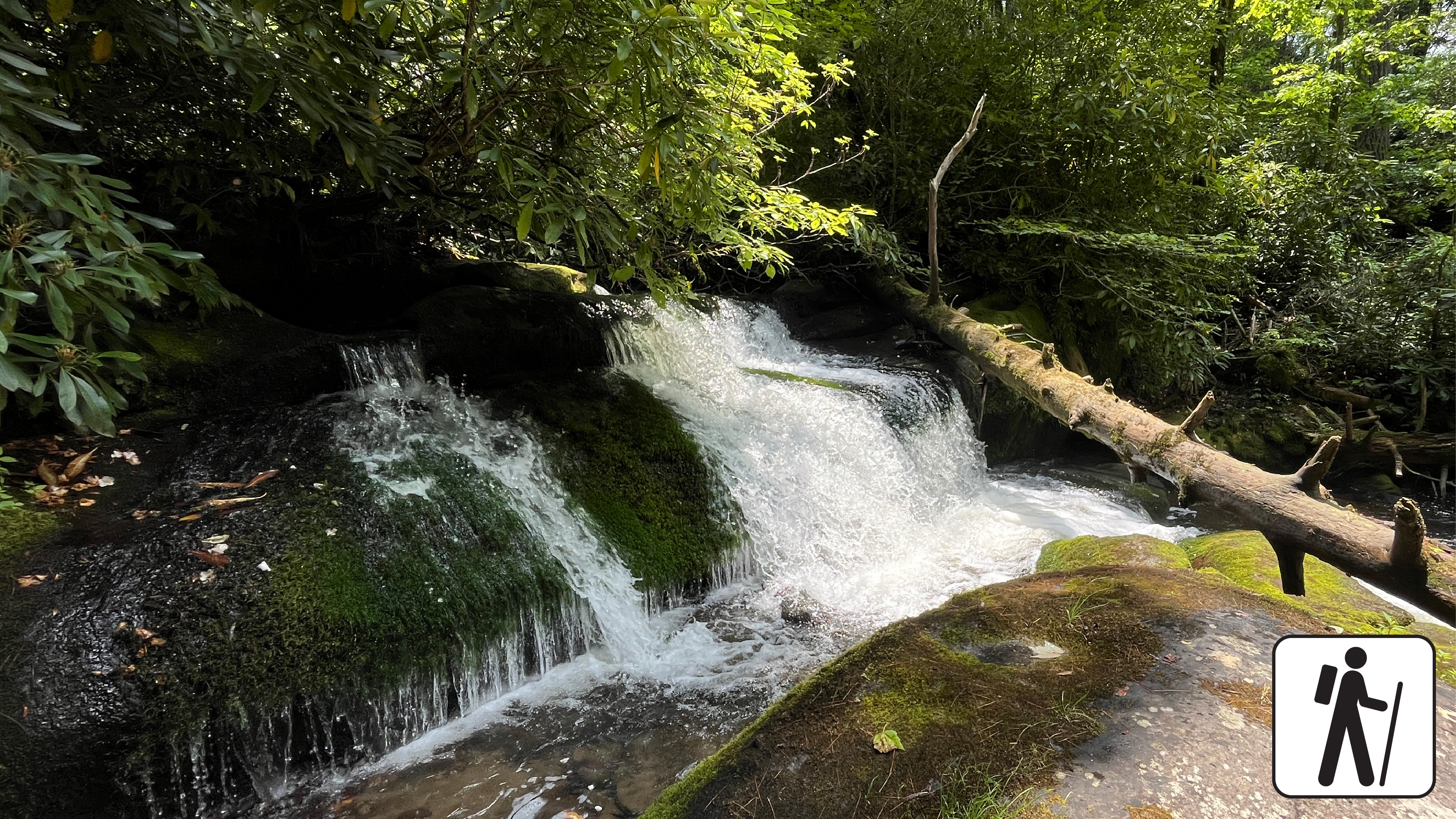
Overview
Hike 1.2 miles (1.9 km) roundtrip along a wide gravel roadbed that follows a mountain stream to a cascade surrounded by moss-covered rocks and mixed hardwood forest in Great Smoky Mountains National Park .
After a half-mile walk along Twentymile Trail to the first junction, take Wolf Ridge Trail one hundred yards from the first bridge and look to your right for a foot trail that leads to the Twentymile Cascade.
If you're up for more, you can continue on Wolf Ridge Trail to the Twentymile Loop Trail for a longer 7.6-mile (12.2-km) loop through one of the more remote areas of the Smokies known for its picturesque streams and shady hardwood forest. This longer loop includes narrower sections of trail with some muddy and rocky areas. Twentymile Trail is wider with fewer ups and downs than Wolf Ridge.
Length
1.2 miles (1.9 km) roundtrip
Parking & Trailhead
Twentymile Trailhead at the end of the road just beyond Twentymile Ranger Station. Don't forget your parking tag .
Nearest Restroom
Facilities near Deep Creek or outside the park before arriving
Alternate Hikes
Goldmine Loop Trail : 4 miles (6.4 km) roundtrip
Pets The Gatlinburg Trail and Oconaluftee River Trail are the only two park trails where pets are permitted. Pets are also allowed in picnic areas, in campgrounds, and on roads.
Accessibility Occasional roots and rocks along the trail.
Trailheads Grassy Branch Trail Trailhead 1,657 ft Drive there · Twin Creeks Trail Trailhead 1,943 ft Drive there · Twin Creeks Trail Trailhead 1,538 ft Drive there
History
Along the way I.N. Trentham Cemetery
Trailhead Two Mile Lead Concession Horse Trail Trailhead 1,456 ft Drive there
History
Along the way Walker Sisters' House
PeaksGaps
Along the way Mule Gap Water Oak Gap Bearwallow Bald
History
Along the way Welch-Kirkland Cemetery
HistoryBackcountry camps
Along the way #18 West Prong Walkers Valley Cemetery
Trailhead West Prong Trail Trailhead 1,362 ft Drive there
no dogs · entrance fee applies
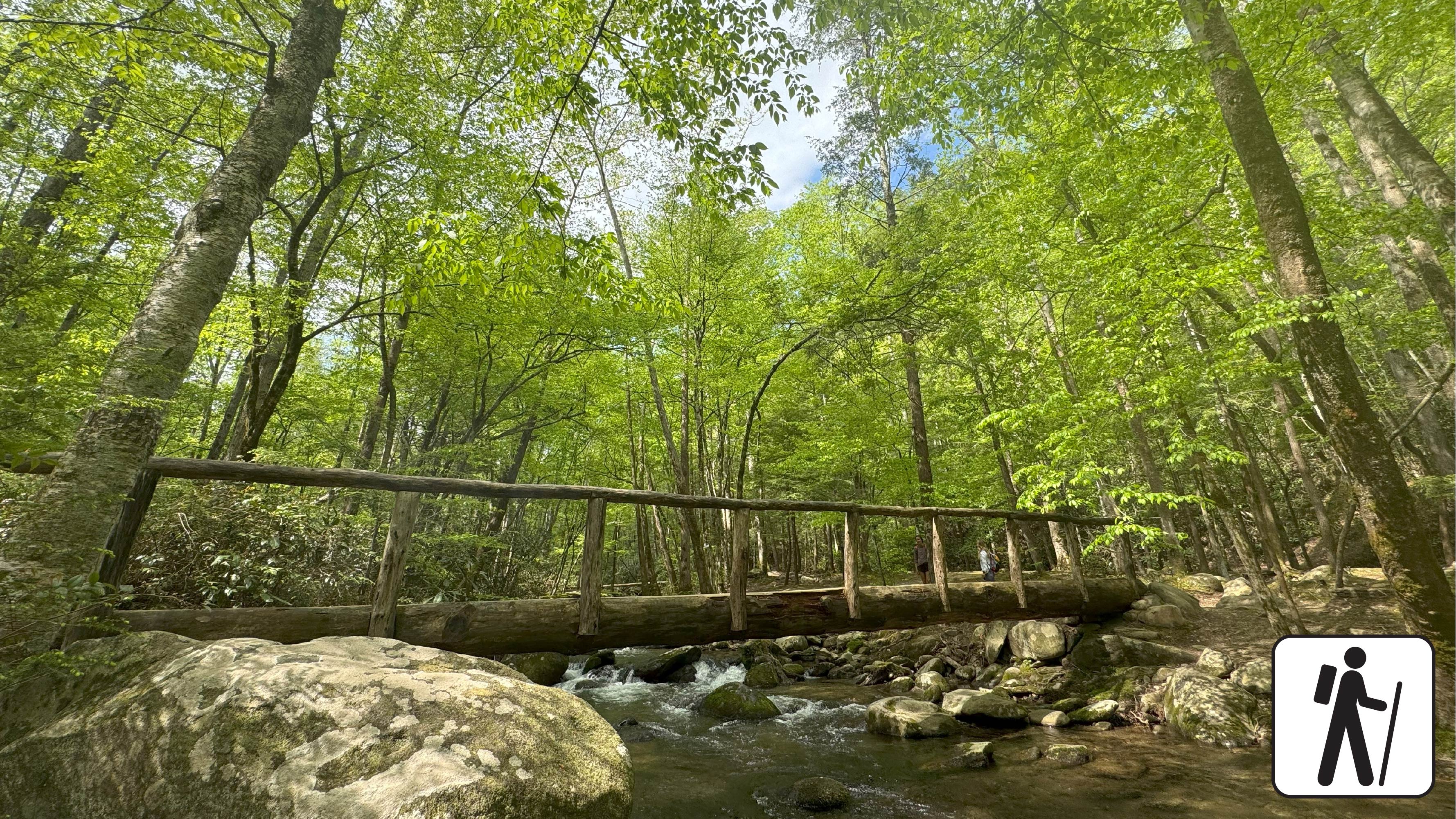
Overview
West Prong Trail is a 2.7-mile (4.3 km) horse and hiking trail that climbs nearly 1,000ft from Tremont Road near the Great Smoky Mountains Institute at Tremont to provide hiking connections between Tremont, Elkmont, and Cades Cove trails. Seasonal wildflowers and wildlife such as deer, black bears, and invasive wild hogs are popular sights on this trail. For hikers interested in exploring the settlement history of Cades Cove, mile 0.3 presents a fork, where hikers can travel 100 yards to Walker Valley Cemetery, the serene resting place of several residents of the area from the late 1800s and early 1900s. Hikers that opt for this route may retrace their footsteps or follow an unmaintained trail that reconnects with West Prong Trail at mile 1.1.
West Prong Trail continues to scale the side of Fodderstack Mountain to take hikers through hardwood forests with pines, sourwoods, and chestnut trees. West Prong Little River sings from below. Campsite #18 at mile 2.1 is a large group camping spot with a fire ring and bear cables along the river. The trail continues through the campsite, across the foot log bridge to the right, and to the left at the hemlock tree. Hikers that reach a sign for campsite A have traveled too far into the campsite and should turn around to locate the trail.
The West Prong Trail ends at mile 2.7 at the junction with Bote Mountain Trail.
Mile 0.3: Fork that offers a 100-yard spur trail to Walker Valley Cemetery to the right as West Prong Trail continues to the left. Hikers that go right can reconnect with West Prong Trail at mile 1.1 by following the unmaintained trail, or they can reconnect with West Prong Trail by following their footsteps back to the fork.
Mile 2.0: The trail crosses a creek that is traversable with a rock-hop.
Mile 2.1: Large group camping area with fire ring, bear cables, and access to West Prong Little River
Mile 2.7: The trail ends at the junction with Bote Mountain Trail. Hikers return the way they came along West Prong Trail to the trailhead.
Length
2.7 miles (4.3 km) to junction with Bote Mountain Trail
5.4 miles (8.7 km) roundtrip
Parking & Trailhead
The trailhead and parking area are located across from the entrance to the Great Smoky Mountains Institute at Tremont. From the parking lot, there is a pump house uphill to the left. The trail starts behind the pump house. Surplus parking and large-vehicle parking is available to the left just past the main parking area. Don't forget your parking tag .
Nearest Restroom
Smokemont Campground
Alternate Hikes
Smokemont Loop Trail with Bradley Cemetery: 6 miles (9.66 km) roundtrip
Pets The Gatlinburg Trail and Oconaluftee River Trail are the only two park trails where pets are permitted. Pets are also allowed in picnic areas, in campgrounds, and on roads.
Accessibility Accessible parking spaces are available at the trailhead. This trail is soil and includes occasional rocks, roots, water crossings, log footbridge crossings and moderately steep grades.
History
Along the way John Oliver Barn
Trailhead Abrams Falls Trail Trailhead 1,708 ft Drive there
History
Along the way Wiggins-Watson Cemetery
WaterfallsPeaksBackcountry camps
Along the way #13 Sheep Pen Gap #95 Dalton Branch Parson Bald Moore Springs Branch Falls
History
Along the way Woody Cemetery
Write-ups that name no single mapped trail, in the Service's words.
The lines are the National Park Service's public trails layer, the trailheads and the waterfalls, views, peaks and historic places along them the Service's public points of interest, read 2026-10-14 and simplified for the map. The write-ups are the Service's own "things to do", unedited. Heights come from USGS 3DEP through Terrain Tiles on AWS (Mapzen/Tilezen), read along each line and rounded; a short trail on steep ground can be off by a few tens of feet. Closures change: check the park's own site before you go.