228 named trails · 145 miles · 19 trailheads · 5 with the Park Service's own write-up. The lines, trailheads and points are the Park Service's; the write-ups are the Service's own words; the climbing is read from USGS elevation along each line.
228 trails, A to Z.
0.4 mi one way · about 70 ft of climbing · 8 ft–79 ft · native surface · hiking
Visitor centers
8 ft
60 ft · 0.3 mi
high 66 ft
Along the way Alcatraz Ranger Office
On the parks map · Drive to the trail's end
0.1 mi one way · 11 ft–11 ft · paver surface · hiking
11 ft
11 ft · 0.1 mi
high 11 ft
On the parks map · Drive to the trail's end
0.1 mi one way · 11 ft–13 ft · paver surface · hiking
11 ft
13 ft · 0.1 mi
high 13 ft
On the parks map · Drive to the trail's end
0.1 mi one way · 11 ft–15 ft · paver surface · hiking
11 ft
14 ft · 0.1 mi
high 14 ft
On the parks map · Drive to the trail's end
11 ft–11 ft · paver surface · bike, hiking
On the parks map · Drive to the trail's end
0.1 mi one way · 12 ft–15 ft · paver surface · hiking
14 ft
12 ft · 0.1 mi
high 15 ft
On the parks map · Drive to the trail's end
0.3 mi one way · 11 ft–15 ft · paver surface · hiking
11 ft
14 ft · 0.3 mi
high 15 ft
On the parks map · Drive to the trail's end
0.4 mi one way · about 250 ft of climbing · 174 ft–411 ft · native surface · bike, hiking, horse
174 ft
411 ft · 0.3 mi
high 411 ft
On the parks map · Drive to the trail's end
2.2 mi one way · about 550 ft of climbing · 389 ft–900 ft · bike, hiking, horse
755 ft
899 ft · 0.5 mi
high 899 ft
On the parks map · Drive to the trail's end
1.1 mi one way · about 1,200 ft of climbing · 586 ft–1,752 ft · native surface · hiking
586 ft
1,751 ft · 1.1 mi
high 1,752 ft
On the parks map · Drive to the trail's end
0.1 mi one way · 12 ft–15 ft · paver surface · hiking
Picnic areas
14 ft
12 ft · 0.1 mi
high 14 ft
Along the way WARMING HUT PICNIC AREA
On the parks map · Drive to the trail's end
0.2 mi one way · about 10 ft of climbing · 76 ft–89 ft · native surface · hiking
Views
89 ft
89 ft · 0.2 mi
high 89 ft
Along the way Battery East Vista
On the parks map · Drive to the trail's end
1.8 mi one way · about 300 ft of climbing · 141 ft–371 ft · paver surface · bike, hiking, horse
Views Picnic areas
244 ft
316 ft · 0.6 mi
high 354 ft
Along the way IMMIGRANT POINT PICNIC AREA IMMIGRANT POINT OVERLOOK
On the parks map · Drive to the trail's end
0.2 mi one way · 20 ft of descent · 155 ft–178 ft · bike, hiking, horse
171 ft
156 ft · 0.2 mi
high 171 ft
On the parks map · Drive to the trail's end
about 20 ft of climbing · 19 ft–43 ft · native surface · hiking
19 ft
43 ft · 0.0 mi
high 43 ft
On the parks map · Drive to the trail's end
10 ft of descent · 20 ft–33 ft · native surface · hiking
33 ft
20 ft · 0.0 mi
high 33 ft
On the parks map · Drive to the trail's end
10 ft of descent · 20 ft–34 ft · native surface · hiking
On the parks map · Drive to the trail's end
10 ft of descent · 23 ft–37 ft · native surface · hiking
37 ft
23 ft · 0.0 mi
high 37 ft
On the parks map · Drive to the trail's end
25 ft–33 ft · native surface · hiking
33 ft
25 ft · 0.0 mi
high 33 ft
On the parks map · Drive to the trail's end
1.0 mi one way · about 300 ft of climbing · 935 ft–1,218 ft · native surface · bike, hiking, horse
Views
972 ft
1,218 ft · 1.0 mi
high 1,218 ft
Along the way SAN FRANCISCO DISCOVERY SITE
On the parks map · Drive to the trail's end
0.5 mi one way · about 60 ft of climbing · 169 ft–215 ft · gravel surface · bike, hiking, horse
204 ft
198 ft · 0.4 mi
high 215 ft
On the parks map · Drive to the trail's end
0.6 mi one way · about 200 ft of climbing · 64 ft–252 ft · native surface · hiking
85 ft
252 ft · 0.3 mi
high 252 ft
On the parks map · Drive to the trail's end
0.1 mi one way · about 30 ft of climbing · 172 ft–200 ft · gravel surface · hiking
185 ft
200 ft · 0.1 mi
high 200 ft
On the parks map · Drive to the trail's end
30 ft of descent · 18 ft–43 ft · native surface · hiking
43 ft
18 ft · 0.0 mi
high 43 ft
On the parks map · Drive to the trail's end
166 ft–167 ft · native surface · hiking
On the parks map · Drive to the trail's end
0.4 mi one way · about 60 ft of climbing · 74 ft–178 ft · asphalt surface · bike, hiking, horse
74 ft
101 ft · 0.1 mi
high 101 ft
Trailhead Battery Davis Trail 70 ft Drive there
On the parks map
0.3 mi one way · 100 ft of descent · 29 ft–144 ft · hiking
Views
119 ft
94 ft · 0.1 mi
high 119 ft
Along the way Battery East Vista Battery Lancaster Overlook
On the parks map · Drive to the trail's end
188 ft–193 ft · gravel surface · hiking
191 ft
193 ft · 0.0 mi
high 193 ft
On the parks map · Drive to the trail's end
222 ft–230 ft · native surface · hiking
222 ft
230 ft · 0.0 mi
high 230 ft
On the parks map · Drive to the trail's end
0.4 mi one way · about 30 ft of climbing · 422 ft–465 ft · native, wood surface · hiking
430 ft
422 ft · 0.3 mi
high 465 ft
On the parks map · Drive to the trail's end
0.1 mi one way · 20 ft of descent · 302 ft–326 ft · gravel surface · hiking
326 ft
302 ft · 0.1 mi
high 326 ft
On the parks map · Drive to the trail's end
0.2 mi one way · about 40 ft of climbing · 31 ft–68 ft · gravel surface · hiking
31 ft
46 ft · 0.2 mi
high 68 ft
On the parks map · Drive to the trail's end
2.1 mi one way · about 150 ft of climbing · 286 ft–368 ft · bike, hiking, horse
Views
293 ft
325 ft · 0.4 mi
high 368 ft
Along the way National Cemetery Overlook
On the parks map · Drive to the trail's end
0.2 mi one way · 30 ft of descent · 285 ft–314 ft · hiking
Views
314 ft
285 ft · 0.2 mi
high 314 ft
Along the way PACIFIC OVERLOOK
On the parks map · Drive to the trail's end
0.6 mi one way · 100 ft of descent · 169 ft–281 ft · bike, hiking, horse
Views
276 ft
169 ft · 0.5 mi
high 276 ft
Along the way Golden Gate Overlook PACIFIC OVERLOOK
Trailhead Trailhead - CHECK! and NAME! 215 ft Drive there
On the parks map
1.9 mi one way · about 10 ft of climbing · 9 ft–21 ft · bike, hiking, horse
Views Picnic areas
10 ft
12 ft · 0.3 mi
high 21 ft
Along the way WARMING HUT PICNIC AREA West Bluff Picnic Area Battery East Vista
On the parks map · Drive to the trail's end
0.1 mi one way · 60 ft of descent · 33 ft–97 ft · paver surface · hiking
97 ft
33 ft · 0.1 mi
high 97 ft
On the parks map · Drive to the trail's end
2.8 mi one way · about 750 ft of climbing · 36 ft–889 ft · native surface · bike, hiking, horse
40 ft
748 ft · 2.0 mi
high 748 ft
On the parks map · Drive to the trail's end
1.4 mi one way · about 350 ft of climbing · 1,250 ft–1,653 ft · bike, hiking, horse
1,613 ft
1,633 ft · 0.6 mi
high 1,653 ft
Hike the Bolinas Ridge Trail the Park Service's write-up
1-11 Hours · dogs allowed
Start Bolinas Ridge Trailhead along Sir Francis Drake Boulevard
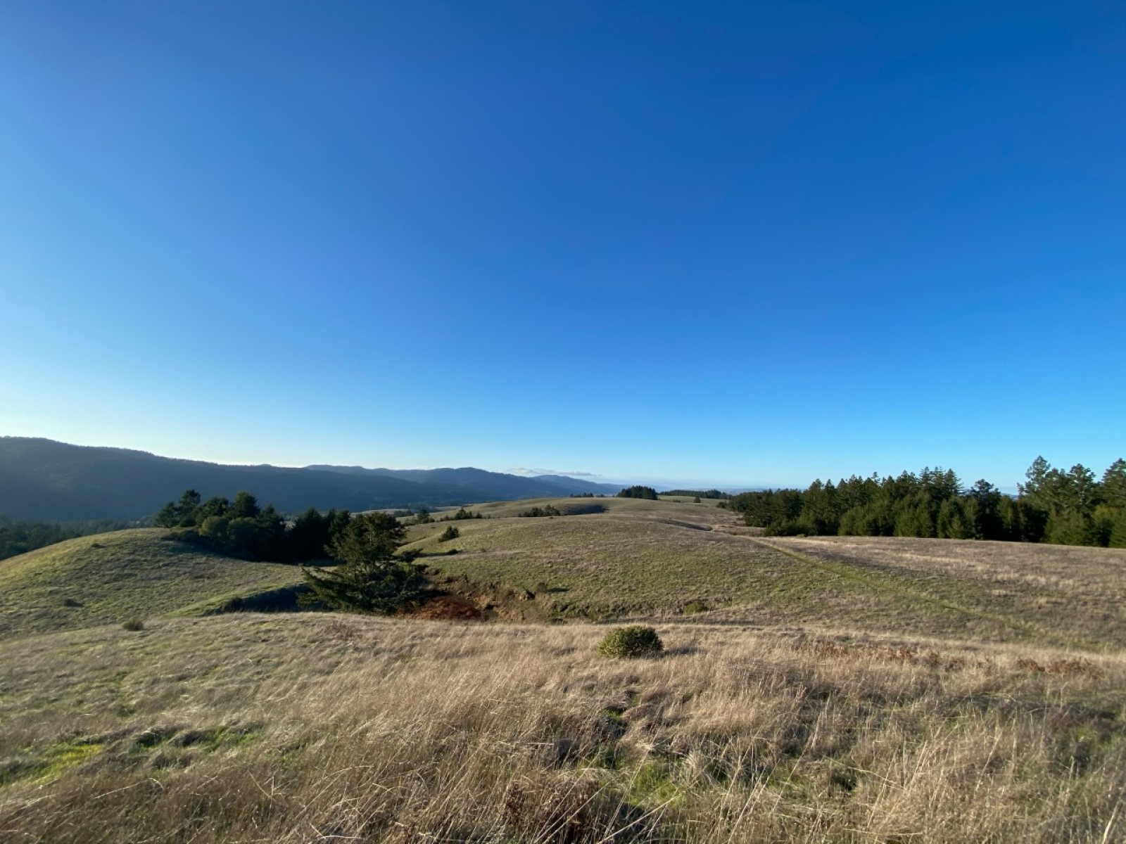
The Bolinas Ridge Trail offers many views of Olema Valley. Photo: NPS / J. Dupont Distance: up to 22 miles (35 km) roundtrip
Difficulty: Easy to difficult, largely depending on how far one hikes
Admire the expansive views of the Olema Valley from a ridge crest on this multi-use trail where you may walk your leashed dog. (Dogs must be on a six-foot or shorter leash at all times. Visit Point Reyes National Seashore's Pets page for additional regulations and safety tips.) The Bolinas Ridge Trail is a current ranch/fire road that is shared with bike and horse riders. Most of the northern part of the trail passes through active cattle pastures. Grazing cattle may be present; give them plenty of space when passing. This is an out-and-back trail (although connecting trails offer the opportunity of loop hikes), so it provides visitors with the flexibility to choose how long they want to make their adventure. The Bolinas Ridge trail spans 11 miles (17.6 km) from its northern trailhead along Sir Francis Drake Boulevard to its southern terminus on the Fairfax-Bolinas Road. Turn around and retrace your steps whenever you are ready. The trail description below proceeds from north to south.
The Bolinas Ridge Trail's northernmost 2.4 miles (3.8 km) pass through grasslands, gradually increasing in elevation. Due to the absence of trees, this section offers some of the best views along the trail of Olema Valley to the west, Tomales Bay to the northwest, and Black Mountain to the north.
The Bolinas Ridge Trail intersects with the Jewell Trail 1.4 miles (2.2 km) from the northern trailhead. The Jewell Trail leads east and downhill to Lagunitas Creek and the Cross Marin Trail . If you don't mind walking 0.7 miles (1.2 km) along Sir Francis Drake Boulevard, follow Jewell Trail to Cross Marin Trail to Sir Francis Drake Boulevard and back along the road to the trailhead for a 4.3-mile-long (6.9-km-long) loop hike.
The Bolinas Ridge Trail continues south from the Jewell Trail junction with grasslands initially on both sides of the trail. The trail begins to run along the edge of a Douglas fir and coast redwood forest 2.4 miles (3.8 km) from the northern trailhead. The trail skirts along the edge of the woods, staying mostly out from under the tree canopy for the next 3.3 miles (5.3 km).
The Shafter Grade Road/Trail descends to the east 5.1 miles (8.2 km) from Bolinas Ridge Trail's northern trailhead. The Shafter Grade connects with the Cross Marin Trail at the southeast boundary of Samuel P. Taylor State Park and provides options for loop hikes in excess of 10.3 miles (16.5 km).
The Bolinas Ridge Trail more completely enters the forest 5.7 miles (9.1 km) south of its northern trailhead. South of here, far-reaching views are few and far between.
The Randall Trail descends west to Highway 1 (aka Shoreline Highway) 0.5 miles (0.8 km) later. Continuing south through the forest for another 1.6 miles (2.6 km) brings the hiker to the McCurdy Trail, which similarly descends west to Highway 1. Starting from either the Randall or McCurdy Trailheads, combining the appropriate sections of the Randall, Bolinas Ridge, McCurdy, and Olema Valley Trails results in an 8.1-mile-long (13-km-long) loop hike.
The Bolinas Ridge Trail remains in the forest for another 1.7 miles (2.7 km) as it winds to the south before encountering a drier 1-mile-long (1.6-km-long) section of the ridge dominated by fragrant chaparral. From a few sections of this part of the trail, one can look south to Bolinas Lagoon, Stinson Beach, Bolinas Bay, and the Pacific Ocean. Hikers will reenter the redwood forest and find shade along the southernmost 0.5 miles (0.8 km) of the Bolinas Ridge Trail and at the small parking area along the Fairfax-Bolinas Road.
This route description alone is not a substitute for a trail map. Print out Point Reyes National Seashore's South District trail map (3,422 KB PDF) before your visit, or pick up the trail map at the Bear Valley Visitor Center on your way. (While designated as part of Golden Gate National Recreation Area, Bolinas Ridge Trail and most of the trails referenced on this page are managed by Point Reyes National Seashore.)
Always check current conditions before heading out into the park and familiarize yourself with park regulations . Please practice Leave No Trace principles.
Visit the park's Hiking at Point Reyes National Seashore page for hiking tips and information about trail etiquette and safety.
Visit the park's Trail Advisories and Closures page for current information about closed trails, trails blocked by trees, or other temporary hazards or advisories.
Accessibility The parking for the Bolinas Ridge Trailhead on Sir Francis Drake Boulevard consists of two roadside pullouts that are mostly unpaved. There is a narrow V-shaped chute/gate that prevents cattle from escaping at the trailhead which might be difficult to pass through for some users. Cyclists must lift their bikes over this feature. The trail surface is mostly compacted soil. While the footing is typically even, rain and heavy traffic can make the trail muddy and rutted in various sections. The trail/road is eight to ten feet wide in most places, and traverses through open grasslands, shrubs, and forests. Steep grades exist at various locations.
This hike on nps.gov
On the parks map · Drive to the trail's end
0.1 mi one way · about 100 ft of climbing · 35 ft–137 ft · gravel surface · hiking
35 ft
137 ft · 0.1 mi
high 137 ft
On the parks map · Drive to the trail's end
0.1 mi one way · about 20 ft of climbing · 98 ft–119 ft · hiking
98 ft
119 ft · 0.1 mi
high 119 ft
On the parks map · Drive to the trail's end
0.2 mi one way · about 80 ft of climbing · 219 ft–299 ft · hiking
Views
219 ft
299 ft · 0.2 mi
high 299 ft
Along the way National Cemetery Overlook
On the parks map · Drive to the trail's end
0.4 mi one way · about 80 ft of climbing · 111 ft–189 ft · hiking
112 ft
189 ft · 0.3 mi
high 189 ft
On the parks map · Drive to the trail's end
0.1 mi one way · about 100 ft of climbing · 95 ft–201 ft · native surface · hiking
95 ft
201 ft · 0.1 mi
high 201 ft
On the parks map · Drive to the trail's end
50 ft of descent · 30 ft–83 ft · wood surface · hiking
Beaches
83 ft
30 ft · 0.0 mi
high 83 ft
Along the way China Beach
On the parks map · Drive to the trail's end
0.3 mi one way · 182 ft–190 ft · sand surface · bike, hiking, horse
184 ft
182 ft · 0.3 mi
high 190 ft
On the parks map · Drive to the trail's end
0.1 mi one way · 340 ft–347 ft · asphalt surface · hiking
341 ft
340 ft · 0.1 mi
high 347 ft
On the parks map · Drive to the trail's end
2.1 mi one way · about 50 ft of climbing · 1,100 ft of descent · 117 ft–1,202 ft · native surface · bike, hiking, horse
1,198 ft
117 ft · 2.1 mi
high 1,202 ft
On the parks map · Drive to the trail's end
0.2 mi one way · about 50 ft of climbing · 456 ft–504 ft · native surface · bike, hiking, horse
456 ft
504 ft · 0.3 mi
high 504 ft
On the parks map · Drive to the trail's end
17 mi one way · about 3,500 ft of climbing · 13 ft–901 ft · asphalt, gravel, native, sand surface · bike, hiking, horse, c
Views History Visitor centers Beaches
338 ft
796 ft · 1.6 mi
high 803 ft
Along the way RODEO BEACH USS San Francisco Memorial Battery Godfrey Overlook Eagle's Point Lookout Golden Gate Overlook Lifesaving Station Overlook Mile Rock Overlook Observation Deck PACIFIC OVERLOOK Lands End Lookout Visitor Center
Trailheads Lands End Trailhead 155 ft Drive there · Sutro Heights Entrance 193 ft Drive there · Trailhead - CHECK! and NAME! 215 ft Drive there · UPPER FISHERMANS TRAIL 303 ft Drive there
On the parks map
0.8 mi one way · about 200 ft of climbing · 92 ft–273 ft · native surface · bike, hiking, horse
92 ft
251 ft · 0.8 mi
high 273 ft
On the parks map · Drive to the trail's end
0.3 mi one way · 150 ft of descent · 517 ft–663 ft · bike, hiking, horse
663 ft
517 ft · 0.3 mi
high 663 ft
On the parks map · Drive to the trail's end
0.7 mi one way · about 100 ft of climbing · 887 ft–1,019 ft · native surface · bike, hiking, horse
909 ft
887 ft · 0.6 mi
high 1,019 ft
On the parks map · Drive to the trail's end
1.2 mi one way · 9 ft–14 ft · paver surface · bike, hiking, horse
12 ft
11 ft · 0.1 mi
high 12 ft
Crissy Field Restored Wetlands the Park Service's write-up
1-2 Hours · dogs allowed
Start Crissy Field
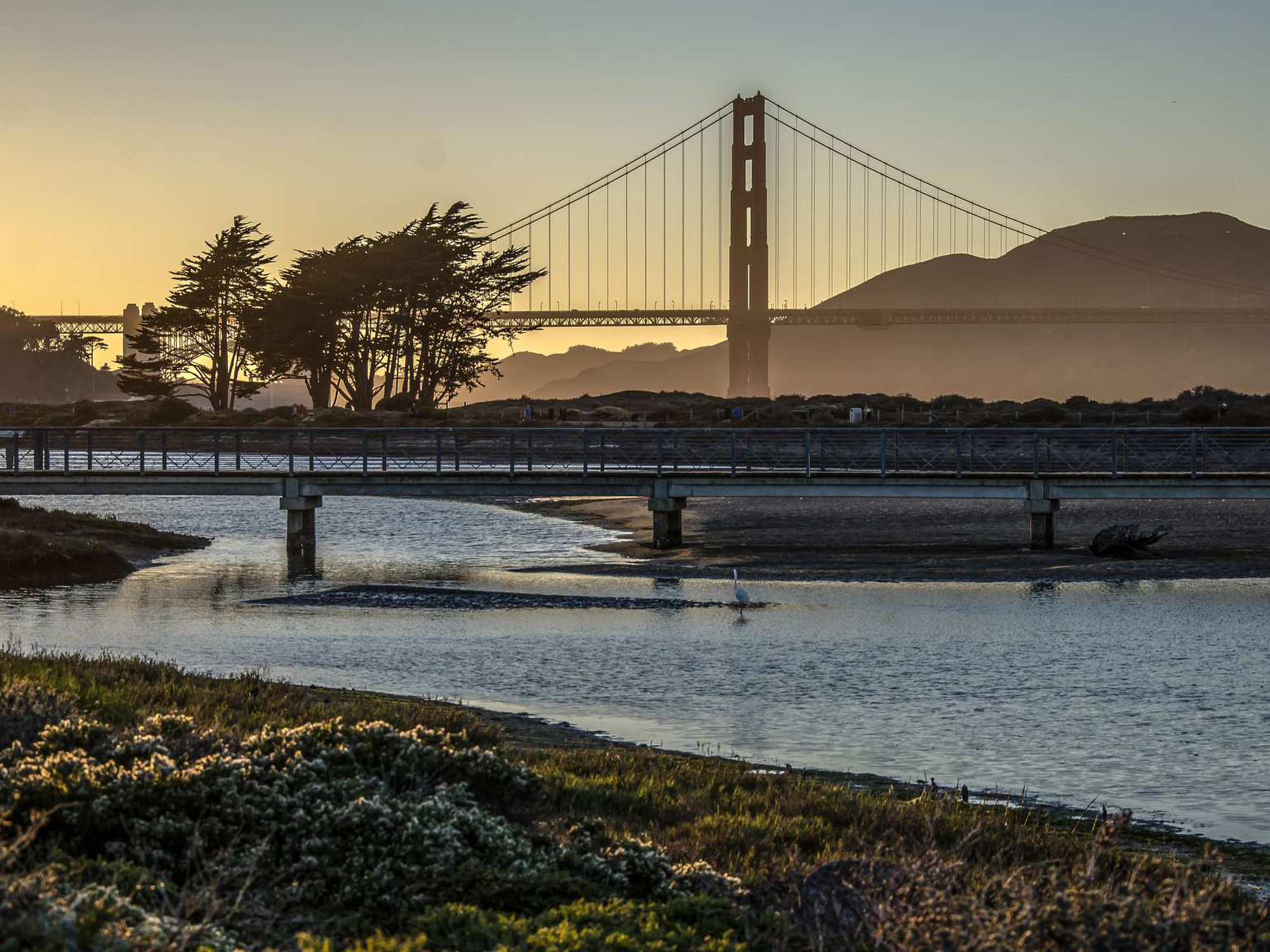
Crissy Field at dusk Photo: Alison Taggart-Barone Explore and walk around the restored wetlands of Crissy Field.
Originally a coastal wetlands occupied seasonally by the Ohlone people, the Crissy Field area has seen more changes in use than any other site in the Presidio. The Crissy Field Promenade runs along the bay and has spectacular views of the Golden Gate Bridge and the San Francisco Bay.
Along your stroll, look out for shorebirds and wildlife living in the wetland habitat
Accessibility Crissy Field Accessibility Crissy Field has accessible parking, restrooms, trails, picnicking, seasonal beach mat access, and beach wheelchairs (by request). There are two areas in Crissy Field, East Beach and West Bluff. Both areas have several accessible parking spaces. . East Beach has: An accessible restroom facility, a concrete building adjacent to the parking lot. An accessible dog washing station is also available here. An accessible picnic area for family and group picnicking. West Bluff has: Generally accessible picnic sites, an accessible Accessible restrooms near the Warming Hut There is an amphitheater that has accessible seating along the top row, here you also find an accessible picnic table Torpedo Wharf is usable, but has cracked and heaving asphalt, please proceed with caution. The Crissy Field Promenade is generally accessible and relatively flat. Beach Wheelchairs area available by reservation at least 5 days in advance. Please contact us for more information.
This hike on nps.gov
On the parks map · Drive to the trail's end
1.6 mi one way · 750 ft of descent · 23 ft–784 ft · native surface · bike, hiking, horse
784 ft
23 ft · 1.5 mi
high 784 ft
On the parks map · Drive to the trail's end
1.1 mi one way · about 30 ft of climbing · 550 ft of descent · 72 ft–618 ft · native surface · hiking
602 ft
72 ft · 1.1 mi
high 618 ft
On the parks map · Drive to the trail's end
0.6 mi one way · 150 ft of descent · 72 ft–218 ft · native surface · bike, hiking
212 ft
72 ft · 0.6 mi
high 218 ft
On the parks map · Drive to the trail's end
0.1 mi one way · 80 ft of descent · 490 ft–569 ft · native surface · hiking
569 ft
490 ft · 0.1 mi
high 569 ft
On the parks map · Drive to the trail's end
0.1 mi one way · 12 ft–13 ft · paver surface · hiking
Picnic areas
12 ft
13 ft · 0.1 mi
high 13 ft
Along the way EAST CRISSY PICNIC AREA
On the parks map · Drive to the trail's end
6 ft–9 ft · hiking
On the parks map · Drive to the trail's end
0.2 mi one way · 7 ft–12 ft · paver, wood surface · hiking
Picnic areas
12 ft
11 ft · 0.1 mi
high 12 ft
Along the way EAST CRISSY PICNIC AREA
On the parks map · Drive to the trail's end
0.1 mi one way · 11 ft–12 ft · paver surface · hiking
Picnic areas
11 ft
12 ft · 0.1 mi
high 12 ft
Along the way EAST CRISSY PICNIC AREA
On the parks map · Drive to the trail's end
11 ft–13 ft · wood surface · bike, hiking
11 ft
12 ft · 0.0 mi
high 13 ft
On the parks map · Drive to the trail's end
0.1 mi one way · 11 ft–13 ft · paver surface · hiking
11 ft
12 ft · 0.1 mi
high 13 ft
On the parks map · Drive to the trail's end
0.2 mi one way · about 30 ft of climbing · 338 ft–369 ft · hiking
338 ft
368 ft · 0.2 mi
high 369 ft
On the parks map · Drive to the trail's end
0.1 mi one way · 20 ft of descent · 127 ft–151 ft · hiking
151 ft
127 ft · 0.1 mi
high 151 ft
On the parks map · Drive to the trail's end
30 ft of descent · 248 ft–276 ft · hiking
Views
276 ft
248 ft · 0.0 mi
high 276 ft
Along the way INSPIRATION POINT OVERLOOK
On the parks map · Drive to the trail's end
0.1 mi one way · 10 ft of descent · 267 ft–280 ft · hiking
280 ft
267 ft · 0.1 mi
high 280 ft
On the parks map · Drive to the trail's end
118 ft–122 ft · hiking
On the parks map · Drive to the trail's end
0.8 mi one way · 250 ft of descent · 79 ft–261 ft · hiking
Views Picnic areas
217 ft
130 ft · 0.3 mi
high 227 ft
Along the way EL POLIN PICNIC AREA INSPIRATION POINT OVERLOOK
On the parks map · Drive to the trail's end
0.6 mi one way · 70 ft of descent · 202 ft–271 ft · native surface · hiking
Views History
271 ft
202 ft · 0.6 mi
high 271 ft
Along the way USS San Francisco Memorial Lifesaving Station Overlook Mile Rock Overlook
On the parks map · Drive to the trail's end
0.2 mi one way · about 10 ft of climbing · 81 ft–104 ft · hiking
Picnic areas
98 ft
86 ft · 0.1 mi
high 98 ft
Along the way EL POLIN PICNIC AREA
On the parks map · Drive to the trail's end
0.2 mi one way · about 50 ft of climbing · 106 ft–156 ft · hiking
106 ft
156 ft · 0.2 mi
high 156 ft
On the parks map · Drive to the trail's end
0.3 mi one way · about 150 ft of climbing · 156 ft–308 ft · native surface · hiking, horse
156 ft
307 ft · 0.3 mi
high 308 ft
On the parks map · Drive to the trail's end
0.9 mi one way · about 10 ft of climbing · 450 ft of descent · 59 ft–492 ft · native surface · bike, hiking, horse
492 ft
64 ft · 0.9 mi
high 492 ft
On the parks map · Drive to the trail's end
1.2 mi one way · about 70 ft of climbing · 400 ft of descent · 170 ft–475 ft · native surface · bike, hiking, horse
475 ft
175 ft · 1.2 mi
high 475 ft
On the parks map · Drive to the trail's end
0.8 mi one way · about 50 ft of climbing · 350 ft of descent · 95 ft–386 ft · native surface · bike, hiking, horse
180 ft
95 ft · 0.3 mi
high 180 ft
On the parks map · Drive to the trail's end
2.3 mi one way · about 300 ft of climbing · 10 ft–231 ft · gravel surface · bike, hiking
27 ft
100 ft · 1.1 mi
high 124 ft
On the parks map · Drive to the trail's end
0.4 mi one way · about 80 ft of climbing · 13 ft–85 ft · gravel surface · hiking
13 ft
70 ft · 0.4 mi
high 70 ft
On the parks map · Drive to the trail's end
0.1 mi one way · about 10 ft of climbing · 20 ft of descent · 344 ft–362 ft · hiking
351 ft
344 ft · 0.1 mi
high 362 ft
On the parks map · Drive to the trail's end
0.2 mi one way · 80 ft of descent · 19 ft–103 ft · gravel surface · hiking
103 ft
25 ft · 0.2 mi
high 103 ft
On the parks map · Drive to the trail's end
0.5 mi one way · about 10 ft of climbing · 100 ft of descent · 7 ft–84 ft · asphalt, gravel surface · bike, hiking, horse
Tunnels
84 ft
7 ft · 0.2 mi
high 84 ft
Along the way RAILROAD TUNNEL ENTRANCE WEST
On the parks map · Drive to the trail's end
40 ft of descent · 26 ft–65 ft · paver surface · hiking
65 ft
26 ft · 0.0 mi
high 65 ft
On the parks map · Drive to the trail's end
about 20 ft of climbing · 196 ft–217 ft · gravel surface · hiking
On the parks map · Drive to the trail's end
1.1 mi one way · 700 ft of descent · 154 ft–866 ft · hiking
866 ft
154 ft · 1.0 mi
high 866 ft
On the parks map · Drive to the trail's end
1.6 mi one way · about 40 ft of climbing · 850 ft of descent · 94 ft–917 ft · native surface · bike, hiking, horse
917 ft
111 ft · 1.5 mi
high 917 ft
On the parks map · Drive to the trail's end
0.1 mi one way · 70 ft of descent · 28 ft–101 ft · sand surface · hiking
Beaches
101 ft
28 ft · 0.1 mi
high 101 ft
Along the way Fort Funston Beach
On the parks map · Drive to the trail's end
0.9 mi one way · about 100 ft of climbing · 80 ft–190 ft · sand surface · bike, hiking, horse
88 ft
186 ft · 0.8 mi
high 190 ft
On the parks map · Drive to the trail's end
0.1 mi one way · about 30 ft of climbing · 105 ft–136 ft · asphalt surface · bike, hiking, horse
105 ft
136 ft · 0.1 mi
high 136 ft
On the parks map · Drive to the trail's end
0.2 mi one way · about 100 ft of climbing · 256 ft–355 ft · asphalt surface · bike, hiking, horse
256 ft
355 ft · 0.2 mi
high 355 ft
On the parks map · Drive to the trail's end
0.8 mi one way · about 20 ft of climbing · 26 ft–83 ft · paver surface · bike, hiking, horse
Visitor centers Tunnels
38 ft
60 ft · 0.1 mi
high 60 ft
Along the way RAILROAD TUNNEL ENTRANCE WEST GOLDEN GATE NRA HEADQUARTERS
On the parks map · Drive to the trail's end
1.4 mi one way · about 750 ft of climbing · 146 ft–904 ft · hiking
146 ft
904 ft · 1.4 mi
high 904 ft
On the parks map · Drive to the trail's end
11 ft–13 ft · wood surface · bike, hiking, horse
On the parks map · Drive to the trail's end
0.7 mi one way · about 150 ft of climbing · 651 ft–827 ft · bike, hiking, horse
Campgrounds
827 ft
781 ft · 0.7 mi
high 827 ft
Along the way Hawk Camp Campground
On the parks map · Drive to the trail's end
about 50 ft of climbing · 839 ft–888 ft · hiking
839 ft
888 ft · 0.1 mi
high 888 ft
On the parks map · Drive to the trail's end
0.4 mi one way · about 40 ft of climbing · 794 ft–886 ft · hiking
836 ft
794 ft · 0.3 mi
high 836 ft
On the parks map · Drive to the trail's end
0.6 mi one way · 150 ft of descent · 160 ft–288 ft · bike, hiking
Campgrounds
288 ft
160 ft · 0.6 mi
high 288 ft
Along the way Haypress Campground
On the parks map · Drive to the trail's end
0.2 mi one way · about 100 ft of climbing · 858 ft–955 ft · native surface · bike, hiking, horse
858 ft
955 ft · 0.2 mi
high 955 ft
On the parks map · Drive to the trail's end
0.4 mi one way · about 250 ft of climbing · 554 ft–788 ft · native surface · bike, hiking, horse
554 ft
782 ft · 0.4 mi
high 782 ft
On the parks map · Drive to the trail's end
0.7 mi one way · about 200 ft of climbing · 462 ft–859 ft · native surface · hiking
793 ft
735 ft · 0.4 mi
high 859 ft
On the parks map · Drive to the trail's end
0.2 mi one way · about 100 ft of climbing · 198 ft–320 ft · hiking
Views
198 ft
320 ft · 0.1 mi
high 320 ft
Along the way IMMIGRANT POINT OVERLOOK
On the parks map · Drive to the trail's end
0.1 mi one way · about 80 ft of climbing · 103 ft–182 ft · wood surface · hiking
153 ft
182 ft · 0.0 mi
high 182 ft
On the parks map · Drive to the trail's end
1.8 mi one way · about 500 ft of climbing · 73 ft–575 ft · native surface · bike, hiking, horse
136 ft
558 ft · 1.4 mi
high 575 ft
On the parks map · Drive to the trail's end
0.1 mi one way · about 30 ft of climbing · 157 ft–192 ft · hiking
On the parks map · Drive to the trail's end
0.5 mi one way · 10 ft of descent · 13 ft–26 ft · bike, hiking
26 ft
13 ft · 0.4 mi
high 26 ft
On the parks map · Drive to the trail's end
1.1 mi one way · about 400 ft of climbing · 28 ft–425 ft · bike, hiking
Campgrounds
37 ft
329 ft · 0.7 mi
high 329 ft
Along the way Kirby Cove Campground
On the parks map · Drive to the trail's end
0.4 mi one way · about 60 ft of climbing · 20 ft–84 ft · gravel surface · hiking
Campgrounds Beaches
33 ft
79 ft · 0.3 mi
high 79 ft
Along the way KIRBY BEACH Kirby Cove Campground
On the parks map · Drive to the trail's end
0.2 mi one way · 150 ft of descent · 50 ft–181 ft · wood surface · hiking
181 ft
50 ft · 0.2 mi
high 181 ft
On the parks map · Drive to the trail's end
0.9 mi one way · about 20 ft of climbing · 40 ft of descent · 15 ft–33 ft · gravel surface · hiking
33 ft
21 ft · 0.8 mi
high 33 ft
On the parks map · Drive to the trail's end
0.1 mi one way · about 30 ft of climbing · 170 ft–203 ft · gravel surface · hiking
170 ft
203 ft · 0.1 mi
high 203 ft
Trailhead Lands End Trailhead 155 ft Drive there
On the parks map
30 ft of descent · 177 ft–202 ft · gravel surface · hiking
202 ft
177 ft · 0.0 mi
high 202 ft
On the parks map · Drive to the trail's end
0.4 mi one way · about 60 ft of climbing · 112 ft–162 ft · native surface · bike, hiking, horse
118 ft
162 ft · 0.4 mi
high 162 ft
On the parks map · Drive to the trail's end
0.1 mi one way · about 50 ft of climbing · 189 ft–239 ft · native surface · bike, hiking
189 ft
239 ft · 0.1 mi
high 239 ft
On the parks map · Drive to the trail's end
0.1 mi one way · 20 ft of descent · 30 ft–44 ft · gravel surface · bike, hiking, horse
44 ft
30 ft · 0.1 mi
high 44 ft
On the parks map · Drive to the trail's end
0.8 mi one way · about 100 ft of climbing · 67 ft–191 ft · wood surface · hiking
67 ft
191 ft · 0.5 mi
high 191 ft
On the parks map · Drive to the trail's end
1.7 mi one way · about 850 ft of climbing · 1,172 ft–2,029 ft · hiking, horse
1,172 ft
1,958 ft · 1.3 mi
high 1,958 ft
On the parks map · Drive to the trail's end
0.6 mi one way · about 20 ft of climbing · 250 ft of descent · 39 ft–310 ft · hiking
Views
Along the way PRESIDIO OVERLOOK
On the parks map · Drive to the trail's end
0.1 mi one way · 40 ft of descent · 118 ft–154 ft · hiking
154 ft
118 ft · 0.1 mi
high 154 ft
On the parks map · Drive to the trail's end
0.1 mi one way · 60 ft of descent · 197 ft–256 ft · hiking
256 ft
197 ft · 0.1 mi
high 256 ft
On the parks map · Drive to the trail's end
0.1 mi one way · 30 ft of descent · 156 ft–191 ft · hiking
179 ft
156 ft · 0.1 mi
high 179 ft
On the parks map · Drive to the trail's end
0.5 mi one way · about 50 ft of climbing · 40 ft–92 ft · native surface · hiking
40 ft
92 ft · 0.5 mi
high 92 ft
On the parks map · Drive to the trail's end
1.4 mi one way · about 700 ft of climbing · 221 ft–896 ft · bike, hiking
221 ft
896 ft · 1.4 mi
high 896 ft
On the parks map · Drive to the trail's end
0.1 mi one way · 40 ft of descent · 18 ft–60 ft · gravel surface · hiking
60 ft
18 ft · 0.1 mi
high 60 ft
On the parks map · Drive to the trail's end
11 ft–11 ft · paver surface · bike, hiking, horse
On the parks map · Drive to the trail's end
0.2 mi one way · about 100 ft of climbing · 75 ft–185 ft · native surface · hiking
75 ft
184 ft · 0.2 mi
high 185 ft
On the parks map · Drive to the trail's end
0.2 mi one way · about 250 ft of climbing · 33 ft–540 ft · native surface · bike, hiking, horse
33 ft
67 ft · 0.1 mi
high 67 ft
On the parks map · Drive to the trail's end
about 30 ft of climbing · 195 ft–226 ft · paver surface · hiking
Views History
195 ft
226 ft · 0.0 mi
high 226 ft
Along the way USS San Francisco Memorial Lifesaving Station Overlook
On the parks map · Drive to the trail's end
0.8 mi one way · about 50 ft of climbing · 173 ft–225 ft · gravel surface · hiking
Views
196 ft
224 ft · 0.8 mi
high 225 ft
Along the way BIRD ISLAND OVERLOOK
On the parks map · Drive to the trail's end
0.2 mi one way · about 30 ft of climbing · 161 ft–191 ft · paver surface · bike, hiking, horse
161 ft
191 ft · 0.1 mi
high 191 ft
Trailhead Lands End Trailhead 155 ft Drive there
On the parks map
1.8 mi one way · about 800 ft of climbing · 83 ft–893 ft · native surface · bike, hiking, horse
151 ft
893 ft · 1.6 mi
high 893 ft
On the parks map · Drive to the trail's end
0.7 mi one way · about 350 ft of climbing · 195 ft–577 ft · native surface
195 ft
566 ft · 0.6 mi
high 566 ft
Trailhead Milagra Battery Trail 192 ft Drive there
On the parks map
0.1 mi one way · about 10 ft of climbing · 607 ft–618 ft · native surface · hiking
607 ft
616 ft · 0.1 mi
high 618 ft
On the parks map · Drive to the trail's end
0.2 mi one way · 620 ft–626 ft · gravel surface · hiking
626 ft
624 ft · 0.2 mi
high 626 ft
On the parks map · Drive to the trail's end
0.6 mi one way · about 50 ft of climbing · 90 ft of descent · 613 ft–697 ft · native surface · hiking
653 ft
613 ft · 0.6 mi
high 697 ft
Trailhead Milagra Ridge Trail 644 ft Drive there
On the parks map
0.1 mi one way · 90 ft of descent · 604 ft–661 ft · native surface · hiking
661 ft
604 ft · 0.1 mi
high 661 ft
On the parks map · Drive to the trail's end
0.1 mi one way · about 30 ft of climbing · 47 ft–78 ft · native surface · hiking
Beaches
47 ft
78 ft · 0.1 mi
high 78 ft
Along the way Mile Rock Beach
On the parks map · Drive to the trail's end
0.1 mi one way · about 150 ft of climbing · 33 ft–178 ft · native surface · hiking
Beaches
33 ft
178 ft · 0.1 mi
high 178 ft
Along the way Mile Rock Beach
On the parks map · Drive to the trail's end
1.3 mi one way · about 200 ft of climbing · 583 ft–770 ft · hiking, horse
598 ft
725 ft · 1.2 mi
high 770 ft
On the parks map · Drive to the trail's end
0.2 mi one way · about 20 ft of climbing · 204 ft–235 ft · native surface · bike, hiking, horse
223 ft
235 ft · 0.1 mi
high 235 ft
Trailhead TENNESSEE VALLEY TRAILHEAD 200 ft Drive there
On the parks map
6.1 mi one way · about 800 ft of climbing · 1,600 ft of descent · 20 ft–1,015 ft · native surface · bike, hiking, horse
628 ft
880 ft · 1.4 mi
high 918 ft
On the parks map · Drive to the trail's end
0.2 mi one way · about 10 ft of climbing · 30 ft of descent · 111 ft–144 ft · native surface · hiking
144 ft
124 ft · 0.2 mi
high 144 ft
On the parks map · Drive to the trail's end
0.1 mi one way · 30 ft of descent · 116 ft–149 ft · native surface · hiking
147 ft
116 ft · 0.1 mi
high 149 ft
On the parks map · Drive to the trail's end
0.3 mi one way · about 20 ft of climbing · 150 ft of descent · 148 ft–319 ft · native surface · hiking
302 ft
148 ft · 0.3 mi
high 319 ft
On the parks map · Drive to the trail's end
1.2 mi one way · about 800 ft of climbing · 243 ft–1,052 ft · native surface · bike, hiking, horse
371 ft
1,052 ft · 1.1 mi
high 1,052 ft
Trailhead Mori Ridge Trail 236 ft Drive there
On the parks map
0.1 mi one way · 150 ft of descent · 745 ft–886 ft · native surface · hiking
886 ft
745 ft · 0.1 mi
high 886 ft
On the parks map · Drive to the trail's end
0.9 mi one way · about 450 ft of climbing · 719 ft–1,163 ft · hiking, horse
719 ft
1,163 ft · 0.8 mi
high 1,163 ft
On the parks map · Drive to the trail's end
1.8 mi one way · about 150 ft of climbing · 300 ft of descent · 148 ft–336 ft · bike, hiking, horse
Views
252 ft
157 ft · 0.3 mi
high 252 ft
Along the way PRESIDIO OVERLOOK
On the parks map · Drive to the trail's end
0.3 mi one way · about 20 ft of climbing · 153 ft–176 ft · bike, hiking, horse
153 ft
176 ft · 0.3 mi
high 176 ft
On the parks map · Drive to the trail's end
0.1 mi one way · 292 ft–294 ft · bike, hiking, horse
On the parks map · Drive to the trail's end
30 ft of descent · 265 ft–294 ft · hiking
294 ft
265 ft · 0.1 mi
high 294 ft
On the parks map · Drive to the trail's end
0.6 mi one way · about 60 ft of climbing · 100 ft of descent · 118 ft–248 ft · hiking
223 ft
150 ft · 0.2 mi
high 223 ft
On the parks map · Drive to the trail's end
0.1 mi one way · 227 ft–236 ft · hiking
227 ft
236 ft · 0.1 mi
high 236 ft
On the parks map · Drive to the trail's end
0.1 mi one way · about 10 ft of climbing · 227 ft–240 ft · hiking
239 ft
231 ft · 0.1 mi
high 239 ft
On the parks map · Drive to the trail's end
0.1 mi one way · about 10 ft of climbing · 469 ft–481 ft · native surface · hiking
470 ft
481 ft · 0.1 mi
high 481 ft
Trailhead MUIR BEACH OVERLOOK TRAIL 488 ft Drive there
On the parks map
0.1 mi one way · 70 ft of descent · 412 ft–485 ft · gravel surface · hiking
Views
483 ft
412 ft · 0.1 mi
high 483 ft
Along the way MUIR BEACH OVERLOOK
Trailhead MUIR BEACH OVERLOOK TRAIL 488 ft Drive there
On the parks map
0.3 mi one way · 12 ft–23 ft · native surface · hiking
15 ft
17 ft · 0.3 mi
high 23 ft
On the parks map · Drive to the trail's end
1.0 mi one way · about 450 ft of climbing · 727 ft–1,051 ft · native surface · hiking
727 ft
1,051 ft · 1.0 mi
high 1,051 ft
Trailhead Notch Trail at Skyline College 702 ft Drive there
On the parks map
0.1 mi one way · about 20 ft of climbing · 70 ft–94 ft · native surface · hiking
70 ft
94 ft · 0.1 mi
high 94 ft
On the parks map · Drive to the trail's end
0.7 mi one way · about 150 ft of climbing · 33 ft–175 ft · native surface · hiking
33 ft
175 ft · 0.7 mi
high 175 ft
On the parks map · Drive to the trail's end
1.3 mi one way · 600 ft of descent · 28 ft–621 ft · native surface · bike, hiking
621 ft
179 ft · 0.6 mi
high 621 ft
On the parks map · Drive to the trail's end
about 20 ft of climbing · 259 ft–280 ft · native surface · hiking
259 ft
280 ft · 0.0 mi
high 280 ft
On the parks map · Drive to the trail's end
0.9 mi one way · 250 ft of descent · 109 ft–348 ft · bike, hiking
348 ft
109 ft · 0.8 mi
high 348 ft
On the parks map · Drive to the trail's end
0.5 mi one way · 30 ft of descent · 27 ft–58 ft · gravel surface · bike, hiking, horse
28 ft
32 ft · 0.2 mi
high 32 ft
Trailhead Old Mori Road 60 ft Drive there
On the parks map
0.7 mi one way · about 100 ft of climbing · 113 ft–226 ft · bike, hiking, horse
119 ft
122 ft · 0.3 mi
high 131 ft
On the parks map · Drive to the trail's end
1.2 mi one way · 400 ft of descent · 225 ft–647 ft · native surface · bike, hiking, horse
647 ft
225 ft · 1.2 mi
high 647 ft
On the parks map · Drive to the trail's end
0.6 mi one way · 400 ft of descent · 88 ft–496 ft · hiking
496 ft
121 ft · 0.5 mi
high 496 ft
On the parks map · Drive to the trail's end
1.1 mi one way · about 10 ft of climbing · 300 ft of descent · 195 ft–486 ft · native surface · hiking
486 ft
208 ft · 1.1 mi
high 486 ft
Trailhead MUIR BEACH OVERLOOK TRAIL 488 ft Drive there
On the parks map
0.1 mi one way · 50 ft of descent · 329 ft–383 ft · hiking
383 ft
329 ft · 0.1 mi
high 383 ft
On the parks map · Drive to the trail's end
about 20 ft of climbing · 77 ft–100 ft · gravel surface · hiking
77 ft
100 ft · 0.0 mi
high 100 ft
On the parks map · Drive to the trail's end
0.8 mi one way · about 150 ft of climbing · 11 ft–80 ft · hiking
Views
15 ft
80 ft · 0.2 mi
high 80 ft
Along the way Crissy Field Overlook
On the parks map · Drive to the trail's end
1.1 mi one way · about 100 ft of climbing · 200 ft of descent · 82 ft–300 ft · bike, hiking, horse
285 ft
82 ft · 0.6 mi
high 285 ft
Explore Sutro Baths and Sutro Heights Park the Park Service's write-up
1-3 Hours · dogs allowed
Start Sutro Bath Ruins
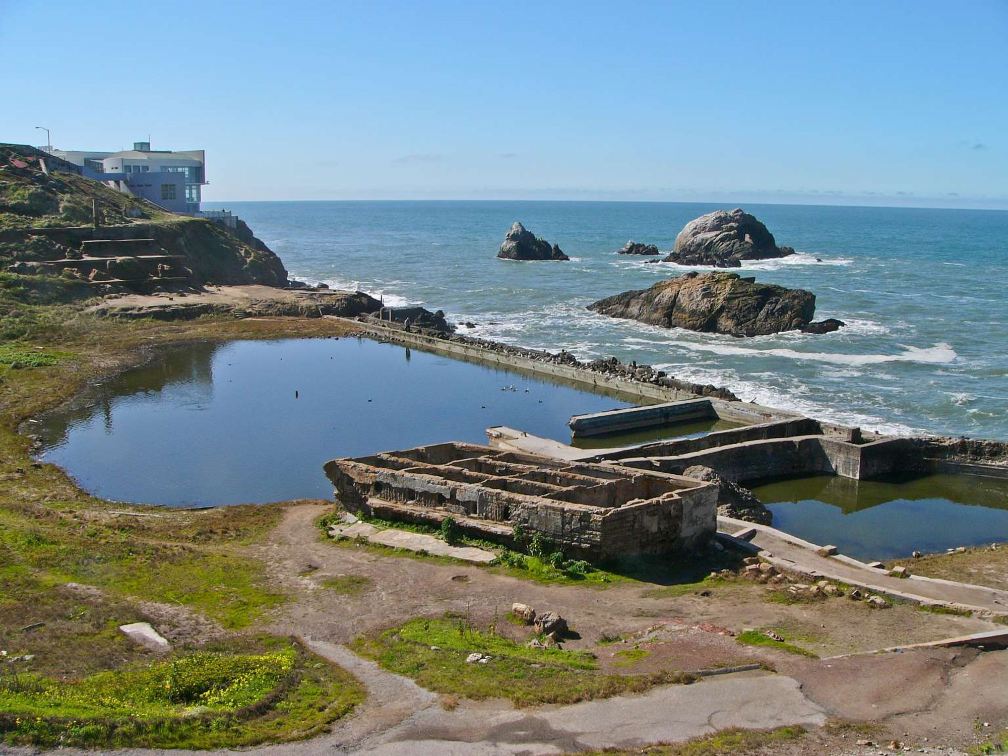
Sutro Bath Ruins Explore the ruins of the Sutro Baths and Sutro Heights Park .
Learn about Adolph Sutro and his influence on San Francisco and Land's End while taking in the breathtaking views of the Pacific Ocean.
Accessibility This is a generally accessible activity. Accessible parking is available nearby at the Lands End Lookout Visitor Center and along Point Lobos Ave. There are gravel pathways in Sutro Baths and in Sutro Heights Park that are generally accessible.
This hike on nps.gov
On the parks map · Drive to the trail's end
0.1 mi one way · 90 ft of descent · 48 ft–139 ft · native surface · hiking
Beaches
139 ft
48 ft · 0.1 mi
high 139 ft
Along the way PIRATE'S COVE BEACH
On the parks map · Drive to the trail's end
1.5 mi one way · about 60 ft of climbing · 700 ft of descent · 161 ft–569 ft · native surface · hiking
418 ft
161 ft · 1.0 mi
high 418 ft
On the parks map · Drive to the trail's end
0.6 mi one way · about 150 ft of climbing · 69 ft–207 ft · gravel, native, paver surface · hiking
123 ft
207 ft · 0.4 mi
high 207 ft
On the parks map · Drive to the trail's end
0.4 mi one way · about 80 ft of climbing · 92 ft–166 ft · bike, hiking, horse
Views Visitor centers
92 ft
166 ft · 0.4 mi
high 166 ft
Along the way Battery Lancaster Overlook Golden Gate Bridge Pavilion
On the parks map · Drive to the trail's end
1.8 mi one way · about 100 ft of climbing · 37 ft–182 ft · paver surface · bike, hiking, horse
Views Visitor centers
40 ft
77 ft · 0.8 mi
high 108 ft
Along the way Battery Lancaster Overlook Crissy Field Overlook PRESIDIO VISITOR CENTER
On the parks map · Drive to the trail's end
0.1 mi one way · 155 ft–158 ft · bike, hiking, horse
Views Visitor centers
155 ft
158 ft · 0.1 mi
high 158 ft
Along the way Battery Lancaster Overlook Golden Gate Bridge Pavilion
On the parks map · Drive to the trail's end
0.1 mi one way · 150 ft of descent · 39 ft–178 ft · native surface · hiking
178 ft
39 ft · 0.1 mi
high 178 ft
On the parks map · Drive to the trail's end
0.1 mi one way · 11 ft–12 ft · paver surface · hiking
Picnic areas
12 ft
11 ft · 0.1 mi
high 12 ft
Along the way EAST CRISSY PICNIC AREA
On the parks map · Drive to the trail's end
0.4 mi one way · about 200 ft of climbing · 883 ft–1,107 ft · bike, hiking, horse
901 ft
1,107 ft · 0.4 mi
high 1,107 ft
On the parks map · Drive to the trail's end
0.9 mi one way · 70 ft of descent · 86 ft–161 ft · bike, hiking, horse
153 ft
86 ft · 0.7 mi
high 154 ft
On the parks map · Drive to the trail's end
0.3 mi one way · about 90 ft of climbing · 297 ft–389 ft · native surface · bike, hiking, horse
297 ft
389 ft · 0.3 mi
high 389 ft
On the parks map · Drive to the trail's end
1.5 mi one way · about 500 ft of climbing · 673 ft–1,161 ft · hiking, horse
710 ft
1,161 ft · 1.5 mi
high 1,161 ft
On the parks map · Drive to the trail's end
0.1 mi one way · about 30 ft of climbing · 74 ft–119 ft · hiking
Views
119 ft
106 ft · 0.1 mi
high 119 ft
Along the way Overlook
On the parks map · Drive to the trail's end
0.2 mi one way · 40 ft of descent · 150 ft–187 ft · native surface · hiking, horse
187 ft
150 ft · 0.2 mi
high 187 ft
On the parks map · Drive to the trail's end
0.3 mi one way · about 50 ft of climbing · 323 ft–374 ft · hiking
Campgrounds Picnic areas
346 ft
366 ft · 0.1 mi
high 366 ft
Along the way Rob Hill Campground IMMIGRANT POINT PICNIC AREA
On the parks map · Drive to the trail's end
747 ft–752 ft · native surface · hiking, horse
On the parks map · Drive to the trail's end
0.7 mi one way · 400 ft of descent · 344 ft–719 ft · bike, hiking, horse
719 ft
344 ft · 0.7 mi
high 719 ft
On the parks map · Drive to the trail's end
1.1 mi one way · 150 ft of descent · 47 ft–192 ft · native surface · bike, hiking, horse
178 ft
47 ft · 0.9 mi
high 178 ft
On the parks map · Drive to the trail's end
0.2 mi one way · 20 ft of descent · 169 ft–187 ft · native surface · bike, hiking, horse
183 ft
169 ft · 0.2 mi
high 187 ft
On the parks map · Drive to the trail's end
2.0 mi one way · about 40 ft of climbing · 700 ft of descent · 112 ft–583 ft · native surface · bike, hiking, horse
583 ft
112 ft · 1.6 mi
high 583 ft
On the parks map · Drive to the trail's end
2.0 mi one way · about 50 ft of climbing · 600 ft of descent · 337 ft–894 ft · native surface · hiking
Tunnels
893 ft
337 ft · 2.0 mi
high 893 ft
Along the way BARRY BAKER TUNNEL
On the parks map · Drive to the trail's end
0.1 mi one way · about 50 ft of climbing · 715 ft–763 ft · native surface · hiking
715 ft
763 ft · 0.1 mi
high 763 ft
Trailhead Notch Trail at Skyline College 706 ft Drive there
On the parks map
0.2 mi one way · about 150 ft of climbing · 758 ft–928 ft · native surface · bike, hiking, horse
758 ft
928 ft · 0.2 mi
high 928 ft
On the parks map · Drive to the trail's end
0.5 mi one way · about 250 ft of climbing · 568 ft–798 ft · native surface · bike, hiking, horse
752 ft
675 ft · 0.3 mi
high 798 ft
On the parks map · Drive to the trail's end
0.3 mi one way · about 40 ft of climbing · 90 ft of descent · 216 ft–307 ft · hiking
307 ft
258 ft · 0.3 mi
high 307 ft
On the parks map · Drive to the trail's end
about 40 ft of climbing · 581 ft–622 ft · bike, hiking, horse
581 ft
622 ft · 0.0 mi
high 622 ft
On the parks map · Drive to the trail's end
0.1 mi one way · 59 ft–67 ft · native surface · bike, hiking, horse
59 ft
67 ft · 0.1 mi
high 67 ft
On the parks map · Drive to the trail's end
0.2 mi one way · about 150 ft of climbing · 40 ft–167 ft · native surface · hiking
40 ft
167 ft · 0.2 mi
high 167 ft
On the parks map · Drive to the trail's end
2.7 mi one way · about 1,200 ft of climbing · 167 ft–1,331 ft · native surface · bike, hiking, horse
167 ft
1,331 ft · 2.6 mi
high 1,331 ft
On the parks map · Drive to the trail's end
0.2 mi one way · about 30 ft of climbing · 70 ft of descent · 410 ft–633 ft · native surface · hiking
609 ft
611 ft · 0.1 mi
high 633 ft
On the parks map · Drive to the trail's end
0.2 mi one way · 183 ft–184 ft · sand surface · bike, hiking, horse
183 ft
183 ft · 0.2 mi
high 184 ft
Trailhead Coastal Trail at Funston Lot 184 ft Drive there
On the parks map
0.1 mi one way · 60 ft of descent · 85 ft–141 ft · gravel surface · hiking
141 ft
85 ft · 0.1 mi
high 141 ft
Trailhead Lands End Trailhead 155 ft Drive there
On the parks map
0.2 mi one way · 70 ft of descent · 37 ft–103 ft · asphalt surface · bike, hiking, horse
Views
103 ft
37 ft · 0.2 mi
high 103 ft
Along the way Overlook
Explore Sutro Baths and Sutro Heights Park the Park Service's write-up
1-3 Hours · dogs allowed
Start Sutro Bath Ruins
Sutro Bath Ruins Explore the ruins of the Sutro Baths and Sutro Heights Park .
Learn about Adolph Sutro and his influence on San Francisco and Land's End while taking in the breathtaking views of the Pacific Ocean.
Accessibility This is a generally accessible activity. Accessible parking is available nearby at the Lands End Lookout Visitor Center and along Point Lobos Ave. There are gravel pathways in Sutro Baths and in Sutro Heights Park that are generally accessible.
This hike on nps.gov
On the parks map · Drive to the trail's end
0.3 mi one way · about 100 ft of climbing · 53 ft–160 ft · asphalt surface · hiking
Views
53 ft
160 ft · 0.3 mi
high 160 ft
Along the way Overlook
On the parks map · Drive to the trail's end
0.1 mi one way · 27 ft–33 ft · wood surface · hiking
27 ft
30 ft · 0.0 mi
high 30 ft
On the parks map · Drive to the trail's end
0.5 mi one way · 177 ft–193 ft · bike, hiking, horse
181 ft
181 ft · 0.3 mi
high 184 ft
Trailhead Sutro Heights Entrance 193 ft Drive there
On the parks map
0.1 mi one way · 183 ft–189 ft · asphalt surface · bike, hiking, horse
189 ft
183 ft · 0.1 mi
high 189 ft
Explore Sutro Baths and Sutro Heights Park the Park Service's write-up
1-3 Hours · dogs allowed
Start Sutro Bath Ruins
Sutro Bath Ruins Explore the ruins of the Sutro Baths and Sutro Heights Park .
Learn about Adolph Sutro and his influence on San Francisco and Land's End while taking in the breathtaking views of the Pacific Ocean.
Accessibility This is a generally accessible activity. Accessible parking is available nearby at the Lands End Lookout Visitor Center and along Point Lobos Ave. There are gravel pathways in Sutro Baths and in Sutro Heights Park that are generally accessible.
This hike on nps.gov
On the parks map · Drive to the trail's end
0.7 mi one way · about 100 ft of climbing · 1,023 ft–1,111 ft · native surface · hiking, horse
1,023 ft
1,111 ft · 0.7 mi
high 1,111 ft
On the parks map · Drive to the trail's end
0.5 mi one way · about 50 ft of climbing · 200 ft of descent · 1,006 ft–1,184 ft · native surface · hiking, horse
1,184 ft
1,054 ft · 0.5 mi
high 1,184 ft
On the parks map · Drive to the trail's end
1.7 mi one way · about 300 ft of climbing · 1,055 ft–1,255 ft · native surface · bike, hiking, horse
Views
1,055 ft
1,255 ft · 0.5 mi
high 1,255 ft
Along the way SAN FRANCISCO DISCOVERY SITE
On the parks map · Drive to the trail's end
0.1 mi one way · 30 ft of descent · 369 ft–397 ft · native surface · bike, hiking, horse
397 ft
369 ft · 0.1 mi
high 397 ft
On the parks map · Drive to the trail's end
0.1 mi one way · about 150 ft of climbing · 35 ft–177 ft · native surface · hiking
35 ft
177 ft · 0.1 mi
high 177 ft
On the parks map · Drive to the trail's end
1.0 mi one way · 250 ft of descent · 17 ft–150 ft · hiking
150 ft
47 ft · 0.4 mi
high 150 ft
On the parks map · Drive to the trail's end
0.3 mi one way · 39 ft–48 ft · hiking
45 ft
43 ft · 0.2 mi
high 48 ft
On the parks map · Drive to the trail's end
1.8 mi one way · about 40 ft of climbing · 250 ft of descent · 18 ft–202 ft · bike, hiking
104 ft
96 ft · 0.3 mi
high 105 ft
Trailhead TENNESSEE VALLEY TRAILHEAD 200 ft Drive there
On the parks map
5.2 mi one way · about 1,600 ft of climbing · -325 ft–149 ft · asphalt surface · bike, hiking
-4 ft
-1 ft · 1.0 mi
high -1 ft
On the parks map · Drive to the trail's end
0.1 mi one way · about 90 ft of climbing · 218 ft–307 ft · native surface · hiking
218 ft
307 ft · 0.1 mi
high 307 ft
On the parks map · Drive to the trail's end
0.5 mi one way · about 20 ft of climbing · 40 ft of descent · 11 ft–293 ft · hiking
Views Picnic areas
262 ft
253 ft · 0.1 mi
high 262 ft
Along the way WARMING HUT PICNIC AREA West Bluff Picnic Area Battery Godfrey Overlook Golden Gate Overlook National Cemetery Overlook
Trailhead Trailhead - CHECK! and NAME! 215 ft Drive there
On the parks map
0.5 mi one way · about 150 ft of climbing · 41 ft–306 ft · native surface · hiking, horse
296 ft
41 ft · 0.3 mi
high 296 ft
Trailhead UPPER FISHERMANS TRAIL 303 ft Drive there
On the parks map
0.3 mi one way · about 40 ft of climbing · 53 ft–89 ft · native surface · bike, hiking, horse
53 ft
89 ft · 0.3 mi
high 89 ft
On the parks map · Drive to the trail's end
1.3 mi one way · 700 ft of descent · 183 ft–888 ft · hiking
888 ft
183 ft · 1.3 mi
high 888 ft
On the parks map · Drive to the trail's end
0.1 mi one way · about 20 ft of climbing · 358 ft–373 ft · native surface · hiking
Picnic areas
358 ft
373 ft · 0.1 mi
high 373 ft
Along the way East Fort Miley Picnic Area
On the parks map · Drive to the trail's end
12 ft–15 ft · paver surface · hiking
Picnic areas
Along the way West Bluff Picnic Area
On the parks map · Drive to the trail's end
0.2 mi one way · about 70 ft of climbing · 223 ft–337 ft · native surface · hiking
Picnic areas
267 ft
337 ft · 0.1 mi
high 337 ft
Along the way West Fort Miley
On the parks map · Drive to the trail's end
0.1 mi one way · about 20 ft of climbing · 44 ft–65 ft · hiking
44 ft
54 ft · 0.1 mi
high 65 ft
On the parks map · Drive to the trail's end
1.2 mi one way · about 500 ft of climbing · 11 ft–517 ft · native surface · bike, hiking, horse
27 ft
517 ft · 1.1 mi
high 517 ft
On the parks map · Drive to the trail's end
0.7 mi one way · about 70 ft of climbing · 300 ft of descent · 587 ft–853 ft · native surface · hiking
853 ft
620 ft · 0.7 mi
high 853 ft
On the parks map · Drive to the trail's end
27 more mapped segments without a name are on the map, not in the list.
Write-ups that name no single mapped trail, in the Service's words.
The lines are the National Park Service's public trails layer, the trailheads and the waterfalls, views, peaks and historic places along them the Service's public points of interest, read 2026-10-14 and simplified for the map. The write-ups are the Service's own "things to do", unedited. Heights come from USGS 3DEP through Terrain Tiles on AWS (Mapzen/Tilezen), read along each line and rounded; a short trail on steep ground can be off by a few tens of feet. Closures change: check the park's own site before you go.