
Hungerford Trail 24
Begins at the forest's mile 0, 43.7160, -85.6057 - no trailhead mapped Drive to where the trail begins
Hungerford Recreation Area the Forest Service's write-up
<strong>Recreation Enhancement Act Fee -</strong> <em>Day Use - Horse Trailhead</em> <ul> <li>Day: $5.00</li> <li>Week: $15.00</li> </ul> <em>Camping - Horse Trail Camp</em> <ul> <li>Per Night: $15.00</li> </ul> <em>Boat Launch/Lake Sites and Mountain Bike Trailhead</em> <ul> <li>No Fee</li> </ul> · reservation required · season May 1 to October 31
The Hungerford Recreation Area is a nonmotorized area consisting of over 6,500 acres of National Forest System lands. The area provides opportunities to hike, snowshoe, cross-country ski, horseback ride, mountain bike and enjoy the National Forests. The horseback riding and mountian biking trails are two seperate trails. The two trails cross each other at several locations, but "You Are Here" maps are located at trail junctions to aid in navigation. The trail is marked with blue diamonds for the mountain bike trail with a bike symbol and blue diamonds with horses for the horse trail.
Boat Launch/Lake campsites - The 30-acre lake offers a variety of fishing and boating opportunities. Horses are not permitted in this area or in the lake. This site is particularly scenic during the fall. There is mixed federal and private ownership around the lake.
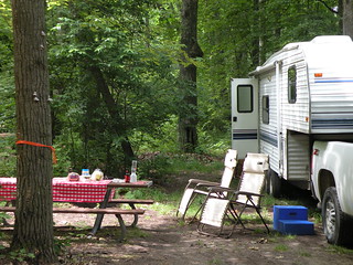
Family Campground - The horse trail and mountain bike connector trails located in the campground. The horseback trail connector trail is located near the group site. The trail camp is very popular during the summer with horseback trail riders. The loop campground is nestled in among a variety of leafy green tress.
Horseback Riding - There are over 40-miles of premier horse trails in the Hungerford Recreation Area.
Mountain Biking - There are two-loops for mountain bikes, creating a 10-mile trail.
Scenary and Topgraphy - The trails go through heavily forested areas of oak, maple, aspen, and red and white pine. At times riders will cross or utilize roads. Parts of the trails are suitable for less experienced riders, while other segments offer a more experienced riding opportunity. The topography ranges from hilly to very hilly. Riders will experience a range in scenery as they ride through the heavily forested areas and into open fields and meadows.
Brochure with map : This brochure is set to print on 11 x 17 paper, landscape (wide) orientation. To print on 8 1/2 x 11 paper set the print area to "shrink to printable area", this will make the text on the page smaller.
Flickr Photo Album
Restrictions <em><strong>Allowed</strong></em> <ul><li>Nonmotorized Use/Nonmotorized Snow Use</li><li>Saddle and Pack Animals (Horse Trail Only)</li><li>Mountain Bikes (Mountain Bike Trail Only)</li></ul><em><strong>Prohibited</strong></em> <ul><li>Motorized Vehicles, Motorized Over-snow Vehicles</li></ul>As a visitor to the National Forest, you are asked to follow certain rules designed to protect the Forest, natural resources and to provide for public safety of visitors. These rules are available to you <a href="http://www.fs.usda.gov/detail/hmnf/notices/?cid=STELPRDB5181640">on-line</a> or at any office of the Huron-Manistee National Forests. Please take time to read and understand them. General Topic orders apply across the Forests. <em><strong>Applicable Orders - </strong></em> <ul><li>Motorized Vehicle Use of Roads, Trails and Off-road Areas</li><li>Occupancy and Use</li></ul>