Chicken Creek Nature Trail
ExhibitsPicnic areas
Along the way A Different Shade of Green Fossil Butte National Monument orientation Nature Trail Orientation Picnic Area - Welcome ... standing in an ancient lake The Sagebrush Sea Picnic Area

National Monument · Wyoming
3 named trails · 4 miles · 1 with the Park Service's own write-up. The lines, trailheads and points are the Park Service's; the write-ups are the Service's own words; the climbing is read from USGS elevation along each line.
3 trails, A to Z.
ExhibitsPicnic areas
Along the way A Different Shade of Green Fossil Butte National Monument orientation Nature Trail Orientation Picnic Area - Welcome ... standing in an ancient lake The Sagebrush Sea Picnic Area
ExhibitsPicnic areas
Along the way Fossil Butte National Monument orientation Nature Trail Orientation Picnic Area
Exhibits
Along the way A Fossil Hunter's Home A Town called Fossil Butte Burrowing Mammals Fish, Dead and Buried Fossil Butte National Monument orientation panel Historic Quarry Trail Orientation Layers of Fossil Fish Raptors at Home on Fish Cliff Slump or Debris Flow Spur Trail to Historic Quarry The Wasatch Formation Trail Marker
1-2 Hours · dogs allowed
Start Historic Quarry Parking Lot
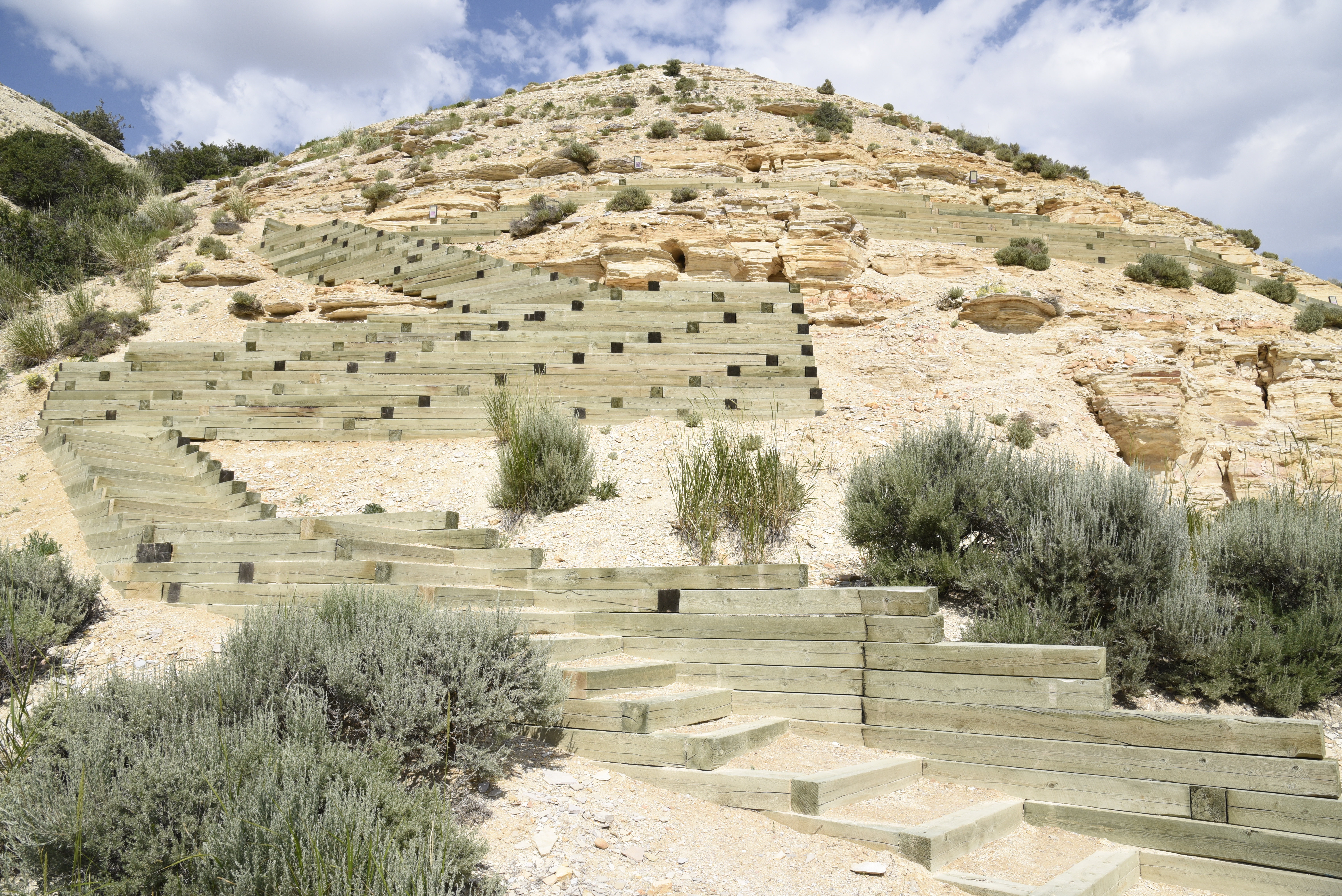
The Historic Quarry Trail offers a great way to experience the geology of Fossil Butte. You will pass through parts of the Wasatch and Green River Formations. A short, side loop leads to a historic fossil quarry. Wayside exhibits provide information about the geology and paleontology of the park. Be aware that fossils are not visible along the trail. Fossils are on display in the visitor center.
This 2.5 mile loop trail begins at an elevation of 6675 feet (2035 m) elevation and gains almost 700 ft (213 m). This trail is considered moderate to strenuous depending on how acclimated one is to the elevation. Restrooms, water, and a small picnic area are available at the start of the trail. This trail is not accessible to wheelchairs or strollers.
Please be cautious hiking at Fossil Butte National Monument. The trailhead is located at an elevation of 6675 feet (2035 m) in a desert; you will get sunburned and dehydrated more easily than at lower elevations. The air is also much thinner than at lower elevations and can put more strain on you. There is no shade on the trail and conditions can get very hot during the summer. As dry as the landscape may look, hidden streams and ponds attract plenty of mosquitoes during the summer months. Be sure to pack sunscreen, a hat, bug spray, and plenty of water. Avoid hiking in thunderstorms.
Collecting fossils or other natural or cultural items is prohibited by federal law 36 CFR 2.1.
Accessibility This dirt trail is a 2.5 mile loop where you gain 600 feet in elevation. The trailhead is located at approximately 6675 feet (2035 m) elevation. The trail is generally only wide enough for a single file line. At the top of the loop there is a section with several flights of stairs that allow you to climb up to the historic quarry.
1 more mapped segment without a name is on the map, not in the list.
Write-ups that name no single mapped trail, in the Service's words.
The lines are the National Park Service's public trails layer, the trailheads and the waterfalls, views, peaks and historic places along them the Service's public points of interest, read 2026-10-14 and simplified for the map. The write-ups are the Service's own "things to do", unedited. Heights come from USGS 3DEP through Terrain Tiles on AWS (Mapzen/Tilezen), read along each line and rounded; a short trail on steep ground can be off by a few tens of feet. Closures change: check the park's own site before you go.