Barksdale Pic Area Trail
Trailhead Shootin' Star Trailhead 8,557 ft Drive there

National Monument · Colorado
21 named trails · 13 miles · 2 trailheads · 3 with the Park Service's own write-up. The lines, trailheads and points are the Park Service's; the write-ups are the Service's own words; the climbing is read from USGS elevation along each line.
21 trails, A to Z.
Trailhead Shootin' Star Trailhead 8,557 ft Drive there
Trailhead Shootin' Star Trailhead 8,557 ft Drive there
Bridges
Along the way Boulder Creek Bridge Boulder Creek Bridge
ViewsExhibitsBridges
Along the way Hornbek Loop Trail Bridge Jawless fish Land Plants Land Vertebrates Geologic Overlook
30-60 Minutes · no dogs · entrance fee applies
Start Geologic Trail
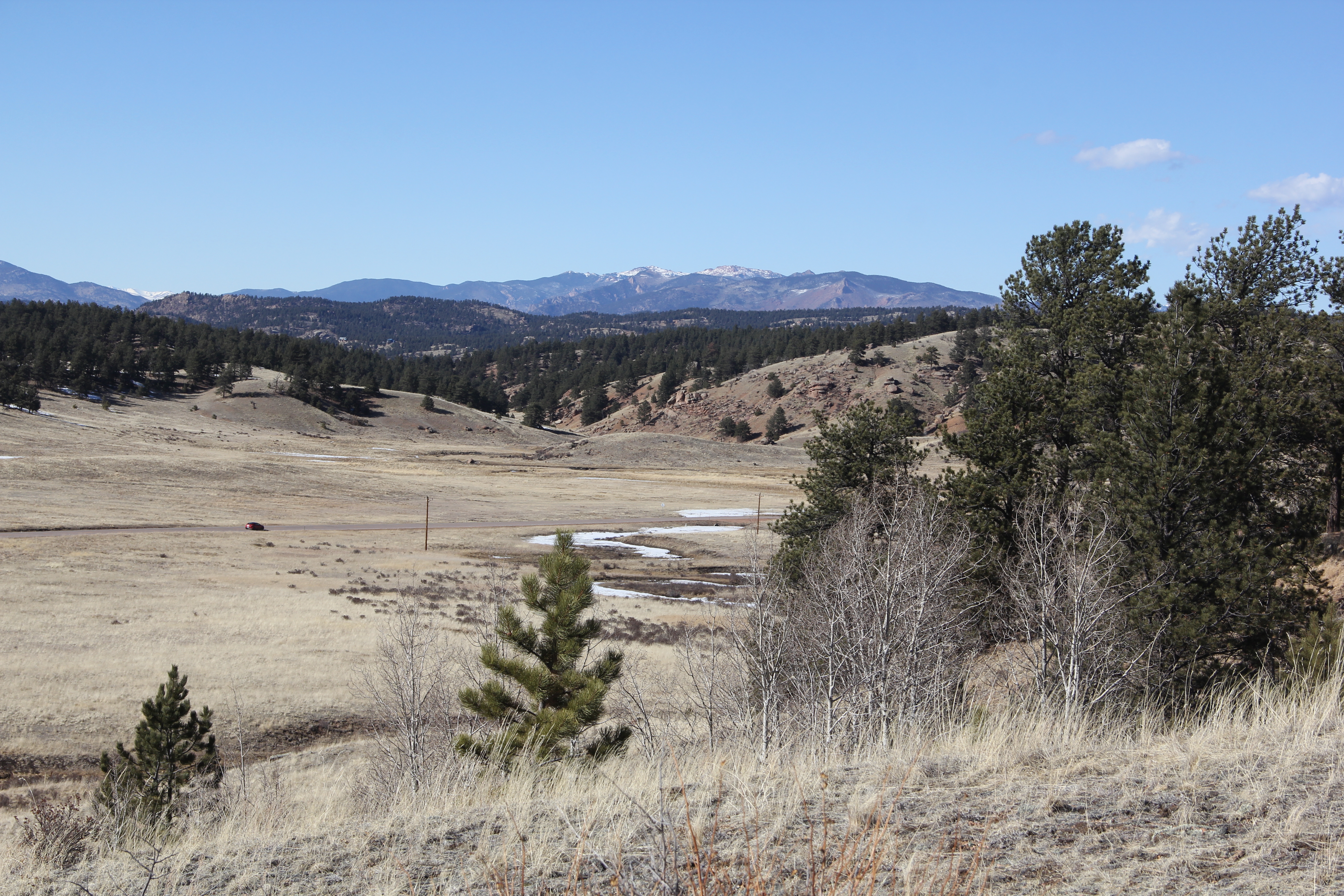
The Geologic Trail is a self-guided 1.2 mile (round trip) trail that that highlights over a billion years of geologic history of the Florissant valley. It passes over the ancient lake bed, crosses County Road 1, then ascends past the remnants of a massive pyroclastic flow, and ends at a scenic overview of the Florissant valley.
Pets Pets are not allowed on any trails at Florissant Fossil Beds. They are allowed, on a leash, in the parking lot, and adjacent picnic area in front of the visitor center.
Accessibility The Geologic Trail is a 1.2 mile (round trip) trail that can be accessed behind the visitor center and off the Petrified Forest Loop. The trail begins on a gravel, 6 foot wide section that is part of the Petrified Forest Loop. After about .1 miles on this section you'll come to the junction of the beginning of the Geologic Trail. From there, the trail ascends about 20 feet on a narrow trail and then descends 20 feet down again using wooden steps. Then the trail crosses a two lane county road and continues on a narrow dirt/rock trail until it comes to a foot bridge that has three steps on either side. Then the trail ascends a narrow rocky path for about 105 feet to the over view.
Exhibits
Along the way FFB-Gateway to the Gold Belt Tour Hornbek Homestead Pioneers, Prospectors, and Paleontologists
Exhibits
Along the way Hornbek Homestead
ViewsExhibitsBridges
Along the way Wildlife Loop Trail Bridge Hornbek Homestead Pioneers, Prospectors, and Paleontologists Geologic Overlook
Visitor centers
Along the way Florissant Fossil Beds Visitor Center
Trailhead Visitor Center Area Trailhead 8,393 ft Drive there
ExhibitsVisitor centers
Along the way Birds Early Dinosaurs Earth Cools Florissant Formation Jawless fish Land Plants Land Vertebrates Mammoth relatives near and far Wall Mountain Tuff Florissant Fossil Beds Visitor Center
Trailhead Visitor Center Area Trailhead 8,393 ft Drive there
30-60 Minutes · no dogs · entrance fee applies
Start Petrified Forest Loop Trail
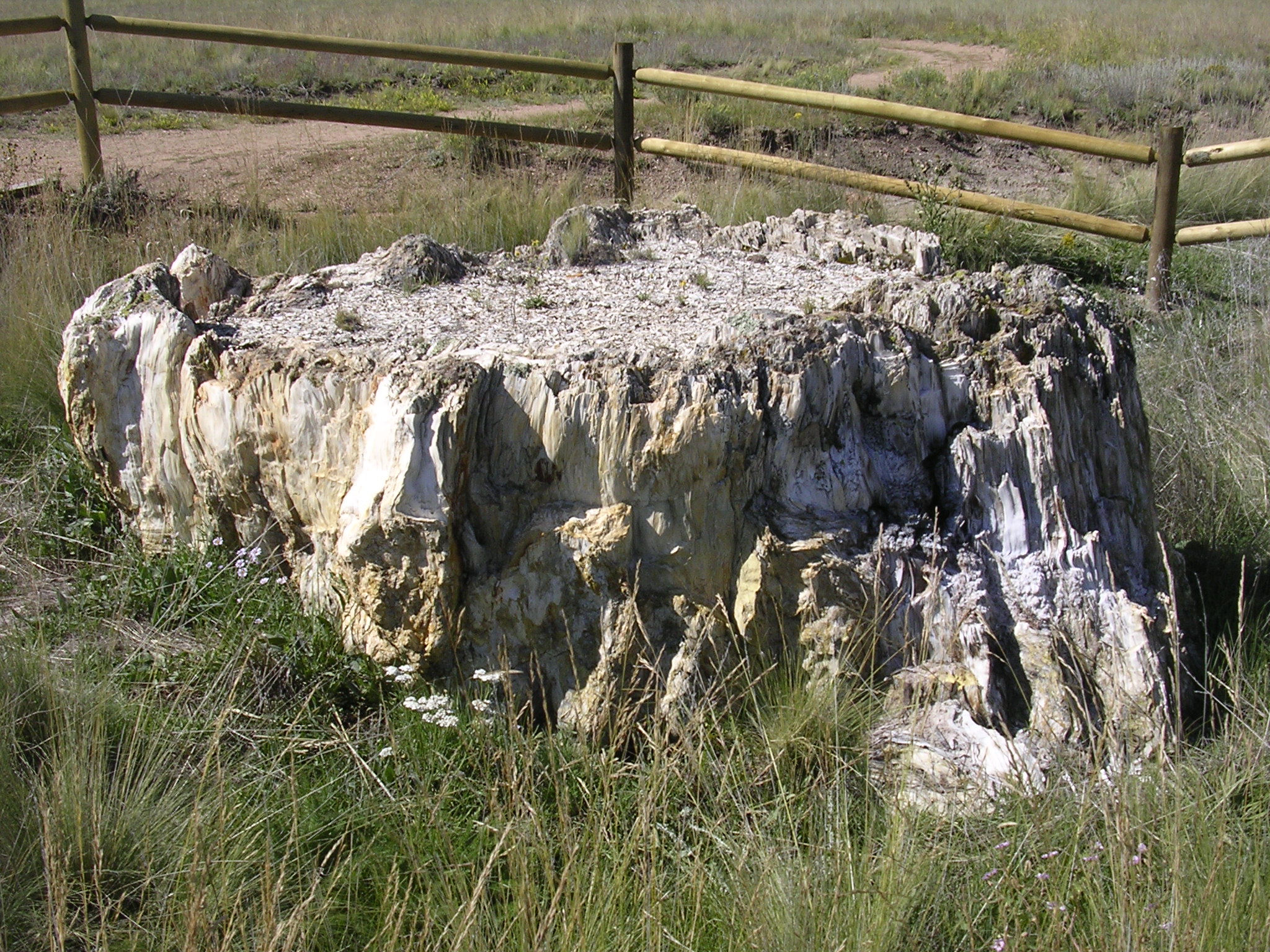
The one-mile, self-guided Petrified Forest Loop Trail is the main trail to hike on to see fossils at Florissant Fossil Beds. The fossils you will see on this trail are petrified redwood tree stumps. These are some of the biggest petrified tree stumps in the world (by diameter). The trail is gravel and is mostly level. It can be accessed behind the visitor center. There are interpretive exhibit panels along the way.
Pets Pets are not allowed on this, and/or any of the trails at Florissant Fossil Beds. They are allowed in the parking lot and in the picnic area near the parking lot on a leash.
Accessibility Service animals are allowed on this trail on a leash. The trail is one mile in length and relatively flat. It has a few sections that go up in elevation about 20 - 30 feet at about 30% grade and a few downhill sections going down 20 - 30 feet at about 30% grade. There are some water bars on the trail. The trail has a gravel base. The trail is about 4 - 6 feet wide.
ExhibitsVisitor centers
Along the way Life in the Forest Life Zones No Smoking, Sawmill and Hans Loop, VC and Parking Lot Present Touches Past relatives near and far Resource Protection Area Revegetation Area/ Wall Mountain Tuff The Role of Fire Florissant Fossil Beds Visitor Center
10-30 Minutes · no dogs · entrance fee applies
Start Ponderosa Loop Trail
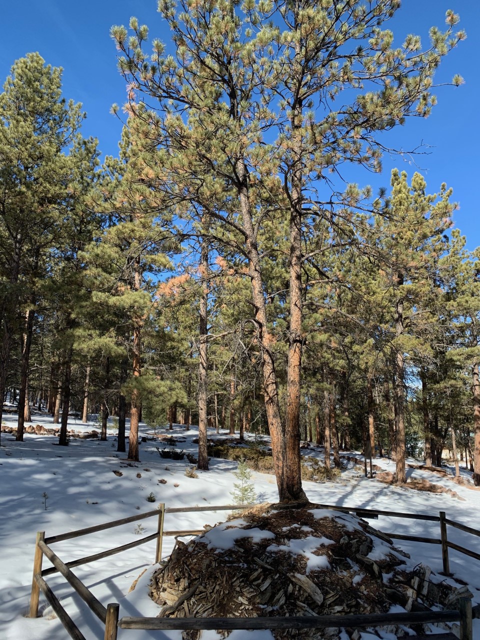
The Ponderosa Loop Trail is a 1/2 mile long, accessible, trail located behind the visitor center at Florissant Fossil Beds. This is a short, easy, and peaceful walk through a mostly Ponderosa pine forest. It features numerous exhibits along the trail that interpret the natural history of the area. One of the main features on the trail is a modern Ponderosa pine tree growing out of a petrified redwood tree stump.
Pets Pets are not allowed on any of the trails at Florissant Fossil Beds. They are allowed, on a leash, in the parking lot and/or picnic area next to the parking lot in front of the visitor center.
Accessibility The 1/2 mile Ponderosa Loop Trail has been graded for accessibility and is composed of compacted finely crushed rock. The trail width is about 6 feet. The trail can be accessed by going through the visitor center and finding the trail head just beyond the outdoor exhibit area which is behind the visitor center. The parking lot, front patio, visitor center, and outdoor exhibit area leading to the trail head are all accessible. Service animals are allowed on this trail.
ExhibitsBridges
Along the way Boulder Creek Bridge Life in the Forest Life Zones No Smoking, Sawmill and Hans Loop, VC and Parking Lot Present Touches Past Resource Protection Area
Bridges
Along the way Boulder Creek Bridge
Exhibits
Along the way Life Zones Revegetation Area/ Wall Mountain Tuff Visitors Arrive
Trailhead Shootin' Star Trailhead 8,557 ft Drive there
ExhibitsVisitor centers
Along the way Present Touches Past relatives near and far Florissant Fossil Beds Visitor Center
Trailhead Visitor Center Area Trailhead 8,393 ft Drive there
Bridges
Along the way Twin Rock Trail Bridge
ExhibitsVisitor centers
Along the way relatives near and far Florissant Fossil Beds Visitor Center
Trailhead Visitor Center Area Trailhead 8,393 ft Drive there
ExhibitsVisitor centers
Along the way Life in the Forest relatives near and far Florissant Fossil Beds Visitor Center
Trailhead Visitor Center Area Trailhead 8,393 ft Drive there
ExhibitsVisitor centers
Along the way relatives near and far Florissant Fossil Beds Visitor Center
Trailhead Visitor Center Area Trailhead 8,393 ft Drive there
Visitor centers
Along the way Florissant Fossil Beds Visitor Center
Trailhead Visitor Center Area Trailhead 8,393 ft Drive there
The lines are the National Park Service's public trails layer, the trailheads and the waterfalls, views, peaks and historic places along them the Service's public points of interest, read 2026-10-14 and simplified for the map. The write-ups are the Service's own "things to do", unedited. Heights come from USGS 3DEP through Terrain Tiles on AWS (Mapzen/Tilezen), read along each line and rounded; a short trail on steep ground can be off by a few tens of feet. Closures change: check the park's own site before you go.