National Recreation Area · New Jersey, Pennsylvania

Trails in Delaware Water Gap National Recreation Area

57 named trails · 93 miles · 58 trailheads · 2 with the Park Service's own write-up. The lines, trailheads and points are the Park Service's; the write-ups are the Service's own words; the climbing is read from USGS elevation along each line.

Open on the parks mapEvery park with trailsPark on nps.gov

57 trails, A to Z.

Arrow Island Trail

0.9 mi one way · about 20 ft of climbing · 250 ft of descent · 377 ft–592 ft · earth surface · hiking

Views

590 ft 377 ft · 0.8 mi high 590 ft

Along the way Arrow Island Overlook

Trailhead Arrow Island & Slateford Loop Trail 589 ft Drive there

Blue Mountain Lake Inner Loop

2.0 mi one way · about 250 ft of climbing · 1,066 ft–1,202 ft · earth surface · hiking

Picnic areas

1,071 ft 1,158 ft · 0.8 mi high 1,162 ft

Along the way Blue Mt Lakes Recreation Site

Trailhead Blue Mountain Lake Trail 1,106 ft Drive there

Blue Mountain Lake Outer Loop

4.2 mi one way · about 450 ft of climbing · 1,066 ft–1,306 ft · earth surface · hiking

Picnic areas

1,210 ft 1,067 ft · 0.9 mi high 1,247 ft

Along the way Blue Mt Lakes Recreation Site

Trailhead Blue Mountain Lake Trail 1,106 ft Drive there

Buchanan Trail

0.8 mi one way · about 150 ft of climbing · 828 ft–979 ft · earth surface · hiking

828 ft 956 ft · 0.3 mi high 956 ft

Trailhead Cliff Park - Buchanan Trail and Pond Loop Trail 824 ft Drive there

Buttermilk Falls Trail

1.5 mi one way · about 1,100 ft of climbing · 431 ft–1,551 ft · earth surface · hiking

Waterfalls

431 ft 1,159 ft · 1.0 mi high 1,163 ft

Along the way Buttermilk Falls

Trailhead Buttermilk Falls Trail 420 ft Drive there

Cliff Trail

1.0 mi one way · about 300 ft of climbing · 631 ft–975 ft · gravel surface · hiking

Views

632 ft 901 ft · 0.4 mi high 901 ft

Along the way Cliff Trail - Riverview Overlook Cliff Trail - Tri-State Overlook

Hike the Cliff Trail the Park Service's write-up

1-4 Hours · dogs allowed

Start Cliff Trail at Hackers Trailhead

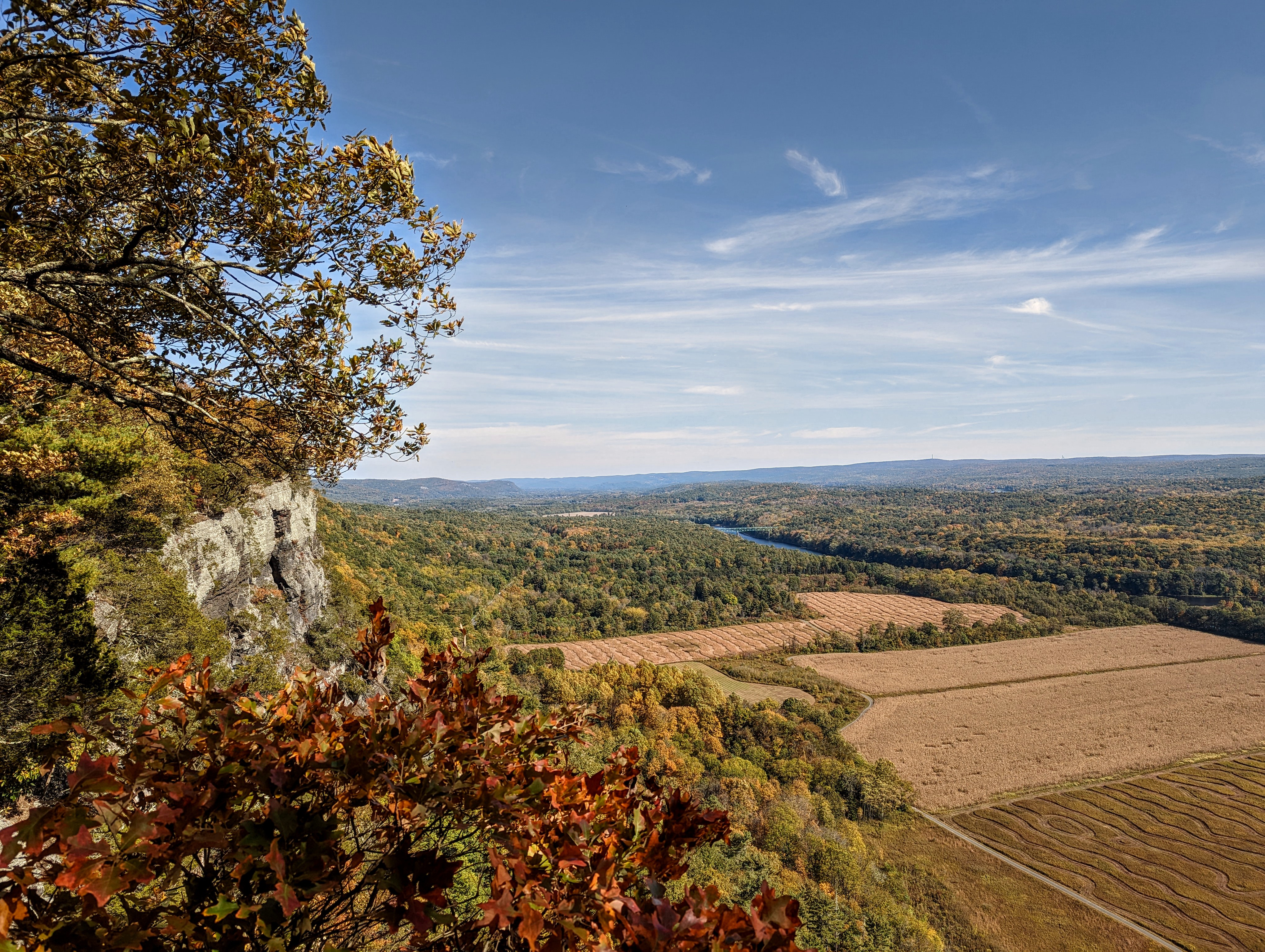
A view from the Cliff Trail. The Raymonskill ridge hovering over the river and farmfields below.
The Cliff Trail has amazing views of the Delaware River Valley in multiple spots along the trail. Photo: NPS Photo/ J. Grier

The Cliff Trail is a 2.8 mile, out-and-back trail that winds along the Raymondskill Ridge. This trail begins with a steady incline with an elevation gain of about 250 feet. After reaching the ridge, the incline flattens out for an easier, more level walk along the ridgeline. There are four overlooks along this trail: Tri-state, Minisink, Riverview, and the trail terminates at the Milford Knob overlook.

The views from this trail are 180 degree overlooks of gorgeous Delaware River Valley, including agricultural fields, forests, towns and structures, and the cliffs the overlooks are perched on.

This trail can be done in sections from different starting points such as Cliff Park and Milford Knob trailheads.

Accessibility This trail is quite rocky and uneven. Moderate elevation gain will make this trail difficult for people with mobility issues.

This hike on nps.gov

Conashaugh View Trail

7.6 mi one way · about 850 ft of climbing · 1,400 ft of descent · 463 ft–938 ft · earth surface · hiking, horse

819 ft 814 ft · 1.3 mi high 910 ft

Trailhead Conashaugh View Trail - Conashaugh Rd Trailhead 919 ft Drive there

Coppermine Trail

0.9 mi one way · about 600 ft of climbing · 331 ft–946 ft · earth surface · hiking

468 ft 946 ft · 0.7 mi high 946 ft

Trailhead Coppermine Trail - Old Mine Rd 328 ft Drive there

Crater Lake Loop Trail

1.3 mi one way · about 200 ft of climbing · 1,351 ft–1,447 ft · earth surface · hiking

Picnic areas

1,355 ft 1,372 ft · 0.5 mi high 1,394 ft

Along the way Crater Lake Recreation Site

Trailhead Crater Lake Loop Trail 1,357 ft Drive there

Dingmans Creek Trail - Accessible closed

0.3 mi one way · about 30 ft of climbing · 496 ft–530 ft · wood surface · hiking · temporarily closed

WaterfallsVisitor centers

500 ft 530 ft · 0.3 mi high 530 ft

Along the way Dingmans Falls Visitor Center Dingmans Falls Silver Thread Falls

Trailhead Dingmans Creek Trail 505 ft Drive there

George W. Childs Park Trail

0.7 mi one way · about 150 ft of climbing · 788 ft–941 ft · wood surface · hiking

WaterfallsViewsHistory

819 ft 829 ft · 0.1 mi high 829 ft

Along the way George W. Childs Park George W. Childs Park - Factory Falls Overlook George W. Childs Park - Factory Falls Overlook #2 George W. Childs Park - Fulmer Falls Overlook George W. Childs Park - Deer Leap Falls George W. Childs Park - Factory Falls George W. Childs Park - Fulmer Falls

George W. Childs Park Trail - Accessible

0.4 mi one way · about 10 ft of climbing · 50 ft of descent · 899 ft–953 ft · hiking

WaterfallsViewsHistory

950 ft 917 ft · 0.3 mi high 953 ft

Along the way George W. Childs Park George W. Childs Park - Factory Falls Overlook George W. Childs Park - Factory Falls Overlook #2 George W. Childs Park - Factory Falls

Hamilton Ridge Trail

2.8 mi one way · about 50 ft of climbing · 500 ft of descent · 371 ft–884 ft · earth surface · hiking

843 ft 392 ft · 2.5 mi high 883 ft

Trailheads Hamilton Ridge Trail - Old Mine Rd 844 ft Drive there · Hamilton Ridge Trail - Old Mine Rd S 367 ft Drive there

Hidden Lake Loop Trail

1.8 mi one way · about 90 ft of climbing · 598 ft–650 ft · earth surface · hiking

Picnic areas

609 ft 607 ft · 1.7 mi high 650 ft

Along the way Hidden Lake Recreation Site

Trailheads Hidden Lake Loop East Trailhead 599 ft Drive there · Hidden Lake Loop Trail 610 ft Drive there

Joseph M. McDade Recreational Trail

28 mi one way · about 1,000 ft of climbing · 323 ft–574 ft · earth, gravel surface · bike, hiking, ski · seasonal: Closed 12/15-7/15

CampgroundsVisitor centersBoat launches

567 ft 441 ft · 19 mi high 567 ft

Along the way Bushkill Access Boat Launch Smithfield Beach Boat Launch Dingmans Campground Bushkill Meeting Center

Trailheads McDade Trail - Bushkill Access South Trailhead 344 ft Drive there · McDade Trail - Bushkill Access Trailhead 333 ft Drive there · McDade Trail - Bushkill Village Trailhead 354 ft Drive there · McDade Trail - Conashaugh Trailhead 425 ft Drive there · McDade Trail - Egypt Mills Trailhead 359 ft Drive there · McDade Trail - Eshback Trailhead 359 ft Drive there · McDade Trail - Hialeah Trailhead 346 ft Drive there · McDade Trail - Jerry Lees Trailhead 365 ft Drive there · McDade Trail - Pittman Orchard Trailhead 389 ft Drive there · McDade Trail - Riverview Trailhead 336 ft Drive there · McDade Trail - Schneider Farm Trailhead 409 ft Drive there · McDade Trail - Smithfield Beach Trailhead 329 ft Drive there · McDade Trail - Turn Farm Trailhead 422 ft Drive there · McDade Trail - White Pines Trailhead 398 ft Drive there

Kaiser Trail

1.1 mi one way · about 600 ft of climbing · 403 ft–999 ft · earth surface · hiking

736 ft 999 ft · 0.6 mi high 999 ft

Trailhead Kaiser Trail 394 ft Drive there

Lower Hornbecks Creek Trail

1.1 mi one way · about 100 ft of climbing · 382 ft–491 ft · gravel surface · hiking

Waterfalls

384 ft 491 ft · 1.1 mi high 491 ft

Along the way Lower Hornbecks Falls

Trailhead Hornbecks Creek Trail - US209 386 ft Drive there

Easy Hike Along Hornbecks Creek the Park Service's write-up

dogs allowed

Start Lower Hornbecks Creek Trail

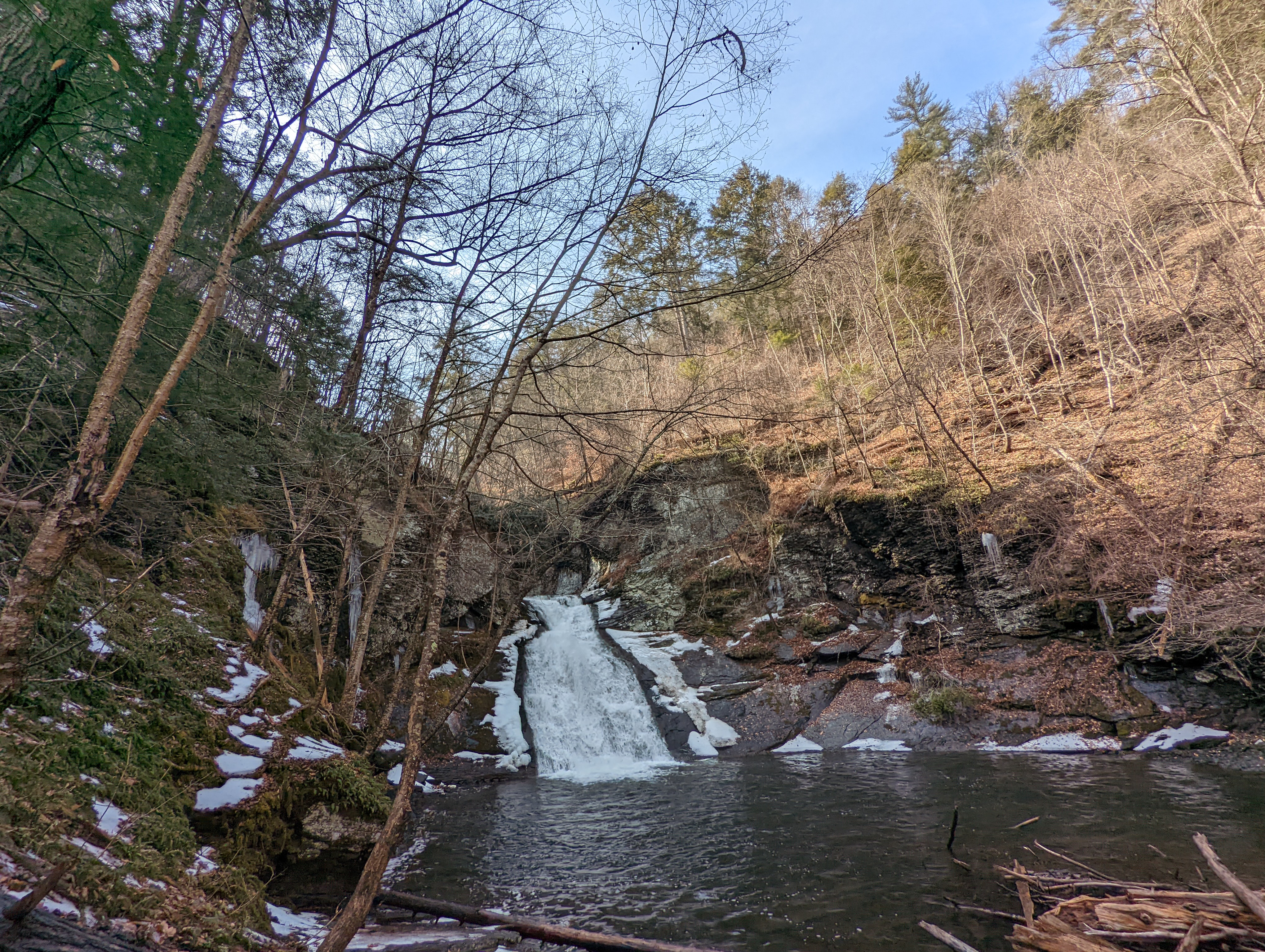
A small, tiered waterfall and pool with a small amount of snow around it.
Lower Hornbecks Creek's waterfall in late winter. Photo: NPS Photo/ J. Grier

An easy, one-mile out and back hike along the Lower Hornbecks Creek will lead visitors to a small waterfall, but the waterfall is only part of the view!

During the hike, there are multiple bridges allowing for beautiful views of the creek all along the trail.

This hike is easy and good for familes, as there is only 110 feet of total elevation gain and the trail is relatively wide and flat.

For the trail map, visit Lower Hornbecks Creek Trail - Delaware Water Gap National Recreation Area (U.S. National Park Service) .

Accessibility This trail is not ADA accessible. The trail surface is uneven and may have rocks or roots, or may be slippery and muddy in areas. The elevation gain is 110 feet.

This hike on nps.gov

Milford Knob Trail

1.3 mi one way · about 400 ft of climbing · 483 ft–872 ft · earth surface · hiking

Views

483 ft 673 ft · 0.8 mi high 673 ft

Along the way Cliff Trail - Milford Knob Overlook

Trailhead Milford Knob Trail 483 ft Drive there

Mount Tammany Trail

1.3 mi one way · about 1,200 ft of climbing · 327 ft–1,458 ft · earth surface · hiking

Views

327 ft 1,458 ft · 1.2 mi high 1,458 ft

Along the way Arrow Island on Red Dot Overlook Mt. Tammany Overlook

Trailhead Mt. Tammany Trail 341 ft Drive there

Orchard Trail

0.6 mi one way · about 200 ft of climbing · 655 ft–861 ft · earth surface · hiking

History

677 ft 861 ft · 0.5 mi high 861 ft

Along the way Millbrook Village

Trailheads Donkeys Corner Trail - Millbrook Village 651 ft Drive there · Orchard Trail - Millbrook Village 670 ft Drive there

Pond Loop Trail

0.3 mi one way · about 30 ft of climbing · 819 ft–850 ft · earth surface · hiking

820 ft 850 ft · 0.3 mi high 850 ft

Trailhead Cliff Park - Buchanan Trail and Pond Loop Trail 824 ft Drive there

Raymondskill Creek Trail

0.6 mi one way · about 10 ft of climbing · 350 ft of descent · 412 ft–621 ft · earth, wood surface · hiking

Waterfalls

579 ft 412 ft · 0.2 mi high 579 ft

Along the way Raymondskill Falls

Trailheads Hackers Trail 607 ft Drive there · Raymondskill Falls Trail 622 ft Drive there

Toms Creek Trail

0.8 mi one way · about 100 ft of climbing · 378 ft–477 ft · earth surface · hiking

Picnic areas

378 ft 477 ft · 0.8 mi high 477 ft

Along the way Toms Creek Recreation Site

Trailhead Toms Creek Trail 378 ft Drive there

Upper Hornbecks Creek Trail

0.4 mi one way · 150 ft of descent · 661 ft–834 ft · earth surface · hiking

Waterfalls

834 ft 665 ft · 0.4 mi high 834 ft

Along the way Upper Hornbecks Falls

Trailhead Hornbecks Creek Trail - Emery Rd 836 ft Drive there

Van Campens Glen Trail

1.1 mi one way · about 250 ft of climbing · 376 ft–552 ft · earth surface · hiking

Waterfalls

376 ft 539 ft · 0.9 mi high 543 ft

Along the way Van Campens Glen Falls

Trailheads Van Campens Glen Trail 372 ft Drive there · Van Campens Glen Trail - Upper Glen Lot 555 ft Drive there

About these trails

The lines are the National Park Service's public trails layer, the trailheads and the waterfalls, views, peaks and historic places along them the Service's public points of interest, read 2026-10-14 and simplified for the map. The write-ups are the Service's own "things to do", unedited. Heights come from USGS 3DEP through Terrain Tiles on AWS (Mapzen/Tilezen), read along each line and rounded; a short trail on steep ground can be off by a few tens of feet. Closures change: check the park's own site before you go.