Adam Run Trail
Picnic areas
Along the way Hampton Hills
Trailhead Hampton Hills 764 ft Drive there

National Park · Ohio
119 named trails · 219 miles · 10 trailheads · 6 with the Park Service's own write-up. The lines, trailheads and points are the Park Service's; the write-ups are the Service's own words; the climbing is read from USGS elevation along each line.
119 trails, A to Z.
Picnic areas
Along the way Hampton Hills
Trailhead Hampton Hills 764 ft Drive there
Picnic areas
Along the way Lost Meadows
Trailhead Station Road Bridge 639 ft Drive there
Picnic areas
Along the way Brandywine Falls
1-2 Hours · dogs allowed
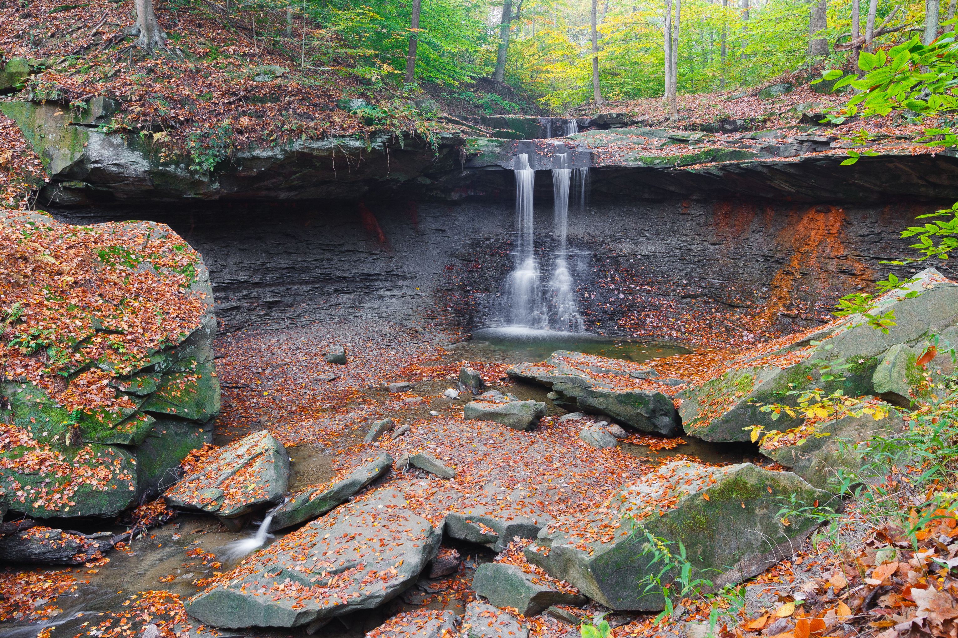
The scenic overlook at Blue Hen Falls is a popular hiking destination in the Boston area. The 15-foot waterfall is lovely throughout the year. The hike is 3 miles roundtrip from the Boston Mill Visitor Center on the rugged Buckeye Trail. There is a 580-foot change in elevation. For most people, that's steep! We recommend wearing sturdy walking shoes. If the ground is wet or icy, save this hike for a drier day.
Park at Boston Mill Visitor Center or Boston Trailhead . Limited spaces are also available at the oversize vehicle lot, across from the main visitor center parking lot. Parking areas tend to fill up on weekends and days with warm weather. Consider doing this hike early or late in the day to avoid the midday crowds.
During operating hours, stop at the visitor center for maps and information. Public restrooms are in the gray building next to the visitor center. Fill up a water bottle here to bring on your hike. There is no drinking water at Blue Hen Falls.
The hike at a glance
Distance: 3 miles roundtrip (or more if parking farther away)
Elevation change: 580 feet
Nearest restrooms & water: Boston Mill Visitor Center
A hilly hike
From the big park sign outside the visitor center, follow the curved path to the intersection of Riverview and Boston Mills roads. Carefully cross Riverview Road and find the stone staircase that marks the entrance to the Buckeye Trail. This statewide trail is marked by blue “blazes” painted on trees and posts. To protect the forest habitat, please follow these blazes and stay on the marked trail.
The trail climbs and descends two steep ridges along its route to the falls. The hike begins with an immediate 200-foot climb. This is followed by a 100-foot staircase down to the ravine floor to cross a footbridge. After crossing the creek, the trail climbs a second hill and skirts around a maintenance yard at the top. Carefully cross Boston Mills Road at the top of the hill and stay alert for oncoming traffic. Follow the trail as it zigzags through the forest and down to the waterfall. Return to Boston along the same route.
Alternate routes
For a longer hike that avoids the busy Boston parking areas, consider starting your hike from elsewhere along the Buckeye Trail. The nearest alternative is the Jaite Trailhead, located near the intersection of Riverview and Vaughn roads. Be sure to consult a map and plan ahead for your hike. Distances and hike times will vary by location. Bring extra water as needed.
Hiking tips and reminders
Pack water and wear sturdy walking shoes.
Do not walk on roads.
The Buckeye Trail can be very muddy and is hilly.
Use caution when crossing roads.
Stay on the main trail to help preserve plants and reduce erosion.
Park only in designated areas. Parking along roadways is prohibited. Vehicles parked illegally may be ticketed and towed.
Accessibility This section of the Buckeye Trail is not wheelchair accessible. It is hilly with an unpaved surface that is rocky and muddy in places. There are multiple staircases along this hike. Service animals and leashed comfort pets are welcome. Audio description is available for exhibit panels in the visitor center.
1-2 Hours · dogs allowed
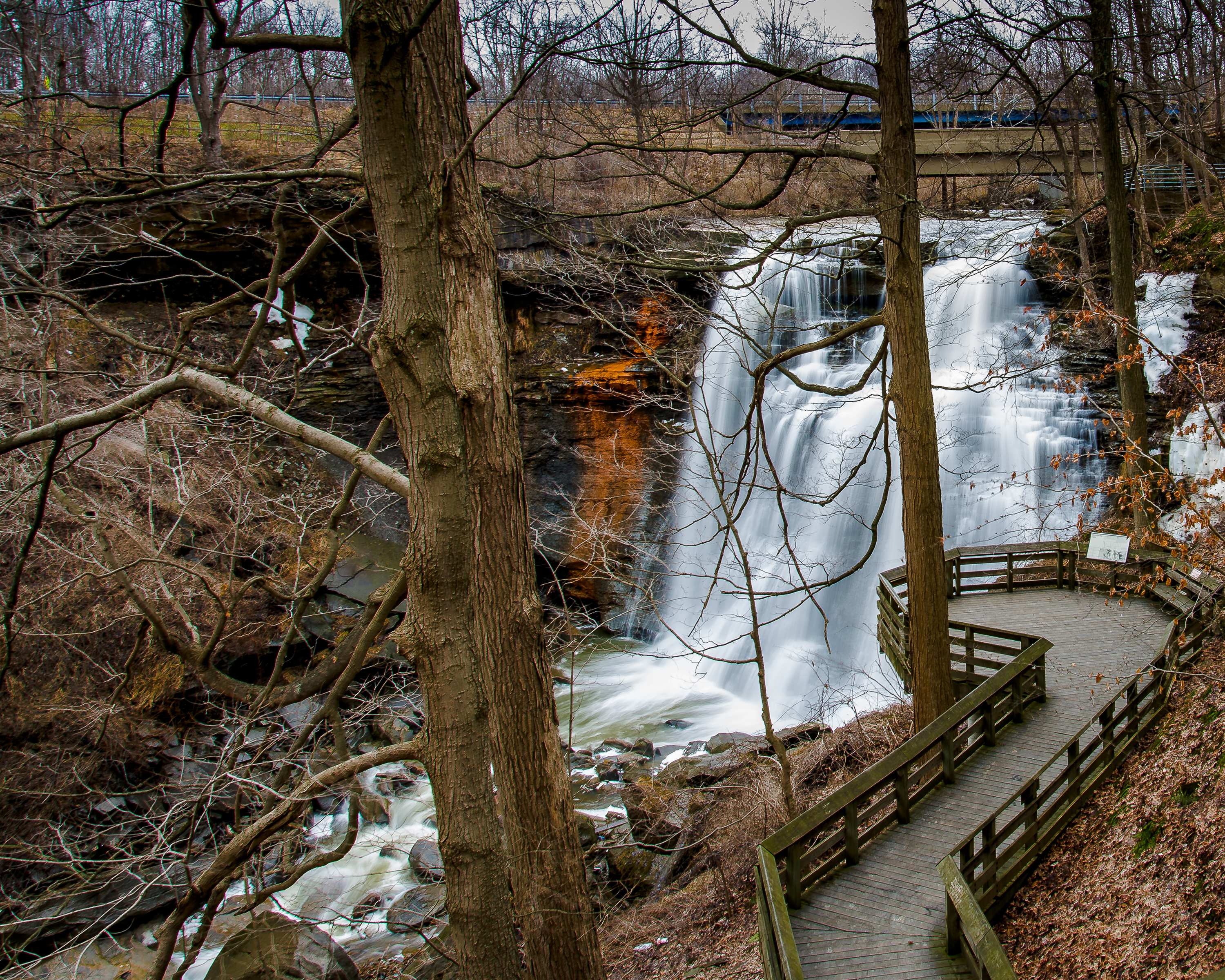
This hike is best done early or late in the day to avoid the midday crowds. Park at Brandywine Falls Trailhead . Spaces are limited. The gorge loop includes sections of several trails. If you didn’t get a trail map at the visitor center, consult the one at the bulletin board near the restrooms or use the NPS App . This is a 1.5-mile hike with a 160-foot elevation change. We recommend wearing sturdy walking shoes. To protect this fragile habitat, please stay on marked trails.
Follow the path toward the falls, then take a left onto the trail just before the boardwalk. The clockwise loop takes you down into the gorge, over a footbridge above the creek, and back up the other side. Keep bearing right at all trail intersections. After you pass the Inn at Brandywine Falls and cross back over the creek – and over the falls – take a right at the small bulletin board. The path leads to the falls viewing boardwalk and back to the parking lot. For a closer look at the falls, follow the signs and walk down approximately 80 steps to a lower viewing deck.
The hike at a glance
Distance: 1.5 miles roundtrip (or more if starting elsewhere; see below)
Elevation change: 160 feet
Nearest restrooms & water: Brandywine Falls Trailhead
Alternate routes
For a longer hike that avoids the busy Brandywine Falls parking area, consider starting your hike from the village of Boston. Several parking areas are available, including those at Boston Mill Visitor Center, Boston Trailhead, and Stanford Trailhead. Be sure to consult a map and plan ahead for this hike, as there are multiple options at trail intersections. Bring water. There is also drinking water available seasonally at Brandywine Falls Trailhead.
From Boston Mill Visitor Center
Park at Boston Mill Visitor Center . Follow the path from the parking lot toward the visitor center, carefully crossing the railroad tracks when safe to do so. Stop at the visitor center and/or restrooms as needed. Continue around the visitor center and walk across the pedestrian bridge over the Cuyahoga River. Turn right and follow signs and stencils on the ground to access the Ohio & Erie Canal Towpath Trail . Turn left onto the Towpath and hike 0.5 miles north. Turn right onto the connector trail toward Stanford House . Carefully cross the road and follow the trail up to the right, past the pond and around the barn. From here follow the Stanford Trail for 1.2 miles, then follow signs to connect to the Brandywine Gorge Loop. A roundtrip hike from this location is approximately 5.7 miles and includes a cumulative 440-foot change in elevation.
From Boston Trailhead
Park at Boston Trailhead . Follow the connector trail from the southeast corner of the parking area toward the Towpath Trail. Turn right onto the Towpath Trail and hike 0.5 miles north. Turn right onto the connector trail toward Stanford House . Carefully cross the road and follow the trail up to the right, past the pond and around the barn. From here follow the Stanford Trail for 1.2 miles, then follow signs to connect to the Brandywine Gorge Loop. A roundtrip hike from this location is approximately 5.5 miles and includes a cumulative 440-foot change in elevation.
From Stanford Trailhead
Park at Stanford Trailhead . The parking area includes standard parking spaces as well as horse trailer spaces. Trailhead information is located near the southern end of the parking area. Hike connectors and the Stanford Trail for 1.5 miles, then follow signs to connect to the Brandywine Gorge Loop. A roundtrip hike from this location is approximately 4 miles and includes a cumulative 400-foot change in elevation.
Accessibility This trail is not wheelchair accessible. It is hilly with an unpaved surface that is rocky in places. Service animals and leashed comfort pets are welcome. Audio description is available for the exhibit panels along the trail. Wheelchair users can view Brandywine Falls by following the short path from the parking lot to the upper boardwalk viewing area.
Picnic areas
Along the way Ottowa Point
Picnic areas
Along the way Lost Meadows
Trailhead Wetmore 877 ft Drive there
Picnic areas
Along the way Brushwood Lake
Picnic areasVisitor centers
Along the way Canal Visitor Center Canal
Picnic areas
Along the way Kendall Lake
Picnic areas
Along the way O'Neill Woods
Trailhead O'Neill Woods 952 ft Drive there
Picnic areas
Along the way Lost Meadows
Picnic areas
Along the way Brushwood Lake
1-2 Hours · dogs allowed
This hike is best done early or late in the day to avoid the midday crowds. Park at Brandywine Falls Trailhead . Spaces are limited. The gorge loop includes sections of several trails. If you didn’t get a trail map at the visitor center, consult the one at the bulletin board near the restrooms or use the NPS App . This is a 1.5-mile hike with a 160-foot elevation change. We recommend wearing sturdy walking shoes. To protect this fragile habitat, please stay on marked trails.
Follow the path toward the falls, then take a left onto the trail just before the boardwalk. The clockwise loop takes you down into the gorge, over a footbridge above the creek, and back up the other side. Keep bearing right at all trail intersections. After you pass the Inn at Brandywine Falls and cross back over the creek – and over the falls – take a right at the small bulletin board. The path leads to the falls viewing boardwalk and back to the parking lot. For a closer look at the falls, follow the signs and walk down approximately 80 steps to a lower viewing deck.
The hike at a glance
Distance: 1.5 miles roundtrip (or more if starting elsewhere; see below)
Elevation change: 160 feet
Nearest restrooms & water: Brandywine Falls Trailhead
Alternate routes
For a longer hike that avoids the busy Brandywine Falls parking area, consider starting your hike from the village of Boston. Several parking areas are available, including those at Boston Mill Visitor Center, Boston Trailhead, and Stanford Trailhead. Be sure to consult a map and plan ahead for this hike, as there are multiple options at trail intersections. Bring water. There is also drinking water available seasonally at Brandywine Falls Trailhead.
From Boston Mill Visitor Center
Park at Boston Mill Visitor Center . Follow the path from the parking lot toward the visitor center, carefully crossing the railroad tracks when safe to do so. Stop at the visitor center and/or restrooms as needed. Continue around the visitor center and walk across the pedestrian bridge over the Cuyahoga River. Turn right and follow signs and stencils on the ground to access the Ohio & Erie Canal Towpath Trail . Turn left onto the Towpath and hike 0.5 miles north. Turn right onto the connector trail toward Stanford House . Carefully cross the road and follow the trail up to the right, past the pond and around the barn. From here follow the Stanford Trail for 1.2 miles, then follow signs to connect to the Brandywine Gorge Loop. A roundtrip hike from this location is approximately 5.7 miles and includes a cumulative 440-foot change in elevation.
From Boston Trailhead
Park at Boston Trailhead . Follow the connector trail from the southeast corner of the parking area toward the Towpath Trail. Turn right onto the Towpath Trail and hike 0.5 miles north. Turn right onto the connector trail toward Stanford House . Carefully cross the road and follow the trail up to the right, past the pond and around the barn. From here follow the Stanford Trail for 1.2 miles, then follow signs to connect to the Brandywine Gorge Loop. A roundtrip hike from this location is approximately 5.5 miles and includes a cumulative 440-foot change in elevation.
From Stanford Trailhead
Park at Stanford Trailhead . The parking area includes standard parking spaces as well as horse trailer spaces. Trailhead information is located near the southern end of the parking area. Hike connectors and the Stanford Trail for 1.5 miles, then follow signs to connect to the Brandywine Gorge Loop. A roundtrip hike from this location is approximately 4 miles and includes a cumulative 400-foot change in elevation.
Accessibility This trail is not wheelchair accessible. It is hilly with an unpaved surface that is rocky in places. Service animals and leashed comfort pets are welcome. Audio description is available for the exhibit panels along the trail. Wheelchair users can view Brandywine Falls by following the short path from the parking lot to the upper boardwalk viewing area.
Picnic areas
Along the way Happy Days Visitor Center
Trailhead Happy Days Visitor Lodge 926 ft Drive there
Picnic areas
Along the way Pine Hollow
Views
Along the way Ledges Overlook
1-2 Hours · dogs allowed
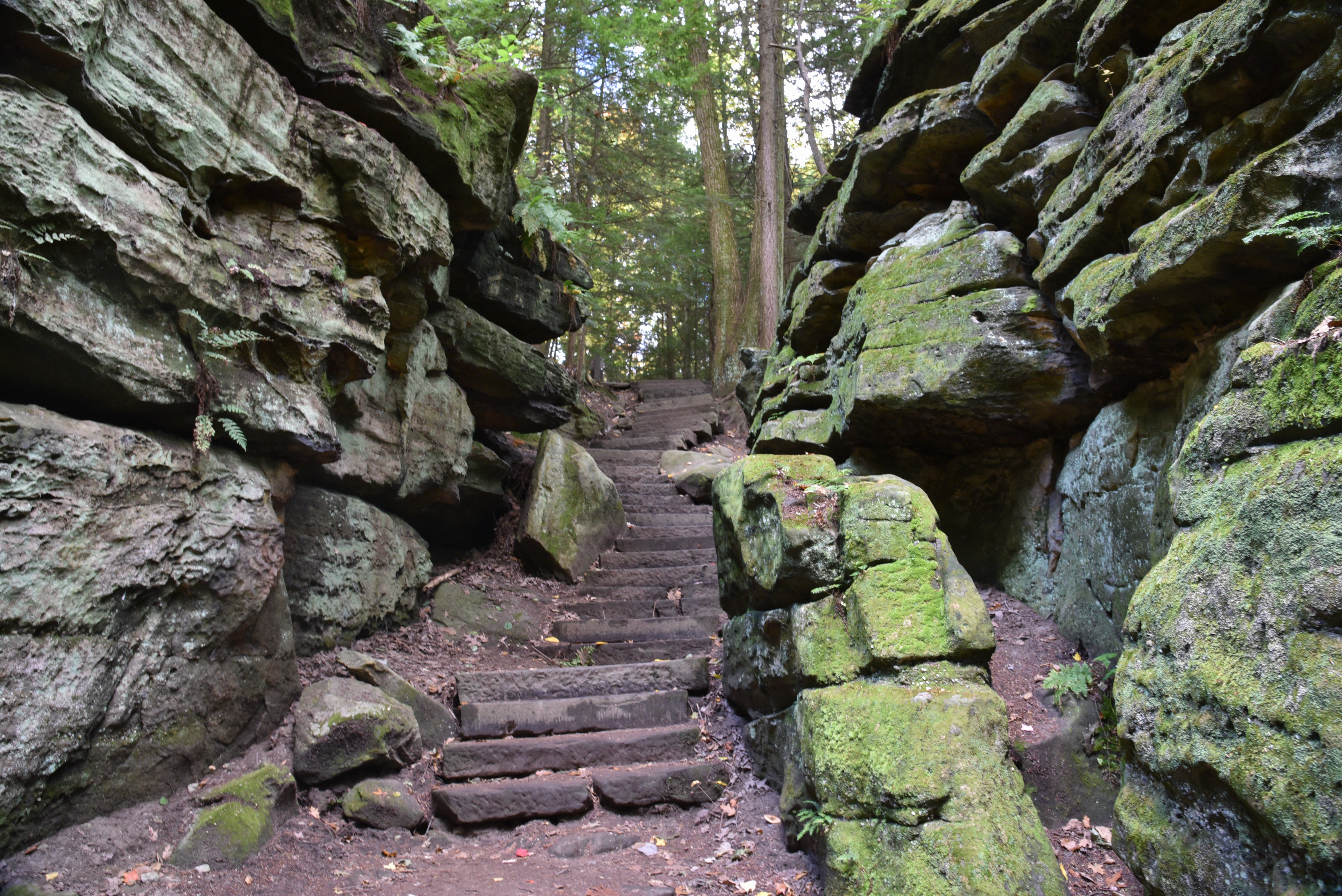
The Ledges Trail circles a plateau of striking rock formations and provides stunning views along the way. The trail is rocky and unpaved, with at least 80 feet of elevation change over its length. We recommend wearing sturdy walking shoes or boots, and being mindful of where you step. Be especially careful during the winter if the trail is icy or covered in snow. To protect this fragile habitat, the national park does not allow any climbing on the rock formations.
To begin, park at the Ledges Trailhead and consult the trail map on the bulletin board by the gate. The trail system is complex, so watch the signs. Follow the Ledges Trail to complete a 1.8-mile loop or use the network of connector trails to take a shorter hike. You can visit the Ledges Overlook along the trail, or you can walk there from the parking lot by crossing the wide, grassy playfield.
Alternate Routes
For a longer hike or a different approach, consider starting your hike from the nearby Pine Grove, Haskell Run, or Kendall Lake trailheads. Be sure to consult a map and plan ahead for these routes, as there are multiple options at trail intersections.
From Pine Grove Trailhead
Park at Pine Grove Trailhead , which is located near the southeast corner of the parking lot for the Octagon Shelter . There are restrooms and seasonally available water at the shelter. Follow either of two paths to the left and behind the kiosk to access the Ledges Trail.
From Haskell Run Trailhead
Park in the main lot for Happy Days Lodge . Follow the walkway through the tunnel under the road. Haskell Run Trailhead information is located near the corner of the accessible parking lot behind the lodge. Hike the Haskell Run Trail for a quarter mile, then follow signs to connect to the Ledges Trail.
From Kendall Lake Trailhead
For an even longer hike, park at Kendall Lake Trailhead . Public restrooms with running water are available on the lower level of the nearby Kendall Lake Shelter . Carefully cross the road to access a connector to the Pine Grove Trail. Then follow one of two additional connector trails to access the Ledges Trail. The total mileage of this hike will depend on the route taken. A roundtrip hike from here to the Ledges will be at least 3 miles and can be much longer.
Accessibility This trail is not wheelchair accessible. It is hilly with an unpaved surface that is rocky in places. Service animals and leashed comfort pets are welcome. Audio description is available for the exhibit panels along the trail.
ViewsPicnic areas
Along the way Ledges Ledges Overlook
Picnic areas
Along the way Brecksville
Picnic areasVisitor centers
Along the way Canal Visitor Center Boston Store Visitor Center Hunt House
Trailheads Botzum 746 ft Drive there · Ira 722 ft Drive there · Towhead Trail 614 ft Drive there
Trailhead Station Road Bridge 639 ft Drive there
Picnic areas
Along the way Oak Hill
1-2 Hours · dogs allowed
The Ledges Trail circles a plateau of striking rock formations and provides stunning views along the way. The trail is rocky and unpaved, with at least 80 feet of elevation change over its length. We recommend wearing sturdy walking shoes or boots, and being mindful of where you step. Be especially careful during the winter if the trail is icy or covered in snow. To protect this fragile habitat, the national park does not allow any climbing on the rock formations.
To begin, park at the Ledges Trailhead and consult the trail map on the bulletin board by the gate. The trail system is complex, so watch the signs. Follow the Ledges Trail to complete a 1.8-mile loop or use the network of connector trails to take a shorter hike. You can visit the Ledges Overlook along the trail, or you can walk there from the parking lot by crossing the wide, grassy playfield.
Alternate Routes
For a longer hike or a different approach, consider starting your hike from the nearby Pine Grove, Haskell Run, or Kendall Lake trailheads. Be sure to consult a map and plan ahead for these routes, as there are multiple options at trail intersections.
From Pine Grove Trailhead
Park at Pine Grove Trailhead , which is located near the southeast corner of the parking lot for the Octagon Shelter . There are restrooms and seasonally available water at the shelter. Follow either of two paths to the left and behind the kiosk to access the Ledges Trail.
From Haskell Run Trailhead
Park in the main lot for Happy Days Lodge . Follow the walkway through the tunnel under the road. Haskell Run Trailhead information is located near the corner of the accessible parking lot behind the lodge. Hike the Haskell Run Trail for a quarter mile, then follow signs to connect to the Ledges Trail.
From Kendall Lake Trailhead
For an even longer hike, park at Kendall Lake Trailhead . Public restrooms with running water are available on the lower level of the nearby Kendall Lake Shelter . Carefully cross the road to access a connector to the Pine Grove Trail. Then follow one of two additional connector trails to access the Ledges Trail. The total mileage of this hike will depend on the route taken. A roundtrip hike from here to the Ledges will be at least 3 miles and can be much longer.
Accessibility This trail is not wheelchair accessible. It is hilly with an unpaved surface that is rocky in places. Service animals and leashed comfort pets are welcome. Audio description is available for the exhibit panels along the trail.
Trailhead Frazee House 624 ft Drive there
Trailhead Station Road Bridge 639 ft Drive there
Visitor centers
Along the way Hunt House
Trailhead Wetmore 877 ft Drive there
dogs allowed · Spring
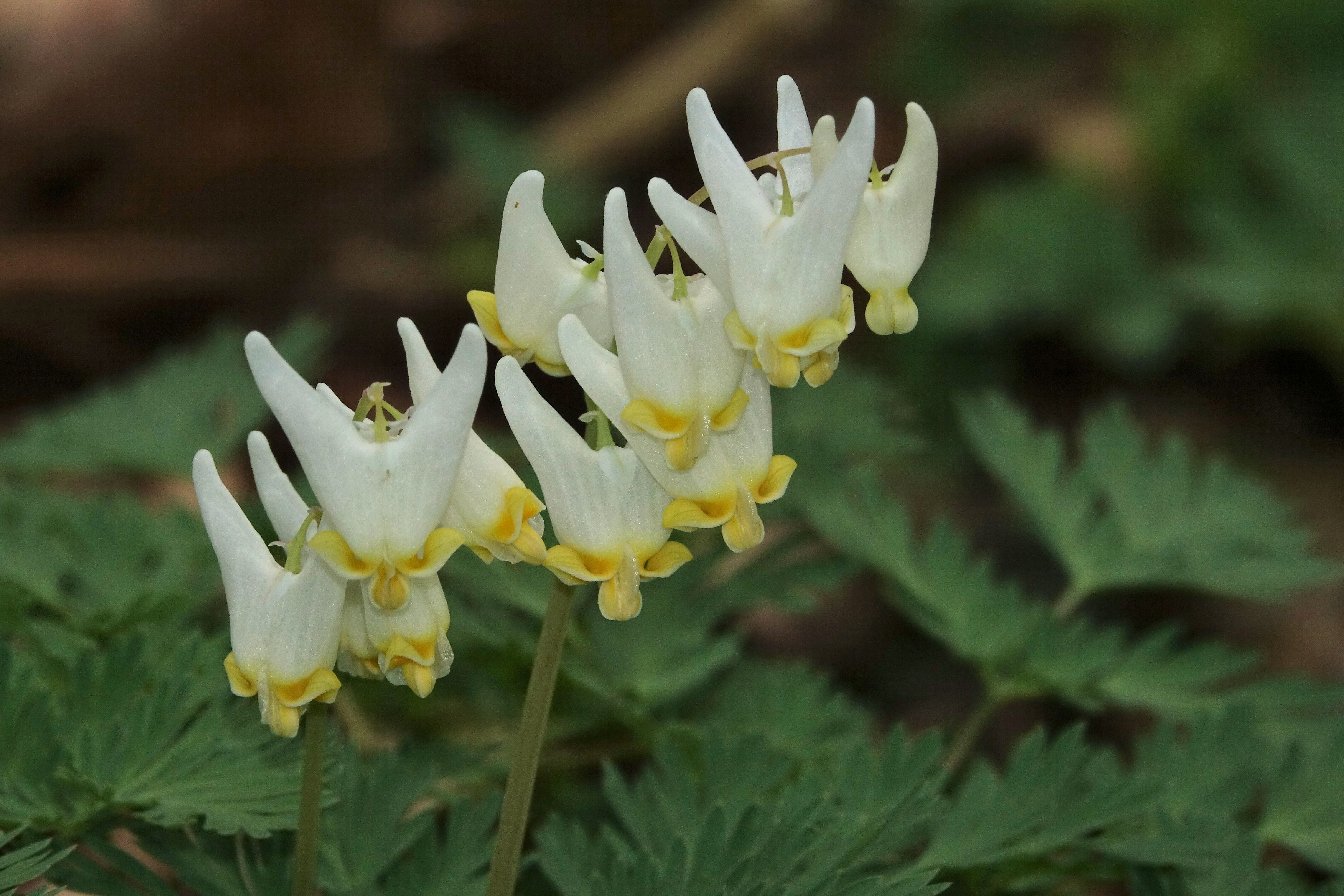
Native spring wildflowers are often called “spring ephemerals” because they appear for such a short time. They must grow and reproduce while temperatures are warm and sunlight can reach the forest floor.
The first to arrive is the skunk cabbage which prefers soggy areas fed by groundwater. Starting in mid-February, look for them near the Ira Trailhead at Beaver Marsh and along the Haskell Run Trail near the Ledges. Their fleshy flowers produce enough heat for them to survive the last of winter.
The next early wildflowers may begin appearing at the end of March, once snow is no longer on the ground. By mid-April, a variety are up and attracting insects for pollination. The blooming frenzy continues through mid-May, until the trees leaf out and cast too much shade. The exact timing of nature’s show varies year-to-year with Northeast Ohio’s notoriously unpredictable weather. It is also impacted by climate change. Once things start, the sequence of wildflowers is fairly predictable.
Coltsfoot (a nonnative which resembles a dandelion), harbinger-of-spring , and spring beauty are often the first bloomers. They are joined shortly by cut-leaved toothwort and bloodroot . Soon large-flowered trillium overshadows them, and squirrel corn and Dutchman’s breeches arrive. Jack-in-the-pulpit begins hiding in his flower, while wild geranium nods nearby. The season’s showstopper is Virginia bluebells which forms a blue carpet along certain streams.
The Stanford Trail blooms early, starting with daffodils which are lovely but nonnative. Bloodroot, trillium, and toothwort pop up a bit later. Look for them closer to the Brandywine Gorge Loop .
The Brandywine Gorge Loop is lovely year-round, but spring showcases a variety of flowers. You may find Dutchman’s breeches, various types of trillium, and mayapples. In mid-spring, we also recommend the 0.8-mile Daffodil Trail in Furnace Run Metro Park and the 1.9-mile Spring Hollow Trail in Hampton Hills Metro Park .
Starting in late April, people flock to the Furnace Run Trail near Everett Covered Bridge to see the Virginia bluebells. Another popular spot is the Hemlock Creek Picnic Area at Bedford Reservation.
To get away from the late-season crowds, consider the Plateau Trail at Oak Hill Trailhead . In May, Jack-in-the-pulpit and wild geranium dot the woodlands.
Here are our ranger tips for wildflower viewing:
Some flowers do not open or open fully on rainy or overcast days. Pick a sunny day to look for wildflowers.
Early morning and late afternoon are the best times for wildflower photography. The less wind the better.
Stay on the trail.
Keep pets on a six-foot leash and on the trail.
Above all, do not pick or trample the flowers. Some take years to bloom.
Accessibility The recommended trails are unpaved and often muddy in spring. The Stanford, Brandywine Falls, and Ledges areas have steep hills. The Plateau Trail has rolling hills. The section of Furnace Run Trail by Everett Covered Bridge is flat, as is the Towpath Trail at Beaver Marsh. More detailed information is on our hiking page . Service and comfort animals which follow our behavioral guidelines are welcome on park trails.
dogs allowed · Fall
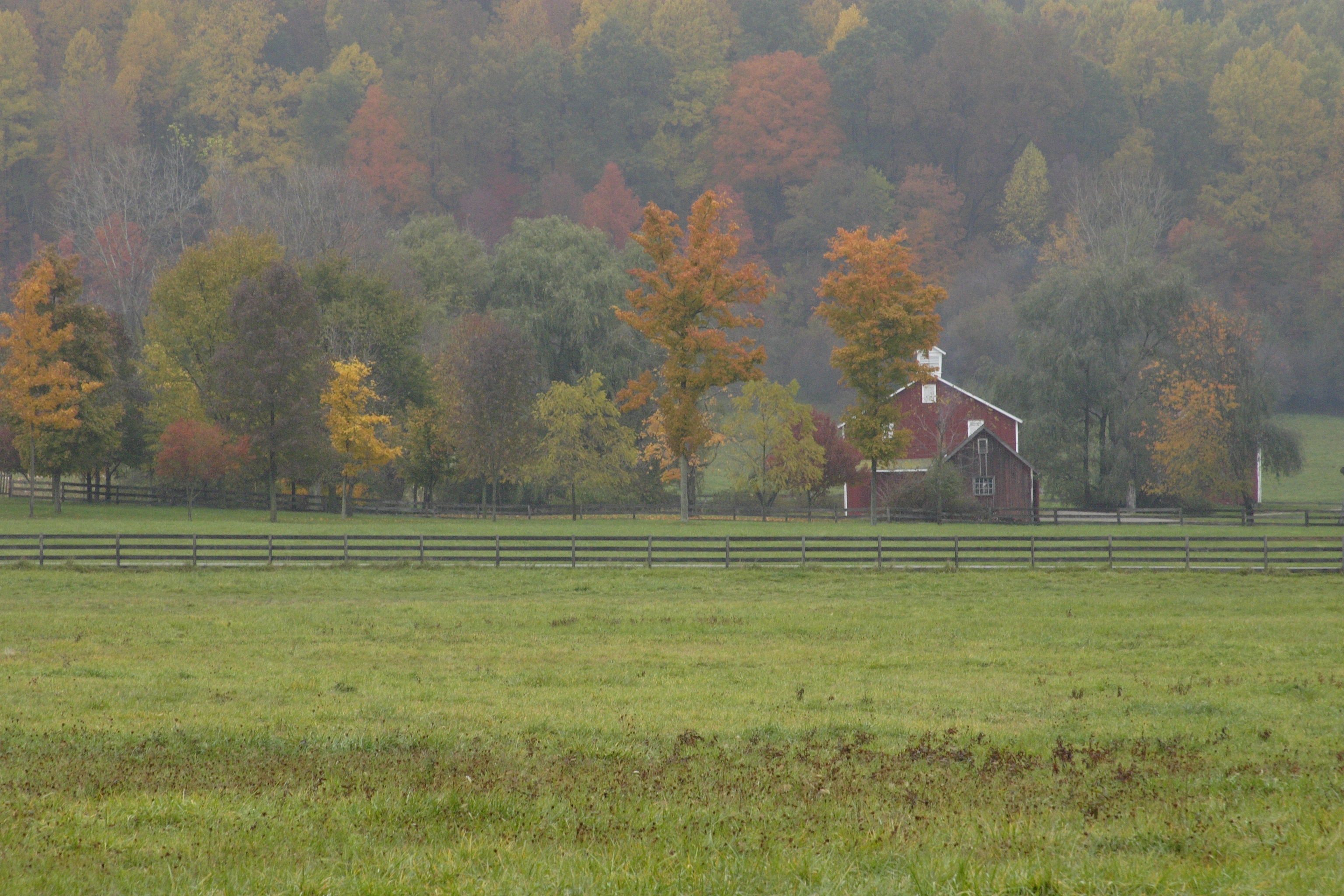
Leaf peeping fans, here are our tips on where to look for the best fall colors in Cuyahoga Valley. Peak color is usually during the third week of October. The timing is mostly tied to the decrease in daylight hours as winter nears. This makes it fairly consistent year to year. Weather is a factor too. Trees under stress from severe drought or other issues will shed their leaves early. Colors are most vivid when we have warm, sunny days and cool, frost-free nights. Cloudy days and too much rain can dull them. Different broad-leaf trees peak at different times, so it is possible to experience splendid autumn foliage the entire month.
The sugar and red maples are usually the first to display spectacular reds, yellows, and oranges. They are followed by the white and pin oak becoming a brownish red. Black gum, dogwood, and northern red oak turn various shades of red. Tulip tree, bigtooth aspen, silver maple, and black maple change to yellow.
Avoid the Crowds
We often see a rise in visitation during the fall leaf-peeping season. Many of our parking lots fill up around midday on warm, sunny weekends. Avoid the crowd by coming on weekdays, in the mornings, or later in the day.
Early October
Walk the inner loop of the Oak Hill Trail . There you can see the magnificent reds of the maple, glowing oranges of the sassafras, and striking yellows of the white ash and big tooth aspen. This trail is especially scenic in the early morning when the large trees in the open fields and by Sylvan Pond become sunlit.
Mid October
Experience the full autumn spectrum at Brandywine Falls and along the Brandywine Gorge Trail. Colors range from the brilliant reds of the sugar maples to the deep browns of the white oaks. This area is ideal for photography in the late afternoon.
Late October
Head to the Ledges area trails in Virginia Kendall. These are great places to experience the late turning oaks. Also look for the yellows of hazelnut and witch hazel. Both trees peak late because they grow low in the dense forest. Ledges Overlook offers a view of the changing colors across the Cuyahoga Valley.
Other popular places to view and photograph fall colors are Everett Covered Bridge , Hale Farm & Village , Horseshoe Pond, Kendall Lake , Kendall Hills , and Blue Hen Falls.
Accessibility If you have limited mobility, here are our top tips. Photograph Kendall Hills from Pine Hollow Trailhead and Hale Farm & Village from the entrance drive. View Horseshoe Pond and Kendall Lake from their fishing piers; each one is near the trailhead. The upper boardwalk at Brandywine Falls and the Everett Covered Bridge are both wheelchair accessible. See Short Towpath Trail Walks for information about the Beaver Marsh, and Station Road Bridge areas. For other trail information, visit the linked Places pages. Service animals and leashed comfort animals are always welcome.
30-60 Minutes · dogs allowed
Start Starting Trailheads
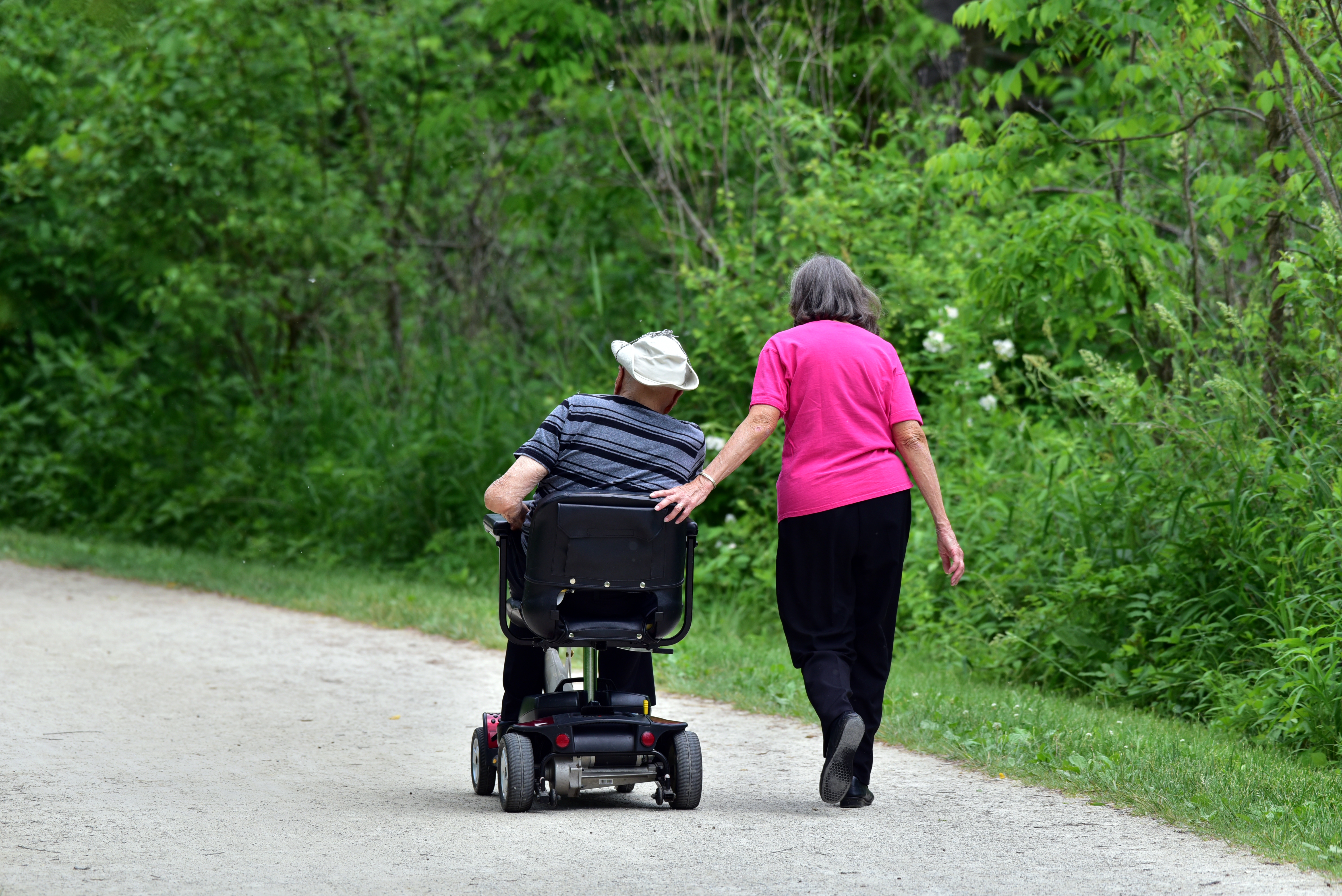
The Towpath Trail is beloved in Northeast Ohio. People use it for walking, running, biking, wildlife watching, cross-country skiing, and—in a few spots—horseback riding. It is about 100 miles long, with about 20 miles of those in the national park. Here we are recommending several short walks for those who have mobility disabilities, are visiting with children, or have limited time. These highlights include Ira Trailhead to Beaver Marsh, Station Road Bridge to Mudcatcher, and Canal Exploration Center to Tinkers Creek Aqueduct. The Towpath Trail offers you the opportunity to hike at your own pace and distance. You can visit these locations all in one day or spread the walks out over multiple visits. You’ll find more detailed information, including a list of amenities, at the links to each trailhead.
Canal Exploration Center to Tinkers Creek Aqueduct
Stroll through history in the northern part of Cuyahoga Valley. Begin at Canal Exploration Center , open seasonally . The trailhead has an information kiosk with park maps, picnic tables, and restrooms. Follow the walkway to the historic white building beside the reconstructed Lock 38 . Outdoor exhibits explain how a canal lock worked and the businesses that served waiting boat passengers. Take a photo with Blossom (the bronze mule) and continue south on the Towpath Trail. Tinkers Creek Aqueduct is a natural place to turn around. There are benches along the way. The roundtrip is 1 mile. Extend the walk to 3 miles by turning around at Wilson/Alexander Mill , with Frazee House just beyond there.
Station Road Bridge to Mudcatcher
This walk combines scenic views of the Cuyahoga River with transportation history and opportunities to see wildlife. Begin at the information kiosk at Station Road Bridge Trailhead . There are restrooms, benches, and drinking water at the nearby Brecksville Station . A cluster of exhibits celebrates the recovery of the Cuyahoga River. These include a tactile eagle and fish as well as an audio station and a heron statue. The view from Station Road Bridge is a favorite with photographers. Continue along the connector to the Towpath Trail and turn left. Take the first left to see where two dams were removed in 2020. Continue north until the path rejoins the main trail. Just beyond the Lock 36 panel is the Mudcatcher panel. During the nesting season, continue a little farther to see the valley’s first eagle nest. At the start of the open field, look left to spy a huge bundle of sticks high in a tree across the river. Turn around here and return along the Towpath to the trailhead. This loop is about 1.5 miles.
Boston Store Trailhead to Lock 32
This short walk explores Boston’s history as a canal town. The Boston Store Trailhead offers handicap and limited mobility parking. (Other visitors need to park at Boston Trailhead .) Both lots have bulletin boards with information and park maps. There is drinking water at the restrooms behind the historic store. Shopping and refreshments are inside. Seating is available on the wraparound porch. The Towpath Trail runs beside the building. Cross the road to explore exhibits about canal boat building, including a small play boat for children. Walk north until you reach Lock 32 and its tactile panel. At the far end, look for wildlife in the wetlands which have formed in the old canal. Double back for a roundtrip of 0.2 miles. This walk can be combined with a stop at nearby Boston Mill Visitor Center, open daily .
Lock 29 to Peninsula Feeder
Start at the Lock 29 Trailhead parking lot. Accessible restrooms are on the east end by the railroad tracks. An information kiosk is on the west end with the historic canal lock just beyond. Walk inside to explore the tactile exhibits. The Towpath Trail crosses over Lock 29 and the Cuyahoga River. Note that the ramp to the upper level has a steeper (but wheelchair accessible) grade. Be alert for bike traffic. Views from the pedestrian bridge are lovely and there is another graphic panel on the far side at the Moody and Thomas Mill ruins. Turn around and head north to Lock 30 and the Peninsula Feeder to further explore river and canal history. From Lock 29 Trailhead to Peninsula Feeder and back is 1.5 miles. This area can be congested around midday on warm weekends.
Hunt House to Lock 27
Start at Hunt House Trailhead which offers seating and park maps at the information kiosk. Cross the road to the small visitor center with seasonal hours . Hunt House offers an area to picnic, restrooms with flush toilets, and outdoor tactile and audio exhibits about growing up in the village of Everett. Walk a short distance north on the Towpath Trail to Lock 27 to learn more about canal history and village life. From Hunt House Trailhead to Lock 27 and back is .5 miles.
Ira Trailhead to the Beaver Marsh
Park at Ira Trailhead and pick up a map at the bulletin board, if needed. The trailhead offers a picnic area, restroom access, and tactile wildlife exhibits. Follow the short connecting path to the Towpath Trail and turn left. Wildlife is common in the old canal to your left, now part of a larger wetland. Head north for 0.25 miles to reach the boardwalk. The viewing platforms have several benches and more tactile exhibits. Beaver Marsh is popular throughout the year. The best time of day to visit is mornings or evenings when wildlife is most active. Turn around at the boardwalk, or walk a little farther north to the graphic panel and bench overlooking the Cuyahoga River.
Accessibility The Towpath Trail is wheelchair accessible, except during certain weather conditions. The park does not clear trails of snow and ice. Certain spots flood or become muddy after heavy rains, especially in the spring. Within the national park, the surface is mostly compacted crushed limestone. There are short paved sections and several wooden boardwalks and footbridges. Service animals and leashed comfort pets are welcome. The Towpath Trail has a few stone benches. See our Physical/Mobility disabilities page for information about Other Power Driven Mobility Devices. See our Blindness/Low Vision page for a list of audio described locations and tactile exhibits. Note that the Towpath Trail is a multi-use trail shared by people who are walking, running, bicycling, and (in some places) horsebacking riding. For your safety, follow the Towpath guidelines.
Visitor centers
Along the way Boston Store Visitor Center
The lines are the National Park Service's public trails layer, the trailheads and the waterfalls, views, peaks and historic places along them the Service's public points of interest, read 2026-10-14 and simplified for the map. The write-ups are the Service's own "things to do", unedited. Heights come from USGS 3DEP through Terrain Tiles on AWS (Mapzen/Tilezen), read along each line and rounded; a short trail on steep ground can be off by a few tens of feet. Closures change: check the park's own site before you go.