Alcove Nature Trail
Exhibits
Along the way Alcove Nature Trail Wayside Exhibit Lower Black Ridge Trailhead Wayside Exhibit
Trailhead Black Ridge / Alcove Nature Trailhead 5,793 ft Drive there

National Monument · Colorado
22 named trails · 43 miles · 21 trailheads · 3 with the Park Service's own write-up. The lines, trailheads and points are the Park Service's; the write-ups are the Service's own words; the climbing is read from USGS elevation along each line.
22 trails, A to Z.
Exhibits
Along the way Alcove Nature Trail Wayside Exhibit Lower Black Ridge Trailhead Wayside Exhibit
Trailhead Black Ridge / Alcove Nature Trailhead 5,793 ft Drive there
SheltersExhibits
Along the way Alcove Nature Trail Wayside Exhibit Lower Black Ridge Trailhead Wayside Exhibit Upper Black Ridge Trailhead Wayside Exhibit Visitor Center Picnic Shelter
Trailheads Black Ridge / Alcove Nature Trailhead 5,793 ft Drive there · Canyon Rim Trailhead 5,785 ft Drive there · East Black Ridge Trailhead 6,516 ft Drive there
1-8 Hours · no dogs · Spring, Summer, Fall
Start Saddlehorn Visitor Center
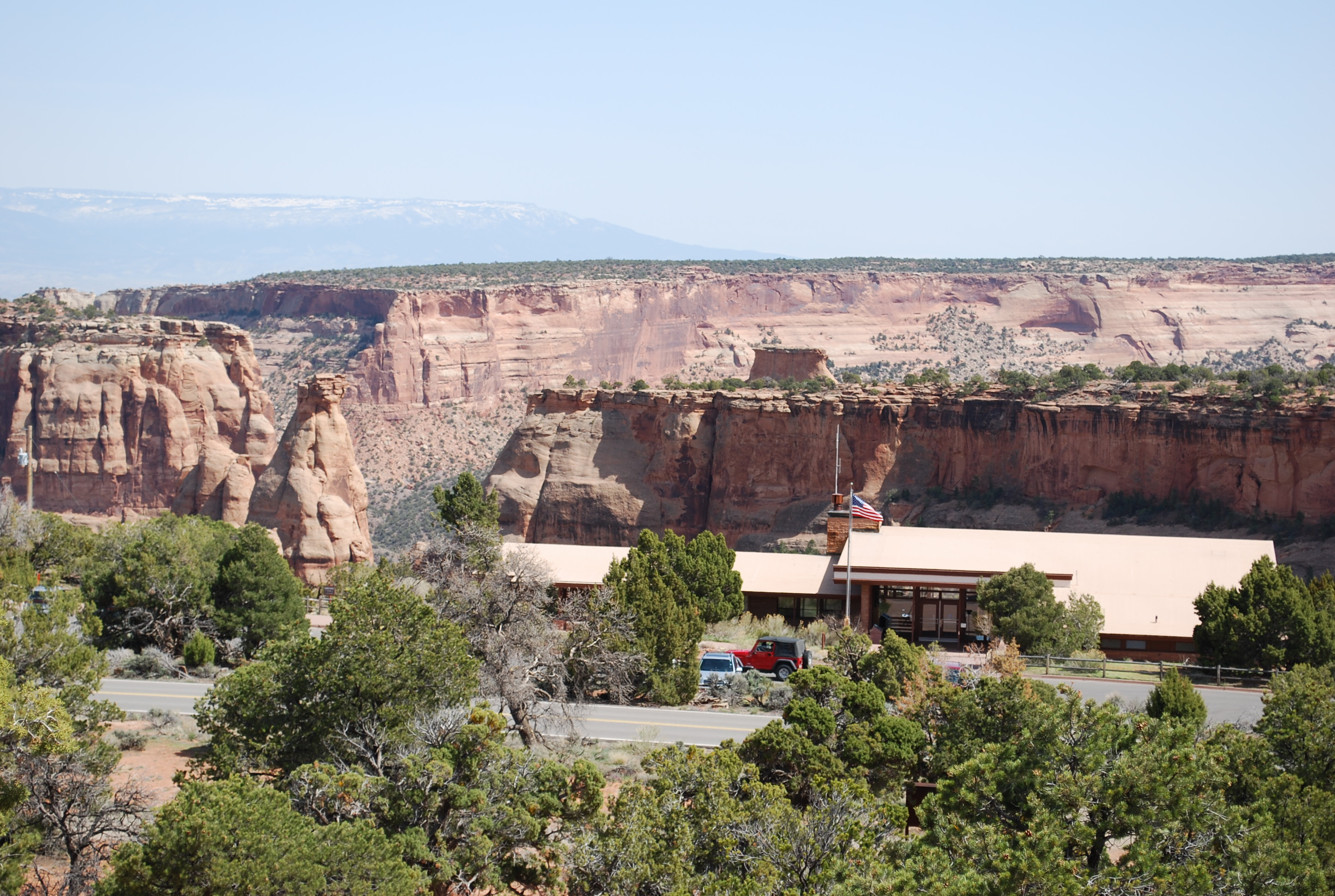
Saddlehorn Visitor Center is where most people begin their excursion to Colorado National Monument. There are a handful of great trails, short and long, that begin here. The 18-minute park film, exhibit hall, and bookstore are all located in the visitor center. Check out the What To See tab in the app to choose between Short Hiking Trails and Longer Hiking Trails and see descriptions of each.
Stay hydrated by drinking water at least every half hour, and wear plenty of sunscreen. Hats and sunglasses are highly recommended. Practice Leave No Trace principles by staying on the main trail, ensuring your trash gets taken with you and is stored securely, and taking only pictures and memories. It is illegal to approach wildlife, so admire lizards, desert bighorn sheep, and other critters from a distance.
Short Hiking Trails
These easy trails will give you a good first taste of what the Monument has to offer.
Alcove Nature Trail
Location: Directly across Rim Rock Drive from the Saddlehorn Visitor Center
Mileage: 0.5 one way (0.8 km) one-way
Difficulty Level: Easy (mostly level)
Elevation of trail (not elevation gain): 5,800 feet (1768 meters)
Average time: 1/2 hour
Usage: Hiking only. Horses prohibited.
Description: Level trail that travels to an alcove in a box canyon. Detailed trail guides are available at the trailhead and the visitor center. A good introduction to some of the plants, animals, and rocks of the monument. Great for families with small children.
Canyon Rim Trail
Location: Starts behind the Saddlehorn Visitor Center and ends at Book Cliffs View.
Mileage: 0.5 one way (0.8 km)
Difficulty Level: Easy
Elevation of trail (not elevation gain): 5,626 feet (1715 meters)
Average time: 1/2 hour
Usage: Hiking only. Horses prohibited.
Description: Level trail following the cliff edge above colorful Wedding Canyon. Outstanding views make this a favorite for landscape and wildlife photographers. Check out the Canyon Rim and Window Rock Trail brochure . You can connect to Window Rock Trail from Canyon Rim at the Bookcliff Shelter. Adding this extension to your hike adds another quarter mile to your one-way distance.
Longer Hiking Trail
The Black Ridge Trail is great for a longer day hike or an overnight in the backcountry. It climbs up from the same trailhead as the Alcove Nature Trail, but once you're on the ridge it's mostly rolling hills. Ask for a free backcountry permit for overnight camping from a ranger in the visitor center.
Black Ridge Trail
Location: Three access points: (1) across from the Saddlehorn Visitor Center in the north, (2) accessed by the CCC Trail 3.8 miles (6.1 km) east from the visitor center - trailhead on the right, (3) and at 6.4 miles (10.3 km) east from the visitor center - trailhead on the left; you can also access Liberty Cap Trail from this trailhead.
Mileage: 5.5 one way (8.8 km)
Difficulty Level: Moderate
Elevation: 5,790 to 6,730 feet (1765 to 2051 meters)
Average time: 3 hours
Usage: Hiking and horseback riding.
Description: Highest trail in the park with far-reaching views west to Utah canyonlands, east to Grand Valley, and south to the San Juan Mountains. Follows up-and-down terrain of Black Ridge. Trail crosses into McInnis Canyons National Conservation Area (Bureau of Land Management lands).
Pets Pets are not allowed on any trail in the Monument. Do not leave pets in a car - even with the windows down, it gets too hot. Service animals are welcome in any building and on any trail. However, Black Ridge Trail is steep and not recommended for service animals.
Accessibility The visitor center has accessible front and back doors with an automatic door button located ahead of the doorway, inside and outside of both front and back doors. The visitor center has accessible restrooms and an accessible picnic table, both located to the right of the main entryway doors. The restroom doors are not automatic and push inward from the outside - they require pulling from inside the restroom in order to exit the restroom. The picnic table is covered and located through the outdoor hallway that passes the doors to the restrooms. The picnic table is square and has a bench on three sides, with one open side for wheelchair use. If you're curious, you can review our facility measurements . A handful of photos are available on our Accessibility webpage . At the Visitor Center, videos are open-captioned, and an induction loop is provided for users of hearing aids. For those without T-coil enabled hearing aids assisted listening devices are available at the front desk. An audio description tour of the exhibits is also available. Handheld tour devices are available at the entryway to the exhibit hall on the right side, about halfway up the wall. Ask a ranger for assistance if desired. Across Rim Rock Drive from the Visitor Center is the Alcove Nature Trail. The first 1/4 mile has a firm natural trail tread surface 5 feet wide with a average running slope of 7%. This is the most accessible trail in the Monument as of 2022.
20-60 Minutes · no dogs · entrance fee applies
Start Saddlehorn Visitor Center
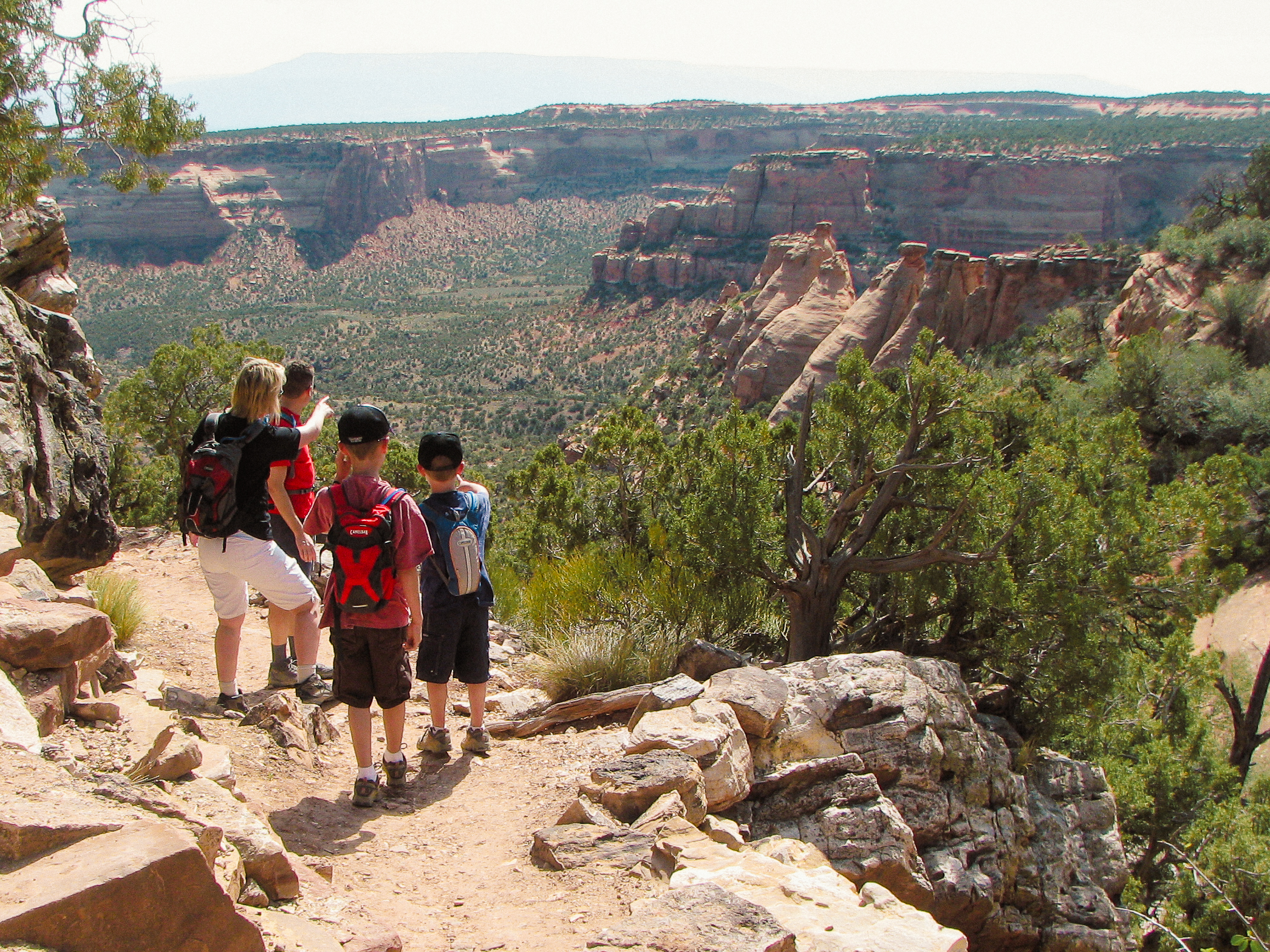
These out-and-back short hiking trails start from along scenic Rim Rock Drive in Colorado National Monument. All are less than two miles round-trip, perfect for short treks from the car to get better views of these outstanding canyons.
Canyon Rim, Alcove Nature, and Window Rock Trails
Starting at Saddlehorn Visitor Center , Canyon Rim Trail and Alcove Nature Trail introduce you to the landscapes and ecosystems of the monument. Window Rock Trail can connect from Canyon Rim Trail at the Book Cliff Shelter, or from the trailhead on the north side of Saddlehorn Campground Loop C.
Otto's Trail
A mile east of the visitor center, Otto's Trail takes you to the end of a peninsula into the canyons, and you're surrounded on three sides by the panorama of Wedding and Monument Canyons.
Coke Ovens Trail
At the Upper Monument Canyon trailhead, you also access Coke Ovens Trail , which descends from the road part-way down into the canyon and leads you to the top of the southernmost "Coke Oven" rock formation.
Pets Pets are not allowed on any trails in the monument. Service animals are welcome.
Accessibility Only the first quarter mile of Alcove Nature Trail is considered an accessible trail. It is unpaved, but the tread is compacted, decomposed gravel. Other short hikes in the monument might still require stone steps, uneven terrain, and close proximity to steep canyon drop-offs.
Views
Along the way Monument Canyon
Trailhead C.C.C. Trailhead 6,144 ft Drive there
SheltersExhibitsPicnic areasVisitor centers
Along the way Alcove Nature Trail Wayside Exhibit Lower Black Ridge Trailhead Wayside Exhibit Visitor Center Picnic Area Book Cliffs View Shelter Visitor Center Picnic Shelter Visitor Center
Trailheads Black Ridge / Alcove Nature Trailhead 5,793 ft Drive there · Canyon Rim Trailhead 5,785 ft Drive there · Window Rock Trailhead 5,711 ft Drive there
Trailhead Coke Ovens Trailhead 6,130 ft Drive there
Exhibits
Along the way Lower No Thoroughfare Canyon Trailhead Wayside Exhibit
Trailheads Devils Kitchen Trailhead 5,043 ft Drive there · Devils Kitchen Trailhead 5,051 ft Drive there · Echo Canyon Trailhead 5,051 ft Drive there · No Thoroughfare Trailhead 5,051 ft Drive there · Old Gordon Trailhead 5,051 ft Drive there
1-8 Hours · no dogs
Start Devils Kitchen Picnic Area
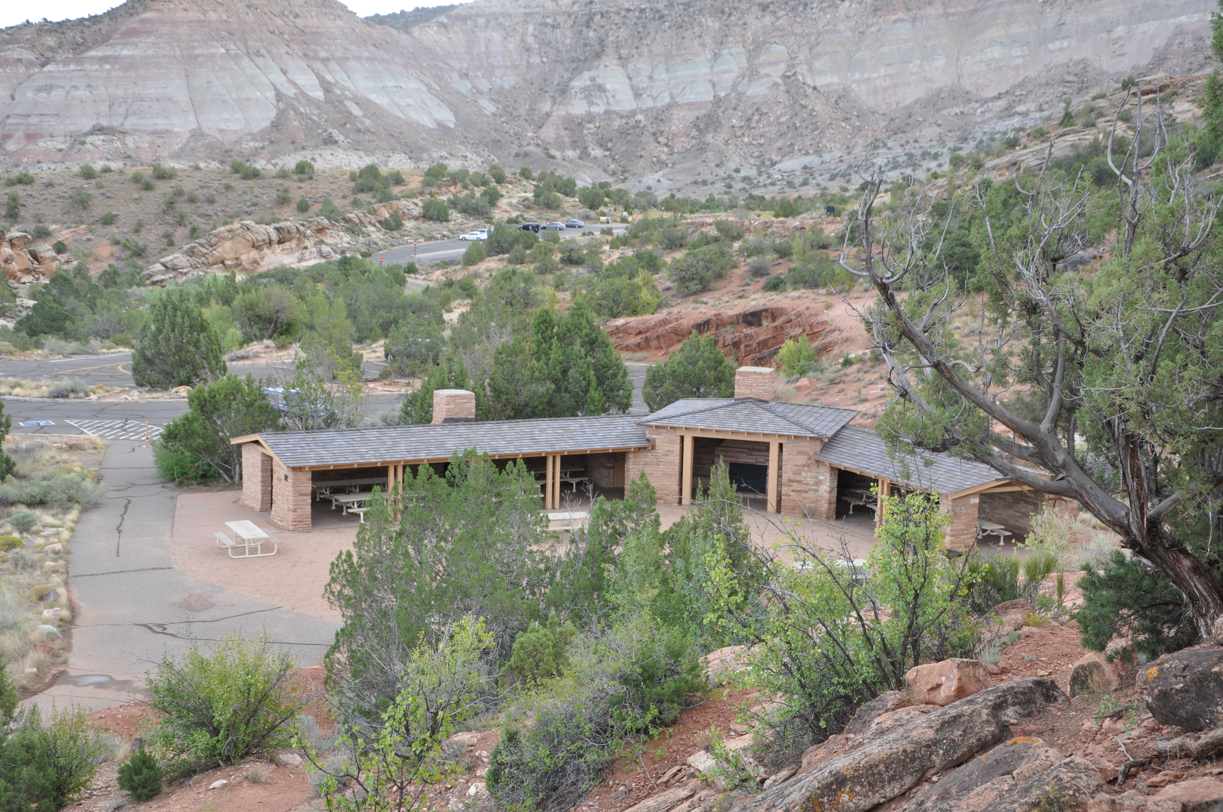
You can access many amazing hiking trails from Devils Kitchen Picnic Area. This area is just inside the Monument from the East Entrance, closest to the city of Grand Junction. There's a parking area on the east side of the road that often fills up quickly. More parking is available on the west side of the road at the Picnic Area. Check out the What To See tab in the app to choose between Short Hiking Trails and Longer Hiking Trails and see descriptions of each.
Stay hydrated by drinking water at least every half hour, and wear plenty of sunscreen. Hats and sunglasses are highly recommended. Practice Leave No Trace principles by staying on the main trail, ensuring your trash gets taken with you and is stored securely, and taking only pictures and memories. It is illegal to approach wildlife, so admire lizards, desert bighorn sheep, and other critters from a distance.
Shorter Hiking Trails
Devils Kitchen Trail
Location: From the east entrance, travel 0.2 miles (0.3 km). Limited parking is on the left. For additional parking, turn right into the Devils Kitchen Picnic Area. The trailhead is shared with two other trails: No Thoroughfare Canyon Trail and Old Gordon Trail. Serpents Trail access is across the road.
Mileage: 0.75 one way (1.2 km)
Difficulty Level: Moderate
Elevation: 4,990 to 5,060 feet (1521 to 1542 meters)
Average time: 1 hour
Usage: Hiking and horseback riding.
Description: Gradual ascent to a natural opening formed by a circle by huge upright boulders. At the first fork, go right. At the second fork, go left. Follow the trail across the wash. As you proceed up the canyon, you will see the large rock grotto that is Devils Kitchen. Keep on the established trail and follow the carved steps up the slickrock. As you approach the base of the rock formation, go left around it and hike into the rock opening.
Serpents Trail
Location: From the east entrance, travel 0.2 miles (0.3 km). Limited parking is on the left. For additional parking, turn right into the Devils Kitchen Picnic Area.
Mileage: 1.75 one way (2.8 km)
Difficulty Level: Steep
Elevation: 5,060 to 5,760 feet (1542 to 1756 meters)
Average time: 2 hours
Usage: Hiking only. Horses prohibited.
Description: Called "the crookedest road in the world," this historic trail has 16 switchbacks. The trail climbs steadily from east to west through Wingate Sandstone. Built in the early 1900s, this route was part of the main road until 1950.
Echo Canyon Trail
Location: From the east entrance, travel 0.2 miles (0.3 km). Limited parking is on the left. For additional parking, turn right into the Devils Kitchen Picnic Area. This trail starts out as the Old Gordon Trail, at the same trailhead as No Thoroughfare and Devils Kitchen.
Mileage: 1.5 one way (2.8 km)
Difficulty Level: Easy
Elevation: 4,990 to 5,060 feet (1521 to 1542 meters)
Average time: 2 hours
Usage: Hiking only. Horses prohibited.
Description: Follow Old Gordon Trail for 0.5 miles to a signed junction directing hikers down the slickrock into Echo Canyon. This canyon's shady interior offers an escape from the relentless midsummer heat and ends at a pool beneath towering cottonwood trees.
Longer Hiking Trails
Old Gordon Trail
Location: From the east entrance, travel 0.2 miles (0.3 km). Limited parking is on the left. For additional parking, turn right into the Devils Kitchen Picnic Area. The trailhead is shared with two other trails: No Thoroughfare Canyon Trail and Devils Kitchen Trail.
Mileage: 4.0 one way (6.4 km)
Difficulty Level: Easy
Elevation: 4,980 to 6,620 feet (1518 to 2018 meters)
Average time: 2 1/2 hours
Usage: Hiking and horseback riding.
Description: Steadily ascending trail that follows the path of a historic lumber and cattle drive road. The park's geologic story is told almost in its entirety through the layers of rock exposed along this mostly undeveloped route. Enjoy the great variety of cacti blooming in the spring.
No Thoroughfare Canyon Trail
Location: From the east entrance, travel 0.2 miles (0.3 km). Limited parking is on the left. For additional parking, turn right into the Devils Kitchen Picnic Area. The trailhead is shared with two other trails: Old Gordon Trail and Devils Kitchen Trail.
Mileage: 8.5 one way (13.7 km)
Difficulty Level: Moderate to strenuous
Elevation: 5,000 to 6,820 feet (1524 to 2079 meters)
Average time: Full day
Usage: Hiking only. Horses prohibited.
Description (from lower trailhead): Enjoy a moderately easy hike along the canyon wash for 1 mile to the First Pool, sometimes dry by mid summer. Continue for another 0.8 miles to the First Waterfall, also often dry by summertime. Canyon walls rise over 400 feet around you. If you decide to hike the entire canyon, take a compass and topographic map. The trail is unmaintained beyond the second waterfall. Isolated. Primitive. Most hikers do not attempt the entire route. Check the weather as flash floods pose an imminent danger.
Pets Pets are not allowed on any trail in the Monument. Do not leave pets in a car - even with the windows down, it gets too hot. Service animals are welcome in any building and on any trail. However, Black Ridge Trail is steep and not recommended for service animals.
Accessibility Devils Kitchen Picnic Area has accessible restrooms and picnic tables. None of the trails in this area are considered accessible, due to uneven terrain and/or steepness. Service animals are welcome on all trails but not recommended on Serpents Trail due to its steepness.
Trailhead Echo Canyon Trailhead 5,051 ft Drive there
Exhibits
Along the way Upper Liberty Cap Trailhead Wayside Exhibit Wildwood Trailhead Wayside Exhibit
Trailheads Upper Liberty Cap Trailhead 6,510 ft Drive there · Wildwood Trailhead 4,776 ft Drive there
ViewsExhibits
Along the way Lower Monument Trailhead Wayside Exhibit Upper Monument Canyon Trailhead Wayside Exhibit Monument Canyon
Trailheads Coke Ovens Trailhead 6,130 ft Drive there · Lower Monument Canyon Trailhead 4,720 ft Drive there · Monument Canyon Trailhead 6,133 ft Drive there
4-6 Hours · no dogs
Start Lower Monument Canyon Trailhead
Monument-Wedding Canyons Loop
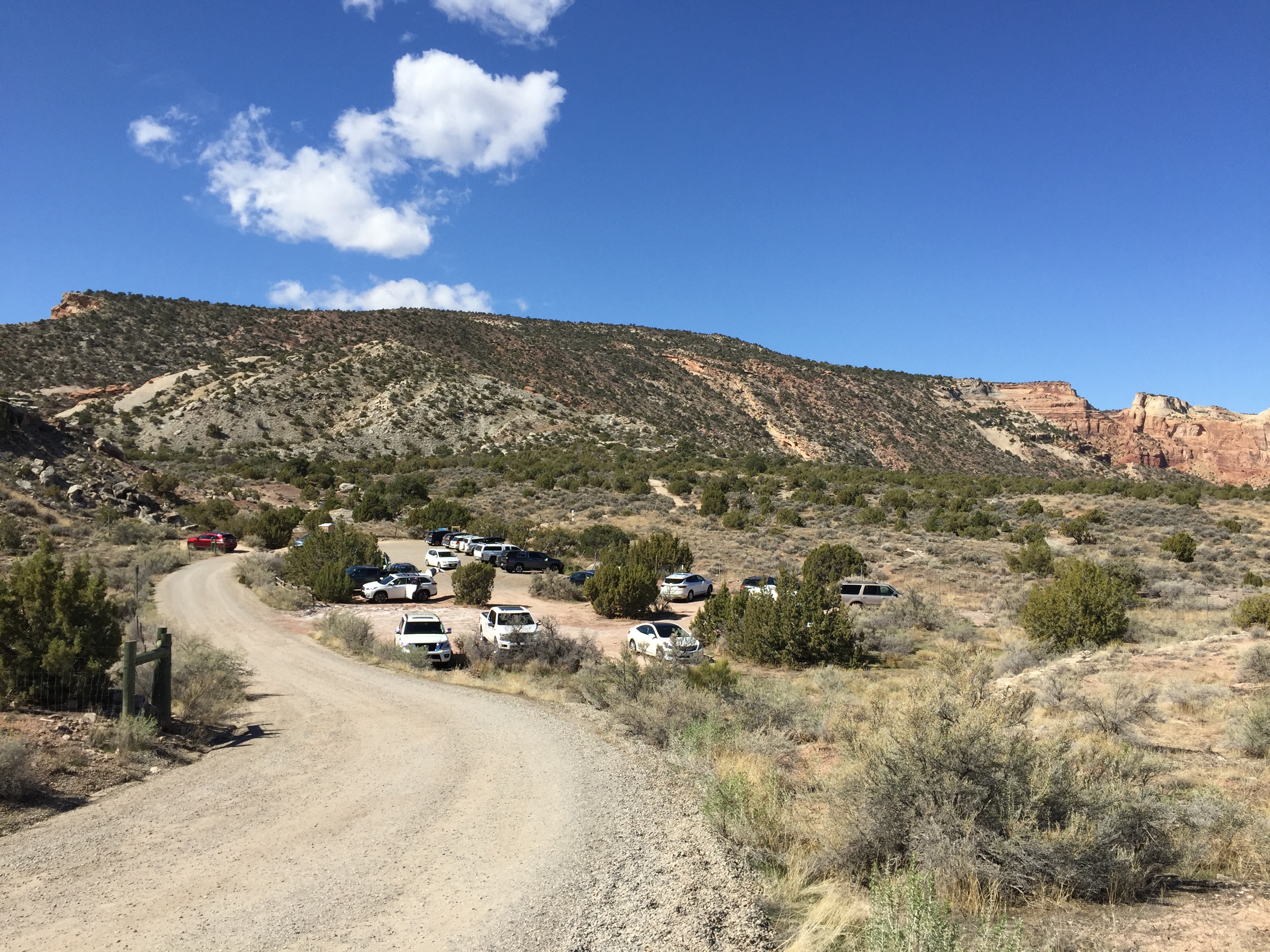
Location: From the west (Fruita) entrance of the Monument, turn right onto Highway 340 (going east); after 2.1 miles (3.4 km) turn right just beyond mile marker #5 onto a dirt road that appears to be a driveway; go 0.1 mile (0.2 km) to the trailhead. Maps can direct you to Lower Monument Canyon Trailhead.
Mileage: ~5 miles (8.05 km) loop, +3.5 miles (5.63 km) one way up Monument Canyon from the meeting point with Wedding Canyon undeveloped trail
Difficulty Level: Moderate to steep
Elevation: 4,700 to 6,140 feet (1433 to 1871 meters) from lower trailhead to upper trailhead
Average time: 4-6 hours
Usage: Hiking and horseback riding permitted along the
lower 5 miles. Hiking only above 5 miles on Monument Canyon Trail.
Description (from lower trailhead): Shortly after beginning the trail, choose to go clockwise or counterclockwise around this loop. Starting towards the left fork, you enter Monument Canyon first. If you choose the right fork, you'll be starting in Wedding Canyon on an undeveloped trail. At the far end of the loop, you'll be walking beneath Independence Monument. If you choose to go farther into the canyon along Monument Canyon Trail, you'll get to walk below many of the park's major rock sculptures, including Kissing Couple and the Coke Ovens. Check out a photo gallery of this hike.
Pets Pets are not allowed on any trail in the Monument. Do not leave pets in a car - even with the windows down, it gets too hot. Service animals are welcome in any building and on any trail.
Accessibility This area is not considered accessible, due to uneven terrain, steepness, and lack of paved parking surfaces. This parking lot tends to fill up quickly on weekends and holidays.
Trailhead Old Gordon Trailhead 5,051 ft Drive there
Exhibits
Along the way Otto's Trailhead Wayside Exhibit
Trailhead Otto's Trailhead 5,833 ft Drive there
Exhibits
Along the way Lower No Thoroughfare Canyon Trailhead Wayside Exhibit Upper Serpents Trailhead Wayside Exhibit
Trailheads Devils Kitchen Trailhead 5,043 ft Drive there · Devils Kitchen Trailhead 5,051 ft Drive there · Echo Canyon Trailhead 5,051 ft Drive there · No Thoroughfare Trailhead 5,051 ft Drive there · Old Gordon Trailhead 5,051 ft Drive there · Serpents Trailhead 5,876 ft Drive there
Trailhead The Ribbon Trailhead 6,650 ft Drive there
Exhibits
Along the way Upper No Thoroughfare Canyon Trailhead Wayside Exhibit
Trailhead Upper No Thoroughfare Canyon Trailhead 6,849 ft Drive there
ViewsExhibits
Along the way Ute Canyon Wayside Exhibit Lower Ute Canyon
Trailhead Ute Canyon Trailhead 6,435 ft Drive there
Shelters
Along the way Campground Loop C Shelter
Trailhead Window Rock Trailhead 5,711 ft Drive there
Write-ups that name no single mapped trail, in the Service's words.
The lines are the National Park Service's public trails layer, the trailheads and the waterfalls, views, peaks and historic places along them the Service's public points of interest, read 2026-10-14 and simplified for the map. The write-ups are the Service's own "things to do", unedited. Heights come from USGS 3DEP through Terrain Tiles on AWS (Mapzen/Tilezen), read along each line and rounded; a short trail on steep ground can be off by a few tens of feet. Closures change: check the park's own site before you go.