
National Memorial · Texas
Trails in Chamizal National Memorial
3 named trails · 2 miles · 1 with the Park Service's own write-up. The lines, trailheads and points are the Park Service's; the write-ups are the Service's own words; the climbing is read from USGS elevation along each line.
3 trails, A to Z.
Outer Loop
Trail use at Chamizal National Memorial the Park Service's write-up
dogs allowed
Start Cultural Center
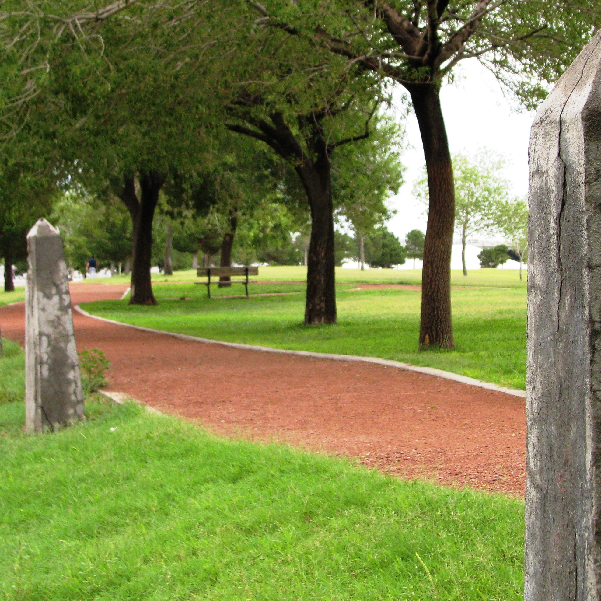
If your are looking for a multi-use trail in the heart of El Paso, we have got you covered. Chamizal National Memorial has paved trails that loop around 55 acres of rolling hills along the United States and Mexico border. Trail lenght is roughly under 1.5 miles, has gentle grades, and is hard packed with red gravel.You will have the ability to walk, jog, run, and ride your bicycle on the trails. You are also allowed to walk your dogs on trail, as long as you have them on leash and pick up when needed.
You will have the oppurtunity to walk beside an international border crossing know as Bridge of the Americas. You will also have the chance to see 27 Boundary Fence posts that were placed by the Mexican governemnt to mark the northern most bend of the Rio Grande, during its meanidering in this area.Keep an eye out for the urban wildlife that you can see, such as hummingbirds and rock squirrels. You can ease your experience with access to our comfort station on the park grounds or come into the Culutural Center to cool off with restrooms, water fountains and exhibit. You may also get maps and information at the Cultural Center. If not, click the link provides to access a Map .
Remember when visiting, the park grounds are open from 7 am to 7 pm to andthe Cultural center is open from 10 am to 5 pm. Depending on the season, be sure to check weather conditions as conditions can be either hot or trail conditions can be slippery with rain. Stay hydrated and wear comfortable clothing.. Have fun and be safe!
Accessibility The Trails at Chamizal National Memorial are maintained to be accessible for individuals with disabilities. Click on Accessibility for more information.
Sidewalk
26 more mapped segments without a name are on the map, not in the list.
About these trails
The lines are the National Park Service's public trails layer, the trailheads and the waterfalls, views, peaks and historic places along them the Service's public points of interest, read 2026-10-14 and simplified for the map. The write-ups are the Service's own "things to do", unedited. Heights come from USGS 3DEP through Terrain Tiles on AWS (Mapzen/Tilezen), read along each line and rounded; a short trail on steep ground can be off by a few tens of feet. Closures change: check the park's own site before you go.