Abbott Lake Trail
Lodges
Along the way Peaks of Otter Lodge
Trailhead Trailhead 2,507 ft Drive there

Parkway · North Carolina, Virginia
224 named trails · 819 miles · 130 trailheads · 8 with the Park Service's own write-up. The lines, trailheads and points are the Park Service's; the write-ups are the Service's own words; the climbing is read from USGS elevation along each line.
224 trails, A to Z.
Lodges
Along the way Peaks of Otter Lodge
Trailhead Trailhead 2,507 ft Drive there
ViewsGaps
Along the way Humpback Gap Humpback Gap Overlook
Trailhead Trailhead 2,373 ft Drive there
ViewsPeaksGapsBridges
Along the way I-64 Bridge US Route 250 Bridge Virginia Route 617 Bridge Bobblets Gap Petites Gap Reids Gap Rockfish Gap Cove Mountain Dripping Rock Parking Area Harveys Knob Overlook Iron Mine Hollow South Overlook Mills Gap Overlook and 9 more
Trailheads Appalachian Trail and Glenwood Horse Trail Alternate Loop Access 2,406 ft Drive there · Trailhead 3,526 ft Drive there · Trailhead 1,915 ft Drive there · Trailhead 2,134 ft Drive there · Trailhead 2,694 ft Drive there · Trailhead 2,642 ft Drive there · Trailhead 2,346 ft Drive there · Trailhead 2,340 ft Drive there · Trailhead 2,421 ft Drive there · Trailhead 2,940 ft Drive there · Trailhead 2,373 ft Drive there · Trailhead 2,437 ft Drive there · Trailhead 2,527 ft Drive there
WaterfallsViews
Along the way Sunset Field Overlook Apple Orchard Falls
Trailhead Trailhead 3,458 ft Drive there
Bridges
Along the way Boone Fork Bridge
GapsBridges
Along the way Bent Creek Gap Road Bridge Bent Creek Gap
Trailhead Bent Creek Gap MP 400.3 3,269 ft Drive there
Trailhead Mt Mitchell Parking Area 6,577 ft Drive there
History
Along the way Alice Caudill Cemetery Alvis Blevins Cemetery
ViewsPeaks
Along the way Beacon Heights Beacon Heights Parking Area
ViewsGaps
Along the way Bearpen Gap Bear Pen Gap Overlook
Trailhead Trailhead 5,563 ft Drive there
Views
Along the way Walker Knob Overlook
Trailhead Balsam Gap Overlook MP 359.7 5,316 ft Drive there
Tunnels
Along the way Little Pisgah Ridge Tunnel
Views
Along the way Big Spy Mountain Overlook
Trailhead Trailhead 3,193 ft Drive there
Views
Along the way 12 O'Clock Knob Overlook
Trailheads Trailhead 3,210 ft Drive there · Trailhead 3,207 ft Drive there
ViewsPeaksHistoryGaps
Along the way Low Notch Grassy Gap Cemetery Bluff Mountain Alligator Back Overlook Basin Cove Overlook Bluff Mountain Overlook Brinegar Cabin Overlook Fodder Stack Parking Area
Trailheads Alligator Back Overlook 3,390 ft Drive there · Basin Cove Overlook 3,301 ft Drive there · Trailhead 3,683 ft Drive there · Trailhead 3,518 ft Drive there · Trailhead 3,707 ft Drive there · Trailhead 3,682 ft Drive there
PeaksHistory
Along the way Alice Caudill Cemetery Bluff Mountain Brooks Knob
Peaks
Along the way Bluff Mountain
CampgroundsPicnic areas
Along the way Julian Price Campground Price Park Picnic Area
Views
Along the way Boston Knob Overlook
Trailhead Trailhead 2,522 ft Drive there
Visitor centers
Along the way Moses Cone Manor House and Visitor Center
Views
Along the way Buck Mountain Overlook
Trailhead Trailhead 1,469 ft Drive there
ViewsGaps
Along the way Buck Spring Gap Buck Springs Gap Overlook
Trailhead Buck Springs Parking Area MP 407.6 4,998 ft Drive there
ViewsGapsLodges
Along the way Buck Spring Gap Pisgah Inn Buck Springs Gap Overlook
Trailheads Buck Springs Parking Area MP 407.6 4,998 ft Drive there · Pisgah Inn MP 408.5 4,930 ft Drive there
ViewsGapsTunnels
Along the way Buck Spring Gap Buck Spring Tunnel Buck Springs Gap Overlook
Trailheads Buck Springs Parking Area MP 407.6 4,998 ft Drive there · Mt. Pisgah Parking Area MP 407.6 4,994 ft Drive there
Peaks
Along the way Buzzards Roost
WaterfallsViews
Along the way Cascades Overlook Cascade Falls
Trailhead Trailhead 3,054 ft Drive there
ViewsBridges
Along the way Virginia Route 672 Bridge Yellow Mountain Road Bridge Chestnut Ridge Overlook
Trailhead Trailhead 1,459 ft Drive there
Bridges
Along the way Yellow Mountain Road Bridge
Views
Along the way Chestoa View Parking Area
Views
Along the way Cold Prong Overlook
History
Along the way Cone Cemetery
Visitor centers
Along the way Moses Cone Manor House and Visitor Center
Campgrounds
Along the way Crabtree Falls Campground
Campgrounds
Along the way Crabtree Falls Campground
Trailhead Craggy Gardens Picnic Area 367.6 5,223 ft Drive there
1-4 Hours · dogs allowed · Spring, Summer
Start Craggy Gardens, Milepost 364-367
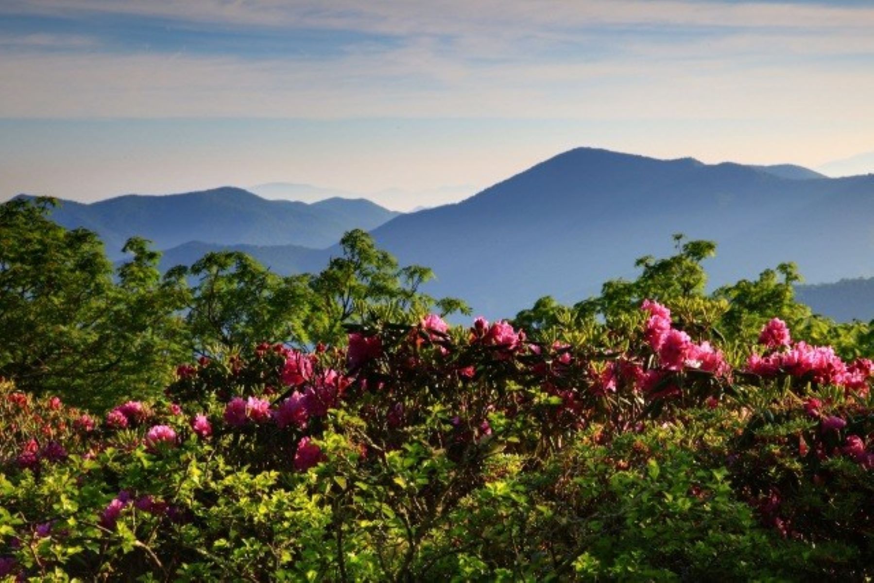
Western North Carolina has more vascular plant diversity than all of Europe, and the Parkway’s elevation changes, high rainfall, and rich soil make it an ideal environment for plants and wildflowers, including a rare, high elevation forest that explodes with bountiful bursts of pink, purple, and white rhododendron each summer. One of the best—and most accessible—ways to enjoy these colorful blooms is by visiting Craggy Gardens.
Enjoy the view as you drive to Craggy Gardens. At 5,500 feet in elevation, the vistas are spectacular on clear days. Look for blooms along the Parkway, at the picnic area, and around the visitor center. Stop in the visitor center to view the natural history exhibits and maybe buy a souvenir of your visit.
For an up close view of the rhododendron, follow the self-guided Craggy Gardens Trail from the southern end of the visitor center parking lot. You’ll hike through a stunted mixed-hardwood forest of mountain ash, birch, and beech before passing through a dense thicket of rhododendron and heath plants. This moderate uphill climb ends at a rustic trail shelter after 0.3 miles.
To enjoy the “gardens,” take the short spur trail to the left of the shelter. Soon, you’ll reach the top of a high-elevation meadow, where you’ll find unobstructed views of the surrounding mountains and adjacent Pisgah National Forest. Rhododendron bushes are abundant in the meadow. The Catawba rhododendron is a medium-sized shrub with dark, waxy leaves and pink or purple flowers. Their blooms usually peak from early to mid-June, depending on environmental factors such as rainfall, wind, and temperature. Please help protect these special resources by staying on designated trails.
The high-elevation forest of the Blue Ridge Parkway is a special ecosystem that supports the survival of many unique and endemic species, including the Catawba rhododendron. A native of the eastern United States, this evergreen shrub grows above 3,000 feet on rocky, exposed ridges. The colorful blooms signal the onset of summer in the Appalachian Mountains.
Accessibility Blooming rhododendron can be readily seen at Craggy Gardens along the side of the Parkway, in the picnic area, and around the visitor center. The Craggy Gardens Trail is a unpaved dirt trail that varies from 2 to 4 feet wide with moderate uphill gain and several sections of roots and rocks.
GapsVisitor centers
Along the way Pinnacle Gap Craggy Gardens Visitor Center
Trailhead Craggy Gardens Visitor Center MP 366.8 5,501 ft Drive there
ViewsPeaks
Along the way Craggy Pinnacle Craggy Dome Overlook
PeaksHistory
Along the way Cumberland Knob (Smith) Cemetery Cumberland Knob
Trailhead Trailhead 2,734 ft Drive there
PeaksHistory
Along the way Cumberland Knob (Smith) Cemetery Cumberland Knob
Trailhead Trailhead 2,734 ft Drive there
Peaks
Along the way Rich Mountain
ViewsPeaks
Along the way Devils Courthouse Devils Courthouse Overlook
Trailhead Devils Courthouse MP 422.4 5,464 ft Drive there
1-2 Hours · dogs allowed
Start Devils Courthouse, Milepost 422
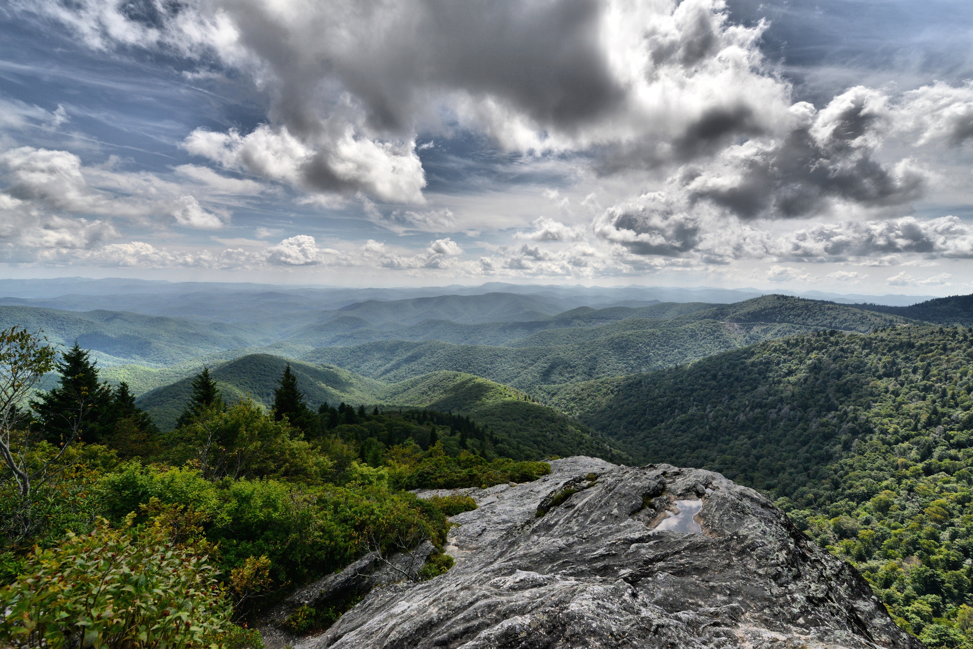
The Devils Courthouse Trail is a great hike for the entire family. Children and family members with a reasonable amount of physical fitness can enjoy the walk to the overlook. Once you’re at the top, look down at the parking lot and take pride in how far you’ve hiked. Enjoy the sweeping views in every direction. From this vantage point you can see into three other states—South Carolina, Georgia, and Tennessee.
The paved trail starts from the Devils Courthouse Overlook at Milepost 422 on the Parkway. The climb up the moderate to strenuous trail is worth the view from the overlook at the top. The first portion of the trail is paved. The hike is only 0.5 miles to the top, but it's a steep climb. There are places to stop and rest along the way. Wear sturdy shoes and bring a light jacket. It can be windy up top.
The surrounding red spruce and Fraser fir forest is a unique ecosystem that is a relic from the last ice age dating back over 10,000 years ago. Glaciers didn't come this far south, but temperatures were cooler. Species that could tolerate and thrive in cold temperatures survived farther south than they typically do now. Tiny fragments of these forests remain today on high mountain peaks due to their cooler and moister environments. Hiking the trail at Devils Courthouse is like hiking in the boreal forests of Canada.
Toward the end of the trail, a connector trail to the Mountains-to-Sea Trail breaks off to the left. To continue to the overlook, keep right. At the top, the forest gives way to a rocky outcrop and the overlook at the very top. On a clear day, this viewpoint allows a panoramic vista of the surrounding mountains and the valley below Devils Courthouse. It is a great place to look for soaring birds like hawks, vultures, and eagles. Peregrine falcons have nested on the rock face below, however not for several years. Biologists believe visitors climbing over the barrier walls at the overlook may have unwittingly interfered with these threatened bird’s fragile nesting habitat. Please remain behind the overlook walls.
Accessibility The first half of the trail is a paved walkway 3-4 feet wide with a grade that varies between an estimated 4%-20% and includes raised water diversion humps. At the midway point, the trail becomes a steep, narrow rocky path which includes a series of wooden steps.
Waterfalls
Along the way Douglas Falls
WaterfallsVisitor centersBridges
Along the way Linville Falls Trail Bridge #1 Linville Falls Visitor Center Duggers Creek Falls
Bridges
Along the way Highland Road Bridge
HistoryVisitor centers
Along the way Wood Cemetery Peaks of Otter Visitor Center
Trailhead Trailhead 2,534 ft Drive there
WaterfallsViews
Along the way Fallingwater Cascades Parking Area Fallingwater Cascades
Trailhead Trailhead 2,553 ft Drive there
Views
Along the way Flat Top Trail Parking Area
Trailhead Trailhead 2,514 ft Drive there
Bridges
Along the way Yellow Mountain Road Bridge
Visitor centers
Along the way Moses Cone Manor House and Visitor Center
Peaks
Along the way Bell Knob Flat Rock Knob
ViewsPeaks
Along the way Flat Rock Flat Rock Parking Overlook
PeaksVisitor centersTowersBridges
Along the way Flat Top Carriage Trail Bridge Flat Top Mountain Flat Top Tower Moses Cone Manor House and Visitor Center
ViewsPeaksPicnic areas
Along the way Flat Top Mountain Peaks of Otter Peaks of Otter Picnic Area Flat Top Trail Parking Area
Trailhead Trailhead 2,514 ft Drive there
ViewsPeaks
Along the way Fodder Stack Wildcat Rocks Overlook
Views
Along the way Fox Hunters Paradise Overlook
Trailhead Trailhead 2,843 ft Drive there
PeaksGapsTowers
Along the way Flat Laurel Gap Fryingpan Gap Big Bald Fryingpan Mountain Fryingpan Mountain Lookout Tower
Gaps
Along the way Fryingpan Gap
Views
Along the way Glassmine Falls Overlook
GapsBridges
Along the way Virginia Route 617 Bridge Bobblets Gap Petites Gap
Trailheads Trailhead 3,193 ft Drive there · Trailhead 2,373 ft Drive there
Gaps
Along the way Blackhorse Gap
Trailhead Appalachian Trail and Glenwood Horse Trail Alternate Loop Access 2,406 ft Drive there
HistoryBackcountry camps
Along the way Basin Cove Backcountry Campsites Alice Caudill Cemetery
WaterfallsViews
Along the way Graveyard Fields Overlook Second Falls
Trailhead Graveyard Fields Overlook MP 418.8 5,114 ft Drive there
ViewsPeaksLakesBridges
Along the way Sims Creek Bridge Sims Pond Green Knob Sims Pond Overlook
ViewsBridges
Along the way Sims Creek Bridge Sims Creek Overlook
Views
Along the way Greenstone Overlook
Trailhead Trailhead 2,988 ft Drive there
History
Along the way Cumberland Knob (Smith) Cemetery
2-3 Hours · dogs allowed · Spring, Summer, Fall
Start Cumberland Knob Recreation Area
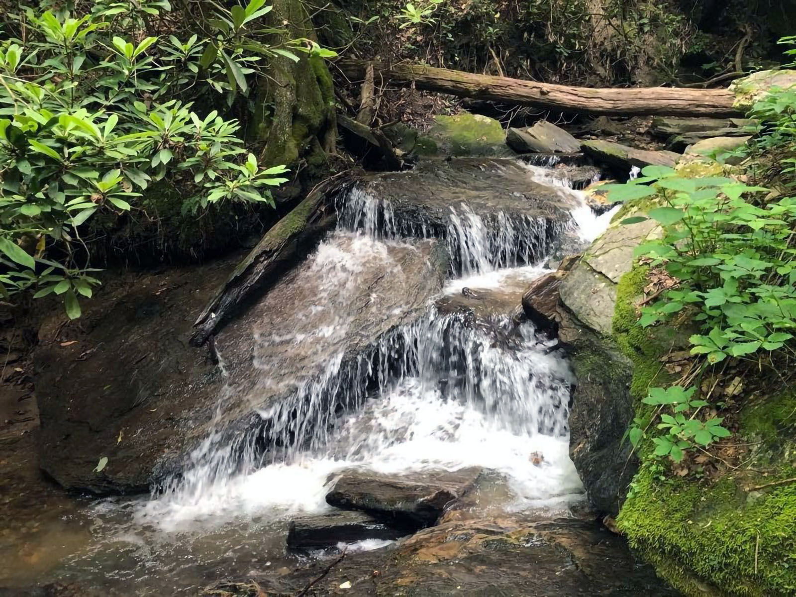
The Gully Creek Trail is a 2.5-mile strenuous loop hike that follows cascades of water and beautiful woodland scenery. Hikers should expect to spend 2-2.5 hours on the trail and experience a change in elevation from a low of 1,996 feet to a high of 2,751 feet. The hike begins at the Cumberland Knob Picnic Area, the parkway’s first concessionaire and visitor center which features bathroom facilities and a shelter for inclement weather.
This hike showcases several small to medium cascading waterfalls alongside towering trees. Expect 7 or more water crossings, depending on weather. Be advised that the trail is narrow in places and may require strategic foot work to traverse. When hiking counterclockwise be prepared for several switchbacks at the end.
While there are no long-range views, this hike offers rewarding micro-views. Flowers, fungi, and more can be seen growing throughout the seasons on this trail. To help plan your trip consult the Cumberland Knob Recreation Area map .
Accessibility The Gully Creek trail is deemed strenuous with seven water crossings, narrow trails, and elevation change from a low of 1,996 feet to a high of 2,751 feet. The picnic areas and restroom facilities at the Cumberland Knob Recreation Center are accessible from the parking area.
ViewsBridges
Along the way Holloway Mountain Road Bridge Rufus L. Gwyn Memorial Parking Area
PeaksVisitor centers
Along the way Harkening Hill Peaks of Otter Visitor Center
Trailhead Trailhead 2,534 ft Drive there
Gaps
Along the way Haywood Gap
Trailheads Trailhead 2,597 ft Drive there · Trailhead 2,620 ft Drive there
60-90 Minutes · dogs allowed
Start Blue Ridge Music Center at Blue Ridge Parkway Milepost 213
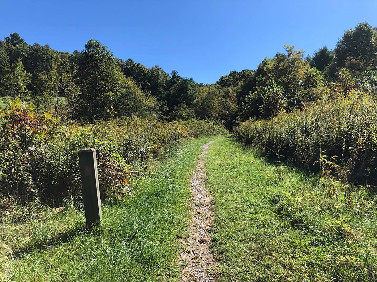
The High Meadow Trail is an easy, family-friendly Kids In Parks TRACK Trail, that is full of woodland and meadow scenery to explore. The 1.35-mile-long one-way trail provides views of birds, flowers, fungi, and the Chestnut Creek. As you are hiking, listen for mountain music floating on the breeze. Musicians play every afternoon at the nearby Blue Ridge Music Center, from May through October.
Children especially enjoy hiking this Kids in Parks TRACK Trail. Young hikers can pick up free TRACK trail brochures to help them explore the trail. Brochures are available at both trailheads. These pamphlets are full of interactive activities to introduce kids to the outdoors. Learn what trees are best for string instruments, identify birds on your hike, or play nature hike and seek!
Identifying some of the wide variety of trees and flowers that you encounter along the trail can add to the enjoyment of hiking this leisure trail, so be sure to take a few guides with you. Spring, summer and fall hikes will provide seasonal wildflowers and mushrooms to identify. During autumn, vibrantly colored leaves line the trail.
Return to the Music Center after your hike to enjoy some old time or bluegrass music! The Blue Ridge Music Center has live music daily during summer and early fall. Test your mountain music knowledge by visiting the indoor museum to discover the roots of this music in the Blue Ridge Mountains.
Accessibility The high meadow trial is not handicap accessible due to the terrain and narrow trail bed. Trail width is anywhere from 2ft to 5ft wide. The surface material is mostly compacted dirt and leaf litter. Watch for raised roots and sticks on the ground. Uneven tread requires good balance.
Trailhead Trailhead 3,054 ft Drive there
Peaks
Along the way The Rocks
Views
Along the way Humpback Gap Overlook
Trailhead Trailhead 2,373 ft Drive there
ViewsGaps
Along the way Indian Gap Indian Gap Parking Area
Trailhead Trailhead 2,102 ft Drive there
HistoryPicnic areasBridges
Along the way James River Bridge Putt Cemetery James River Picnic Area
Views
Along the way John Rock Overlook
Trailhead Trailhead 5,336 ft Drive there
Lodges
Along the way Peaks of Otter Lodge
Trailhead Trailhead 2,507 ft Drive there
Views
Along the way Jumpinoff Rock Parking Area
Trailhead Jumping off Rocks Overlook 3,162 ft Drive there
Visitor centersBridges
Along the way Linville Falls Trail Bridge #1 Linville Falls Visitor Center
Visitor centersBridges
Along the way Linville Falls Trail Bridge #1 Linville Falls Visitor Center
ViewsBridges
Along the way Linville River Bridge Linville River Parking Area
Views
Along the way Little Glade Mill Pond Overlook
Waterfalls
Along the way Second Falls
ViewsGaps
Along the way Black Camp Gap Black Camp Gap Parking Area
Trailhead Trailhead 4,499 ft Drive there
Trailhead Trailhead 3,291 ft Drive there
Views
Along the way Flat Laurel Gap Overlook
Trailhead Pisgah Inn MP 408.5 4,930 ft Drive there
Visitor centers
Along the way Humpback Rocks Visitor Center
Trailhead Trailhead 2,317 ft Drive there
WaterfallsViewsPeaksHistoryBackcountry campsGapsVisitor centersTunnelsBridges
Along the way Johns River Road Backcountry Campsites Air Bellows Road Bridge Azalea Road Bridge Bamboo Road Bridge Big Witch Bridge County Road Bridge County Road Bridge Docks Gap Bridge Goshen Creek Bridge Goshen Creek Culvert #1 Goshen Creek Culvert #2 Hood Road Bridge and 113 more
Trailheads Balsam Gap MP 443.0 3,340 ft Drive there · Balsam Gap Overlook MP 359.7 5,316 ft Drive there · Basin Cove Overlook 3,301 ft Drive there · Bee Tree Gap at MP 367.6 4,893 ft Drive there · Buck Springs Parking Area MP 407.6 4,998 ft Drive there · Cherry Cove Overlook MP 415.7 4,317 ft Drive there · Craggy Gardens Picnic Area 367.6 5,223 ft Drive there · Craven Gap MP 377.4 3,125 ft Drive there · Double Top Mtn. MP 435.2 5,356 ft Drive there · Folk Art Center MP 382.1 2,250 ft Drive there · Forest Service Road 816 MP 420.1 5,886 ft Drive there · Grassy Ridge Mine Overlook MP 436.9 5,253 ft Drive there · Graybeard Overlook MP 363.4 5,592 ft Drive there · I-26 Overpass MP 391.8 2,269 ft Drive there · Jumping off Rocks Overlook 3,162 ft Drive there · Lick Log Gap MP 435.8 5,144 ft Drive there · Mt Mitchell Parking Area 6,577 ft Drive there · Mt. Mitchell Access Road 5,362 ft Drive there · Mt. Pisgah Parking Area MP 407.6 4,994 ft Drive there · Northwest Trading Post Mp 258.5 3,112 ft Drive there · Ox Creek MP 375.6 3,258 ft Drive there · Singecat Ridge Overlook MP 345.5 3,407 ft Drive there · SR 215 Off Parkway MP 423.2 5,122 ft Drive there · State Highway 16 MP 261.3 3,099 ft Drive there · Stations Inn Off Parkway Mp 248.1 PwR 2,829 ft Drive there · Sweeten Creek Road MP 388.1 2,336 ft Drive there · Trail Crosses Parkway at MP 414.5 4,399 ft Drive there · Trail Crosses Parkway MP 381.3 2,444 ft Drive there · Trail Crosses Parkway MP 384.8 2,122 ft Drive there · Trailhead 4,395 ft Drive there · Trailhead 3,518 ft Drive there · Trailhead 2,203 ft Drive there · Trailhead 5,822 ft Drive there · Trailhead 3,420 ft Drive there · Trailhead 2,549 ft Drive there · Trailhead 4,167 ft Drive there · Trailhead 2,383 ft Drive there · Trailhead 3,737 ft Drive there · US 25 MP 388.9 2,244 ft Drive there
1-8 Hours · dogs allowed
Start Rough Butt Bald Overlook (Milepost 425)
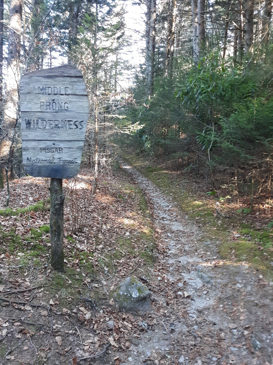
"A wilderness, in contrast with those areas where man and his own works dominate the landscape, is hereby recognized as an area where the earth and its community of life are untrammeled by man, where man himself is a visitor who does not remain."
-The Wilderness Act
In 1964, the Wilderness Act was established to give some federal lands the highest level of protection. Meant to preserve the "wildest of the wild," wilderness areas have no roads and no development. They are often the last pieces of pristine wildlands that once stretched across the whole country. Managed to minimize evidence of human presence, trails are not marked with signs or blazes and are often only minimally maintained. Having a map, compass, and the ability to use them are requirements in wilderness. Hiking in wilderness areas often requires a higher level of skills and preparedness than other trails.
Wilderness rules include:
No campfires allowed
Group size must be less than 10
Bicycles are not allowed
The Middle Prong Wilderness Area is nearly 8,000 acres of rugged terrain located within Pisgah National Forest south of Asheville. Designated in 1984, the Middle Prong has the Blue Ridge Parkway for part of its southern and western boundary. This proximity makes the Parkway an excellent jumping off point for wilderness hiking.
Park at the Rough Butt Bald Overlook at Milepost 425.4. Across the road and slightly south of the overlook there is a trail that enters the forest. This blue-blazed connector trail soon comes to a T-junction with the Mountains-to-Sea Trail (MST). Take a right and head north on the MTS. You will quickly encounter the Middle Prong Wilderness sign marking your entrance into the wilderness area. The MST will continue through the Middle Prong Wilderness for approximately 5 miles until it crosses NC Highway 215. Other trails will branch off the MST to the north and head further into the wilderness area.
Wilderness conjures up different feelings to different people. To some, the idea of being in a wild, undeveloped area where they must depend on their own self-reliance is exhilarating. To others, wilderness can be a scary, inhospitable place that seems entirely inaccessible to them. And, of course, many fall somewhere in between those sentiments. The beauty of the Middle Prong Wilderness is that it can be explored on many different levels. The novice hiker can take a short stroll on the well-established Mountains-to-Sea Trail and get a taste of wilderness travel. An experienced hiker can test their mettle by plotting a longer route into the heart of the Middle Prong.
Either way, it's worth it. This is an exceptionally beautiful place and generally less crowded than other trails in the area. The forest is dense and moist with mosses and ferns draping the trees and ground. Ranging between 5,000 and 6,000 feet in elevation, the Middle Prong Wilderness has Fraser fir and red spruce forest, grassy open meadows, cold mountain streams, and high peak ridges. Some sections of trail are wider and follow an old railroad bed from long ago logging operations.
Are you ready to give wilderness a try?! Be prepared. Do your homework. Expand your comfort zone and challenge yourself. The reward is experiencing a magnificent area that is a hidden gem of the Parkway.
Accessibility The trail from the Rough Butt Bald Overlook is a narrow (2-3 feet wide) dirt path with rocks and exposed roots. It is rated as moderately difficult with some elevation changes and obstacles like small creek crossings. Trails in wilderness areas are not marked, so users must pay close attention and be skilled in map and compass reading.
WaterfallsViewsGapsTunnelsBridges
Along the way Bamboo Road Bridge North Carolina Route 16 Bridge Wilson Creek Bridge Bridges Camp Gap Buckeye Gap Bull Gap Craven Gap Deep Gap Horse Gap Licklog Gap Pigeon Gap Sleepy Gap and 17 more
Trailheads Chestnut Cove Overlook MP 398.3 3,035 ft Drive there · Craven Gap MP 377.4 3,125 ft Drive there · Double Top Mtn. MP 435.2 5,356 ft Drive there · Grassy Ridge Mine Overlook MP 436.9 5,253 ft Drive there · Lick Log Gap MP 435.8 5,144 ft Drive there · Looking Glass Rock Overlook MP 417.0 4,485 ft Drive there · Sleepy Gap Parking Area MP 397.3 2,929 ft Drive there · State Highway 16 MP 261.3 3,099 ft Drive there · Trailhead 4,542 ft Drive there · Trailhead 4,555 ft Drive there · US 276 Off Parkway MP 411.9 3,695 ft Drive there · Walnut Cove Overlook MP 396.4 2,916 ft Drive there
Views
Along the way Onion Mountain Overlook
Trailhead Trailhead 3,186 ft Drive there
ViewsPicnic areasVisitor centersBridges
Along the way Otter Creek Bridge Otter Creek Culvert #6 Otter Creek Culvert #7 Virginia Route 130 & Otter Creek Bridge James River Picnic Area Lower Otter Creek Overlook Otter Lake Overlook B Terrapin Hill Overlook James River Visitor Center
Trailheads Trailhead 645 ft Drive there · Trailhead 789 ft Drive there · Trailhead 677 ft Drive there · Trailhead 659 ft Drive there
Views
Along the way Otter Lake Overlook A Otter Lake Overlook B Otter Lake Parking Area
Trailheads Trailhead 645 ft Drive there · Trailhead 662 ft Drive there
ViewsGapsVisitor centersBridges
Along the way Lynn Gap Road Bridge Lynn Gap Swafford Gap Table Rock Overlook Museum of North Carolina Minerals
CampgroundsVisitor centers
Along the way Peaks of Otter Campground Peaks of Otter Visitor Center
Trailheads Trailhead 2,534 ft Drive there · Trailhead 2,562 ft Drive there
Peaks
Along the way Little Bald Mountain
ViewsDams
Along the way Price Lake Dam Lakeview Overlook Price Lake Overlook
Trailhead Rattlesnake Lodge MP 374.4 3,310 ft Drive there
1-3 Hours · dogs allowed
Start Rattlesnake Lodge
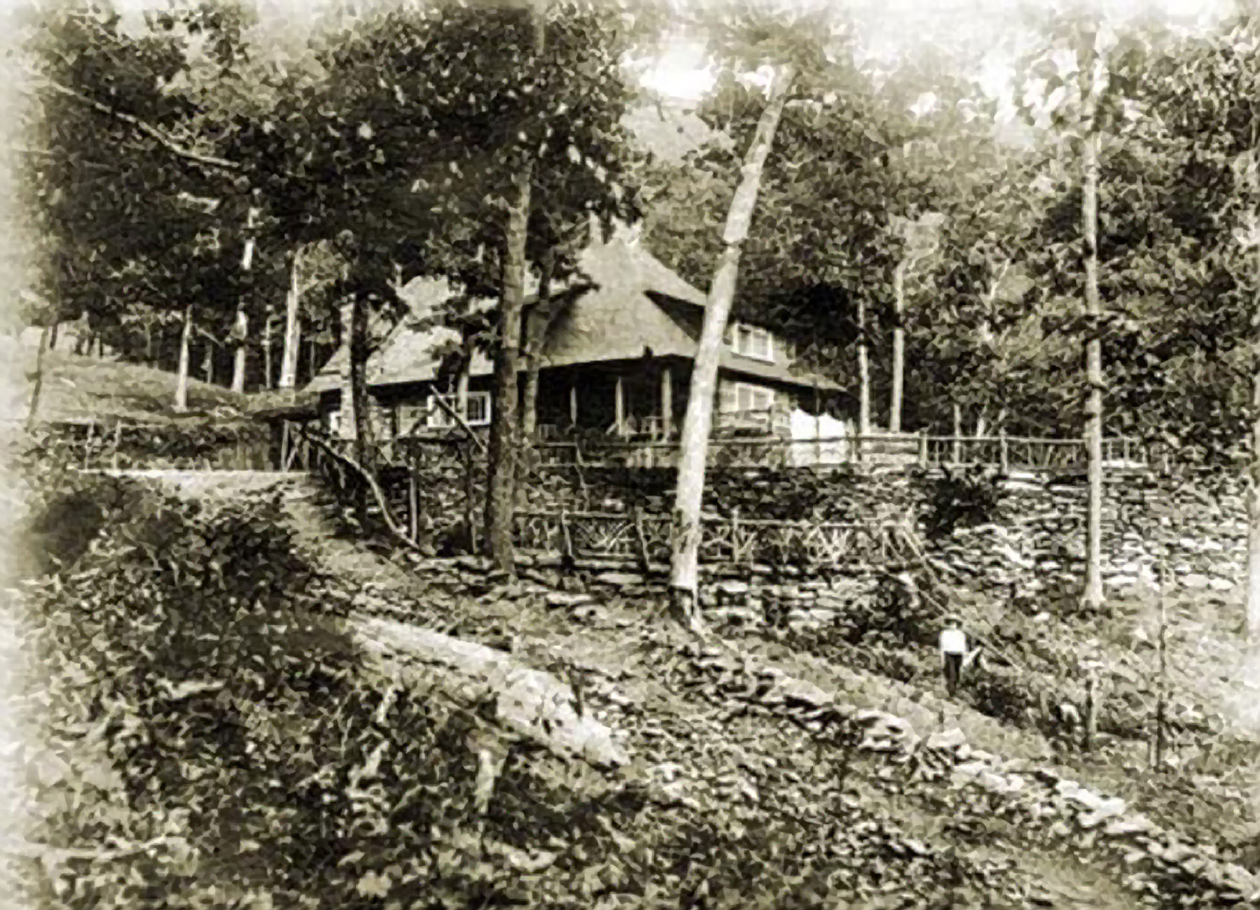
Rattlesnake Lodge is a great hike that is popular with locals because it is a short drive from Asheville and is not a long hike. It’s perfect if you’re looking for a shorter hike or if your time is limited. As a bonus, it's a historic site with remains of structures more than 100 years old that you can explore.
Dr. Chase Ambler built a home here in 1903 as a remote escape for his family. The cooler temperatures of the higher elevation and the outdoor lifestyle it offered made it an ideal location for the Amblers. Over the years, they added additional land, structures, and amenities to the property. It eventually totaled over 300 acres and became an interesting mix of rural functionality and city luxuries. While most of the buildings and property features have burned, crumbled, or been overtaken by nature, a careful observer can find evidence of the barn, a swimming pool, the lodge site, a tool shed, the spring house and cisterns, a caretaker’s cabin, the potato house, and a tennis court. A map of the site can be found at www.rattlesnakelodge.com.
Rattlesnake Lodge was aptly named as 41 rattlesnakes were said to have been killed in the first three years the Amblers were there. The snake skins were hung on the living room ceiling. Certainly an interesting decorating choice! Dr. Ambler was known to offer $5 to anyone who brought him a rattlesnake to add to his collection. Five dollars was big bucks in those days, so undoubtedly rattlesnakes from near and far were sacrificed for the reward. Please note that it is illegal to kill or harm snakes in the park now.
Notwithstanding his apparent lack of love for snakes, Dr. Ambler was a community leader and a conservationist. The horse trail through his property was extended all the way to Mount Mitchell and much of its route today is part of the Mountains-to-Sea Trail (MST). Dr. Ambler was the chairman of a committee that eventually became the Carolina Mountain Club, which today maintains much of the MST. He was a strong advocate for the Weeks Act of 1911 that protected the headwaters of rivers and watersheds and lead to the creation of national forests in the eastern U.S. like Pisgah National Forest. Dr. Ambler was also an early supporter of the creation of the Great Smoky Mountains National Park and there is a peak named Mount Ambler in the park to honor him. The Ambler family left a legacy at Rattlesnake Lodge and we are fortunate that we can visit a place that was so special to them.
Hike Description
• From the Blue Ridge Parkway, park at the Tanbark Ridge Tunnel at Milepost 374.4. On the south side of the tunnel there are dirt pull-offs on both sides of the road for parking. The trail begins on the west side of the road next to a small cascading creek. Very quickly, the trail splits. Both trails are moderately steep, approximately 0.5 miles long, and connect to the Mountains-to-Sea Trail (MST) that runs through the Rattlesnake Lodge site. (Both trails are marked with blue blazes. The MST is marked with white blazes.) The left trail will bring you closer to the old lodge site. The right trail connects to the MST further north and closer to the potato house and the traveler’s “shack.” A good option is to take one of the trails up and the other down for a nice loop hike.
• Because the long Mountains-to-Sea Trail passes through Rattlesnake Lodge, you can hike further on that trail for a longer hike. There is also a 0.2 mile spur trail up from the old spring house to what was the main water reservoir for the property.
• Whatever trail you take to get to Rattlesnake Lodge, you’ll be hiking through a mid-elevation deciduous forest. (The lodge site is at approximately 3,700 feet). Colorful wildflowers dot the trail in the spring and summer. Poison ivy is also common, so stay on the trail! This wooded hike keeps you in the shade almost all of the time, but doesn’t provide many views. Unless you hike in winter, when the leafless trees allow for more long-range views. (Sometimes Parkway winter closures limit access to trailheads. Check the road closure map before you head out).
Accessibility The trails to Rattlesnake Lodge average 2-3 feet wide and have a dirt and rock surface. An abundance of rocks and roots makes trail surfaces uneven. The trails climb 400-600 feet in elevation. There are no facilities associated with this hike.
ViewsPeaksGaps
Along the way Highest Point on the Blue Ridge Parkway Motor Road Richland Balsam Haywood-Jackson Overlook
Trailhead Trailhead 6,007 ft Drive there
ViewsHistoryBridges
Along the way Rutrough Road Bridge Virginia Route 116 Bridge Virginia Route 24 Bridge Virginia Route 651 Bridge Virginia Route 666 (Overpass) Bridge Virginia Route 668 Bridge Baker (Lawhorn) Cemetery Gum Spring Overlook Stewart Knob Overlook
Trailheads Trailhead 1,370 ft Drive there · Trailhead 1,433 ft Drive there
Views
Along the way Gum Spring Overlook
Trailhead Trailhead 1,433 ft Drive there
ViewsPeaks
Along the way Roanoke Mountain Roanoke Mountain Overlook
Trailhead Trailhead 2,142 ft Drive there
Bridges
Along the way Roanoke River Bridge
20-60 Minutes · dogs allowed
Start Roanoke River Overlook at Blue Ridge Parkway Milepost 114.9
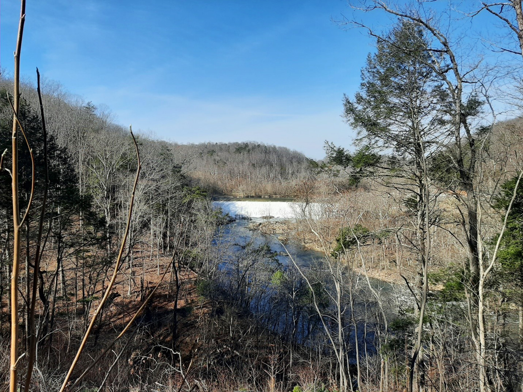
The Roanoke River Trail is a 0.35 mile easy hike starts at an overlook before descending towards the Roanoke River. From this trail you can either take the Fisherman’s Trail down to the Roanoke River, head to a stone pedestrian overlook for a great view the river, or hike on the looped trail that takes you under the Roanoke River Bridge. All trails offer splendid views of the water.
The overlook sets the scene with a view of the river and nearby Niagara Dam. Immediately the trail begins its downward descent transitioning from a paved to more traditional path. Along the way, there are plenty of opportunities for photos of the dam and river from the side of the cliff. The parkway bridge that passes over the river is hard to miss. At this point the trail is about 50’ under the bridge.
Just before crossing under the bridge, the pathway forks. Taking the path to the left will lead you down to the water, another 80’ down. This is appropriately called the Fisherman’s Trail. Along this short path, which turns into a series of stairs, there is a wayside that talks about the Niagara Power Plant, the smallest hydroelectric plant in the American Electric Power System. Along the way are also a couple of benches which can provide needed breaks. The water is too rough for swimming, but fishing is allowed with a valid license.
Most people hiking the loop will want to go under the bridge, and from there you have a choice of where to go. Stay on the main trail to complete the loop, or head out the small diverging path to view the water from a pedestrian overlook. This quaint stone structure looks out over the river from a different vantage point than those offered along the trail. Visitors who are looking for a slightly longer walk may feel inclined to walk to all three trails.
Benches along the trails provide pleasant spots to rest and enjoy the scenery.
Is it worth driving out your way to experience Roanoke River Trail? Maybe not. But if you are in the area, it is a pleasant way to get some exercise without committing an entire afternoon to the endeavor. The trails offer nice views of the water, small plaques point out some of the common trees and plants found nearby, a wayside on the Fisherman’s Trail tells the history of the Niagara Power Plant across the river, and with the railroad so close by, you may get the chance to see a train.
Accessibility The Roanoke River Trail is not handicap accessible due to the terrain and narrow trail bed. It is also not recommended for strollers. The trail bed varies between 2-4 feet wide and is a mostly downhill. The surface material transitions from a paved path to mostly compacted dirt and leaf litter. Watch for raised roots and sticks on the ground. Uneven tread requires good balance. All sections of the trail contain some stairs. The Fisherman’s trail is mostly stair and is not recommended for anyone who has difficulty with descending or climbing them. There are several benches along all portions of the trail that can provide breaks as needed. Throughout the trail there are a series of plaques with a short blurb about local plants, there is currently no assistive listening for these. The wayside about the Niagara Power Plant currently has no assistive listening available.
ViewsPeaksGaps
Along the way The Saddle Grassy Knoll Rocky Knob Rock Castle Gorge Overlook The Saddle Overlook
Trailheads Trailhead 3,367 ft Drive there · Trailhead 3,187 ft Drive there
Backcountry camps
Along the way Rock Castle Gorge Backcountry Campsites
Trailhead Trailhead 3,047 ft Drive there
Views
Along the way 12 O'Clock Knob Overlook
Trailheads Rocky Knob Picnic Loop Trailhead 3,200 ft Drive there · Trailhead 3,210 ft Drive there · Trailhead 3,211 ft Drive there · Trailhead 3,207 ft Drive there
ViewsVisitor centers
Along the way Rock Castle Gorge Overlook Rocky Knob Visitor Center
Trailheads Rocky Knob Picnic Loop Trailhead 3,200 ft Drive there · Trailhead 3,210 ft Drive there
Gaps
Along the way Heffner Gap
Views
Along the way Rough Ridge Overlook
ViewsBridges
Along the way Round Meadow Creek Bridge Round Meadow Overlook
Views
Along the way Roy Taylor Forest Overlook
Trailhead Trailhead 5,590 ft Drive there
Peaks
Along the way Sharp Top Mountain
Peaks
Along the way Sharp Top Mountain
Trailhead Trailhead 2,562 ft Drive there
ViewsPeaksGapsTunnelsBridges
Along the way Bent Creek Gap Road Bridge Beaverdam Gap Bent Creek Gap Chestnut Cove Gap Elk Pasture Gap Grady Fork Gap Sleepy Gap Candler Knob Ferrin Knob Lance Mountain Little Pisgah Mountain Buck Spring Tunnel and 6 more
Trailheads Beaverdam Gap Overlook MP 401.7 3,570 ft Drive there · Bent Creek Gap MP 400.3 3,269 ft Drive there · Big Ridge Overlook MP 403.6 3,818 ft Drive there · Elk Pasture Gap MP 405.5 4,238 ft Drive there · Mills River Overlook MP 404.5 4,077 ft Drive there · Mt. Pisgah Parking Area MP 407.6 4,994 ft Drive there · Sleepy Gap Parking Area MP 397.3 2,929 ft Drive there · SR 191 at Parkway Ramp MP 393.8 2,007 ft Drive there · Stony Bald Overlook MP 402.6 3,744 ft Drive there · Walnut Cove Overlook MP 396.4 2,916 ft Drive there
Views
Along the way The Slacks Overlook
Trailhead Trailhead 2,790 ft Drive there
Views
Along the way The Slacks Overlook
Trailhead Trailhead 2,790 ft Drive there
Views
Along the way Sleepy Gap Parking Area
Views
Along the way Smart View Overlook
Trailhead Trailhead 2,566 ft Drive there
Trailhead Trailhead 2,495 ft Drive there
Views
Along the way Green Knob Overlook
Peaks
Along the way Snowball Mountain
ViewsHistoryBridges
Along the way Linn Cove Viaduct Stack Rock Creek Bridge Underground Stream Bridge Coffey Cemetery Boulder Field Overlook Calloway Peak Overlook Pilot Ridge Overlook Rough Ridge Overlook Stack Rock Parking Area Yonahlossee Overlook
Views
Along the way Cold Prong Overlook
ViewsPeaks
Along the way The Lump The Lump Overlook
Views
Along the way The Priest Overlook
Trailhead Trailhead 2,689 ft Drive there
Views
Along the way Thunder Ridge Overlook
Trailhead Trailhead 3,526 ft Drive there
ViewsPicnic areas
Along the way Jeffress Park Picnic Area Cascades Overlook Tomkins Knob Overlook
HistoryPicnic areasVisitor centers
Along the way Putt Cemetery James River Picnic Area James River Visitor Center
Trailhead Trailhead 659 ft Drive there
Bridges
Along the way Flat Top Carriage Trail Bridge
ViewsBridges
Along the way Boone Fork Bridge Calloway Peak Overlook
Waterfalls
Along the way Upper Falls
Waterfalls
Along the way Linville Falls
Visitor centers
Along the way Blue Ridge Parkway Visitor Center
Trailheads Parkway Headquarters MP 384.1 2,254 ft Drive there · Trail Crosses Parkway MP 384.8 2,122 ft Drive there
60-90 Minutes · dogs allowed
Start Blue Ridge Parkway Visitor Center, Milepost 384
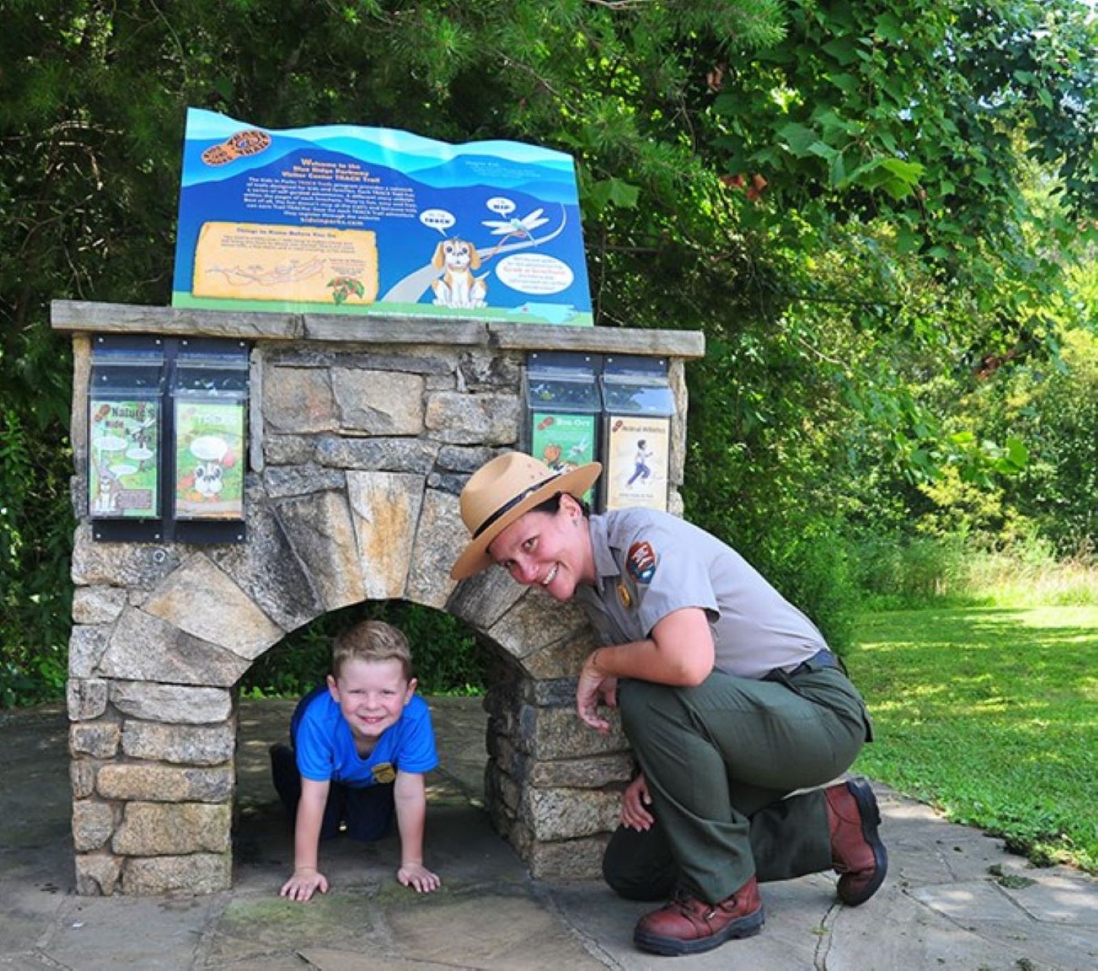
There is a hidden loop trail at the Blue Ridge Parkway Visitor Center in Asheville. It’s one of only a few loop trails along the Blue Ridge Parkway. At 1.3 miles long, it is the perfect length for a family hike or a leg stretcher after a long drive
Get everyone out of the car and onto the trail at the Blue Ridge Parkway Visitor Center. It's a nice 1.3-mile ramble through a mixed forest with some unique features along the way. The Visitor Center Loop Trail begins in the back corner of the Blue Ridge Parkway Visitor Center’s parking lot, next to a small stone replica of one of the Parkway’s tunnels. It is a designated Kids in Parks TRACK Trail . Access the trail using the steps and then follow the trail to the left. Orange dots or blazes on the trees mark the trail. Follow the orange blazes and they will return you to the starting point.
It’s hard not to notice the large oak trees at the start of the trail. This may mean that there was a once a home site here. These trees may have surrounded a house or lined a driveway. During the hike, the trail will lead you through a tunnel. You’ll be crossing underneath the Blue Ridge Parkway! Down the trail, the Mountains-to-Sea Trail will split off towards the Folk Art Center (it is a one way 2.5-mile hike to the Folk Art Center). Further on you’ll walk along a long ridge and then cross the Parkway to return back to the parking area. Use extreme caution as you cross the Parkway road surface. Cars sometimes travel faster than they should and there is an on-ramp intersection near the trail crossing that can cause congestion. Once across the Parkway, there’s a little moist ravine reminiscent of a tiny fern gulley. Climb up and you are almost done. All in all, this is a family-friendly nature trail.
The Blue Ridge Parkway Visitor Center Loop Trail is a fairly short, easy walk that is great for people of almost any hiking skills, including families with small children. It has very little change in elevation and is mostly level throughout. It is a good hike after travelling all day.
Accessibility The trail has a natural dirt surface that is rocky in places with some rock steps. Overall, there is little elevation change, but there are some inclines with grades of over 20%. The trail is narrow in places, less than 2 feet wide.
PeaksVisitor centers
Along the way Waterrock Knob Waterrock Knob Visitor Center
Trailhead Trailhead 5,822 ft Drive there
Views
Along the way Moses Cone Overlook
Trailhead Trailhead 2,968 ft Drive there
Views
Along the way White Oak Flats Overlook
Trailhead Trailhead 1,454 ft Drive there
Waterfalls
Along the way White Rock Falls
Waterfalls
Along the way White Rock Falls
Trailhead Trailhead 2,788 ft Drive there
Trailhead Trailhead 2,548 ft Drive there
Trailhead Trailhead 2,548 ft Drive there
Views
Along the way Wildcat Rocks Overlook
Bridges
Along the way Virginia Route 651 Bridge
WaterfallsViews
Along the way Yankee Horse Ridge Parking Area Wigwam Falls
Trailhead Trailhead 3,142 ft Drive there
The lines are the National Park Service's public trails layer, the trailheads and the waterfalls, views, peaks and historic places along them the Service's public points of interest, read 2026-10-14 and simplified for the map. The write-ups are the Service's own "things to do", unedited. Heights come from USGS 3DEP through Terrain Tiles on AWS (Mapzen/Tilezen), read along each line and rounded; a short trail on steep ground can be off by a few tens of feet. Closures change: check the park's own site before you go.