
National Preserve · Florida
Trails in Big Cypress National Preserve
70 named trails · 464 miles · 4 trailheads · 2 with the Park Service's own write-up. The lines, trailheads and points are the Park Service's; the write-ups are the Service's own words; the climbing is read from USGS elevation along each line.
70 trails, A to Z.
Bear Island Grade
BIU 4
Boot Hill West
Boundary Line
Buckskin
Burns Lake North
Burns Lake South
CDU Oasis
CDU Rock Road
Concho Billie Trail
Fennell Camp
Fire Prairie East Trail
Trailhead Fire Prarie Trailhead 12 ft Drive there
Florida National Scenic Trail
Florida National Scenic Trail the Park Service's write-up
2-5 Days · no dogs
Start 52105 Tamiami Trail East, Ochopee, FL 34141 (southern terminus), 1400 Fort Pickens Rd, Pensacola Beach, FL 32561 (northern terminus)
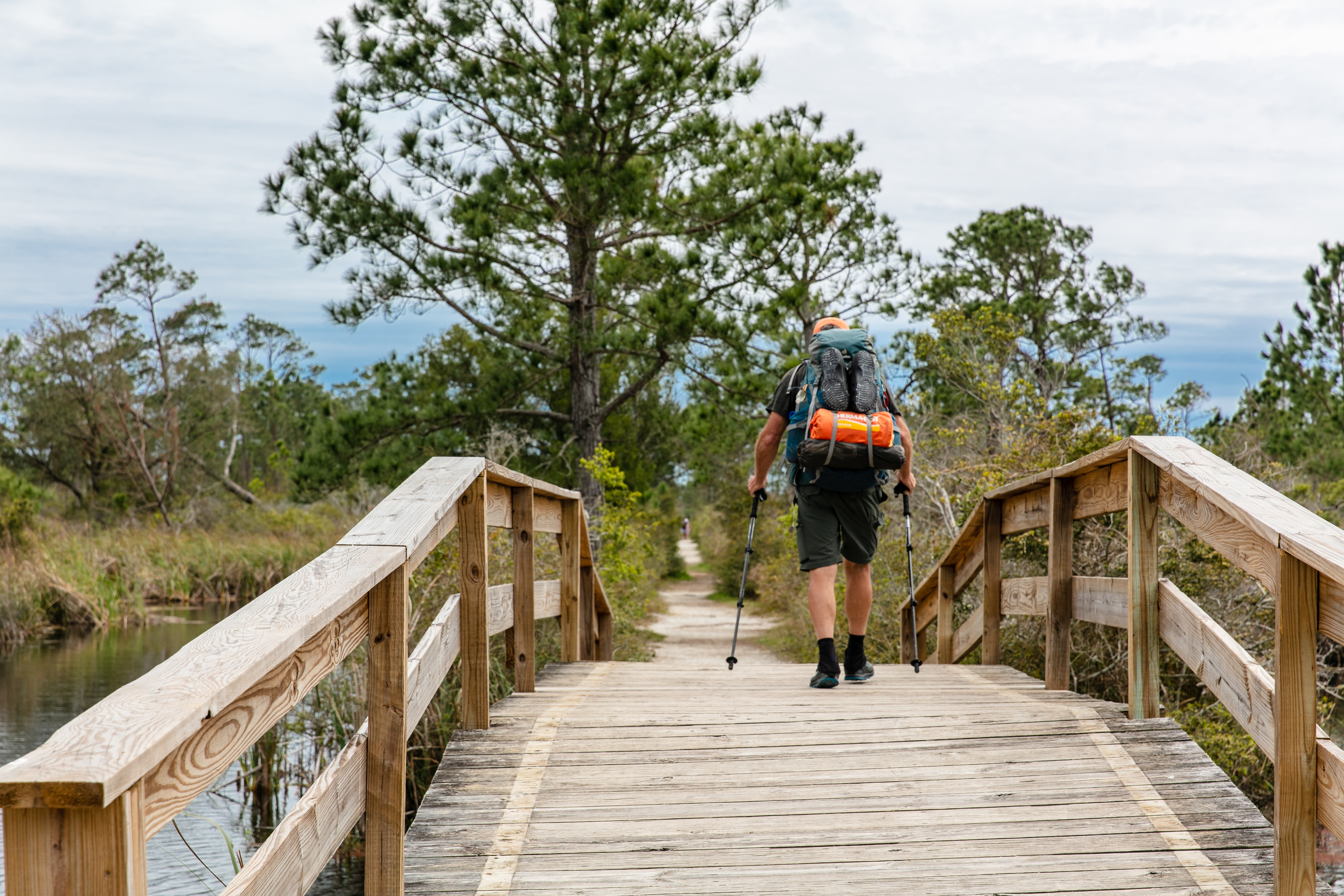
The Florida National Scenic Trail stretches about 1,400 miles from Gulf Islands National Seashore to Big Cypress National Preserve. The southernmost section of the trail is within the National Preserve. The southern terminus of the trail begins at the Oasis Visitor Center and stretches northward for approximately 36 miles to the Preserve's northern border. The northernmost section of the trail is within Gulf Islands National Seashore. It begins at Fort Pickens and runs parallel to the coastline for 7 miles before exiting the park, then reentering in the Santa Rosa area of the National Seashore for another 7 miles.
The trail passes through a variety of habitat types including beaches, hardwood hammocks, pinelands, prairies and cypress. Beyond the National Preserve boundary the trail is limited to a small number of hikers who are members of the Florida Trail Association per month traveling through the Seminole Reservation.
There are several backcountry campsites located along the trail. Backcountry permits are required to camp at these sites.
During the dry season (November-April), there may be very little to no water along the trail. Hikers need to pack in their own water.
This trail is moderately strenuous. Footing can be difficult and during the rainy season, the trail can be heavily vegetated and overgrown. Portions of the trail can be under water at certain times of year. Water can be as deep as 3 to 4 feet.
Several portions of the trail require hiking along the highway, up to 40 miles or more depending on the route chosen by the traveler. There are two sections where hikers may take an east or west route depending on personal preference and hiking ability. Be prepared with permits and clothing for drastic changes in temperature and weather pattern.
Accessibility This is a moderately strenuous hike. Hikers should be in good health and experienced in hiking in southern and northern Florida. Do not attempt if you have any underlying health conditions or limited mobility.
Florida National Scenic Trail Byway
Florida Trail (North)
Gator Hook Trail
Trailhead Gator Hook Trailhead 6 ft Drive there
Gator Hook Trail the Park Service's write-up
2-4 Hours · no dogs
Start Gator Hook Trailhead - Loop Road
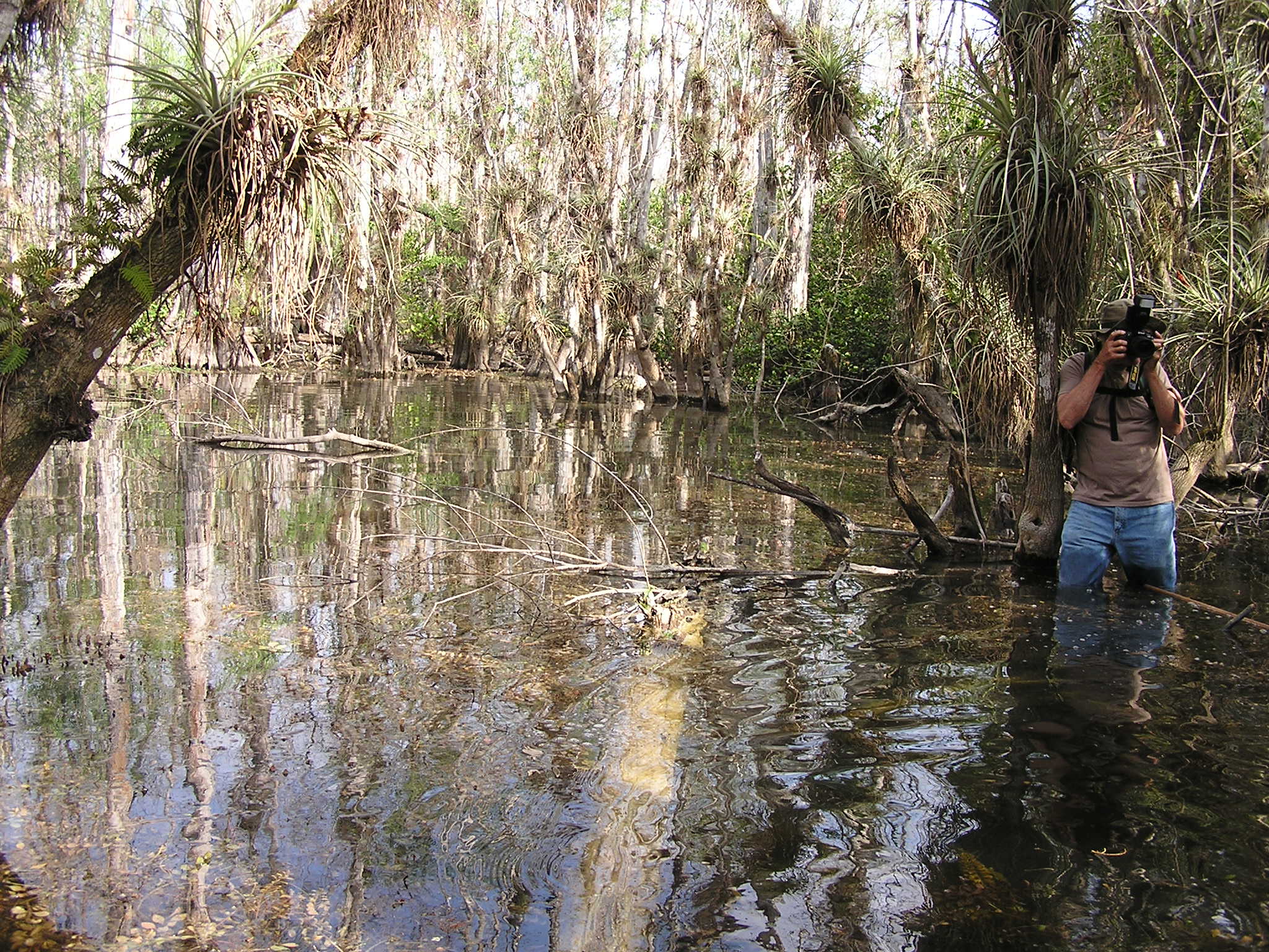
Exploring the swamp requires getting your feet wet. The five-mile roundtrip Gator Hook Trail offers such an opportunity. The trail begins along an elevated logging tram, but soon enters ankle to knee-deep water. For some, the water may rise to hip height. This scenic, moderately strenous hike, is unlike any other in Big Cypress National Preserve. You will become immersed in the resource (literally and figuratively), and experience something that very few visitors do - a wet hike through the cypress swamp.
Accessibility This trail is a moderately strenuous hike which involves hiking through several inches to 4 feet of water. Individuals who attempt this trail should be in good health and highly mobile. Footing can be uneven in spots where the water has dissolved the limestone. Visitors should use care when walking across the exposed limestone as it can be uneven and slippery. Hiking poles or walking sticks are suggested and sturdy footwear.
Halfway Creek
Boat launches
Along the way Seagrape Drive Boat Launch
Hard Rock Trail
Harold Strand Trail
Hess Hammock
Jet Port
Land H Trail
Left Hand Skillet
Little Deer
Lost Dog 1
Lost Dog 2
Monroe North
Monroe South
Monument
Monument Bypass
Mud Lake
Mud Lake Bypass
North Little Deer
North Raccoon Point
Oasis TRU
Pace's Dike
Perocchi Grade
Pipeline ORV Trail
Plains Trail
Poppenhager
Raccoon Point CDU
Raccoon Point TRU
Raccoon Point West Off Road Trail
Red Bird Lane
Red Bird Return
Ridge Trail
Backcountry camps
Along the way Gator Head
Roberts Lakes Trail
Backcountry camps
Along the way Robert's Lake Campsite
Rock Road Bypass
Sandy Road
Skillet North
Stump Camp Trail
Windmill Trail
Windmill Tram
Z4 Need Name 10
Backcountry camps
Along the way Campsite 2
Z4 Need Name 11
Backcountry camps
Along the way Campsite 3
Z4 Need Name 12
Backcountry camps
Along the way Campsite 4
Z4 Need Name 13
Z4 Need Name 14
Backcountry camps
Along the way Campsite 10
Z4 Need Name 15
Z4 Need Name 16
Backcountry camps
Along the way Campsite 12 Campsite 13
Z4 Need Name 17
Backcountry camps
Along the way Campsite 15
Z4 Need Name 18
Z4 Need Name 19
Z4 Need Name 20
Backcountry camps
Along the way Campsite 16
Z4 Need Name 4
Backcountry camps
Along the way Campsite 14
Z4 Need Name 5
Z4 Need Name 6
Z4 Need Name 8
Z4 Need Name 9
Backcountry camps
Along the way Campsite 1
546 more mapped segments without a name are on the map, not in the list.
More hikes the Park Service describes
Write-ups that name no single mapped trail, in the Service's words.
- Fire Prairie Trail · 1-3 Hours · no dogs
This five-mile long out and back trail is a great way to see the sawgrass prairies of Big Cypress National Preserve. Good for all skill levels, this trail provides unique viewing areas of some of the more elusive wildlife here. Bring plenty of water, sunscreen, and a hat. - Kirby Storter Roadside Park · 15-60 Minutes · no dogs
This immersive boardwalk will take you into a cypress strand. Good for the whole family, this boardwalk is open daily from an hour before sunrise until an hour after sunset. - The Deep Lake Trail · 30-90 Minutes · no dogs
This one-mile moderate hike to Deep Lake is a unique experiences. Deep Lake is over 95 feet deep, and the deepest lake in south Florida. Leave yourself about an hour to complete the trail. During the wet season (May-October) the trail can be wet and muddy.
About these trails
The lines are the National Park Service's public trails layer, the trailheads and the waterfalls, views, peaks and historic places along them the Service's public points of interest, read 2026-10-14 and simplified for the map. The write-ups are the Service's own "things to do", unedited. Heights come from USGS 3DEP through Terrain Tiles on AWS (Mapzen/Tilezen), read along each line and rounded; a short trail on steep ground can be off by a few tens of feet. Closures change: check the park's own site before you go.