Trails in Allegheny Portage Railroad National Historic Site
26 named trails · 18 miles · 2 with the Park Service's own write-up. The lines, trailheads and points are the Park Service's; the write-ups are the Service's own words; the climbing is read from USGS elevation along each line.
0.2 mi one way · about 150 ft of climbing · 1,463 ft–1,592 ft · bike
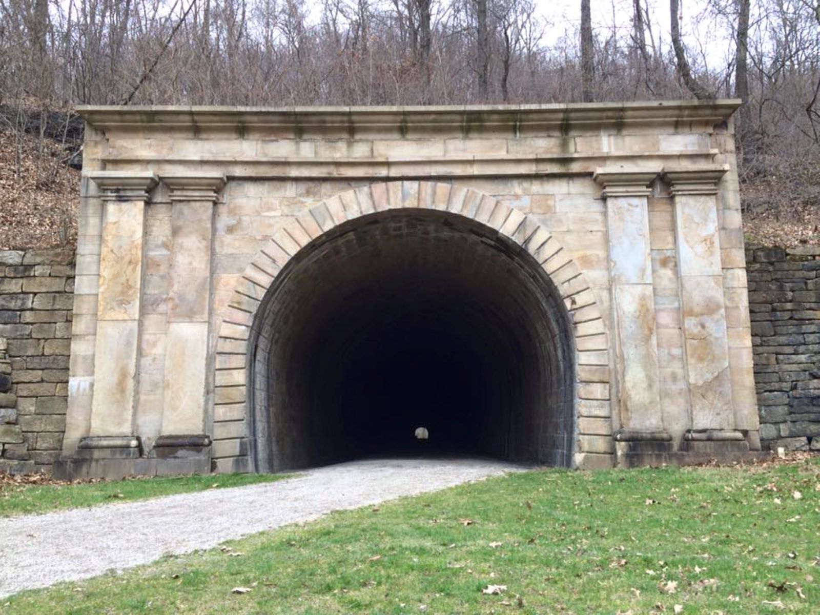
Hike or bike to the Staple Bend Tunnel the Park Service's write-up
dogs allowed
Staple Bend Tunnel Photo: NPS
The Staple Bend Tunnel, the first railroad tunnel in America, can be accessed from the trailhead on Beech Hill Road in Mineral Point. Visitors can hike or bike approximately two miles each way to the 901 foot long tunnel following the old railroad bed. This section is also part of the Path of the Flood Trail as you parallel the Little Conemaugh River towards Johnstown. Visitors can imagine what it would have been like to travel on this important transportation. Interpretive panels help tell the story of the Main Line Canal, Allegheny Portage Railroad, the tunnel and the workers who blasted through the Allegheny Mountains.
Park grounds are open daily from sunrise to sunset. Please note, there is no winter maintenance on the trail.
Accessibility From the parking lot in Mineral Point, the trail is approximately four miles round trip to the tunnel and back. It can only be accessed by hiking or by bicycle. Vehicle are not permitted on the trail. The trail is flat and the surface is crushed limestone.
2.2 mi one way · about 20 ft of climbing · 90 ft of descent · 1,362 ft–1,445 ft · bike
Hike or bike to the Staple Bend Tunnel the Park Service's write-up
dogs allowed
Staple Bend Tunnel Photo: NPS
The Staple Bend Tunnel, the first railroad tunnel in America, can be accessed from the trailhead on Beech Hill Road in Mineral Point. Visitors can hike or bike approximately two miles each way to the 901 foot long tunnel following the old railroad bed. This section is also part of the Path of the Flood Trail as you parallel the Little Conemaugh River towards Johnstown. Visitors can imagine what it would have been like to travel on this important transportation. Interpretive panels help tell the story of the Main Line Canal, Allegheny Portage Railroad, the tunnel and the workers who blasted through the Allegheny Mountains.
Park grounds are open daily from sunrise to sunset. Please note, there is no winter maintenance on the trail.
Accessibility From the parking lot in Mineral Point, the trail is approximately four miles round trip to the tunnel and back. It can only be accessed by hiking or by bicycle. Vehicle are not permitted on the trail. The trail is flat and the surface is crushed limestone.
Write-ups that name no single mapped trail, in the Service's words.
Guided Hikes · dogs allowed Heritage Hikes are led by a park ranger during the summer months. The distance varies by hike. Reservations are required.
Hike along the Summit Level · dogs allowed At the bottom of the boardwalk at Engine House 6 Exhibit Shelter, visitors are walking along the Summit Level of the Allegheny Portage Railroad. This section is the highest point that the Allegheny Portage Railroad crossed the Allegheny Mountains. The Allegheny Portage Railroad had 10 inclined planes and 11 levels.
Hike the Inclines 6 to 10 Trail · dogs allowed The Inclines 6 to 10 Trail follows the route of the Allegheny Portage Railroad. The hiking sections of the trail are located on or near the original route of the Allegheny Portage Railroad. The bicycle section is located on the route of the New Portage Railroad. Sections of this trail are very steep and rugged.
The Skew Arch Bridge · dogs allowed The Skew Arch Bridge is an original feature of the Allegheny Portage Railroad. It is the only road bridge that was built along the path of the railroad. It was constructed of stone and allowed for Huntington, Cambria and Indiana Turnpike traffic to cross over the railroad. The "skew arch" was designed to accommodate the bend in the turnpike road.
About these trails
The lines are the National Park Service's public trails layer, the trailheads and the waterfalls, views, peaks and historic places along them the Service's public points of interest, read 2026-10-14 and simplified for the map. The write-ups are the Service's own "things to do", unedited. Heights come from USGS 3DEP through Terrain Tiles on AWS (Mapzen/Tilezen), read along each line and rounded; a short trail on steep ground can be off by a few tens of feet. Closures change: check the park's own site before you go.